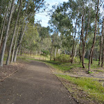
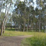
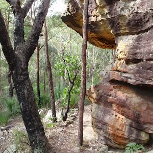
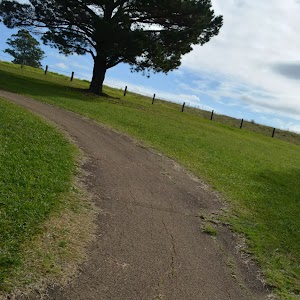
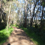
Whether on foot or wheels this is a pleasant stroll around the asphalt bike track and footpath through Rouse Hill Regional Park. A great adventure for kids or for adults wanting to ramble through eucalypt forest, parkland and old farm. Starting from the great playground and picnic area you will follow the footpath past plenty of picnic tables with a toilet near the start and along the way. A pleasant way to stretch the legs.
Rouse Hill Path circuit
And Walk
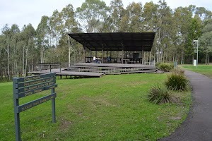
Rouse Hill Path circuit


45 mins
1.5 km Circuit

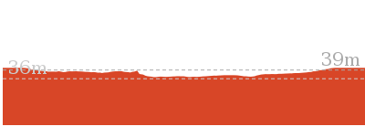
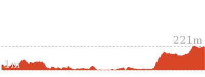
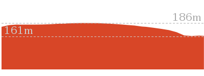
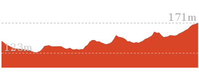
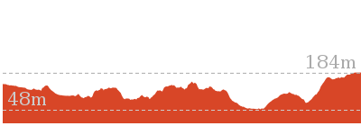
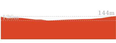
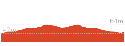
31 m
Moderate track


Rouse Hill main car park
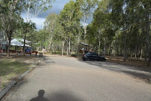
The main car park is found at the end of the 750m long driveway off Worcester Rd, Rouse Hill. There is room to park about 60 cars in the shade of the tall trees[1]. There is no signposted mobility parking but each parking bay is marked and 2.7m wide.
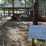
Rouse Hill main Picnic area and playground
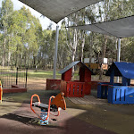
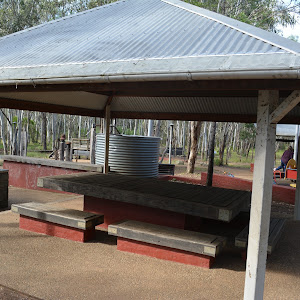
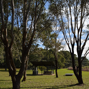
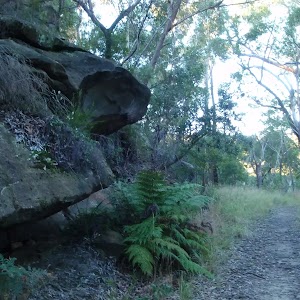
Nestled among the tall eucalypt forest at the southern end of the main car park in Rouse Hill Regional Park is a lovely playground, picnic area and toilet block.
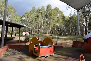
The well equiped children’s playground has a timber maze[2], climbing equipment[3], slides[4], and other equpment[5][6][7].
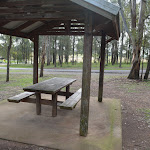
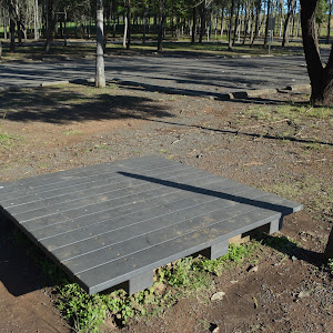
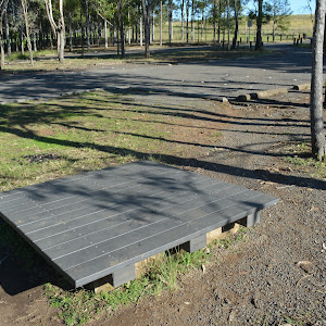
The picnic facilities between the car park and the playground include two large sheltered tables
The well equiped children’s playground has a timber maze[2], climbing equipment[3], slides[4], and other equpment[5][6][7].
The picnic facilities between the car park and the playground include two large sheltered tables
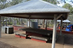
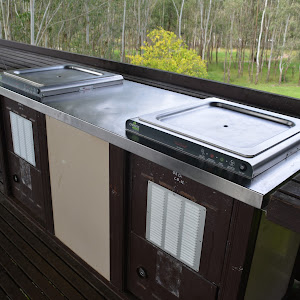
and BBQ’s

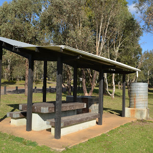
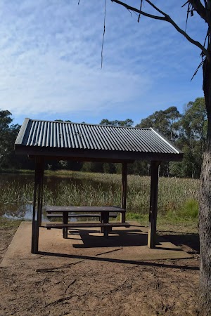
. There are other seats and picnic tables around the area as well. About 20m west of the playground is a quieter elevated picnic shelter

and BBQ

.
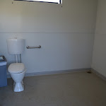
There is a toilet block


about 150m walk from the playground around the edge of the large clearing[8].
(0km) Rouse Hill main car park → Playground intersection

30 m
1 mins
0m
-1m
Easy track
From the southern edge of the main Rouse Hill Regional Park car park, this walk follows the concrete footpath, keeping the sheltered picnic areas
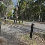
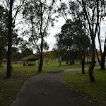
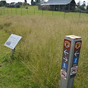
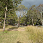
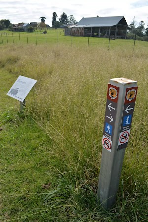
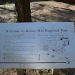
to the left for about 15m[9] to come to the ‘Welcome to Rouse Hill Regional Park’ sign[10]. From here this walk continues beside the playground, following the gravel track[11] for 15m come to a 4-way intersection marked with the large ‘Rouse Hill Regional Park’ sign[12].
(0.03km) Playground intersection → Pavilion Intersection
540 m
11 mins
20m
-4m
Moderate track
Turn right: From the intersection, this walk follows the asphalt footpath gently uphill directly away from the playground[13]. The path leads past the elevated picnic shelter
[14] (on the right) and after about 55m the walk veers left at an intersection[15] to lead past the orange metal bollard[16] (1.1m wide gap). About 15m later this walk comes to another 3-way intersection[17] with a (short timber bridge[18] on the right – that leads towards a series of seats

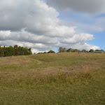
). This walk continues straight along the main asphalt path[19] (ignoring the side paths) for about 300m to leave the trees and continue moderately steeply uphill

through the open grassy area for about 140m, behind the picnic shelter
, to come to a 3-way intersection just before the road/driveway[20].
Turn left: From the intersection, this walk heads gently uphill[21] along the asphalt footpath, keeping the road a short distance to the right for about 30m to come to a paved intersection[22].
(0.57km) Pavilion Intersection → Pavilion toilet
80 m
1 mins
0m
0m
Very easy
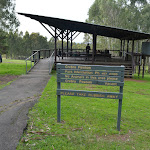
Turn left: From the intersection, this walk heads directly away from the road, gently downhill along the asphalt path towards the picnic shelters. After about 15m this walk leads past the signposted ‘Crebra Pavilion’ picnic shelter[23]


. About another 20m later this path leads to the ‘Fibrosa Pavilion’ picnic shelter[24]


. The walk continues along the footpath for about 35m to come to the toilet block


(on the left) At the end of this side trip, retrace your steps back to the main walk then Turn left .
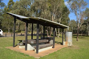
Crebra & Fibrosa Pavilions
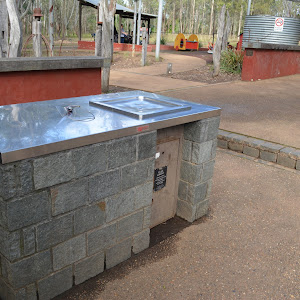
Nestled in the trees in Rouse Hill Regional Park is this very well equipped picnic area. There are two large (11x12m) sheltered areas. Closest to the road is the ‘Crebra Pavilion’ picnic shelter[25] with two large tables
, a BBQ
and tank water
. About 20m away is the similarly designed ‘Fibrosa Pavilion’ picnic shelter[26]
. Further down the path, you will find the toilet block
with an accessible cubicle
. There is parking nearby and sloping open grassy areas around. These facilities can be booked for exclusive use. A lovely place to spend time with family or friends.
(0.57km) Pavilion Intersection → Western Picnic area int.
200 m
3 mins
1m
-6m
Easy track
Continue straight: From the intersection, this walk heads gently downhill along the asphalt footpath, keeping the road a short distance to the right. After 10m this walk leads around a metal orange bollard[29] (1.3m wide gap), then about 20m later leads past a picnic shelter[30]

(on the right). This walk continues along the path as it meanders downhill for another 70m to pass another picnic shelter[31]

(on the left). From here the walk continues down along the path for another 100m to a faint intersection, just before the road (as the path bends right) above the Western Picnic area


.
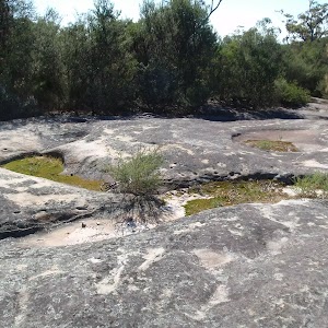
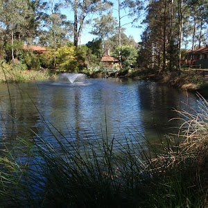
Western Picnic area
Just near the entrance (250m along driveway) of the Rouse Hill Regional Park is this queit and lovely picnic area. There are two sheltered picnic tables[32]
with BBQs[33]
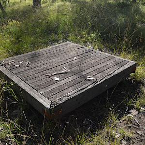
. There is also a scattering of picnic platforms[34] and seats
. The picnic area is near an unfenced pond[35] and there is plenty of open grassy area around[36]. There is road side parking for about 6 cars[37]. A pleasant spot to stop while exploring the area.
(0.77km) Western picnic area int. → Tree hollow intersection
170 m
3 mins
5m
0m
Easy track
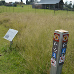
Turn right: From the intersection, this walk heads across the road/driveway[38] (watching for traffic) and follows the asphalt footpath gently uphill for 30m to come to a clear three-way intersection marked with a ‘Welcome to Rouse Hill Regional Park’ information sign[39] and a bench seat[40]

.
Continue straight: From the intersection, this walk heads uphill along the asphalt footpath as it winds through the open grassy area for 120m to pass a large dead tree[41] and comes to an intersection with a grassy trail[42] (on the left just as the path bends right near the road).
(0.95km) Tree hollow intersection → Rouse Hill main car park
580 m
12 mins
5m
-20m
Moderate track
Veer right: From the intersection, this walk follows the asphalt footpath towards[43] and then between the timber bollards[44] (1.2m gap), then across the road[45] (watch for traffic). This walk then follows the asphalt path on the other side of the road for about 10m to come to a three-way intersection[46] near the picnic shelters.
Continue straight: From the intersection, this walk follows the asphalt footpath downhill through the grassy clearing, away from the road and initially keeping the sheltered picnic area
Continue straight: From the intersection, this walk follows the asphalt footpath downhill through the grassy clearing, away from the road and initially keeping the sheltered picnic area
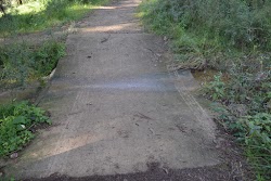
on the right. The path meanders mostly downhill and after 80m the path steepens
for a time then leads less steeply down for another 50m into a eucalypt forest. The walk then continues downhill along the path for 300m among the trees, ignoring the side paths to come to a 3-way intersection (with a short timber bridge[47] on the left, that leads to a series of seats
). The walk continues straight for about 15m to pass the orange metal bollard[48] (1.1m wide gap), then about 30m later this walk veers right at a 3-way intersection[49]. The walk continues down along the path past the elevated picnic shelter
for 55m to come to an intersection[50], just before the playground, marked with a large ‘Rouse Hill Regional Park’ sign[51] (on the right).
Turn left : From the intersection, this walk heads directly away from the face of ‘Rouse Hill Regional Park’ sign[52] along the gravel track, keeping the playground on the right. After about 15m this walk comes to a ‘Welcome to Rouse Hill Regional Park’ sign[53]. From here this walk follows the concrete path for 15m, past the sheltered picnic area
to come to the main Rouse Hill Regional Park car park[54].
Maps for the Rouse Hill Path circuit walk
You can download the PDF for this walk to print a map.
These maps below cover the walk and the wider area around the walk, they are worth carrying for safety reasons.
| Riverstone | 1:25 000 Map Series | 90301S RIVERSTONE | NSW-90301S |
| Penrith | 1:100 000 Map Series | 9030 PENRITH | 9030 |
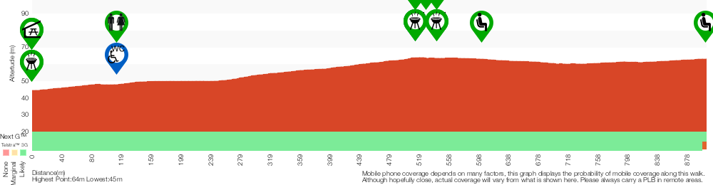
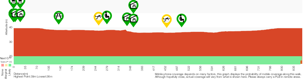
Cross sectional view of the Rouse Hill Path circuit bushwalking track
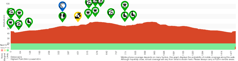
Analysis and summary of the altitude variation on the Rouse Hill Path circuit
Accessibility summary information for the Rouse Hill Path circuit
Parking: There are 0 designated accessible parking areas on this walk.
Toilets: There are 1 designated accessible toilets on this walk.
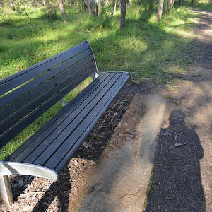
Seats: There are 9 places to sit on this walk.
They are on average 100m apart, with a maximum gap of 480m.
Hazards: There are 1 specific noteable accessability related hazards on this walk.
Wheelchair Steep Two sections of this path (about 25m long) are moderately (1.6:12) steep. Found about 450m into the walk.
Accessibility Details

Found 0m into this walk

Found 0m into this walk
Found 0m into this walk

Found 50m into this walk


Found 350m into this walk


Found 520m into this walk


Found 570m into this walk

Found 600m into this walk

Found 670m into this walk
Found 770m into this walk


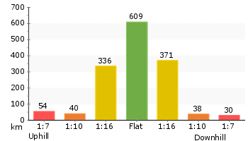
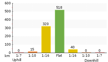
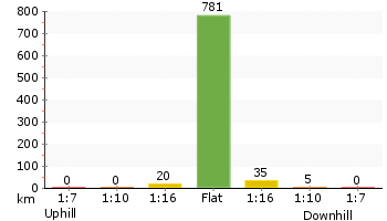
Overview of this walks grade – based on the AS 2156.1 – 2001
Under this standard, a walk is graded based on the most difficult section of the walk.
| Length | 1.5 km | ||
| Time | 45 mins | ||
| . | |||
| Grade 3/6 Moderate track |
AS 2156.1 | Gradient | Gentle hills with occasional steps (2/6) |
| Quality of track | Smooth and hardened path (1/6) | ||
| Signs | Directional signs along the way (3/6) | ||
| Experience Required | No experience required (1/6) | ||
| Weather | Weather generally has little impact on safety (1/6) | ||
| Infrastructure | Generally useful facilities (such as fenced cliffs and seats) (1/6) |
Some more details of this walks Grading
Here is a bit more details explaining grading looking at sections of the walk
Gradient
Around 1.4km of this walk has gentle hills with occasional steps, whilst the remaining 130m is flat with no steps.
Quality of track
This whole walk, 1.5km follows a smooth and hardened path.
Signs
Around 1km of this walk has directional signs at most intersection, whilst the remaining 510m is clearly signposted.
Experience Required
This whole walk, 1.5km requires no previous bushwalking experience.
weather
This whole walk, 1.5km is not usually affected by severe weather events (that would unexpectedly impact safety and navigation).
Infrastructure
This whole walk, 1.5km is close to useful facilities (such as fenced cliffs and seats).
Similar walks
A list of walks that share part of the track with the Rouse Hill Path circuit walk.
865 m Circuit
20 mins
Moderate track
1.8 km Return
45 mins
Easy track
Other Nearby walks
A list of walks that start near the Rouse Hill Path circuit walk.

499 m One way
15 mins
Easy track

12.9 km One way
5 hrs 30 mins
Hard track
12.6 km One way
5 hrs 30 mins
Hard track
1.4 km Return
30 mins
Moderate track
515 m One way
15 mins
Moderate track
2.2 km One way
1 Hr
Moderate track
5.1 km Circuit
2 hrs
Hard track
9 km One way
3 hrs 45 mins
Hard track
4.1 km One way
1 hr 45 mins
Moderate track

4.4 km One way
1 hr 45 mins
Moderate track
439 m Circuit
15 mins
Moderate track
4.2 km Circuit
2 hrs
Hard track
Plan your trip to and from the walk here
The Rouse Hill Path circuit walk starts and ends at the Rouse Hill main car park (gps: -33.680471, 150.91068)
Your main transport option to Rouse Hill main car park is by;
![]() Car. There is free parking available.
Car. There is free parking available.
(get details)


Short URL = http://wild.tl/rhpc
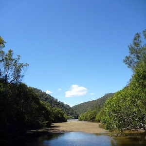
Gallery images
There are other downloads I am still working on.
You will probably need to login to access these — still all free.
* KML (google earth file)
* GPX (GPS file)
Special Maps/ brochures
* A3 topo maps
* PDF with Lands Topo map base
* PDF with arial image (and map overlay)
I wanted to get the main site live first, this extra stuff will come in time.
Happy walking
Matt 🙂
Rouse Hill Estate walk
And Walk
Rouse Hill Estate walk

45 mins
1.8 km Return
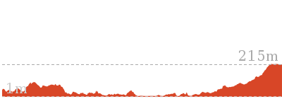
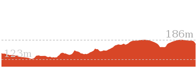
21 m
Easy track
This walk is a great way to step back in time and explore the old Rouse Hill Estate. There are optional side trips that take you to some well-equipped picnic areas if you have the extra time. The walk mostly follows wide grassy trails and gives you good views of the whole estate. There are a series of information signs that help give you a deeper understanding of the history of the area. A pleasant stroll around an old farm site.


Rouse Hill main car park
The main car park is found at the end of the 750m long driveway off Worcester Rd, Rouse Hill. There is room to park about 60 cars in the shade of the tall trees[1]. There is no signposted mobility parking but each parking bay is marked and 2.7m wide.
Rouse Hill main Picnic area and playground
Nestled among the tall eucalypt forest at the southern end of the main car park in Rouse Hill Regional Park is a lovely playground, picnic area and toilet block.
The well equiped children’s playground has a timber maze[2], climbing equipment[3], slides[4], and other equpment[5][6][7].
The picnic facilities between the car park and the playground include two large sheltered tables
The well equiped children’s playground has a timber maze[2], climbing equipment[3], slides[4], and other equpment[5][6][7].
The picnic facilities between the car park and the playground include two large sheltered tables
and BBQ’s
. There are other seats and picnic tables around the area as well. About 20m west of the playground is a quieter elevated picnic shelter
and BBQ
.
There is a toilet block
about 150m walk from the playground around the edge of the large clearing[8].
(0km) Rouse Hill main car park → Northern edge of main car park
100 m
2 mins
2m
-1m
Easy track
From the southern edge of the main Rouse Hill Regional Park car park, this walk heads through the asphalt car park to the large ‘Rouse Hill Estate Walk’ sign[9] near the car park exit.
(0.1km) Northern edge of main car park → Rebels intersection
430 m
7 mins
14m
0m
Easy track
Continue straight: From the northern edge of the car park, this walk follows the large ‘Rouse Hill Estate Walk’ sign[10] between the wide timber bollards and across the dirt trail for 20m to then cross rough gravel driveway [11]. The walk continues straight to follow the dirt and grassy trail as it winds uphill for 400m (ignoring the narrower side tracks) to find a ‘rebels’ information sign[12]. Less than 10m past this sign, this walk comes to a t-intersection marked with a ‘Horse Trail’ sign[13].
(0.53km) Rebels intersection → Pavilion toilet
200 m
4 mins
1m
-1m
Easy track
Turn left : From the intersection, this walk follows the mostly flat grassy trail towards the road, initially keeping the ‘Horse Trail’ sign[14] to the left, for just shy of 50m to pass an arrow post[15] and come to an intersection with an asphalt footpath just before the road[16].
Veer left: From the intersection, this walk follows the asphalt footpath towards[17] and then between the timber bollards[18] (1.2m gap), then across the road[19] (watch for traffic). This walk then follows the asphalt path on the other side of the road for about 10m to come to a three-way intersection[20] near the picnic shelters.
Turn right: From the intersection, this walk heads gently uphill[21] along the asphalt footpath, keeping the road a short distance to the right for about 30m to come to a paved intersection[22].
Turn left: From the intersection, this walk heads directly away from the road, gently downhill along the asphalt path towards the picnic shelters. After about 15m this walk leads past the signposted ‘Crebra Pavilion’ picnic shelter[23]
. About another 20m later this path leads to the ‘Fibrosa Pavilion’ picnic shelter[24]
. The walk continues along the footpath for about 35m to come to the toilet block
(on the left) At the end of this side trip, retrace your steps back to the main walk then Continue straight.
Crebra & Fibrosa Pavilions
Nestled in the trees in Rouse Hill Regional Park is this very well equipped picnic area. There are two large (11x12m) sheltered areas. Closest to the road is the ‘Crebra Pavilion’ picnic shelter[25] with two large tables
, a BBQ
and tank water
. About 20m away is the similarly designed ‘Fibrosa Pavilion’ picnic shelter[26]
. Further down the path, you will find the toilet block
with an accessible cubicle
. There is parking nearby and sloping open grassy areas around. These facilities can be booked for exclusive use. A lovely place to spend time with family or friends.
(0.53km) Rebels intersection → Generations intersection
180 m
3 mins
0m
-2m
Easy track
Veer right: From the intersection, this walk heads away from the face of the ‘Horse Trail’ sign[29] and away from the road along the mostly flat grassy trail for just shy of 150m to come to a three-way intersection (near the corner of a black chainlink fence[30] on the right).
Continue straight: From the intersection, this walk follows the main grassy trail keeping the fence a short distance to the right for nearly 50m to come to a three-way intersection marked with a ‘Rouse Hill Estate Walk’ arrow post[31] and a ‘follow 7 generations’ information sign[32].
Continue straight: From the intersection, this walk follows the main grassy trail keeping the fence a short distance to the right for nearly 50m to come to a three-way intersection marked with a ‘Rouse Hill Estate Walk’ arrow post[31] and a ‘follow 7 generations’ information sign[32].
(0.71km) Generations int. → Western picnic area int.
250 m
4 mins
0m
-4m
Easy track
Turn left: From the intersection, this walk follows the ‘Extention Loop 1km’ arrow post[33], distinctly downhill along the dirt and grassy trail. The trail leads downhill for 90m to continue straight at the unsignposted intersection[34], then 100m later this trail leads past a bench seat[35]
and comes to a t-intersection with an asphalt path marked with a ‘Welcome to Rouse Hill Regional Park’ information sign[36].
Turn right: From the intersection, this walk heads downhill along the asphalt footpath for about 30m to then cross[37] the road/driveway (watching for traffic). About 10m after crossing the road, this walk comes to a faint intersection, above the Western Picnic area
(on your right), just as the path bends left[38]. At the end of this side trip, retrace your steps back to the main walk then Turn left.
Western Picnic area
Just near the entrance (250m along driveway) of the Rouse Hill Regional Park is this queit and lovely picnic area. There are two sheltered picnic tables[39]
with BBQs[40]
. There is also a scattering of picnic platforms[41] and seats
. The picnic area is near an unfenced pond[42] and there is plenty of open grassy area around[43]. There is road side parking for about 6 cars[44]. A pleasant spot to stop while exploring the area.
(0.71km) Generations intersection → Buildings intersection
110 m
2 mins
1m
0m
Easy track
Continue straight: From the intersection, this walk follows the higher ‘Rouse Hill Estate Walk’ arrow[45] past the ‘Follow 7 generations’ information sign[46], alongside the fence (on your right). The trail leads for 100m with views of the Rouse Hill Farm buildings[47] (through the fence) to come to an intersection with a grassy trail (on the left)[48].
Rouse Hill House & Farm
During the 1800s and 1900s this area was farmed by six generations of Rouse and Terry families. The land is now divided in the regional park where you are walking and the fenced off Rouse Hill House & Farm building area managed by Sydney Living Museums. Through the fence, you can see the farm buildings and get a taste of the grand property. You can explore the area by driving to 356 Annangrove Road, Rouse Hill and paying a reasonable entry fee. Well worth exploring.
(0.81km) Buildings intersection → Property intersection
90 m
1 mins
1m
0m
Easy track
Continue straight: From the intersection, this walk heads gently uphill along the grassy trail keeping the fence to the right for about 15m to pass the ‘buildings frozen in time?’ information sign[50]. The walk continues along the trail gently uphill for 70m to pass under the power lines[51] then about 15m later come to a seat

and an ‘a significant property?’ information sign[52].
Maps for the Rouse Hill Estate walk walk
You can download the PDF for this walk to print a map.
These maps below cover the walk and the wider area around the walk, they are worth carrying for safety reasons.
| Riverstone | 1:25 000 Map Series | 90301S RIVERSTONE | NSW-90301S |
| Penrith | 1:100 000 Map Series | 9030 PENRITH | 9030 |
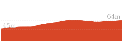
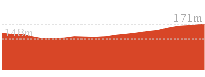
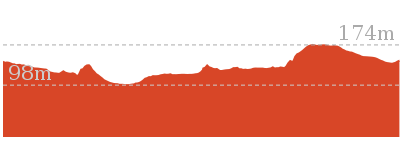
Cross sectional view of the Rouse Hill Estate walk bushwalking track
Analysis and summary of the altitude variation on the Rouse Hill Estate walk
Accessibility summary information for the Rouse Hill Estate walk
Parking: There are 0 designated accessible parking areas on this walk.
Toilets: There are 1 designated accessible toilets on this walk.
Seats: There are 3 places to sit on this walk.
They are on average 450m apart, with a maximum gap of 900m.
Hazards: There are 0 specific noteable accessability related hazards on this walk.
Accessibility Details
Found 0m into this walk
Found 0m into this walk
Found 110m into this walk
Found 110m into this walk
Found 510m into this walk
Found 510m into this walk
Found 510m into this walk
Found 540m into this walk

Overview of this walks grade – based on the AS 2156.1 – 2001
Under this standard, a walk is graded based on the most difficult section of the walk.
| Length | 1.8 km | ||
| Time | 45 mins | ||
| . | |||
| Grade 2/6 Easy track |
AS 2156.1 | Gradient | Gentle hills with occasional steps (2/6) |
| Quality of track | Clear and well formed track or trail (2/6) | ||
| Signs | Clearly signposted (1/6) | ||
| Experience Required | No experience required (1/6) | ||
| Weather | Weather generally has little impact on safety (1/6) | ||
| Infrastructure | Generally useful facilities (such as fenced cliffs and seats) (1/6) |
Some more details of this walks Grading
Here is a bit more details explaining grading looking at sections of the walk
Gradient
Around 670m of this walk has gentle hills with occasional steps, whilst the remaining 240m is flat with no steps.
Quality of track
This whole walk, 900m follows a clear and well formed track or trail.
Signs
This whole walk, 900m is clearly signposted.
Experience Required
This whole walk, 900m requires no previous bushwalking experience.
weather
This whole walk, 900m is not usually affected by severe weather events (that would unexpectedly impact safety and navigation).
Infrastructure
This whole walk, 900m is close to useful facilities (such as fenced cliffs and seats).
Similar walks
A list of walks that share part of the track with the Rouse Hill Estate walk walk.
1.5 km Circuit
45 mins
Moderate track
Other Nearby walks
A list of walks that start near the Rouse Hill Estate walk walk.
865 m Circuit
20 mins
Moderate track
499 m One way
15 mins
Easy track
12.9 km One way
5 hrs 30 mins
Hard track
12.6 km One way
5 hrs 30 mins
Hard track
1.4 km Return
30 mins
Moderate track
515 m One way
15 mins
Moderate track
2.2 km One way
1 Hr
Moderate track
5.1 km Circuit
2 hrs
Hard track
9 km One way
3 hrs 45 mins
Hard track
4.1 km One way
1 hr 45 mins
Moderate track
4.4 km One way
1 hr 45 mins
Moderate track
439 m Circuit
15 mins
Moderate track
Plan your trip to and from the walk here
The Rouse Hill Estate walk walk starts and ends at the Rouse Hill main car park (gps: -33.680472, 150.91068)
Your main transport option to Rouse Hill main car park is by;
![]() Car. There is free parking available.
Car. There is free parking available.
(get details)
Short URL = http://wild.tl/rhew
Gallery images
There are other downloads I am still working on.
You will probably need to login to access these — still all free.
* KML (google earth file)
* GPX (GPS file)
Special Maps/ brochures
* A3 topo maps
* PDF with Lands Topo map base
* PDF with arial image (and map overlay)
I wanted to get the main site live first, this extra stuff will come in time.
Happy walking
Matt 🙂
Second Ponds Creek walk
And Walk
Second Ponds Creek walk

20 mins
865 m Circuit
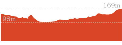
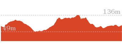
11 m
Moderate track
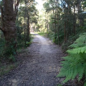
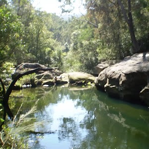
This walk gives you the opportunity to stroll alongside a creek and explore an open eucalypt forest. An easy mostly flat walk starting at a wonderful playground and picnic area, this is a walk for everyone. As you walk you can learn more about the diverse history of the area on the information signs, sit and enjoy the bird life, or take a picnic on the side trip up the dam.


Rouse Hill main car park
The main car park is found at the end of the 750m long driveway off Worcester Rd, Rouse Hill. There is room to park about 60 cars in the shade of the tall trees[1]. There is no signposted mobility parking but each parking bay is marked and 2.7m wide.
Rouse Hill main Picnic area and playground
Nestled among the tall eucalypt forest at the southern end of the main car park in Rouse Hill Regional Park is a lovely playground, picnic area and toilet block.
The well equiped children’s playground has a timber maze[2], climbing equipment[3], slides[4], and other equpment[5][6][7].
The picnic facilities between the car park and the playground include two large sheltered tables
The well equiped children’s playground has a timber maze[2], climbing equipment[3], slides[4], and other equpment[5][6][7].
The picnic facilities between the car park and the playground include two large sheltered tables
and BBQ’s
. There are other seats and picnic tables around the area as well. About 20m west of the playground is a quieter elevated picnic shelter
and BBQ
.
There is a toilet block
about 150m walk from the playground around the edge of the large clearing[8].
(0km) Rouse Hill main car park → Toilet Block
150 m
2 mins
1m
-2m
Very easy
From the main large car park in Rouse Hill Regional Park (beside the playground[9] and picnic area[10]
), this walk follows the asphalt path[11] gently downhill towards the large clearing keeping the playground and BBQ area on the right. After about 40m this walk comes to the edge of the grassy clearing and turns left at the 3-way intersection[12], to walk along the path for about 30m to pass a picnic platform[13]

(on the left) and come to a sheltered seating area[14]

(on the right). This walk continues along the path passing another picnic platform[15]

then after about 60m comes to the front of the toilet block[16]
.
(0km) Rouse Hill main car park → Maze Intersection
70 m
2 mins
0m
-2m
Easy track
Continue straight: From the southern edge of the main Rouse Hill Regional Park car park, this walk follows the concrete footpath, keeping the sheltered picnic areas
to the left for about 15m[17] to come to the ‘Welcome to Rouse Hill Regional Park’ sign[18]. From here this walk continues beside the playground, following the gravel track[19] for 15m come to a 4-way intersection marked with the large ‘Rouse Hill Regional Park’ sign[20].
Continue straight: From the intersection, this walk follows the mostly flat dirt/gravel track[21], directly away from the car park and asphalt path to head behind the ‘Rouse Hill Regional Park’ sign[22]. The track gently bends left[23] and after 35m comes to a clear 3-way intersection, marked by a ‘Take a stroll around’ sign[24] (behind the timber maze).
(0.07km) Maze Intersection → Second Ponds northern int.
270 m
4 mins
0m
-4m
Moderate track
Continue straight: From the intersection, this walk heads gently downhill along the wide track keeping the playground and timber maze on the left[25]. After a few meters, this walk heads past the back entrance to the maze[26] then continues (away from the playground) for 30m to find a picnic platform

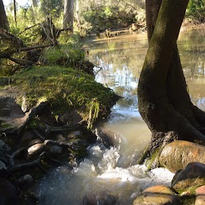
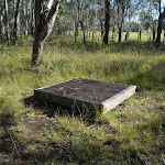
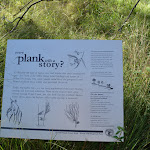
(on the left). This walk continues for about 15m to the ‘Every plant tells a story’ sign[27] where the track then starts to meander for 100m through the forest to cross a concrete ford

, that floods during heavy or prolonged rain. This part of the track does become boggy after rain. About 30m after the ford this walk leads past a seat

then continues for another 70m to cross a small gulley then head gently uphill to a 3-way intersection[28][29], marked by an arrow post[30][31].
(0.34km) Second Ponds northern int. → Second Ponds Picnic shelters
190 m
3 mins
3m
0m
Easy track
Turn left: From the intersection, this walk follows the ‘Extension track’ arrow[32] gently uphill along the gravel track for about 60m towards the clearing, where the track bends right to reach an intersection marked with a ‘Weathering and Droughts’ sign[33] (on the right).
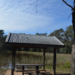
Continue straight: From the intersection, this walk follows the wide gravel track gently uphill initially keeping large clearing on the left. After about 70m this walk leads alongside a dam[34] (on the right) and comes to a sheltered picnic table
Continue straight: From the intersection, this walk follows the wide gravel track gently uphill initially keeping large clearing on the left. After about 70m this walk leads alongside a dam[34] (on the right) and comes to a sheltered picnic table

(on the edge of the dam). The walk continues along the wide gravel track for another 50m to find two more similar picnic shelters


(on the right). At the end of this side trip, retrace your steps back to the main walk then Continue straight.
Second Ponds Picnic shelters
Nestled in a quiet area beside the pond on the eastern edge of Rouse Hill Regional Park is a series lovely sheltered picnic tables
. The unfenced pond is about 60m across and provides a pleasant backdrop[35] and a waterhole for local wildlife. There are also views the other direction across the grassy hills and the old farmland[36]. A pleasant spot to sit and rest or stay to enjoy your picnic.
(0.34km) Second Ponds northern int. → Maze Intersection
460 m
8 mins
9m
-5m
Moderate track
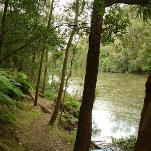
Turn right: From the intersection, this walk follows the ‘Second Ponds Creek Loop’ arrow[37] (in the opposite direction to the ‘Extension track’ arrow) gently downhill where the track soon bends right. The track leads for about 40m to pass an informal track[38] (on the left that leads towards the creek) then come to a ‘Flooded with history’ information sign[39] (on the left). The track continues to gently meander alongside the creek for another 80m to cross a concrete ford
. This ford and track floods after heavy or prolonged rain and this area may also become boggy. The walk continues along the clear track for another 50m to come to a ‘Birds & black snakes’ information sign[40] and a seat

(on the left). From here this walk meanders gently uphill through the forest for about 120m to the ‘Rich Aboriginal area’ sign[41] (on the left). This walk continues to meanders gently uphill through the forest[42] for another 160m to come to a 3-way intersection[43] (beside the timber maze), marked by a ‘Take a stroll around’ sign[44] (on the right).
(0.8km) Maze Intersection → Rouse Hill main car park
70 m
2 mins
2m
0m
Easy track
Turn left: From the intersection, this walk follows the dirt/gravel track[45], directly away from the face of the ‘Take a stroll around’ sign[46] gently uphill towards the playground and picnic area. The track bends right and after 35m this walk comes to a 3-way intersection, marked with a large ‘Rouse Hill Regional Park[47] (on the left).
Continue straight: From the intersection, this walk heads directly away from the face of ‘Rouse Hill Regional Park’ sign[48] along the gravel track, keeping the playground on the right. After about 15m this walk comes to a ‘Welcome to Rouse Hill Regional Park’ sign[49]. From here this walk follows the concrete path for 15m, past the sheltered picnic area
Continue straight: From the intersection, this walk heads directly away from the face of ‘Rouse Hill Regional Park’ sign[48] along the gravel track, keeping the playground on the right. After about 15m this walk comes to a ‘Welcome to Rouse Hill Regional Park’ sign[49]. From here this walk follows the concrete path for 15m, past the sheltered picnic area
to come to the main Rouse Hill Regional Park car park[50].
Maps for the Second Ponds Creek walk walk
You can download the PDF for this walk to print a map.
These maps below cover the walk and the wider area around the walk, they are worth carrying for safety reasons.
| Riverstone | 1:25 000 Map Series | 90301S RIVERSTONE | NSW-90301S |
| Penrith | 1:100 000 Map Series | 9030 PENRITH | 9030 |
Cross sectional view of the Second Ponds Creek walk bushwalking track
Analysis and summary of the altitude variation on the Second Ponds Creek walk
Accessibility summary information for the Second Ponds Creek walk
Parking: There are 0 designated accessible parking areas on this walk.
Toilets: There are 0 designated accessible toilets on this walk.
Seats: There are 5 places to sit on this walk.
They are on average 130m apart, with a maximum gap of 220m.
Hazards: There are 2 specific noteable accessability related hazards on this walk.
Trip Hazard Concrete creek ford. The ford is 2.3m wide 3.3m long and has a gradient in and out of 2:12. Found about 250m into the walk.
Trip Hazard Concrete creek ford. The ford is 2.4m wide 2.9m long and has a gradient in and out of 2:12. Found about 460m into the walk.
Accessibility Details

Found 0m into this walk
Found 0m into this walk
Found 0m into this walk
Found 10m into this walk
Found 20m into this walk


Found 340m into this walk

Found 360m into this walk

Found 360m into this walk

Overview of this walks grade – based on the AS 2156.1 – 2001
Under this standard, a walk is graded based on the most difficult section of the walk.
| Length | 865 m | ||
| Time | 20 mins | ||
| . | |||
| Grade 3/6 Moderate track |
AS 2156.1 | Gradient | Gentle hills with occasional steps (2/6) |
| Quality of track | Clear and well formed track or trail (2/6) | ||
| Signs | Directional signs along the way (3/6) | ||
| Experience Required | No experience required (1/6) | ||
| Weather | Storms may impact on navigation and safety (3/6) | ||
| Infrastructure | Generally useful facilities (such as fenced cliffs and seats) (1/6) |
Some more details of this walks Grading
Here is a bit more details explaining grading looking at sections of the walk
Gradient
Around 800m of this walk has gentle hills with occasional steps, whilst the remaining 65m is flat with no steps.
Quality of track
Around 800m of this walk follows a clear and well formed track or trail, whilst the remaining 65m follows a smooth and hardened path.
Signs
Around 730m of this walk has directional signs at most intersection, whilst the remaining 140m is clearly signposted.
Experience Required
This whole walk, 870m requires no previous bushwalking experience.
weather
Around 460m of this walk is affected by storms that may impact your navigation and safety, whilst the remaining 410m is not usually affected by severe weather events (that would unexpectedly impact safety and navigation).
Infrastructure
This whole walk, 870m is close to useful facilities (such as fenced cliffs and seats).
Similar walks
A list of walks that share part of the track with the Second Ponds Creek walk walk.
1.5 km Circuit
45 mins
Moderate track
Other Nearby walks
A list of walks that start near the Second Ponds Creek walk walk.
1.8 km Return
45 mins
Easy track
499 m One way
15 mins
Easy track
12.9 km One way
5 hrs 30 mins
Hard track
12.6 km One way
5 hrs 30 mins
Hard track
1.4 km Return
30 mins
Moderate track
515 m One way
15 mins
Moderate track
2.2 km One way
1 Hr
Moderate track
5.1 km Circuit
2 hrs
Hard track
9 km One way
3 hrs 45 mins
Hard track
4.1 km One way
1 hr 45 mins
Moderate track
4.4 km One way
1 hr 45 mins
Moderate track
439 m Circuit
15 mins
Moderate track
Plan your trip to and from the walk here
The Second Ponds Creek walk walk starts and ends at the Rouse Hill main car park (gps: -33.680471, 150.91068)
Your main transport option to Rouse Hill main car park is by;
![]() Car. There is free parking available.
Car. There is free parking available.
(get details)
Short URL = http://wild.tl/spcw
Gallery images
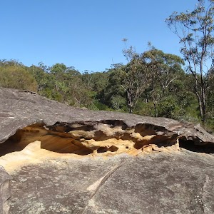
There are other downloads I am still working on.
You will probably need to login to access these — still all free.
* KML (google earth file)
* GPX (GPS file)
Special Maps/ brochures
* A3 topo maps
* PDF with Lands Topo map base
* PDF with arial image (and map overlay)
I wanted to get the main site live first, this extra stuff will come in time.
Happy walking
Matt 🙂
Comments