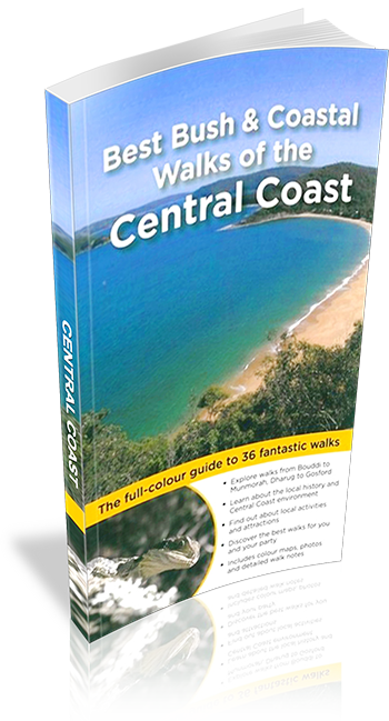
Best Bush & Coastal Walks of the Central Coast
Title: Best Bush & Coastal Walks of the Central Coast
Download Sample: Download PDF
Author: Matt McClelland & the Wildwalks Team
Edition: 1
Publisher: Woodslane
ISBN: 9781921606854
Number of pages: 178
Year of Publication: 2010
Cover Price (au$): 30
Format: Paperback
Website: http://www.wildwalks.com/
Weight (grams): 380
Regions the book covers: NSW Central Coast
Height (cm): 22
Subjects:
Trails - New South Wales - Gosford Region - Guidebooks,Hiking - New South Wales - Gosford Region - Guidebooks,Gosford Region (N.S.W.) - Guidebooks
Niche: wide range of walks many under 2 hours
Interpretive Information: Plenty
Grade system explained: Yes
Ascent and/or Decent provided: Yes
Driving directions provided: Yes
Date walks last reviewed provided: No
A summary of walks provided: Yes
Regional Map of walks provided: Yes
Maps designed for walking: Yes - reasonable detail
Type of maps used (for walking): Simple Topographic
Colour used in walking maps: Multicolour
Size of walking maps: 1/4 page
Colour depth of photos: Colour
Comment on Photographs: Lots of colour photos and full page photos
Level of detail in tracknotes: Detailed route information
Alternate route and side trip suggestions: Many walks
List of walks in book
| Walk Name | Length | Time | Grade | Page |
|---|---|---|---|---|
| Munmorah Coastal | 3.3 km | 1 hr 30 mins | Hard | 12 |
| Norah Head Lighthouse Loop | 2.5 km | 1 Hr | Medium | 16 |
| Redgum Trail | 3.4 km | 1 hr 15 mins | Medium | 22 |
| Lillypilly Loop Trail | 3.6 km | 1 hr 15 mins | Medium | 26 |
| Wyrrabalong Coast Walking Track | 3.8 km | 1 hr 30 mins | Medium | 29 |
| Dubbo Gully to Upper Mangrove Cemetery | 7.2 km | 3 hrs 15 mins | Medium | 32 |
| Ouraka Point Loop | 2.1 km | 1 hr 15 mins | Medium | 36 |
| Ironbark and Flannel Flower Cicuit | 2.1 km | 1 Hr | Medium | 40 |
| Rainforest walk to Nurrunga | 2.2 km | 1 Hr | Medium | 44 |
| Gosford to Lisarow | 11.3 km | 4 hrs 30 mins | Medium | 48 |
| Katandra Reserve Explorer | 5.3 km | 2 hrs 45 mins | Medium | 54 |
| Kincumber to Terrigal | 4.5 km | 2 hrs 30 mins | Medium | 60 |
| Box Head | 3.1 km | 2 hrs | Medium | 66 |
| Bullimah Outlook | 2.3 km | 1 hr 15 mins | Medium | 69 |
| Gerrin Point Circuit | 5.2 km | 2 hrs 30 mins | Medium | 73 |
| Little Beach | 1.2 km | 30 mins | Easy | 78 |
| Bouddi Coastal Walk | 8.1 km | 5 hrs | Medium | 80 |
| Mt Ettalong | 1.4 km | 30 mins | Easy | 86 |
| Patonga to Pearl Beach | 4.2 km | 1 hr 30 mins | Medium | 88 |
| Little Wobby to Woy Woy | 16.1 km | 6 hrs 30 mins | Very Hard | 92 |
| Staples Lookout to Mount Wondabyne Circuit | 10.8 km | 4 hrs 30 mins | Medium | 98 |
| Staples Lookout to Kariong Brook Falls | 5.7 km | 2 hrs 30 mins | Medium | 102 |
| Pindar Cave | 11.5 km | 4 hrs 30 mins | Hard | 104 |
| Bulgandry Engravings | 800 m | 20 mins | Easy | 107 |
| Girrakool Loop | 1.4 km | 45 mins | Medium | 110 |
| Piles Creek Circuit | 4.1 km | 2 hrs | Medium | 114 |
| Bellbird Trail | 3.3 km | 1 hr 15 mins | Easy | 120 |
| Strickland Falls and Cabbage Tree Loop | 3 km | 1 hr 30 mins | Easy | 124 |
| Somersby Falls | 400 m | 20 mins | Medium | 128 |
| Popran Creek from Peats Ridge Road | 2.5 km | 1 hr 15 mins | Medium | 132 |
| Ironbark Road to Glenworth Valley | 10 km | 4 hrs 15 mins | Hard | 134 |
| Emerald Pool Circuit | 10.8 km | 4 hrs 15 mins | Medium | 138 |
| Dubbo Gully and 10-mile Hollow Circuit | 24.3 km | 2 Days | Hard | 148 |
| Devines Hill and Finch's Line Circuit | 9.9 km | 4 hrs 30 mins | Medium | 152 |
| 11km (Mill Creek) Circuit | 8.2 km | 4 hrs 15 mins | Hard | 156 |
| Grass Tree Circuit | 1.7 km | 1 Hr | Medium | 160 |
