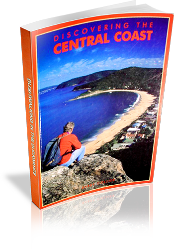
Discovering the Central Coast
Title: Discovering the Central Coast
Author: Barry Collier
Edition: 1
Publisher: Envirobook
ISBN: 0858811669
Number of pages: 144
Year of Publication: 2000
Cover Price (au$): 19.95
Format: Paperback
Website: http://www.envirobook.com.au
Weight (grams): 200
Regions the book covers: Central Coast
Height (cm): 21
Subjects:
Walking - New South Wales - Central Coast - Guidebooks,Central Coast (N.S.W.) - Guidebooks
Niche: Bushwalks on the Central Coast, plus three scenic drives
Interpretive Information: Plenty
Grade system explained: No
Ascent and/or Decent provided: No
Driving directions provided: No
Date walks last reviewed provided: No
A summary of walks provided: No
Regional Map of walks provided: Yes
Maps designed for walking: Yes - limited detail
Type of maps used (for walking): Sketch
Colour used in walking maps: Black and White
Size of walking maps: 1/4 page
Walking map Comment: Maps provided for park or individual walks. Commercial map references given.
Colour depth of photos: Black and White
Comment on Photographs: Small photographs scattered throughout book.
Level of detail in tracknotes: Detailed route information
List of walks in book
| Walk Name | Length | Time | Grade | Page |
|---|---|---|---|---|
| Patonga to Warrah Trig | 2.3 km | 1 hr 15 mins | Some steep sections | 60 |
| Bumble Hill | 5.6 km | 2 hrs 30 mins | Generally easy if attempted.... | 63 |
| Bouddi Coastal Walk | 10.5 km | 5 hrs | Some steep grades | 66 |
| Grahame Drive to Little Beach | 600 m | 20 mins | Easy | 67 |
| Little Beach to Mount Bouddi | 7.3 km | 3 hrs 30 mins | Some steep grades | 68 |
| Mt. Bouddi to the Maitland Bay Information Centre | 3 km | 1 hr 30 mins | Moderate grades with a lot of steps | 72 |
| The Maitland Bay Information Centre to Putty Beach | 3 km | 1 hr 30 mins | Some steep grades | 74 |
| Bullimah Spur | 2.3 km | 1 Hr | Easy. except for 98 steps at the end | 77 |
| Girrakool Loop Track | 1.5 km | 50 mins | Easy | 78 |
| Piles Creek Loop Track | 4 km | 3 hrs | Some steep grades | 80 |
| Somersby Falls | 400 m | 20 mins | Steep Grades, but only for short distances | 84 |
| Lillypilly Loop | 3.5 km | 2 hrs | Some steep grades, while walking in sand can be very tiring | 92 |
| The Red Gum Forest Walk | 3.5 km | 2 hrs | Some steep grades, while walking in sand can be very tiring | 96 |
| Cabbage Tree Trail and the first section of Stony Creek Trail | 1.5 km | 45 mins | Fairly easy; some moderate grades | 100 |
| Second section of Stony Creek Trail | 4 km | 1 hr 30 mins | Fairly easy; some moderate grades | 101 |
| Bellbird Trail | 3 km | 1 hr 30 mins | Easy | 103 |
| West Gosford Mangrove Boardwalk | 370 m | 20 mins | Easy-wheelchair Access | 106 |
| The Entrance foreshore | 900 m | 30 mins | 108 | |
| The Entrance to Berkeley Vale | 7 km | 3 hrs | 110 | |
| Canton Beach | 1.6 km | 45 mins | 115 | |
| Budgewoi to Buff Point | 800 m | 20 mins | 118 | |
| Buff Point to Charmhaven | 2.8 km | 50 mins | 119 | |
| Western Loop | 2.7 km | 1 hr 30 mins | Steep Sections | 122 |
| Eastern Loop | 2 km | 1 Hr | Some moderate grades | 126 |
| The Orchid Track | 750 m | 20 mins | Steep at start and finish, but otherwise easy | 128 |
| St Johns Lookout to Katandra Road | 3.8 km | 2 hrs | Many Steep Grades .... | 129 |
| St Johns Lookout to Katandra Road (loop) | 5.3 km | 3 hrs | Many Steep Grades .... | 129 |
| Guromgai Walk | 1.3 km | 40 mins | Many Steep Grades .... | 129 |
