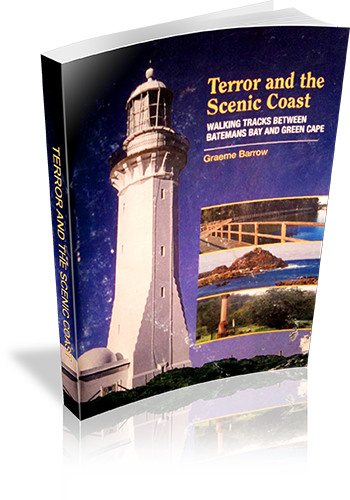
Terror and the Scenic Coast : Walking Tracks Between Batemans Bay And Green Cape
Title: Terror and the Scenic Coast : Walking Tracks Between Batemans Bay And Green Cape
Author: Graeme Barrow
Edition: 1
Publisher: Dagraja Press
ISBN: 0958755264
Number of pages: 76
Year of Publication: 2004
Cover Price (au$): 16.50
Format: Paperback
Weight (grams): 145
Regions the book covers: South Coast NSW
Height (cm): 21
Subjects:
Hiking - New South Wales - South Coast - Guidebooks,South Coast (N.S.W.) - Description and travel - Guidebooks
Interpretive Information: Plenty
Grade system explained: No
Ascent and/or Decent provided: No
Driving directions provided: Yes
Date walks last reviewed provided: No
A summary of walks provided: No
Regional Map of walks provided: Yes
Maps designed for walking: Yes - reasonable detail
Type of maps used (for walking): Detailed Topographic
Colour used in walking maps: Multicolour
Size of walking maps: Full page
Colour depth of photos: Colour
Comment on Photographs: Large photographs every 1-2 pages.
Level of detail in tracknotes: Detailed route information
List of walks in book
| Walk Name | Length | Time | Grade | Page |
|---|---|---|---|---|
| Mangroves Boardwalk | 2 km | 45 mins | Easy | 9 |
| Mogo Bushwalk | 2 km | 30 mins | Easy | 11 |
| Burrewarra Point | 2.5 km | 1 Hr | Easy | 12 |
| Broulee Island | 3.5 km | 1 hr 15 mins | Easy | 13 |
| Comans Mine | 1.5 km | 45 mins | Easy | 14 |
| Camel Rock | 4 km | 1 hr 15 mins | Easy | 16 |
| Lake Mummuga Circuit | 2.5 km | 45 mins | Easy | 17 |
| Kianga Rainforest | 800 m | 30 mins | Easy | 18 |
| Mill Bay Boardwalk | 5 km | 1 hr 15 mins | Easy | 19 |
| Mt Dromedary (Gulaga) | 11 km | 6 hrs | Hard | 21 |
| Pipers Lookout | 250 m | 15 mins | Easy | 24 |
| Long Swamp | 4 km | 1 hr 15 mins | Easy | 28 |
| Mimosa Rocks | 1.5 km | 30 mins | Easy | 29 |
| Nelson Lagoon Circuit | 1 km | 30 mins | Easy | 31 |
| Wajurda Point | 1 km | 30 mins | Easy | 31 |
| Boyds Tower | 600 m | 20 mins | Easy | 31 |
| Moon Bay | 500 m | 30 mins | Easy | 32 |
| Main Ridge Track | 4.5 km | 2 hrs | Moderate | 32 |
| Tathra Coast Walk | 4 km | 1 hr 30 mins | Easy | 35 |
| Kangarutha Track | 9.5 km | 3 hrs 30 mins | Hard | 37 |
| Bournda Trig | 4.5 km | 1 hr 30 mins | Moderate | 41 |
| Bournda Lagoon | 6 km | 2 hrs | Moderate | 43 |
| Scotts Hut Circuit | 2.5 km | 1 Hr | Easy | 45 |
| Merimbula Boardwalk | 3.5 km | 1 hr 30 mins | Easy | 47 |
| Fisherman's Hut | 3 km | 1 Hr | Easy | 48 |
| Pambula River | 1.5 km | 45 mins | Easy | 49 |
| Jiguma Track | 1.5 km | 45 mins | Easy | 50 |
| Goodenia Rainforest | 1.2 km | 45 mins | Moderate (steep climb back) | 50 |
| The Pinnacles | 1.2 km | 30 mins | Easy | 51 |
| Severs Beach | 1 km | 30 mins | Easy | 52 |
| Haycock Point | 5 km | 1 hr 45 mins | Easy | 53 |
| Curalo Lagoon Boardwalk | 4 km | 1 Hr | Easy | 56 |
| Eden Historical Trail | 3.5 km | 2 hrs | Easy | 57 |
| Boyds Tower - Leatherjacket Bay | 9.5 km | 2 hrs 30 mins | Moderate | 62 |
| Saltwater Creek - Mowarray Point | 8 km | 2 hrs | Easy | 65 |
| Saltwater Creek - Hegartys Bay | 10 km | 2 hrs 30 mins | Easy | 67 |
| Bittangabee Bay - Hegartys Bay | 9 km | 3 hrs | Moderate | 68 |
| Bittangabee Bay - Pulpit Rock | 8 km | 2 hrs 30 mins | Easy | 70 |
| Green Cape - Pulpit Rock | 6 km | 1 hr 30 mins | Easy | 72 |
| Mt Imlay | 6 km | 4 hrs | Hard | 75 |
