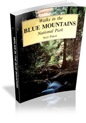
Walks in the Blue Mountains National Park
Title: Walks in the Blue Mountains National Park
Author: Neil Paton
Edition: 1
Publisher: Kangaroo Press
ISBN: 0864171293
Number of pages: 128
Year of Publication: 1987
Cover Price (au$): 10.95
Format: Paperback
Weight (grams): 145
Regions the book covers: Blue Mountains
Height (cm): 19
Subjects:
Nature trails - New South Wales - Blue Mountains National Park - Guidebooks,Hiking - New South Wales - Blue Mountains National Park - Guidebooks,Blue Mountains National Park (N.S.W.) - Guidebooks
Niche: Blue Mountains
Interpretive Information: Minimal
Grade system explained: No
Ascent and/or Decent provided: No
Driving directions provided: No
Date walks last reviewed provided: No
A summary of walks provided: No
Regional Map of walks provided: Yes
Maps designed for walking: Yes - limited detail
Type of maps used (for walking): Sketch
Colour used in walking maps: Black and White
Size of walking maps: 3/4 page
Walking map Comment: Most maps are shared by at least a few walks
Colour depth of photos: Black and White
Comment on Photographs: One photograph every three pages (on average)
Level of detail in tracknotes: Detailed route information
Alternate route and side trip suggestions: Many walks
List of walks in book
| Walk Name | Length | Time | Grade | Page |
|---|---|---|---|---|
| Lapstone to Glenbrook Creek | 10 | |||
| Lower Glenbrook Creek | 12 | |||
| Upper Glenbrook Creek - Martins Lookout to Picnic Point | 13 | |||
| Upper Glenbrook Creek - Perch Ponds to Faulconbridge | 16 | |||
| Red Hands Cave | 19 | |||
| The Oaks | 19 | |||
| Portal Lookout and Euroka Clearing | 20 | |||
| Tobys Glen Area | 22 | |||
| Murphys Glen Area | 22 | |||
| Wilsons Glen | 24 | |||
| Anderson's Fire Trail, Ingar Picnic Area | 24 | |||
| McMahons Lookout Area | 25 | |||
| Terrace Falls, Cataract Falls | 27 | |||
| Nepean Lookout Area | 31 | |||
| Empire Pass | 31 | |||
| Horseshoe Falls Reserve | 32 | |||
| Mabel Falls Reserve | 36 | |||
| The Valley of the Waters | 39 | |||
| Sublime Point | 46 | |||
| Cliff Walk | 47 | |||
| Federal Pass | 54 | |||
| Ruined Castle | 57 | |||
| Mt Solitary | 58 | |||
| Sewage Plant Service Road | 61 | |||
| Narrow Neck Plateau | 62 | |||
| The Devils Hole, Boars Head Rock | 66 | |||
| The Six Foot Track | 69 | |||
| Black Range Track | 78 | |||
| Medlow Gap | 79 | |||
| Radiata Plateau | 80 | |||
| Mt Hay | 82 | |||
| The Lockley Track | 84 | |||
| Neates Glen, the Grand Canyon | 85 | |||
| Evans Lookout to Govetts Leap | 86 | |||
| Govetts Leap to Pulpit Rock | 87 | |||
| Perrys Lookdown and Anvil Rock | 87 | |||
| The Braeside Walk | 88 | |||
| Govetts Leap to Junction Rock | 89 | |||
| Evans Lookout Bridle Trail | 89 | |||
| Perrys Lookdown to Blue Gum Forrest | 90 | |||
| The Rodriguez Pass | 91 | |||
| Blue Gum Forest to Victoria Falls Lookout | 92 | |||
| Pierces Pass | 95 | |||
| Mt Banks | 95 | |||
| Balzer Lookout and the Hanging Rock | 97 | |||
| Henson Glen, Minnie Ha-Ha Falls | 98 | |||
| Mt Wilson | 104 | |||
| Wallangambe River | 109 | |||
| Deep Pass | 112 | |||
| New Yards Hill Area | 112 | |||
| Mt Cookem | 116 | |||
| Scotts Main Range | 117 | |||
| Yerranderie | 119 | |||
| Colong Swamp | 121 | |||
| Kanangra | 123 | |||
| Burragorang Lookout | 126 |
