Berowra Waters to Cowan Station


3 hrs 30 mins

597 m
Hard track
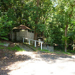


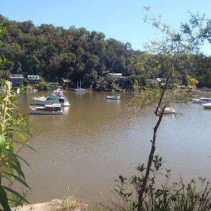
Berowra Waters Garden House

Waterview Restaurant
The Fish Café
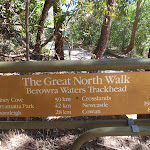
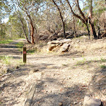
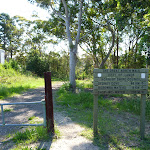
(0km) Berowra Waters track head → End of Kirkpatrick Way

390 m
8 mins
10m
-15m
Very easy
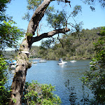
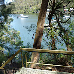
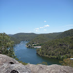
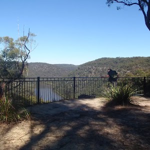
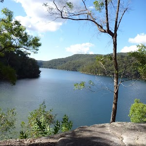
(0.39km) End of Kirkpatrick Way → Berowra Waters view point
810 m
26 mins
127m
-24m
Hard track
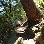
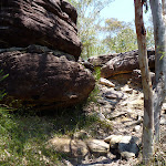
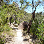
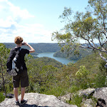
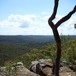
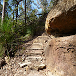
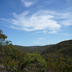
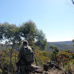
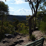
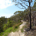
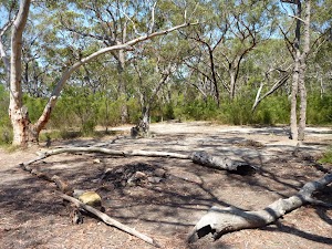
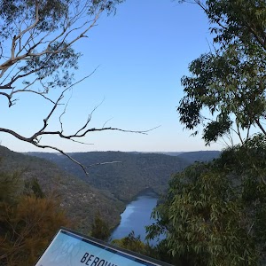
Veer right: From the seat and view[18], this walk follows the ‘Cowan’ sign[19] steeply uphill, following the series of timber[20] and rock steps[21]. After about 50m, the track leads up beside a rock wall[22], and at the top, turns right and mostly flattens out[23] for about 80m before starting to climb again[24]. At the top of this hill, this walk comes to a small clearing[25] (on the left, that has been used as a campsite[26]) and a large unfenced rock platform with great views[27] back over the valley (on your right).
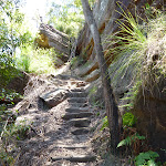
(1.2km) Berowra Waters view point → Deep Bay Creek crossing
390 m
9 mins
4m
-63m
Moderate track
(1.59km) Deep Bay Creek crossing → Int of GNW and Coreen Close western trail
840 m
32 mins
187m
-25m
Hard track
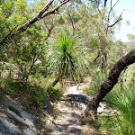
(2.43km) Int of GNW and Coreen Close service trail → Int of ridge top campsite and GNW
220 m
4 mins
2m
-4m
Moderate track
Ridge Top Campground
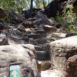
(2.65km) Int of ridge top campsite and Great North Walk → Joe Crafts Creek crossing
1.7 km
37 mins
24m
-196m
Hard track
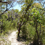
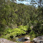
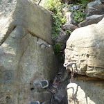
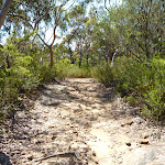
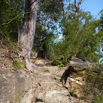
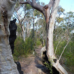
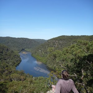
Continue straight: From the intersection[64], this walk follows the GNW arrow post[65] east along the track as it leads very gently downhill along the top of the ridge. Over the next 300m, the track passes a rock platform[66] and comes to a second rock platform with more views[67] and a ‘Great North Walk’ log book box[68] on a post. After leaving your note (and reading through a few entries), this walk continues down along the top of the ridge for another 200m to step down off another rock platform[69] (ignoring the track to your left). Here the walk starts to head downhill for the next 1km – initially the track leads down a series of short rocky steep sections[70][71], and passes some interesting large rock boulders[72][73] along the way. As the track moves further into the valley, it becomes consistently steeper[74] until leading down leading into the ferns and beside Joe Crafts Creek[75][76].
(4.31km) Joe Crafts Creek crossing → Valley viewing area
660 m
26 mins
158m
-5m
Hard track
(4.96km) Valley viewing area → Int of GNW and Glendale Road
880 m
16 mins
25m
-14m
Moderate track
(5.84km) Int of GNW and Glendale Road → Int of GNW and Pacific Highway service trail
830 m
19 mins
33m
-59m
Moderate track
(6.67km) Int of GNW and Pacific Highway service trail → Cowan trackhead
500 m
11 mins
27m
-13m
Moderate track
(7.17km) Int of Great North Walk and Pacific Highway service trail → Cowan Station
40 m
1 mins
0m
-2m
Easy track
Maps for the Berowra Waters to Cowan Station walk
You can download the PDF for this walk to print a map.These maps below cover the walk and the wider area around the walk, they are worth carrying for safety reasons.
| Cowan | 1:25 000 Map Series | 91304N COWAN | NSW-91304N |
| Ku-ring-gai Chase National Park Tourist Map | 1:40 000 Map Series | CMA Ku-ring-gai Chase National Park Tourist Map | CMA Ku-ring-gai Chase National Park Tourist Map |
| Sydney | 1:100 000 Map Series | 9130 SYDNEY | 9130 |
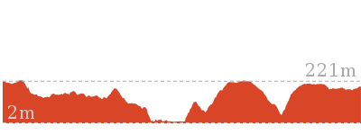
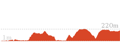
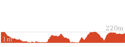
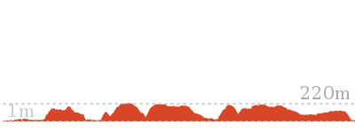
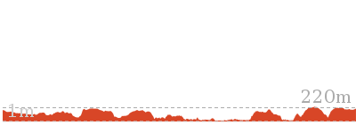
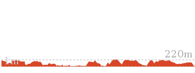
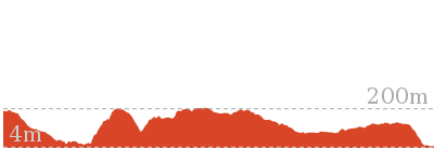
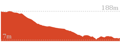
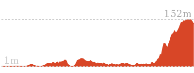
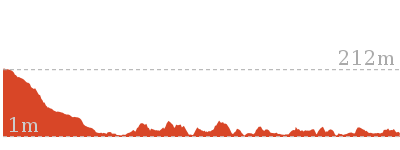
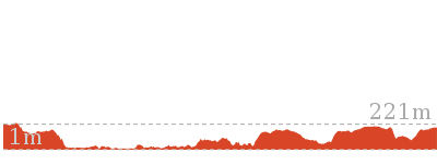
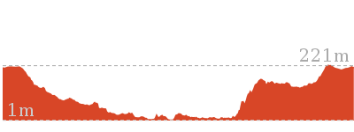
Cross sectional view of the Berowra Waters to Cowan Station bushwalking track
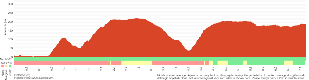
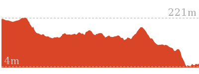
Analysis and summary of the altitude variation on the Berowra Waters to Cowan Station
Overview of this walks grade – based on the AS 2156.1 – 2001
Under this standard, a walk is graded based on the most difficult section of the walk.
| Length | 7.2 km | ||
| Time | 3 hrs 30 mins | ||
| . | |||
| Grade 4/6 Hard track |
AS 2156.1 | Gradient | Very steep (4/6) |
| Quality of track | Rough track, where fallen trees and other obstacles are likely (4/6) | ||
| Signs | Directional signs along the way (3/6) | ||
| Experience Required | Some bushwalking experience recommended (3/6) | ||
| Weather | Forecast, unforecast storms and severe weather may impact on navigation and safety (4/6) | ||
| Infrastructure | Limited facilities, not all cliffs are fenced (3/6) |
Some more details of this walks Grading
Here is a bit more details explaining grading looking at sections of the walk
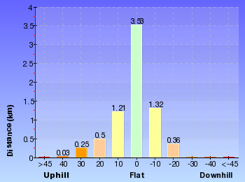
Gradient
3.3km of this walk is very steep and another 2.9km has gentle hills with occasional steps. Whilst another 580m is flat with no steps and the remaining 390m has short steep hills.
Quality of track
4.9km of this walk follows a formed track, with some branches and other obstacles and another 1.2km follows a rough track, where fallen trees and other obstacles are likely. Whilst another 720m follows a clear and well formed track or trail and the remaining 430m follows a smooth and hardened path.
Signs
Around 7km of this walk has directional signs at most intersection, whilst the remaining 430m is clearly signposted.
Experience Required
Around 5km of this walk requires some bushwalking experience, whilst the remaining 1.8km requires no previous bushwalking experience.
weather
6km of this walk is not usually affected by severe weather events (that would unexpectedly impact safety and navigation) and another 660m is affected by forecast, unforecast storms and severe weather events that may impact on navigation and safety. The remaining (390m) is affected by storms that may impact your navigation and safety.
Infrastructure
Around 6km of this walk has limited facilities (such as not all cliffs fenced), whilst the remaining 1.4km is close to useful facilities (such as fenced cliffs and seats).
Similar walks
12.9 km One way
6 hrs
Hard track
14 km One way
7 hrs 30 mins
Hard track
17.2 km One way
8 hrs
Hard track
27.4 km One way
2 Days
Hard track

35.9 km One way
2 Days
Hard track
43.1 km One way
3 Days
Hard track
Other Nearby walks
420 m Return
15 mins
Very easy
13.4 km One way
5 hrs 30 mins
Hard track
33.4 km One way
2 Days
Hard track

4.9 km Return
2 hrs
Moderate track
980 m Return
30 mins
Very easy
13.7 km Return
6 hrs
Hard track

8.2 km Return
3 hrs 30 mins
Hard track
9.4 km One way
4 hrs 30 mins
Hard track

8.7 km One way
4 hrs
Hard track
5.7 km One way
2 hrs 45 mins
Hard track
22.6 km One way
9 hrs 18 mins
Hard track
9.7 km One way
4 hrs 15 mins
Hard track
Plan your trip to and from the walk here
The Berowra Waters to Cowan Station walk starts at the Berowra Waters track head (gps: -33.60055, 151.12561)Your transport options to Berowra Waters track head are by;
(get details)
The Berowra Waters to Cowan Station ends at the Cowan Station (gps: -33.593766, 151.17169)
Your transport options to Cowan Station are by;
(get details)


Short URL = http://wild.tl/bwtcs
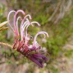
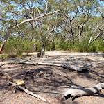
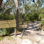
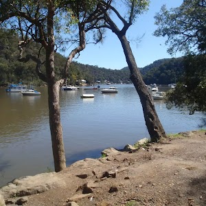
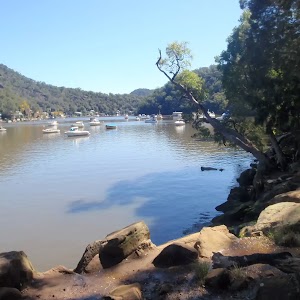
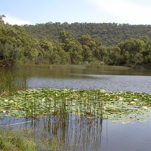
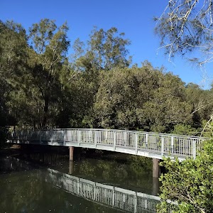
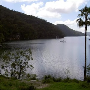
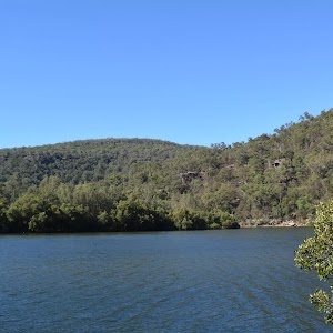
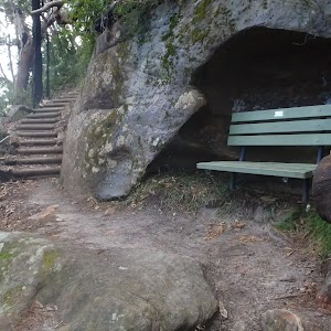
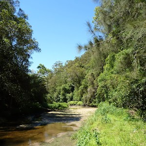
Gallery images
There are other downloads I am still working on.
You will probably need to login to access these — still all free.
* KML (google earth file)
* GPX (GPS file)
Special Maps/ brochures
* A3 topo maps
* PDF with Lands Topo map base
* PDF with arial image (and map overlay)
I wanted to get the main site live first, this extra stuff will come in time.
Happy walking
Matt 🙂
Comments