Victoria Falls Lookout to Blue Gum Forest


8 hrs

1102 m
Experienced only


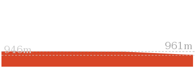
(0km) Victoria Falls Rd car park → Victoria Falls Lookout

100 m
2 mins
0m
-15m
Moderate track
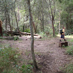
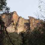
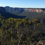
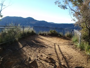
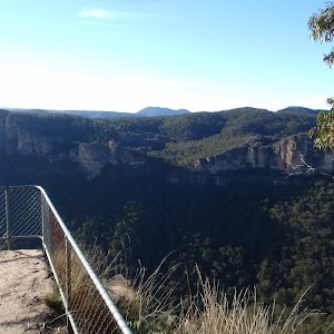
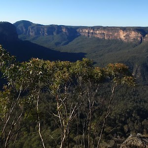
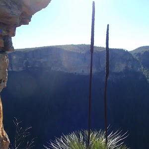
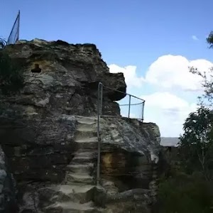
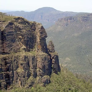
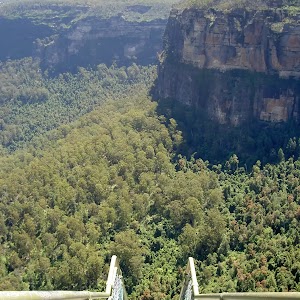
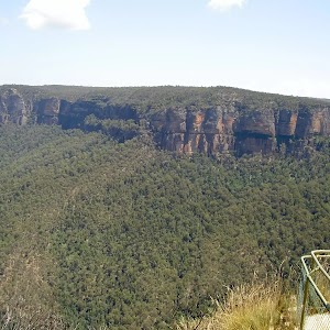
Victoria Falls Lookout
(0.1km) Victoria Falls Lookout → Int. Victoria Creek Cascades and Victoria Falls Tracks
1.3 km
39 mins
24m
-358m
Hard track
(1.38km) Int. Victoria Creek Cascades and Victoria Falls Tracks → Victoria Creek Cascades
90 m
3 mins
14m
0m
Hard track
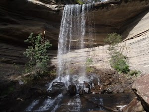
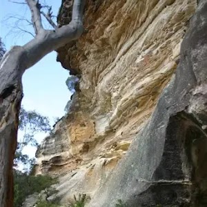
Victoria Cascades
(1.38km) Int. Victoria Creek Cascades and Victoria Falls Tracks → Int. Top of Falls and Victoria Creek Tracks
20 m
0m
-2m
Moderate track
(1.39km) Int. Top of Falls and Victoria Creek Tracks → Top of Falls
20 m
1 mins
1m
-1m
Hard track
(1.39km) Int. Top of Falls and Victoria Creek Tracks → Int. Bottom of Falls and Victoria Creek Tracks
100 m
2 mins
0m
-19m
Hard track
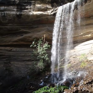
(1.49km) Int. Bottom of Falls and Victoria Creek Tracks → Victoria Falls
50 m
2 mins
13m
0m
Hard track
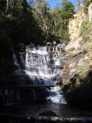
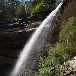
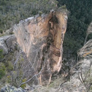
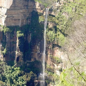
Victoria Falls
(1.49km) Int. Bottom of Falls and Victoria Creek Tracks → Burra Korain Flat Camping Area
1.3 km
29 mins
22m
-126m
Hard track
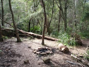
Burra Korain Flat Camping Area
(2.84km) Burra Korain Flat Camping Area → Blue Gum Forest intersection
8.8 km
3 hrs 24 mins
422m
-599m
Experienced only
Continue straight: From the camping area, this walk follows the ‘Acacia Flats’ sign down to the creek. The track crosses the creek and continues along the right-hand bank, heading downstream. The track then undulates and winds on the right side of the creek for approximately 3km in a south-easterly direction. The track crosses a number of creeks, and continues undulating along the south side of the Grose River to an intersection, with a sign pointing back to Burra Korain.
Continue straight: From the intersection, this walk follows the sign to ‘Acacia Flats’[1], keeping the creek below on the left. The track continues for approximately 500m, undulating across the steep hillside. The terrain then begins to flatten out as the track leads onto a creek flat area. After a short while, a clearing with a fireplace is passed, on your right. The track continues to undulate along the hillside, with the creek to the left, for approximately 2km, to an area where the creek flats broaden. The track passes some more clearings with fire places, coming to a sign marked ‘Blue Gum Forest’. The track passes this sign and continues for approximately 500m to a well-signed intersection.
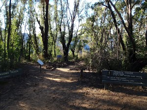
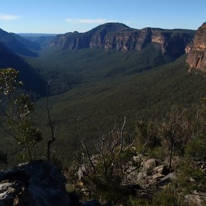
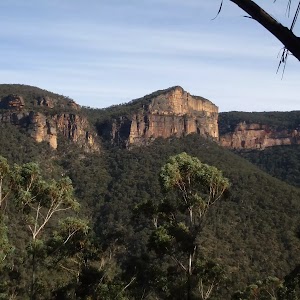
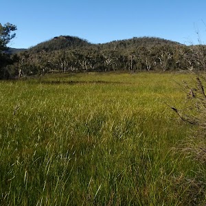
Blue Gum Forest
(11.63km) Blue Gum Forest intersection → Int. Perry’s and Dockers Lookout Tracks
2 km
1 hr 31 mins
603m
-22m
Hard track
Continue straight: From Memorial Lookout, the walk climbs the stairs, keeping the valley on the right, and then contours left around the hill. The track descends slightly before crossing a bridge, and then turns right before leading up the steps to the signposted intersection.
(13.64km) Int. Perry’s and Dockers Lookout Tracks → Dockers Lookout
20 m
1 mins
0m
-13m
Moderate track
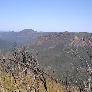
Dockers Lookout

(13.64km) Int. Perry’s and Dockers Lookout Tracks → Perry’s Lookdown
40 m
2 mins
15m
0m
Moderate track
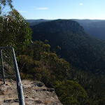
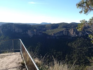
Perry’s Lookdown
(13.68km) Perry’s Lookdown → Perry’s Lookdown car park and camping area
80 m
3 mins
16m
0m
Moderate track
Perrys Lookdown campground
Maps for the Victoria Falls Lookout to Blue Gum Forest walk
You can download the PDF for this walk to print a map.These maps below cover the walk and the wider area around the walk, they are worth carrying for safety reasons.
| Mount Wilson | 1:25 000 Map Series | 89301N MOUNT WILSON | NSW-89301N |
| Katoomba | 1:100 000 Map Series | 8930 KATOOMBA | 8930 |
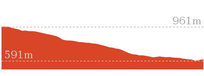
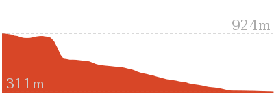
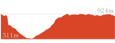
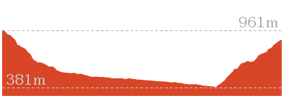
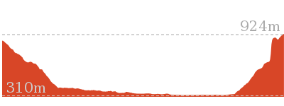
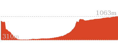
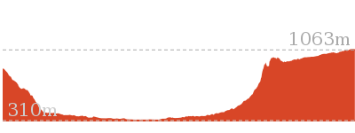
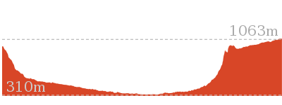
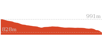
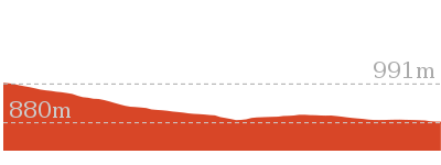
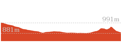
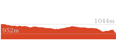
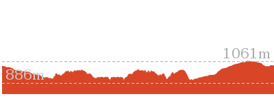
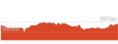
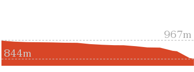
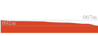
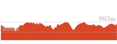
Cross sectional view of the Victoria Falls Lookout to Blue Gum Forest bushwalking track
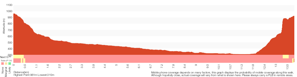
Analysis and summary of the altitude variation on the Victoria Falls Lookout to Blue Gum Forest
Overview of this walks grade – based on the AS 2156.1 – 2001
Under this standard, a walk is graded based on the most difficult section of the walk.
| Length | 13.8 km | ||
| Time | 8 hrs | ||
| . | |||
| Grade 5/6 Experienced only |
AS 2156.1 | Gradient | Very steep (4/6) |
| Quality of track | Rough unclear track (5/6) | ||
| Signs | Minimal directional signs (4/6) | ||
| Experience Required | Some bushwalking experience recommended (3/6) | ||
| Weather | Weather generally has little impact on safety (1/6) | ||
| Infrastructure | Limited facilities (such as cliffs not fenced, significant creeks not bridged) (4/6) |
Some more details of this walks Grading
Here is a bit more details explaining grading looking at sections of the walk
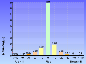
Gradient
Around 12km of this walk is very steep, whilst the remaining 1.7km has short steep hills.
Quality of track
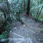
9km of this walk follows a rough unclear track and another 4.5km follows a rough track, where fallen trees and other obstacles are likely. The remaining (490m) follows a formed track, with some branches and other obstacles.
Signs
5km of this walk has minimal directional signs and another 5km is clearly signposted. The remaining (3.4km) has directional signs at most intersection.
Experience Required
Around 7km of this walk requires no previous bushwalking experience, whilst the remaining 7km requires some bushwalking experience.
weather
This whole walk, 14km is not usually affected by severe weather events (that would unexpectedly impact safety and navigation).
Infrastructure
13km of this walk has limited facilities (such as cliffs not fenced, significant creeks not bridged) and another 390m has limited facilities (such as not all cliffs fenced). The remaining (100m) is close to useful facilities (such as fenced cliffs and seats).
Similar walks
206 m Return
15 mins
Moderate track
3.1 km Return
2 hrs
Hard track
4.3 km Return
4 hrs
Hard track
8.1 km One way
5 hrs 30 mins
Hard track
8.9 km One way
2 Days
Experienced only
10.4 km One way
5 hrs 30 mins
Experienced only
12.8 km One way
2 Days
Hard track
14 km Return
6 hrs 30 mins
Experienced only
17.6 km One way
9 hrs
Experienced only
22.2 km One way
2 Days
Experienced only
22.5 km One way
3 Days
Experienced only

Other Nearby walks
5.6 km Return
2 hrs
Hard track
4.2 km Return
1 hr 30 mins
Moderate track
6.4 km Return
2 hrs 30 mins
Very experienced only
7.6 km Return
3 hrs 30 mins
Hard track
460 m Return
15 mins
Moderate track
400 m Return
15 mins
Easy track
13.6 km Circuit
8 hrs
Hard track
4.2 km One way
2 hrs 30 mins
Hard track
816 m Return
45 mins
Hard track
748 m Return
30 mins
Moderate track
630 m Return
30 mins
Moderate track
6.6 km One way
4 hrs 15 mins
Hard track
Plan your trip to and from the walk here
The Victoria Falls Lookout to Blue Gum Forest walk starts at the Victoria Falls Rd car park (gps: -33.573667, 150.29213)Your main transport option to Victoria Falls Rd car park is by;
(get details)
The Victoria Falls Lookout to Blue Gum Forest ends at the Perry’s Lookdown car park and camping area (gps: -33.599394, 150.34602)
Your main transport option to Perry’s Lookdown car park and camping area is by;
(get details)


Short URL = http://wild.tl/vfltbgf
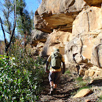
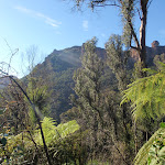
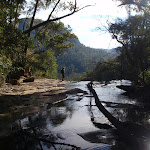
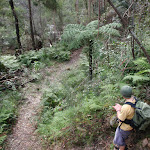
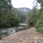
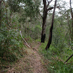
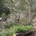
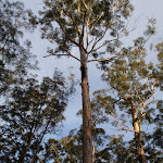
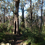
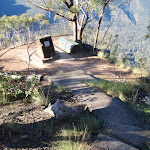
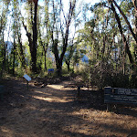
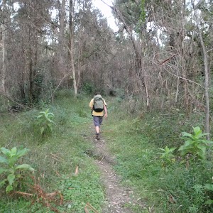
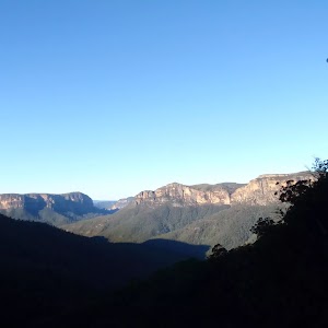
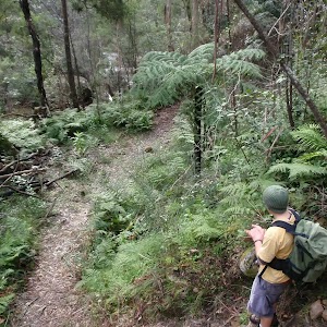
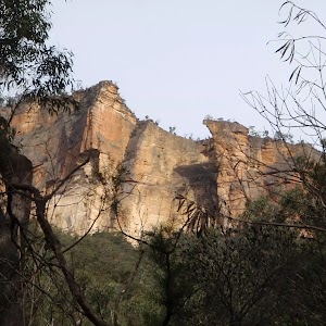
Gallery images
There are other downloads I am still working on.
You will probably need to login to access these — still all free.
* KML (google earth file)
* GPX (GPS file)
Special Maps/ brochures
* A3 topo maps
* PDF with Lands Topo map base
* PDF with arial image (and map overlay)
I wanted to get the main site live first, this extra stuff will come in time.
Happy walking
Matt 🙂
Comments