Along Narrow Neck to Taro’s Ladder


7 hrs

671 m
Moderate track


(0km) Locked gate → Int of southern Castle Head track and Glenraphael Drive

1.2 km
22 mins
30m
-39m
Moderate track
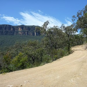
Continue straight: From the intersection, this walk heads south along the management trail and down a steep hill, until it reaches the intersection of Glenraphael Drive and the southern Castle Head track.
(1.16km) Int of southern Castle Head track and Glenraphael Drive → Lookout
220 m
5 mins
20m
-15m
Experienced only
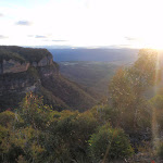
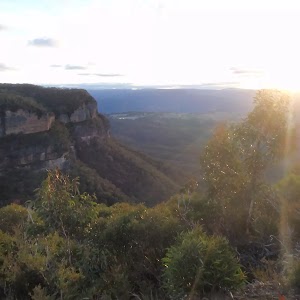
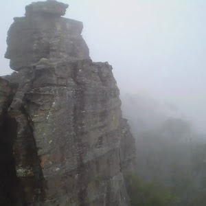
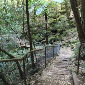
Veer right: From the intersection, this walk heads south-west over a small hill and steeply down the other side to a clearing at the cliffs, where there is a viewing point. At the end of this side trip, retrace your steps back to the main walk then Veer left.
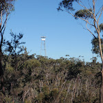
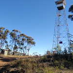
(1.16km) Int of southern Castle Head track and Glenraphael Drive → Fire Tower
5.7 km
1 hr 55 mins
216m
-144m
Moderate track
(6.88km) Fire Tower → End of Glenraphael Drive
3.1 km
1 hr 2 mins
65m
-177m
Moderate track
(10.02km) End of Glenraphael Drive → Top of Taro’s Ladder
250 m
10 mins
11m
-97m
Hard track
Maps for the Along Narrow Neck to Taro’s Ladder walk
You can download the PDF for this walk to print a map.These maps below cover the walk and the wider area around the walk, they are worth carrying for safety reasons.
| Six Foot Track | 1:50 000 Map Series | Six Foot Track | NSW-six-foot-track |
| Jamison | 1:25 000 Map Series | 89302N JAMISON | NSW-89302N |
| Katoomba | 1:25 000 Map Series | 89301S KATOOMBA | NSW-89301S |
| Katoomba | 1:100 000 Map Series | 8930 KATOOMBA | 8930 |
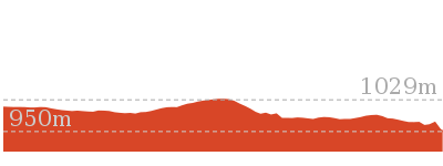
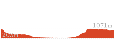
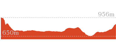
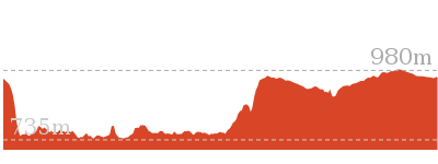
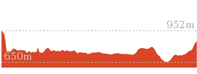
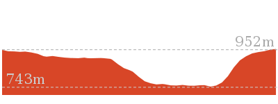
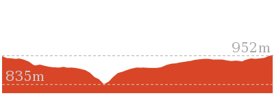
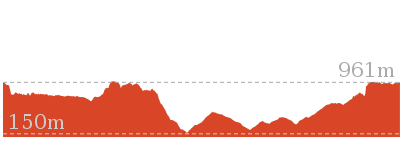
Cross sectional view of the Along Narrow Neck to Taro’s Ladder bushwalking track
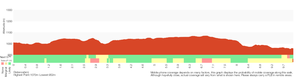
Analysis and summary of the altitude variation on the Along Narrow Neck to Taro’s Ladder
Overview of this walks grade – based on the AS 2156.1 – 2001
Under this standard, a walk is graded based on the most difficult section of the walk.
| Length | 20 km | ||
| Time | 7 hrs | ||
| . | |||
| Grade 3/6 Moderate track |
AS 2156.1 | Gradient | Short steep hills (3/6) |
| Quality of track | Clear and well formed track or trail (2/6) | ||
| Signs | Directional signs along the way (3/6) | ||
| Experience Required | No experience required (1/6) | ||
| Weather | Weather generally has little impact on safety (1/6) | ||
| Infrastructure | Limited facilities, not all cliffs are fenced (3/6) |
Some more details of this walks Grading
Here is a bit more details explaining grading looking at sections of the walk
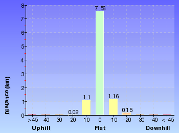
Gradient
Around 9km of this walk has short steep hills, whilst the remaining 850m has gentle hills with occasional steps.
Quality of track
This whole walk, 10km follows a clear and well formed track or trail.
Signs
Around 6km of this walk has directional signs at most intersection, whilst the remaining 4km is clearly signposted.
Experience Required
This whole walk, 10km requires no previous bushwalking experience.
weather
This whole walk, 10km is not usually affected by severe weather events (that would unexpectedly impact safety and navigation).
Infrastructure
Around 7km of this walk is close to useful facilities (such as fenced cliffs and seats), whilst the remaining 3.1km has limited facilities (such as not all cliffs fenced).
Similar walks
4.2 km Return
1 hr 45 mins
Hard track
47.8 km One way
2 Days
Very experienced only

47.8 km One way
3 Days
Very experienced only
Other Nearby walks
11.7 km Return
8 hrs 45 mins
Experienced only
7.9 km Return
5 hrs
Hard track

29.2 km One way
2 Days
Experienced only

29.3 km One way
3 Days
Experienced only

5.9 km Circuit
3 hrs 30 mins
Hard track

6.7 km Return
4 hrs 30 mins
Moderate track
16.2 km Return
11 hrs
Experienced only
12.4 km Return
7 hrs 30 mins
Hard track
2.7 km Return
2 hrs 30 mins
Moderate track
869 m Circuit
1 hr 15 mins
Hard track
1.5 km Circuit
1 hr 45 mins
Hard track
33.8 km Circuit
3 Days
Experienced only
Plan your trip to and from the walk here
The Along Narrow Neck to Taro’s Ladder walk starts and ends at the Locked gate (gps: -33.740883, 150.28013)Your main transport option to Locked gate is by;
(get details)


Short URL = http://wild.tl/annttl
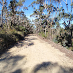
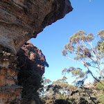
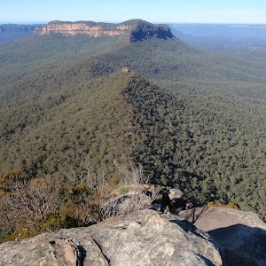
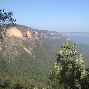
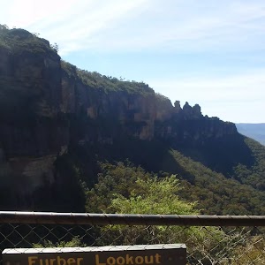
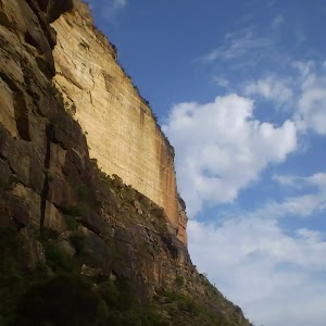
Gallery images
There are other downloads I am still working on.
You will probably need to login to access these — still all free.
* KML (google earth file)
* GPX (GPS file)
Special Maps/ brochures
* A3 topo maps
* PDF with Lands Topo map base
* PDF with arial image (and map overlay)
I wanted to get the main site live first, this extra stuff will come in time.
Happy walking
Matt 🙂
Comments