Leura Park to Copelands Lookout


1 Hr

99 m
Moderate track
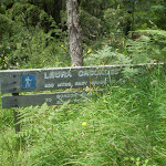


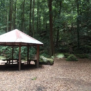
Leura Cascades Picnic Area
(0km) Leura Cascades Picnic Area → Int of Prince Henry Cliff Walk and Majestic Lookout Track

310 m
7 mins
6m
-20m
Moderate track
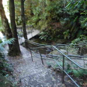
Turn right: From the intersection, this walk follows the ‘Echo Point’ sign up the timber steps (away from the handrail) until the walk flattens out and gently winds around the side of the hill, steadily climbing. After passing a sandstone overhang with a bench-seat, the track comes to an intersection at a rocky outcrop.
(0.31km) Int of Prince Henry Cliff Walk and Majestic Lookout Track → Int of Prince Henry Cliff Walk and Bridal Veil Lookout Track
270 m
6 mins
33m
-6m
Moderate track
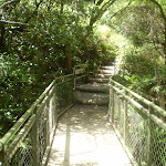
Veer right: From the intersection, this walk follows the ‘Echo Point’ sign along the ‘Prince Henrey Walk’, winding around the side of the hill, passing two picnic seats under a rock overhang and continuing up the side of the hill. The walk climbs up the steep slope via metal and wooden steps, until it flattens out at a fenced boardwalk, which it crosses, continuing up another metal staircase to a bush track, which it follows around the side of the hill to the signposted intersection of the Bridal Veil Lookout track.
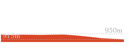
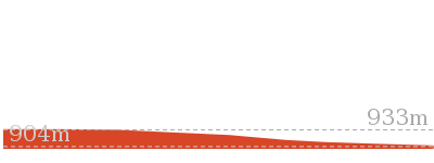
(0.58km) Int of Prince Henry Cliff Walk and Bridal Veil Lookout Track → Bridal Veil Lookout
40 m
1 mins
0m
-14m
Easy track
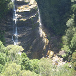
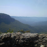
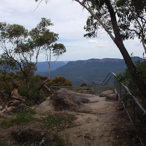
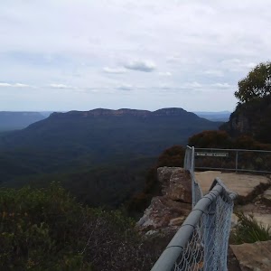
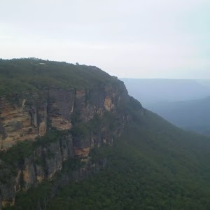
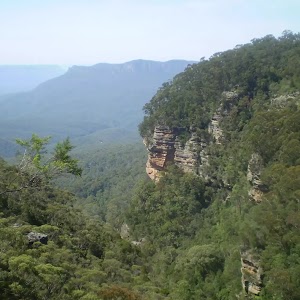
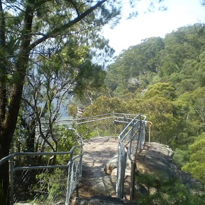
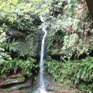
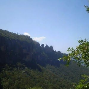
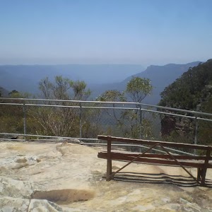
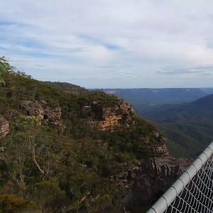
Bridal Veil Lookout

(0.58km) Int of Prince Henry Cliff Walk and Bridal Veil Lookout Track → Copelands Lookout
180 m
4 mins
2m
-32m
Moderate track
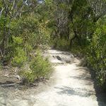
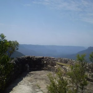
Turn left: From the intersection, this walk follows the ‘Copelands Lookout’ sign down along the bush track, winding down the long, gentle hill to a rock shelf, where it continues down a steep set of wooden steps and along the bush track to the rock platform, fenced off with a short rock wall.
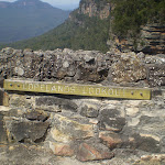
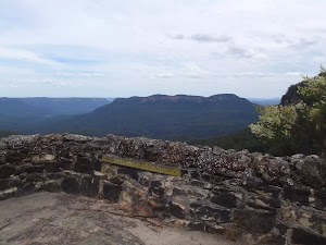
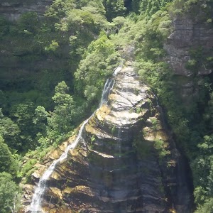
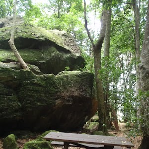
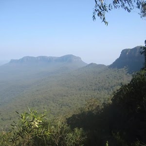
Copelands Lookout
Maps for the Leura Park to Copelands Lookout walk
You can download the PDF for this walk to print a map.These maps below cover the walk and the wider area around the walk, they are worth carrying for safety reasons.
| Six Foot Track | 1:50 000 Map Series | Six Foot Track | NSW-six-foot-track |
| Katoomba | 1:25 000 Map Series | 89301S KATOOMBA | NSW-89301S |
| Katoomba | 1:100 000 Map Series | 8930 KATOOMBA | 8930 |
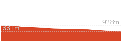
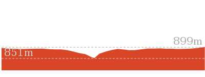
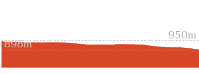
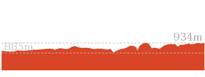
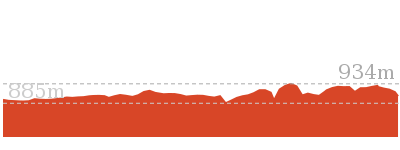
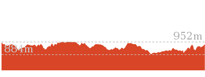
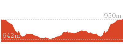
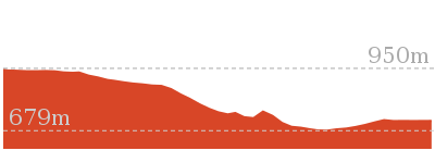
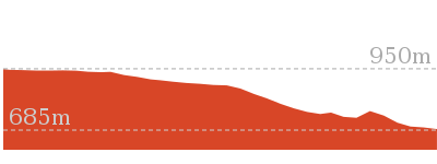
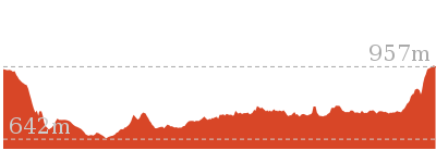
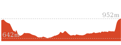
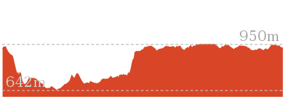
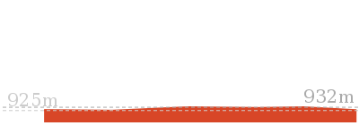
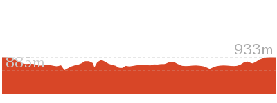
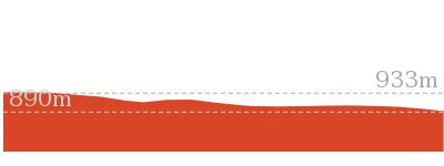
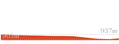
Cross sectional view of the Leura Park to Copelands Lookout bushwalking track
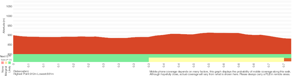
Analysis and summary of the altitude variation on the Leura Park to Copelands Lookout
Overview of this walks grade – based on the AS 2156.1 – 2001
Under this standard, a walk is graded based on the most difficult section of the walk.
| Length | 1.5 km | ||
| Time | 1 Hr | ||
| . | |||
| Grade 3/6 Moderate track |
AS 2156.1 | Gradient | Short steep hills (3/6) |
| Quality of track | Formed track, with some branches and other obstacles (3/6) | ||
| Signs | Clearly signposted (1/6) | ||
| Experience Required | Some bushwalking experience recommended (3/6) | ||
| Weather | Weather generally has little impact on safety (1/6) | ||
| Infrastructure | Limited facilities, not all cliffs are fenced (3/6) |
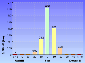
Some more details of this walks Grading
Here is a bit more details explaining grading looking at sections of the walk
Gradient
590m of this walk has short steep hills and another 130m has gentle hills with occasional steps. The remaining (45m) is flat with no steps.
Quality of track
Around 590m of this walk follows a clear and well formed track or trail, whilst the remaining 170m follows a formed track, with some branches and other obstacles.
Signs
This whole walk, 760m is clearly signposted.
Experience Required
Around 400m of this walk requires some bushwalking experience, whilst the remaining 360m requires no previous bushwalking experience.
weather
This whole walk, 760m is not usually affected by severe weather events (that would unexpectedly impact safety and navigation).
Infrastructure
Around 510m of this walk is close to useful facilities (such as fenced cliffs and seats), whilst the remaining 250m has limited facilities (such as not all cliffs fenced).
Similar walks
150 m Return
15 mins
Moderate track
570 m Return
20 mins
Moderate track
844 m Circuit
30 mins
Moderate track

844 m Circuit
30 mins
Moderate track
892 m Return
30 mins
Moderate track
1.8 km One way
1 hr 15 mins
Moderate track
3.2 km One way
1 hr 45 mins
Moderate track
3.3 km Return
1 hr 30 mins
Moderate track
3.6 km Return
2 hrs
Moderate track
6.6 km One way
4 hrs
Hard track

6.8 km One way
3 hrs 30 mins
Moderate track
Other Nearby walks
582 m Return
30 mins
Moderate track
4.8 km Circuit
3 hrs
Hard track
2.3 km Return
1 hr 30 mins
Hard track
1.7 km Return
1 hr 15 mins
Hard track
8 km One way
5 hrs
Hard track
4.4 km One way
3 hrs 45 mins
Hard track
9.4 km Circuit
5 hrs 30 mins
Hard track
308 m Return
15 mins
Moderate track
2 km Circuit
1 Hr
Moderate track
954 m Return
30 mins
Moderate track
432 m Return
15 mins
Easy track
538 m Return
30 mins
Moderate track
Plan your trip to and from the walk here
The Leura Park to Copelands Lookout walk starts and ends at the Leura Cascades Picnic Area (gps: -33.719623, 150.3224)Your transport options to Leura Cascades Picnic Area are by;
(get details)


Short URL = http://wild.tl/lptcl
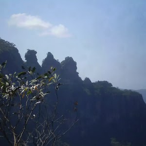
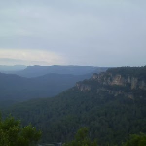
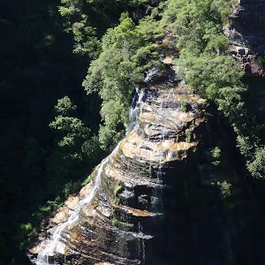
Gallery images
There are other downloads I am still working on.
You will probably need to login to access these — still all free.
* KML (google earth file)
* GPX (GPS file)
Special Maps/ brochures
* A3 topo maps
* PDF with Lands Topo map base
* PDF with arial image (and map overlay)
I wanted to get the main site live first, this extra stuff will come in time.
Happy walking
Matt 🙂
Comments