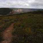
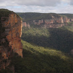
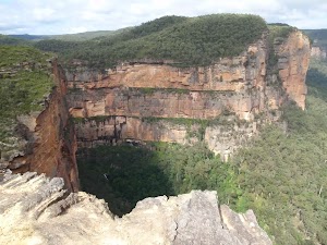
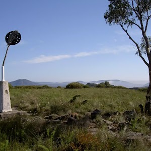
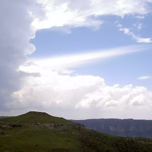
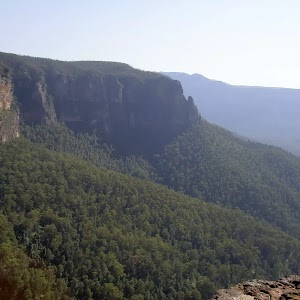
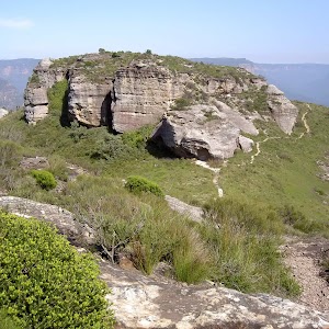
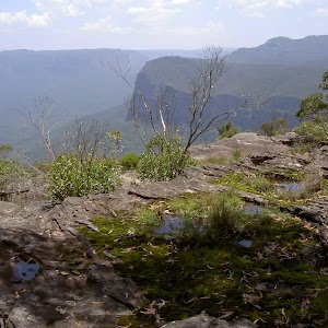
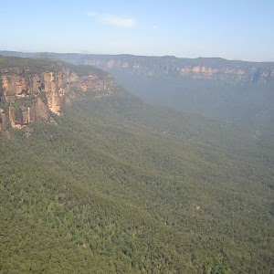
Govetts Creek Lookout


1 hr 30 mins

115 m
Moderate track


(0km) Fortress Ridge car park → Govetts Ck Lookout Trk

1.3 km
26 mins
36m
-46m
Moderate track
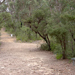
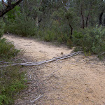
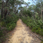
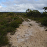
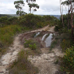
Turn left: From the intersection the track heads down the trail which tends off to the left. The track continues winding away from the main trail as it winds down the spur. The track soon opens into a low heath area, out of the bush, where the trakc becomes more overgrown. As the track continues down the hill it reaches a caldasac with a large bush in the centre of it. Behind the bush is the start of the bushtrack.
(1.31km) Govetts Ck Lookout Trk → Govetts Ck Lookout
120 m
4 mins
1m
-32m
Moderate track
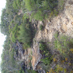
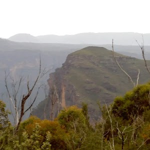
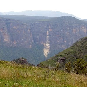
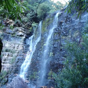
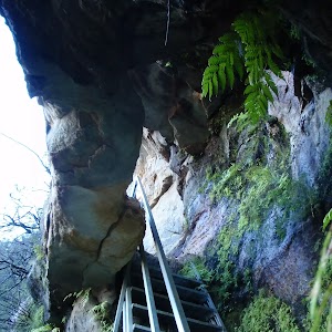
Govetts Creek View
Maps for the Govetts Creek Lookout walk
You can download the PDF for this walk to print a map.These maps below cover the walk and the wider area around the walk, they are worth carrying for safety reasons.
| Katoomba | 1:25 000 Map Series | 89301S KATOOMBA | NSW-89301S |
| Katoomba | 1:100 000 Map Series | 8930 KATOOMBA | 8930 |
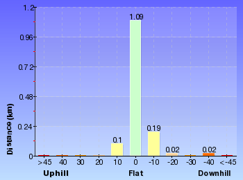
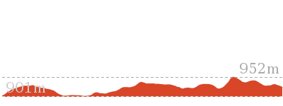
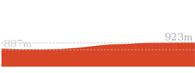
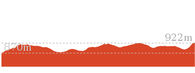
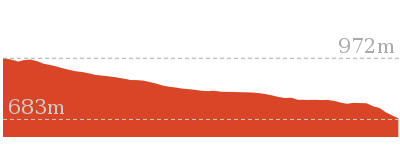
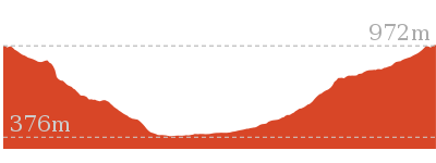
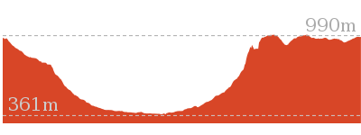
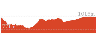
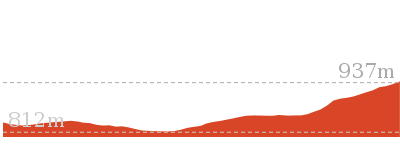
Cross sectional view of the Govetts Creek Lookout bushwalking track

Analysis and summary of the altitude variation on the Govetts Creek Lookout
Overview of this walks grade – based on the AS 2156.1 – 2001
Under this standard, a walk is graded based on the most difficult section of the walk.
| Length | 2.9 km | ||
| Time | 1 hr 30 mins | ||
| . | |||
| Grade 3/6 Moderate track |
AS 2156.1 | Gradient | Short steep hills (3/6) |
| Quality of track | Formed track, with some branches and other obstacles (3/6) | ||
| Signs | Directional signs along the way (3/6) | ||
| Experience Required | Some bushwalking experience recommended (3/6) | ||
| Weather | Weather generally has little impact on safety (1/6) | ||
| Infrastructure | Limited facilities, not all cliffs are fenced (3/6) |
Some more details of this walks Grading
Here is a bit more details explaining grading looking at sections of the walk
Gradient
Around 740m of this walk is flat with no steps, whilst the remaining 690m has short steep hills.
Quality of track
690m of this walk follows a formed track, with some branches and other obstacles and another 620m follows a smooth and hardened path. The remaining (120m) follows a clear and well formed track or trail.
Signs
Around 820m of this walk has directional signs at most intersection, whilst the remaining 620m is clearly signposted.
Experience Required
Around 1.3km of this walk requires no previous bushwalking experience, whilst the remaining 120m requires some bushwalking experience.
weather
This whole walk, 1.4km is not usually affected by severe weather events (that would unexpectedly impact safety and navigation).
Infrastructure
Around 820m of this walk has limited facilities (such as not all cliffs fenced), whilst the remaining 620m is close to useful facilities (such as fenced cliffs and seats).
Similar walks
7.4 km Return
3 hrs
Moderate track
Other Nearby walks
1 km Return
30 mins
Moderate track
6.8 km Return
3 hrs 15 mins
Hard track
16.5 km One way
2 Days
Hard track
3.1 km Return
2 hrs
Hard track
6.4 km Circuit
4 hrs
Very experienced only
10.7 km Circuit
6 hrs 30 mins
Hard track
5.4 km Circuit
3 hrs 30 mins
Hard track
9.3 km Circuit
4 hrs 30 mins
Hard track
2.5 km Return
1 Hr
Hard track
2 km Circuit
1 Hr
Moderate track

3.1 km Return
1 hr 45 mins
Hard track
4.6 km Circuit
2 hrs
Hard track

Plan your trip to and from the walk here
The Govetts Creek Lookout walk starts and ends at the Fortress Ridge car park (gps: -33.658099, 150.3642)Your main transport option to Fortress Ridge car park is by;
(get details)


Short URL = http://wild.tl/gcl
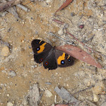
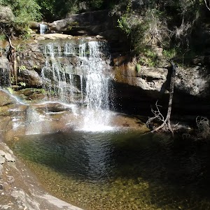
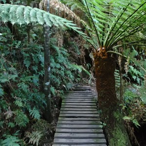
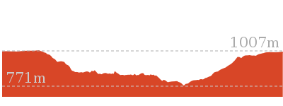
Gallery images
There are other downloads I am still working on.
You will probably need to login to access these — still all free.
* KML (google earth file)
* GPX (GPS file)
Special Maps/ brochures
* A3 topo maps
* PDF with Lands Topo map base
* PDF with arial image (and map overlay)
I wanted to get the main site live first, this extra stuff will come in time.
Happy walking
Matt 🙂
Comments