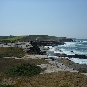
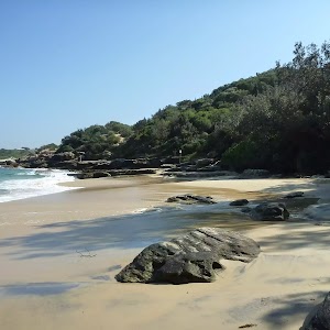
Cape Baily Coast Walk


2 hrs

191 m
Moderate track
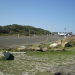


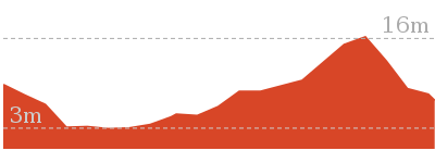
(0km) End of Cape Solander Drive → Tabbigai Gap Track Int

950 m
21 mins
41m
-47m
Moderate track
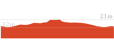
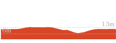
(0.95km) Tabbigai Gap Track Int → Sand dune int
750 m
15 mins
23m
-22m
Moderate track
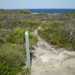
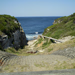
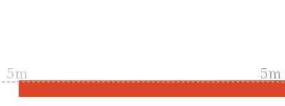
Veer right: From the intersection, this walk heads south-west along track beside the cliffline, gradually turning to the west (along the northern side of Blue Hole Gap) until coming to a small climb inside a sand dunes. On the far side of the dune (about 30m), there is an intersection with a wide sandy track to the right, and a narrower one on the left.
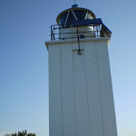
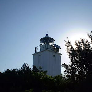
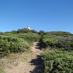
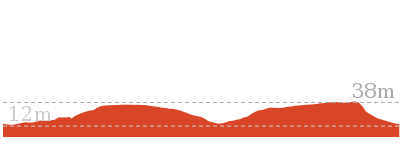
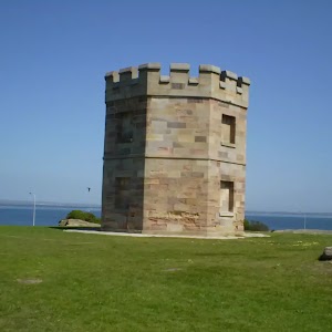
(1.69km) Sand dune int → Cape Bailey Lighthouse
1 km
20 mins
36m
-22m
Moderate track
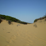
Veer right: From the intersection, this walk follows the sandy bush track, heading up and away from the ocean. The track is relatively defined for most of the way, however in the last 20m the track becomes quite overgrown and a little less defined (the lighthouse is always visible). Once at the lighthouse, there are good views inland, however the views to the east are largely blocked by the high scrub.
Maps for the Cape Baily Coast Walk walk
You can download the PDF for this walk to print a map.These maps below cover the walk and the wider area around the walk, they are worth carrying for safety reasons.
| Port Hacking | 1:25 000 Map Series | 91294N PORT HACKING | NSW-91294N |
| Port Hacking | 1:100 000 Map Series | 9129 PORT HACKING | 9129 |
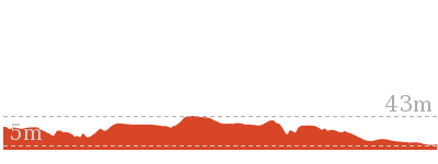
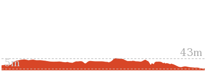
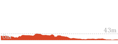
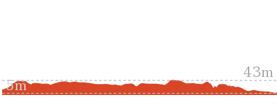
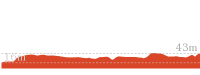
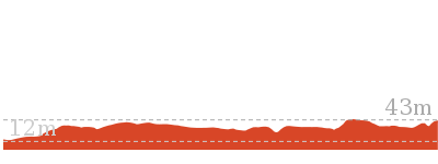
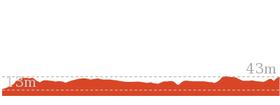
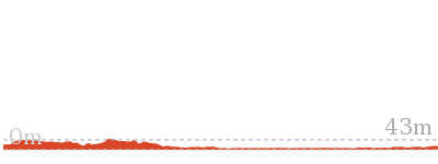
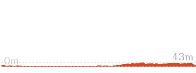
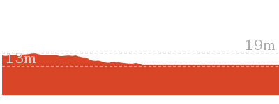
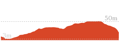
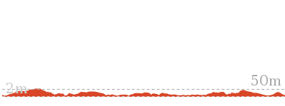
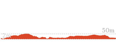
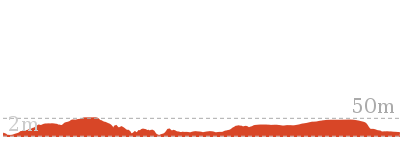
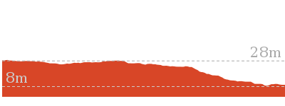
Cross sectional view of the Cape Baily Coast Walk bushwalking track
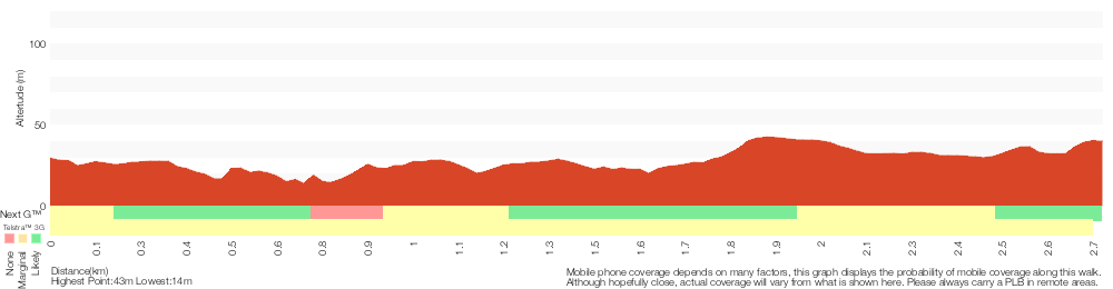
Analysis and summary of the altitude variation on the Cape Baily Coast Walk
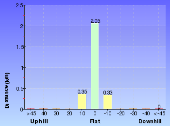
Overview of this walks grade – based on the AS 2156.1 – 2001
Under this standard, a walk is graded based on the most difficult section of the walk.
| Length | 5.5 km | ||
| Time | 2 hrs | ||
| . | |||
| Grade 3/6 Moderate track |
AS 2156.1 | Gradient | Short steep hills (3/6) |
| Quality of track | Formed track, with some branches and other obstacles (3/6) | ||
| Signs | Directional signs along the way (3/6) | ||
| Experience Required | No experience required (1/6) | ||
| Weather | Weather generally has little impact on safety (1/6) | ||
| Infrastructure | Limited facilities, not all cliffs are fenced (3/6) |
Some more details of this walks Grading
Here is a bit more details explaining grading looking at sections of the walk
Gradient
1.2km of this walk has short steep hills and another 950m has gentle hills with occasional steps. The remaining (610m) is flat with no steps.
Quality of track
Around 2km of this walk follows a formed track, with some branches and other obstacles, whilst the remaining 750m follows a clear and well formed track or trail.
Signs
Around 1.8km of this walk has directional signs at most intersection, whilst the remaining 950m is clearly signposted.
Experience Required
This whole walk, 2.7km requires no previous bushwalking experience.
weather
This whole walk, 2.7km is not usually affected by severe weather events (that would unexpectedly impact safety and navigation).
Infrastructure
This whole walk, 2.7km has limited facilities (such as not all cliffs fenced).
Similar walks

3.8 km One way
1 hr 30 mins
Hard track
5 km One way
1 hr 45 mins
Hard track
5.4 km One way
2 hrs 30 mins
Hard track
5.7 km One way
2 hrs 30 mins
Hard track
7.4 km Return
2 hrs 30 mins
Moderate track
8.8 km Return
3 hrs
Moderate track
8.9 km Return
3 hrs
Moderate track
12.7 km One way
4 hrs 15 mins
Hard track
13.1 km One way
4 hrs 30 mins
Hard track
Other Nearby walks
960 m Circuit
20 mins
Easy track

2.8 km Circuit
1 hr 30 mins
Moderate track
1.1 km One way
30 mins
Very easy
84 m Return
10 mins
Very easy
866 m Return
30 mins
Easy track
4.2 km Return
1 hr 30 mins
Moderate track
13 km One way
5 hrs
Hard track
6.6 km Circuit
3 hrs
Hard track
6.8 km Circuit
3 hrs
Hard track
1.1 km Return
30 mins
Moderate track
792 m Circuit
30 mins
Easy track
1.5 km Return
45 mins
Hard track
Plan your trip to and from the walk here
The Cape Baily Coast Walk walk starts and ends at the End of Cape Solander Drive (gps: -34.017944, 151.22963)Your transport options to End of Cape Solander Drive are by;
(get details)


Short URL = http://wild.tl/cbcw
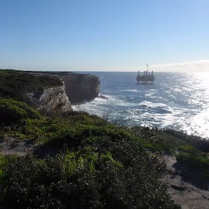
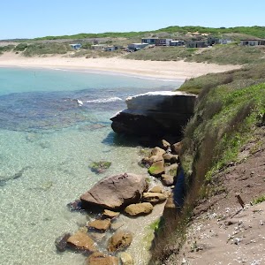
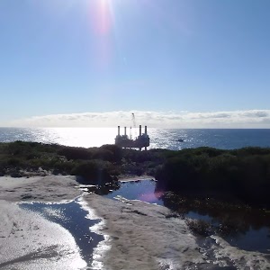
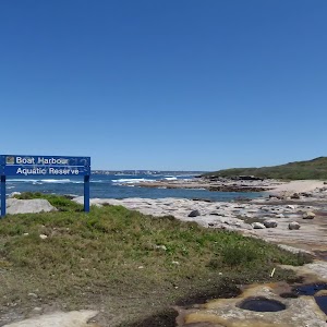
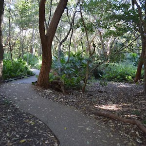
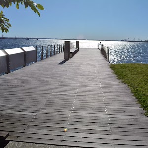
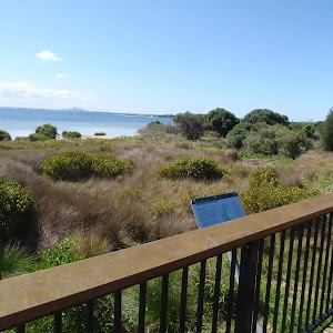
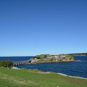
Gallery images
There are other downloads I am still working on.
You will probably need to login to access these — still all free.
* KML (google earth file)
* GPX (GPS file)
Special Maps/ brochures
* A3 topo maps
* PDF with Lands Topo map base
* PDF with arial image (and map overlay)
I wanted to get the main site live first, this extra stuff will come in time.
Happy walking
Matt 🙂
Comments