Scotts Hut

1 hr 15 mins
3.6 km Return

6 m
Easy track
Hobart Beach campground
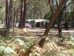
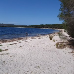
This is a well-established campsite close to the beach and lake. There are garbage and recycling bins. Each camping space is well-defined and there is a large covered common area. The camp surrounds the stone and timber toilet and laundry facility.
(0km) Hobart Beach large shelter → Int. Hobart Lagoon and Hobart Campground Trks

410 m
6 mins
0m
-1m
Easy track
From the sign post at the large shelter, the walk follows the dirt road, leaving the shelter behind on the left. The walk follows the road for a short distance to come to a large, green roofed, wooden building, the toilet block.
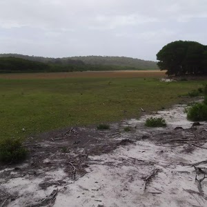
Continue straight: From the toilet block, this walk heads west along the dirt road further into the campground. At the ‘Sites 36-54’[1] the walk turns right following the ‘one way’[2] arrow towards the lake. As the road bends left, follow the track down the hill to the lake to soon come to a three way intersection next to Wallagoot Lake. Here there is a sign pointing back to ‘Hobart Beach Camping Area’[3].
Continue straight: From the toilet block, this walk heads west along the dirt road further into the campground. At the ‘Sites 36-54’[1] the walk turns right following the ‘one way’[2] arrow towards the lake. As the road bends left, follow the track down the hill to the lake to soon come to a three way intersection next to Wallagoot Lake. Here there is a sign pointing back to ‘Hobart Beach Camping Area’[3].
Wallagoot Lake (Lagoon)
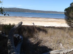
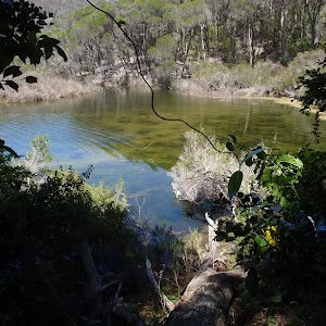
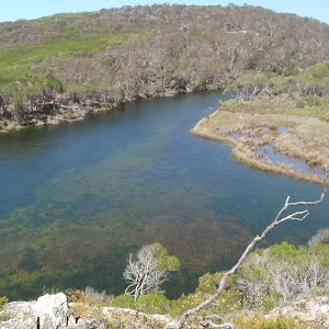
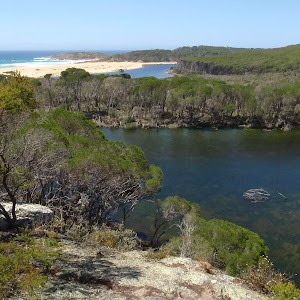
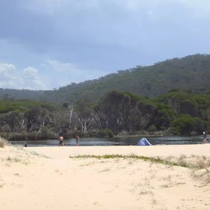
Wallagoot Lake, Bournda National Park, is located between Tathra and Merimbula on the Sapphire Coast Drive. Wallagoot Lake is a large expanse of water, although it is only two to three metres deep. The lake’s catchment is found predominantly within Bournda National Park, the main tributary being Moncks Creek. The lake is blocked from the ocean by sand dunes on the eastern end – these dunes are broken intermittently, connecting the lake with the sea. Wallagoot Lake is home to many bird species including Black Swans and a threatened Tern.
The lake is a popular spot for picnics and other recreation. Hobart Beach camping area lies on the southern shore of the lake, and on the northern edge lies the Wallagoot Lake Boat Club, with its parking, and also a picnic area, providing plenty of opportunities to enjoy the lake. Wallagoot Lake can be accessed by Wallagoot Lake Rd off the Sapphire Coast Drive. More info.
(0.41km) Int. Hobart Lagoon and Hobart Campground Trks → Int. Scotts Hut Picnic Area

1.3 km
19 mins
2m
-2m
Easy track
Turn left: From the intersection, this walk keeps Wallagoot Lake to the right and follows the shoreline. The track continues behind the shoreline and soon tends left away from the views of the lake. The track heads through the heath for a short time to an intersection with two signposts, one of which points back to ‘Hobart Beach camping area via Wallagoot Lake’[4].
Continue straight: From the intersection, the walk follows the ‘Scotts Bay picnic area’[5] sign, with Wallagoot Lake off to the right. The track continues to an intersection on the left and two signposts, one of which points back towards ‘Hobart Beach camping area’[6]
Continue straight: From the intersection, this walk follows the ‘Scotts Bay picnic area’ sign[7] down the path bordered by heath vegetation. The track winds slightly for a short time until arriving at the clearing and picnic facilities.
Scotts Bay picnic area
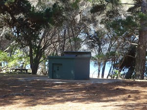
Scotts Bay picnic area, Bournda National Park, is situated on the southern banks of Wallagoot Lake, at Scotts Bay. The picnic area has a large grassed area with a few shady areas closer to the water. An electric BBQ plate, toilets and picnic tables are scattered in the shade. The picnic area surrounds the historic Scotts Hut building. The facilities can be accessed from Bournda Rd.
(1.69km) Int. Scotts Hut Picnic Area → Scotts Hut

130 m
2 mins
1m
0m
Easy track
Veer left: From the intersection behind the picnic area, the walk heads across the grass and the road. The walk then passes through the gate to explore Scotts hut and its garden.
Scotts Hut
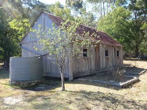
Scotts Hut is situated on the south-western banks of Wallagoot Lake, halfway between Merimbula and Tathra, in Bournda National Park. The reconstructed hut (completed in 1988) was built in a slab cottage style. This cottage has a corrugated iron roof, and wooden walls and floorings. The cottage has been fitted with gutters which feed a water tank at the southern end of the hut. The hut has an open fireplace and its interiors are painted white.
The builder of the hut was Thomas Scott, originally a resident of Cooma and a father of twelve, to two wives[8]. The hut is thought to have been built in 1890 on one of many pieces of land Mr Scott owned around the Wallagoot Lake.
The hut can be accessed via the Sapphire Highway and Bournda Rd. Surrounding the hut is a picnic area and adjacent, Hobart Beach. More info.
Maps for the Scotts Hut walk
You can download the PDF for this walk to print a map.These maps below cover the walk and the wider area around the walk, they are worth carrying for safety reasons.
| Wolumla | 1:25 000 Map Series | 88242N WOLUMLA | NSW-88242N |
| Bega | 1:100 000 Map Series | 8824 BEGA | 8824 |
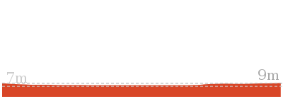
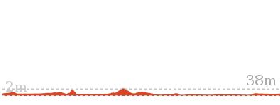
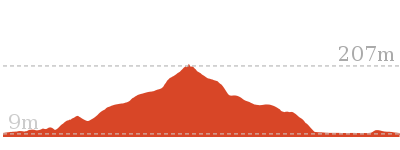
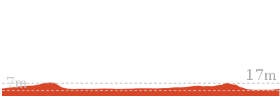
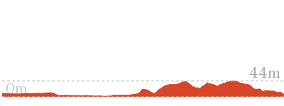
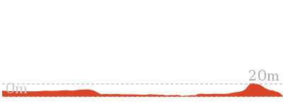
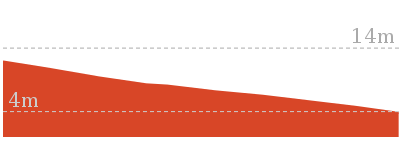
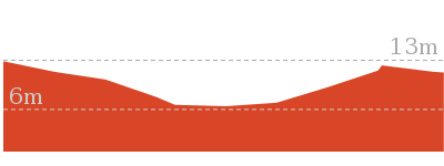
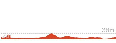
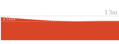
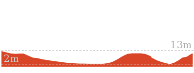
Cross sectional view of the Scotts Hut bushwalking track

Analysis and summary of the altitude variation on the Scotts Hut
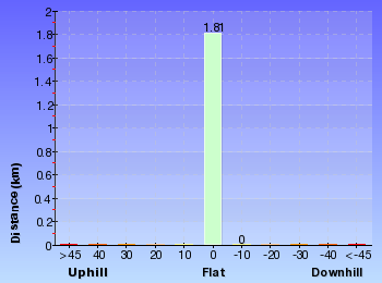
Overview of this walks grade – based on the AS 2156.1 – 2001
Under this standard, a walk is graded based on the most difficult section of the walk.
| Length | 3.6 km | ||
| Time | 1 hr 15 mins | ||
| . | |||
| Grade 2/6 Easy track |
AS 2156.1 | Gradient | Gentle hills with occasional steps (2/6) |
| Quality of track | Clear and well formed track or trail (2/6) | ||
| Signs | Clearly signposted (1/6) | ||
| Experience Required | No experience required (1/6) | ||
| Weather | Weather generally has little impact on safety (1/6) | ||
| Infrastructure | Generally useful facilities (such as fenced cliffs and seats) (1/6) |
Some more details of this walks Grading
Here is a bit more details explaining grading looking at sections of the walk
Gradient
Around 1.7km of this walk has gentle hills with occasional steps, whilst the remaining 110m is flat with no steps.
Quality of track
Around 1.7km of this walk follows a clear and well formed track or trail, whilst the remaining 110m follows a smooth and hardened path.
Signs
This whole walk, 1.8km is clearly signposted.
Experience Required
This whole walk, 1.8km requires no previous bushwalking experience.
weather
This whole walk, 1.8km is not usually affected by severe weather events (that would unexpectedly impact safety and navigation).
Infrastructure
This whole walk, 1.8km is close to useful facilities (such as fenced cliffs and seats).
Similar walks
Other Nearby walks
Plan your trip to and from the walk here
The Scotts Hut walk starts and ends at the Hobart Beach large shelter (gps: -36.797002, 149.93998)Your main transport option to Hobart Beach large shelter is by;
(get details)
Fire Danger
Each park may have its own fire ban, this rating is only valid for today and is based on information from the RFS Please check the RFS Website for more information.Weather Forest
This walk starts in the South Coast weather district always check the formal BOM forecast or pdf before starting your walk.Forecast snapshot
Park Information & Alerts
Short URL = http://wild.tl/sh
Gallery images
There are other downloads I am still working on.
You will probably need to login to access these — still all free.
* KML (google earth file)
* GPX (GPS file)
Special Maps/ brochures
* A3 topo maps
* PDF with Lands Topo map base
* PDF with arial image (and map overlay)
I wanted to get the main site live first, this extra stuff will come in time.
Happy walking
Matt 🙂







Comments