Currie Rd Track to Ferguson St via Magazine Buildings and Davidson Park


4 hrs 30 mins

575 m
Hard track


(0km) Start of Currie Road service trail → Int of Currie Road and Cannons Parade service trails

560 m
10 mins
10m
-16m
Moderate track
(0.56km) Int of Currie Road and Cannons Parade service trails → Int of Natural Bridge and Currie Road Tracks
350 m
6 mins
5m
-12m
Moderate track
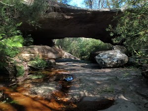
(0.91km) Int of Natural Bridge and Currie Road Tracks → Natural Bridge
250 m
6 mins
0m
-39m
Moderate track
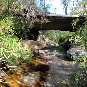
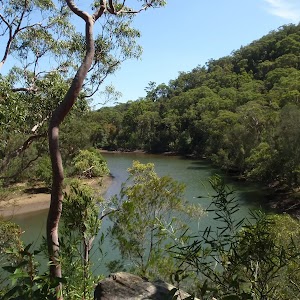
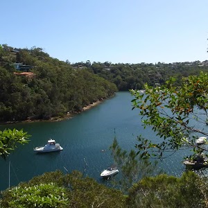
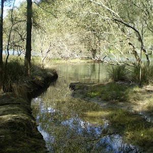
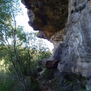
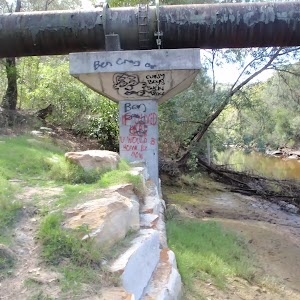
Natural Bridge
(0.91km) Int of Natural Bridge and Currie Road Tracks → Int of Bates Creek and Currie Rd tracks
180 m
3 mins
5m
-1m
Easy track
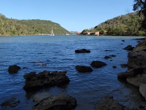
(1.09km) Int of Bates Creek and Currie Rd tracks → Bantry Bay View
1.2 km
22 mins
7m
-89m
Hard track
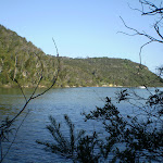
Continue straight: From the end of the service trail, this walk follows the bush track down the rocky path for a short distance to the waters edge where there is a great view of Bantry Bay from the rocky shoreline. At the end of this side trip, retrace your steps back to the main walk then Turn left.
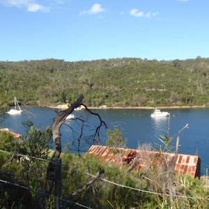
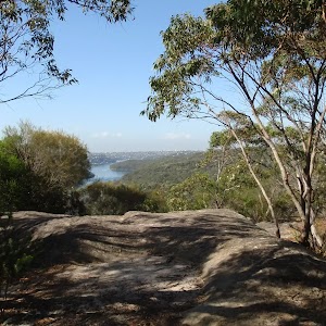
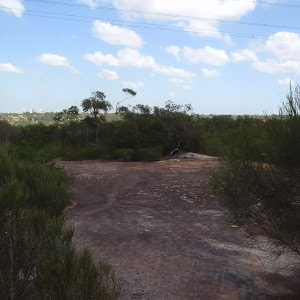
Bantry Bay View
(1.09km) Int of Bates Creek and Currie Rd tracks → Int of Magazine Track and Tipperary Road service trail
730 m
13 mins
5m
-35m
Moderate track
(1.82km) Int of Magazine Track and Tipperary Road service trail → Back of Magazine Buildings
1.1 km
27 mins
45m
-79m
Moderate track
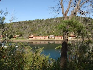
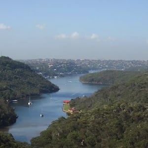
Bantry Bay Explosives Magazine complex
(2.97km) Back of Magazine Buildings → Int of Magazine and Flat Rock Beach Tracks
1.1 km
23 mins
44m
-53m
Moderate track
(4.02km) Int of Magazine and Flat Rock Beach Tracks → Flat Rock Beach
30 m
1 mins
0m
-6m
Moderate track
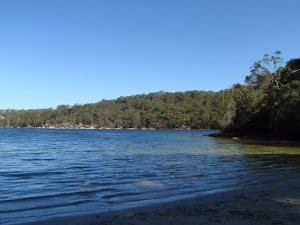
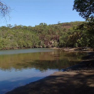
Flat Rock Beach
(4.02km) Int of Magazine and Flat Rock Beach Tracks → Int of Flat Rock and Magazine Tracks
190 m
5 mins
36m
0m
Moderate track
(4.21km) Int of Flat Rock and Magazine Tracks → Int of Downpatrick Road Servicetrail and Flat Rock Track
1.5 km
39 mins
86m
-116m
Moderate track
Continue straight: From the intersection, this walk follows the bush track along the side of the hill, with the ground sloping up to the right. The track meanders through the dense bushland, occasionally catching a nice view over Middle Harbour Creek down to the left, and continues to the intersection of a rough service trail on the right, which heads uphill.
(5.75km) Int of Downpatrick Road Servicetrail and Flat Rock Track → Int of Davidson Park driveway and Flat Rock Track
690 m
16 mins
32m
-41m
Moderate track
(6.44km) Int of Davidson Park driveway and Flat Rock Track → Bottom of the Casuarina Steps
920 m
16 mins
14m
-15m
Very easy
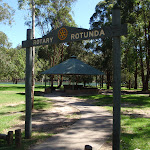
Turn left: From the intersection, this walk follows the Davidson Park driveway, crossing under Roseville Bridge with Middle Harbour Creek on the left. The walk passes a small car park and bends to the right, winding around the large picnic areas (on the left), passing a building with some toilets (also on the left), and continuing along for a little while before coming to the signposted intersection of the Rotary Rotunda footpath.
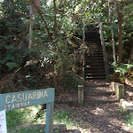
Continue straight: From the intersection, this walk follows the road, keeping the park and Middle Harbour on the left. After a little while, this walk comes to the signposted intersection at the bottom of the ‘Casuarina Stairway’, uphill on the right.
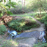
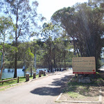
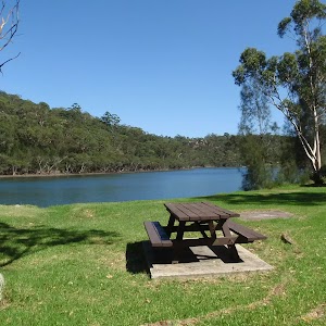
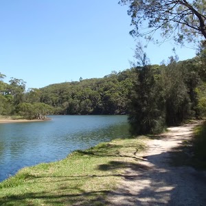
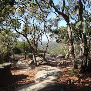
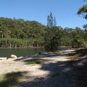
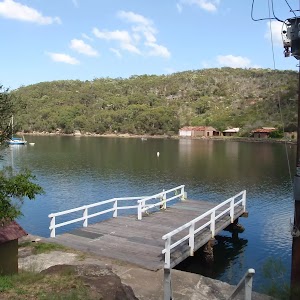
Davidson picnic area

(7.36km) Bottom of the Casuarina Steps → Casuarina Lookout
130 m
2 mins
9m
0m
Moderate track
(7.49km) Casuarina Lookout → Int of Casuarina Track and Boree Road service trail
1.7 km
46 mins
182m
-111m
Hard track
(9.23km) Int of Casuarina Track and Boree Road service trail → Int of Casuarina and Carroll Creek Tracks
1.4 km
34 mins
45m
-101m
Hard track
(10.65km) Int of Casuarina and Carroll Creek Tracks → Int of Carroll Crk and Nothern Beaches Area Depot Servicetrails
410 m
11 mins
51m
0m
Moderate track
(11.06km) Int of Carrol Crk and Northern Beaches Area Depot Servicetrails → End of Ferguson St
120 m
1 mins
6m
-3m
Easy track
Maps for the Currie Rd Track to Ferguson St via Magazine Buildings and Davidson Park walk
You can download the PDF for this walk to print a map.These maps below cover the walk and the wider area around the walk, they are worth carrying for safety reasons.
| Parramatta River | 1:25 000 Map Series | 91303N PARRAMATTA RIVER | NSW-91303N |
| Sydney | 1:100 000 Map Series | 9130 SYDNEY | 9130 |
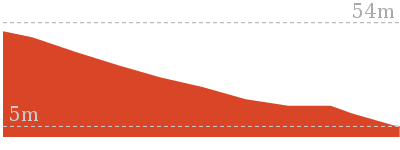
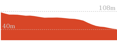
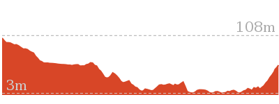
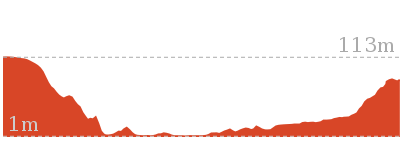
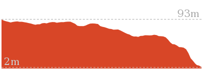
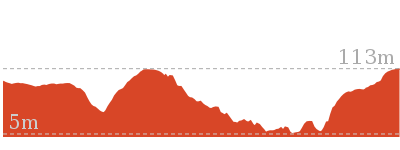
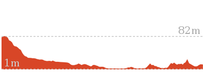
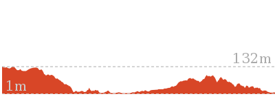
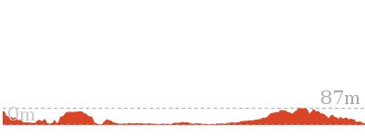
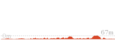
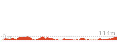
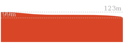
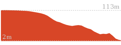
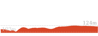
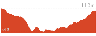
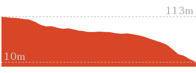
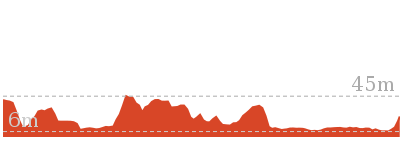
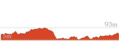
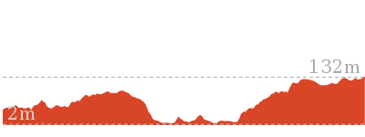
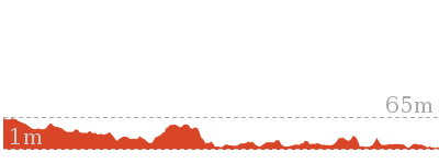
Cross sectional view of the Currie Rd Track to Ferguson St via Magazine Buildings and Davidson Park bushwalking track
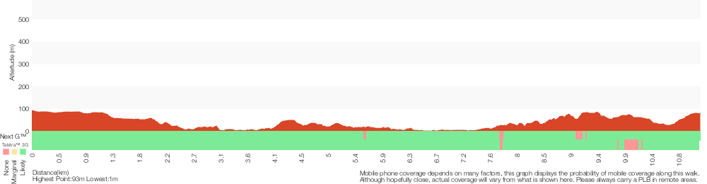
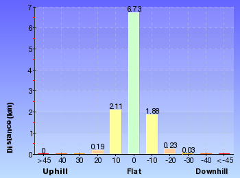
Analysis and summary of the altitude variation on the Currie Rd Track to Ferguson St via Magazine Buildings and Davidson Park
Overview of this walks grade – based on the AS 2156.1 – 2001
Under this standard, a walk is graded based on the most difficult section of the walk.
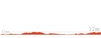
| Length | 11.2 km | ||
| Time | 4 hrs 30 mins | ||
| . | |||
| Grade 4/6 Hard track |
AS 2156.1 | Gradient | Very steep (4/6) |
| Quality of track | Rough track, where fallen trees and other obstacles are likely (4/6) | ||
| Signs | Directional signs along the way (3/6) | ||
| Experience Required | Some bushwalking experience recommended (3/6) | ||
| Weather | Weather generally has little impact on safety (1/6) | ||
| Infrastructure | Limited facilities, not all cliffs are fenced (3/6) |
Some more details of this walks Grading
Here is a bit more details explaining grading looking at sections of the walk
Gradient
7km of this walk has short steep hills and another 2km is flat with no steps. Whilst another 1.4km is very steep and the remaining 890m has gentle hills with occasional steps.
Quality of track
5km of this walk follows a formed track, with some branches and other obstacles and another 3.2km follows a rough track, where fallen trees and other obstacles are likely. Whilst another 1.8km follows a clear and well formed track or trail and the remaining 920m follows a smooth and hardened path.
Signs
Around 8km of this walk has directional signs at most intersection, whilst the remaining 3.4km is clearly signposted.
Experience Required
Around 8km of this walk requires some bushwalking experience, whilst the remaining 3km requires no previous bushwalking experience.
weather
This whole walk, 11km is not usually affected by severe weather events (that would unexpectedly impact safety and navigation).
Infrastructure
Around 7km of this walk is close to useful facilities (such as fenced cliffs and seats), whilst the remaining 4.2km has limited facilities (such as not all cliffs fenced).
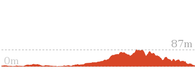
Similar walks

516 m Return
20 mins
Moderate track
1.4 km Return
45 mins
Moderate track
3.4 km One way
1 hr 30 mins
Moderate track
3.7 km Return
1 hr 30 mins
Hard track
3.8 km One way
1 hr 30 mins
Hard track
3.8 km One way
1 hr 45 mins
Hard track
4.5 km Return
1 hr 30 mins
Hard track
4.6 km One way
2 hrs
Hard track
7 km Return
3 hrs 45 mins
Moderate track

7 km Circuit
2 hrs 30 mins
Hard track
7.2 km One way
3 hrs
Moderate track
9 km One way
4 hrs
Hard track
10 km One way
4 hrs 30 mins
Hard track
10 km One way
4 hrs
Hard track

11.5 km One way
4 hrs 30 mins
Hard track
14.1 km One way
5 hrs 30 mins
Moderate track
15.1 km Circuit
5 hrs 45 mins
Experienced only
22.6 km One way
9 hrs 45 mins
Hard track
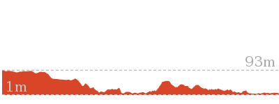
Other Nearby walks
986 m Return
30 mins
Moderate track
5.3 km Return
2 hrs
Moderate track
2 km Return
1 hr 15 mins
Hard track
2.6 km One way
1 hr 15 mins
Hard track
2.2 km One way
45 mins
Moderate track
5.4 km Return
3 hrs
Hard track
1.8 km Return
1 Hr
Hard track
6.7 km Circuit
2 hrs 45 mins
Moderate track
3.1 km One way
2 hrs
Moderate track

6 km One way
2 hrs 45 mins
Hard track
6.8 km One way
3 hrs
Experienced only
6.1 km One way
2 hrs 30 mins
Moderate track
Plan your trip to and from the walk here
The Currie Rd Track to Ferguson St via Magazine Buildings and Davidson Park walk starts at the Start of Currie Road service trail (gps: -33.760107, 151.22467)Your transport options to Start of Currie Road service trail are by;
(get details)
The Currie Rd Track to Ferguson St via Magazine Buildings and Davidson Park ends at the End of Ferguson St (gps: -33.756616, 151.21048)
Your transport options to End of Ferguson St are by;
(get details)


Short URL = http://wild.tl/crttfsvmbadp
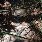
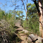
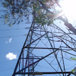
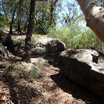
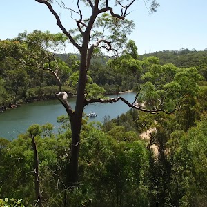
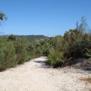
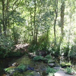
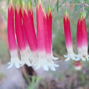
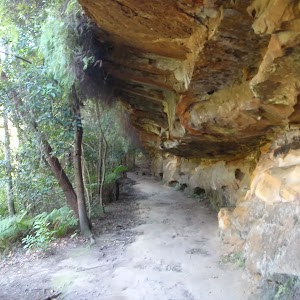
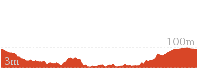
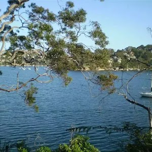
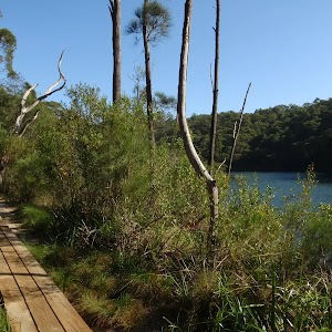
Gallery images
There are other downloads I am still working on.
You will probably need to login to access these — still all free.
* KML (google earth file)
* GPX (GPS file)
Special Maps/ brochures
* A3 topo maps
* PDF with Lands Topo map base
* PDF with arial image (and map overlay)
I wanted to get the main site live first, this extra stuff will come in time.
Happy walking
Matt 🙂
Comments