Fitzpatrick Park to Morgans Creek via Yeramba Lagoon


1 hr 45 mins

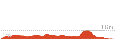
147 m
Moderate track
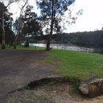


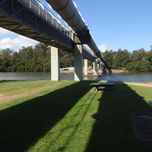
Fitzpatrick Park
(0km) End of Fitzpatrick Park drive way → Int of Lagoon bushtrack and Henry Lawson Drive

320 m
5 mins
2m
-2m
Moderate track
(0.32km) Int of Lagoon bushtrack and Henry Lawson Drive → Yeramba Lagoon car park
1.7 km
30 mins
36m
-36m
Moderate track
Veer right: From the intersection, this walk follows the arrow north (away from the sign on the left side of the track), heading along the bush track for a short while until coming down through a gap in a rock to the intersection with the lagoon bush track, marked by an arrow.
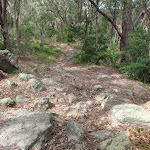
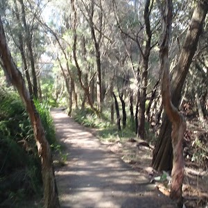
Continue straight: From the intersection, this walk follows the bush track heading north down the rocky hill (keeping the lagoon on your right). The track then heads around side of the lagoon, and passes through a patch of grass trees, continuing through the bush to the intersection just before the dense tree canopy.
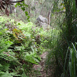
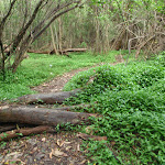
Veer right: From the intersection, this walk follows the bush track heading down under the thick leafy tree canopy. The walk crosses the creek and continues up the hill, winding to the top at an intersection with a bush track.
Veer right: From the intersection, this walk follows the bush track down the gentle hill, passing the top of a large rock platform and continuing up the other side. At the top of the hill, the track comes to an intersection with the north-eastern bush track.
Turn right: From the intersection, this walk follows the bush track heading south towards the lagoon, down the gentle rocky hill. The track is fairly flat for a short while before coming to a ‘Y’ intersection with the Lagoon and Sub Station tracks.
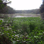
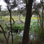
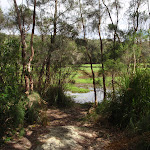
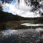
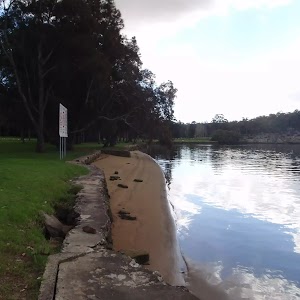
Veer right: From the intersection, this walk follows the bush track heading down the rock outcrop (keeping the lagoon on the right). The track soon passes a burnt car and continues among some short grass trees to the water’s edge. The track follows the lagoon for a short distance until turning up and away from the water, to the intersection with another bush track.
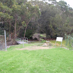
Continue straight: From the intersection, this walk follows the bush track downhill, keeping the lagoon on the right. After a short distance, the track comes to the birdwatchers’ observatory frame (looks a little like monkey bars).
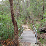
Continue straight: From the frame, this walk follows the bush track, keeping the lagoon on the right. The track soon starts winding down a rocky hill then crosses a short wooden bridge. This walk then heads up a short set of rock steps and across a grassy area to the Yeramba Lagoon car park on Henry Lawson Drive.
(1.97km) Yeramba Lagoon carpark → Int of Henry Lawson Drive and Ridgetop bushtrack
70 m
1 mins
4m
0m
Easy track
(2.04km) Int of Henry Lawson Drive and Ridgetop bushtrack → Int of Ridge Track and Ridgetop service trail
410 m
9 mins
37m
-1m
Moderate track
Continue straight: From the intersection, this walk follows the bush track heading south-east through the bush, winding around for a short distance to the intersection of the Ridgetop service trail.
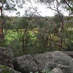
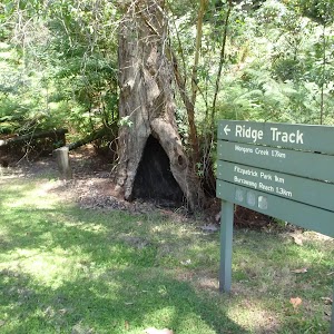
Turn right: From the intersection, this walk follows the management trail heading south-east through the bush (with Georges River off to the right, though not visible). The walk passes an intersection with a bush track then continues along until coming to the intersection with the Ridge Track (not signposted).
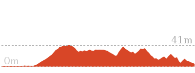
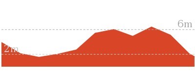
(2.45km) Int of Ridge Track and Ridgetop service trail → Int of Morgans Creek and the Ridge Track
1.6 km
38 mins
68m
-104m
Moderate track
Veer right: From the intersection, this walk follows the ‘Morgans Creek’ arrow along the bush track, crossing over some metal pipes and under two sets of power lines. The walk continues along the ridge for a while until it passing under a third set of power lines. The track then heads down the hill and across a small creek, to the intersection of an un-signposted bush track on the right.
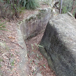
Continue straight: From the intersection, this walk follows the bush track heading up through the thick bush and along the side of the ridge, keeping Georges River on the right. The track heads through some really nice sandstone rock formations, with plenty of gum trees and ferns around. As the track winds around a rock ledge, it comes to signposted track on the right (which heads down to Burrawang Reach).
Continue straight: From the intersection, this walk follows the ‘Morgans Creek 500m’ sign as it heads along the side of the ridge, with the Georges River visible through the trees to the right. The walk winds along until it turns down the ridge and heads down to the Georges River National Park driveway.
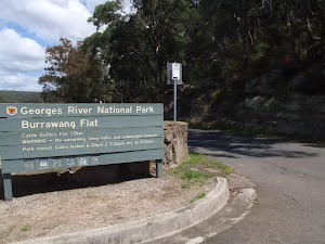
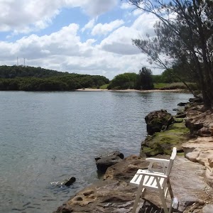
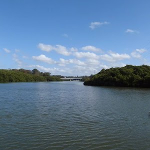
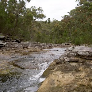
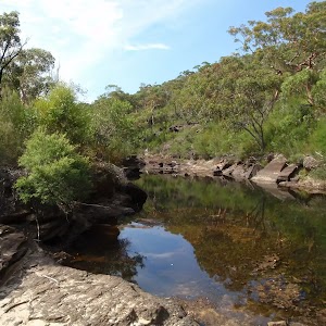
Morgans Creek
Maps for the Fitzpatrick Park to Morgans Creek via Yeramba Lagoon walk
You can download the PDF for this walk to print a map.These maps below cover the walk and the wider area around the walk, they are worth carrying for safety reasons.
| Botany Bay | 1:25 000 Map Series | 91303S BOTANY BAY | NSW-91303S |
| Sydney | 1:100 000 Map Series | 9130 SYDNEY | 9130 |
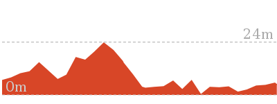
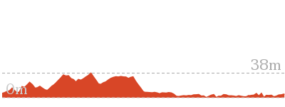
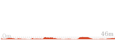
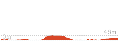
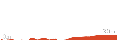
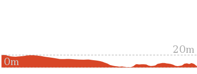
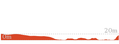
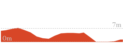
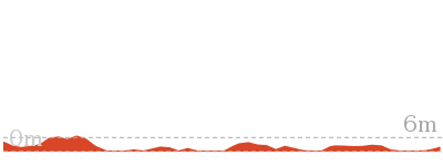
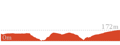
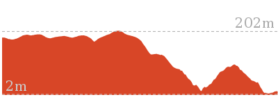
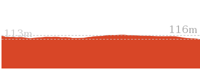
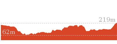
Cross sectional view of the Fitzpatrick Park to Morgans Creek via Yeramba Lagoon bushwalking track
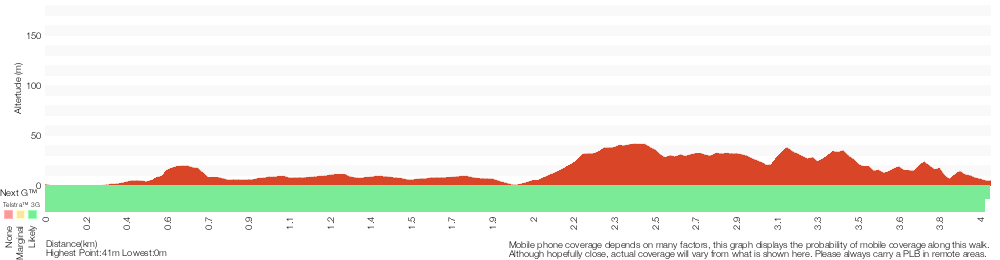
Analysis and summary of the altitude variation on the Fitzpatrick Park to Morgans Creek via Yeramba Lagoon
Overview of this walks grade – based on the AS 2156.1 – 2001
Under this standard, a walk is graded based on the most difficult section of the walk.
| Length | 4 km | ||
| Time | 1 hr 45 mins | ||
| . | |||
| Grade 3/6 Moderate track |
AS 2156.1 | Gradient | Short steep hills (3/6) |
| Quality of track | Formed track, with some branches and other obstacles (3/6) | ||
| Signs | Directional signs along the way (3/6) | ||
| Experience Required | Some bushwalking experience recommended (3/6) | ||
| Weather | Weather generally has little impact on safety (1/6) | ||
| Infrastructure | Limited facilities, not all cliffs are fenced (3/6) |
Some more details of this walks Grading
Here is a bit more details explaining grading looking at sections of the walk
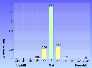
Gradient
2.9km of this walk has gentle hills with occasional steps and another 630m has short steep hills. The remaining (500m) is flat with no steps.
Quality of track
3.8km of this walk follows a formed track, with some branches and other obstacles and another 140m follows a clear and well formed track or trail. The remaining (65m) follows a smooth and hardened path.
Signs
Around 2.5km of this walk has directional signs at most intersection, whilst the remaining 1.5km is clearly signposted.
Experience Required
Around 3km of this walk requires some bushwalking experience, whilst the remaining 1km requires no previous bushwalking experience.
weather
This whole walk, 4km is not usually affected by severe weather events (that would unexpectedly impact safety and navigation).
Infrastructure
Around 2.4km of this walk is close to useful facilities (such as fenced cliffs and seats), whilst the remaining 1.6km has limited facilities (such as not all cliffs fenced).
Similar walks

769 m Circuit
30 mins
Moderate track
1.8 km Circuit
45 mins
Moderate track
2.5 km One way
1 hr 15 mins
Moderate track
2.9 km Circuit
1 hr 15 mins
Hard track
15.8 km One way
5 hrs 30 mins
Moderate track
Other Nearby walks
1.3 km One way
30 mins
Very easy

8 km One way
2 hrs 45 mins
Moderate track
2.8 km One way
1 Hr
Moderate track
4.3 km Return
1 hr 30 mins
Very easy
2.6 km One way
1 Hr
Moderate track
1 km Return
20 mins
Very easy
1.2 km One way
30 mins
Moderate track
566 m Return
15 mins
Very easy
11 km One way
4 hrs
Hard track
5.8 km One way
2 hrs 30 mins
Hard track
918 m Return
20 mins
Very easy
10.1 km One way
5 hrs
Hard track
Plan your trip to and from the walk here
The Fitzpatrick Park to Morgans Creek via Yeramba Lagoon walk starts at the End of Fitzpatrick Park drive way (gps: -33.981192, 151.00098)Your transport options to End of Fitzpatrick Park drive way are by;
(get details)
The Fitzpatrick Park to Morgans Creek via Yeramba Lagoon ends at the Int of Morgans Creek and the Ridge Track (gps: -33.975842, 151.0187)
Your transport options to Int of Morgans Creek and the Ridge Track are by;
(get details)


Short URL = http://wild.tl/fptmcvyl
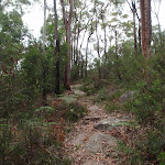
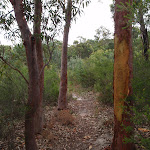
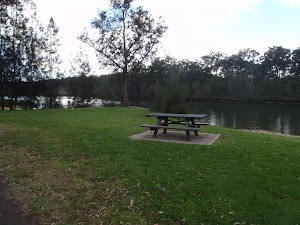
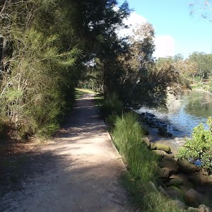
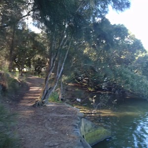
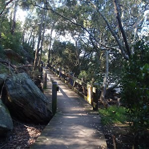
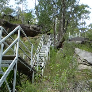
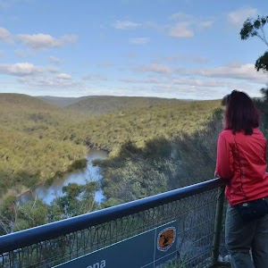
Gallery images
There are other downloads I am still working on.
You will probably need to login to access these — still all free.
* KML (google earth file)
* GPX (GPS file)
Special Maps/ brochures
* A3 topo maps
* PDF with Lands Topo map base
* PDF with arial image (and map overlay)
I wanted to get the main site live first, this extra stuff will come in time.
Happy walking
Matt 🙂
Comments