Somersby to the Basin Campsite


3 Days

2032 m
Hard track
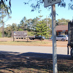


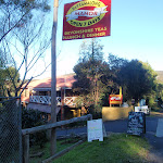


Somersby Store

(0km) Somersby Store → End of Kilkenny Road

2.6 km
48 mins
54m
-69m
Moderate track
(2.63km) End of Kilkenny Road → creek crossing
1.4 km
32 mins
11m
-207m
Hard track
(4.01km) creek crossing → Palm Grove Campsite intersection
1 km
28 mins
114m
-25m
Hard track
(5.05km) Palm Grove Campsite intersection → Ourimbah Valley Trackhead
990 m
24 mins
15m
-143m
Hard track
(6.04km) Ourimbah Valley Trackhead → Int of Platypus Creek La and Ourimbah Creek Rd
1.8 km
32 mins
30m
-25m
Easy track
(7.88km) Int of Platypus Creek La and Ourimbah Creek Rd → Forty Acres
2 km
36 mins
39m
-43m
Moderate track
(9.86km) Forty Acres → Stringy Bark Point
1.8 km
33 mins
43m
-33m
Moderate track
Stringy Bark Point

End of day 1
(11.68km) Stringy Bark Point → Int of Great North Walk and Tooheys Road south
1.8 km
53 mins
237m
-42m
Hard track
(13.51km) Int of Great North Walk and Tooheys Road south → Int of Great North Walk and Tooheys Road north
2.3 km
52 mins
139m
-67m
Hard track
(15.81km) Int of Old GNW track and Tooheys Rd → Archers Campsite
160 m
3 mins
1m
-3m
Moderate track
Archers Campsite

(15.81km) Int of GNW and Tooheys Road north → Powerline tower west of Dead Horse Creek
1.9 km
48 mins
106m
-174m
Hard track
(17.72km) Powerline tower west of Dead Horse Creek → Int of GNW and Cherry Lane
1.5 km
30 mins
53m
-26m
Moderate track
(19.26km) Int of Great North Walk and Cherry Lane → Int of Greta Road and Cherry Lane
1.4 km
27 mins
54m
-15m
Easy track
(20.65km) Int of Greta Road and Cherry Lane → Int of Greta Road and power line service trail
430 m
9 mins
29m
0m
Easy track
(21.08km) Int of Greta Road and power line service trail → Bumble Hill Dray track
670 m
15 mins
6m
-89m
Hard track
(21.75km) Bumble Hill Dray track tower → Int of Great North Walk and Bumble Hill Road
4.6 km
2 hrs
270m
-463m
Moderate track
(26.39km) Int of Great North Walk and Bumble Hill Road → Yarramalong Track Head
310 m
6 mins
1m
-30m
Easy track
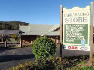
Yarramalong Store
Yarramalong Manor

End of day 2
(26.7km) Yarramalong Track Head → Cedar Brush Track Head
11 km
3 hrs 18 mins
241m
-198m
Easy track
Veer left: From the intersection[194][195], this walk follows the GNW arrow marker and Brush Creek Road gently downhill, while keeping Ravensdale Road on your right. This walk continues gently uphill, passing numerous farm properties[196] for about 300m, then crossing a timber bridge[197]. Then this walk continues on gravel road (with occasional sealed sections) amongst more farm properties[198][199] for about 6.7km, crossing over a timber bridge[200] to find a four-way intersection[201] with ‘Kingtree Ln’ and ‘Misty Valley Ln’. This walk continues straight ahead for another 600m, until coming to an intersection[202] with the ‘Cedar Brush Trackhead’ sign[203] and track on the right.
(37.66km) Cedar Brush Track Head → Int of GNW track & Kingtree Ridge Fire Road
2 km
58 mins
266m
-38m
Hard track
(39.64km) Int of GNW track & Kingtree Ridge Fire Road → GNW rest area
120 m
3 mins
8m
0m
Moderate track
(39.75km) GNW rest area → Int of Kingtree Ridge & Walkers Ridge Roads
3.4 km
1 hr 4 mins
115m
-44m
Moderate track
(43.13km) Int of Kingtree Ridge and Walkers Ridge Roads → Int of Great North Walk and Walkers Ridge Road
370 m
8 mins
11m
-20m
Moderate track
(43.5km) Int of GNW & Walkers Ridge Road → Int of GNW & an unsealed road
370 m
7 mins
12m
-5m
Moderate track
(43.87km) Int of GNW AND an unsealed road → Int of GNW track AND a rocky trail
380 m
9 mins
1m
-63m
Moderate track
(44.25km) Int of GNW track AND a rocky trail → Int of GNW AND Lyrebird trail
910 m
25 mins
48m
-137m
Hard track
(45.15km) Int of GNW tracks AND Lyrebird Trail → Int of Rock Lilly AND Lyrebird trails
1.9 km
47 mins
125m
-139m
Moderate track
(47.02km) Int of Rock Lilly and Lyrebird trails → Basin Campsite
340 m
7 mins
4m
-41m
Moderate track
Basin Campsite
Maps for the Somersby to the Basin Campsite walk
You can download the PDF for this walk to print a map.These maps below cover the walk and the wider area around the walk, they are worth carrying for safety reasons.
| Kulnura | 1:25 000 Map Series | 91314S KULNURA | NSW-91314S |
| Murrays Run | 1:25 000 Map Series | 91314N MURRAYS RUN | NSW-91314N |
| Mangrove | 1:25 000 Map Series | 91313N MANGROVE | NSW-91313N |
| Wyong | 1:25 000 Map Series | 91312N WYONG | NSW-91312N |
| Dooralong | 1:25 000 Map Series | 91311S DOORALONG | NSW-91311S |
| Morisset | 1:25 000 Map Series | 91311N MORISSET | NSW-91311N |
| Gosford | 1:100 000 Map Series | 9131 GOSFORD | 9131 |
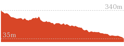
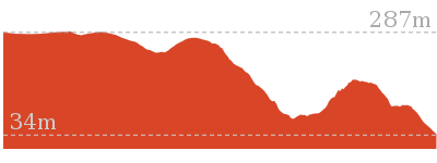
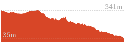
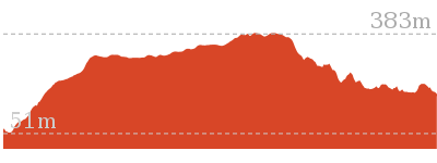
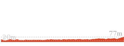
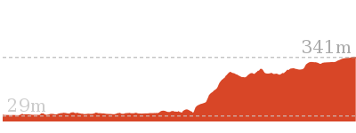
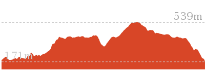
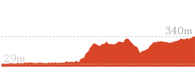
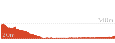
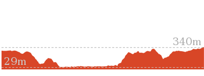
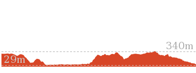
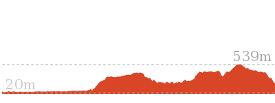
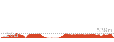
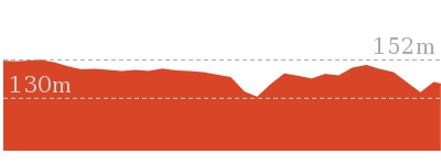
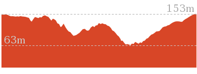
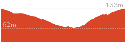
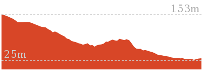
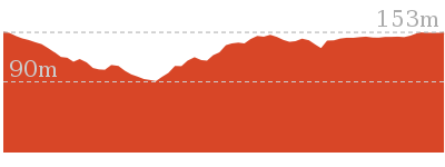
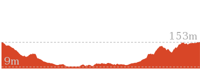
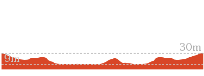
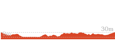
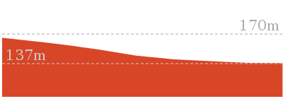
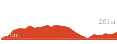
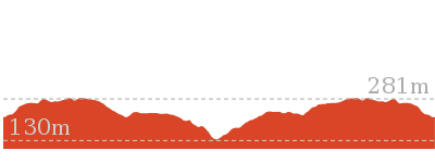
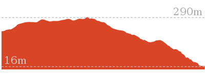
Cross sectional view of the Somersby to the Basin Campsite bushwalking track
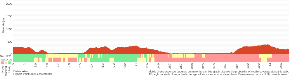
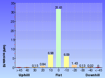
Analysis and summary of the altitude variation on the Somersby to the Basin Campsite
Daily actual walking time estimates
| Day | Walking Time | Length |
|---|---|---|
| 1 | 3 hrs 53 mins | 11.7 km |
| 2 | 6 hrs 3 mins | 15.2 km |
| 3 | 7 hrs 6 mins | 20.7 km |
Overview of this walks grade – based on the AS 2156.1 – 2001
Under this standard, a walk is graded based on the most difficult section of the walk.
| Length | 47.4 km | ||
| Time | 3 Days | ||
| . | |||
| Grade 4/6 Hard track |
AS 2156.1 | Gradient | Very steep (4/6) |
| Quality of track | Rough track, where fallen trees and other obstacles are likely (4/6) | ||
| Signs | Minimal directional signs (4/6) | ||
| Experience Required | Moderate level of bushwalking experience recommended (4/6) | ||
| Weather | Forecast, unforecast storms and severe weather may impact on navigation and safety (4/6) | ||
| Infrastructure | Limited facilities (such as cliffs not fenced, significant creeks not bridged) (4/6) |
Some more details of this walks Grading
Here is a bit more details explaining grading looking at sections of the walk
Gradient
25km of this walk has gentle hills with occasional steps and another 13km is very steep. The remaining (9km) has short steep hills.
Quality of track
15km of this walk follows a clear and well formed track or trail and another 15km follows a formed track, with some branches and other obstacles. Whilst another 12km follows a smooth and hardened path and the remaining 4.3km follows a rough track, where fallen trees and other obstacles are likely.
Signs
25km of this walk has directional signs at most intersection and another 18km is clearly signposted. The remaining (4.3km) has minimal directional signs.
Experience Required
27km of this walk requires no previous bushwalking experience and another 16km requires some bushwalking experience. The remaining (4.8km) requires a leader a with moderate level of bushwalking experience.
weather
38km of this walk is not usually affected by severe weather events (that would unexpectedly impact safety and navigation) and another 7km is affected by storms that may impact your navigation and safety. The remaining (1.9km) is affected by forecast, unforecast storms and severe weather events that may impact on navigation and safety.
Infrastructure
24km of this walk is close to useful facilities (such as fenced cliffs and seats) and another 19km has limited facilities (such as not all cliffs fenced). The remaining (4.2km) has limited facilities (such as cliffs not fenced, significant creeks not bridged).
Similar walks
5.6 km One way
2 hrs 45 mins
Hard track

6 km One way
2 hrs 30 mins
Hard track
8.1 km One way
3 hrs 30 mins
Hard track
9.7 km One way
4 hrs 30 mins
Hard track

9.7 km One way
4 hrs
Hard track
11 km One way
3 hrs 30 mins
Easy track
11.2 km One way
4 hrs 30 mins
Hard track
13 km One way
6 hrs
Hard track
13 km One way
6 hrs
Hard track

15 km One way
5 hrs 30 mins
Hard track
17 km One way
6 hrs 30 mins
Hard track
21.1 km One way
8 hrs
Hard track

26.7 km One way
2 Days
Hard track
33.7 km One way
2 Days
Hard track
60.5 km One way
4 Days
Hard track
Other Nearby walks
1.7 km Return
45 mins
Moderate track
3 km Circuit
1 hr 30 mins
Moderate track
1.7 km Circuit
1 Hr
Moderate track
2.2 km One way
1 Hr
Moderate track
1.8 km Circuit
1 Hr
Moderate track
8.1 km Circuit
3 hrs 30 mins
Moderate track
2.3 km Circuit
1 Hr
Moderate track
3.3 km Circuit
1 hr 15 mins
Moderate track
426 m Return
20 mins
Moderate track
8.3 km Return
3 hrs 15 mins
Moderate track
10.8 km Circuit
4 hrs 15 mins
Hard track
10.1 km Return
4 hrs 15 mins
Hard track
Plan your trip to and from the walk here
The Somersby to the Basin Campsite walk starts at the Somersby Store (gps: -33.358078, 151.29029)Your transport options to Somersby Store are by;
(get details)
The Somersby to the Basin Campsite ends at the Basin Campsite (gps: -33.104008, 151.23088)
Your main transport option to Basin Campsite is by;
(get details)


Short URL = http://wild.tl/sttbc
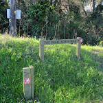
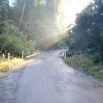
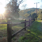
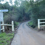
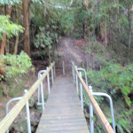
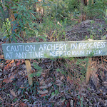
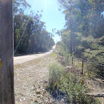
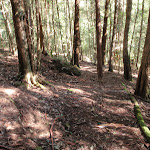
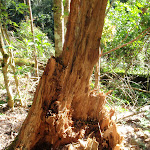
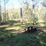
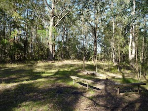
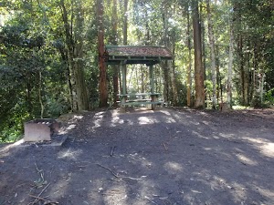
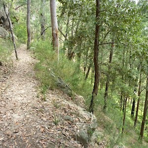
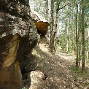
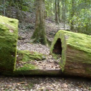
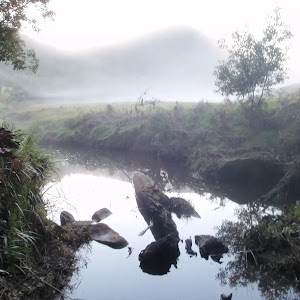
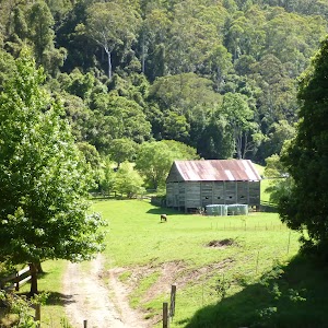
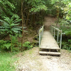
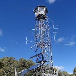
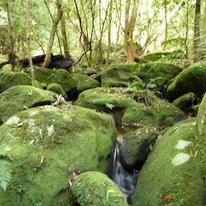
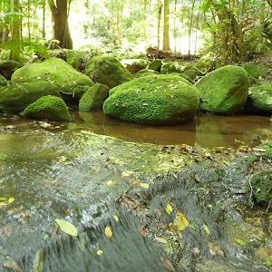
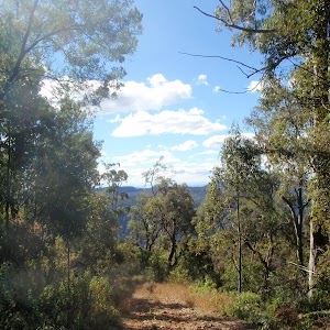
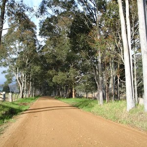
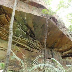
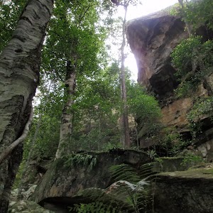
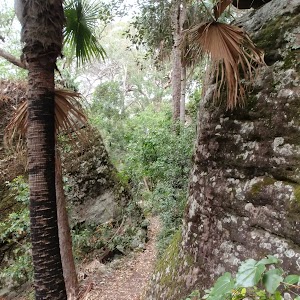
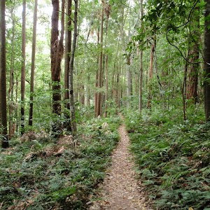
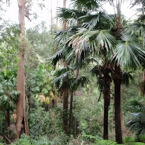
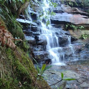
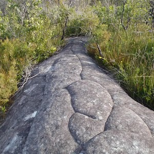
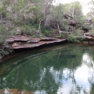
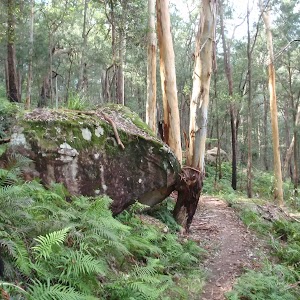
Gallery images
There are other downloads I am still working on.
You will probably need to login to access these — still all free.
* KML (google earth file)
* GPX (GPS file)
Special Maps/ brochures
* A3 topo maps
* PDF with Lands Topo map base
* PDF with arial image (and map overlay)
I wanted to get the main site live first, this extra stuff will come in time.
Happy walking
Matt 🙂
Comments