McKell Park Loop


30 mins

24 m
Moderate track


(0km) Federation Foreshore Parking → McKell Park Playground

180 m
3 mins
2m
-2m
Very easy
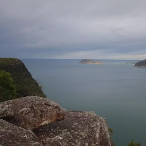
McKell Park
(0.18km) McKell Park Playground → Flat Rock Point
250 m
4 mins
3m
-4m
Very easy
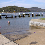
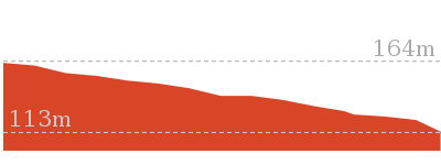
(0.42km) Flat Rock Point → Parsley Bay Boat Ramp
290 m
6 mins
10m
-8m
Very easy
(0.42km) Flat Rock Point → Upper McKell park
260 m
6 mins
17m
-1m
Easy track
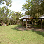
Upper McKell Park Picnic Area
(0.69km) Upper McKell park → Federation Foreshore Parking
240 m
5 mins
2m
-16m
Moderate track
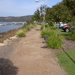
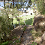
Turn left : From the intersection, this walk heads along the flat concrete footpath[22], keeping the water to your right. The path leads around the edge of the metal and glass ‘Federation’ interpretive signs[23][24] and playground[25]. Here the walk veers right to follow the gravel path[26] between the car park (on your left) and the water[27] (on your right) for about 130m before coming to the end of the car park[28].
Maps for the McKell Park Loop walk
You can download the PDF for this walk to print a map.These maps below cover the walk and the wider area around the walk, they are worth carrying for safety reasons.
| Cowan | 1:25 000 Map Series | 91304N COWAN | NSW-91304N |
| Ku-ring-gai Chase National Park Tourist Map | 1:40 000 Map Series | CMA Ku-ring-gai Chase National Park Tourist Map | CMA Ku-ring-gai Chase National Park Tourist Map |
| Sydney | 1:100 000 Map Series | 9130 SYDNEY | 9130 |
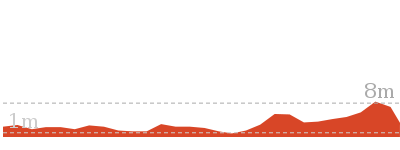
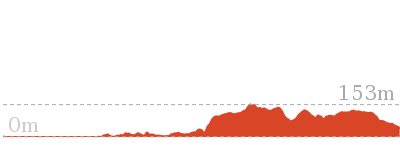
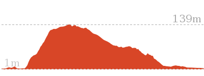
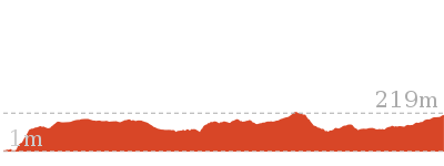
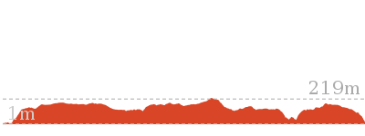
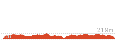
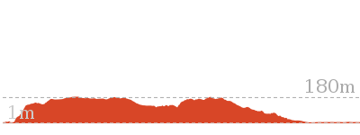
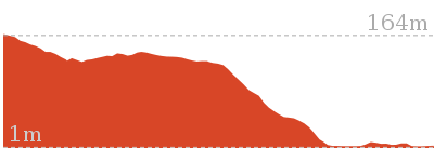
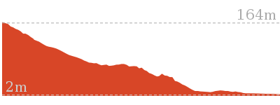
Cross sectional view of the McKell Park Loop bushwalking track
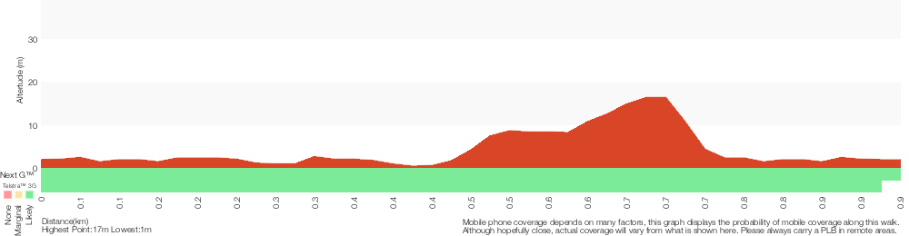
Analysis and summary of the altitude variation on the McKell Park Loop
Overview of this walks grade – based on the AS 2156.1 – 2001
Under this standard, a walk is graded based on the most difficult section of the walk.
| Length | 931 m | ||
| Time | 30 mins | ||
| . | |||
| Grade 3/6 Moderate track |
AS 2156.1 | Gradient | Short steep hills (3/6) |
| Quality of track | Formed track, with some branches and other obstacles (3/6) | ||
| Signs | Directional signs along the way (3/6) | ||
| Experience Required | No experience required (1/6) | ||
| Weather | Weather generally has little impact on safety (1/6) | ||
| Infrastructure | Generally useful facilities (such as fenced cliffs and seats) (1/6) |
Some more details of this walks Grading
Here is a bit more details explaining grading looking at sections of the walk
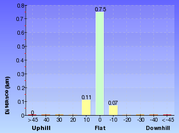
Gradient
600m of this walk is flat with no steps and another 260m has gentle hills with occasional steps. The remaining (65m) has short steep hills.
Quality of track
600m of this walk follows a smooth and hardened path and another 260m follows a clear and well formed track or trail. The remaining (65m) follows a formed track, with some branches and other obstacles.
Signs
Around 860m of this walk is clearly signposted, whilst the remaining 65m has directional signs at most intersection.
Experience Required
This whole walk, 930m requires no previous bushwalking experience.
weather
This whole walk, 930m is not usually affected by severe weather events (that would unexpectedly impact safety and navigation).
Infrastructure
This whole walk, 930m is close to useful facilities (such as fenced cliffs and seats).
Similar walks
1.4 km Return
30 mins
Very easy
13.4 km One way
5 hrs 30 mins
Hard track
Other Nearby walks
16.1 km One way
6 hrs 30 mins
Experienced only

18.1 km Return
8 hrs
Hard track
4.3 km One way
1 hr 45 mins
Moderate track
41.5 km One way
3 Days
Hard track
17 km One way
6 hrs 30 mins
Hard track
19.5 km One way
7 hrs 30 mins
Hard track
28.1 km One way
2 Days
Experienced only
4.3 km Return
2 hrs
Moderate track
15.5 km One way
5 hrs 45 mins
Hard track
2.2 km One way
1 Hr
Moderate track
2.8 km One way
1 hr 15 mins
Moderate track
756 m Return
20 mins
Easy track
Plan your trip to and from the walk here
The McKell Park Loop walk starts and ends at the Federation Foreshore Parking (gps: -33.546516, 151.22899)Your transport options to Federation Foreshore Parking are by;
(get details)


Short URL = http://wild.tl/s
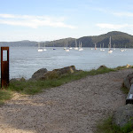
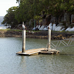
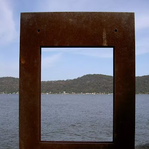
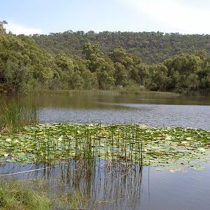
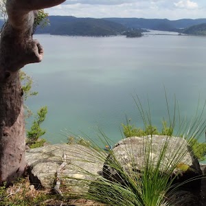
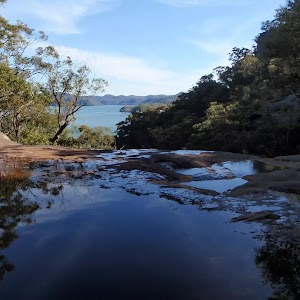
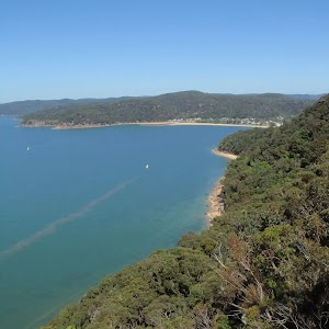
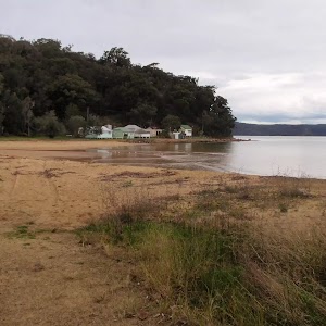
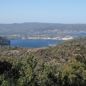
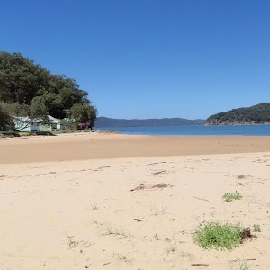
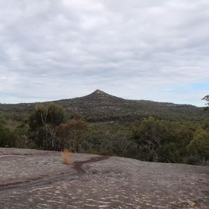
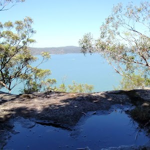
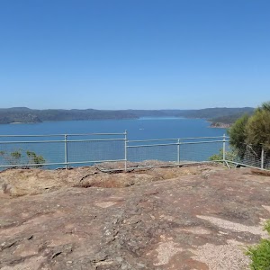
Gallery images
There are other downloads I am still working on.
You will probably need to login to access these — still all free.
* KML (google earth file)
* GPX (GPS file)
Special Maps/ brochures
* A3 topo maps
* PDF with Lands Topo map base
* PDF with arial image (and map overlay)
I wanted to get the main site live first, this extra stuff will come in time.
Happy walking
Matt 🙂
Comments