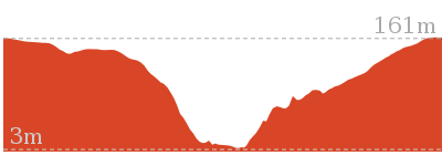
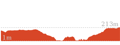
Warrimoo Track to Bobbin Head


2 hrs 45 mins

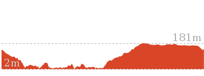
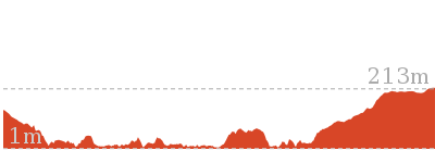
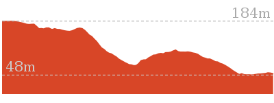
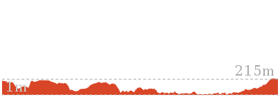
280 m
Moderate track
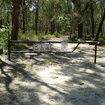


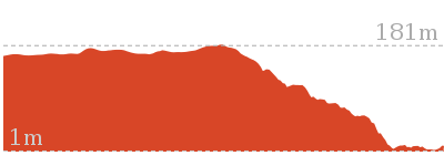
(0km) End of Warrimoo Ave → Sonja Huddles Chair

1.4 km
28 mins
7m
-115m
Moderate track
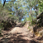
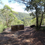
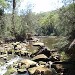
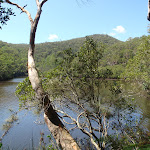
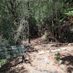
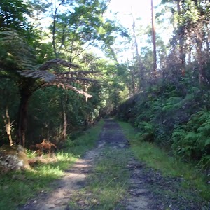
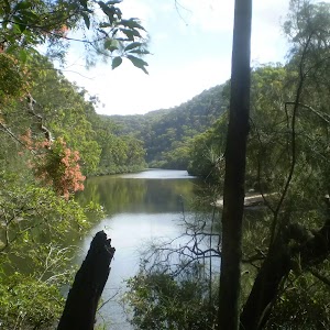
Continue straight: From the intersection, the walk follows the Bobbin Head arrow along the service trail (heading north west). The trail meanders through the bush for a while before winding steadily down a long hill to the end of the ridge. Here, the trail comes to a Memorial Chair at a lookout over Cowan Creek.
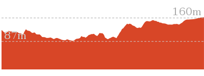
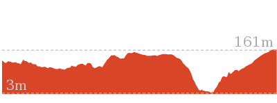
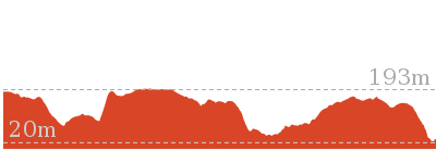
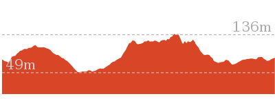
(1.37km) Sonja Huddles Chair → Empire Marina
4.4 km
1 hr 47 mins
260m
-307m
Moderate track
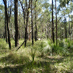
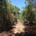
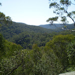
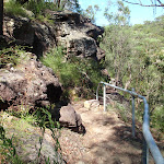
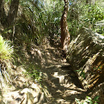
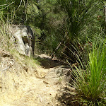
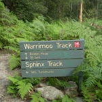
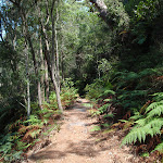
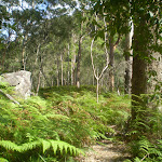
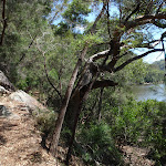
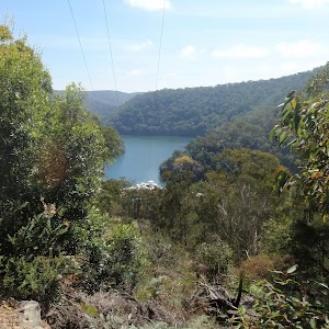
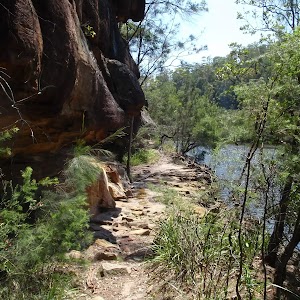
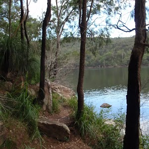
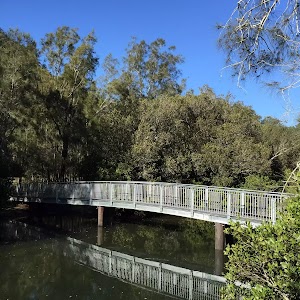
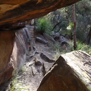
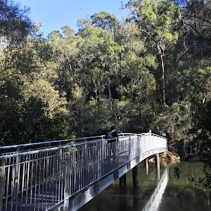
Continue straight: From the intersection this walk follows the ‘Bobbin Head’ arrow on the ‘Warrimoo Track’ sign[1] along the clear track that leads through the mostly flat ferny section, keeping Cowan Creek some distance to your right. After about 100m the track leaves the ferns and passes under a set of high tension power lines[2] where the track undulates along the side of the hill close to Cowan Creek[3] crossing a few small gullies for about 900m to then pass along a long natural sandstone wall[4]. About 150m after this wall the track leads just below a notable sandstone overhang[5] (up to your left) where the track then starts to head downhill for just over 100m to a fairly open grassy salt marsh[6]. The walk stays just to the left of the salt marsh then leads along the edge of a section of mangroves[7] for 100m where the track bends left[8] and leads along side the creek for another 100m to then cross a creek at a wide rocky gully[9]. This is a pleasant cool spot with the usually small creek flowing over the sandstone rock platform with naturally carved holes[10]. For the next 200m the track undulates gently along the foreshore through the casuarina forest[11] to come to a tall overhang[12] that is on a rock platform right on the edge of Cowan Creek, a pleasant place to rest. This section of track may become covered with water at high tide. From the tall overhang the track continues along the shortening natural rock wall[13] for about 150m to then lead along another section of mangroves[14] for 150m. About 60m past the mangroves the track crosses a short flat timber bridge[15], then over the next 200m the track crosses a mossy gully and densely forested gully[16] where the rocky track climbs[17] over a rise, past some large smooth bark angophora’s[18] then down to another tall and long rock wall[19] and some more pleasant water views[20]. Just 20m past this rock wall the track bends left[21] and leads alongside the edge of the mangroves[22] for 200m, were again the track may be covered with water at high tides. From the end of the mangroves the rocky track climbs[23] for about 200m before continuing along the water side through a casuarina forest[24] as the track gently undulates over some rocky sections passing some pleasant water views[25] for 400m to pass below another fairly large sandstone cave/overhang[26] (up the hill to your left). Over the next 250m the track leads through a grassy section[27] beside the creek before crossing a shallow gully over a scattering of sandstone blocks[28][29]. Over the next 300m the mostly flat track leads through a tall wooded forest[30] filled with ferns and crossing a few middens[31] to come to an three-way intersection, just before the marina, marked with a ‘Warrimoo Ave & Sphinx Memorial’ sign[32] pointing back along the track.
Continue straight: From the intersection, this walk follows the ‘Bobbin Head Picnic Area’ sign[33] along the mostly flat track following the foreshore, keeping the water and boats to your right. After about 30m this walk follows a fence and handrail[34] behind a dry dock[35] for 40m. Here the track narrows a bit to head between the rock face and buildings[36] for 100m to turn right at a ‘Warrimo Track’ sign[37] and a yellow painted walker (on the ground). Here the walk heads through the hallway, past the public toilets[38] to the water front of Empire Marina, beside the ‘Kiosk’[39] (on your right).
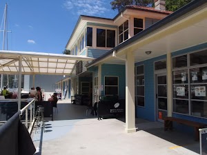
Empire Marina – Galley Foods cafe
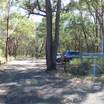
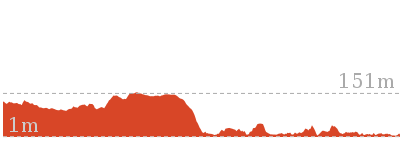
(5.77km) Empire Marina → Bobbin Head Wharf carpark
240 m
4 mins
5m
-9m
Very easy
(6.01km) Bobbin Head Wharf carpark → Bobbin Inn
180 m
4 mins
8m
-1m
Very easy
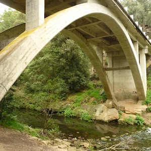
Turn right: From the intersection, this walk follows the footpath beside the road over the wide bridge[58], crossing Cowan Creek[59]. On the far side of the bridge, this walk continues beside the road along side ‘Orchard Park’[60] to pass a side road (on the left)[61]. Just 60m later along the main road (Ku-ring-gai Chase Road) this walk comes to the end of a small set of car parks just beside the ‘Bobbin Inn’ building[62] (on your left), home to cafe and ‘information centre’.
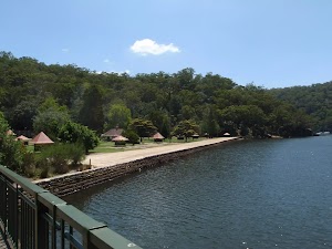
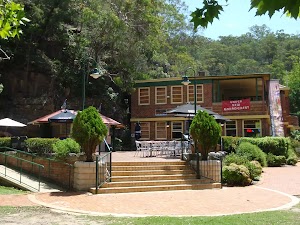
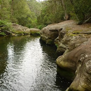
Bobbin Head

Bobbin Inn Cafe
Maps for the Warrimoo Track to Bobbin Head walk
You can download the PDF for this walk to print a map.These maps below cover the walk and the wider area around the walk, they are worth carrying for safety reasons.
| Hornsby | 1:25 000 Map Series | 91304S HORNSBY | NSW-91304S |
| Ku-ring-gai Chase National Park Tourist Map | 1:40 000 Map Series | CMA Ku-ring-gai Chase National Park Tourist Map | CMA Ku-ring-gai Chase National Park Tourist Map |
| Sydney | 1:100 000 Map Series | 9130 SYDNEY | 9130 |
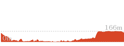
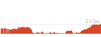
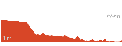
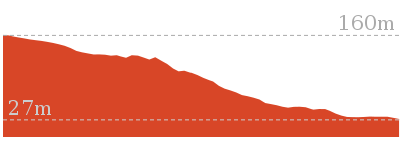
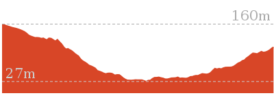
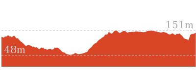
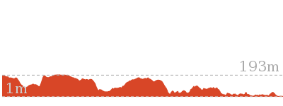
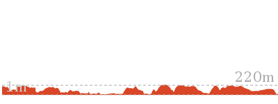
Cross sectional view of the Warrimoo Track to Bobbin Head bushwalking track
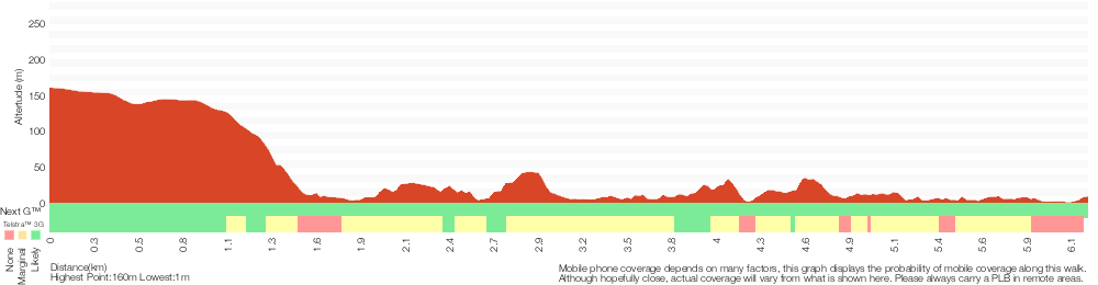
Analysis and summary of the altitude variation on the Warrimoo Track to Bobbin Head
Overview of this walks grade – based on the AS 2156.1 – 2001
Under this standard, a walk is graded based on the most difficult section of the walk.
| Length | 6.2 km | ||
| Time | 2 hrs 45 mins | ||
| . | |||
| Grade 3/6 Moderate track |
AS 2156.1 | Gradient | Short steep hills (3/6) |
| Quality of track | Formed track, with some branches and other obstacles (3/6) | ||
| Signs | Directional signs along the way (3/6) | ||
| Experience Required | Some bushwalking experience recommended (3/6) | ||
| Weather | Storms may impact on navigation and safety (3/6) | ||
| Infrastructure | Limited facilities, not all cliffs are fenced (3/6) |
Some more details of this walks Grading
Here is a bit more details explaining grading looking at sections of the walk
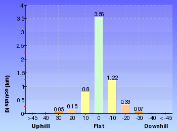
Gradient
4.2km of this walk has short steep hills and another 1.5km has gentle hills with occasional steps. The remaining (420m) is flat with no steps.
Quality of track
5km of this walk follows a formed track, with some branches and other obstacles and another 700m follows a clear and well formed track or trail. The remaining (420m) follows a smooth and hardened path.
Signs
Around 3.7km of this walk has directional signs at most intersection, whilst the remaining 2.5km is clearly signposted.
Experience Required
Around 5km of this walk requires some bushwalking experience, whilst the remaining 1.1km requires no previous bushwalking experience.
weather
Around 3.7km of this walk is affected by storms that may impact your navigation and safety, whilst the remaining 2.5km is not usually affected by severe weather events (that would unexpectedly impact safety and navigation).
Infrastructure
Around 4.2km of this walk has limited facilities (such as not all cliffs fenced), whilst the remaining 2km is close to useful facilities (such as fenced cliffs and seats).
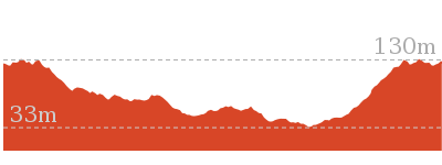
Similar walks
3.4 km One way
1 hr 30 mins
Moderate track
4.2 km One way
1 hr 45 mins
Moderate track
5 km One way
1 hr 45 mins
Moderate track

6.6 km One way
2 hrs 45 mins
Moderate track
9.4 km One way
4 hrs 15 mins
Moderate track
9.6 km Circuit
4 hrs
Moderate track
10.7 km One way
4 hrs 45 mins
Hard track
11 km One way
4 hrs 30 mins
Hard track
12.9 km Circuit
5 hrs
Hard track
14.6 km One way
6 hrs 30 mins
Hard track
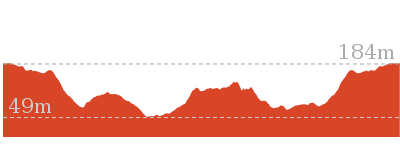
Other Nearby walks
6.5 km One way
2 hrs 30 mins
Hard track
3.5 km Return
1 hr 30 mins
Moderate track
3.2 km One way
1 hr 30 mins
Moderate track
5.5 km One way
2 hrs 15 mins
Hard track
4.4 km Circuit
2 hrs
Moderate track

6.7 km Circuit
3 hrs
Hard track
16.1 km One way
6 hrs 45 mins
Hard track
43.1 km One way
3 Days
Hard track
5.6 km Return
2 hrs 30 mins
Hard track
9.7 km One way
4 hrs
Hard track
22.3 km One way
9 hrs
Hard track
4.2 km Circuit
2 hrs
Hard track
Plan your trip to and from the walk here
The Warrimoo Track to Bobbin Head walk starts at the End of Warrimoo Ave (gps: -33.700621, 151.16556)Your transport options to End of Warrimoo Ave are by;
(get details)
The Warrimoo Track to Bobbin Head ends at the Bobbin Inn (gps: -33.659696, 151.15912)
Your main transport option to Bobbin Inn is by;
(get details)


Short URL = http://wild.tl/wttbh
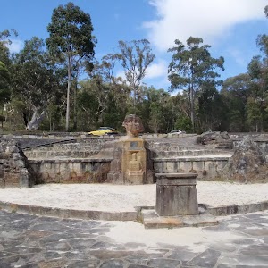
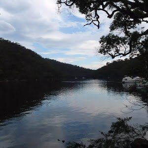
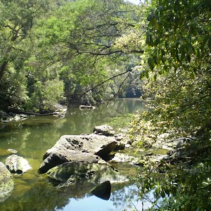
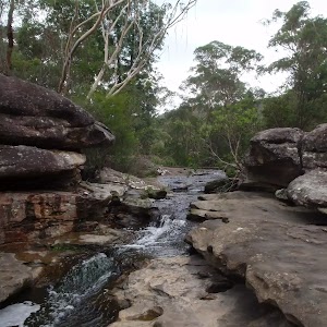
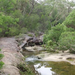
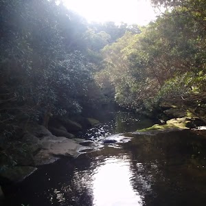
Gallery images
There are other downloads I am still working on.
You will probably need to login to access these — still all free.
* KML (google earth file)
* GPX (GPS file)
Special Maps/ brochures
* A3 topo maps
* PDF with Lands Topo map base
* PDF with arial image (and map overlay)
I wanted to get the main site live first, this extra stuff will come in time.
Happy walking
Matt 🙂
Comments