Browns Waterhole Track


30 mins

49 m
Moderate track


(0km) End of Kissing Pt Rd, Turramurra → Int of Great North Walk and Kissing Point road trail

320 m
7 mins
1m
-19m
Moderate track
(0.32km) Int of GNW and Kissing Point Road trail → Browns Waterhole int
260 m
5 mins
1m
-17m
Easy track
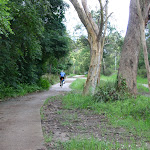
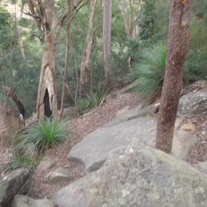
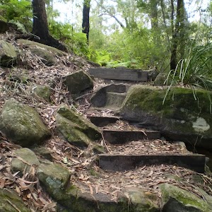
Continue straight: From the intersection, the walk heads fairly steeply downhill along the concrete path. The path passes a few signs[6] over about 100m, then comes to an intersection with a track (on your left), marked with a timber barricade and a GNW arrow post[7].
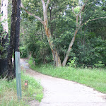
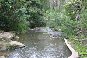
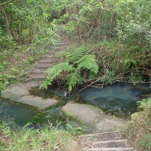
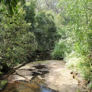
Veer right: From the intersection, this follows the concrete path downhill for just shy of 50m to come to a intersection with a dirt management trail[8]. This intersection is beside the Lane Cove River crossing[9] (on your left) and is marked with a ‘The Great North Walk’ sign here[10].
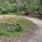
(0.58km) Browns Waterhole int → Browns Waterhole
90 m
2 mins
5m
-1m
Moderate track
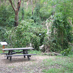
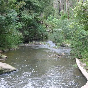
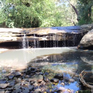
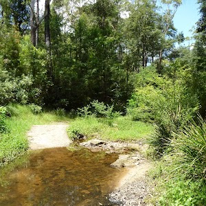
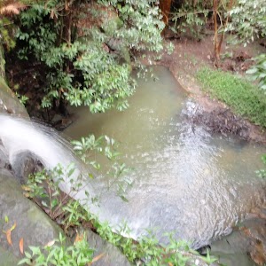
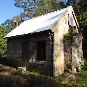
Browns Waterhole
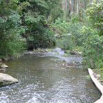
(0.67km) Browns Waterhole → Int of Terry’s Creek Walking Track and Brown’s Waterhole Servicetrail
40 m
1 mins
3m
0m
Very easy
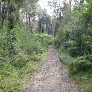
(0.71km) Int of Terry’s Creek Walking Track and Brown’s Waterhole Servicetrail → End of Vimiera Rd
630 m
14 mins
39m
-6m
Moderate track
Maps for the Browns Waterhole Track walk
You can download the PDF for this walk to print a map.These maps below cover the walk and the wider area around the walk, they are worth carrying for safety reasons.
| Parramatta River | 1:25 000 Map Series | 91303N PARRAMATTA RIVER | NSW-91303N |
| Sydney | 1:100 000 Map Series | 9130 SYDNEY | 9130 |
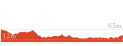
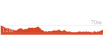
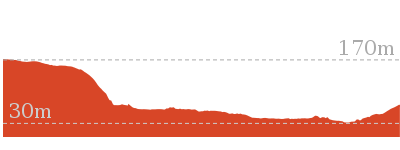
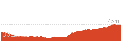
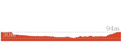
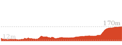
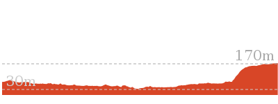
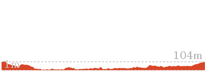
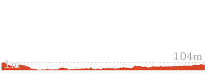
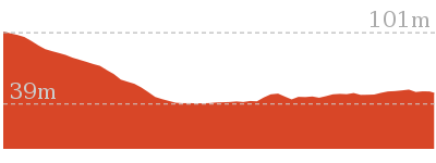
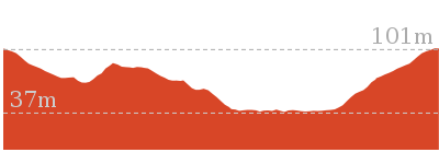
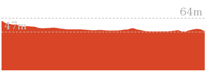
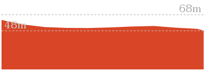
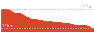
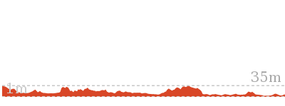
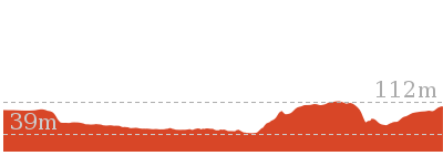
Cross sectional view of the Browns Waterhole Track bushwalking track
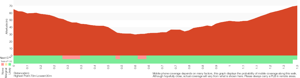
Analysis and summary of the altitude variation on the Browns Waterhole Track
Overview of this walks grade – based on the AS 2156.1 – 2001
Under this standard, a walk is graded based on the most difficult section of the walk.
| Length | 1.3 km | ||
| Time | 30 mins | ||
| . | |||
| Grade 3/6 Moderate track |
AS 2156.1 | Gradient | Short steep hills (3/6) |
| Quality of track | Smooth and hardened path (1/6) | ||
| Signs | Clearly signposted (1/6) | ||
| Experience Required | No experience required (1/6) | ||
| Weather | Storms may impact on navigation and safety (3/6) | ||
| Infrastructure | Limited facilities, not all cliffs are fenced (3/6) |
Some more details of this walks Grading
Here is a bit more details explaining grading looking at sections of the walk
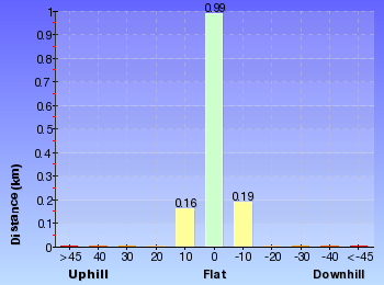
Gradient
630m of this walk has short steep hills and another 470m has gentle hills with occasional steps. The remaining (240m) is flat with no steps.
Quality of track
This whole walk, 1.3km follows a smooth and hardened path.
Signs
This whole walk, 1.3km is clearly signposted.
Experience Required
This whole walk, 1.3km requires no previous bushwalking experience.
weather
Around 1.3km of this walk is not usually affected by severe weather events (that would unexpectedly impact safety and navigation), whilst the remaining 90m is affected by storms that may impact your navigation and safety.
Infrastructure
Around 1km of this walk is close to useful facilities (such as fenced cliffs and seats), whilst the remaining 320m has limited facilities (such as not all cliffs fenced).
Similar walks
4.4 km One way
1 hr 45 mins
Hard track
5.1 km One way
2 hrs
Hard track
6.1 km One way
2 hrs 30 mins
Hard track
8.4 km One way
3 hrs 15 mins
Hard track

8.4 km Circuit
3 hrs
Moderate track
9.7 km One way
3 hrs 45 mins
Hard track
10.2 km One way
3 hrs 45 mins
Moderate track
10.3 km One way
3 hrs 45 mins
Hard track
11.6 km One way
4 hrs 30 mins
Hard track

11.7 km One way
4 hrs 15 mins
Hard track

16.3 km One way
6 hrs
Hard track

18.1 km One way
6 hrs 45 mins
Hard track

20.6 km One way
8 hrs
Hard track

25.8 km One way
2 Days
Hard track

33 km One way
2 Days
Hard track


44.4 km One way
3 Days
Hard track

Other Nearby walks

3.2 km Return
1 hr 30 mins
Moderate track
2.7 km Circuit
1 Hr
Moderate track
2.8 km Return
1 Hr
Moderate track
516 m Return
15 mins
Moderate track
360 m Return
15 mins
Easy track
5.5 km Return
2 hrs
Moderate track

12.2 km One way
4 hrs 30 mins
Hard track
13.3 km One way
4 hrs 30 mins
Hard track


10.7 km One way
4 hrs 30 mins
Hard track
6 km One way
2 hrs 30 mins
Hard track
4.1 km One way
1 hr 30 mins
Moderate track
6.8 km One way
2 hrs 30 mins
Hard track
Plan your trip to and from the walk here
The Browns Waterhole Track walk starts at the End of Kissing Pt Rd, Turramurra (gps: -33.75841, 151.1098)Your transport options to End of Kissing Pt Rd, Turramurra are by;
(get details)
The Browns Waterhole Track ends at the End of Vimiera Rd (gps: -33.764966, 151.10605)
Your transport options to End of Vimiera Rd are by;
(get details)


Short URL = http://wild.tl/bwt
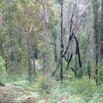
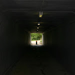
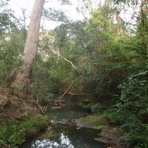
Gallery images
There are other downloads I am still working on.
You will probably need to login to access these — still all free.
* KML (google earth file)
* GPX (GPS file)
Special Maps/ brochures
* A3 topo maps
* PDF with Lands Topo map base
* PDF with arial image (and map overlay)
I wanted to get the main site live first, this extra stuff will come in time.
Happy walking
Matt 🙂
Comments