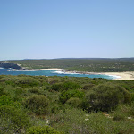
Bundeena to Marley Head


3 hrs 20 mins

274 m
Moderate track


Bundeena
(0km) Bundeena Ferry Wharf → End of Beachcomber Av

1.6 km
30 mins
61m
-21m
Easy track
(1.55km) End of Beachcomber Av → Int of Beachcomber Rd Service Trail and Coast Walk
210 m
4 mins
10m
-2m
Moderate track
Continue straight: From the intersection, this walk follows the asphalt management trail heading towards the green signposts nearby, where it comes to the signposted intersection of the ‘Coast Track’[2].
(1.76km) Int of Beachcomber Rd Servicetrail and Coast Walk → Campsite at end of Beachcomber Rd Servicetrail
260 m
5 mins
9m
-3m
Moderate track
(2.02km) Campsite at end of Beachcomber Rd Servicetrail → Int of Beachcomber Bushtrack and Marley Head Trail
1.1 km
19 mins
20m
-5m
Moderate track
(3.12km) Int of Marley Head Servicetrail and Beachcomber Rd Bushtrack → Int of Coast Track and Marley Head Servicetrail
2.2 km
38 mins
8m
-41m
Moderate track
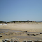
(5.35km) Int of Coast Track and Marley Head Servicetrail → East Marely Beach
450 m
8 mins
1m
-32m
Moderate track
(5.35km) Int of Coast Track and Marley Head Servicetrail → Bundeena Lookout
3 km
1 hr 4 mins
116m
-126m
Moderate track
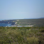
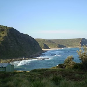
Bundeena Lookout
(8.38km) Bundeena Lookout → Int of Beachcomber Rd Servicetrail and Coast Walk
690 m
12 mins
27m
-4m
Moderate track
(9.07km) Int of Beachcomber Rd Service Trail and Coast Walk → Bundeena Ferry Wharf
1.8 km
34 mins
23m
-71m
Moderate track
Continue straight: From the intersection, this walk heads north around a sweeping left-hand bend along the sealed management trail. Soon, the trail leads past a track (on the right) then passes around a locked gate at the end of of Beachcomber Ave and a ‘Coast Walk’ information sign[4].
Continue straight: From the end of Beachcomber Ave, this walk heads along Beachcomber Ave north-west and gradually around to the north, until turning left into Scarbourough St. The first right is taken into Bournemouth St, then left into Loftus St. The walk continues along this road until turning right into Brighton Rd. Bundeena Ferry is located at the end of Brighton St.
Maps for the Bundeena to Marley Head walk
You can download the PDF for this walk to print a map.These maps below cover the walk and the wider area around the walk, they are worth carrying for safety reasons.
| Port Hacking | 1:25 000 Map Series | 91294N PORT HACKING | NSW-91294N |
| Port Hacking | 1:100 000 Map Series | 9129 PORT HACKING | 9129 |
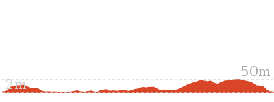
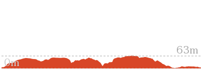
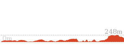
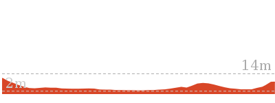
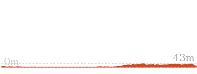
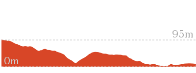
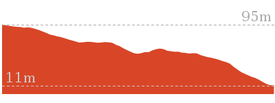
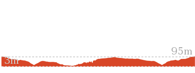
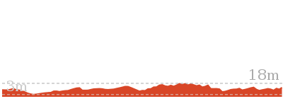
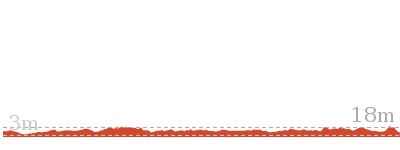
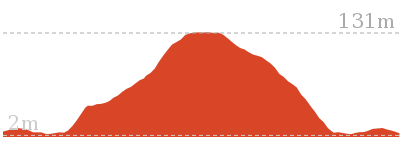
Cross sectional view of the Bundeena to Marley Head bushwalking track
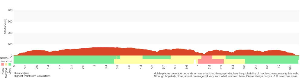
Analysis and summary of the altitude variation on the Bundeena to Marley Head
Overview of this walks grade – based on the AS 2156.1 – 2001
Under this standard, a walk is graded based on the most difficult section of the walk.
| Length | 10.8 km | ||
| Time | 3 hrs 20 mins | ||
| . | |||
| Grade 3/6 Moderate track |
AS 2156.1 | Gradient | Short steep hills (3/6) |
| Quality of track | Formed track, with some branches and other obstacles (3/6) | ||
| Signs | Directional signs along the way (3/6) | ||
| Experience Required | Some bushwalking experience recommended (3/6) | ||
| Weather | Weather generally has little impact on safety (1/6) | ||
| Infrastructure | Limited facilities, not all cliffs are fenced (3/6) |
Some more details of this walks Grading
Here is a bit more details explaining grading looking at sections of the walk
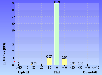
Gradient
7km of this walk has gentle hills with occasional steps and another 3km has short steep hills. The remaining (410m) is flat with no steps.
Quality of track
6km of this walk follows a clear and well formed track or trail and another 3.5km follows a smooth and hardened path. The remaining (1.1km) follows a formed track, with some branches and other obstacles.
Signs
Around 7km of this walk is clearly signposted, whilst the remaining 4.1km has directional signs at most intersection.
Experience Required
Around 8km of this walk requires no previous bushwalking experience, whilst the remaining 3km requires some bushwalking experience.
weather
This whole walk, 11km is not usually affected by severe weather events (that would unexpectedly impact safety and navigation).
Infrastructure
Around 6km of this walk is close to useful facilities (such as fenced cliffs and seats), whilst the remaining 4.7km has limited facilities (such as not all cliffs fenced).
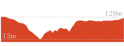
Similar walks
6.8 km Circuit
2 hrs 30 mins
Moderate track
12.7 km Return
4 hrs 30 mins
Moderate track
14 km Return
5 hrs
Moderate track
27.4 km One way
2 Days
Hard track
27.4 km One way
2 Days
Hard track
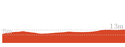
Other Nearby walks
5.1 km Circuit
1 hr 45 mins
Moderate track
2.6 km Return
45 mins
Moderate track
13.1 km One way
4 hrs 30 mins
Hard track
9.7 km Return
3 hrs 30 mins
Hard track
3.8 km Return
1 hr 30 mins
Hard track
11 km Circuit
4 hrs 30 mins
Hard track
4.4 km One way
2 hrs
Hard track

858 m Return
20 mins
Easy track
5 km Return
1 hr 45 mins
Easy track
10.5 km Return
4 hrs
Moderate track
2.3 km Circuit
1 hr 15 mins
Hard track
2.2 km Return
45 mins
Easy track
Plan your trip to and from the walk here
The Bundeena to Marley Head walk starts and ends at the Bundeena Ferry Wharf (gps: -34.082703, 151.15107)Your transport options to Bundeena Ferry Wharf are by;
(get details)


Short URL = http://wild.tl/btmh
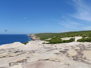
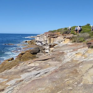
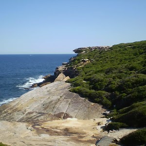
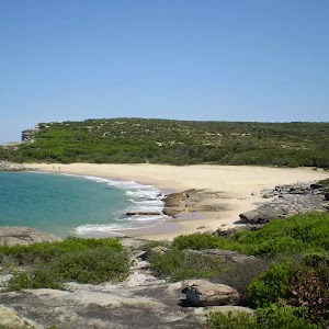
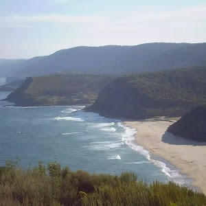
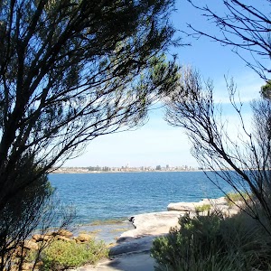
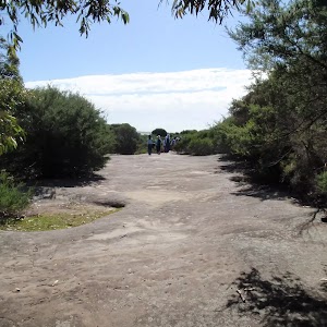
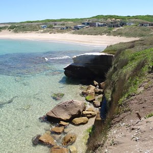
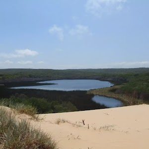
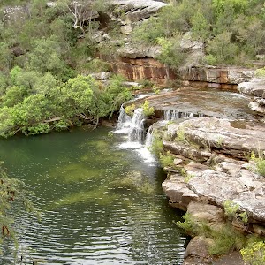
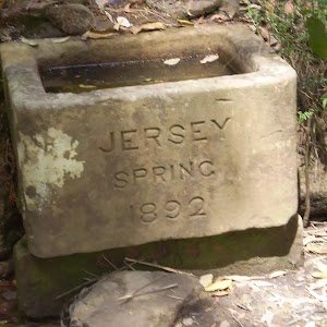
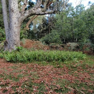
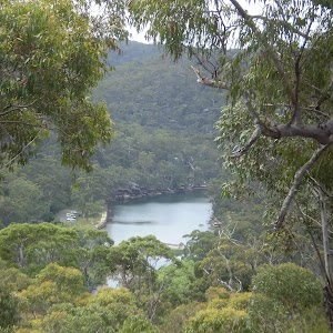
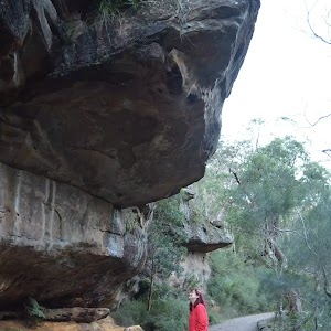
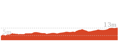
Gallery images
There are other downloads I am still working on.
You will probably need to login to access these — still all free.
* KML (google earth file)
* GPX (GPS file)
Special Maps/ brochures
* A3 topo maps
* PDF with Lands Topo map base
* PDF with arial image (and map overlay)
I wanted to get the main site live first, this extra stuff will come in time.
Happy walking
Matt 🙂
Comments