Wises Track


1 hr 30 mins

50 m
Moderate track


(0km) Int. Sir Bertram Stevens Drive and Wises Trk Gate South → Int. Wises Trk and Karani Trk

1.3 km
23 mins
6m
-47m
Moderate track
(1.33km) Int. Wises Trk and Karani Trk → Int. Sir Bertram Stevens Drive and Wises Trk Gate North
2.8 km
49 mins
44m
-56m
Moderate track
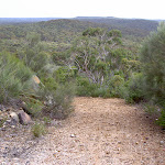
Continue straight: From the intersection, this walk heads north, following the clearest trail for approximately 500m. The walk continues among banksia bushes and short eucalypts along the sandy trail, coming to an intersection with an overgrown trail on the left.
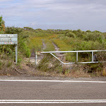
Veer right: From the intersection, the walk heads away from the fork in the track, along the defined trail. The trail soon passes the gate and ‘Wises Track’ sign, coming to Sir Bertram Stevens Drive.
Maps for the Wises Track walk
You can download the PDF for this walk to print a map.These maps below cover the walk and the wider area around the walk, they are worth carrying for safety reasons.
| Otford | 1:25 000 Map Series | 91294S OTFORD | NSW-91294S |
| Port Hacking | 1:25 000 Map Series | 91294N PORT HACKING | NSW-91294N |
| Port Hacking | 1:100 000 Map Series | 9129 PORT HACKING | 9129 |
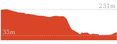
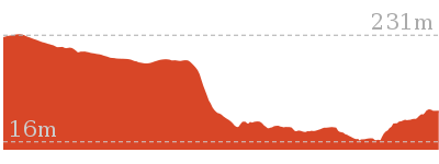
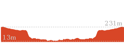
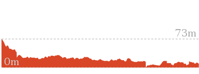
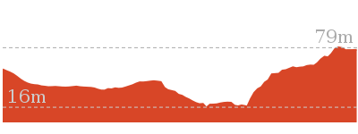
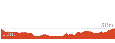
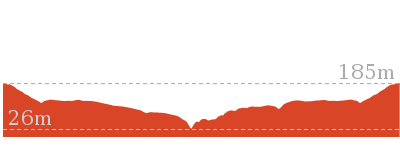
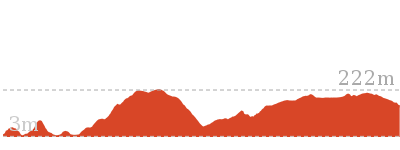
Cross sectional view of the Wises Track bushwalking track
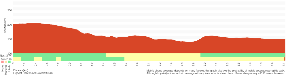
Analysis and summary of the altitude variation on the Wises Track

Overview of this walks grade – based on the AS 2156.1 – 2001
Under this standard, a walk is graded based on the most difficult section of the walk.
| Length | 4.1 km | ||
| Time | 1 hr 30 mins | ||
| . | |||
| Grade 3/6 Moderate track |
AS 2156.1 | Gradient | Short steep hills (3/6) |
| Quality of track | Formed track, with some branches and other obstacles (3/6) | ||
| Signs | Directional signs along the way (3/6) | ||
| Experience Required | No experience required (1/6) | ||
| Weather | Weather generally has little impact on safety (1/6) | ||
| Infrastructure | Limited facilities, not all cliffs are fenced (3/6) |
Some more details of this walks Grading
Here is a bit more details explaining grading looking at sections of the walk
Gradient
Around 2.8km of this walk has gentle hills with occasional steps, whilst the remaining 1.3km has short steep hills.
Quality of track
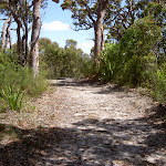
Around 3.7km of this walk follows a clear and well formed track or trail, whilst the remaining 470m follows a formed track, with some branches and other obstacles.
Signs
This whole walk, 4.1km has directional signs at most intersection.
Experience Required
This whole walk, 4.1km requires no previous bushwalking experience.
weather
This whole walk, 4.1km is not usually affected by severe weather events (that would unexpectedly impact safety and navigation).
Infrastructure
Around 3.7km of this walk has limited facilities (such as not all cliffs fenced), whilst the remaining 470m is close to useful facilities (such as fenced cliffs and seats).
Similar walks
Other Nearby walks
4.7 km One way
1 hr 45 mins
Moderate track
11.8 km Return
4 hrs 30 mins
Hard track
12.5 km Circuit
4 hrs 30 mins
Moderate track
8.9 km Return
3 hrs 30 mins
Moderate track

9.7 km One way
3 hrs 45 mins
Moderate track
5.1 km Return
2 hrs
Hard track
4.4 km Circuit
1 hr 45 mins
Moderate track
4.4 km One way
1 hr 45 mins
Hard track
9.2 km Circuit
3 hrs 30 mins
Hard track
13.5 km Circuit
7 hrs
Hard track
11 km One way
4 hrs 30 mins
Hard track
3.2 km Return
2 hrs
Moderate track
Plan your trip to and from the walk here
The Wises Track walk starts at the Int. Sir Bertram Stevens Drive and Wises Trk Gate South (gps: -34.142541, 151.0644)Your main transport option to Int. Sir Bertram Stevens Drive and Wises Trk Gate South is by;
(get details)
The Wises Track ends at the Int. Sir Bertram Stevens Drive and Wises Trk Gate North (gps: -34.112069, 151.05989)
Your main transport option to Int. Sir Bertram Stevens Drive and Wises Trk Gate North is by;
(get details)


Short URL = http://wild.tl/15
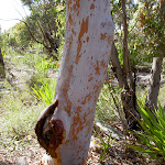
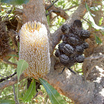
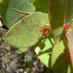
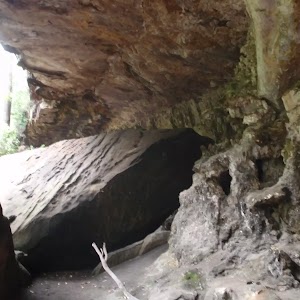
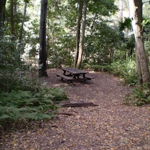
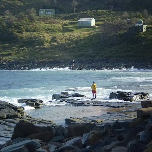
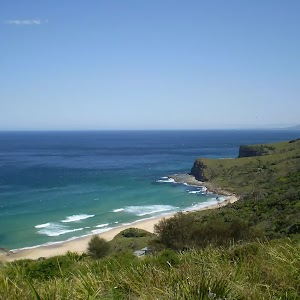
Gallery images
There are other downloads I am still working on.
You will probably need to login to access these — still all free.
* KML (google earth file)
* GPX (GPS file)
Special Maps/ brochures
* A3 topo maps
* PDF with Lands Topo map base
* PDF with arial image (and map overlay)
I wanted to get the main site live first, this extra stuff will come in time.
Happy walking
Matt 🙂
Comments