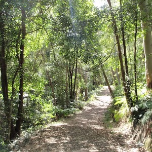
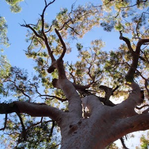
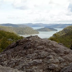
Rainforest Walk


1 hr 30 mins

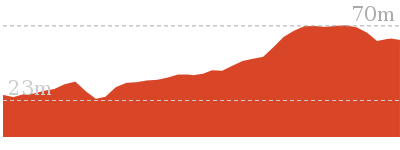
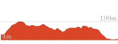
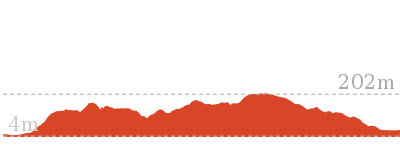
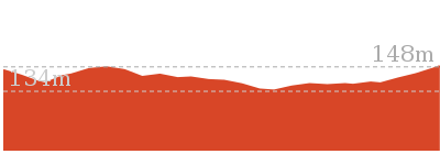
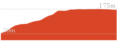
192 m
Hard track

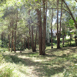


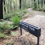


Rumbalara Reserve
(0km) Henry Parry Dr trackhead → Back gate of 2GO car park

160 m
3 mins
4m
-1m
Moderate track
(0.16km) Back gate of 2GO car park → Bottom of staircase on Rainforest walk
200 m
4 mins
12m
-3m
Moderate track
(0.36km) Bottom of staircase on Rainforest walk → Top of staircase on Rainforest walk
30 m
1 mins
4m
-1m
Moderate track
Rumbalara Reserve Flora and Fauna
(0.38km) Top of staircase on Rainforest walk → Southern int of White St firetrail and Rainforest walk
400 m
9 mins
37m
-15m
Moderate track
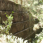
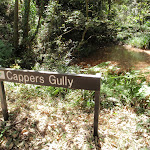
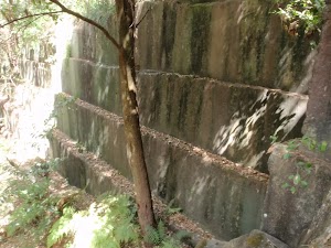
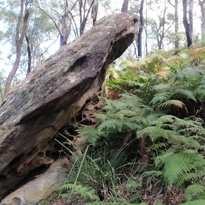
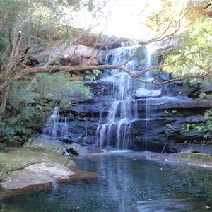
Cappers Gully quarry
(0.78km) Southern int of White St firetrail and Rainforest walk → Southern Int of Rainforest walk and Bayview firetrail
300 m
10 mins
54m
-7m
Hard track
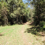
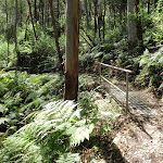
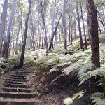
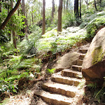
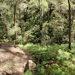
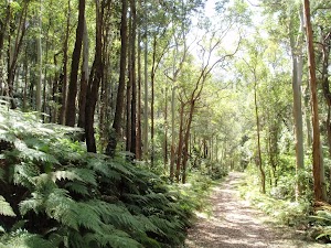
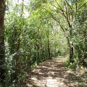
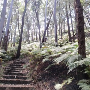
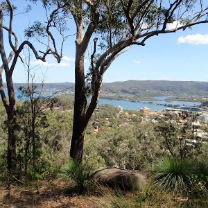
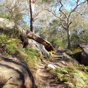
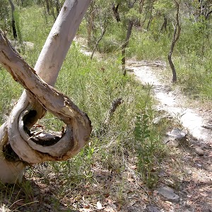
Veer left: From the intersection, this walk follows the ‘Ouraka Point’ arrow up the steps and along the bush track. The walk crosses some short metal footbridges and then climbs more steeply, through beautiful forest scenery. The walk climbs a lot of sandstone steps and some sets of metal stairs, and after some time arrives at an intersection, with a ‘Rainforest Track’ signpost pointing back to ‘Cappers Gully’.
(1.08km) Southern Int of Rainforest walk and Bayview firetrail → Int of Rainforest walk and Casuarina walk
440 m
11 mins
41m
-13m
Hard track
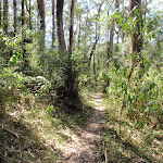
Turn left: From the intersection, this walk follows the ‘Ouraka Point’ arrow down the steps and along the bush track. After descending for a short distance, the track bends to the right and levels out. The track meanders for some time through beautiful forest scenery, crossing two short metal footbridges, before climbing a long set of sandstone steps, then a metal staircase, arriving at an intersection with a management trail, with a ‘Rainforest Track’ signpost pointing back to ‘Cappers Gully’.
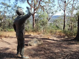
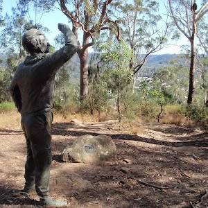
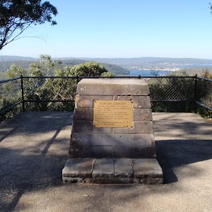
(1.52km) Int of Rainforest walk and Casuarina walk → Sculpture of Charles Sturt
30 m
1 mins
2m
0m
Moderate track
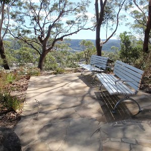
Sculptures in Rumbalara
Maps for the Rainforest Walk walk
You can download the PDF for this walk to print a map.These maps below cover the walk and the wider area around the walk, they are worth carrying for safety reasons.
| Gosford | 1:25 000 Map Series | 91312S GOSFORD | NSW-91312S |
| Gosford | 1:100 000 Map Series | 9131 GOSFORD | 9131 |
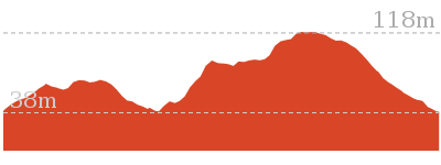
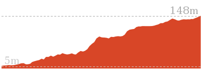
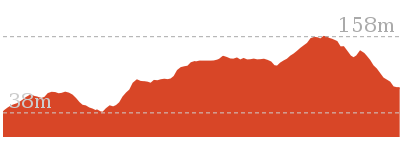
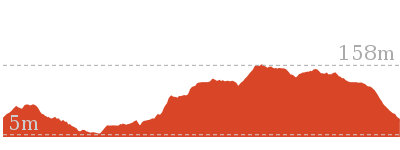
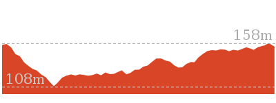
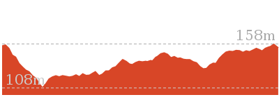
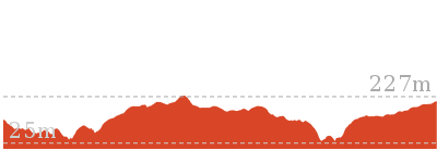
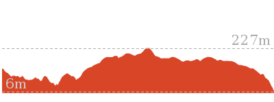
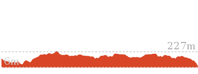
Cross sectional view of the Rainforest Walk bushwalking track
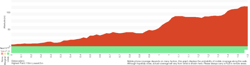
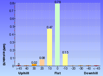
Analysis and summary of the altitude variation on the Rainforest Walk
Overview of this walks grade – based on the AS 2156.1 – 2001
Under this standard, a walk is graded based on the most difficult section of the walk.
| Length | 3 km | ||
| Time | 1 hr 30 mins | ||
| . | |||
| Grade 4/6 Hard track |
AS 2156.1 | Gradient | Very steep (4/6) |
| Quality of track | Formed track, with some branches and other obstacles (3/6) | ||
| Signs | Directional signs along the way (3/6) | ||
| Experience Required | Some bushwalking experience recommended (3/6) | ||
| Weather | Storms may impact on navigation and safety (3/6) | ||
| Infrastructure | Limited facilities, not all cliffs are fenced (3/6) |
Some more details of this walks Grading
Here is a bit more details explaining grading looking at sections of the walk
Gradient
640m of this walk is very steep and another 430m has short steep hills. Whilst another 400m has gentle hills with occasional steps and the remaining 50m is flat with no steps.
Quality of track
Around 1.2km of this walk follows a formed track, with some branches and other obstacles, whilst the remaining 290m follows a clear and well formed track or trail.
Signs
Around 1.4km of this walk has directional signs at most intersection, whilst the remaining 160m is clearly signposted.
Experience Required
Around 820m of this walk requires some bushwalking experience, whilst the remaining 710m requires no previous bushwalking experience.
weather
Around 1.4km of this walk is not usually affected by severe weather events (that would unexpectedly impact safety and navigation), whilst the remaining 160m is affected by storms that may impact your navigation and safety.
Infrastructure
Around 970m of this walk is close to useful facilities (such as fenced cliffs and seats), whilst the remaining 550m has limited facilities (such as not all cliffs fenced).
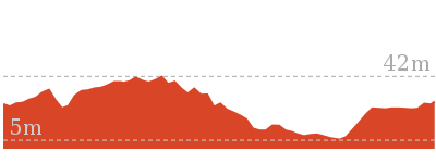
Similar walks
991 m One way
30 mins
Moderate track
1.7 km Circuit
45 mins
Moderate track
2.1 km Circuit
1 hr 15 mins
Hard track
2.2 km One way
1 Hr
Hard track
3 km One way
1 hr 30 mins
Hard track

6.1 km Circuit
2 hrs 45 mins
Hard track
8.5 km One way
3 hrs 45 mins
Hard track
11.3 km One way
4 hrs 30 mins
Hard track
Other Nearby walks
643 m Circuit
30 mins
Moderate track
1.4 km Circuit
45 mins
Hard track
1.6 km Circuit
45 mins
Moderate track

2.1 km Circuit
1 Hr
Moderate track
3.3 km Circuit
1 hr 30 mins
Hard track
900 m Return
30 mins
Hard track

1.5 km One way
45 mins
Hard track
24.8 km One way
10 hrs
Hard track
24.8 km One way
2 Days
Hard track

12.3 km One way
5 hrs 30 mins
Hard track
9.5 km One way
4 hrs
Hard track
18.1 km One way
7 hrs 30 mins
Experienced only
Plan your trip to and from the walk here
The Rainforest Walk walk starts and ends at the Henry Parry Dr trackhead (gps: -33.433759, 151.34689)Your transport options to Henry Parry Dr trackhead are by;
(get details)


Short URL = http://wild.tl/2a
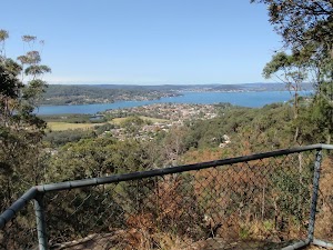
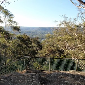
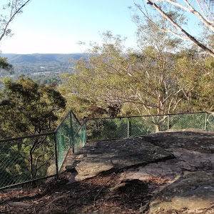
Gallery images
There are other downloads I am still working on.
You will probably need to login to access these — still all free.
* KML (google earth file)
* GPX (GPS file)
Special Maps/ brochures
* A3 topo maps
* PDF with Lands Topo map base
* PDF with arial image (and map overlay)
I wanted to get the main site live first, this extra stuff will come in time.
Happy walking
Matt 🙂
Comments