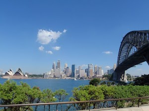
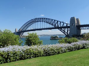
Harbour Bridge to Taronga Zoo


4 hrs

389 m
Moderate track
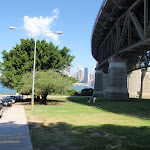


(0km) Milsons Point Station → Tunnel vent lookout

400 m
10 mins
4m
-38m
Very easy
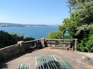
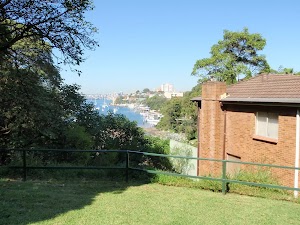
Tunnel vent lookout
(0.4km) Tunnel vent lookout → Dr Mary Booth Lookout
320 m
6 mins
14m
-8m
Moderate track
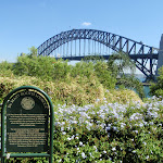
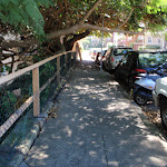
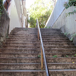
Continue straight: From Jeffreys St ferry wharf[12], this walk follows the foreshore footpath whilst keeping the harbour to your right[13]. The walk heads over a bridge then past a large strangler fig tree[14] beside a sandstone wall. This foreshore walkway also passes several seats[15], steps[16], historic items[17] and grand harbour views[18], and passes over a couple of bridges[19] before turning left and heading up a long flight of steps. At the top of these steps, the walk comes to a large grassy reserve and the signposted ‘Dr Mary Booth Lookout’[20].
Dr Mary Booth Lookout
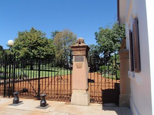
(0.72km) Dr Mary Booth Lookout → Admiralty House
330 m
7 mins
19m
-10m
Moderate track
Continue straight: From the intersection, this walk heads along Waruda St whilst keeping the water glimpses to your right. At the end of a Waruda St, the walk turns left and heads up the steps[26] then follows the path to soon turn right onto Kirribilli Ave[27]. The walk heads past a old white building[28] to find the gate to ‘Admiralty House’[29].
Admiralty House
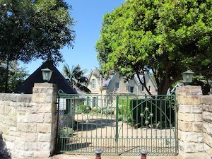
(1.05km) Admiralty House → Lady Gowrie Lookout
100 m
2 mins
0m
-9m
Easy track
Continue straight: From Kirribilli House[35], this walk heads towards the end of Kirribilli Ave[36], towards the water view. Just beyond the end of Kirribilli Ave, this walk heads down a few steps[37] to come to the good views and signposted ‘Lady Gowrie Lookout’[38]. At the end of this side trip, retrace your steps back to the main walk then Turn right.
Kirribilli House
Lady Gowrie Lookout
(1.05km) Admiralty House → Int of Carabella St and Holbrook Ave
160 m
3 mins
1m
-2m
Very easy
(1.21km) Int of Carabella St and Holbrook Ave → Ensemble Theatre
710 m
14 mins
8m
-25m
Easy track
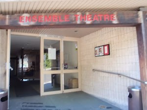
Ensemble Theatre
(1.92km) Ensemble Theatre → Milson Park
90 m
2 mins
1m
-1m
Very easy
Milson Park
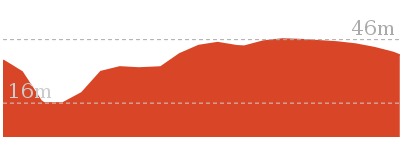
(2.02km) Milson Park → Anderson Park
660 m
14 mins
28m
-28m
Easy track
Turn right: From the intersection, this walk heads down the steps[69] then across the small timber[70] bridge into Anderson Park. Here the walk follows the footpath along the foreshore and soon finds a semi-circular seating area[71] with several plaques[72][73][74], a water view[75] and a drinking fountain[76]. The walk continues along the foreshore of the park to the far side to find a set of stairs heading up from between the toilets[77] and Neutral Bay Marina[78].
Anderson Park
(2.67km) Anderson Park → Int of Wycombe Rd and Hayes St
330 m
7 mins
20m
-10m
Easy track
(3km) Int of Wycombe Rd and Hayes St → Neutral Bay (Hayes Street) Ferry Wharf
100 m
2 mins
0m
-11m
Very easy
Neutral Bay (Hayes Street) Ferry Wharf
(3km) Int of Wycombe Rd and Hayes St → Nutcote House
300 m
5 mins
8m
-2m
Very easy
Nutcote House
(3.3km) Nutcote House → Top of Kurraba ferry steps
240 m
4 mins
10m
-4m
Easy track
(3.53km) Top of Kurraba ferry steps → Int of Kurraba and Shellcove Rds
80 m
2 mins
1m
-4m
Easy track
(3.61km) Int of Kurraba and Shellcove Rds → Spains Lookout
310 m
5 mins
6m
-9m
Easy track
Continue straight: From the intersection, this walk heads uphill following the footpath beside Kurraba Rd[101]. Soon the walk takes the left fork[102] in the road and heads down past Hodgson Lookout[103] and just beyond the intersection with Baden Rd[104], to a small park and ‘Spains Lookout’[105][106] At the end of this side trip, retrace your steps back to the main walk then Turn right.
Spains Lookout
Kurraba Point
(3.61km) Int of Kurraba and Shellcove Rds → Bogota Ave Lookout
780 m
16 mins
22m
-28m
Very easy
Bogota Ave Lookout
(4.39km) Bogota Ave Lookout → Top of Maccallum Pool path
750 m
15 mins
27m
-31m
Easy track
Continue straight: From the intersection, this walk follows the ‘Maccallum Pool’ sign[123] along the path, keeping the water views to your right. Soon the path leads to a ‘Y’ intersection[124] in front of an apartment building[125] (the path on the right leads to Maccallum Pool).
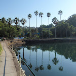
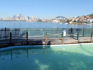
(5.14km) Top of Maccallum Pool path → Maccallum Pool
30 m
1 mins
0m
-7m
Easy track
Maccallum Pool
(5.14km) Top of Maccallum Pool path → Int of Milson Rd and foreshore walk
280 m
5 mins
7m
-7m
Very easy
(5.43km) Int of Milson Rd and foreshore walk → Sophies Lookout
150 m
3 mins
3m
-4m
Very easy
Sophies Lookout
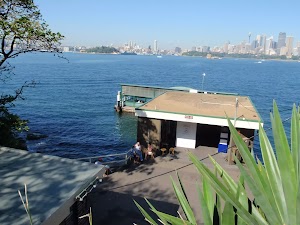
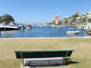
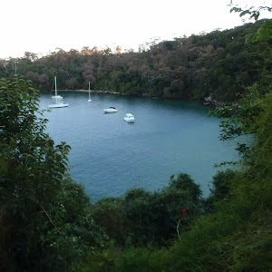
Cremorne Point Ferry Wharf
(5.57km) Sophies Lookout → Robertsons Point Lookout
200 m
3 mins
0m
-8m
Easy track
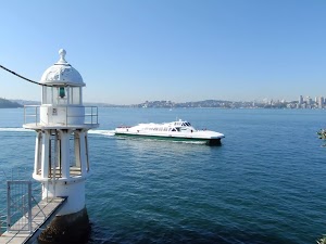
Robertsons Point Lookout
(5.57km) Sophies Lookout → Elephants Ear
370 m
7 mins
13m
-9m
Very easy
Elephants Ear
(5.95km) Elephants Ear → Old Cremorne Ferry Wharf
400 m
9 mins
13m
-22m
Easy track
Continue straight: From the intersection, this walk follows the ‘Old Cremorne Wharf’ sign[167] sign gently uphill along the path, keeping the water to your right. The path soon comes to another intersection where this walk tends right[168], following the path for about 120m (passing a few informal side tracks[169][170]) to find some large sandstone boulders[171] and the entrance to the ‘Old Cremorne’ Ferry Wharf[172][173].
(6.35km) Old Cremorne Ferry Wharf → Bottom of Hodgson Ave steps
320 m
7 mins
23m
-13m
Easy track
(6.67km) Bottom of Hodgson Ave steps → Mosman Bay Marina
430 m
9 mins
10m
-21m
Easy track
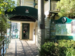
Continue straight: From 5 Bromley Ave[185], this walk heads down the steps[186][187] and follows the path to cross the timber bridge[188] over the valley. The walk bends right and follows the path for ≈250m, enjoying the water views to your right[189]. The path then passes a ‘Harnett Park’ sign[190] (and ignores the upper track on your left), then heads down some steps and turns left. The walk heads past the ‘Rowers Restaurant’[191] to a car park and the Mosman Bay Marina[192].
Rowers Restaurant
(7.1km) Mosman Bay Marina → Mosman Bay Ferry Wharf
400 m
7 mins
7m
-6m
Very easy
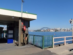
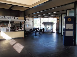
Mosman Bay Ferry Wharf and Shops
(7.5km) Mosman Bay Ferry Wharf → Int of Musgrave and McLeod Sts
270 m
6 mins
40m
-1m
Moderate track
(7.77km) Int of Musgrave and McLeod Sts → South Mosman Wharf
330 m
8 mins
0m
-32m
Easy track
(8.11km) South Mosman Wharf → Curraghbeena Point
90 m
2 mins
18m
0m
Moderate track
Curraghbeena Point Lookout
(8.19km) Curraghbeena Point → End of Curraghbeena Rd
400 m
9 mins
24m
-17m
Moderate track
(8.6km) End of Curraghbeena Rd → Int. Illawarra St and Curlew Camp Rd
250 m
8 mins
13m
-37m
Moderate track
Turn right: From the intersection, this walk heads up the hill along the narrow concrete road[239], keeping the houses to your left. Soon the road leads to an intersection with Illawarra St and some stairs (on your right)[240].
(8.85km) Int. Illawarra St and Curlew Camp Rd → Sirius Cove Reserve
100 m
2 mins
0m
-8m
Easy track
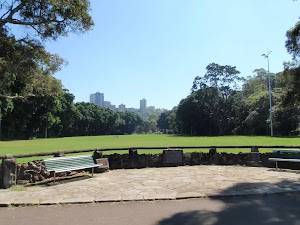
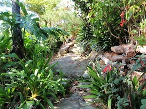
Sirius Cove Reserve
(8.94km) Sirius Cove Reserve → Int. Borogegal Walking Trail and Curlew Camp Trk
480 m
11 mins
33m
-23m
Easy track
Continue straight: From the intersection, this walk follows the sign pointing to ‘Curlew Camp’[242], following the footpath beside the tall barbed wire fence and wall. The track leads over a few sections of boardwalk, and soon comes to an intersection (with a track on the right marked with another ‘Curlew Camp’ sign[243], pointing ‘130 metres’.
(9.42km) Int. Borogegal Walking Trail and Curlew Camp Trk → Camp Curlew
120 m
2 mins
2m
-11m
Moderate track
Continue straight: From the intersection, this walk heads down towards the water and onto the wooden platform. At the end of this side trip, retrace your steps back to the main walk then Continue straight.
Camp Curlew
(9.42km) Int. Borogegal Walking Trail and Curlew Camp Trk → Taronga Zoo Wharf
340 m
9 mins
22m
-26m
Moderate track
Taronga Zoo
Maps for the Harbour Bridge to Taronga Zoo walk
You can download the PDF for this walk to print a map.These maps below cover the walk and the wider area around the walk, they are worth carrying for safety reasons.
| Parramatta River | 1:25 000 Map Series | 91303N PARRAMATTA RIVER | NSW-91303N |
| Sydney | 1:100 000 Map Series | 9130 SYDNEY | 9130 |
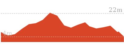
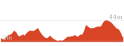
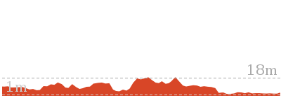
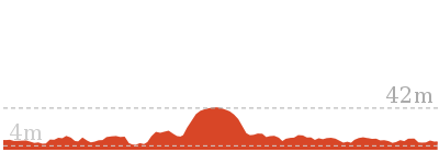
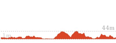
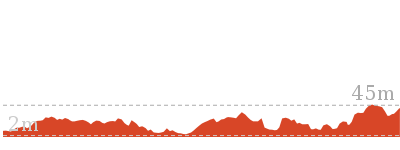
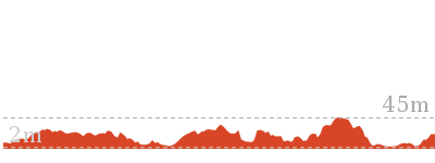
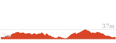
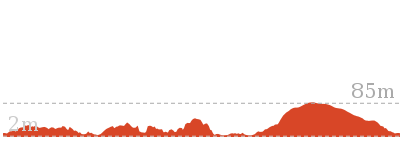
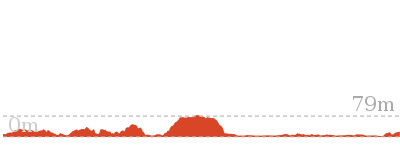
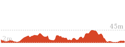
Cross sectional view of the Harbour Bridge to Taronga Zoo bushwalking track
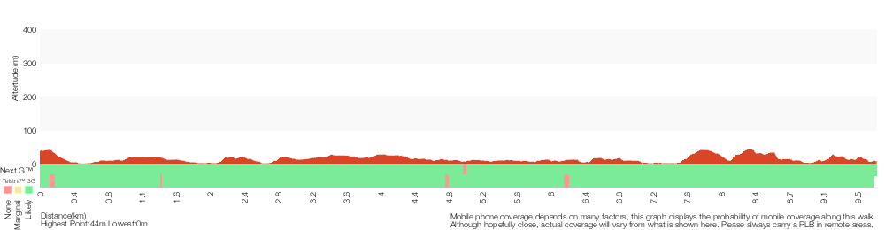
Analysis and summary of the altitude variation on the Harbour Bridge to Taronga Zoo
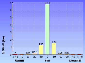
Overview of this walks grade – based on the AS 2156.1 – 2001
Under this standard, a walk is graded based on the most difficult section of the walk.
| Length | 9.8 km | ||
| Time | 4 hrs | ||
| . | |||
| Grade 3/6 Moderate track |
AS 2156.1 | Gradient | Short steep hills (3/6) |
| Quality of track | Clear and well formed track or trail (2/6) | ||
| Signs | Clearly signposted (1/6) | ||
| Experience Required | No experience required (1/6) | ||
| Weather | Weather generally has little impact on safety (1/6) | ||
| Infrastructure | Limited facilities, not all cliffs are fenced (3/6) |
Some more details of this walks Grading
Here is a bit more details explaining grading looking at sections of the walk
Gradient
4.4km of this walk has gentle hills with occasional steps and another 3.7km is flat with no steps. The remaining (1.6km) has short steep hills.
Quality of track
Around 9km of this walk follows a smooth and hardened path, whilst the remaining 940m follows a clear and well formed track or trail.
Signs
This whole walk, 10km is clearly signposted.
Experience Required
This whole walk, 10km requires no previous bushwalking experience.
weather
This whole walk, 10km is not usually affected by severe weather events (that would unexpectedly impact safety and navigation).
Infrastructure
Around 10km of this walk is close to useful facilities (such as fenced cliffs and seats), whilst the remaining 160m has limited facilities (such as not all cliffs fenced).
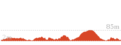
Similar walks
478 m Return
15 mins
Easy track
930 m Return
30 mins
Moderate track
1.7 km One way
1 Hr
Moderate track
2 km One way
45 mins
Easy track
2.7 km Circuit
1 hr 15 mins
Easy track

4.2 km One way
1 hr 45 mins
Moderate track
6.5 km Circuit
3 hrs 30 mins
Moderate track
Other Nearby walks
3.7 km One way
1 hr 45 mins
Moderate track
4.4 km One way
2 hrs
Moderate track
3 km Circuit
1 hr 30 mins
Moderate track
6.8 km One way
3 hrs
Hard track
7 km Circuit
3 hrs
Moderate track
18.9 km One way
8 hrs
Hard track
10.4 km One way
5 hrs
Hard track
6 km One way
2 hrs 30 mins
Moderate track


44.4 km One way
3 Days
Hard track


33 km One way
2 Days
Hard track

548 m Circuit
20 mins
Moderate track
2.8 km One way
1 hr 30 mins
Moderate track
Plan your trip to and from the walk here
The Harbour Bridge to Taronga Zoo walk starts at the Milsons Point Station (gps: -33.845818, 151.21242)Your transport options to Milsons Point Station are by;
(get details)
The Harbour Bridge to Taronga Zoo ends at the Taronga Zoo Wharf (gps: -33.84575, 151.23979)
Your transport options to Taronga Zoo Wharf are by;
(get details)


Short URL = http://wild.tl/hbttz
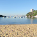
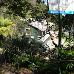
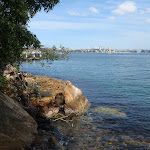
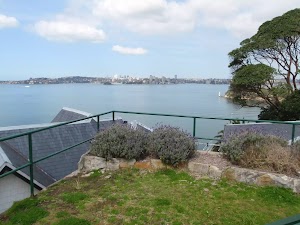
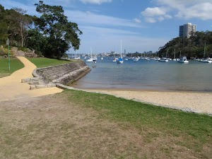
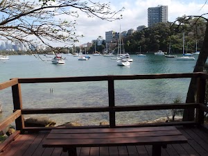
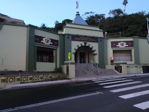
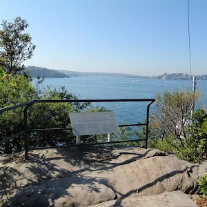
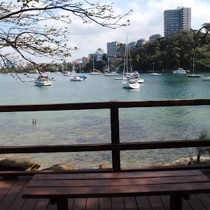
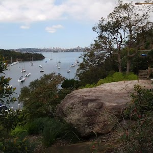
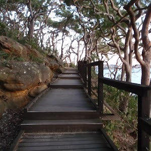
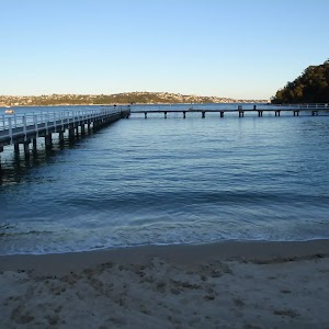
Gallery images
There are other downloads I am still working on.
You will probably need to login to access these — still all free.
* KML (google earth file)
* GPX (GPS file)
Special Maps/ brochures
* A3 topo maps
* PDF with Lands Topo map base
* PDF with arial image (and map overlay)
I wanted to get the main site live first, this extra stuff will come in time.
Happy walking
Matt 🙂
Comments