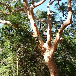
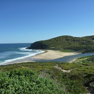
This walk is a good longer option walking experience at Blackbutt Reserve. This walk visits the two larger picnic areas of Richley Reserve and Carnley Reserve, as well as the Lily pond and Rain Forest picnic areas. A highlight to this walk is the throughly recommended side trip to the Wildlife Exhibits at Carnley Reserve. This enjoyable walk is highly recommended.
Blackbutt Circuit Walk
And Walk
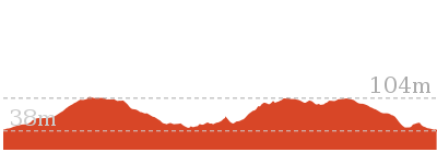
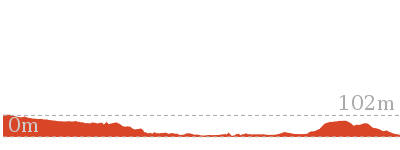
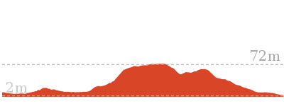
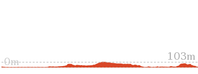
Blackbutt Circuit Walk


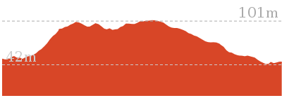
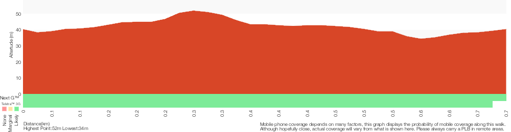
2 hrs 30 mins
6.5 km Circuit

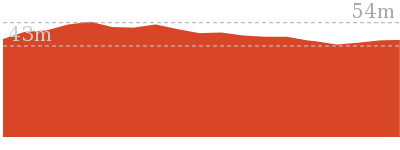
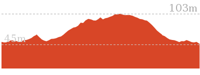
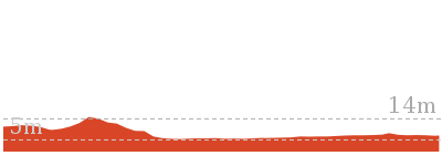
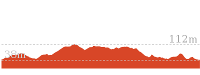
245 m
Moderate track


Blackbutt Reserve
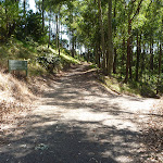
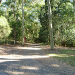
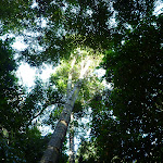
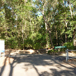
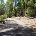
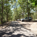
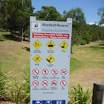
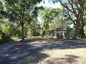
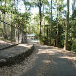
Blackbutt Reserve, near Newcastle, occupies over 182 hectares of land and provides visitors with the chance to enjoy nature trails[1], wildlife exhibits[2][3], children’s playgrounds[4] and recreational facilities. The reserve is the perfect place for a relaxing family picnic or to explore on a bushwalk. Native wildlife, such as the Powerful Owl and the Grey-headed flying fox[5] can be seen within the park. There is an information cottage[6] at Carnley Avenue, which is open 7am to 5pm, or 7am to 7pm during daylight savings. The reserve has car parking at Carnley Avenue, Richley Reserve, Lookout Road and Mahonoy Drive. For more information, phone 02 4904 3344.
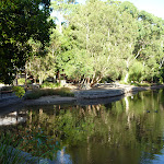
Richley Reserve
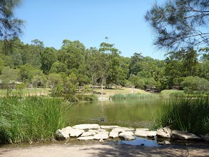
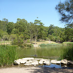
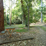
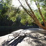
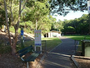
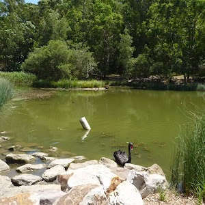
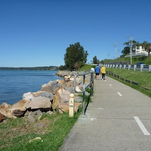
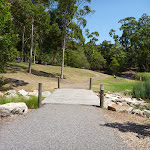
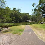
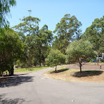
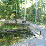
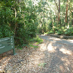
The Richley Reserve, within Blackbutt Reserve, has a park office[7], large pond areas[8] with swans (beware the swans[9] as they defend their territory), sheltered picnic tables[10], water taps[11], toilets[12], open grassed areas[13], a children’s playground[14], electric barbecues[15] and a car park[16]. The Richley Reserve car park has disability friendly parking and is open from 7am to 5pm or 7am to 7pm during daylight savings. For further information phone 02 4904 3344.
(0km) Richley Reserve (Car Park) → Richley Reserve (Ponds end)

140 m
3 mins
8m
0m
Very easy
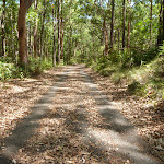
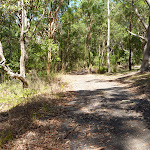
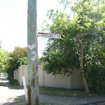
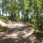
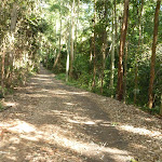
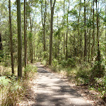
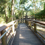
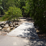
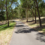
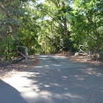
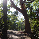
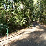
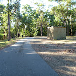
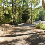
From the Richley Reserve Car Park[17] (Freybery St, New Lambton), this walk follows the ‘Tall Tree Ridge Walk’ sign[18][19] and sealed trail gently uphill, while keeping the sheltered picnic table and large pond on your left. This walk continues through forest, with a pond on your left, for about 140m until coming to a four-way intersection[20], with a timber post[21] with chain attached (on the right) and another large pond[22] (on your left and ahead).
(0.14km) Richley Reserve (Ponds end) → Int of Forest Way AND Tall Trees Walks
340 m
6 mins
14m
-1m
Moderate track
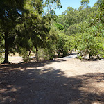
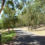
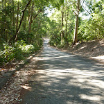
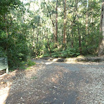
Turn right: From the intersection[23][24], this walk follows the sealed trail gently uphill, while initially keeping the timber post with chain[25] attached on your right and keeping the large pond[26] directly behind. This walk continues through attractive forest[27] (ignoring side tracks[28]) for about 300m, until coming to a level T-intersection[29][30], with a ‘Richley Carpark’ sign[31] directly ahead.
(0.48km) Int of Forest Way & Tall Trees Walks → Lily Pond Picnic Area
680 m
13 mins
9m
-28m
Moderate track
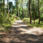
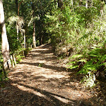
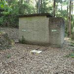
Turn right: From the intersection[32], this walk follows the sealed trail gently downhill, while initially keeping the ‘Tall Trees Walk to Carnley Ave Carpark’ sign[33] on your left. This walk continues through forest for about 180m, to find an open picnic area[34] (on the right). Then this walk continues straight ahead for about 210m until coming to a three-way intersection[35][36], with a ‘Forest Way Walk’ sign (on the left) and a toilet[37] (on the right ahead).
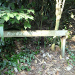
Turn left: From the intersection[38][39], this walk follows the ‘Forest Way Walk’ sign[40] and trail gently downhill, while initially keeping the toilets[41] on your right and the sign on your left. This walk continues for about 45m to find a picnic table[42] (on the right). Then this walk continues through forest[43][44] for about 260m, until coming to Lily Pond Picnic Area[45][46][47][48].
Turn left: From the intersection[38][39], this walk follows the ‘Forest Way Walk’ sign[40] and trail gently downhill, while initially keeping the toilets[41] on your right and the sign on your left. This walk continues for about 45m to find a picnic table[42] (on the right). Then this walk continues through forest[43][44] for about 260m, until coming to Lily Pond Picnic Area[45][46][47][48].
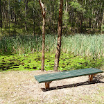
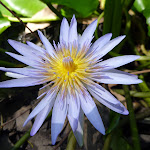
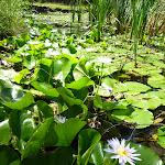
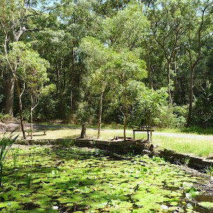
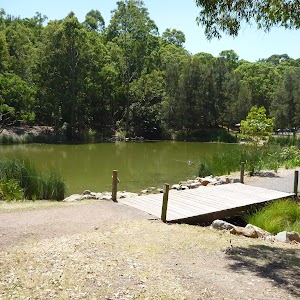
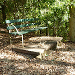
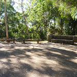
Lily Pond Picnic Area
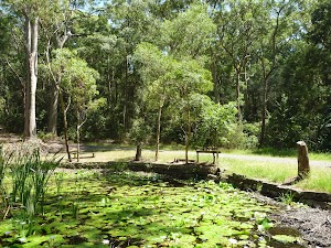
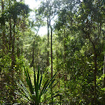
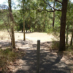
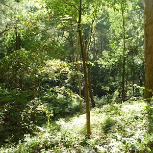
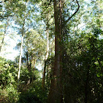
The Lily Pond picnic area in Blackbutt Reserve feels like a small, watery oasis surrounded by eucalyptus forest[49]. There is an attractive tropical water lily pond[50] with a healthy cover of Nymphaea[51], which is particularly beautiful when flowering. Also at this picnic area are bench seats[52], picnic tables[53], small grassed areas[54] and an elevated timber barbecue[55].
(1.16km) Lily Pond Picnic Area → End of Ridgeway Road (New Hampton Heights)
560 m
11 mins
33m
-8m
Moderate track
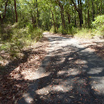
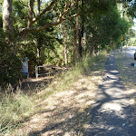
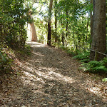
Continue straight: From the Lily Pond Picnic Area[56][57][58], this walk follows the trail gently uphill, while initially keeping the ‘Lily Pond Picnic Area’ sign on your left. This walk continues for about 170m, to find a three-way intersection[59] with a faint track (on the left) and a ‘Forest Way Walk’ sign[60] (on the right). Then this walk continues straight ahead through forest for about 30m to cross a bridge over a dry rocky creek[61][62]. This walk then continues for about 280m, with houses visible[63] on the left, until coming to a T-intersection[64][65] with a level trail and two green metal posts[66] directly ahead.
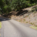
Turn sharp left: From the intersection[67], this walk follows the trail gently uphill, while initially keeping the two green metal posts[68] on your right. This walk continues through forest for about 60m, until passing around a locked metal gate[69] and coming to the end of Ridgeway Road[70][71] (amongst houses).
Turn sharp left: From the intersection[67], this walk follows the trail gently uphill, while initially keeping the two green metal posts[68] on your right. This walk continues through forest for about 60m, until passing around a locked metal gate[69] and coming to the end of Ridgeway Road[70][71] (amongst houses).
(1.72km) End of Ridgeway Road → Int of Lookout Road & Forest Way
760 m
14 mins
45m
-3m
Moderate track
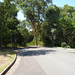
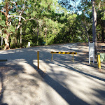
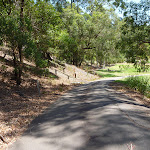
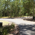
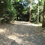
Continue straight: From the end of Ridgeway Rd[72][73] (in New Lampton Heights), this walk follows Ridgeway Rd gently uphill, while leaving the locked gate[74] and ‘Blackbutt Reserve – Ridgeway Rd Entrance’ sign directly behind. This walk continues for about 250m, beside houses[75], to find a four-way intersection[76], with Croudace Rd. Then this walk continues straight ahead for about 400m, until coming to a level section of road as Ridgeway Road[77][78] bends sharply right[79] (there is a water tower[80] in a park on the left). This walk turns left and follows the footpath (while keeping the water tank on your left) next to Lookout Rd for about 100m, until coming to a three-way intersection[81][82] with a wide track and ‘Blackbutt Reserve – Ridgeway Rd Entrance’ sign[83] on the left.
(2.48km) Int of Lookout Road AND Forest Way → Int of Tall Trees AND Forest Way Walks
250 m
6 mins
0m
-26m
Easy track
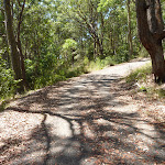
Veer left: From the intersection[84][85](Lookout Rd, New Lambton Heights), this walk follows the track gently downhill, while passing the ‘Blackbutt Reserve – Forest Way Entrance’ sign[86] (on your left) and keeping Lookout Road on your right. After about 20m, the walk passes around a locked metal gate[87]. Then this walk continues through forest for about 240m, with houses[88] visible on the right, until coming to a three-way intersection[89] with a trail and ‘Forest Way Walk’ sign[90][91] on the right.
(2.73km) Tall Trees & Forest Way Walks → Int of Main Ridge & Tall Trees Walks
640 m
13 mins
33m
-16m
Easy track
Turn sharp right: From the intersection[92], this walk follows the ‘Tall Tree Ridge Walk’ sign[93] and sealed trail gently downhill, while keeping the valley on the left. This walk continues, undulating through thick forest[94] for about 290m until coming to a three-way intersection[95], with a ‘Tall Trees Walk to Richley Carpark’ sign[96] directly ahead.
Turn left: From the intersection[97], this walk follows the ‘Tall Trees Walk to Carnley Ave Carpark’ sign[98] gently downhill, while keeping the valley on your right. This walk continues, undulating through forest for about 400m until coming to a level three-way intersection[99][100], with a ‘Tall Trees Walk to Richley Carpark’ sign[101] (on the left) and a sealed trail (on the right).
Turn left: From the intersection[97], this walk follows the ‘Tall Trees Walk to Carnley Ave Carpark’ sign[98] gently downhill, while keeping the valley on your right. This walk continues, undulating through forest for about 400m until coming to a level three-way intersection[99][100], with a ‘Tall Trees Walk to Richley Carpark’ sign[101] (on the left) and a sealed trail (on the right).
(3.37km) Int of Main Ridge & Tall Trees Walks → Int of Main Ridge & Blueberry Ash Walks
150 m
3 mins
2m
-8m
Easy track
Turn right: From the intersection[102], this walk follows the sealed trail[103] gently downhill, while walking directly away from the ‘Main Ridge Walk to Carnley Carpark’ sign[104] and keeping the valley on the left. This walk continues through dense forest for about 170m until coming to a three-way intersection[105], with a ‘To Tall Trees Walk’ sign[106] (on the right) and a gently downhill trail[107] (on the left).
(3.52km) Int of Main Ridge and Blueberry Ash Walks → Int of Rain Forest Walk and Lookout Road
420 m
9 mins
22m
-17m
Easy track
Continue straight: From the intersection[108], this walk follows the ‘Main Ridge Walk to Lookout Rd Car Park’ sign[109] and sealed road gently downhill, while keeping the valley on your left. This walk continues, undulating for about 400m through attractive forest[110][111] until coming to a three-way intersection[112] with a road and brick buildings[113] (on the left) and yellow metal posts and a ‘Main Ridge Walk (Loop)’ sign[114][115] (on the right).
(3.94km) Int of Lookout Road & Main Ridge Trail → Int of Lookout Trail AND Rain Forest Walk
330 m
7 mins
13m
-17m
Easy track
Turn right: From the intersection[116], this walk passes through the yellow metal posts and crosses the car park gently uphill[117], while initially passing the ‘Main Ridge Walk (loop) sign[118] on the right. This walk continues for about 25m, until coming to a three-way intersection[119][120] with a trail and ‘Sensory Trail (return)’ sign[121] on the left.
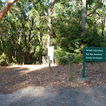
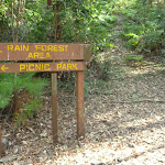
Turn left: From the intersection[122], this walk follows the ‘Sensory Trail (return)’ sign[123] and trail gently downhill. This walk continues through forest for about 140m, to pass a ‘Rain Forest Area/Picnic Park’ sign[124] (on the right). Then this walk continues for about 170m, passing the ‘Senses Track 150m’ sign[125][126] (on the left), until crossing a bridge[127] with a timber fence and coming to a three-way intersection, with a ‘Lookout Rd 420m’ sign[128] ahead.
Turn left: From the intersection[122], this walk follows the ‘Sensory Trail (return)’ sign[123] and trail gently downhill. This walk continues through forest for about 140m, to pass a ‘Rain Forest Area/Picnic Park’ sign[124] (on the right). Then this walk continues for about 170m, passing the ‘Senses Track 150m’ sign[125][126] (on the left), until crossing a bridge[127] with a timber fence and coming to a three-way intersection, with a ‘Lookout Rd 420m’ sign[128] ahead.
(4.27km) Int of Lookout Trail & Rain Forest Walk → Int of Rain Forest Walk & Lookout Trail
120 m
3 mins
5m
-8m
Moderate track
Turn left: From the intersection[129], this walk follows the trail[130] gently uphill, while initially leaving the bridge[131] on the left and passing the ‘Lookout Rd 420m’ sign[132] on the right. This walk continues through rainforest for about 130m, passing a ‘Rainforest Restoration Project’ sign[133][134] (on the right), until coming to a three-way intersection[135], with a gently uphill trail on the right and a gently downhill trail on the left.
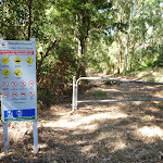
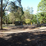
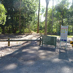
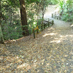
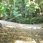
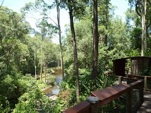
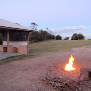
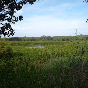
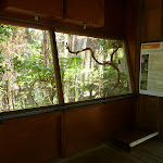
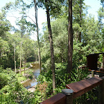
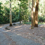
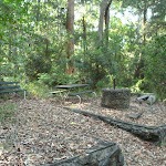
Rod Earp Rainforest Picnic Area
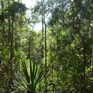
This secluded, dense rainforest within Blackbutt Reserve has bench seats[136] and a picnic table[137]. The forest in this area hosts a large population of grey-headed flying foxes. These large bats[139] migrate for food and then return to roost during the day. Watch out for the bat guano the ground. This picnic area feels a world away from downtown Newcastle.
(4.39km) Int of Rain Forest Walk & Link Track → Main Ridge & Rain Forest Walks
530 m
13 mins
14m
-44m
Easy track
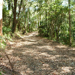
Continue straight: From the intersection[140], this walk follows the gravel trail[141] gently downhill, while initially keeping the gently downhill trail[142] behind you on your left and keeping the valley on your left. This walk continues (passing a ‘Rainforest Picnic Area’ sign[143] on your right) through dense rainforest for about 400m, until coming to a three-way intersection[144][145], with a sealed road and ‘Rainforest Walk’ sign[146][147] (on the right). Then this walk turns left onto the gently downhill sealed road[148] and after about 30m, crosses a bridge[149] at the Rainforest picnic area[150]. This walk then follows the road gently uphill, passing a closed toilet block[151] (on the right) for about 110m, until coming to a three-way intersection[152] with a sealed road (on the left) and a ‘Wildlife Exhibit’ sign[153] (on the right).
(4.92km) Main Ridge & Rain Forest Walks → Int of Main Ridge Trail & Lookout Road
250 m
5 mins
4m
-15m
Easy track
Turn right: From the intersection[154], this walk follows the ‘Wildlife Exhibit’ sign[155] and sealed road gently downhill, while keeping the valley on the right. This walk continues, undulating for about 260m until coming to a three-way intersection[156], with a ‘Lookout Road Carpark’ sign[157] and gently uphill sealed road on the left.
(5.17km) Int of Main Ridge Trail & Lookout Road → Int of Boardwalk & Main Ridge Trail
130 m
3 mins
2m
-9m
Moderate track
Continue straight: From the intersection[158], this walk follows the ‘Wildlife Exhibitions 120m’ sign[159] and sealed road[160] gently downhill, while keeping the ‘Lookout Road Carpark’ sign[161] directly behind you. This walk continues through forest[162] for about 140m, until coming to a four-way intersection[163] with the Wildlife Exhibits boardwalk[164] (on the left), a car park[165] ahead and a disabled car park (on the right).
(5.3km) Int of Boardwalk & Main Ridge Trail → Int of Boardwalk & Carnley Trail
380 m
8 mins
12m
-13m
Very easy
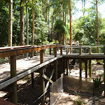
Turn left: From the intersection[166][167][168], this walk follows the ‘Animals’ sign[169] and timber boardwalk gently uphill, while initially keeping the car park[170] on the right. This walk continues, undulating for about 300m on an elevated boardwalk[171] through large and small animal enclosures[172][173], with a fascinating selection of native animals[174][175] and birds[176][177][178]. Then this walk continues on a sealed footpath for about 70m, until passing through a high timber fenced gate and coming to a three-way intersection, with a sealed trail[179] (on the left towards the pond[180]) and a trail[181] directly ahead. Now Turn left to rejoin the main walk .
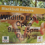
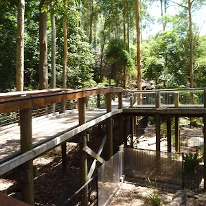
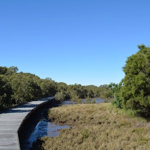
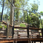
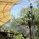
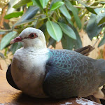
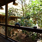
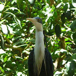
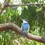
Blackbutt Wildlife Exhibits
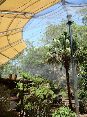
This boardwalk in the Blackbutt Reserve offers wildlife exhibits[182] on an elevated timber boardwalk which is wheelchair accessible. Some of the wildlife that you are likely to encounter are kangaroos, koalas[183], wombats[184], Lace monitors[185], Wonga Pigeons, Red-winged Parrots, Black-winged Stilt[186], Buff-banded Rail, Herons[187], Eastern long-necked Turtle, Kingfishers[188], Turquoise Parrot, Banded Plover, Peaceful Dove[189], Cockatoos, Lorikeets, True Parrots, Major Mitchell Cockatoo, Bush Stone Curlew, Long-tailed Finch and Barking Owls[190]. Entry is free and the exhibit is open from 9.00am to 5.00pm every day (closed Christmas Day, Good Friday and until 1pm ANZAC Day). Personal koala encounters[191] are available at 2pm daily and cost $3.50/person. For further information, phone: 02 4904 3344. More info.
(5.3km) Int of Boardwalk & Main Ridge Trail → Int of Boardwalk & Carnley Trail
100 m
2 mins
2m
-2m
Very easy
Veer left: From the intersection[192], this walk follows the sealed trail gently downhill, while initially keeping the ‘Animals’ sign[193] and elevated timber boardwalk[194] on the left. This walk continues for about 90m, passing an ‘Animals’ sign[195] and ‘Information’ sign (on the left) and concrete stairs (on the right), until coming to a three-way intersection[196][197], with a large timber fenced gate[198] (on the left).
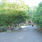
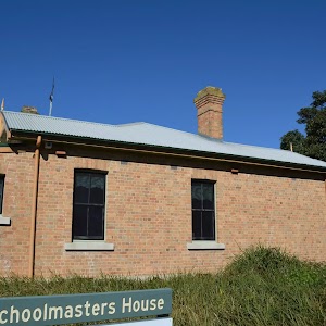
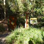
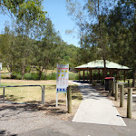
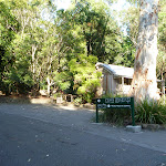
Carnley Ave Reserve
The Carnley Avenue Reserve, within Blackbutt Reserve, is wheelchair accessible and has toilets[199], drinking fountains[200], gas/electric barbeques[201], sheltered picnic tables[202], a children’s playground[203], fenced displays of kangaroos and emu[204], a large black duck pond[205] and an information centre[206] that is housed within a replica pioneering cottage. The information cottage has a range of souvenirs, focusing on quality and affordable products. A fee of $4 per vehicle can be paid from the automatic machines[207] in the car park. The information centre is open 7am to 5pm, or 7am to 7pm during daylight savings. For further information phone: 02 4904 3344.
(5.4km) Int of Boardwalk & Carnley Trail → Int of Blueberry Ash Walk & Carnley Trail
150 m
2 mins
9m
-3m
Easy track
Turn right: From the intersection[208], this walk follows the sealed trail[209] gently downhill and towards the Black Duck Pond[210], while initially keeping the large timber fenced gate[211] on your left. This walk continues for about 20m until coming to a four-way intersection[212], with the replica pioneering cottage[213][214], Black Duck Pond and a ‘Richley Reserve’ sign[215] (on the left).
Continue straight: From the intersection[216][217], this walk follows the sealed road, while initially keeping the Black Duck Pond[218] on your left and the replica pioneering cottage[219][220] directly behind you. This walk continues, passing the Black Duck Pond (on the left) and continues gently uphill[221] for about 150m (passing a sheltered picnic area[222] and children’s playground on the right) until coming to a three-way intersection[223] with a gravel trail (on the left), a metal ring fence (on the right) and a ‘Main Ridge Walk (loop)’ sign[224].
Continue straight: From the intersection[216][217], this walk follows the sealed road, while initially keeping the Black Duck Pond[218] on your left and the replica pioneering cottage[219][220] directly behind you. This walk continues, passing the Black Duck Pond (on the left) and continues gently uphill[221] for about 150m (passing a sheltered picnic area[222] and children’s playground on the right) until coming to a three-way intersection[223] with a gravel trail (on the left), a metal ring fence (on the right) and a ‘Main Ridge Walk (loop)’ sign[224].
(5.55km) Int of Carnley Trail & Blueberry Ash Walk → Int of Carnley & Tall Trees Trails
310 m
6 mins
18m
0m
Moderate track
Veer right: From the intersection[225], this walk follows the ‘Main Ridge Walk (loop)’ sign[226] on your left and trail gently downhill. This walk continues through forest with a metal ring fence (on the left) for about 170m, until coming to a three-way intersection[227][228] with a gently downhill trail[229] (on the right) and the end of the metal ring fence.
Continue straight: From the intersection[230][231], this walk follows the gently downhill trail and moves directly away from the metal ring fence, while initially keeping the trail and fence[232] on your right. This walk continues, undulating for about 170m until coming to a three-way intersection[233][234], with a ‘Richley Car Park’ sign[235].
Continue straight: From the intersection[230][231], this walk follows the gently downhill trail and moves directly away from the metal ring fence, while initially keeping the trail and fence[232] on your right. This walk continues, undulating for about 170m until coming to a three-way intersection[233][234], with a ‘Richley Car Park’ sign[235].
(5.85km) Int of Main Ridge & Tall Trees Walks → Richley Reserve (Short Cut Intersection)
190 m
4 mins
0m
-25m
Moderate track
Continue straight: From the intersection[236], this walk passes around a metal post[237] and follows the ‘Richley Carpark 400m’ sign[238] and sealed footpath gently downhill, while leaving the bench seat[239] directly behind. This walk continues through forest for about 140m, to pass around a metal post[240] and find a large grassy picnic area[241][242]. Then this walk continues straight ahead over grass and through some trees for about 70m, until coming to a sealed trail[243][244][245] (with the valley beyond).
(6.04km) Richley Reserve (Short Cut Intersection) → Richley Reserve (Car Park)
290 m
6 mins
6m
-9m
Very easy
Turn right: From the trail[246][247] below the large elevated grassed picnic area[248], this walk follows the trail gently downhill, while keeping the valley on your left. This walk continues through grassed parkland[249] for about 120m, until coming to a three-way intersection[250] with a sealed trail and a ‘Tall Tree Walk (loop)’ sign[251] (on the right).
Turn left: From the intersection[252][253], this walk follows the sealed trail gently downhill, keeping the ‘Tall Tree Walk (loop)’ sign[254] directly behind you while walking towards the road and car park. This walk continues for about 45m, passing through a metal gate[255] to find a three-way intersection, with a road[256] on the right and the car park[257] on the left. Then this walk turns left and follows the car park gently uphill for about 150m, until coming to a ‘Tall Tree Ridge Walk’ sign[258] and sheltered picnic tables[259][260] ahead. Now Continue straight to rejoin the main walk .
Turn left: From the intersection[252][253], this walk follows the sealed trail gently downhill, keeping the ‘Tall Tree Walk (loop)’ sign[254] directly behind you while walking towards the road and car park. This walk continues for about 45m, passing through a metal gate[255] to find a three-way intersection, with a road[256] on the right and the car park[257] on the left. Then this walk turns left and follows the car park gently uphill for about 150m, until coming to a ‘Tall Tree Ridge Walk’ sign[258] and sheltered picnic tables[259][260] ahead. Now Continue straight to rejoin the main walk .
(6.04km) Richley Reserve (Short Cut Intersection) → Richley Reserve (Four Way Intersection)
260 m
5 mins
10m
-8m
Very easy
Turn left: From the trail[261][262] below the large elevated grassed picnic area, this walk follows the gently downhill trail west, while keeping the valley on your right. This walk continues for about 120m to find a sheltered picnic area[263] (on the right). Then this walk continues straight ahead and gently uphill for about 160m, becoming gently downhill and passing timber steps[264] (on the left) and a toilet block (on the right), until coming to a four-way intersection[265], with a playground[266] on the right and a timber footbridge[267] directly ahead.
(6.3km) Richley Reseve (four way intersection) → Richley Reserve (car park)
180 m
3 mins
2m
-7m
Very easy
Turn right: From the intersection[268], this walk follows the footpath[269] gently downhill, while initially keeping the timber footbridge[270] on your left. This walk continues for about 180m, beside a pond[271] (on your left), until coming to a car park[272] with a sheltered picnic table[273] and ‘Tall Tree Ridge Walk’ sign[274] (on the left).
Maps for the Blackbutt Circuit Walk walk
You can download the PDF for this walk to print a map.
These maps below cover the walk and the wider area around the walk, they are worth carrying for safety reasons.
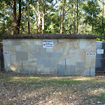
| Wallsend | 1:25 000 Map Series | 92323S WALLSEND | NSW-92323S |
| Newcastle | 1:100 000 Map Series | 9232 NEWCASTLE | 9232 |
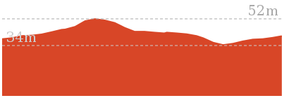
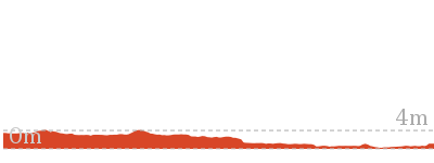
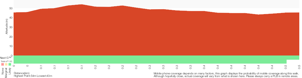
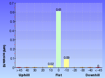
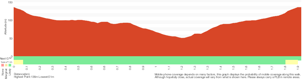
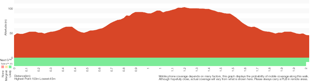
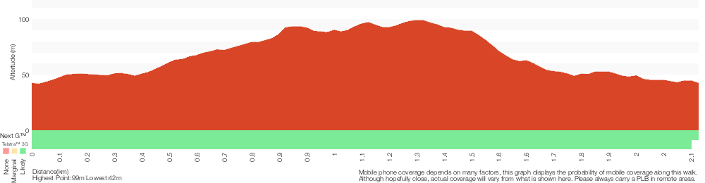
Cross sectional view of the Blackbutt Circuit Walk bushwalking track

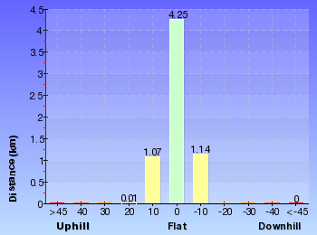
Analysis and summary of the altitude variation on the Blackbutt Circuit Walk
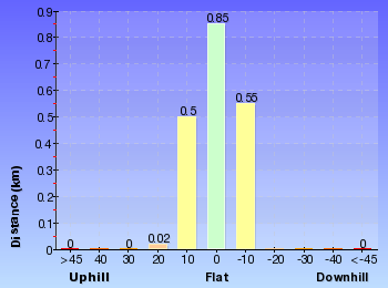
Overview of this walks grade – based on the AS 2156.1 – 2001
Under this standard, a walk is graded based on the most difficult section of the walk.
| Length | 6.5 km | ||
| Time | 2 hrs 30 mins | ||
| . | |||
| Grade 3/6 Moderate track |
AS 2156.1 | Gradient | Gentle hills with occasional steps (2/6) |
| Quality of track | Clear and well formed track or trail (2/6) | ||
| Signs | Directional signs along the way (3/6) | ||
| Experience Required | No experience required (1/6) | ||
| Weather | Weather generally has little impact on safety (1/6) | ||
| Infrastructure | Generally useful facilities (such as fenced cliffs and seats) (1/6) |
Some more details of this walks Grading
Here is a bit more details explaining grading looking at sections of the walk
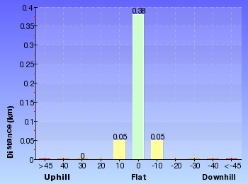
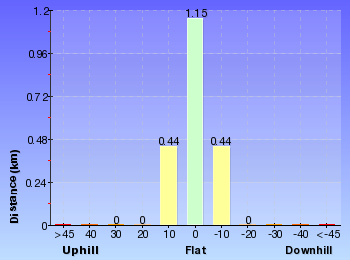
Gradient
Around 4.1km of this walk is flat with no steps, whilst the remaining 2.4km has gentle hills with occasional steps.
Quality of track
Around 4.6km of this walk follows a smooth and hardened path, whilst the remaining 1.9km follows a clear and well formed track or trail.
Signs
Around 3.8km of this walk is clearly signposted, whilst the remaining 2.7km has directional signs at most intersection.
Experience Required
This whole walk, 6km requires no previous bushwalking experience.
weather
This whole walk, 6km is not usually affected by severe weather events (that would unexpectedly impact safety and navigation).
Infrastructure
This whole walk, 6km is close to useful facilities (such as fenced cliffs and seats).
Similar walks
A list of walks that share part of the track with the Blackbutt Circuit Walk walk.
480 m Circuit
15 mins
Very easy
731 m Circuit
30 mins
Very easy

1.9 km Circuit
1 Hr
Moderate track
2 km Circuit
1 Hr
Moderate track
2.1 km Circuit
1 Hr
Moderate track
2.5 km Circuit
1 Hr
Moderate track
2.7 km Circuit
1 Hr
Moderate track

2.8 km Circuit
1 hr 15 mins
Moderate track

2.9 km Circuit
1 hr 15 mins
Moderate track

6 km Circuit
2 hrs 30 mins
Moderate track
Other Nearby walks
A list of walks that start near the Blackbutt Circuit Walk walk.
7.9 km One way
2 hrs 45 mins
Hard track
12.1 km One way
5 hrs 30 mins
Hard track

1.3 km Return
40 mins
Easy track
4.4 km One way
1 hr 30 mins
Moderate track
1.9 km One way
45 mins
Hard track
948 m Return
30 mins
Hard track
13.3 km One way
4 hrs 30 mins
Moderate track
25.7 km One way
2 Days
Hard track
1.2 km Circuit
30 mins
Hard track
2.4 km Return
1 Hr
Very easy
1.2 km Return
30 mins
Very easy
945 m One way
30 mins
Easy track
Plan your trip to and from the walk here
The Blackbutt Circuit Walk walk starts and ends at the Richley Reserve (Car Park) (gps: -32.932399, 151.70001)
Your transport options to Richley Reserve (Car Park) are by;
![]() Bus. (get details)
Bus. (get details)
![]() Car. There is free parking available.
Car. There is free parking available.
(get details)


Short URL = http://wild.tl/2n
Gallery images
There are other downloads I am still working on.
You will probably need to login to access these — still all free.
* KML (google earth file)
* GPX (GPS file)
Special Maps/ brochures
* A3 topo maps
* PDF with Lands Topo map base
* PDF with arial image (and map overlay)
I wanted to get the main site live first, this extra stuff will come in time.
Happy walking
Matt 🙂
Blackbutt Wildlife Exhibit
And Walk
Blackbutt Wildlife Exhibit

15 mins
480 m Circuit
14 m
Very easy
A must do at Blackbutt Reserve. This wheelchair accessible elevated boardwalk gets you in amongst the trees, as you amble through enclosure after enclosure of native flora and fauna. There are even close encounters with Koalas!. This free walk is open 9am to 5pm every day (closed Christmas Day, Good Friday and until 1pm ANZAC Day). Great for all ages, this easy walk is thoroughly recommended.


Blackbutt Reserve
Blackbutt Reserve, near Newcastle, occupies over 182 hectares of land and provides visitors with the chance to enjoy nature trails[1], wildlife exhibits[2][3], children’s playgrounds[4] and recreational facilities. The reserve is the perfect place for a relaxing family picnic or to explore on a bushwalk. Native wildlife, such as the Powerful Owl and the Grey-headed flying fox[5] can be seen within the park. There is an information cottage[6] at Carnley Avenue, which is open 7am to 5pm, or 7am to 7pm during daylight savings. The reserve has car parking at Carnley Avenue, Richley Reserve, Lookout Road and Mahonoy Drive. For more information, phone 02 4904 3344.
Carnley Ave Reserve
The Carnley Avenue Reserve, within Blackbutt Reserve, is wheelchair accessible and has toilets[7], drinking fountains[8], gas/electric barbeques[9], sheltered picnic tables[10], a children’s playground[11], fenced displays of kangaroos and emu[12], a large black duck pond[13] and an information centre[14] that is housed within a replica pioneering cottage. The information cottage has a range of souvenirs, focusing on quality and affordable products. A fee of $4 per vehicle can be paid from the automatic machines[15] in the car park. The information centre is open 7am to 5pm, or 7am to 7pm during daylight savings. For further information phone: 02 4904 3344.
Blackbutt Wildlife Exhibits
This boardwalk in the Blackbutt Reserve offers wildlife exhibits[16] on an elevated timber boardwalk which is wheelchair accessible. Some of the wildlife that you are likely to encounter are kangaroos, koalas[17], wombats[18], Lace monitors[19], Wonga Pigeons, Red-winged Parrots, Black-winged Stilt[20], Buff-banded Rail, Herons[21], Eastern long-necked Turtle, Kingfishers[22], Turquoise Parrot, Banded Plover, Peaceful Dove[23], Cockatoos, Lorikeets, True Parrots, Major Mitchell Cockatoo, Bush Stone Curlew, Long-tailed Finch and Barking Owls[24]. Entry is free and the exhibit is open from 9.00am to 5.00pm every day (closed Christmas Day, Good Friday and until 1pm ANZAC Day). Personal koala encounters[25] are available at 2pm daily and cost $3.50/person. For further information, phone: 02 4904 3344. More info.
(0km) Int of Boardwalk & Main Ridge Trail → Int of Boardwalk & Carnley Trail
380 m
8 mins
12m
-13m
Very easy
From the intersection[26][27][28], this walk follows the ‘Animals’ sign[29] and timber boardwalk gently uphill, while initially keeping the car park[30] on the right. This walk continues, undulating for about 300m on an elevated boardwalk[31] through large and small animal enclosures[32][33], with a fascinating selection of native animals[34][35] and birds[36][37][38]. Then this walk continues on a sealed footpath for about 70m, until passing through a high timber fenced gate and coming to a three-way intersection, with a sealed trail[39] (on the left towards the pond[40]) and a trail[41] directly ahead.
(0.38km) Int of Boardwalk & Carnley Trail → Int of Boardwalk & Main Ridge Trail
100 m
2 mins
2m
-2m
Very easy
Continue straight: From the intersection[42][43], this walk follows the sealed trail gently uphill, while initially passing the large timber fenced gate[44] on the right and keeping the valley on the left. This walk continues for about 90m, passing an ‘Animals’ sign[45] and ‘Information’ sign (on the right) and concrete stairs (on the left), until coming to a four-way intersection[46], with an ‘Animals’ sign and elevated boardwalk[47] (on the right) and disabled parking[48] and general car parking (on the left).
Maps for the Blackbutt Wildlife Exhibit walk
You can download the PDF for this walk to print a map.
These maps below cover the walk and the wider area around the walk, they are worth carrying for safety reasons.
| Wallsend | 1:25 000 Map Series | 92323S WALLSEND | NSW-92323S |
| Newcastle | 1:100 000 Map Series | 9232 NEWCASTLE | 9232 |
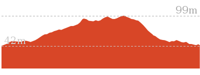
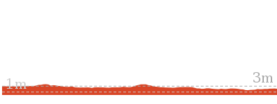
Cross sectional view of the Blackbutt Wildlife Exhibit bushwalking track
Analysis and summary of the altitude variation on the Blackbutt Wildlife Exhibit
Overview of this walks grade – based on the AS 2156.1 – 2001
Under this standard, a walk is graded based on the most difficult section of the walk.
| Length | 480 m | ||
| Time | 15 mins | ||
| . | |||
| Grade 1/6 Very easy |
AS 2156.1 | Gradient | Flat, no steps (1/6) |
| Quality of track | Smooth and hardened path (1/6) | ||
| Signs | Clearly signposted (1/6) | ||
| Experience Required | No experience required (1/6) | ||
| Weather | Weather generally has little impact on safety (1/6) | ||
| Infrastructure | Generally useful facilities (such as fenced cliffs and seats) (1/6) |
Some more details of this walks Grading
Here is a bit more details explaining grading looking at sections of the walk
Gradient
This whole walk, 480m is flat with no steps.
Quality of track
This whole walk, 480m follows a smooth and hardened path.
Signs
This whole walk, 480m is clearly signposted.
Experience Required
This whole walk, 480m requires no previous bushwalking experience.
weather
This whole walk, 480m is not usually affected by severe weather events (that would unexpectedly impact safety and navigation).
Infrastructure
This whole walk, 480m is close to useful facilities (such as fenced cliffs and seats).
Similar walks
A list of walks that share part of the track with the Blackbutt Wildlife Exhibit walk.
2.1 km Circuit
1 Hr
Moderate track
2.5 km Circuit
1 Hr
Moderate track
2.9 km Circuit
1 hr 15 mins
Moderate track
6 km Circuit
2 hrs 30 mins
Moderate track
6.5 km Circuit
2 hrs 30 mins
Moderate track
Other Nearby walks
A list of walks that start near the Blackbutt Wildlife Exhibit walk.
2 km Circuit
1 Hr
Moderate track
731 m Circuit
30 mins
Very easy
2.8 km Circuit
1 hr 15 mins
Moderate track
1.9 km Circuit
1 Hr
Moderate track
2.7 km Circuit
1 Hr
Moderate track
7.9 km One way
2 hrs 45 mins
Hard track
12.1 km One way
5 hrs 30 mins
Hard track
1.3 km Return
40 mins
Easy track
4.4 km One way
1 hr 30 mins
Moderate track
13.3 km One way
4 hrs 30 mins
Moderate track
25.7 km One way
2 Days
Hard track
1.9 km One way
45 mins
Hard track
Plan your trip to and from the walk here
The Blackbutt Wildlife Exhibit walk starts and ends at the Int of Boardwalk & Main Ridge Trail (gps: -32.937903, 151.69805)
Your transport options to Int of Boardwalk & Main Ridge Trail are by;
![]() Bus. (get details)
Bus. (get details)
![]() Car. There is free parking available.
Car. There is free parking available.
(get details)
Short URL = http://wild.tl/bwe
Gallery images
There are other downloads I am still working on.
You will probably need to login to access these — still all free.
* KML (google earth file)
* GPX (GPS file)
Special Maps/ brochures
* A3 topo maps
* PDF with Lands Topo map base
* PDF with arial image (and map overlay)
I wanted to get the main site live first, this extra stuff will come in time.
Happy walking
Matt 🙂
Richley Reserve Circuit
And Walk
Richley Reserve Circuit

30 mins
731 m Circuit
21 m
Very easy
This easy walk, which is wheelchair accessible, travels through open grasslands that are surrounded by healthy eucalyptus forest. The grasslands have two large ponds, with two black swans on the lower pond. Do beware of the swans defending their territory. Richley Reserve is well maintained and makes this walk particularly attractive. This walk is recommended.


Blackbutt Reserve
Blackbutt Reserve, near Newcastle, occupies over 182 hectares of land and provides visitors with the chance to enjoy nature trails[1], wildlife exhibits[2][3], children’s playgrounds[4] and recreational facilities. The reserve is the perfect place for a relaxing family picnic or to explore on a bushwalk. Native wildlife, such as the Powerful Owl and the Grey-headed flying fox[5] can be seen within the park. There is an information cottage[6] at Carnley Avenue, which is open 7am to 5pm, or 7am to 7pm during daylight savings. The reserve has car parking at Carnley Avenue, Richley Reserve, Lookout Road and Mahonoy Drive. For more information, phone 02 4904 3344.
Richley Reserve
The Richley Reserve, within Blackbutt Reserve, has a park office[7], large pond areas[8] with swans (beware the swans[9] as they defend their territory), sheltered picnic tables[10], water taps[11], toilets[12], open grassed areas[13], a children’s playground[14], electric barbecues[15] and a car park[16]. The Richley Reserve car park has disability friendly parking and is open from 7am to 5pm or 7am to 7pm during daylight savings. For further information phone 02 4904 3344.
(0km) Richley Reserve (car park) → Richley Reseve (four way intersection)
180 m
3 mins
7m
-2m
Very easy
From the Richley Reserve car park[17] (next to the ‘Tall Tree Ridge Walk’ sign[18]), this walk follows the footpath[19], while keeping the sign[20] and pond[21] on your right. This walk continues with the pond on your right for about 180m, until the footpath becomes gently uphill and comes to a four-way intersection[22], with a timber footbridge[23] on the right and a children’s playground[24] on the left.
(0.18km) Richley Reserve (Four Way Intersection) → Richley Reserve (Short Cut Intersection)
260 m
5 mins
8m
-10m
Very easy
Turn left: From the intersection[25][26], this walk follows the trail gently uphill, while initially keeping the children’s playground[27] on your left and the timber footbridge[28] directly behind you. This walk continues for about 160m, passing a toilet block (on your left) and timber steps[29][30] (on your right), to find a gently downhill section of trail (with a sheltered picnic area[31] on the left). Then this walk continues straight ahead and gently uphill for about 120m, until coming to a section of trail[32][33][34] that allows easy access to the large elevated grassed picnic area[35] to the right.
(0.44km) Richley Reserve (Short Cut Intersection) → Int of Richley Reserve & Tall Tree Walk (loop)
90 m
2 mins
0m
-4m
Very easy
Continue straight: From the trail[36][37] below the large elevated grassed picnic area[38], this walk follows the trail gently downhill, while keeping the valley on your left. This walk continues through grassed parkland[39] for about 120m, until coming to a three-way intersection[40] with a sealed trail and a ‘Tall Tree Walk (loop)’ sign[41] (on the right).
(0.53km) Int of Richley Reserve & Tall Tree Walk (loop) → Richley Reserve (Car Park)
200 m
4 mins
6m
-5m
Very easy
Turn left: From the intersection[42][43], this walk follows the sealed trail gently downhill, keeping the ‘Tall Tree Walk (loop)’ sign[44] directly behind you while walking towards the road and car park. This walk continues for about 45m, passing through a metal gate[45] to find a three-way intersection, with a road[46] on the right and the car park[47] on the left. Then this walk turns left and follows the car park gently uphill for about 150m, until coming to a ‘Tall Tree Ridge Walk’ sign[48] and sheltered picnic tables[49][50] ahead.
Maps for the Richley Reserve Circuit walk
You can download the PDF for this walk to print a map.
These maps below cover the walk and the wider area around the walk, they are worth carrying for safety reasons.
| Wallsend | 1:25 000 Map Series | 92323S WALLSEND | NSW-92323S |
| Newcastle | 1:100 000 Map Series | 9232 NEWCASTLE | 9232 |
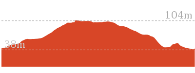
Cross sectional view of the Richley Reserve Circuit bushwalking track
Analysis and summary of the altitude variation on the Richley Reserve Circuit
Overview of this walks grade – based on the AS 2156.1 – 2001
Under this standard, a walk is graded based on the most difficult section of the walk.
| Length | 731 m | ||
| Time | 30 mins | ||
| . | |||
| Grade 1/6 Very easy |
AS 2156.1 | Gradient | Flat, no steps (1/6) |
| Quality of track | Smooth and hardened path (1/6) | ||
| Signs | Clearly signposted (1/6) | ||
| Experience Required | No experience required (1/6) | ||
| Weather | Weather generally has little impact on safety (1/6) | ||
| Infrastructure | Generally useful facilities (such as fenced cliffs and seats) (1/6) |
Some more details of this walks Grading
Here is a bit more details explaining grading looking at sections of the walk
Gradient
This whole walk, 730m is flat with no steps.
Quality of track
This whole walk, 730m follows a smooth and hardened path.
Signs
This whole walk, 730m is clearly signposted.
Experience Required
This whole walk, 730m requires no previous bushwalking experience.
weather
This whole walk, 730m is not usually affected by severe weather events (that would unexpectedly impact safety and navigation).
Infrastructure
This whole walk, 730m is close to useful facilities (such as fenced cliffs and seats).
Similar walks
A list of walks that share part of the track with the Richley Reserve Circuit walk.
2.8 km Circuit
1 hr 15 mins
Moderate track
2.9 km Circuit
1 hr 15 mins
Moderate track
6 km Circuit
2 hrs 30 mins
Moderate track
6.5 km Circuit
2 hrs 30 mins
Moderate track
Other Nearby walks
A list of walks that start near the Richley Reserve Circuit walk.
2.7 km Circuit
1 Hr
Moderate track
2.1 km Circuit
1 Hr
Moderate track
1.9 km Circuit
1 Hr
Moderate track
2.5 km Circuit
1 Hr
Moderate track
2 km Circuit
1 Hr
Moderate track
480 m Circuit
15 mins
Very easy
7.9 km One way
2 hrs 45 mins
Hard track
12.1 km One way
5 hrs 30 mins
Hard track
1.3 km Return
40 mins
Easy track
4.4 km One way
1 hr 30 mins
Moderate track
1.9 km One way
45 mins
Hard track
948 m Return
30 mins
Hard track
Plan your trip to and from the walk here
The Richley Reserve Circuit walk starts and ends at the Richley Reserve (car park) (gps: -32.932403, 151.7)
Your transport options to Richley Reserve (car park) are by;
![]() Bus. (get details)
Bus. (get details)
![]() Car. There is free parking available.
Car. There is free parking available.
(get details)
Short URL = http://wild.tl/rrc
Gallery images
There are other downloads I am still working on.
You will probably need to login to access these — still all free.
* KML (google earth file)
* GPX (GPS file)
Special Maps/ brochures
* A3 topo maps
* PDF with Lands Topo map base
* PDF with arial image (and map overlay)
I wanted to get the main site live first, this extra stuff will come in time.
Happy walking
Matt 🙂
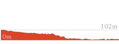
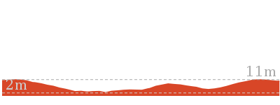
Rod Earp Rain Forest Circuit (from Lookout Rd)

1 Hr
1.9 km Circuit
104 m
Moderate track
This quiet and secluded walk is an easy amble through attractive rainforest. This walk circumnavigates Rainforest Creek and takes the walker into cool dense forest. You are likely to see flying foxes in the trees and if you are lucky, a Powerful Owl. Accessed from the quieter Lookout Road car park, this walk escapes the crowds well. A recommended walk, particularly on a hot day.


Blackbutt Reserve
Blackbutt Reserve, near Newcastle, occupies over 182 hectares of land and provides visitors with the chance to enjoy nature trails[1], wildlife exhibits[2][3], children’s playgrounds[4] and recreational facilities. The reserve is the perfect place for a relaxing family picnic or to explore on a bushwalk. Native wildlife, such as the Powerful Owl and the Grey-headed flying fox[5] can be seen within the park. There is an information cottage[6] at Carnley Avenue, which is open 7am to 5pm, or 7am to 7pm during daylight savings. The reserve has car parking at Carnley Avenue, Richley Reserve, Lookout Road and Mahonoy Drive. For more information, phone 02 4904 3344.
Lookout Road Recreation Area
The Lookout Road Recreation Area in Blackbutt Reserve has picnic tables[7], a drinking fountain[8], shelter[9], picnic tables and car parking[10]. There is ample, free car parking. The car park is open from 7am to 5pm, or 7am to 7pm during daylight savings. For further information phone: 02 4904 3344.
(0km) Lookout Road Recreation Area → Int of Rain Forest Walk & Lookout Road
330 m
9 mins
0m
-36m
Moderate track
From the Lookout Road Recreation Area[11][12][13](off Lookout Rd, New Lambton Heights), this walk passes through metal gates[14][15] and follows the ‘Lower Carpark’ sign[16] and road[17] moderately steeply downhill, while leaving the picnic area behind and to the right. This walk continues for about 300m, becoming gently downhill, until coming to a three-way intersection[18][19], with a trail and ‘Sensory Trail (return)’ sign[20] on the right.
(0.33km) Int of Rain Forest Walk AND Lookout Road → Int of Lookout Trail AND Rain Forest Walk
310 m
7 mins
12m
-17m
Easy track
Turn right: From the intersection[21], this walk follows the ‘Sensory Trail (return)’ sign[22] and trail gently downhill. This walk continues through forest for about 140m, to pass a ‘Rain Forest Area/Picnic Park’ sign[23] (on the right). Then this walk continues for about 170m, passing the ‘Senses Track 150m’ sign[24][25] (on the left), until crossing a bridge[26] with a timber fence and coming to a three-way intersection, with a ‘Lookout Rd 420m’ sign[27] ahead.
(0.63km) Int of Lookout Trail & Rain Forest Walk → Int of Rain Forest Walk & Lookout Trail
120 m
3 mins
5m
-8m
Moderate track
Turn left: From the intersection[28], this walk follows the trail[29] gently uphill, while initially leaving the bridge[30] on the left and passing the ‘Lookout Rd 420m’ sign[31] on the right. This walk continues through rainforest for about 130m, passing a ‘Rainforest Restoration Project’ sign[32][33] (on the right), until coming to a three-way intersection[34], with a gently uphill trail on the right and a gently downhill trail on the left.
Rod Earp Rainforest Picnic Area
This secluded, dense rainforest within Blackbutt Reserve has bench seats[35] and a picnic table[36]. The forest in this area hosts a large population of grey-headed flying foxes. These large bats[38] migrate for food and then return to roost during the day. Watch out for the bat guano the ground. This picnic area feels a world away from downtown Newcastle.
(0.75km) Int of Rain Forest Walk & Link Track → Main Ridge & Rain Forest Walks
530 m
13 mins
14m
-44m
Easy track
Continue straight: From the intersection[39], this walk follows the gravel trail[40] gently downhill, while initially keeping the gently downhill trail[41] behind you on your left and keeping the valley on your left. This walk continues (passing a ‘Rainforest Picnic Area’ sign[42] on your right) through dense rainforest for about 400m, until coming to a three-way intersection[43][44], with a sealed road and ‘Rainforest Walk’ sign[45][46] (on the right). Then this walk turns left onto the gently downhill sealed road[47] and after about 30m, crosses a bridge[48] at the Rainforest picnic area[49]. This walk then follows the road gently uphill, passing a closed toilet block[50] (on the right) for about 110m, until coming to a three-way intersection[51] with a sealed road (on the left) and a ‘Wildlife Exhibit’ sign[52] (on the right).
(1.28km) Main Ridge & Rain Forest Walks → Int of Lookout Road & Main Ridge Trail
160 m
4 mins
27m
0m
Easy track
Turn left: From the intersection[53], this walk follows the sealed road gently uphill, while leaving the ‘Rainforest Walk to Lookout Rd Carpark’ sign[54] directly behind you and initially passing a small picnic area[55] on your right. This walk continues through dense forest[56] for about 170m until coming to a level three-way intersection[57], with a picnic area[58] directly ahead and ‘Rainforest Walk’ sign[59] on the right.
(1.44km) Int of Lookout Road & Main Ridge Trail → Lookout Road Recreation Area
500 m
12 mins
46m
0m
Moderate track
Turn left: From the intersection[60][61], this walk follows the sealed road[62] gently uphill, while moving directly away from the face of the ‘Rainforest Walk’ sign[63]. This walk continues, heading through a picnic area for about 160m, passing two square brick buildings[64], and then coming to a three-way intersection[65] with a gently downhill sealed road[66] (on the right) and a gently uphill sealed car park[67], past yellow metal posts (directly ahead).
Continue straight: From the intersection[68], this walk passes through the yellow metal posts and crosses the car park gently uphill[69], while initially passing the ‘Main Ridge Walk (loop) sign[70] on the right. This walk continues for about 25m, until coming to a three-way intersection[71][72] with a trail and ‘Sensory Trail (return)’ sign[73] on the left.
Continue straight: From the intersection[74][75], this walk follows the road[76] gently uphill, while initially passing the ‘Sensory Trail (return)’ sign[77] on your left. This walk continues, becoming moderately steeply uphill for about 300m, to pass through a metal gate[78] and into the Lookout Road Recreation Area[79][80][81].
Maps for the Rod Earp Rain Forest Circuit (from Lookout Rd) walk
You can download the PDF for this walk to print a map.
These maps below cover the walk and the wider area around the walk, they are worth carrying for safety reasons.
| Wallsend | 1:25 000 Map Series | 92323S WALLSEND | NSW-92323S |
| Newcastle | 1:100 000 Map Series | 9232 NEWCASTLE | 9232 |
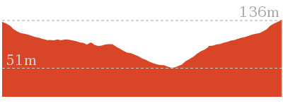
Cross sectional view of the Rod Earp Rain Forest Circuit (from Lookout Rd) bushwalking track
Analysis and summary of the altitude variation on the Rod Earp Rain Forest Circuit (from Lookout Rd)
Overview of this walks grade – based on the AS 2156.1 – 2001
Under this standard, a walk is graded based on the most difficult section of the walk.
| Length | 1.9 km | ||
| Time | 1 Hr | ||
| . | |||
| Grade 3/6 Moderate track |
AS 2156.1 | Gradient | Short steep hills (3/6) |
| Quality of track | Clear and well formed track or trail (2/6) | ||
| Signs | Directional signs along the way (3/6) | ||
| Experience Required | No experience required (1/6) | ||
| Weather | Weather generally has little impact on safety (1/6) | ||
| Infrastructure | Generally useful facilities (such as fenced cliffs and seats) (1/6) |
Some more details of this walks Grading
Here is a bit more details explaining grading looking at sections of the walk
Gradient
1km of this walk has gentle hills with occasional steps and another 650m has short steep hills. The remaining (270m) is flat with no steps.
Quality of track
Around 980m of this walk follows a smooth and hardened path, whilst the remaining 960m follows a clear and well formed track or trail.
Signs
Around 1.7km of this walk is clearly signposted, whilst the remaining 270m has directional signs at most intersection.
Experience Required
This whole walk, 1.9km requires no previous bushwalking experience.
weather
This whole walk, 1.9km is not usually affected by severe weather events (that would unexpectedly impact safety and navigation).
Infrastructure
This whole walk, 1.9km is close to useful facilities (such as fenced cliffs and seats).
Similar walks
A list of walks that share part of the track with the Rod Earp Rain Forest Circuit (from Lookout Rd) walk.
2 km Circuit
1 Hr
Moderate track
2.1 km Circuit
1 Hr
Moderate track
2.5 km Circuit
1 Hr
Moderate track
6 km Circuit
2 hrs 30 mins
Moderate track
6.5 km Circuit
2 hrs 30 mins
Moderate track
Other Nearby walks
A list of walks that start near the Rod Earp Rain Forest Circuit (from Lookout Rd) walk.
731 m Circuit
30 mins
Very easy
2.8 km Circuit
1 hr 15 mins
Moderate track
2.9 km Circuit
1 hr 15 mins
Moderate track
480 m Circuit
15 mins
Very easy
2.7 km Circuit
1 Hr
Moderate track
7.9 km One way
2 hrs 45 mins
Hard track
12.1 km One way
5 hrs 30 mins
Hard track
1.3 km Return
40 mins
Easy track
4.4 km One way
1 hr 30 mins
Moderate track
13.3 km One way
4 hrs 30 mins
Moderate track
25.7 km One way
2 Days
Hard track
1.9 km One way
45 mins
Hard track
Plan your trip to and from the walk here
The Rod Earp Rain Forest Circuit (from Lookout Rd) walk starts and ends at the Lookout Road Recreation Area (gps: -32.933649, 151.69092)
Your transport options to Lookout Road Recreation Area are by;
![]() Bus. (get details)
Bus. (get details)
![]() Car. There is free parking available.
Car. There is free parking available.
(get details)
Short URL = http://wild.tl/rerfc
Gallery images
There are other downloads I am still working on.
You will probably need to login to access these — still all free.
* KML (google earth file)
* GPX (GPS file)
Special Maps/ brochures
* A3 topo maps
* PDF with Lands Topo map base
* PDF with arial image (and map overlay)
I wanted to get the main site live first, this extra stuff will come in time.
Happy walking
Matt 🙂
Rod Earp Rainforest Circuit (from Carnley Ave)

1 Hr
2 km Circuit
99 m
Moderate track
This walk takes the walker into a dense cool rainforest that seems a world away from the hustle and bustle of Newcastle city. You’re likely to see flying foxes in the trees and, if you’re lucky, a Powerful Owl. Starting and finishing at the Carnley Ave Reserve, this walk can easily be combined with a visit to the Wildlife Exhibits and/or a picnic at Carnley Ave Reserve. A recommended walk.


Blackbutt Reserve
Blackbutt Reserve, near Newcastle, occupies over 182 hectares of land and provides visitors with the chance to enjoy nature trails[1], wildlife exhibits[2][3], children’s playgrounds[4] and recreational facilities. The reserve is the perfect place for a relaxing family picnic or to explore on a bushwalk. Native wildlife, such as the Powerful Owl and the Grey-headed flying fox[5] can be seen within the park. There is an information cottage[6] at Carnley Avenue, which is open 7am to 5pm, or 7am to 7pm during daylight savings. The reserve has car parking at Carnley Avenue, Richley Reserve, Lookout Road and Mahonoy Drive. For more information, phone 02 4904 3344.
Carnley Ave Reserve
The Carnley Avenue Reserve, within Blackbutt Reserve, is wheelchair accessible and has toilets[7], drinking fountains[8], gas/electric barbeques[9], sheltered picnic tables[10], a children’s playground[11], fenced displays of kangaroos and emu[12], a large black duck pond[13] and an information centre[14] that is housed within a replica pioneering cottage. The information cottage has a range of souvenirs, focusing on quality and affordable products. A fee of $4 per vehicle can be paid from the automatic machines[15] in the car park. The information centre is open 7am to 5pm, or 7am to 7pm during daylight savings. For further information phone: 02 4904 3344.
Blackbutt Wildlife Exhibits
This boardwalk in the Blackbutt Reserve offers wildlife exhibits[16] on an elevated timber boardwalk which is wheelchair accessible. Some of the wildlife that you are likely to encounter are kangaroos, koalas[17], wombats[18], Lace monitors[19], Wonga Pigeons, Red-winged Parrots, Black-winged Stilt[20], Buff-banded Rail, Herons[21], Eastern long-necked Turtle, Kingfishers[22], Turquoise Parrot, Banded Plover, Peaceful Dove[23], Cockatoos, Lorikeets, True Parrots, Major Mitchell Cockatoo, Bush Stone Curlew, Long-tailed Finch and Barking Owls[24]. Entry is free and the exhibit is open from 9.00am to 5.00pm every day (closed Christmas Day, Good Friday and until 1pm ANZAC Day). Personal koala encounters[25] are available at 2pm daily and cost $3.50/person. For further information, phone: 02 4904 3344. More info.
(0km) Int of Boardwalk & Main Ridge Trail → Main Ridge & Rain Forest Walks
380 m
8 mins
24m
-6m
Moderate track
From the intersection[26], this walk follows the sealed road[27] gently uphill, while initially keeping the timber fenced boardwalk[28] to the Wildlife Exhibits on your right. This walk continues through forest[29] for about 140m until coming to a three-way intersection[30], with a ‘Lookout Road Carpark 400m’ sign[31] (on the right).
Continue straight: From the intersection[32], this walk follows the ‘Rainforest Walk’ sign[33] and sealed road gently downhill. This walk continues undulating for about 260m until coming to a three-way intersection[34], with a sealed road (on the right) and a ‘Rainforest Walk to Lookout Rd Carpark’ sign[35] (on the left).
Continue straight: From the intersection[32], this walk follows the ‘Rainforest Walk’ sign[33] and sealed road gently downhill. This walk continues undulating for about 260m until coming to a three-way intersection[34], with a sealed road (on the right) and a ‘Rainforest Walk to Lookout Rd Carpark’ sign[35] (on the left).
(0.38km) Main Ridge & Rain Forest Walks → Int of Rain Forest Walk & Link Track
530 m
13 mins
44m
-14m
Easy track
Turn left: From the intersection[36], this walk follows the ‘Rainforest Walk to Lookout Rd Carpark’ sign[37] and sealed road gently downhill, while keeping the valley on the left. This walk continues for about 110m, passing a closed toilet block[38] (on the left), until crossing over a bridge at the Rainforest picnic area[39]. Then this walk continues gently uphill for about 30m, until coming to a three-way intersection[40][41] with a gravel trail[42] (on the right). This walk then turns right, following the ‘Rainforest Walk’ sign[43][44] on the gravel trail for about 400m through dense rainforest[45] (passing a ‘Rainforest Picnic Area’ sign[46] on the left), until coming to a three-way intersection[47] with a gently downhill trail (on the right) and a gently uphill trail[48] (on the left).
Rod Earp Rainforest Picnic Area
This secluded, dense rainforest within Blackbutt Reserve has bench seats[49] and a picnic table[50]. The forest in this area hosts a large population of grey-headed flying foxes. These large bats[52] migrate for food and then return to roost during the day. Watch out for the bat guano the ground. This picnic area feels a world away from downtown Newcastle.
(0.91km) Int of Rain Forest Walk & Lookout Trail → Int of Lookout Trail & Rain Forest Walk
120 m
3 mins
8m
-5m
Moderate track
Continue straight: From the intersection[53][54], this walk follows the trail gently downhill, while keeping the gently uphill trail[55] on your left and the valley on your right. This walk continues through rainforest for about 130m, passing a ‘Rainforest Restoration Project’ sign[56] (on the left), until coming to a three-way intersection[57], with a trail and bridge[58] on the right, and a ‘Lookout Rd 420m’ sign[59] on the left.
(1.03km) Int of Lookout Trail AND Rain Forest Walk → Int of Rain Forest Walk AND Lookout Road
310 m
7 mins
17m
-12m
Easy track
Turn right: From the intersection[60][61], this walk crosses the bridge and follows the trail moderately steeply uphill[62], while leaving the face of the ‘Lookout Rd 420m’ sign directly behind. This walk continues, passing the ‘Senses Track 150m’ sign[63] (on the right) and becoming gently uphill through forest for about 170m to pass a ‘Rain Forest Area/Picnic Park’ sign[64] (on the left). Then this walk continues for about 140m, until coming to a car park[65][66] and sealed road, with a ‘Sensory Trail (return)’ sign[67] on the left.
(1.34km) Int of Rain Forest Walk & Lookout Road → Int of Lookout Road & Main Ridge Trail
20 m
0m
-1m
Easy track
Turn right: From the intersection[68][69], this walk follows the road gently downhill and across the car park, while initially leaving the ‘Sensory Trail (return)’ sign[70] on your right. This walk continues for about 25m, until passing through yellow metal posts[71] and coming to a three-way intersection, with a ‘Main Ridge Walk (loop)’ sign[72][73] and trail[74] (on the left) and square brick buildings[75] (on the right).
(1.36km) Rain Forest Walk & Main Ridge Walk → Int of Lookout Road & Main Ridge Trail
150 m
3 mins
0m
-9m
Moderate track
Continue straight: From the intersection[76], this walk follows the sealed road[77], while passing the two square brick buildings[78][79] (on your right) and leaving the yellow metal posts[80] (directly behind). This walk continues through a picnic area for about 160m until coming to a three-way intersection[81] with a sealed road and ‘Rainforest Walk’ sign[82] (on the right).
(1.51km) Int of Lookout Road & Main Ridge Trail → Int of Main Ridge Trail & Lookout Road
410 m
9 mins
4m
-42m
Easy track
Turn right: From the intersection[83][84], this walk follows the ‘Rainforest Walk’ sign[85] gently downhill, while keeping the valley on your right. This walk continues through dense forest[86] for about 170m until coming to a T-intersection[87], with a ‘Rainforest Walk to Lookout Rd Carpark’ sign[88] indicating a right turn.
Continue straight: From the intersection[89], this walk follows the ‘Wildlife Exhibit’ sign[90] and sealed road gently downhill, while keeping the valley on the right. This walk continues, undulating for about 260m until coming to a three-way intersection[91], with a ‘Lookout Road Carpark’ sign[92] and gently uphill sealed road on the left.
Continue straight: From the intersection[89], this walk follows the ‘Wildlife Exhibit’ sign[90] and sealed road gently downhill, while keeping the valley on the right. This walk continues, undulating for about 260m until coming to a three-way intersection[91], with a ‘Lookout Road Carpark’ sign[92] and gently uphill sealed road on the left.
(1.91km) Int of Main Ridge Trail & Lookout Road → Int of Boardwalk & Main Ridge Trail
130 m
3 mins
2m
-9m
Moderate track
Continue straight: From the intersection[93], this walk follows the ‘Wildlife Exhibitions 120m’ sign[94] and sealed road[95] gently downhill, while keeping the ‘Lookout Road Carpark’ sign[96] directly behind you. This walk continues through forest[97] for about 140m, until coming to a four-way intersection[98] with the Wildlife Exhibits boardwalk[99] (on the left), a car park[100] ahead and a disabled car park (on the right).
Maps for the Rod Earp Rainforest Circuit (from Carnley Ave) walk
You can download the PDF for this walk to print a map.
These maps below cover the walk and the wider area around the walk, they are worth carrying for safety reasons.
| Wallsend | 1:25 000 Map Series | 92323S WALLSEND | NSW-92323S |
| Newcastle | 1:100 000 Map Series | 9232 NEWCASTLE | 9232 |
Cross sectional view of the Rod Earp Rainforest Circuit (from Carnley Ave) bushwalking track
Analysis and summary of the altitude variation on the Rod Earp Rainforest Circuit (from Carnley Ave)
Overview of this walks grade – based on the AS 2156.1 – 2001
Under this standard, a walk is graded based on the most difficult section of the walk.
| Length | 2 km | ||
| Time | 1 Hr | ||
| . | |||
| Grade 3/6 Moderate track |
AS 2156.1 | Gradient | Gentle hills with occasional steps (2/6) |
| Quality of track | Clear and well formed track or trail (2/6) | ||
| Signs | Directional signs along the way (3/6) | ||
| Experience Required | No experience required (1/6) | ||
| Weather | Weather generally has little impact on safety (1/6) | ||
| Infrastructure | Generally useful facilities (such as fenced cliffs and seats) (1/6) |
Some more details of this walks Grading
Here is a bit more details explaining grading looking at sections of the walk
Gradient
Around 1.5km of this walk has gentle hills with occasional steps, whilst the remaining 530m is flat with no steps.
Quality of track
Around 1.1km of this walk follows a smooth and hardened path, whilst the remaining 960m follows a clear and well formed track or trail.
Signs
Around 1.5km of this walk is clearly signposted, whilst the remaining 530m has directional signs at most intersection.
Experience Required
This whole walk, 2km requires no previous bushwalking experience.
weather
This whole walk, 2km is not usually affected by severe weather events (that would unexpectedly impact safety and navigation).
Infrastructure
This whole walk, 2km is close to useful facilities (such as fenced cliffs and seats).
Similar walks
A list of walks that share part of the track with the Rod Earp Rainforest Circuit (from Carnley Ave) walk.
1.9 km Circuit
1 Hr
Moderate track
2.1 km Circuit
1 Hr
Moderate track
2.5 km Circuit
1 Hr
Moderate track
6 km Circuit
2 hrs 30 mins
Moderate track
6.5 km Circuit
2 hrs 30 mins
Moderate track
Other Nearby walks
A list of walks that start near the Rod Earp Rainforest Circuit (from Carnley Ave) walk.
480 m Circuit
15 mins
Very easy
731 m Circuit
30 mins
Very easy
2.8 km Circuit
1 hr 15 mins
Moderate track
2.9 km Circuit
1 hr 15 mins
Moderate track
2.7 km Circuit
1 Hr
Moderate track
7.9 km One way
2 hrs 45 mins
Hard track
12.1 km One way
5 hrs 30 mins
Hard track
1.3 km Return
40 mins
Easy track
4.4 km One way
1 hr 30 mins
Moderate track
13.3 km One way
4 hrs 30 mins
Moderate track
25.7 km One way
2 Days
Hard track
1.9 km One way
45 mins
Hard track
Plan your trip to and from the walk here
The Rod Earp Rainforest Circuit (from Carnley Ave) walk starts and ends at the Int of Boardwalk & Main Ridge Trail (gps: -32.937903, 151.69805)
Your transport options to Int of Boardwalk & Main Ridge Trail are by;
![]() Bus. (get details)
Bus. (get details)
![]() Car. There is free parking available.
Car. There is free parking available.
(get details)
Short URL = http://wild.tl/rerfcw
Gallery images
There are other downloads I am still working on.
You will probably need to login to access these — still all free.
* KML (google earth file)
* GPX (GPS file)
Special Maps/ brochures
* A3 topo maps
* PDF with Lands Topo map base
* PDF with arial image (and map overlay)
I wanted to get the main site live first, this extra stuff will come in time.
Happy walking
Matt 🙂
Black Duck Creek Circuit Walk
And Walk
Black Duck Creek Circuit Walk

1 Hr
2.1 km Circuit
89 m
Moderate track
This walk circumnavigates Black Duck Creek by following the shady Blueberry Ash trail. The walk then returns to Carnley Reserve using the Main Ridge Walking Trail. This relatively short walk has a good combination of shady moist forest and more exposed ridge forest. Make sure you visit the Wildlife Exhibit while at Carnley Reserve. A recommended walk.


Blackbutt Reserve
Blackbutt Reserve, near Newcastle, occupies over 182 hectares of land and provides visitors with the chance to enjoy nature trails[1], wildlife exhibits[2][3], children’s playgrounds[4] and recreational facilities. The reserve is the perfect place for a relaxing family picnic or to explore on a bushwalk. Native wildlife, such as the Powerful Owl and the Grey-headed flying fox[5] can be seen within the park. There is an information cottage[6] at Carnley Avenue, which is open 7am to 5pm, or 7am to 7pm during daylight savings. The reserve has car parking at Carnley Avenue, Richley Reserve, Lookout Road and Mahonoy Drive. For more information, phone 02 4904 3344.
Carnley Ave Reserve
The Carnley Avenue Reserve, within Blackbutt Reserve, is wheelchair accessible and has toilets[7], drinking fountains[8], gas/electric barbeques[9], sheltered picnic tables[10], a children’s playground[11], fenced displays of kangaroos and emu[12], a large black duck pond[13] and an information centre[14] that is housed within a replica pioneering cottage. The information cottage has a range of souvenirs, focusing on quality and affordable products. A fee of $4 per vehicle can be paid from the automatic machines[15] in the car park. The information centre is open 7am to 5pm, or 7am to 7pm during daylight savings. For further information phone: 02 4904 3344.
(0km) Carnley Avenue Reserve → Int of Blueberry Ash Walk & Carnley Trail
130 m
2 mins
9m
-1m
Easy track
From the intersection[16][17], this walk follows the sealed road, while initially keeping the Black Duck Pond[18] on your left and the replica pioneering cottage[19][20] directly behind you. This walk continues, passing the Black Duck Pond (on the left) and continues gently uphill[21] for about 150m (passing a sheltered picnic area[22] and children’s playground on the right) until coming to a three-way intersection[23] with a gravel trail (on the left), a metal ring fence (on the right) and a ‘Main Ridge Walk (loop)’ sign[24].
(0.13km) Int of Blueberry Ash Walk and Carnley Trail → Int of Rain Forest Walk and Lookout Road
1.2 km
24 mins
72m
-25m
Easy track
Turn sharp left: From the intersection[25], this walk follows the ‘Blueberry Ash Walk to Lookout Rd CarPark’ sign[26] and gravel trail[27] gently downhill, while leaving the metal ring fence[28] directly behind. This walk continues, undulating through mature forest for about 800m, with Black Duck Creek visible (on the left), until coming to a T-intersection[29] with a sealed road and the ‘Blueberry Ash Walk to Carnley Ave Carpark’ sign[30].
Turn left: From the intersection[31], this walk follows the ‘Main Ridge Walk to Lookout Rd Car Park’ sign[32] and sealed road gently downhill, while keeping the valley on your left. This walk continues, undulating for about 400m through attractive forest[33][34] until coming to a three-way intersection[35] with a road and brick buildings[36] (on the left) and yellow metal posts and a ‘Main Ridge Walk (Loop)’ sign[37][38] (on the right).
Turn left: From the intersection[31], this walk follows the ‘Main Ridge Walk to Lookout Rd Car Park’ sign[32] and sealed road gently downhill, while keeping the valley on your left. This walk continues, undulating for about 400m through attractive forest[33][34] until coming to a three-way intersection[35] with a road and brick buildings[36] (on the left) and yellow metal posts and a ‘Main Ridge Walk (Loop)’ sign[37][38] (on the right).
(1.32km) Rain Forest Walk & Main Ridge Walk → Int of Lookout Road & Main Ridge Trail
150 m
3 mins
0m
-9m
Moderate track
Veer left: From the intersection[39], this walk follows the sealed road[40], while passing the two square brick buildings[41][42] (on your right) and leaving the yellow metal posts[43] (directly behind). This walk continues through a picnic area for about 160m until coming to a three-way intersection[44] with a sealed road and ‘Rainforest Walk’ sign[45] (on the right).
(1.47km) Int of Lookout Road & Main Ridge Trail → Int of Main Ridge Trail & Lookout Road
410 m
9 mins
4m
-42m
Easy track
Turn right: From the intersection[46][47], this walk follows the ‘Rainforest Walk’ sign[48] gently downhill, while keeping the valley on your right. This walk continues through dense forest[49] for about 170m until coming to a T-intersection[50], with a ‘Rainforest Walk to Lookout Rd Carpark’ sign[51] indicating a right turn.
Continue straight: From the intersection[52], this walk follows the ‘Wildlife Exhibit’ sign[53] and sealed road gently downhill, while keeping the valley on the right. This walk continues, undulating for about 260m until coming to a three-way intersection[54], with a ‘Lookout Road Carpark’ sign[55] and gently uphill sealed road on the left.
Continue straight: From the intersection[52], this walk follows the ‘Wildlife Exhibit’ sign[53] and sealed road gently downhill, while keeping the valley on the right. This walk continues, undulating for about 260m until coming to a three-way intersection[54], with a ‘Lookout Road Carpark’ sign[55] and gently uphill sealed road on the left.
(1.87km) Int of Main Ridge Trail & Lookout Road → Int of Boardwalk & Carnley Trail
230 m
5 mins
4m
-11m
Moderate track
Continue straight: From the intersection[56], this walk follows the ‘Wildlife Exhibitions 120m’ sign[57] and sealed road[58] gently downhill, while keeping the ‘Lookout Road Carpark’ sign[59] directly behind you. This walk continues through forest[60] for about 140m, until coming to a four-way intersection[61] with the Wildlife Exhibits boardwalk[62] (on the left), a car park[63] ahead and a disabled car park (on the right).
Veer left: From the intersection[64], this walk follows the sealed trail gently downhill, while initially keeping the ‘Animals’ sign[65] and elevated timber boardwalk[66] on the left. This walk continues for about 90m, passing an ‘Animals’ sign[67] and ‘Information’ sign (on the left) and concrete stairs (on the right), until coming to a three-way intersection[68][69], with a large timber fenced gate[70] (on the left).
Veer left: From the intersection[64], this walk follows the sealed trail gently downhill, while initially keeping the ‘Animals’ sign[65] and elevated timber boardwalk[66] on the left. This walk continues for about 90m, passing an ‘Animals’ sign[67] and ‘Information’ sign (on the left) and concrete stairs (on the right), until coming to a three-way intersection[68][69], with a large timber fenced gate[70] (on the left).
Blackbutt Wildlife Exhibits
This boardwalk in the Blackbutt Reserve offers wildlife exhibits[71] on an elevated timber boardwalk which is wheelchair accessible. Some of the wildlife that you are likely to encounter are kangaroos, koalas[72], wombats[73], Lace monitors[74], Wonga Pigeons, Red-winged Parrots, Black-winged Stilt[75], Buff-banded Rail, Herons[76], Eastern long-necked Turtle, Kingfishers[77], Turquoise Parrot, Banded Plover, Peaceful Dove[78], Cockatoos, Lorikeets, True Parrots, Major Mitchell Cockatoo, Bush Stone Curlew, Long-tailed Finch and Barking Owls[79]. Entry is free and the exhibit is open from 9.00am to 5.00pm every day (closed Christmas Day, Good Friday and until 1pm ANZAC Day). Personal koala encounters[80] are available at 2pm daily and cost $3.50/person. For further information, phone: 02 4904 3344. More info.
(2.1km) Int of Boardwalk & Carnley Trail → Carnley Avenue Reserve
20 m
0m
-2m
Very easy
Turn right: From the intersection[81], this walk follows the sealed trail[82] gently downhill and towards the Black Duck Pond[83], while initially keeping the large timber fenced gate[84] on your left. This walk continues for about 20m until coming to a four-way intersection[85], with the replica pioneering cottage[86][87], Black Duck Pond and a ‘Richley Reserve’ sign[88] (on the left).
Maps for the Black Duck Creek Circuit Walk walk
You can download the PDF for this walk to print a map.
These maps below cover the walk and the wider area around the walk, they are worth carrying for safety reasons.
| Wallsend | 1:25 000 Map Series | 92323S WALLSEND | NSW-92323S |
| Newcastle | 1:100 000 Map Series | 9232 NEWCASTLE | 9232 |
Cross sectional view of the Black Duck Creek Circuit Walk bushwalking track
Analysis and summary of the altitude variation on the Black Duck Creek Circuit Walk
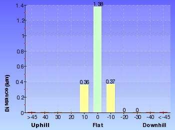
Overview of this walks grade – based on the AS 2156.1 – 2001
Under this standard, a walk is graded based on the most difficult section of the walk.
| Length | 2.1 km | ||
| Time | 1 Hr | ||
| . | |||
| Grade 3/6 Moderate track |
AS 2156.1 | Gradient | Gentle hills with occasional steps (2/6) |
| Quality of track | Clear and well formed track or trail (2/6) | ||
| Signs | Directional signs along the way (3/6) | ||
| Experience Required | No experience required (1/6) | ||
| Weather | Weather generally has little impact on safety (1/6) | ||
| Infrastructure | Generally useful facilities (such as fenced cliffs and seats) (1/6) |
Some more details of this walks Grading
Here is a bit more details explaining grading looking at sections of the walk
Gradient
Around 1.7km of this walk has gentle hills with occasional steps, whilst the remaining 390m is flat with no steps.
Quality of track
Around 1.2km of this walk follows a clear and well formed track or trail, whilst the remaining 930m follows a smooth and hardened path.
Signs
Around 1.8km of this walk is clearly signposted, whilst the remaining 280m has directional signs at most intersection.
Experience Required
This whole walk, 2.1km requires no previous bushwalking experience.
weather
This whole walk, 2.1km is not usually affected by severe weather events (that would unexpectedly impact safety and navigation).
Infrastructure
This whole walk, 2.1km is close to useful facilities (such as fenced cliffs and seats).
Similar walks
A list of walks that share part of the track with the Black Duck Creek Circuit Walk walk.
480 m Circuit
15 mins
Very easy
1.9 km Circuit
1 Hr
Moderate track
2 km Circuit
1 Hr
Moderate track
2.5 km Circuit
1 Hr
Moderate track
2.9 km Circuit
1 hr 15 mins
Moderate track
6 km Circuit
2 hrs 30 mins
Moderate track
6.5 km Circuit
2 hrs 30 mins
Moderate track
Other Nearby walks
A list of walks that start near the Black Duck Creek Circuit Walk walk.
731 m Circuit
30 mins
Very easy
2.8 km Circuit
1 hr 15 mins
Moderate track
2.7 km Circuit
1 Hr
Moderate track
7.9 km One way
2 hrs 45 mins
Hard track
12.1 km One way
5 hrs 30 mins
Hard track
1.3 km Return
40 mins
Easy track
4.4 km One way
1 hr 30 mins
Moderate track
13.3 km One way
4 hrs 30 mins
Moderate track
25.7 km One way
2 Days
Hard track
1.9 km One way
45 mins
Hard track
948 m Return
30 mins
Hard track
1.2 km Circuit
30 mins
Hard track
Plan your trip to and from the walk here
The Black Duck Creek Circuit Walk walk starts and ends at the Carnley Avenue Reserve (gps: -32.937008, 151.69804)
Your transport options to Carnley Avenue Reserve are by;
![]() Bus. (get details)
Bus. (get details)
![]() Car. There is free parking available.
Car. There is free parking available.
(get details)
Short URL = http://wild.tl/bdccw
Gallery images
There are other downloads I am still working on.
You will probably need to login to access these — still all free.
* KML (google earth file)
* GPX (GPS file)
Special Maps/ brochures
* A3 topo maps
* PDF with Lands Topo map base
* PDF with arial image (and map overlay)
I wanted to get the main site live first, this extra stuff will come in time.
Happy walking
Matt 🙂
Main Ridge Circuit Walk
And Walk
Main Ridge Circuit Walk

1 Hr
2.5 km Circuit
92 m
Moderate track
This walk follows a wide trail along eucalyptus lined broad ridges as it circumnavigates Black Duck Creek. This walk starts and finishes at Carnley Reserve and while there, why not enjoy a picnic and/or visit to the Wildlife Exhibits. Combined with the excellent facilities at Carnley Reserve, this walk is recommended for everybody, on all but the hottest days of summer.
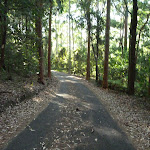
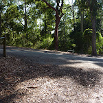


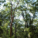

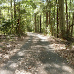

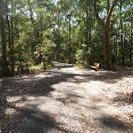


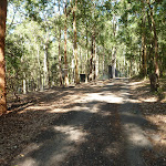
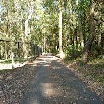
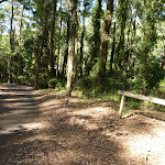

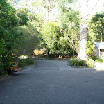

Blackbutt Reserve
Blackbutt Reserve, near Newcastle, occupies over 182 hectares of land and provides visitors with the chance to enjoy nature trails[1], wildlife exhibits[2][3], children’s playgrounds[4] and recreational facilities. The reserve is the perfect place for a relaxing family picnic or to explore on a bushwalk. Native wildlife, such as the Powerful Owl and the Grey-headed flying fox[5] can be seen within the park. There is an information cottage[6] at Carnley Avenue, which is open 7am to 5pm, or 7am to 7pm during daylight savings. The reserve has car parking at Carnley Avenue, Richley Reserve, Lookout Road and Mahonoy Drive. For more information, phone 02 4904 3344.
Carnley Ave Reserve
The Carnley Avenue Reserve, within Blackbutt Reserve, is wheelchair accessible and has toilets[7], drinking fountains[8], gas/electric barbeques[9], sheltered picnic tables[10], a children’s playground[11], fenced displays of kangaroos and emu[12], a large black duck pond[13] and an information centre[14] that is housed within a replica pioneering cottage. The information cottage has a range of souvenirs, focusing on quality and affordable products. A fee of $4 per vehicle can be paid from the automatic machines[15] in the car park. The information centre is open 7am to 5pm, or 7am to 7pm during daylight savings. For further information phone: 02 4904 3344.
(0km) Int of Boardwalk & Main Ridge Trail → Main Ridge & Rain Forest Walks
380 m
8 mins
24m
-6m
Moderate track
From the intersection[16], this walk follows the sealed road[17] gently uphill, while initially keeping the timber fenced boardwalk[18] to the Wildlife Exhibits on your right. This walk continues through forest[19] for about 140m until coming to a three-way intersection[20], with a ‘Lookout Road Carpark 400m’ sign[21] (on the right).
Continue straight: From the intersection[22], this walk follows the ‘Rainforest Walk’ sign[23] and sealed road gently downhill. This walk continues undulating for about 260m until coming to a three-way intersection[24], with a sealed road (on the right) and a ‘Rainforest Walk to Lookout Rd Carpark’ sign[25] (on the left).
Continue straight: From the intersection[22], this walk follows the ‘Rainforest Walk’ sign[23] and sealed road gently downhill. This walk continues undulating for about 260m until coming to a three-way intersection[24], with a sealed road (on the right) and a ‘Rainforest Walk to Lookout Rd Carpark’ sign[25] (on the left).
(0.38km) Main Ridge & Rain Forest Walks → Int of Lookout Road & Main Ridge Trail
160 m
4 mins
27m
0m
Easy track
Continue straight: From the intersection[26], this walk follows the sealed road gently uphill, while leaving the ‘Rainforest Walk to Lookout Rd Carpark’ sign[27] directly behind you and initially passing a small picnic area[28] on your right. This walk continues through dense forest[29] for about 170m until coming to a level three-way intersection[30], with a picnic area[31] directly ahead and ‘Rainforest Walk’ sign[32] on the right.
(0.54km) Int of Lookout Road & Main Ridge Trail → Rain Forest Walk & Main Ridge Walk
150 m
3 mins
9m
0m
Moderate track
Turn left: From the intersection[33][34], this walk follows the sealed road[35] gently uphill, while moving directly away from the face of the ‘Rainforest Walk’ sign[36]. This walk continues, heading through a picnic area for about 160m, passing two square brick buildings[37], and then coming to a three-way intersection[38] with a gently downhill sealed road[39] (on the right) and a gently uphill sealed car park[40], past yellow metal posts (directly ahead).
(0.69km) Int of Rain Forest Walk and Lookout Road → Int of Main Ridge & Tall Trees Walks
580 m
12 mins
25m
-24m
Easy track
Veer right: From the intersection[41], this walk follows the ‘Main Ridge Walk (loop)’ sign[42] and sealed road[43] gently downhill, initially keeping the sign on your left and the valley on your right. This walk continues, undulating through attractive forest[44][45] for about 400m until coming to a three-way intersection[46] with a trail[47] (on the right) and a ‘Tall Trees Walk’ sign[48] (on the left).
Continue straight: From the intersection[49], this walk follows the ‘Main Ridge Walk to Carnley Ave Carpark’ sign[50] and sealed trail gently uphill, while leaving the gently downhill trail[51] behind on your right. This walk continues through dense forest for about 170m until coming to a level T-intersection[52], with a ‘Main Ridge Walk to Carnley Carpark’ sign[53] directly ahead.
Continue straight: From the intersection[49], this walk follows the ‘Main Ridge Walk to Carnley Ave Carpark’ sign[50] and sealed trail gently uphill, while leaving the gently downhill trail[51] behind on your right. This walk continues through dense forest for about 170m until coming to a level T-intersection[52], with a ‘Main Ridge Walk to Carnley Carpark’ sign[53] directly ahead.
(1.26km) Int of Main Ridge & Tall Trees Walks → Main Ridge & Carnley Trails
880 m
18 mins
2m
-49m
Moderate track
Turn right: From the intersection[54][55], this walk follows the ‘Main Ridge Walk to Carnley Ave Carpark’ sign[56] and sealed trail gently uphill, while keeping the sealed gently downhill trail on your right. This walk continues through forest on a ridge for about 70m, to find an open gravel area[57][58] (on the left). Then this walk continues straight ahead, undulating for about 600m, until coming to a four-way intersection[59][60], with a ‘Main Ridge Walk (loop)’ sign[61] (on the left).
Turn right: From the intersection[62][63], this walk follows the trail gently downhill[64], while moving directly away from the face of the ‘Richley Car Park’ sign[65] and keeping the valley on the left. This walk continues, undulating for about 170m until coming to a three-way intersection[66], with a trail and metal ring fence[67] (on the left).
Turn right: From the intersection[62][63], this walk follows the trail gently downhill[64], while moving directly away from the face of the ‘Richley Car Park’ sign[65] and keeping the valley on the left. This walk continues, undulating for about 170m until coming to a three-way intersection[66], with a trail and metal ring fence[67] (on the left).
(2.15km) Main Ridge & Carnley Trails → Int of Carnley Trail & Blueberry Ash Walk
140 m
2 mins
0m
-3m
Moderate track
Continue straight: From the intersection[68][69], this walk follows the trail gently downhill, while initially passing the trail (next to the metal ring fence) on the left and keeping the fence on your left. This walk continues through forest for about 170m, until coming to a three-way intersection[70][71], with a trail and ‘Main Ridge Walk (loop)’ sign[72] on the right and the metal ring fence[73] on the left.
(2.28km) Int of Blueberry Ash Walk & Carnley Trail → Carnley Avenue Reserve
130 m
2 mins
1m
-9m
Easy track
Veer left: From the intersection[74], this walk follows the ‘Black Duck’ sign[75] and sealed road[76] gently downhill, while keeping the metal ring fence[77] on your left. This walk continues for about 150m, passing a sheltered picnic area[78] and children’s playground (on the left), until passing Black Duck Pond[79] (on your right) and coming to a four-way intersection[80], with a replica pioneering cottage[81] directly ahead.
(2.41km) Carnley Avenue Reserve → Int of Boardwalk & Main Ridge Trail
110 m
2 mins
4m
-2m
Very easy
Continue straight: From the intersection[82], this walk follows the ‘Animal’ sign[83] and sealed trail gently uphill, while initially passing the replica pioneering cottage[84][85] on the right. This walk continues for about 20m until coming to a three-way intersection[86], with a large timber fenced gate[87] (on the right).
Turn left: From the intersection[88][89], this walk follows the sealed trail gently uphill, while initially passing the large timber fenced gate[90] on the right and keeping the valley on the left. This walk continues for about 90m, passing an ‘Animals’ sign[91] and ‘Information’ sign (on the right) and concrete stairs (on the left), until coming to a four-way intersection[92], with an ‘Animals’ sign and elevated boardwalk[93] (on the right) and disabled parking[94] and general car parking (on the left).
Turn left: From the intersection[88][89], this walk follows the sealed trail gently uphill, while initially passing the large timber fenced gate[90] on the right and keeping the valley on the left. This walk continues for about 90m, passing an ‘Animals’ sign[91] and ‘Information’ sign (on the right) and concrete stairs (on the left), until coming to a four-way intersection[92], with an ‘Animals’ sign and elevated boardwalk[93] (on the right) and disabled parking[94] and general car parking (on the left).
Blackbutt Wildlife Exhibits
This boardwalk in the Blackbutt Reserve offers wildlife exhibits[95] on an elevated timber boardwalk which is wheelchair accessible. Some of the wildlife that you are likely to encounter are kangaroos, koalas[96], wombats[97], Lace monitors[98], Wonga Pigeons, Red-winged Parrots, Black-winged Stilt[99], Buff-banded Rail, Herons[100], Eastern long-necked Turtle, Kingfishers[101], Turquoise Parrot, Banded Plover, Peaceful Dove[102], Cockatoos, Lorikeets, True Parrots, Major Mitchell Cockatoo, Bush Stone Curlew, Long-tailed Finch and Barking Owls[103]. Entry is free and the exhibit is open from 9.00am to 5.00pm every day (closed Christmas Day, Good Friday and until 1pm ANZAC Day). Personal koala encounters[104] are available at 2pm daily and cost $3.50/person. For further information, phone: 02 4904 3344. More info.
Maps for the Main Ridge Circuit Walk walk
You can download the PDF for this walk to print a map.
These maps below cover the walk and the wider area around the walk, they are worth carrying for safety reasons.
| Wallsend | 1:25 000 Map Series | 92323S WALLSEND | NSW-92323S |
| Newcastle | 1:100 000 Map Series | 9232 NEWCASTLE | 9232 |
Cross sectional view of the Main Ridge Circuit Walk bushwalking track
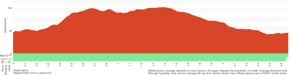
Analysis and summary of the altitude variation on the Main Ridge Circuit Walk
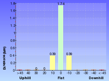
Overview of this walks grade – based on the AS 2156.1 – 2001
Under this standard, a walk is graded based on the most difficult section of the walk.
| Length | 2.5 km | ||
| Time | 1 Hr | ||
| . | |||
| Grade 3/6 Moderate track |
AS 2156.1 | Gradient | Gentle hills with occasional steps (2/6) |
| Quality of track | Clear and well formed track or trail (2/6) | ||
| Signs | Directional signs along the way (3/6) | ||
| Experience Required | No experience required (1/6) | ||
| Weather | Weather generally has little impact on safety (1/6) | ||
| Infrastructure | Generally useful facilities (such as fenced cliffs and seats) (1/6) |
Some more details of this walks Grading
Here is a bit more details explaining grading looking at sections of the walk
Gradient
Around 1.8km of this walk has gentle hills with occasional steps, whilst the remaining 700m is flat with no steps.
Quality of track
Around 1.4km of this walk follows a smooth and hardened path, whilst the remaining 1.1km follows a clear and well formed track or trail.
Signs
Around 1.9km of this walk is clearly signposted, whilst the remaining 590m has directional signs at most intersection.
Experience Required
This whole walk, 2.5km requires no previous bushwalking experience.
weather
This whole walk, 2.5km is not usually affected by severe weather events (that would unexpectedly impact safety and navigation).
Infrastructure
This whole walk, 2.5km is close to useful facilities (such as fenced cliffs and seats).
Similar walks
A list of walks that share part of the track with the Main Ridge Circuit Walk walk.
480 m Circuit
15 mins
Very easy
1.9 km Circuit
1 Hr
Moderate track
2 km Circuit
1 Hr
Moderate track
2.1 km Circuit
1 Hr
Moderate track
2.8 km Circuit
1 hr 15 mins
Moderate track
2.9 km Circuit
1 hr 15 mins
Moderate track
6 km Circuit
2 hrs 30 mins
Moderate track
6.5 km Circuit
2 hrs 30 mins
Moderate track
Other Nearby walks
A list of walks that start near the Main Ridge Circuit Walk walk.
731 m Circuit
30 mins
Very easy
2.7 km Circuit
1 Hr
Moderate track
7.9 km One way
2 hrs 45 mins
Hard track
12.1 km One way
5 hrs 30 mins
Hard track
1.3 km Return
40 mins
Easy track
4.4 km One way
1 hr 30 mins
Moderate track
13.3 km One way
4 hrs 30 mins
Moderate track
25.7 km One way
2 Days
Hard track
1.9 km One way
45 mins
Hard track
948 m Return
30 mins
Hard track
1.2 km Circuit
30 mins
Hard track
2.4 km Return
1 Hr
Very easy
Plan your trip to and from the walk here
The Main Ridge Circuit Walk walk starts and ends at the Int of Boardwalk & Main Ridge Trail (gps: -32.937903, 151.69805)
Your transport options to Int of Boardwalk & Main Ridge Trail are by;
![]() Bus. (get details)
Bus. (get details)
![]() Car. There is free parking available.
Car. There is free parking available.
(get details)
Short URL = http://wild.tl/2l
Gallery images
There are other downloads I am still working on.
You will probably need to login to access these — still all free.
* KML (google earth file)
* GPX (GPS file)
Special Maps/ brochures
* A3 topo maps
* PDF with Lands Topo map base
* PDF with arial image (and map overlay)
I wanted to get the main site live first, this extra stuff will come in time.
Happy walking
Matt 🙂
Forestway Circuit Walk
And Walk
Forestway Circuit Walk

1 Hr
2.7 km Circuit
91 m
Moderate track
This is a good walk, a highlight being the delightful Lily Pond picnic area, with its lush vegetation and attractive flowers. This walk travels through eucalyptus forest as well as one section of road walking through a quiet suburban street. The side trip to Richley Park is worthwhile to access the extra facilities there. A recommended walk that doesn’t attract the crowds.
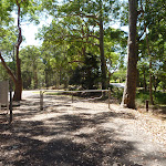
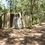

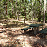


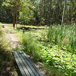


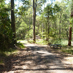

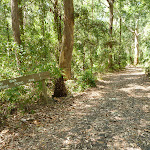

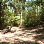

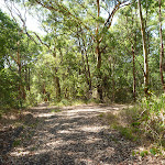
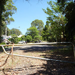
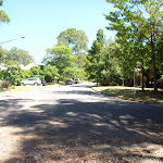


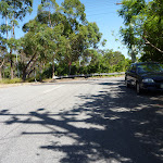

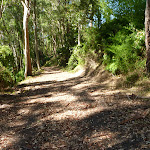


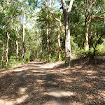


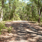

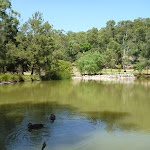
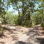
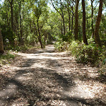

Blackbutt Reserve
Blackbutt Reserve, near Newcastle, occupies over 182 hectares of land and provides visitors with the chance to enjoy nature trails[1], wildlife exhibits[2][3], children’s playgrounds[4] and recreational facilities. The reserve is the perfect place for a relaxing family picnic or to explore on a bushwalk. Native wildlife, such as the Powerful Owl and the Grey-headed flying fox[5] can be seen within the park. There is an information cottage[6] at Carnley Avenue, which is open 7am to 5pm, or 7am to 7pm during daylight savings. The reserve has car parking at Carnley Avenue, Richley Reserve, Lookout Road and Mahonoy Drive. For more information, phone 02 4904 3344.
Mahognay Picnic Area (Queens St)
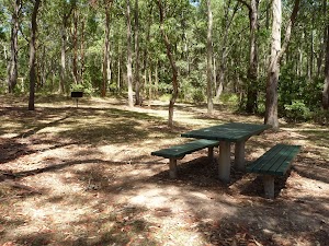
(0km) Mahognay Picnic Area (Queens St) → Int of Forest Way Walk & Mahogany Drive Trail
70 m
1 mins
3m
-1m
Moderate track
From the Mahogany Picnic Area[11][12] (on Queens Rd, New Lambton), this walk passes around the locked gate[13] and follows the gently uphill trail for about 70m (with picnic tables on the right), until coming to toilets[14] (on the left) and a three-way intersection[15][16], with two ‘Forest Way Walk’ signs directly ahead.
(0.07km) Int of Forest Way Walk & Mahogany Drive Trail → Lily Pond Picnic Area
300 m
6 mins
1m
-14m
Moderate track
Turn right: From the intersection[17][18], this walk follows the ‘Forest Way Walk’ sign[19] and trail gently downhill, while initially keeping the toilets[20] on your right and the sign on your left. This walk continues for about 45m to find a picnic table[21] (on the right). Then this walk continues through forest[22][23] for about 260m, until coming to Lily Pond Picnic Area[24][25][26][27].
Lily Pond Picnic Area
The Lily Pond picnic area in Blackbutt Reserve feels like a small, watery oasis surrounded by eucalyptus forest[28]. There is an attractive tropical water lily pond[29] with a healthy cover of Nymphaea[30], which is particularly beautiful when flowering. Also at this picnic area are bench seats[31], picnic tables[32], small grassed areas[33] and an elevated timber barbecue[34].
(0.37km) Lily Pond Picnic Area → Int of Forest Way & Bower Bird Creek Trails
500 m
10 mins
26m
-8m
Moderate track
Continue straight: From the Lily Pond Picnic Area[35][36][37], this walk follows the trail gently uphill, while initially keeping the ‘Lily Pond Picnic Area’ sign on your left. This walk continues for about 170m, to find a three-way intersection[38] with a faint track (on the left) and a ‘Forest Way Walk’ sign[39] (on the right). Then this walk continues straight ahead through forest for about 30m to cross a bridge over a dry rocky creek[40][41]. This walk then continues for about 280m, with houses visible[42] on the left, until coming to a T-intersection[43][44] with a level trail and two green metal posts[45] directly ahead.
(0.87km) Int of Forest Way & Bower Bird Creek Trails → End of Ridgeway Road (New Hampton Heights)
70 m
1 mins
7m
0m
Moderate track
Turn sharp left: From the intersection[46], this walk follows the trail gently uphill, while initially keeping the two green metal posts[47] on your right. This walk continues through forest for about 60m, until passing around a locked metal gate[48] and coming to the end of Ridgeway Road[49][50] (amongst houses).
(0.94km) End of Ridgeway Road → Int of Lookout Road & Forest Way
760 m
14 mins
45m
-3m
Moderate track
Continue straight: From the end of Ridgeway Rd[51][52] (in New Lampton Heights), this walk follows Ridgeway Rd gently uphill, while leaving the locked gate[53] and ‘Blackbutt Reserve – Ridgeway Rd Entrance’ sign directly behind. This walk continues for about 250m, beside houses[54], to find a four-way intersection[55], with Croudace Rd. Then this walk continues straight ahead for about 400m, until coming to a level section of road as Ridgeway Road[56][57] bends sharply right[58] (there is a water tower[59] in a park on the left). This walk turns left and follows the footpath (while keeping the water tank on your left) next to Lookout Rd for about 100m, until coming to a three-way intersection[60][61] with a wide track and ‘Blackbutt Reserve – Ridgeway Rd Entrance’ sign[62] on the left.
(1.69km) Int of Lookout Road AND Forest Way → Int of Tall Trees AND Forest Way Walks
250 m
6 mins
0m
-26m
Easy track
Veer left: From the intersection[63][64](Lookout Rd, New Lambton Heights), this walk follows the track gently downhill, while passing the ‘Blackbutt Reserve – Forest Way Entrance’ sign[65] (on your left) and keeping Lookout Road on your right. After about 20m, the walk passes around a locked metal gate[66]. Then this walk continues through forest for about 240m, with houses[67] visible on the right, until coming to a three-way intersection[68] with a trail and ‘Forest Way Walk’ sign[69][70] on the right.
(1.94km) Int of Tall Trees and Forest Way Walks → Int of Forest Way & Tall Trees Walks
310 m
7 mins
0m
-21m
Easy track
Turn left: From the intersection[71], this walk follows the ‘Tall Trees Walk to Richley Carpark’ sign[72] gently downhill, while keeping the gently uphill trail on the left. This walk continues through forest for about 300m until coming to a three-way intersection[73], with a ‘Tall Trees Walk to Carnley Ave Carpark’ sign[74] (on the left) and a trail (on the right).
(2.25km) Int of Forest Way AND Tall Trees Walks → Richley Reserve (Four Way Intersection)
420 m
7 mins
1m
-17m
Moderate track
Veer right: From the intersection[75], this walk follows the ‘Richley Carpark’ sign[76] and sealed trail gently downhill, while keeping the sign directly behind you. This walk continues through attractive forest[77] (ignoring side tracks[78]) for about 300m, until coming to a four-way intersection[79][80], with a large attractive pond[81] directly ahead.
Continue straight: From the intersection[82][83], this walk follows the trail gently downhill between the two large ponds[84], while keeping the timber post with chain[85] attached directly behind you. This walk follows the trail for about 80m, crossing a timber footbridge[86], until coming to a four-way intersection[87], with a children’s playground[88] ahead (on the left). At the end of this side trip, retrace your steps back to the main walk then Turn right.
Continue straight: From the intersection[82][83], this walk follows the trail gently downhill between the two large ponds[84], while keeping the timber post with chain[85] attached directly behind you. This walk follows the trail for about 80m, crossing a timber footbridge[86], until coming to a four-way intersection[87], with a children’s playground[88] ahead (on the left). At the end of this side trip, retrace your steps back to the main walk then Turn right.
Richley Reserve
The Richley Reserve, within Blackbutt Reserve, has a park office[89], large pond areas[90] with swans (beware the swans[91] as they defend their territory), sheltered picnic tables[92], water taps[93], toilets[94], open grassed areas[95], a children’s playground[96], electric barbecues[97] and a car park[98]. The Richley Reserve car park has disability friendly parking and is open from 7am to 5pm or 7am to 7pm during daylight savings. For further information phone 02 4904 3344.
(2.25km) Int of Forest Way & Tall Trees Walks → Int of Forest Way Walk & Mahogany Drive Trail
380 m
7 mins
8m
-14m
Very easy
Continue straight: From the intersection[99], this walk follows the sealed trail gently downhill, while initially keeping the ‘Tall Trees Walk to Carnley Ave Carpark’ sign[100] on your left. This walk continues through forest for about 180m, to find an open picnic area[101] (on the right). Then this walk continues straight ahead for about 210m until coming to a three-way intersection[102][103], with a ‘Forest Way Walk’ sign (on the left) and a toilet[104] (on the right ahead).
(2.63km) Int of Forest Way Walk & Mahogany Drive Trail → Mahognay Picnic Area (Queens St)
70 m
1 mins
1m
-3m
Moderate track
Continue straight: From the intersection[105][106], this walk follows the trail gently downhill, while moving directly away from both ‘Forest Way Walk’ signs[107] and initially keeping the toilets[108][109] on your right. This walk continues for about 70m, (with picnic tables[110] on the left), until passing around a locked gate[111] and coming to the Mahogany Car Park and Picnic Area[112].
Maps for the Forestway Circuit Walk walk
You can download the PDF for this walk to print a map.
These maps below cover the walk and the wider area around the walk, they are worth carrying for safety reasons.
| Wallsend | 1:25 000 Map Series | 92323S WALLSEND | NSW-92323S |
| Newcastle | 1:100 000 Map Series | 9232 NEWCASTLE | 9232 |
Cross sectional view of the Forestway Circuit Walk bushwalking track
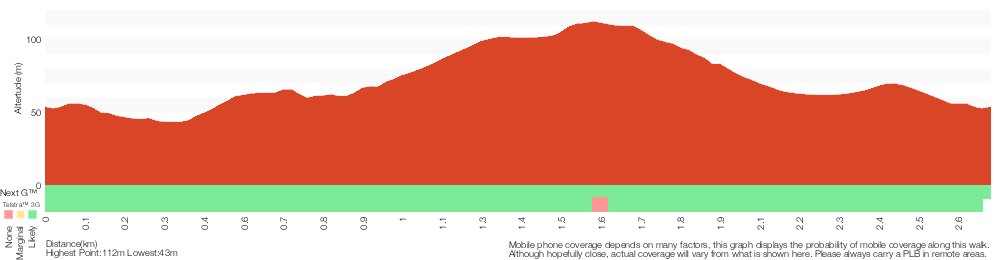
Analysis and summary of the altitude variation on the Forestway Circuit Walk
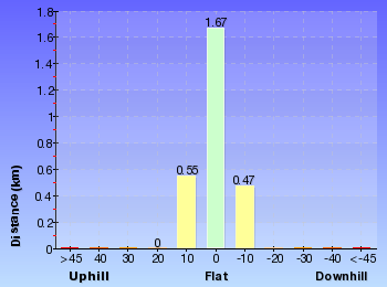
Overview of this walks grade – based on the AS 2156.1 – 2001
Under this standard, a walk is graded based on the most difficult section of the walk.
| Length | 2.7 km | ||
| Time | 1 Hr | ||
| . | |||
| Grade 3/6 Moderate track |
AS 2156.1 | Gradient | Gentle hills with occasional steps (2/6) |
| Quality of track | Clear and well formed track or trail (2/6) | ||
| Signs | Directional signs along the way (3/6) | ||
| Experience Required | No experience required (1/6) | ||
| Weather | Weather generally has little impact on safety (1/6) | ||
| Infrastructure | Generally useful facilities (such as fenced cliffs and seats) (1/6) |
Some more details of this walks Grading
Here is a bit more details explaining grading looking at sections of the walk
Gradient
Around 2.1km of this walk is flat with no steps, whilst the remaining 560m has gentle hills with occasional steps.
Quality of track
Around 2.2km of this walk follows a smooth and hardened path, whilst the remaining 500m follows a clear and well formed track or trail.
Signs
Around 1.8km of this walk has directional signs at most intersection, whilst the remaining 930m is clearly signposted.
Experience Required
This whole walk, 2.7km requires no previous bushwalking experience.
weather
This whole walk, 2.7km is not usually affected by severe weather events (that would unexpectedly impact safety and navigation).
Infrastructure
This whole walk, 2.7km is close to useful facilities (such as fenced cliffs and seats).
Similar walks
A list of walks that share part of the track with the Forestway Circuit Walk walk.
2.8 km Circuit
1 hr 15 mins
Moderate track
6 km Circuit
2 hrs 30 mins
Moderate track
6.5 km Circuit
2 hrs 30 mins
Moderate track
Other Nearby walks
A list of walks that start near the Forestway Circuit Walk walk.
2.9 km Circuit
1 hr 15 mins
Moderate track
731 m Circuit
30 mins
Very easy
2.1 km Circuit
1 Hr
Moderate track
1.9 km Circuit
1 Hr
Moderate track
2.5 km Circuit
1 Hr
Moderate track
2 km Circuit
1 Hr
Moderate track
480 m Circuit
15 mins
Very easy
1.3 km Return
40 mins
Easy track
7.9 km One way
2 hrs 45 mins
Hard track
12.1 km One way
5 hrs 30 mins
Hard track
4.4 km One way
1 hr 30 mins
Moderate track
1.9 km One way
45 mins
Hard track
Plan your trip to and from the walk here
The Forestway Circuit Walk walk starts and ends at the Mahognay Picnic Area (Queens St) (gps: -32.930167, 151.70397)
Your transport options to Mahognay Picnic Area (Queens St) are by;
![]() Bus. (get details)
Bus. (get details)
![]() Car. There is free parking available.
Car. There is free parking available.
(get details)
Short URL = http://wild.tl/fcw
Gallery images
There are other downloads I am still working on.
You will probably need to login to access these — still all free.
* KML (google earth file)
* GPX (GPS file)
Special Maps/ brochures
* A3 topo maps
* PDF with Lands Topo map base
* PDF with arial image (and map overlay)
I wanted to get the main site live first, this extra stuff will come in time.
Happy walking
Matt 🙂
Tall Trees Circuit Walk
And Walk
Tall Trees Circuit Walk

1 hr 15 mins
2.8 km Circuit
90 m
Moderate track
This walk circumnavigates Coal Mine Creek on good trails. The walk starts and finishes at Richley Reserve, which has excellent picnic facilities combined with a lovely outlook over large ponds. The well established eucalyptus forest that this walk travels through surrounds you as you walk along these trail. This is a good walk which is made all the more pleasant by using the excellent facilities of Richley Reserve in Blackbutt Reserve.


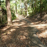

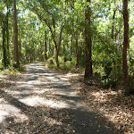

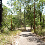

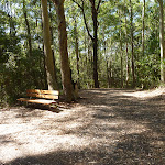


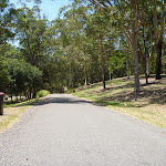


Blackbutt Reserve
Blackbutt Reserve, near Newcastle, occupies over 182 hectares of land and provides visitors with the chance to enjoy nature trails[1], wildlife exhibits[2][3], children’s playgrounds[4] and recreational facilities. The reserve is the perfect place for a relaxing family picnic or to explore on a bushwalk. Native wildlife, such as the Powerful Owl and the Grey-headed flying fox[5] can be seen within the park. There is an information cottage[6] at Carnley Avenue, which is open 7am to 5pm, or 7am to 7pm during daylight savings. The reserve has car parking at Carnley Avenue, Richley Reserve, Lookout Road and Mahonoy Drive. For more information, phone 02 4904 3344.
Richley Reserve
The Richley Reserve, within Blackbutt Reserve, has a park office[7], large pond areas[8] with swans (beware the swans[9] as they defend their territory), sheltered picnic tables[10], water taps[11], toilets[12], open grassed areas[13], a children’s playground[14], electric barbecues[15] and a car park[16]. The Richley Reserve car park has disability friendly parking and is open from 7am to 5pm or 7am to 7pm during daylight savings. For further information phone 02 4904 3344.
(0km) Richley Reserve (Car Park) → Richley Reserve (Ponds end)
140 m
3 mins
8m
0m
Very easy
From the Richley Reserve Car Park[17] (Freybery St, New Lambton), this walk follows the ‘Tall Tree Ridge Walk’ sign[18][19] and sealed trail gently uphill, while keeping the sheltered picnic table and large pond on your left. This walk continues through forest, with a pond on your left, for about 140m until coming to a four-way intersection[20], with a timber post[21] with chain attached (on the right) and another large pond[22] (on your left and ahead).
(0.14km) Richley Reserve (Ponds end) → Int of Forest Way AND Tall Trees Walks
340 m
6 mins
14m
-1m
Moderate track
Turn right: From the intersection[23][24], this walk follows the sealed trail gently uphill, while initially keeping the timber post with chain[25] attached on your right and keeping the large pond[26] directly behind. This walk continues through attractive forest[27] (ignoring side tracks[28]) for about 300m, until coming to a level T-intersection[29][30], with a ‘Richley Carpark’ sign[31] directly ahead.
(0.48km) Int of Forest Way & Tall Trees Walks → Tall Trees Walk & Lookout Road Trails
600 m
13 mins
47m
-5m
Easy track
Veer left: From the intersection[32], this walk follows the ‘Tall Trees Walk to Carnley Ave Carpark’ sign[33] and sealed trail gently uphill. This walk continues through forest for about 300m until coming to a three-way intersection[34], with a ‘Tall Tree Ridge Walk’ sign[35] directly ahead.
Continue straight: From the intersection[36], this walk follows the ‘Tall Tree Ridge Walk’ sign[37] and sealed trail gently downhill, while keeping the valley on the left. This walk continues, undulating through thick forest[38] for about 290m until coming to a three-way intersection[39], with a ‘Tall Trees Walk to Richley Carpark’ sign[40] directly ahead.
Continue straight: From the intersection[36], this walk follows the ‘Tall Tree Ridge Walk’ sign[37] and sealed trail gently downhill, while keeping the valley on the left. This walk continues, undulating through thick forest[38] for about 290m until coming to a three-way intersection[39], with a ‘Tall Trees Walk to Richley Carpark’ sign[40] directly ahead.
(1.08km) Main Ridge & Lookout Road Trails → Int of Main Ridge & Tall Trees Walks
350 m
7 mins
7m
-11m
Very easy
Turn left: From the intersection[41], this walk follows the ‘Tall Trees Walk to Carnley Ave Carpark’ sign[42] gently downhill, while keeping the valley on your right. This walk continues, undulating through forest for about 400m until coming to a level three-way intersection[43][44], with a ‘Tall Trees Walk to Richley Carpark’ sign[45] (on the left) and a sealed trail (on the right).
(1.43km) Int of Main Ridge & Tall Trees Walks → Int of Carnley & Tall Trees Trails
710 m
14 mins
2m
-34m
Easy track
Continue straight: From the intersection[46][47], this walk follows the ‘Main Ridge Walk to Carnley Ave Carpark’ sign[48] and sealed trail gently uphill, while keeping the sealed gently downhill trail on your right. This walk continues through forest on a ridge for about 70m, to find an open gravel area[49][50] (on the left). Then this walk continues straight ahead, undulating for about 600m, until coming to a four-way intersection[51][52], with a ‘Main Ridge Walk (loop)’ sign[53] (on the left).
(2.14km) Int of Main Ridge & Tall Trees Walks → Richley Reserve (Short Cut Intersection)
190 m
4 mins
0m
-25m
Moderate track
Turn left : From the intersection[54], this walk passes around a metal post[55] and follows the ‘Richley Carpark 400m’ sign[56] and sealed footpath gently downhill, while leaving the bench seat[57] directly behind. This walk continues through forest for about 140m, to pass around a metal post[58] and find a large grassy picnic area[59][60]. Then this walk continues straight ahead over grass and through some trees for about 70m, until coming to a sealed trail[61][62][63] (with the valley beyond).
(2.34km) Richley Reserve (Short Cut Intersection) → Richley Reserve (Car Park)
290 m
6 mins
6m
-9m
Very easy
Turn right: From the trail[64][65] below the large elevated grassed picnic area[66], this walk follows the trail gently downhill, while keeping the valley on your left. This walk continues through grassed parkland[67] for about 120m, until coming to a three-way intersection[68] with a sealed trail and a ‘Tall Tree Walk (loop)’ sign[69] (on the right).
Turn left: From the intersection[70][71], this walk follows the sealed trail gently downhill, keeping the ‘Tall Tree Walk (loop)’ sign[72] directly behind you while walking towards the road and car park. This walk continues for about 45m, passing through a metal gate[73] to find a three-way intersection, with a road[74] on the right and the car park[75] on the left. Then this walk turns left and follows the car park gently uphill for about 150m, until coming to a ‘Tall Tree Ridge Walk’ sign[76] and sheltered picnic tables[77][78] ahead.
Turn left: From the intersection[70][71], this walk follows the sealed trail gently downhill, keeping the ‘Tall Tree Walk (loop)’ sign[72] directly behind you while walking towards the road and car park. This walk continues for about 45m, passing through a metal gate[73] to find a three-way intersection, with a road[74] on the right and the car park[75] on the left. Then this walk turns left and follows the car park gently uphill for about 150m, until coming to a ‘Tall Tree Ridge Walk’ sign[76] and sheltered picnic tables[77][78] ahead.
(2.34km) Richley Reserve (Short Cut Intersection) → Richley Reserve (Four Way Intersection)
260 m
5 mins
10m
-8m
Very easy
Turn left: From the trail[79][80] below the large elevated grassed picnic area, this walk follows the gently downhill trail west, while keeping the valley on your right. This walk continues for about 120m to find a sheltered picnic area[81] (on the right). Then this walk continues straight ahead and gently uphill for about 160m, becoming gently downhill and passing timber steps[82] (on the left) and a toilet block (on the right), until coming to a four-way intersection[83], with a playground[84] on the right and a timber footbridge[85] directly ahead.
(2.59km) Richley Reseve (four way intersection) → Richley Reserve (car park)
180 m
3 mins
2m
-7m
Very easy
Turn right: From the intersection[86], this walk follows the footpath[87] gently downhill, while initially keeping the timber footbridge[88] on your left. This walk continues for about 180m, beside a pond[89] (on your left), until coming to a car park[90] with a sheltered picnic table[91] and ‘Tall Tree Ridge Walk’ sign[92] (on the left).
Maps for the Tall Trees Circuit Walk walk
You can download the PDF for this walk to print a map.
These maps below cover the walk and the wider area around the walk, they are worth carrying for safety reasons.
| Wallsend | 1:25 000 Map Series | 92323S WALLSEND | NSW-92323S |
| Newcastle | 1:100 000 Map Series | 9232 NEWCASTLE | 9232 |
Cross sectional view of the Tall Trees Circuit Walk bushwalking track
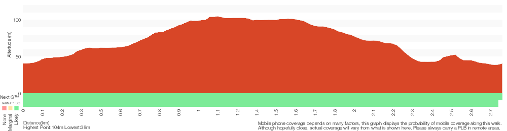
Analysis and summary of the altitude variation on the Tall Trees Circuit Walk
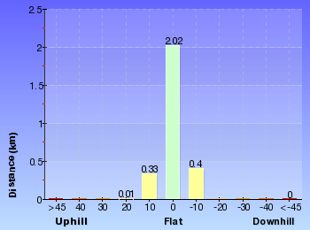
Overview of this walks grade – based on the AS 2156.1 – 2001
Under this standard, a walk is graded based on the most difficult section of the walk.
| Length | 2.8 km | ||
| Time | 1 hr 15 mins | ||
| . | |||
| Grade 3/6 Moderate track |
AS 2156.1 | Gradient | Gentle hills with occasional steps (2/6) |
| Quality of track | Clear and well formed track or trail (2/6) | ||
| Signs | Directional signs along the way (3/6) | ||
| Experience Required | No experience required (1/6) | ||
| Weather | Weather generally has little impact on safety (1/6) | ||
| Infrastructure | Generally useful facilities (such as fenced cliffs and seats) (1/6) |
Some more details of this walks Grading
Here is a bit more details explaining grading looking at sections of the walk
Gradient
Around 1.4km of this walk is flat with no steps, whilst the remaining 1.4km has gentle hills with occasional steps.
Quality of track
Around 2.1km of this walk follows a smooth and hardened path, whilst the remaining 710m follows a clear and well formed track or trail.
Signs
Around 2.2km of this walk is clearly signposted, whilst the remaining 530m has directional signs at most intersection.
Experience Required
This whole walk, 2.8km requires no previous bushwalking experience.
weather
This whole walk, 2.8km is not usually affected by severe weather events (that would unexpectedly impact safety and navigation).
Infrastructure
This whole walk, 2.8km is close to useful facilities (such as fenced cliffs and seats).
Similar walks
A list of walks that share part of the track with the Tall Trees Circuit Walk walk.
731 m Circuit
30 mins
Very easy
2.5 km Circuit
1 Hr
Moderate track
2.7 km Circuit
1 Hr
Moderate track
2.9 km Circuit
1 hr 15 mins
Moderate track
6 km Circuit
2 hrs 30 mins
Moderate track
6.5 km Circuit
2 hrs 30 mins
Moderate track
Other Nearby walks
A list of walks that start near the Tall Trees Circuit Walk walk.
2.1 km Circuit
1 Hr
Moderate track
1.9 km Circuit
1 Hr
Moderate track
2 km Circuit
1 Hr
Moderate track
480 m Circuit
15 mins
Very easy
7.9 km One way
2 hrs 45 mins
Hard track
12.1 km One way
5 hrs 30 mins
Hard track
1.3 km Return
40 mins
Easy track
4.4 km One way
1 hr 30 mins
Moderate track
1.9 km One way
45 mins
Hard track
948 m Return
30 mins
Hard track
13.3 km One way
4 hrs 30 mins
Moderate track
25.7 km One way
2 Days
Hard track
Plan your trip to and from the walk here
The Tall Trees Circuit Walk walk starts and ends at the Richley Reserve (Car Park) (gps: -32.932399, 151.70001)
Your transport options to Richley Reserve (Car Park) are by;
![]() Bus. (get details)
Bus. (get details)
![]() Car. There is free parking available.
Car. There is free parking available.
(get details)
Short URL = http://wild.tl/ttcw
Gallery images
There are other downloads I am still working on.
You will probably need to login to access these — still all free.
* KML (google earth file)
* GPX (GPS file)
Special Maps/ brochures
* A3 topo maps
* PDF with Lands Topo map base
* PDF with arial image (and map overlay)
I wanted to get the main site live first, this extra stuff will come in time.
Happy walking
Matt 🙂
Richley Reserve to Carnley Reserve Circuit

1 hr 15 mins
2.9 km Circuit
96 m
Moderate track
A great family length walk that takes in both of the large reserves in the Blackbutt Park. This walk starts at Richley Reserve and travels to Carnley Reserve and the Wildlife Exhibits before returning a different way to Richley Reserve. Never far from facilities, this walk suits families or those who want to stay on the wider trails. An excellent walk.


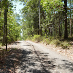
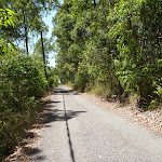


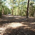
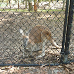

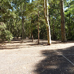

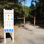


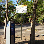

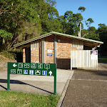

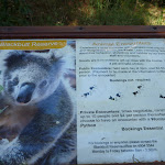


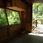
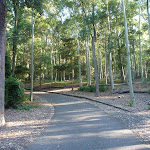
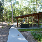

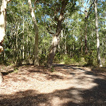
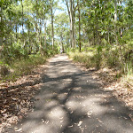
Blackbutt Reserve
Blackbutt Reserve, near Newcastle, occupies over 182 hectares of land and provides visitors with the chance to enjoy nature trails[1], wildlife exhibits[2][3], children’s playgrounds[4] and recreational facilities. The reserve is the perfect place for a relaxing family picnic or to explore on a bushwalk. Native wildlife, such as the Powerful Owl and the Grey-headed flying fox[5] can be seen within the park. There is an information cottage[6] at Carnley Avenue, which is open 7am to 5pm, or 7am to 7pm during daylight savings. The reserve has car parking at Carnley Avenue, Richley Reserve, Lookout Road and Mahonoy Drive. For more information, phone 02 4904 3344.
Richley Reserve
The Richley Reserve, within Blackbutt Reserve, has a park office[7], large pond areas[8] with swans (beware the swans[9] as they defend their territory), sheltered picnic tables[10], water taps[11], toilets[12], open grassed areas[13], a children’s playground[14], electric barbecues[15] and a car park[16]. The Richley Reserve car park has disability friendly parking and is open from 7am to 5pm or 7am to 7pm during daylight savings. For further information phone 02 4904 3344.
(0km) Richley Reserve (Car Park) → Int of Richley Reserve & Tall Tree Walk (loop)
200 m
4 mins
5m
-6m
Very easy
From the Richley Reserve (Car Park)[17], this walk follows the car park gently downhill, while leaving the ponds directly behind you. This walk continues for about 150m, to find a three-way intersection[18][19], with a metal gate and ‘Blackbutt Reserve – Freyberg St Entrance’ sign[20] (on the right). This walk turns right and continues gently uphill for about 45m, passing through the metal gate, until coming to a three-way intersection[21] with a sealed trail and ‘Tall Tree Walk (loop)’ sign[22] (on the left).
(0.2km) Int of Richley Reserve & Tall Tree Walk (loop) → Int of Main Ridge AND Tall Trees Walks
660 m
13 mins
32m
-3m
Easy track
Veer left: From the intersection[23][24], this walk follows the ‘Wildlife Exhibit’ sign[25] and trail gently uphill, while keeping the valley on your left. This walk continues through forest[26] for about 300m, until coming to a faint three-way intersection[27] with a track on the left (houses[28] visible on the left) at a right-hand turn in the trail.
Turn right: From the intersection[29][30], this walk follows the trail gently uphill[31], while leaving Dunkley Ave and the houses[32][33] directly behind. This walk continues through attractive forest[34] for about 400m until coming to a four-way intersection[35], with a ‘Main Ridge Walk (loop) sign[36] (on the right) and a timber seat[37].
Turn right: From the intersection[29][30], this walk follows the trail gently uphill[31], while leaving Dunkley Ave and the houses[32][33] directly behind. This walk continues through attractive forest[34] for about 400m until coming to a four-way intersection[35], with a ‘Main Ridge Walk (loop) sign[36] (on the right) and a timber seat[37].
(0.85km) Int of Carnley & Tall Trees Trails → Carlney Ave Car Park (Eastern end)
270 m
7 mins
0m
-28m
Moderate track
Turn left: From the intersection[38][39], this walk follows the trail gently downhill[40], while moving directly away from the face of the ‘Richley Car Park’ sign[41] and keeping the valley on the left. This walk continues, undulating for about 170m until coming to a three-way intersection[42], with a trail and metal ring fence[43] (on the left).
Veer left: From the intersection[44][45], this walk follows the trail gently downhill, while keeping the metal ring fence on your right. This walk continues for about 60m, until passing around a locked metal gate[46][47] and coming to the end of the metal ring fence and the Carnley Avenue car park[48][49].
Veer left: From the intersection[44][45], this walk follows the trail gently downhill, while keeping the metal ring fence on your right. This walk continues for about 60m, until passing around a locked metal gate[46][47] and coming to the end of the metal ring fence and the Carnley Avenue car park[48][49].
(1.13km) Carlney Ave Car Park (Eastern end) → Carnley Ave Car Park (western end)
140 m
2 mins
2m
-2m
Very easy
Veer right: From the intersection[50], this walk follows the road gently downhill through the car park, while leaving the metal ring fence[51] and locked metal gate directly behind. This walk continues for about 60m, turning right (leaving Carnley Avenue on the left in the distance). Then this walk continues for about 40m, to come to a three-way intersection, with a footpath and ‘Blackbutt Reserve – Carnley Ave Car Park’ sign[52] on the right. This walk then continues straight ahead for about 50m, crossing a bridge over Black Duck Creek[53] and then continuing gently uphill for about 50m, until coming to a three-way intersection[54][55] with a footpath and ‘Blackbutt Reserve – Carnley Ave Entrance’ sign[56] (on the right).
Carnley Ave Reserve
The Carnley Avenue Reserve, within Blackbutt Reserve, is wheelchair accessible and has toilets[57], drinking fountains[58], gas/electric barbeques[59], sheltered picnic tables[60], a children’s playground[61], fenced displays of kangaroos and emu[62], a large black duck pond[63] and an information centre[64] that is housed within a replica pioneering cottage. The information cottage has a range of souvenirs, focusing on quality and affordable products. A fee of $4 per vehicle can be paid from the automatic machines[65] in the car park. The information centre is open 7am to 5pm, or 7am to 7pm during daylight savings. For further information phone: 02 4904 3344.
(1.26km) Carnley Ave Car Park → Int of Boardwalk & Carnley Trail
110 m
2 mins
4m
0m
Easy track
Turn right: From the Carnley Ave Car Park[66][67] (Off Carnley Ave, Kotara), this walk follows the footpath through the metal fenced gate way[68], while initially keeping the ‘Blackbutt Reserve – Carnley Ave Reserve’ sign[69] on your left. This walk follows the footpath for about 90m (passing toilets[70], picnic tables and a children’s playground[71] on the left), until coming to a four-way intersection[72], with Black Duck Pond[73] directly ahead and a replica pioneering cottage on the left.
Turn left: From the intersection[74], this walk follows the ‘Animal’ sign[75] and sealed trail gently uphill, while initially passing the replica pioneering cottage[76][77] on the right. This walk continues for about 20m until coming to a three-way intersection[78], with a large timber fenced gate[79] (on the right).
Turn left: From the intersection[74], this walk follows the ‘Animal’ sign[75] and sealed trail gently uphill, while initially passing the replica pioneering cottage[76][77] on the right. This walk continues for about 20m until coming to a three-way intersection[78], with a large timber fenced gate[79] (on the right).
(1.37km) Int of Boardwalk & Carnley Trail → Int of Boardwalk & Main Ridge Trail
100 m
2 mins
2m
-2m
Very easy
Turn left: From the intersection[80][81], this walk follows the sealed trail gently uphill, while initially passing the large timber fenced gate[82] on the right and keeping the valley on the left. This walk continues for about 90m, passing an ‘Animals’ sign[83] and ‘Information’ sign (on the right) and concrete stairs (on the left), until coming to a four-way intersection[84], with an ‘Animals’ sign and elevated boardwalk[85] (on the right) and disabled parking[86] and general car parking (on the left).
Blackbutt Wildlife Exhibits
This boardwalk in the Blackbutt Reserve offers wildlife exhibits[87] on an elevated timber boardwalk which is wheelchair accessible. Some of the wildlife that you are likely to encounter are kangaroos, koalas[88], wombats[89], Lace monitors[90], Wonga Pigeons, Red-winged Parrots, Black-winged Stilt[91], Buff-banded Rail, Herons[92], Eastern long-necked Turtle, Kingfishers[93], Turquoise Parrot, Banded Plover, Peaceful Dove[94], Cockatoos, Lorikeets, True Parrots, Major Mitchell Cockatoo, Bush Stone Curlew, Long-tailed Finch and Barking Owls[95]. Entry is free and the exhibit is open from 9.00am to 5.00pm every day (closed Christmas Day, Good Friday and until 1pm ANZAC Day). Personal koala encounters[96] are available at 2pm daily and cost $3.50/person. For further information, phone: 02 4904 3344. More info.
(1.47km) Int of Boardwalk & Main Ridge Trail → Int of Boardwalk & Carnley Trail
380 m
8 mins
12m
-13m
Very easy
Turn right: From the intersection[97][98][99], this walk follows the ‘Animals’ sign[100] and timber boardwalk gently uphill, while initially keeping the car park[101] on the right. This walk continues, undulating for about 300m on an elevated boardwalk[102] through large and small animal enclosures[103][104], with a fascinating selection of native animals[105][106] and birds[107][108][109]. Then this walk continues on a sealed footpath for about 70m, until passing through a high timber fenced gate and coming to a three-way intersection, with a sealed trail[110] (on the left towards the pond[111]) and a trail[112] directly ahead.
(1.85km) Int of Boardwalk & Carnley Trail → Carnley Avenue Reserve
20 m
0m
-2m
Very easy
Turn left: From the intersection[113], this walk follows the sealed trail[114] gently downhill and towards the Black Duck Pond[115], while initially keeping the large timber fenced gate[116] on your left. This walk continues for about 20m until coming to a four-way intersection[117], with the replica pioneering cottage[118][119], Black Duck Pond and a ‘Richley Reserve’ sign[120] (on the left).
(1.87km) Carnley Avenue Reserve → Int of Blueberry Ash Walk & Carnley Trail
130 m
2 mins
9m
-1m
Easy track
Continue straight: From the intersection[121][122], this walk follows the sealed road, while initially keeping the Black Duck Pond[123] on your left and the replica pioneering cottage[124][125] directly behind you. This walk continues, passing the Black Duck Pond (on the left) and continues gently uphill[126] for about 150m (passing a sheltered picnic area[127] and children’s playground on the right) until coming to a three-way intersection[128] with a gravel trail (on the left), a metal ring fence (on the right) and a ‘Main Ridge Walk (loop)’ sign[129].
(2km) Int of Carnley Trail & Blueberry Ash Walk → Int of Carnley & Tall Trees Trails
310 m
6 mins
18m
0m
Moderate track
Veer right: From the intersection[130], this walk follows the ‘Main Ridge Walk (loop)’ sign[131] on your left and trail gently downhill. This walk continues through forest with a metal ring fence (on the left) for about 170m, until coming to a three-way intersection[132][133] with a gently downhill trail[134] (on the right) and the end of the metal ring fence.
Continue straight: From the intersection[135][136], this walk follows the gently downhill trail and moves directly away from the metal ring fence, while initially keeping the trail and fence[137] on your right. This walk continues, undulating for about 170m until coming to a three-way intersection[138][139], with a ‘Richley Car Park’ sign[140].
Continue straight: From the intersection[135][136], this walk follows the gently downhill trail and moves directly away from the metal ring fence, while initially keeping the trail and fence[137] on your right. This walk continues, undulating for about 170m until coming to a three-way intersection[138][139], with a ‘Richley Car Park’ sign[140].
(2.3km) Int of Main Ridge & Tall Trees Walks → Richley Reserve (Short Cut Intersection)
190 m
4 mins
0m
-25m
Moderate track
Continue straight: From the intersection[141], this walk passes around a metal post[142] and follows the ‘Richley Carpark 400m’ sign[143] and sealed footpath gently downhill, while leaving the bench seat[144] directly behind. This walk continues through forest for about 140m, to pass around a metal post[145] and find a large grassy picnic area[146][147]. Then this walk continues straight ahead over grass and through some trees for about 70m, until coming to a sealed trail[148][149][150] (with the valley beyond).
(2.49km) Richley Reserve (Short Cut Intersection) → Richley Reserve (car park)
440 m
8 mins
12m
-15m
Very easy
Turn left: From the trail[151][152] below the large elevated grassed picnic area, this walk follows the gently downhill trail west, while keeping the valley on your right. This walk continues for about 120m to find a sheltered picnic area[153] (on the right). Then this walk continues straight ahead and gently uphill for about 160m, becoming gently downhill and passing timber steps[154] (on the left) and a toilet block (on the right), until coming to a four-way intersection[155], with a playground[156] on the right and a timber footbridge[157] directly ahead.
Turn right: From the intersection[158], this walk follows the footpath[159] gently downhill, while initially keeping the timber footbridge[160] on your left. This walk continues for about 180m, beside a pond[161] (on your left), until coming to a car park[162] with a sheltered picnic table[163] and ‘Tall Tree Ridge Walk’ sign[164] (on the left).
Turn right: From the intersection[158], this walk follows the footpath[159] gently downhill, while initially keeping the timber footbridge[160] on your left. This walk continues for about 180m, beside a pond[161] (on your left), until coming to a car park[162] with a sheltered picnic table[163] and ‘Tall Tree Ridge Walk’ sign[164] (on the left).
Maps for the Richley Reserve to Carnley Reserve Circuit walk
You can download the PDF for this walk to print a map.
These maps below cover the walk and the wider area around the walk, they are worth carrying for safety reasons.
| Wallsend | 1:25 000 Map Series | 92323S WALLSEND | NSW-92323S |
| Newcastle | 1:100 000 Map Series | 9232 NEWCASTLE | 9232 |
Cross sectional view of the Richley Reserve to Carnley Reserve Circuit bushwalking track
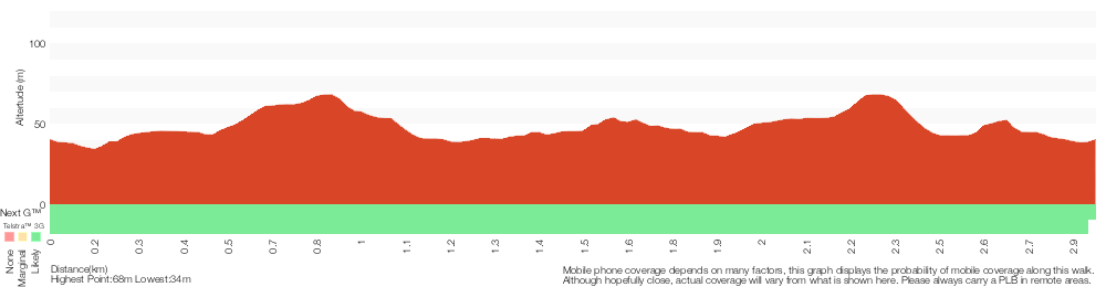
Analysis and summary of the altitude variation on the Richley Reserve to Carnley Reserve Circuit
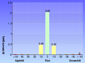
Overview of this walks grade – based on the AS 2156.1 – 2001
Under this standard, a walk is graded based on the most difficult section of the walk.
| Length | 2.9 km | ||
| Time | 1 hr 15 mins | ||
| . | |||
| Grade 3/6 Moderate track |
AS 2156.1 | Gradient | Gentle hills with occasional steps (2/6) |
| Quality of track | Smooth and hardened path (1/6) | ||
| Signs | Directional signs along the way (3/6) | ||
| Experience Required | No experience required (1/6) | ||
| Weather | Weather generally has little impact on safety (1/6) | ||
| Infrastructure | Generally useful facilities (such as fenced cliffs and seats) (1/6) |
Some more details of this walks Grading
Here is a bit more details explaining grading looking at sections of the walk
Gradient
Around 2.8km of this walk is flat with no steps, whilst the remaining 130m has gentle hills with occasional steps.
Quality of track
This whole walk, 2.9km follows a smooth and hardened path.
Signs
Around 2.2km of this walk is clearly signposted, whilst the remaining 770m has directional signs at most intersection.
Experience Required
This whole walk, 2.9km requires no previous bushwalking experience.
weather
This whole walk, 2.9km is not usually affected by severe weather events (that would unexpectedly impact safety and navigation).
Infrastructure
This whole walk, 2.9km is close to useful facilities (such as fenced cliffs and seats).
Similar walks
A list of walks that share part of the track with the Richley Reserve to Carnley Reserve Circuit walk.
480 m Circuit
15 mins
Very easy
731 m Circuit
30 mins
Very easy
2.1 km Circuit
1 Hr
Moderate track
2.5 km Circuit
1 Hr
Moderate track
2.8 km Circuit
1 hr 15 mins
Moderate track
6 km Circuit
2 hrs 30 mins
Moderate track
6.5 km Circuit
2 hrs 30 mins
Moderate track
Other Nearby walks
A list of walks that start near the Richley Reserve to Carnley Reserve Circuit walk.
2.7 km Circuit
1 Hr
Moderate track
1.9 km Circuit
1 Hr
Moderate track
2 km Circuit
1 Hr
Moderate track
7.9 km One way
2 hrs 45 mins
Hard track
12.1 km One way
5 hrs 30 mins
Hard track
1.3 km Return
40 mins
Easy track
4.4 km One way
1 hr 30 mins
Moderate track
1.9 km One way
45 mins
Hard track
948 m Return
30 mins
Hard track
13.3 km One way
4 hrs 30 mins
Moderate track
25.7 km One way
2 Days
Hard track
1.2 km Circuit
30 mins
Hard track
Plan your trip to and from the walk here
The Richley Reserve to Carnley Reserve Circuit walk starts and ends at the Richley Reserve (Car Park) (gps: -32.932399, 151.70001)
Your transport options to Richley Reserve (Car Park) are by;
![]() Bus. (get details)
Bus. (get details)
![]() Car. There is free parking available.
Car. There is free parking available.
(get details)
Short URL = http://wild.tl/rrtcrc
Gallery images
There are other downloads I am still working on.
You will probably need to login to access these — still all free.
* KML (google earth file)
* GPX (GPS file)
Special Maps/ brochures
* A3 topo maps
* PDF with Lands Topo map base
* PDF with arial image (and map overlay)
I wanted to get the main site live first, this extra stuff will come in time.
Happy walking
Matt 🙂
Comments