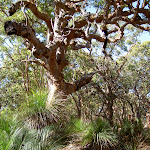
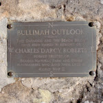
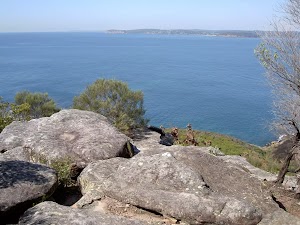
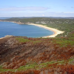
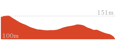
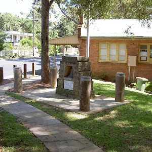
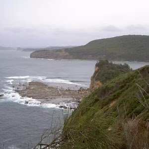
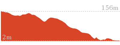
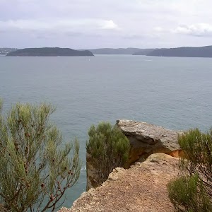
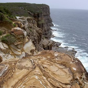
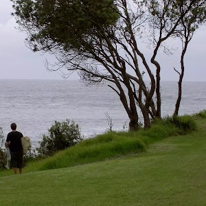
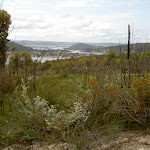
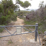
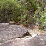
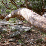
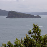
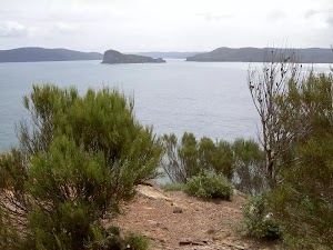
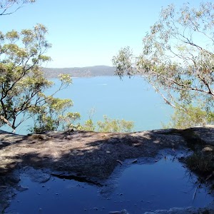
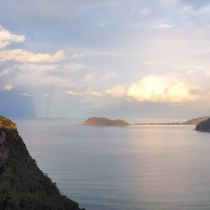
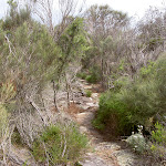
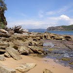
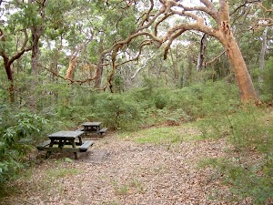
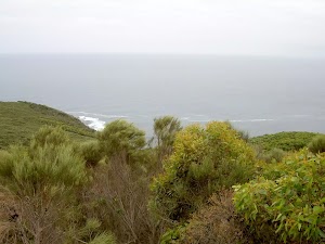
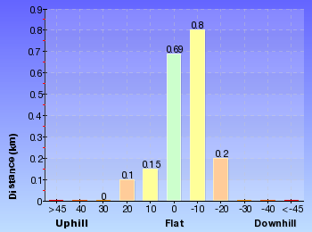
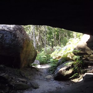
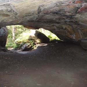
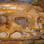
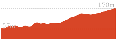
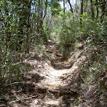
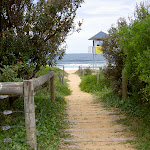
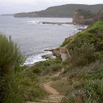
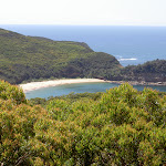
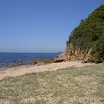
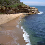
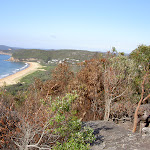
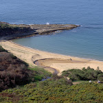
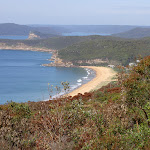
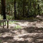
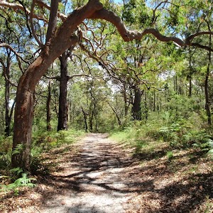
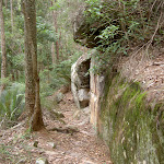
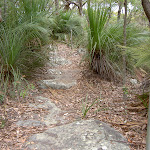
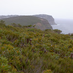
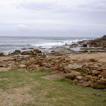
Bullimah Outlook
And Walk
Bullimah Outlook


1 hr 15 mins

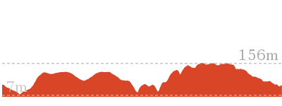
95 m
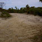
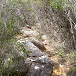
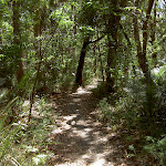
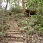
Moderate track
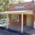


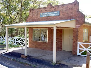
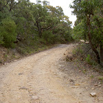
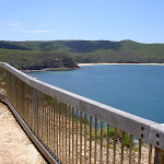
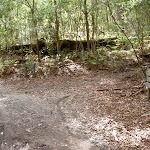
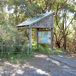
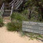
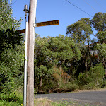
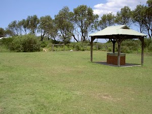
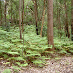
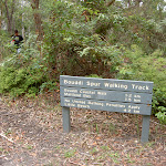
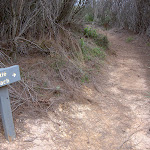
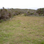
Maitland Bay Information Centre
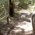
(0km) Maitland Bay Information Centre → Int. of Maitland Bay Info Centre Trk and Bullimah Lookout Trk

180 m
4 mins
1m
-17m
Moderate track
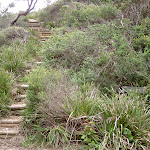
(0.18km) Int. of Maitland Bay Info Centre Trk and Bullimah Lookout Trk → Int. of Killcare Heights Lookout Trk and Bullimah Lookout Trk
350 m
7 mins
7m
-18m
Moderate track
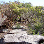
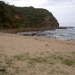
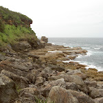
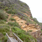
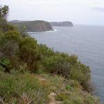
(0.53km) Int. of Killcare Heights Lookout Trk and Bullimah Lookout Trk → Bullimah Outlook
640 m
18 mins
13m
-39m
Moderate track
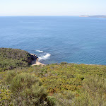
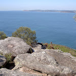
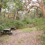
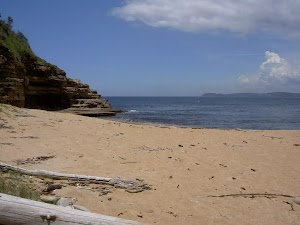
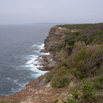
Bullimah Outlook
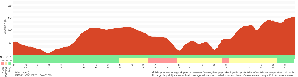
Maps for the Bullimah Outlook walk
You can download the PDF for this walk to print a map.
These maps below cover the walk and the wider area around the walk, they are worth carrying for safety reasons.
| Broken Bay | 1:25 000 Map Series | 91301N BROKEN BAY | NSW-91301N |
| Sydney | 1:100 000 Map Series | 9130 SYDNEY | 9130 |
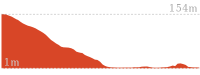
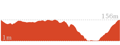
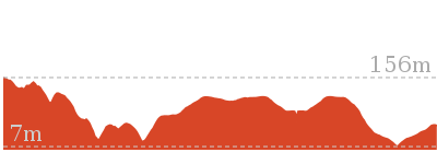
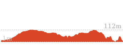
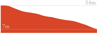
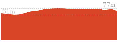
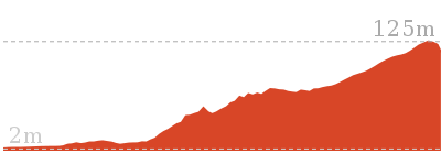
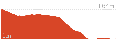
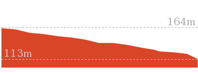
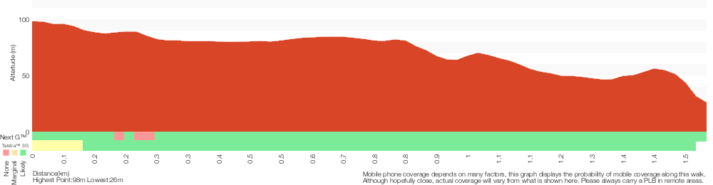
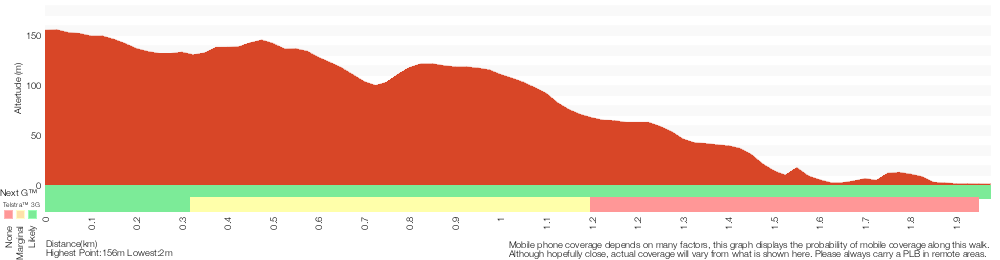
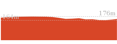
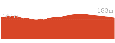
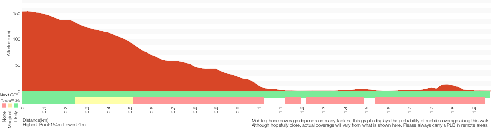
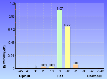
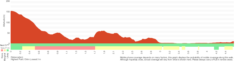
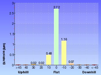
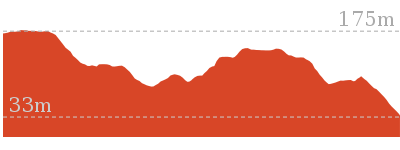
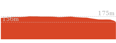
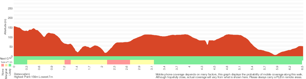
Cross sectional view of the Bullimah Outlook bushwalking track
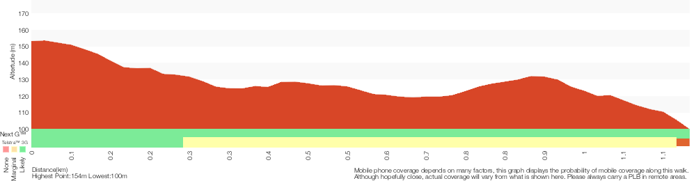
Analysis and summary of the altitude variation on the Bullimah Outlook
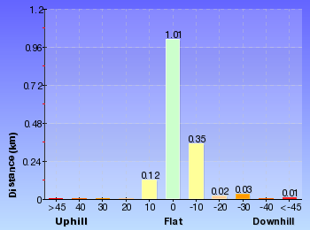
Overview of this walks grade – based on the AS 2156.1 – 2001
Under this standard, a walk is graded based on the most difficult section of the walk.
| Length | 2.3 km | ||
| Time | 1 hr 15 mins | ||
| . | |||
| Grade 3/6 Moderate track |
AS 2156.1 | Gradient | Short steep hills (3/6) |
| Quality of track | Formed track, with some branches and other obstacles (3/6) | ||
| Signs | Directional signs along the way (3/6) | ||
| Experience Required | No experience required (1/6) | ||
| Weather | Weather generally has little impact on safety (1/6) | ||
| Infrastructure | Limited facilities, not all cliffs are fenced (3/6) |
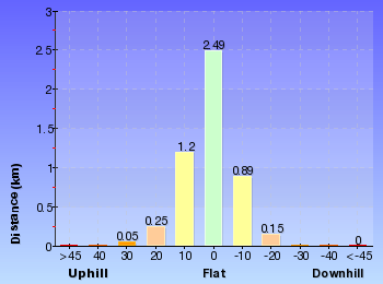
Some more details of this walks Grading
Here is a bit more details explaining grading looking at sections of the walk
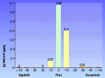
Gradient
This whole walk, 1.2km has short steep hills.
Quality of track
This whole walk, 1.2km follows a formed track, with some branches and other obstacles.
Signs
Around 820m of this walk has directional signs at most intersection, whilst the remaining 350m is clearly signposted.
Experience Required
This whole walk, 1.2km requires no previous bushwalking experience.
weather
This whole walk, 1.2km is not usually affected by severe weather events (that would unexpectedly impact safety and navigation).
Infrastructure
Around 980m of this walk has limited facilities (such as not all cliffs fenced), whilst the remaining 180m is close to useful facilities (such as fenced cliffs and seats).
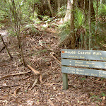
Similar walks
A list of walks that share part of the track with the Bullimah Outlook walk.
1.8 km Return
1 Hr
Hard track
2.1 km Return
1 Hr
Hard track
3.9 km Return
1 hr 30 mins
Hard track
4.5 km One way
1 hr 45 mins
Hard track

5.2 km Circuit
2 hrs 30 mins
Hard track
6 km Circuit
2 hrs 15 mins
Hard track
27 km Circuit
2 Days
Hard track
Other Nearby walks
A list of walks that start near the Bullimah Outlook walk.
6.5 km One way
3 hrs
Hard track
1.8 km Return
1 Hr
Moderate track
3.9 km Return
1 hr 45 mins
Hard track
8.5 km Circuit
4 hrs
Hard track
7.5 km One way
3 hrs 30 mins
Moderate track
8.1 km One way
5 hrs
Hard track
9.1 km Circuit
4 hrs
Hard track
5 km One way
2 hrs 30 mins
Hard track
1.2 km Return
1 Hr
Moderate track
3.1 km Return
2 hrs
Moderate track

3.1 km Return
1 hr 15 mins
Moderate track
1.4 km Return
30 mins
Easy track
Plan your trip to and from the walk here
The Bullimah Outlook walk starts and ends at the Maitland Bay Information Centre (gps: -33.520086, 151.38267)
Your transport options to Maitland Bay Information Centre are by;
![]() Bus. (get details)
Bus. (get details)
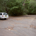
![]() Car. There is free parking available.
Car. There is free parking available.
(get details)


Short URL = http://wild.tl/blfmbic
Gallery images
There are other downloads I am still working on.
You will probably need to login to access these — still all free.
* KML (google earth file)
* GPX (GPS file)
Special Maps/ brochures
* A3 topo maps
* PDF with Lands Topo map base
* PDF with arial image (and map overlay)
I wanted to get the main site live first, this extra stuff will come in time.
Happy walking
Matt 🙂
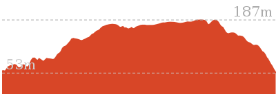
Box Head Track
And Walk
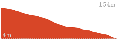
Box Head Track

2 hrs
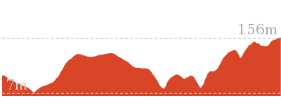
126 m
Moderate track
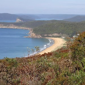
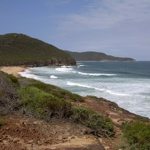
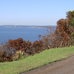
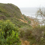
Starting on Hawke Head Drive, this walk explores the southernmost ridge in Bouddi NP. The walk provides excellent views over Woy Woy, Broken Bay, Hawkesbury River and the Tasman Sea. It takes in spectacular views over Lion Island and Pearl Beach from the many rocky outcrops along the Box Head ridge.


(0km) Hawke Head Drive car park → Hawke Head Drive
220 m
5 mins
3m
-12m
Moderate track
(0.22km) Hawke Head Drive → Box Head Trail
70 m
2 mins
0m
-8m
Moderate track
(0.29km) Box Head Trail → Box Head
1.3 km
25 mins
24m
-79m
Moderate track
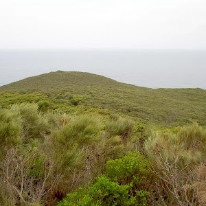
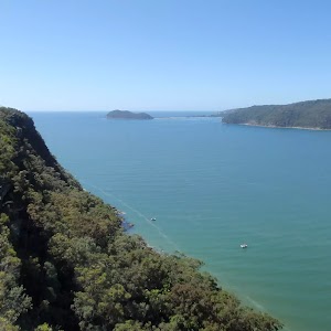
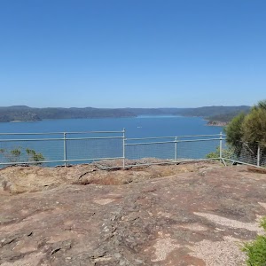
Box Head
Maps for the Box Head Track walk
You can download the PDF for this walk to print a map.
These maps below cover the walk and the wider area around the walk, they are worth carrying for safety reasons.
| Broken Bay | 1:25 000 Map Series | 91301N BROKEN BAY | NSW-91301N |
| Sydney | 1:100 000 Map Series | 9130 SYDNEY | 9130 |
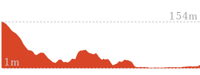
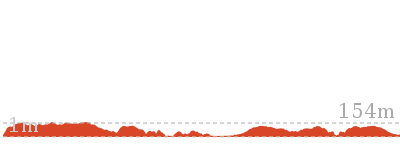
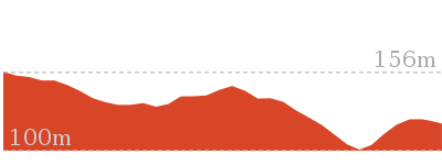
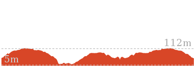
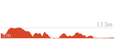
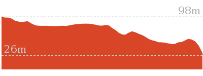
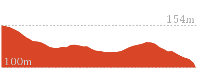
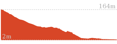
Cross sectional view of the Box Head Track bushwalking track

Analysis and summary of the altitude variation on the Box Head Track

Overview of this walks grade – based on the AS 2156.1 – 2001
Under this standard, a walk is graded based on the most difficult section of the walk.
| Length | 3.1 km | ||
| Time | 2 hrs | ||
| . | |||
| Grade 3/6 Moderate track |
AS 2156.1 | Gradient | Gentle hills with occasional steps (2/6) |
| Quality of track | Formed track, with some branches and other obstacles (3/6) | ||
| Signs | Directional signs along the way (3/6) | ||
| Experience Required | No experience required (1/6) | ||
| Weather | Weather generally has little impact on safety (1/6) | ||
| Infrastructure | Limited facilities, not all cliffs are fenced (3/6) |
Some more details of this walks Grading
Here is a bit more details explaining grading looking at sections of the walk
Gradient
This whole walk, 1.5km has gentle hills with occasional steps.
Quality of track
Around 1.5km of this walk follows a formed track, with some branches and other obstacles, whilst the remaining 65m follows a clear and well formed track or trail.
Signs
This whole walk, 1.5km has directional signs at most intersection.
Experience Required
This whole walk, 1.5km requires no previous bushwalking experience.
weather
This whole walk, 1.5km is not usually affected by severe weather events (that would unexpectedly impact safety and navigation).
Infrastructure
This whole walk, 1.5km has limited facilities (such as not all cliffs fenced).
Similar walks
A list of walks that share part of the track with the Box Head Track walk.
3.1 km Return
1 hr 15 mins
Moderate track
7.5 km One way
3 hrs 30 mins
Moderate track
8.5 km Circuit
4 hrs
Hard track
27 km Circuit
2 Days
Hard track
Other Nearby walks
A list of walks that start near the Box Head Track walk.
1.4 km Return
30 mins
Easy track
1.8 km Return
1 Hr
Hard track
5.2 km Circuit
2 hrs 30 mins
Hard track
5.1 km Return
2 hrs
Moderate track
6 km Circuit
2 hrs 15 mins
Hard track

2.3 km Return
1 hr 15 mins
Moderate track
4.5 km One way
1 hr 45 mins
Hard track
2.1 km Return
1 Hr
Hard track
3.9 km Return
1 hr 30 mins
Hard track
2.2 km One way
1 Hr
Moderate track
2.8 km One way
1 hr 15 mins
Moderate track
756 m Return
20 mins
Easy track
Plan your trip to and from the walk here
The Box Head Track walk starts and ends at the Hawke Head Drive car park (gps: -33.534259, 151.34714)
Your main transport option to Hawke Head Drive car park is by;
![]() Car. There is free parking available.
Car. There is free parking available.
(get details)
Short URL = http://wild.tl/bht
Gallery images
There are other downloads I am still working on.
You will probably need to login to access these — still all free.
* KML (google earth file)
* GPX (GPS file)
Special Maps/ brochures
* A3 topo maps
* PDF with Lands Topo map base
* PDF with arial image (and map overlay)
I wanted to get the main site live first, this extra stuff will come in time.
Happy walking
Matt 🙂
Hawke Head Drive to Box Head
And Walk
Hawke Head Drive to Box Head
1 hr 15 mins
126 m
Moderate track
This walk, from Hawke Head Drive, is the most direct route to Box Head. The walk explores Box Head headland and the many rocky outcrops on the way. There is great variation in the vegetation and a great variety in the views across the ocean and up into the mouth of Broken Bay. The cul-de-sac at the end of Hawke Head Drive has limited parking.


(0km) Hawke Head Drive car park → Box Head Trail
290 m
7 mins
3m
-20m
Moderate track
Turn left: From the intersection, this walk follows the ‘Tallow’ arrow along the management trail, going down the hill. The trail tends right for approximately 30m, to the signposted intersection for ‘Box Head’ and ‘Tallow Beach’.
(0.29km) Box Head Trail → Box Head
1.3 km
25 mins
24m
-79m
Moderate track
Box Head
Maps for the Hawke Head Drive to Box Head walk
You can download the PDF for this walk to print a map.
These maps below cover the walk and the wider area around the walk, they are worth carrying for safety reasons.
| Broken Bay | 1:25 000 Map Series | 91301N BROKEN BAY | NSW-91301N |
| Sydney | 1:100 000 Map Series | 9130 SYDNEY | 9130 |
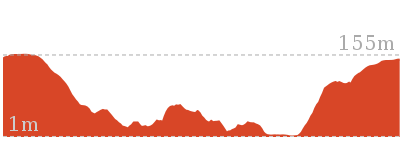
Cross sectional view of the Hawke Head Drive to Box Head bushwalking track
Analysis and summary of the altitude variation on the Hawke Head Drive to Box Head
Overview of this walks grade – based on the AS 2156.1 – 2001
Under this standard, a walk is graded based on the most difficult section of the walk.
| Length | 3.1 km | ||
| Time | 1 hr 15 mins | ||
| . | |||
| Grade 3/6 Moderate track |
AS 2156.1 | Gradient | Gentle hills with occasional steps (2/6) |
| Quality of track | Formed track, with some branches and other obstacles (3/6) | ||
| Signs | Directional signs along the way (3/6) | ||
| Experience Required | No experience required (1/6) | ||
| Weather | Weather generally has little impact on safety (1/6) | ||
| Infrastructure | Limited facilities, not all cliffs are fenced (3/6) |
Some more details of this walks Grading
Here is a bit more details explaining grading looking at sections of the walk
Gradient
This whole walk, 1.5km has gentle hills with occasional steps.
Quality of track
Around 1.5km of this walk follows a formed track, with some branches and other obstacles, whilst the remaining 65m follows a clear and well formed track or trail.
Signs
This whole walk, 1.5km has directional signs at most intersection.
Experience Required
This whole walk, 1.5km requires no previous bushwalking experience.
weather
This whole walk, 1.5km is not usually affected by severe weather events (that would unexpectedly impact safety and navigation).
Infrastructure
This whole walk, 1.5km has limited facilities (such as not all cliffs fenced).
Similar walks
A list of walks that share part of the track with the Hawke Head Drive to Box Head walk.
3.1 km Return
2 hrs
Moderate track
7.5 km One way
3 hrs 30 mins
Moderate track
8.5 km Circuit
4 hrs
Hard track
27 km Circuit
2 Days
Hard track
Other Nearby walks
A list of walks that start near the Hawke Head Drive to Box Head walk.
1.4 km Return
30 mins
Easy track
1.8 km Return
1 Hr
Hard track
5.2 km Circuit
2 hrs 30 mins
Hard track
5.1 km Return
2 hrs
Moderate track
6 km Circuit
2 hrs 15 mins
Hard track
2.3 km Return
1 hr 15 mins
Moderate track
4.5 km One way
1 hr 45 mins
Hard track
2.1 km Return
1 Hr
Hard track
3.9 km Return
1 hr 30 mins
Hard track
2.2 km One way
1 Hr
Moderate track
2.8 km One way
1 hr 15 mins
Moderate track
756 m Return
20 mins
Easy track
Plan your trip to and from the walk here
The Hawke Head Drive to Box Head walk starts and ends at the Hawke Head Drive car park (gps: -33.534259, 151.34714)
Your main transport option to Hawke Head Drive car park is by;
![]() Car. There is free parking available.
Car. There is free parking available.
(get details)
Short URL = http://wild.tl/hhdtbh
Gallery images
There are other downloads I am still working on.
You will probably need to login to access these — still all free.
* KML (google earth file)
* GPX (GPS file)
Special Maps/ brochures
* A3 topo maps
* PDF with Lands Topo map base
* PDF with arial image (and map overlay)
I wanted to get the main site live first, this extra stuff will come in time.
Happy walking
Matt 🙂
Bouddi Spur to Maitland Bay
And Walk
Bouddi Spur to Maitland Bay

1 hr 45 mins
271 m
Hard track
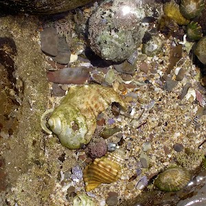
This walk is great following lunch at Dingeldei Picnic area. The walk explores the rock flats of Maitland Bay, with many interesting shells and the shipwreck of the S.S. Maitland. The walk provides the option to spend time at Maitland Beach on the way to the wreck. The wreck is best seen at low tide, along with the rest of the rock flats below the headland.


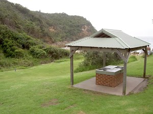
The Dingeldei Memorial Shelter
(0km) Dingeldei Picnic Area and Carpark → Bouddi Lookout
890 m
21 mins
38m
-74m
Moderate track
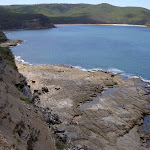
Bouddi Lookout
(0.89km) Bouddi Lookout → Int. Bouddi Trail and Dingeldei Picnic Trail
350 m
8 mins
0m
-56m
Moderate track
(1.24km) Int. Bouddi Coastal Trk and Dingeldei Picnic Trail → Eastern corner of Maitland Beach
390 m
13 mins
7m
-67m
Hard track
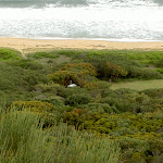
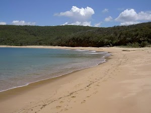
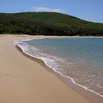
Maitland Beach
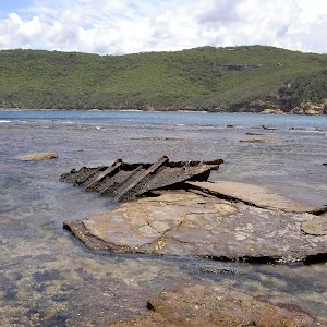
(1.63km) Eastern corner of Maitland Beach → S.S. Maitland Shipwreck
310 m
7 mins
14m
-15m
Hard track
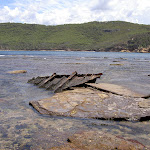
S.S. Maitland Shipwreck

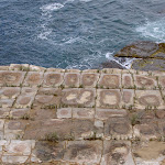
Wreckage of the Maitland can still be seen today, with parts of the boiler and a section of the iron hull strewn across the rock flats of the point. The bay was previously known as Boat Harbour, then renamed Maitland Bay after the disaster in 1898. More info.
Maps for the Bouddi Spur to Maitland Bay walk
You can download the PDF for this walk to print a map.
These maps below cover the walk and the wider area around the walk, they are worth carrying for safety reasons.
| Broken Bay | 1:25 000 Map Series | 91301N BROKEN BAY | NSW-91301N |
| Sydney | 1:100 000 Map Series | 9130 SYDNEY | 9130 |
Cross sectional view of the Bouddi Spur to Maitland Bay bushwalking track
Analysis and summary of the altitude variation on the Bouddi Spur to Maitland Bay
Overview of this walks grade – based on the AS 2156.1 – 2001
Under this standard, a walk is graded based on the most difficult section of the walk.
| Length | 3.9 km | ||
| Time | 1 hr 45 mins | ||
| . | |||
| Grade 4/6 Hard track |
AS 2156.1 | Gradient | Very steep (4/6) |
| Quality of track | Rough track, where fallen trees and other obstacles are likely (4/6) | ||
| Signs | Minimal directional signs (4/6) | ||
| Experience Required | No experience required (1/6) | ||
| Weather | Storms may impact on navigation and safety (3/6) | ||
| Infrastructure | Limited facilities (such as cliffs not fenced, significant creeks not bridged) (4/6) |
Some more details of this walks Grading
Here is a bit more details explaining grading looking at sections of the walk
Gradient
Around 1.2km of this walk has short steep hills, whilst the remaining 700m is very steep.
Quality of track
Around 1.2km of this walk follows a formed track, with some branches and other obstacles, whilst the remaining 700m follows a rough track, where fallen trees and other obstacles are likely.
Signs
Around 1.2km of this walk has directional signs at most intersection, whilst the remaining 700m has minimal directional signs.
Experience Required
This whole walk, 1.9km requires no previous bushwalking experience.
weather
Around 1.6km of this walk is not usually affected by severe weather events (that would unexpectedly impact safety and navigation), whilst the remaining 310m is affected by storms that may impact your navigation and safety.
Infrastructure
Around 1.2km of this walk is close to useful facilities (such as fenced cliffs and seats), whilst the remaining 700m has limited facilities (such as cliffs not fenced, significant creeks not bridged).
Similar walks
A list of walks that share part of the track with the Bouddi Spur to Maitland Bay walk.
1.8 km Return
1 Hr
Moderate track
3.9 km Return
1 hr 30 mins
Hard track
5 km One way
2 hrs 30 mins
Hard track
6 km Circuit
2 hrs 15 mins
Hard track
6.5 km One way
3 hrs
Hard track
8.1 km One way
5 hrs
Hard track
9.1 km Circuit
4 hrs
Hard track
27 km Circuit
2 Days
Hard track
Other Nearby walks
A list of walks that start near the Bouddi Spur to Maitland Bay walk.
1.2 km Return
1 Hr
Moderate track
2.3 km Return
1 hr 15 mins
Moderate track
4.5 km One way
1 hr 45 mins
Hard track
2.1 km Return
1 Hr
Hard track
1.8 km Return
1 Hr
Hard track
5.2 km Circuit
2 hrs 30 mins
Hard track
8.5 km Circuit
4 hrs
Hard track
7.5 km One way
3 hrs 30 mins
Moderate track
3.1 km Return
2 hrs
Moderate track
3.1 km Return
1 hr 15 mins
Moderate track
922 m Return
20 mins
Easy track
1.3 km Circuit
30 mins
Easy track
Plan your trip to and from the walk here
The Bouddi Spur to Maitland Bay walk starts and ends at the Dingeldei Picnic Area and Carpark (gps: -33.516278, 151.40326)
Your main transport option to Dingeldei Picnic Area and Carpark is by;
![]() Car. There is free parking available.
Car. There is free parking available.
(get details)
Short URL = http://wild.tl/mbts
Gallery images
There are other downloads I am still working on.
You will probably need to login to access these — still all free.
* KML (google earth file)
* GPX (GPS file)
Special Maps/ brochures
* A3 topo maps
* PDF with Lands Topo map base
* PDF with arial image (and map overlay)
I wanted to get the main site live first, this extra stuff will come in time.
Happy walking
Matt 🙂
Maitland Bay Shipwreck Track
And Walk
Maitland Bay Shipwreck Track

1 hr 30 mins
195 m
Hard track
From the Maitland Bay Information Centre, this walk heads straight down the hill to Maitland Beach and the shipwreck of the S.S. Maitland. On the way down, the track passes many rock landings providing great views of Maitland Bay and the bush of the surrounding gullies. Perched on the edge of the rock shelf, in the water east of the beach, are the remains of the S.S Maitland. The walk down to the shipwreck is magnificent and it is well worth spending some extra time to enjoy the beach.


Maitland Bay Information Centre
(0km) Maitland Bay Information Centre → Maitland Beach West End
1.1 km
24 mins
2m
-151m
Hard track
Veer left: From the intersection, the walk follows the bush track down the staircase. The walk winds through the forest, passing a rock platform with nice views over Maitland Bay. The track continues down the hill from the rock platform, keeping the rock face to the right and an overhang to the left, continuing for some time before crossing over a wooden bridge and going down more steps to a signposted intersection.
Turn left: From the intersection, the walk follows the footpath down the hill, descending some steps, towards the beach that can be heard. The walk heads down to Maitland Beach with the final stretch winding down through open scrub to the sandy beach.
(1.06km) Maitland Beach West End → Eastern corner of Maitland Beach
600 m
10 mins
6m
-7m
Hard track
Continue straight: From the creek, this walk heads along the beach, keeping the ocean on the right. The track intersection is before the headland cliff line and after the beach’s cliff line, in an area of low scrub. The intersection is marked by a small wooden sign with an arrow pointing up the hill.
Maitland Beach
(1.66km) Eastern corner of Maitland Beach → S.S. Maitland Shipwreck
310 m
7 mins
14m
-15m
Hard track
S.S. Maitland Shipwreck
Wreckage of the Maitland can still be seen today, with parts of the boiler and a section of the iron hull strewn across the rock flats of the point. The bay was previously known as Boat Harbour, then renamed Maitland Bay after the disaster in 1898. More info.
Maps for the Maitland Bay Shipwreck Track walk
You can download the PDF for this walk to print a map.
These maps below cover the walk and the wider area around the walk, they are worth carrying for safety reasons.
| Broken Bay | 1:25 000 Map Series | 91301N BROKEN BAY | NSW-91301N |
| Sydney | 1:100 000 Map Series | 9130 SYDNEY | 9130 |
Cross sectional view of the Maitland Bay Shipwreck Track bushwalking track
Analysis and summary of the altitude variation on the Maitland Bay Shipwreck Track
Overview of this walks grade – based on the AS 2156.1 – 2001
Under this standard, a walk is graded based on the most difficult section of the walk.
| Length | 3.9 km | ||
| Time | 1 hr 30 mins | ||
| . | |||
| Grade 4/6 Hard track |
AS 2156.1 | Gradient | Very steep (4/6) |
| Quality of track | Rough track, where fallen trees and other obstacles are likely (4/6) | ||
| Signs | Minimal directional signs (4/6) | ||
| Experience Required | No experience required (1/6) | ||
| Weather | Storms may impact on navigation and safety (3/6) | ||
| Infrastructure | Limited facilities (such as cliffs not fenced, significant creeks not bridged) (4/6) |
Some more details of this walks Grading
Here is a bit more details explaining grading looking at sections of the walk
Gradient
1.1km of this walk has short steep hills and another 600m has gentle hills with occasional steps. The remaining (310m) is very steep.
Quality of track
1.4km of this walk follows a formed track, with some branches and other obstacles and another 310m follows a rough track, where fallen trees and other obstacles are likely. The remaining (250m) follows a clear and well formed track or trail.
Signs
Around 1.5km of this walk has minimal directional signs, whilst the remaining 430m has directional signs at most intersection.
Experience Required
This whole walk, 2km requires no previous bushwalking experience.
weather
Around 1.7km of this walk is not usually affected by severe weather events (that would unexpectedly impact safety and navigation), whilst the remaining 310m is affected by storms that may impact your navigation and safety.
Infrastructure
1.5km of this walk has limited facilities (such as cliffs not fenced, significant creeks not bridged) and another 250m has limited facilities (such as not all cliffs fenced). The remaining (180m) is close to useful facilities (such as fenced cliffs and seats).
Similar walks
A list of walks that share part of the track with the Maitland Bay Shipwreck Track walk.
2.1 km Return
1 Hr
Hard track
2.3 km Return
1 hr 15 mins
Moderate track
3.9 km Return
1 hr 45 mins
Hard track
4.5 km One way
1 hr 45 mins
Hard track
5 km One way
2 hrs 30 mins
Hard track
5.2 km Circuit
2 hrs 30 mins
Hard track
6 km Circuit
2 hrs 15 mins
Hard track
8.1 km One way
5 hrs
Hard track
9.1 km Circuit
4 hrs
Hard track
27 km Circuit
2 Days
Hard track
Other Nearby walks
A list of walks that start near the Maitland Bay Shipwreck Track walk.
1.8 km Return
1 Hr
Hard track
6.5 km One way
3 hrs
Hard track
1.8 km Return
1 Hr
Moderate track
8.5 km Circuit
4 hrs
Hard track
7.5 km One way
3 hrs 30 mins
Moderate track
1.2 km Return
1 Hr
Moderate track
3.1 km Return
2 hrs
Moderate track
3.1 km Return
1 hr 15 mins
Moderate track
1.4 km Return
30 mins
Easy track
1.7 km One way
1 Hr
Moderate track

4.5 km One way
2 hrs
Hard track
5.1 km Return
2 hrs
Moderate track
Plan your trip to and from the walk here
The Maitland Bay Shipwreck Track walk starts and ends at the Maitland Bay Information Centre (gps: -33.520086, 151.38267)
Your main transport option to Maitland Bay Information Centre is by;
![]() Car. There is free parking available.
Car. There is free parking available.
(get details)
Short URL = http://wild.tl/mbtxx
Gallery images
There are other downloads I am still working on.
You will probably need to login to access these — still all free.
* KML (google earth file)
* GPX (GPS file)
Special Maps/ brochures
* A3 topo maps
* PDF with Lands Topo map base
* PDF with arial image (and map overlay)
I wanted to get the main site live first, this extra stuff will come in time.
Happy walking
Matt 🙂
Maitland Bay Information Centre to Putty Beach

1 hr 45 mins
126 m
Hard track
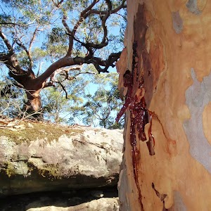
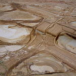
This walk is an excellent way to see some of Bouddi National Parks greatest views. The walk follows the Maitland Bay Track and the Bouddi Coastal walk to Putty Beach. The track shows off Maitland Bay from a number of different lookouts, while passing through different types of vegetation. There are also many interesting rock patterns along the coastal cliffs.
Maitland Bay Information Centre
(0km) Maitland Bay Information Centre → Int. of Maitland Bay Info Centre Trk and Bouddi Coastal Walk
820 m
18 mins
2m
-112m
Hard track
Veer left: From the intersection, the walk follows the bush track down the staircase. The walk winds through the forest, passing a rock platform with nice views over Maitland Bay. The track continues down the hill from the rock platform, keeping the rock face to the right and an overhang to the left, continuing for some time before crossing over a wooden bridge and going down more steps to a signposted intersection.
(0.82km) Int. of Maitland Bay Trk and Bouddi Coastal Walk → Maitland Beach West End
250 m
6 mins
0m
-39m
Moderate track
Maitland Beach
(0.82km) Int. of Maitland Bay Trk and Bouddi Coastal Walk → Gerrin Point
1.3 km
31 mins
74m
-68m
Hard track
(2.15km) Gerrin Point → Int. of Bullimah Beach Trk and Bouddi Coastal Walk
330 m
7 mins
6m
-36m
Moderate track
(2.47km) Int. of Bullimah Beach Trk and Bouddi Coastal Walk → Bullimah Beach
140 m
3 mins
2m
-12m
Moderate track
Bullimah Beach
(2.47km) Int. of Bullimah Beach Trk and Bouddi Coastal Walk → Putty Beach Camping Area Trk
880 m
18 mins
28m
-47m
Hard track
Continue straight: From the creek, this walk heads west along the beach, keeping the water on the left. After approximately 200m, the walk reaches a spot on the beach opposite a white-roofed building behind the dunes, just before another wide (dry) creek entry.
(3.35km) Putty Beach Camping Area Trk → Putty Beach car park
1.1 km
19 mins
16m
-6m
Moderate track
Turn right: From the beach, this walk heads up the hill along a stony path, to the car park behind the beach.
Maps for the Maitland Bay Information Centre to Putty Beach walk
You can download the PDF for this walk to print a map.
These maps below cover the walk and the wider area around the walk, they are worth carrying for safety reasons.
| Broken Bay | 1:25 000 Map Series | 91301N BROKEN BAY | NSW-91301N |
| Sydney | 1:100 000 Map Series | 9130 SYDNEY | 9130 |
Cross sectional view of the Maitland Bay Information Centre to Putty Beach bushwalking track
Analysis and summary of the altitude variation on the Maitland Bay Information Centre to Putty Beach
Overview of this walks grade – based on the AS 2156.1 – 2001
Under this standard, a walk is graded based on the most difficult section of the walk.
| Length | 4.5 km | ||
| Time | 1 hr 45 mins | ||
| . | |||
| Grade 4/6 Hard track |
AS 2156.1 | Gradient | Short steep hills (3/6) |
| Quality of track | Formed track, with some branches and other obstacles (3/6) | ||
| Signs | Minimal directional signs (4/6) | ||
| Experience Required | No experience required (1/6) | ||
| Weather | Weather generally has little impact on safety (1/6) | ||
| Infrastructure | Limited facilities (such as cliffs not fenced, significant creeks not bridged) (4/6) |
Some more details of this walks Grading
Here is a bit more details explaining grading looking at sections of the walk
Gradient
Around 3.2km of this walk has short steep hills, whilst the remaining 1.3km has gentle hills with occasional steps.
Quality of track
Around 4.4km of this walk follows a formed track, with some branches and other obstacles, whilst the remaining 55m follows a clear and well formed track or trail.
Signs
2.7km of this walk has minimal directional signs and another 1.1km is clearly signposted. The remaining (700m) has directional signs at most intersection.
Experience Required
This whole walk, 4.5km requires no previous bushwalking experience.
weather
This whole walk, 4.5km is not usually affected by severe weather events (that would unexpectedly impact safety and navigation).
Infrastructure
1.7km of this walk has limited facilities (such as not all cliffs fenced) and another 1.5km is close to useful facilities (such as fenced cliffs and seats). The remaining (1.3km) has limited facilities (such as cliffs not fenced, significant creeks not bridged).
Similar walks
A list of walks that share part of the track with the Maitland Bay Information Centre to Putty Beach walk.
2.1 km Return
1 Hr
Hard track
2.3 km Return
1 hr 15 mins
Moderate track
3.9 km Return
1 hr 30 mins
Hard track
5.2 km Circuit
2 hrs 30 mins
Hard track
6 km Circuit
2 hrs 15 mins
Hard track
7.5 km One way
3 hrs 30 mins
Moderate track
8.1 km One way
5 hrs
Hard track
27 km Circuit
2 Days
Hard track
Other Nearby walks
A list of walks that start near the Maitland Bay Information Centre to Putty Beach walk.
1.8 km Return
1 Hr
Hard track
6.5 km One way
3 hrs
Hard track
1.8 km Return
1 Hr
Moderate track
3.9 km Return
1 hr 45 mins
Hard track
8.5 km Circuit
4 hrs
Hard track
9.1 km Circuit
4 hrs
Hard track
5 km One way
2 hrs 30 mins
Hard track
1.2 km Return
1 Hr
Moderate track
3.1 km Return
2 hrs
Moderate track
3.1 km Return
1 hr 15 mins
Moderate track
1.4 km Return
30 mins
Easy track
1.7 km One way
1 Hr
Moderate track
Plan your trip to and from the walk here
The Maitland Bay Information Centre to Putty Beach walk starts at the Maitland Bay Information Centre (gps: -33.520086, 151.38267)
Your main transport option to Maitland Bay Information Centre is by;
![]() Car. There is free parking available.
Car. There is free parking available.
(get details)
The Maitland Bay Information Centre to Putty Beach ends at the Putty Beach car park (gps: -33.530994, 151.36069)
Your main transport option to Putty Beach car park is by;
![]() Car. There is free parking available.
Car. There is free parking available.
(get details)
Short URL = http://wild.tl/mbictpb
Gallery images
There are other downloads I am still working on.
You will probably need to login to access these — still all free.
* KML (google earth file)
* GPX (GPS file)
Special Maps/ brochures
* A3 topo maps
* PDF with Lands Topo map base
* PDF with arial image (and map overlay)
I wanted to get the main site live first, this extra stuff will come in time.
Happy walking
Matt 🙂
Little Beach to Mount Bouddi Track
And Walk
Little Beach to Mount Bouddi Track

2 hrs 30 mins
343 m
Hard track
This walk curves around from Graham car park, taking in the secluded Little Beach and Caves Bay before finishing at Mt Bouddi’s Dingeldei Picnic Area. The walk passes through many different types of vegetation. The service trail from above Little Beach to above Caves Bay is very sandy, in contrast to the dirt track followed for the rest of the walk. This walk has excellent views of headlands and out into the Tasman Sea.


(0km) Grahame Dr car park → Little Beach
600 m
11 mins
1m
-46m
Moderate track
Continue straight: From the intersection, this walk heads down the hill, following the ‘Little Beach 200m’ sign. After approximately 300m, the walk comes to Little Beach campsite and continues to the point where the creek meets the beach.
Little Beach
(0.6km) Little Beach → Int. Bouddi Trail Access and Little Beach Trk
320 m
6 mins
26m
0m
Moderate track
(0.91km) Int. Bouddi Trail Access and Little Beach Trk → Sandy Clearing Little Beach Access Trail Int.
460 m
15 mins
77m
0m
Hard track
(1.37km) Sandy Clearing Little Beach Access Trail Int. → Int. Graham Drive Carpark Trk and Bouddi Trail
640 m
11 mins
12m
-8m
Moderate track
Continue straight: From the intersection, this walk follows the management trail down the hill, keeping the sea far on the left of the track. The trail continues down to a large sandy area marked by a ‘Little Beach car park’ sign.
(2.01km) Int. Graham Drive Carpark Trk and Bouddi Trail → Int. Bouddi Trail and Dingeldei Picnic Trail
1.8 km
45 mins
97m
-147m
Moderate track
Turn right: From the clearing, this walk follows the ‘Maitland Bay’ arrow along the bush track, going down the hill and keeping the ocean to the left. The walk then descends and climbs steeply, with numerous steps, crossing two creeks, before coming to a third creek crossing with a wooden bridge. From the bridge, the walk climbs to the top of the stairs then continues along the hillside to the signposted intersection.
(3.8km) Int. Bouddi Coastal Trk and Dingeldei Picnic Trail → S.S. Maitland Shipwreck
700 m
20 mins
21m
-82m
Hard track
Turn left: From the intersection, this walk follows the cliff line out towards the sea, beneath the rocky headland. The walk heads over rocks and boulders, to the rock flats at the point. Here lies the S.S.Maitland shipwreck. At the end of this side trip, retrace your steps back to the main walk then Veer left.
S.S. Maitland Shipwreck
Wreckage of the Maitland can still be seen today, with parts of the boiler and a section of the iron hull strewn across the rock flats of the point. The bay was previously known as Boat Harbour, then renamed Maitland Bay after the disaster in 1898. More info.
(3.8km) Int. Bouddi Trail and Dingeldei Picnic Trail → Bouddi Lookout
350 m
8 mins
56m
0m
Moderate track
Bouddi Lookout
(4.15km) Bouddi Lookout → Dingeldei Picnic Area and Carpark
890 m
21 mins
74m
-38m
Moderate track
The Dingeldei Memorial Shelter
Maps for the Little Beach to Mount Bouddi Track walk
You can download the PDF for this walk to print a map.
These maps below cover the walk and the wider area around the walk, they are worth carrying for safety reasons.
| Broken Bay | 1:25 000 Map Series | 91301N BROKEN BAY | NSW-91301N |
| Sydney | 1:100 000 Map Series | 9130 SYDNEY | 9130 |
Cross sectional view of the Little Beach to Mount Bouddi Track bushwalking track
Analysis and summary of the altitude variation on the Little Beach to Mount Bouddi Track
Overview of this walks grade – based on the AS 2156.1 – 2001
Under this standard, a walk is graded based on the most difficult section of the walk.
| Length | 5 km | ||
| Time | 2 hrs 30 mins | ||
| . | |||
| Grade 4/6 Hard track |
AS 2156.1 | Gradient | Short steep hills (3/6) |
| Quality of track | Rough track, where fallen trees and other obstacles are likely (4/6) | ||
| Signs | Directional signs along the way (3/6) | ||
| Experience Required | No experience required (1/6) | ||
| Weather | Weather generally has little impact on safety (1/6) | ||
| Infrastructure | Limited facilities, not all cliffs are fenced (3/6) |
Some more details of this walks Grading
Here is a bit more details explaining grading looking at sections of the walk
Gradient
Around 2.7km of this walk has short steep hills, whilst the remaining 2.4km has gentle hills with occasional steps.
Quality of track
4.3km of this walk follows a formed track, with some branches and other obstacles and another 460m follows a rough track, where fallen trees and other obstacles are likely. The remaining (280m) follows a clear and well formed track or trail.
Signs
Around 4.4km of this walk has directional signs at most intersection, whilst the remaining 630m is clearly signposted.
Experience Required
This whole walk, 5km requires no previous bushwalking experience.
weather
This whole walk, 5km is not usually affected by severe weather events (that would unexpectedly impact safety and navigation).
Infrastructure
Around 3.2km of this walk has limited facilities (such as not all cliffs fenced), whilst the remaining 1.9km is close to useful facilities (such as fenced cliffs and seats).
Similar walks
A list of walks that share part of the track with the Little Beach to Mount Bouddi Track walk.
1.2 km Return
1 Hr
Moderate track
1.8 km Return
1 Hr
Moderate track
3.9 km Return
1 hr 45 mins
Hard track
3.9 km Return
1 hr 30 mins
Hard track
6 km Circuit
2 hrs 15 mins
Hard track
6.5 km One way
3 hrs
Hard track
8.1 km One way
5 hrs
Hard track
9.1 km Circuit
4 hrs
Hard track
27 km Circuit
2 Days
Hard track
Other Nearby walks
A list of walks that start near the Little Beach to Mount Bouddi Track walk.
2.3 km Return
1 hr 15 mins
Moderate track
4.5 km One way
1 hr 45 mins
Hard track
2.1 km Return
1 Hr
Hard track
1.8 km Return
1 Hr
Hard track
5.2 km Circuit
2 hrs 30 mins
Hard track
8.5 km Circuit
4 hrs
Hard track
7.5 km One way
3 hrs 30 mins
Moderate track
3.1 km Return
2 hrs
Moderate track
3.1 km Return
1 hr 15 mins
Moderate track
922 m Return
20 mins
Easy track
1.3 km Circuit
30 mins
Easy track
3.2 km Return
1 hr 15 mins
Easy track
Plan your trip to and from the walk here
The Little Beach to Mount Bouddi Track walk starts at the Grahame Dr car park (gps: -33.509886, 151.41234)
Your main transport option to Grahame Dr car park is by;
![]() Car. There is free parking available.
Car. There is free parking available.
(get details)
The Little Beach to Mount Bouddi Track ends at the Dingeldei Picnic Area and Carpark (gps: -33.516278, 151.40326)
Your main transport option to Dingeldei Picnic Area and Carpark is by;
![]() Car. There is free parking available.
Car. There is free parking available.
(get details)
Short URL = http://wild.tl/lbtmbt
Gallery images
There are other downloads I am still working on.
You will probably need to login to access these — still all free.
* KML (google earth file)
* GPX (GPS file)
Special Maps/ brochures
* A3 topo maps
* PDF with Lands Topo map base
* PDF with arial image (and map overlay)
I wanted to get the main site live first, this extra stuff will come in time.
Happy walking
Matt 🙂
Gerrin Point Circuit
And Walk
Gerrin Point Circuit

2 hrs 30 mins
269 m
Hard track


Marie Byles Lookout

(0km) Marie Byles Lookout → Maitland Bay Information Centre
400 m
7 mins
9m
-3m
Moderate track
Veer left: From the intersection, this walk heads north, keeping the road above to the left. The track tends left to a dirt driveway and the road, continuing along the road and passing a large water tank on the left. The walk continues to the Maitland Bay Information Centre, approximately 300m up the road.
Maitland Bay Information Centre
(0.4km) Maitland Bay Information Centre → Int. of Maitland Bay Info Centre Trk and Bullimah Lookout Trk
180 m
4 mins
1m
-17m
Moderate track
(0.59km) Int. of Maitland Bay Info Centre Trk and Bullimah Lookout Trk → Int. of Maitland Bay Info Centre Trk and Bouddi Coastal Walk
630 m
14 mins
1m
-95m
Hard track
(1.22km) Int. of Maitland Bay Trk and Bouddi Coastal Walk → Maitland Beach West End
250 m
6 mins
0m
-39m
Moderate track
Maitland Beach
S.S. Maitland Shipwreck
Wreckage of the Maitland can still be seen today, with parts of the boiler and a section of the iron hull strewn across the rock flats of the point. The bay was previously known as Boat Harbour, then renamed Maitland Bay after the disaster in 1898. More info.
(1.22km) Int. of Maitland Bay Trk and Bouddi Coastal Walk → Gerrin Point
1.3 km
31 mins
74m
-68m
Hard track
Gerrin Point Lookout
(2.55km) Gerrin Point → Int. of Bullimah Beach Trk and Bouddi Coastal Walk
330 m
7 mins
6m
-36m
Moderate track
(2.88km) Int. of Bullimah Beach Trk and Bouddi Coastal Walk → Bullimah Beach
140 m
3 mins
2m
-12m
Moderate track
Bullimah Beach
(2.88km) Int. of Bullimah Beach Trk and Bouddi Coastal Walk → Putty Beach Camping Area Trk
880 m
18 mins
28m
-47m
Hard track
Continue straight: From the creek, this walk heads west along the beach, keeping the water on the left. After approximately 200m, the walk reaches a spot on the beach opposite a white-roofed building behind the dunes, just before another wide (dry) creek entry.
Putty Beach
(3.76km) Putty Beach Camping Area Trk → Putty Beach Camping Area
90 m
1 mins
1m
0m
Moderate track
Putty Beach Camping Area
Campsites must be booked in peak periods, up to 3 months in advance. They can be booked by phoning (02) 4320 4203.
A campsite costs $14/ adult (16+) and $7/child (5-15).
Park Entry and parking: Parking and entry costs $7/ 24 hours. Single park entry passes can be picked up from Killcare Cellars and General Store – 56 Araluen Drive, Killcare. Alternatively they can be obtained from ticket dispensers in the Picnic and Camping Areas.
General enquiries – call DECC Central Coast (02) 4320 4200 or 4329 4280.
(3.85km) Putty Beach Camping Area → Jacqueline Ave
410 m
16 mins
96m
0m
Hard track
Veer left: From the intersection, the walk heads away from the ocean, passing a ‘Bouddi National Park’ sign[2] and some power poles near the road.
(4.26km) Jacqueline Ave → Int. of The Scenic Rd Service Trail and The Scenic Rd
530 m
12 mins
40m
-5m
Hard track
Continue straight: From the cul-de-sac, the walk heads through the bushes along the track, away from the ocean and the houses. The track opens up into a management trail, which heads up the hill and continues to an intersection with another management trail (on the left).
Continue straight: From the intersection, the walk heads up the hill, away from the ocean, for a short time. The trail narrows to pass between boulders and continues as a track up the hill to The Scenic Road.
(4.79km) Int. of The Scenic Rd Service Trail and The Scenic Rd → Marie Byles Lookout
380 m
7 mins
13m
0m
Easy track
Maps for the Gerrin Point Circuit walk
You can download the PDF for this walk to print a map.
These maps below cover the walk and the wider area around the walk, they are worth carrying for safety reasons.
| Broken Bay | 1:25 000 Map Series | 91301N BROKEN BAY | NSW-91301N |
| Sydney | 1:100 000 Map Series | 9130 SYDNEY | 9130 |
Cross sectional view of the Gerrin Point Circuit bushwalking track
Analysis and summary of the altitude variation on the Gerrin Point Circuit
Overview of this walks grade – based on the AS 2156.1 – 2001
Under this standard, a walk is graded based on the most difficult section of the walk.
| Length | 5.2 km | ||
| Time | 2 hrs 30 mins | ||
| . | |||
| Grade 4/6 Hard track |
AS 2156.1 | Gradient | Very steep (4/6) |
| Quality of track | Rough track, where fallen trees and other obstacles are likely (4/6) | ||
| Signs | Minimal directional signs (4/6) | ||
| Experience Required | No experience required (1/6) | ||
| Weather | Weather generally has little impact on safety (1/6) | ||
| Infrastructure | Limited facilities (such as cliffs not fenced, significant creeks not bridged) (4/6) |
Some more details of this walks Grading
Here is a bit more details explaining grading looking at sections of the walk
Gradient
3.3km of this walk has short steep hills and another 730m has gentle hills with occasional steps. Whilst another 730m is flat with no steps and the remaining 410m is very steep.
Quality of track
4km of this walk follows a formed track, with some branches and other obstacles and another 520m follows a clear and well formed track or trail. Whilst another 410m follows a rough track, where fallen trees and other obstacles are likely and the remaining 260m follows a smooth and hardened path.
Signs
3.3km of this walk has minimal directional signs and another 1.1km is clearly signposted. The remaining (700m) has directional signs at most intersection.
Experience Required
This whole walk, 5km requires no previous bushwalking experience.
weather
This whole walk, 5km is not usually affected by severe weather events (that would unexpectedly impact safety and navigation).
Infrastructure
2.2km of this walk has limited facilities (such as not all cliffs fenced) and another 1.7km has limited facilities (such as cliffs not fenced, significant creeks not bridged). The remaining (1.2km) is close to useful facilities (such as fenced cliffs and seats).
Similar walks
A list of walks that share part of the track with the Gerrin Point Circuit walk.
1.8 km Return
1 Hr
Hard track
2.1 km Return
1 Hr
Hard track
2.3 km Return
1 hr 15 mins
Moderate track
3.9 km Return
1 hr 30 mins
Hard track
4.5 km One way
1 hr 45 mins
Hard track
6 km Circuit
2 hrs 15 mins
Hard track
8.1 km One way
5 hrs
Hard track
27 km Circuit
2 Days
Hard track
Other Nearby walks
A list of walks that start near the Gerrin Point Circuit walk.
8.5 km Circuit
4 hrs
Hard track
6.5 km One way
3 hrs
Hard track
1.8 km Return
1 Hr
Moderate track
3.9 km Return
1 hr 45 mins
Hard track
7.5 km One way
3 hrs 30 mins
Moderate track
3.1 km Return
2 hrs
Moderate track
3.1 km Return
1 hr 15 mins
Moderate track
9.1 km Circuit
4 hrs
Hard track
5 km One way
2 hrs 30 mins
Hard track
1.2 km Return
1 Hr
Moderate track
1.4 km Return
30 mins
Easy track
5.1 km Return
2 hrs
Moderate track
Plan your trip to and from the walk here
The Gerrin Point Circuit walk starts and ends at the Marie Byles Lookout (gps: -33.522843, 151.38117)
Your transport options to Marie Byles Lookout are by;
![]() Bus. (get details)
Bus. (get details)
![]() Car. There is free parking available.
Car. There is free parking available.
(get details)
Short URL = http://wild.tl/gpc
Gallery images
There are other downloads I am still working on.
You will probably need to login to access these — still all free.
* KML (google earth file)
* GPX (GPS file)
Special Maps/ brochures
* A3 topo maps
* PDF with Lands Topo map base
* PDF with arial image (and map overlay)
I wanted to get the main site live first, this extra stuff will come in time.
Happy walking
Matt 🙂
Maitland Bay Info Centre – Mt Bouddi – Maitland Bay

2 hrs 15 mins
287 m
Hard track

Maitland Bay Information Centre
(0km) Maitland Bay Information Centre → The Scenic Rd Gate Trk
720 m
16 mins
24m
-49m
Hard track
Turn left: From the gate, this walk turns left, heading down the hill. The track then continues along the lightly undulating management trail, leading soon to an intersection with another management trail on the left.
(0.72km) The Scenic Rd Gate Trk → Int. Stroms Fire Trail and Mt Bouddi Rd
1.4 km
25 mins
42m
-20m
Moderate track
(2.12km) Int. Stroms Fire Trail and Mt Bouddi Rd → Dingeldei Picnic Area
620 m
12 mins
18m
-13m
Easy track
The Dingeldei Memorial Shelter
(2.74km) Dingeldei Picnic Area and Carpark → Bouddi Lookout
890 m
21 mins
38m
-74m
Moderate track
Bouddi Lookout
(3.63km) Bouddi Lookout → Int. Bouddi Trail and Dingeldei Picnic Trail
350 m
8 mins
0m
-56m
Moderate track
(3.98km) Int. Bouddi Coastal Trk and Dingeldei Picnic Trail → Eastern corner of Maitland Beach
390 m
13 mins
7m
-67m
Hard track
(4.37km) Eastern corner of Maitland Beach → S.S. Maitland Shipwreck
310 m
7 mins
14m
-15m
Hard track
S.S. Maitland Shipwreck
Wreckage of the Maitland can still be seen today, with parts of the boiler and a section of the iron hull strewn across the rock flats of the point. The bay was previously known as Boat Harbour, then renamed Maitland Bay after the disaster in 1898. More info.
(4.37km) Eastern corner of Maitland Beach → Maitland Beach West End
600 m
10 mins
7m
-6m
Hard track
Continue straight: From the creek, this walk heads along the beach, keeping the ocean on the left. The walk leads to the base of some paved steps, which lead up the hill away from the beach.
Maitland Beach
(4.97km) Maitland Beach West End → Maitland Bay Information Centre
1.1 km
24 mins
151m
-2m
Hard track
Turn right: From the intersection, the walk follows the ‘Parking Area’ sign along the bush track. The track winds up the hill to a bridge and then continues on, passing a large overhang (on the right), above which is a view from a rock landing. The track continues up the stairs for some time, coming to an intersection.
Veer right: From the intersection, the walk goes up the staircase, following the ‘Parking Area’ sign up the hill. The staircase continues for some time until it reaches the car park intersection. From here, the walk turns right, passing an information board, to the brick building next to the road – Maitland Bay Information Centre.
Maps for the Maitland Bay Info Centre – Mt Bouddi – Maitland Bay walk
You can download the PDF for this walk to print a map.
These maps below cover the walk and the wider area around the walk, they are worth carrying for safety reasons.
| Broken Bay | 1:25 000 Map Series | 91301N BROKEN BAY | NSW-91301N |
| Sydney | 1:100 000 Map Series | 9130 SYDNEY | 9130 |
Cross sectional view of the Maitland Bay Info Centre – Mt Bouddi – Maitland Bay bushwalking track
Analysis and summary of the altitude variation on the Maitland Bay Info Centre – Mt Bouddi – Maitland Bay
Overview of this walks grade – based on the AS 2156.1 – 2001
Under this standard, a walk is graded based on the most difficult section of the walk.
| Length | 6 km | ||
| Time | 2 hrs 15 mins | ||
| . | |||
| Grade 4/6 Hard track |
AS 2156.1 | Gradient | Very steep (4/6) |
| Quality of track | Rough track, where fallen trees and other obstacles are likely (4/6) | ||
| Signs | Minimal directional signs (4/6) | ||
| Experience Required | No experience required (1/6) | ||
| Weather | Weather generally has little impact on safety (1/6) | ||
| Infrastructure | Limited facilities (such as cliffs not fenced, significant creeks not bridged) (4/6) |
Some more details of this walks Grading
Here is a bit more details explaining grading looking at sections of the walk
Gradient
2.7km of this walk has gentle hills with occasional steps and another 2.3km has short steep hills. Whilst another 620m is flat with no steps and the remaining 390m is very steep.
Quality of track
4.1km of this walk follows a formed track, with some branches and other obstacles and another 960m follows a clear and well formed track or trail. Whilst another 620m follows a smooth and hardened path and the remaining 390m follows a rough track, where fallen trees and other obstacles are likely.
Signs
3.1km of this walk has directional signs at most intersection and another 2.3km has minimal directional signs. The remaining (620m) is clearly signposted.
Experience Required
This whole walk, 6km requires no previous bushwalking experience.
weather
This whole walk, 6km is not usually affected by severe weather events (that would unexpectedly impact safety and navigation).
Infrastructure
2.3km of this walk has limited facilities (such as not all cliffs fenced) and another 2.1km is close to useful facilities (such as fenced cliffs and seats). The remaining (1.6km) has limited facilities (such as cliffs not fenced, significant creeks not bridged).
Similar walks
A list of walks that share part of the track with the Maitland Bay Info Centre – Mt Bouddi – Maitland Bay walk.
1.8 km Return
1 Hr
Moderate track
2.1 km Return
1 Hr
Hard track
2.3 km Return
1 hr 15 mins
Moderate track
3.9 km Return
1 hr 45 mins
Hard track
3.9 km Return
1 hr 30 mins
Hard track
4.5 km One way
1 hr 45 mins
Hard track
5 km One way
2 hrs 30 mins
Hard track
5.2 km Circuit
2 hrs 30 mins
Hard track
6.5 km One way
3 hrs
Hard track
8.1 km One way
5 hrs
Hard track
9.1 km Circuit
4 hrs
Hard track
27 km Circuit
2 Days
Hard track
Other Nearby walks
A list of walks that start near the Maitland Bay Info Centre – Mt Bouddi – Maitland Bay walk.
1.8 km Return
1 Hr
Hard track
8.5 km Circuit
4 hrs
Hard track
7.5 km One way
3 hrs 30 mins
Moderate track
1.2 km Return
1 Hr
Moderate track
3.1 km Return
2 hrs
Moderate track
3.1 km Return
1 hr 15 mins
Moderate track
1.4 km Return
30 mins
Easy track
1.7 km One way
1 Hr
Moderate track
4.5 km One way
2 hrs
Hard track
5.1 km Return
2 hrs
Moderate track
4.1 km One way
1 hr 45 mins
Hard track
1.5 km Return
30 mins
Easy track
Plan your trip to and from the walk here
The Maitland Bay Info Centre – Mt Bouddi – Maitland Bay walk starts and ends at the Maitland Bay Information Centre (gps: -33.520114, 151.38269)
Your main transport option to Maitland Bay Information Centre is by;
![]() Car. There is free parking available.
Car. There is free parking available.
(get details)
Short URL = http://wild.tl/h
Gallery images
There are other downloads I am still working on.
You will probably need to login to access these — still all free.
* KML (google earth file)
* GPX (GPS file)
Special Maps/ brochures
* A3 topo maps
* PDF with Lands Topo map base
* PDF with arial image (and map overlay)
I wanted to get the main site live first, this extra stuff will come in time.
Happy walking
Matt 🙂
Bouddi Spur to Little Beach via Bombi Moor

3 hrs
297 m
Hard track
This walk explores a large part of the Bouddi National Park coastline. Features of this walk include the walk out to Bombi Moors and down to Little Beach. The tracks connecting these spots explore some excellent rainforest areas and wonderful heath covered headlands. Interesting, beautiful and a great place for a swim, this walk is well worth the effort.


The Dingeldei Memorial Shelter
(0km) Dingeldei Picnic Area and Carpark → Bouddi Lookout
890 m
21 mins
38m
-74m
Moderate track
Bouddi Lookout
(0.89km) Bouddi Lookout → Int. Bouddi Trail and Dingeldei Picnic Trail
350 m
8 mins
0m
-56m
Moderate track
(1.24km) Int. Bouddi Trail and Dingeldei Picnic Trail → End of Caves Bay management trail
1.2 km
33 mins
105m
-96m
Moderate track
(2.41km) End of Caves Bay management trail → Bombi Moors
2 km
37 mins
54m
-67m
Moderate track
Veer right: From the intersection, this walk follows the management trail up the sandy hill, keeping the sea to the right. The trail soon comes to the signposted intersection, with another trail on the right.
Continue straight: From the intersection, this walk heads down the hill, keeping the sea to the right. The walk descends for some time before turning gently and climbing for a while to the signposted intersection.
Turn right: From the intersection the sandy track follows the ‘Trail 81’ and ‘Bombi Moors’ signs up the hill. The track heads undulates for quite some time down to a grassy caldasac near the cliff edge.
Bombi Moors
(4.41km) Bombi Moors → Sandy Clearing Little Beach Access Trail Int.
730 m
14 mins
54m
-4m
Moderate track
(5.14km) Sandy Clearing Little Beach Access Trail Int. → Int. Bouddi Trail Access and Little Beach Trk
460 m
15 mins
0m
-77m
Hard track
(5.6km) Int. Bouddi Trail Access and Little Beach Trk → Little Beach
320 m
6 mins
0m
-26m
Moderate track
Little Beach
Little Beach Campsite
(5.91km) Little Beach → Grahame Dr car park
600 m
11 mins
46m
-1m
Moderate track
Continue straight: From the intersection, this walk follows the ‘Little Beach Carpark 300m’ sign along the management trail, going up the hill. The walk drops through a gully, crossing the creek and climbing up the hill before passing around a gate and arriving in the car park.
Maps for the Bouddi Spur to Little Beach via Bombi Moor walk
You can download the PDF for this walk to print a map.
These maps below cover the walk and the wider area around the walk, they are worth carrying for safety reasons.
| Broken Bay | 1:25 000 Map Series | 91301N BROKEN BAY | NSW-91301N |
| Sydney | 1:100 000 Map Series | 9130 SYDNEY | 9130 |
Cross sectional view of the Bouddi Spur to Little Beach via Bombi Moor bushwalking track
Analysis and summary of the altitude variation on the Bouddi Spur to Little Beach via Bombi Moor
Overview of this walks grade – based on the AS 2156.1 – 2001
Under this standard, a walk is graded based on the most difficult section of the walk.
| Length | 6.5 km | ||
| Time | 3 hrs | ||
| . | |||
| Grade 4/6 Hard track |
AS 2156.1 | Gradient | Short steep hills (3/6) |
| Quality of track | Rough track, where fallen trees and other obstacles are likely (4/6) | ||
| Signs | Directional signs along the way (3/6) | ||
| Experience Required | No experience required (1/6) | ||
| Weather | Weather generally has little impact on safety (1/6) | ||
| Infrastructure | Limited facilities, not all cliffs are fenced (3/6) |
Some more details of this walks Grading
Here is a bit more details explaining grading looking at sections of the walk
Gradient
Around 3.8km of this walk has gentle hills with occasional steps, whilst the remaining 2.7km has short steep hills.
Quality of track
6km of this walk follows a formed track, with some branches and other obstacles and another 460m follows a rough track, where fallen trees and other obstacles are likely. The remaining (280m) follows a clear and well formed track or trail.
Signs
Around 6km of this walk has directional signs at most intersection, whilst the remaining 630m is clearly signposted.
Experience Required
This whole walk, 7km requires no previous bushwalking experience.
weather
This whole walk, 7km is not usually affected by severe weather events (that would unexpectedly impact safety and navigation).
Infrastructure
Around 4.6km of this walk has limited facilities (such as not all cliffs fenced), whilst the remaining 1.9km is close to useful facilities (such as fenced cliffs and seats).
Similar walks
A list of walks that share part of the track with the Bouddi Spur to Little Beach via Bombi Moor walk.
1.2 km Return
1 Hr
Moderate track
1.8 km Return
1 Hr
Moderate track
3.9 km Return
1 hr 45 mins
Hard track
5 km One way
2 hrs 30 mins
Hard track
6 km Circuit
2 hrs 15 mins
Hard track
8.1 km One way
5 hrs
Hard track
9.1 km Circuit
4 hrs
Hard track
27 km Circuit
2 Days
Hard track
Other Nearby walks
A list of walks that start near the Bouddi Spur to Little Beach via Bombi Moor walk.
2.3 km Return
1 hr 15 mins
Moderate track
4.5 km One way
1 hr 45 mins
Hard track
2.1 km Return
1 Hr
Hard track
3.9 km Return
1 hr 30 mins
Hard track
1.8 km Return
1 Hr
Hard track
5.2 km Circuit
2 hrs 30 mins
Hard track
8.5 km Circuit
4 hrs
Hard track
7.5 km One way
3 hrs 30 mins
Moderate track
3.1 km Return
2 hrs
Moderate track
3.1 km Return
1 hr 15 mins
Moderate track
922 m Return
20 mins
Easy track
1.3 km Circuit
30 mins
Easy track
Plan your trip to and from the walk here
The Bouddi Spur to Little Beach via Bombi Moor walk starts at the Dingeldei Picnic Area and Carpark (gps: -33.516278, 151.40326)
Your transport options to Dingeldei Picnic Area and Carpark are by;
![]() Bus. (get details)
Bus. (get details)
![]() Car. There is free parking available.
Car. There is free parking available.
(get details)
The Bouddi Spur to Little Beach via Bombi Moor ends at the Grahame Dr car park (gps: -33.509886, 151.41234)
Your transport options to Grahame Dr car park are by;
![]() Bus. (get details)
Bus. (get details)
![]() Car. There is free parking available.
Car. There is free parking available.
(get details)
Short URL = http://wild.tl/i
Gallery images
There are other downloads I am still working on.
You will probably need to login to access these — still all free.
* KML (google earth file)
* GPX (GPS file)
Special Maps/ brochures
* A3 topo maps
* PDF with Lands Topo map base
* PDF with arial image (and map overlay)
I wanted to get the main site live first, this extra stuff will come in time.
Happy walking
Matt 🙂
Comments