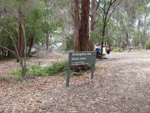
Bittangabee Bay to Pulpit Rock


2 hrs

140 m
Hard track
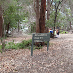


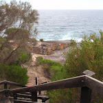


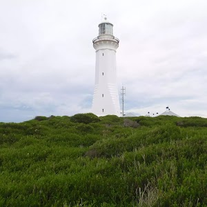
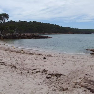
Bittangabee Bay Picnic Area
(0km) Bittangabee Bay Picnic Area → Bittangabee Campsite

210 m
5 mins
13m
-5m
Moderate track
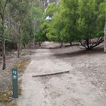
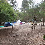
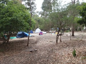
Bittangabee campground
(0.21km) Bittangabee Campsite → Int. Light to Light Trk and Bittangabee Storehouse Trk
30 m
1 mins
0m
-4m
Moderate track
(0.24km) Int. Light to Light Trk and Bittangabee Storehouse Trk → Int. Light to Light Trk and Bittangabee Storehouse Trail
150 m
3 mins
2m
-10m
Hard track
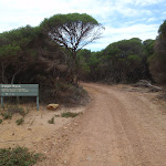
Turn right: From the intersection, the walk leads up the hill, keeping the bay on your left and the storehouse ruins behind on the right. The track veers right, up the hill to a signposted intersection. Now Veer left to rejoin the main walk .
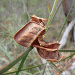
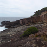
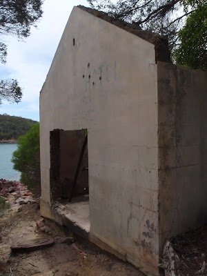
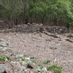
Bittangabee Storehouse ruins
(0.24km) Int. Light to Light Trk and Bittangabee Storehouse Trk → Bittangabee Sth Headland Lookout
240 m
5 mins
6m
-8m
Moderate track
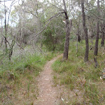
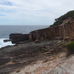
Turn right: From the intersection, this walk follows the ‘Walking Track’ sign and arrow posts up the hill. The track winds through the heath and melaleuca for a short time, passing near the campsite (on the right) while following the arrow markers. The track leads closer to the sea on the left, to a clearing overlooking a rock shelf below at the sea and the mouth of Bittangabee Bay.
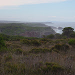
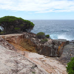
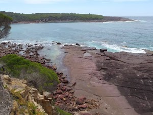
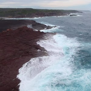
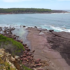
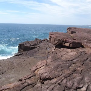
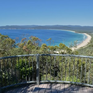
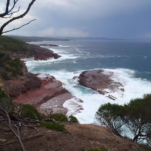
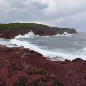
Southern Bittangabee Point lookout
(0.48km) Bittangabee Sth Headland Lookout → Int. Light to Light Walk and Pulpit Rock Rd Access
3.8 km
1 hr 10 mins
99m
-62m
Moderate track
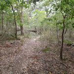
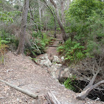
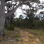
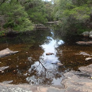
Continue straight: From the top of the stairs, this walk leads upstream of the creek, which is below on the right. The track follows this creek for some time, tending left away from it into the bush at times. The track winds slightly uphill for a while, then winds downhill to cross the rocky surface of another creek. The track heads up the hill and over the ridge before heading down to another creek bed. The track then leads up the hill to the cul-de-sac of a service trail.
(4.3km) Int. Light to Light Walk and Pulpit Rock Rd Access → Pulpit Rock Lookout
900 m
16 mins
7m
-38m
Moderate track
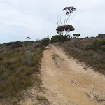
Veer right: From the intersection, this walk follows the track marker along the hillside, keeping the ocean on the left of the track. The track passes a few overgrown service trails on either side, as it continues on to the signposted intersection with the main service trail.
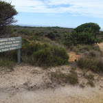
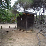
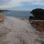
Turn left: From the intersection, this walk follows none of the signs but instead heads down the hill towards the sea. The track winds down through the heath to the one-way car park and toilet. The walk continues through to the far side of the car park, where there is a fenced lookout over the rocks.
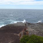
(5.2km) Pulpit Rock Lookout → Pulpit Rock
60 m
2 mins
2m
-13m
Hard track
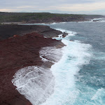
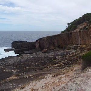
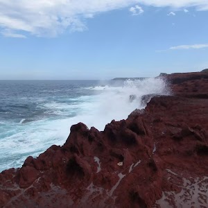
Pulpit Rock

(5.25km) Pulpit Rock → Pulpit Rock Lookout
60 m
2 mins
13m
-2m
Hard track
Maps for the Bittangabee Bay to Pulpit Rock walk
You can download the PDF for this walk to print a map.These maps below cover the walk and the wider area around the walk, they are worth carrying for safety reasons.
| Kiah | 1:25 000 Map Series | 88231S KIAH | NSW-88231S |
| Green Cape | 1:100 000 Map Series | 8923 GREEN CAPE | 8923 |
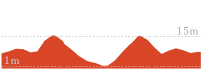
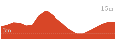
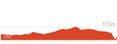
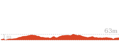
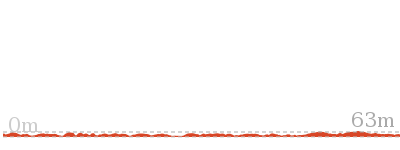
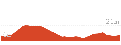
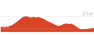
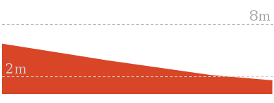
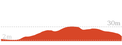
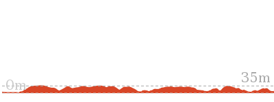
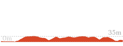
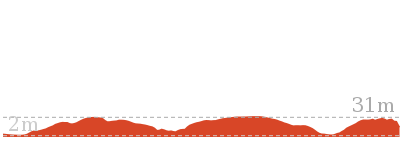
Cross sectional view of the Bittangabee Bay to Pulpit Rock bushwalking track
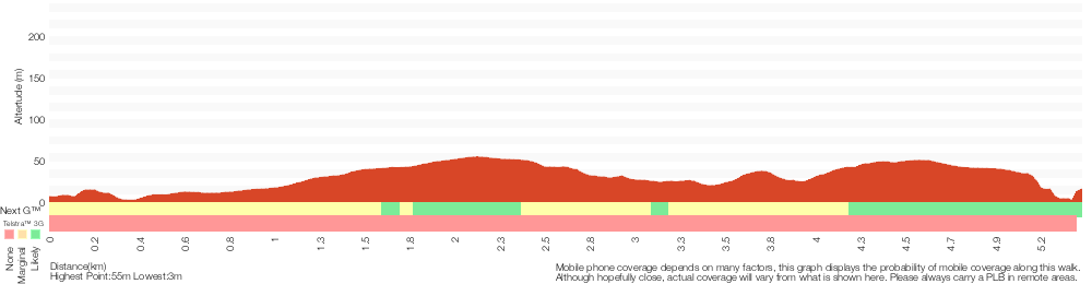
Analysis and summary of the altitude variation on the Bittangabee Bay to Pulpit Rock
Overview of this walks grade – based on the AS 2156.1 – 2001
Under this standard, a walk is graded based on the most difficult section of the walk.
| Length | 5.3 km | ||
| Time | 2 hrs | ||
| . | |||
| Grade 4/6 Hard track |
AS 2156.1 | Gradient | Very steep (4/6) |
| Quality of track | Formed track, with some branches and other obstacles (3/6) | ||
| Signs | Minimal directional signs (4/6) | ||
| Experience Required | No experience required (1/6) | ||
| Weather | Forecast, unforecast storms and severe weather may impact on navigation and safety (4/6) | ||
| Infrastructure | Limited facilities, not all cliffs are fenced (3/6) |
Some more details of this walks Grading
Here is a bit more details explaining grading looking at sections of the walk
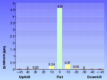
Gradient
3.8km of this walk has short steep hills and another 860m is flat with no steps. Whilst another 510m has gentle hills with occasional steps and the remaining 110m is very steep.
Quality of track
This whole walk, 5km follows a formed track, with some branches and other obstacles.
Signs
Around 5km of this walk has directional signs at most intersection, whilst the remaining 110m has minimal directional signs.
Experience Required
This whole walk, 5km requires no previous bushwalking experience.
weather
Around 5km of this walk is not usually affected by severe weather events (that would unexpectedly impact safety and navigation), whilst the remaining 110m is affected by forecast, unforecast storms and severe weather events that may impact on navigation and safety.
Infrastructure
Around 3.9km of this walk has limited facilities (such as not all cliffs fenced), whilst the remaining 1.4km is close to useful facilities (such as fenced cliffs and seats).
Similar walks
110 m Return
10 mins
Hard track

715 m Circuit
20 mins
Hard track
954 m Return
30 mins
Moderate track
3.8 km One way
1 hr 30 mins
Hard track
8.5 km One way
3 hrs
Hard track
30.9 km One way
2 Days
Hard track
30.9 km One way
3 Days
Hard track

Other Nearby walks
1.1 km Circuit
30 mins
Moderate track
1.8 km Return
45 mins
Moderate track
5.2 km Return
2 hrs
Hard track

9.1 km Return
3 hrs 30 mins
Hard track
180 m Return
5 mins
Moderate track
52 m Return
10 mins
Easy track

3.3 km Return
1 hr 30 mins
Moderate track
8.5 km Return
3 hrs
Hard track

9.1 km One way
3 hrs 30 mins
Hard track
9.8 km Return
3 hrs 30 mins
Hard track
8.5 km Return
3 hrs
Hard track
826 m Return
30 mins
Easy track

Plan your trip to and from the walk here
The Bittangabee Bay to Pulpit Rock walk starts at the Bittangabee Bay Picnic Area (gps: -37.216819, 150.01486)Your main transport option to Bittangabee Bay Picnic Area is by;
(get details)
The Bittangabee Bay to Pulpit Rock ends at the Pulpit Rock Lookout (gps: -37.239771, 150.03414)
Your main transport option to Pulpit Rock Lookout is by;
(get details)


Short URL = http://wild.tl/bbtpr
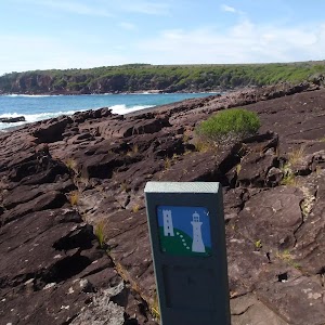
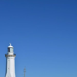
Gallery images
There are other downloads I am still working on.
You will probably need to login to access these — still all free.
* KML (google earth file)
* GPX (GPS file)
Special Maps/ brochures
* A3 topo maps
* PDF with Lands Topo map base
* PDF with arial image (and map overlay)
I wanted to get the main site live first, this extra stuff will come in time.
Happy walking
Matt 🙂
Comments