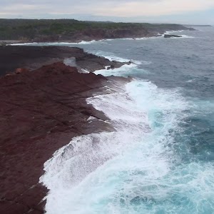
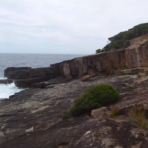
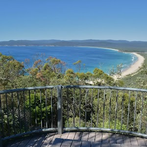
Green Cape to Pulpit Rock


1 hr 30 mins

89 m
Hard track
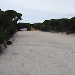


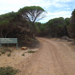


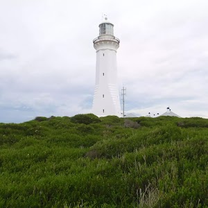
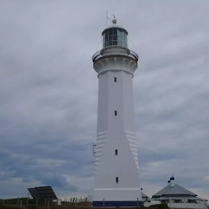
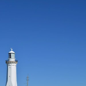
Green Cape
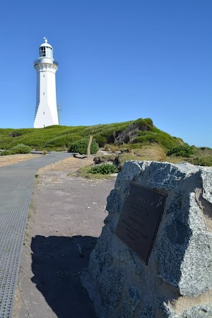
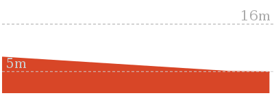
(0km) Green Cape Lighthouse Car park → Ly-ee-moon Graveyard

250 m
4 mins
3m
-5m
Easy track
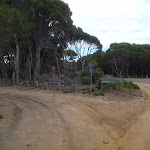
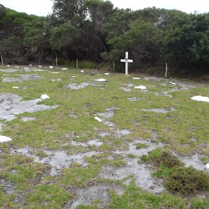
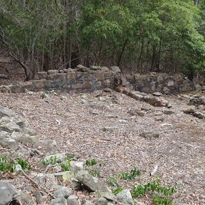
Ly-ee-moon Graveyard
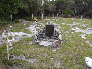
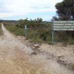
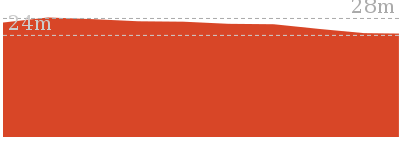
(0.25km) Ly-ee-moon Graveyard → Int. Light to Light Trk and Pulpit Rock Rd
2.8 km
49 mins
70m
-44m
Moderate track
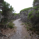
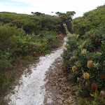
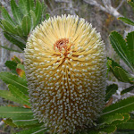
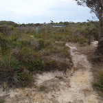
Continue straight: From the intersection, this walk follows the track marker through the heath, keeping the ocean on the right of the track. The track leads across the hill, through the heath and Banksias for a short time, coming to an overgrown service trail (on both sides of the track).
Continue straight: From the intersection, this walk follows the track-marker along the hillside through the heath, keeping the ocean to the right of the track. The track soon turns left to wind up the hill, before turning right and continuing across the hillside. The track leads through the heath and Banksias, with the hill above on the left, coming to a signposted intersection with a service trail.
(3.01km) Int. Light to Light Trk and Pulpit Rock Rd → Pulpit Rock Lookout
640 m
12 mins
1m
-36m
Moderate track
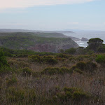
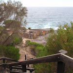
(3.66km) Pulpit Rock Lookout → Pulpit Rock
60 m
2 mins
2m
-13m
Hard track
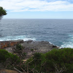
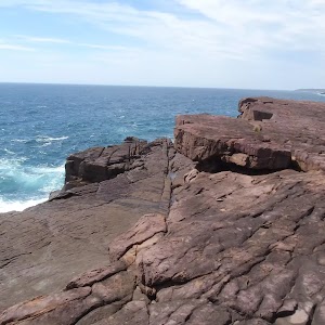
Pulpit Rock

(3.71km) Pulpit Rock → Pulpit Rock Lookout
60 m
2 mins
13m
-2m
Hard track
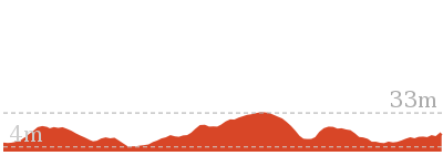
Maps for the Green Cape to Pulpit Rock walk
You can download the PDF for this walk to print a map.These maps below cover the walk and the wider area around the walk, they are worth carrying for safety reasons.
| Narrabarba | 1:25 000 Map Series | 88232N NARRABARBA | NSW-88232N |
| Kiah | 1:25 000 Map Series | 88231S KIAH | NSW-88231S |
| Green Cape | 1:100 000 Map Series | 8923 GREEN CAPE | 8923 |
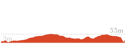
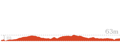
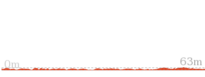
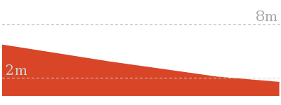
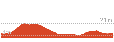
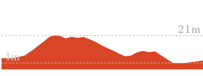
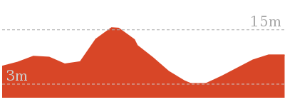
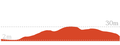
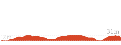
Cross sectional view of the Green Cape to Pulpit Rock bushwalking track
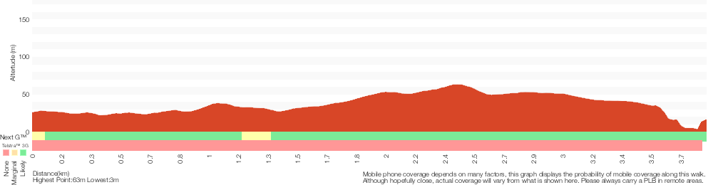
Analysis and summary of the altitude variation on the Green Cape to Pulpit Rock
Overview of this walks grade – based on the AS 2156.1 – 2001
Under this standard, a walk is graded based on the most difficult section of the walk.
| Length | 3.8 km | ||
| Time | 1 hr 30 mins | ||
| . | |||
| Grade 4/6 Hard track |
AS 2156.1 | Gradient | Very steep (4/6) |
| Quality of track | Formed track, with some branches and other obstacles (3/6) | ||
| Signs | Minimal directional signs (4/6) | ||
| Experience Required | No experience required (1/6) | ||
| Weather | Forecast, unforecast storms and severe weather may impact on navigation and safety (4/6) | ||
| Infrastructure | Limited facilities, not all cliffs are fenced (3/6) |
Some more details of this walks Grading
Here is a bit more details explaining grading looking at sections of the walk
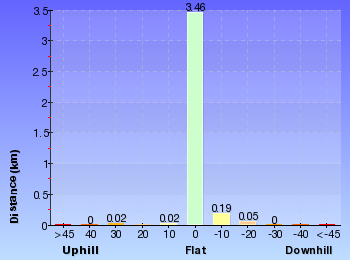
Gradient
3km of this walk has gentle hills with occasional steps and another 640m is flat with no steps. The remaining (110m) is very steep.
Quality of track
Around 3.5km of this walk follows a formed track, with some branches and other obstacles, whilst the remaining 250m follows a clear and well formed track or trail.
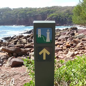
Signs
2.3km of this walk has directional signs at most intersection and another 1.3km is clearly signposted. The remaining (110m) has minimal directional signs.
Experience Required
This whole walk, 3.8km requires no previous bushwalking experience.
weather
Around 3.7km of this walk is not usually affected by severe weather events (that would unexpectedly impact safety and navigation), whilst the remaining 110m is affected by forecast, unforecast storms and severe weather events that may impact on navigation and safety.
Infrastructure
Around 2.9km of this walk has limited facilities (such as not all cliffs fenced), whilst the remaining 890m is close to useful facilities (such as fenced cliffs and seats).
Similar walks
110 m Return
10 mins
Hard track
490 m Return
30 mins
Easy track
5.3 km One way
2 hrs
Hard track
8.5 km One way
3 hrs
Hard track
30.9 km One way
2 Days
Hard track
30.9 km One way
3 Days
Hard track

Other Nearby walks
826 m Return
30 mins
Easy track

52 m Return
10 mins
Easy track

180 m Return
5 mins
Moderate track
1.1 km Circuit
30 mins
Moderate track
1.8 km Return
45 mins
Moderate track
5.2 km Return
2 hrs
Hard track

9.1 km Return
3 hrs 30 mins
Hard track

715 m Circuit
20 mins
Hard track
954 m Return
30 mins
Moderate track
3.3 km Return
1 hr 30 mins
Moderate track
8.5 km Return
3 hrs
Hard track
9.1 km One way
3 hrs 30 mins
Hard track
Plan your trip to and from the walk here
The Green Cape to Pulpit Rock walk starts at the Green Cape Lighthouse Car park (gps: -37.259557, 150.04796)Your main transport option to Green Cape Lighthouse Car park is by;
(get details)
The Green Cape to Pulpit Rock ends at the Pulpit Rock Lookout (gps: -37.239771, 150.03414)
Your main transport option to Pulpit Rock Lookout is by;
(get details)


Short URL = http://wild.tl/gctpr
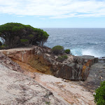
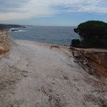
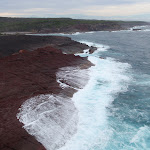
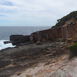
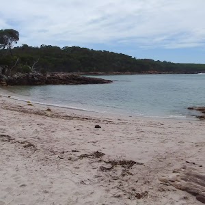
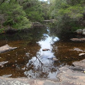
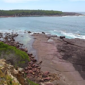
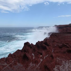
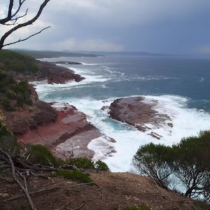
Gallery images
There are other downloads I am still working on.
You will probably need to login to access these — still all free.
* KML (google earth file)
* GPX (GPS file)
Special Maps/ brochures
* A3 topo maps
* PDF with Lands Topo map base
* PDF with arial image (and map overlay)
I wanted to get the main site live first, this extra stuff will come in time.
Happy walking
Matt 🙂
Comments