Congewai East Track Head to Watagan Forest Motel via Forestry HQ Campsite


2 Days

1702 m
Hard track
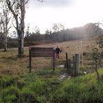


(0km) Congewai Valley east trackhead → Property Gate

760 m
17 mins
54m
-12m
Hard track
Continue straight: From here[7], this walk climbs over the fence using the stile and follows the track gently uphill[8], keeping the more open farmland[9] on your left. The walk continues for about 300m to an intersection with a wide dirt trail, just before a vehicular gate[10], marked with a GNW arrow post.
(0.76km) Property Gate → Int on GNW bushtrack
1.2 km
31 mins
125m
-1m
Hard track
(1.96km) Int on GNW bushtrack → Int of Georges Rd & GNW bushtrack
1.7 km
52 mins
239m
-36m
Hard track
(3.69km) Int of Georges Rd AND GNW track → Old Loggers Hut
130 m
2 mins
0m
-8m
Moderate track
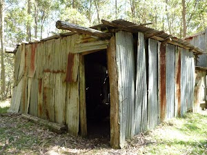
Old Loggers Hut
(3.82km) Old Loggers Hut → Georges Rd rest area
300 m
5 mins
2m
-2m
Moderate track

(4.12km) Georges Rd rest area → Barraba Campsite
320 m
6 mins
13m
-3m
Moderate track
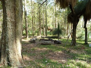
Continue straight: From the intersection[39], this walk follows the ‘Barraba Trig Rest Area’ sign[40] north-east, gently uphill along the trail[41]. Following a few GNW arrow markers over about 90m, this trail then comes to a large flat clearing[42][43] signposted as ‘Barraba campsite’[44], with some lovely large grass trees[45].
Barraba Campsite
(4.43km) Barraba Campsite → Saddle Rest Area
1.8 km
43 mins
78m
-164m
Hard track
Continue straight: From the locked gate[53], this walk heads downhill along the wide dirt trail, directly away from the ‘Barraba Trig’ sign[54]. The trail leads down for about 400m, moderately steeply for a while. As the trail mostly flattens out, the walk climbs over another fence beside a locked gate[55] using the stile[56]. The walk continues down along this trail for almost 200m to pass ‘The Barbara Lowes Conservation area’ sign[57]. Here, the walk climbs over the fence using the stile[58] beside the vehicular gate[59]. There are filtered valley views to your left[60].
Continue straight: From the locked gate[61], this walk follows the trail gently downhill[62], while keeping the views on your left (and ignoring the trail on your left). This walk undulates gently up and down the side of the hill for about 1 km, until coming to a saddle[63], with views on the left and dam[64] on the right.
(6.25km) Saddle Rest Area → Int of Georges Rd AND Watagans National Park boundary gate
730 m
17 mins
36m
-57m
Moderate track
(6.98km) Int of Georges Rd AND Watagans National Park boundary gate → Top of the 125r Lookout trail
1.3 km
33 mins
99m
-53m
Hard track
(8.31km) Top of the 125r Lookout trail → 125r Lookout Rest Area
860 m
17 mins
15m
-50m
Moderate track
(8.31km) Top of the 125r Lookout trail → Northern rest area
1.3 km
31 mins
76m
-68m
Moderate track
Great North Walk Rest Area

(9.63km) Northern rest area → Narrow Place Lookout
1.5 km
33 mins
57m
-90m
Moderate track
(11.15km) Narrow Place Lookout → Int of Georges Road & Congewai Creek track
1.9 km
37 mins
67m
-53m
Moderate track
(13.02km) Int of Georges Road AND Congewai Creek track → Int of Georges AND Heaton Rds
2.9 km
55 mins
67m
-100m
Moderate track
(15.92km) Int of Georges & Heaton Rds → Forestry H.Q campsite
1.2 km
25 mins
60m
-7m
Moderate track
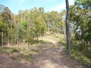
Veer left: From the intersection[113], this walk follows the ‘Hunters Lookout’ sign[114] gently uphill along Bakers Road[115]. The walk continues along this road for a bit over 150m, coming to a three-way intersection[116], just in front of the signposted ‘Watagan Headquarters’ campsite[117].
Watagan Headquarters
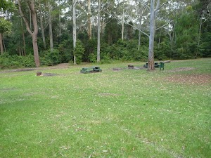
End of day 1
(17.15km) Forestry H.Q campsite → Hunter Lookout picnic area
1.6 km
27 mins
21m
-38m
Moderate track
Continue straight: From the intersection[128], this walk follows Bakers Road north and gently uphill, while keeping Rocky Creek Road (no signpost) on your right. The walk continues, undulating gently for about 400m until coming to a three-way intersection with Glen Road[129] (on the right).
Continue straight: From the intersection[130], this walk follows Bakers Road gently uphill[131], while keeping Glen Road on your right. The walk continues, undulating gently for about 250m until coming to Hunter Lookout picnic area[132] (on the left).
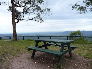
Veer left: From the intersection, this walk heads off the road and up the hill following the Hunter Lookout picnic area sign, past the wooden gate and the public toilet, to the picnic area area and the lookout.
Hunter Lookout

(18.77km) Hunter Lookout picnic area → Macleans Lookout
700 m
16 mins
39m
-38m
Moderate track
Veer left: From the Hunter Lookout picnic area[138] (on Bakers Road), this walk follows Bakers Road north and gently downhill[139], while keeping Hunter Lookout on your left. The walk continues for about 400m until coming to a Y-intersection[140] (Bakers Road loop).
Continue straight: From the intersection[141] (Bakers Road Loop), this walk follows the track gently uphill[142], while keeping the other end of Bakers Road Loop to your right, gently downhill. The walk follows the road for about 130m until coming to Macleans Lookout[143].
(19.47km) Maclean Lookout → Int of GNW track & a wide track
490 m
12 mins
7m
-74m
Hard track
Continue straight: From the intersection[149], this walk follows the trail gently downhill[150], while keeping the ‘Heaton Lookout’ sign on your right. The walk continues (becoming moderately steep downhill) for about 280m until coming to a three-way intersection[151] with a track on the left.
(19.97km) Int of GNW track AND a wide track → Int of GNW track AND Glen Road
170 m
5 mins
19m
-12m
Hard track
(20.14km) Int of GNW track & Glen Road → Int of GNW track & a wide bushtrack
130 m
4 mins
12m
-8m
Hard track
(20.28km) Int of GNW track & a wide bushtrack → Int of GNW track & a narrow road
720 m
21 mins
75m
-59m
Hard track
(21km) Int of GNW track & a wide track → Int of GNW track and Fosters Road south
340 m
8 mins
30m
-17m
Moderate track
Continue straight: From the intersection[176], this walk follows the wide track gently downhill, while keeping the ‘Macleans Lookout 2km’ sign[177] on your right. The walk continues for about 140m to a three-way intersection[178], with Fosters Road on your right and ‘Fosters Road’ sign[179] on your left.
(21.34km) Int of GNW track and Fosters Road south → Int of GNW track and Wallis Creek
1.9 km
1 Hr
172m
-282m
Hard track
Continue straight: From the intersection[191], this walk follows the ‘Heaton Lookout’ sign[192] downhill along the road a few metres, then veers left to follow the GNW arrow down the old trail[193]. The walk leads fairly steeply down for about 180m then passes around a timber barrier[194]. Here the track narrows and continues more steeply downhill[195] through forest for about 250m to a gully and creek crossing[196] (with many fallen dead trees[197]).
Continue straight: This walk crosses the creek[198] and follows the track, while keeping the valley on your left. The walk follows the track steeply up for a short distance, then follows along the base of a cliff[199] for about 120m to pass through a long sandstone cave[200]. The rocky track leads steeply down through the dense rainforest for 700m, following a series of GNW arrow posts to the bottom of the gully beside Wallis Creek[201].
(23.22km) Int of GNW track and Wallis Creek → Int of GNW track and Heaton Lookout
2.2 km
59 mins
201m
-115m
Hard track
Continue straight: From the intersection[210], this walk follows the GNW arrow east, directly away from the face of the ‘Barniers Road’ sign[211]. The walk continues along the old trail for about 450m to find an intersection[212] with a track (on the right). Here the walk turns right, following the ‘The Great North Walk’ sign[213] moderately steeply down the narrow track[214] for about 220m and then crosses a creek[215]. The walk continues moderately steeply uphill[216] around another gully and after about 500m, comes to a T-intersection[217] with Heaton trail and Heaton Lookout[218] directly ahead.
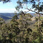
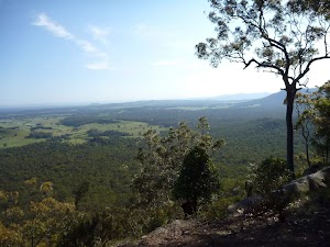
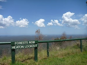
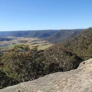
Heaton Lookout
(25.43km) Heaton Lookout. → Heaton Communications Tower
2.4 km
54 mins
144m
-54m
Moderate track
(27.86km) Heaton Communications Tower → Heaton Gap Lookout
620 m
13 mins
3m
-69m
Moderate track
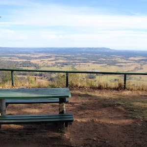
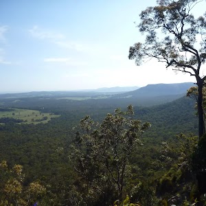
Heaton Gap Lookout

(28.48km) Heaton Gap Lookout → Heaton Gap Track Head
1.2 km
32 mins
6m
-272m
Hard track
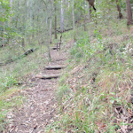
Veer left: From the intersection[252], this walk follows the GNW arrow post and power lines[253] steeply downhill[254] along the trail. The walk continues for about 180m to find a three-way intersection[255], with a GNW arrow marker on the right (where the power line trail bends left). The walk turns right, leaving the power lines and following the GNW arrow marker steeply down a narrower forested track[256]. The track winds down some timber steps, towards the sound of traffic for about 160m then down a timber staircase[257] to the edge of Freemans Drive. Here the walk crosses Freemans Drive[258] (busy road, please be careful to look and listen for traffic) and comes to the Watagan Forest Motel[259], petrol station (on the left), picnic area[260] and signposted ‘Heaton Gap Track Head’[261] (on the right).
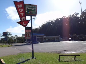
Watagan Forest Motel
Maps for the Congewai East Track Head to Watagan Forest Motel via Forestry HQ Campsite walk
You can download the PDF for this walk to print a map.These maps below cover the walk and the wider area around the walk, they are worth carrying for safety reasons.
| Quorrobolong | 1:25 000 Map Series | 91322S QUORROBOLONG | NSW-91322S |
| Cessnock | 1:50 000 Map Series | 91322 CESSNOCK | CW-91322 |
| Cessnock | 1:100 000 Map Series | 9132 CESSNOCK | 9132 |
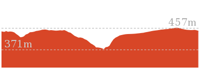
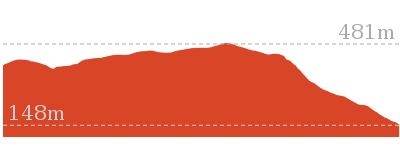
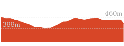
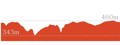
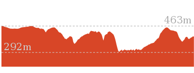
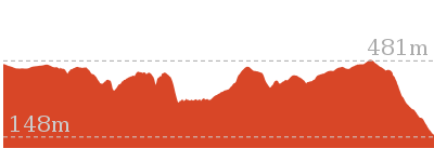
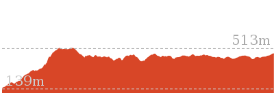
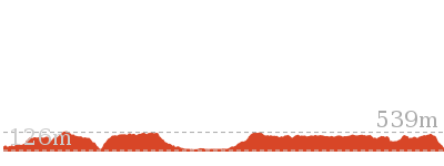
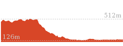
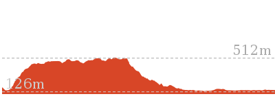
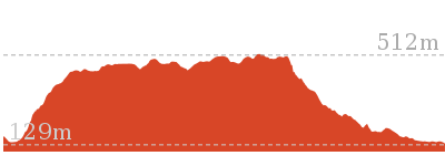
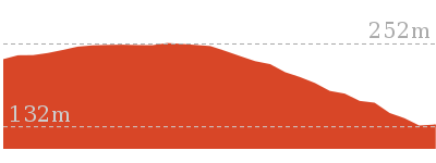
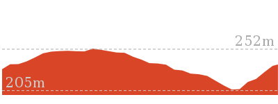
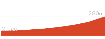
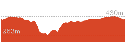
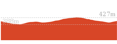
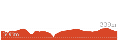
Cross sectional view of the Congewai East Track Head to Watagan Forest Motel via Forestry HQ Campsite bushwalking track

Analysis and summary of the altitude variation on the Congewai East Track Head to Watagan Forest Motel via Forestry HQ Campsite

Daily actual walking time estimates
| Day | Walking Time | Length |
|---|---|---|
| 1 | 6 hrs 44 mins | 18 km |
| 2 | 5 hrs 11 mins | 12.5 km |
Overview of this walks grade – based on the AS 2156.1 – 2001
Under this standard, a walk is graded based on the most difficult section of the walk.
| Length | 29.7 km | ||
| Time | 2 Days | ||
| . | |||
| Grade 4/6 Hard track |
AS 2156.1 | Gradient | Very steep (4/6) |
| Quality of track | Rough track, where fallen trees and other obstacles are likely (4/6) | ||
| Signs | Minimal directional signs (4/6) | ||
| Experience Required | Moderate level of bushwalking experience recommended (4/6) | ||
| Weather | Storms may impact on navigation and safety (3/6) | ||
| Infrastructure | Limited facilities (such as cliffs not fenced, significant creeks not bridged) (4/6) |
Some more details of this walks Grading
Here is a bit more details explaining grading looking at sections of the walk
Gradient
12km of this walk has short steep hills and another 10km is very steep. The remaining (8km) has gentle hills with occasional steps.
Quality of track
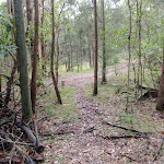
16km of this walk follows a clear and well formed track or trail and another 9km follows a formed track, with some branches and other obstacles. The remaining (4.5km) follows a rough track, where fallen trees and other obstacles are likely.
Signs
26km of this walk has directional signs at most intersection and another 3.7km has minimal directional signs. The remaining (170m) is clearly signposted.
Experience Required
15km of this walk requires no previous bushwalking experience and another 12km requires some bushwalking experience. The remaining (2.6km) requires a leader a with moderate level of bushwalking experience.
weather
Around 28km of this walk is not usually affected by severe weather events (that would unexpectedly impact safety and navigation), whilst the remaining 1.7km is affected by storms that may impact your navigation and safety.
Infrastructure
20km of this walk has limited facilities (such as not all cliffs fenced) and another 6km is close to useful facilities (such as fenced cliffs and seats). The remaining (3.9km) has limited facilities (such as cliffs not fenced, significant creeks not bridged).
Similar walks
2.5 km Circuit
1 Hr
Hard track

4.3 km One way
2 hrs
Hard track
4.4 km Return
3 hrs 30 mins
Moderate track
5.6 km Circuit
2 hrs 30 mins
Hard track
8.1 km One way
4 hrs
Hard track
12.5 km One way
6 hrs
Hard track
17.2 km One way
7 hrs
Hard track
60.5 km One way
4 Days
Hard track
Other Nearby walks
13.8 km One way
5 hrs
Hard track
17.8 km One way
7 hrs
Hard track
4.1 km One way
2 hrs
Hard track
12.6 km One way
5 hrs 30 mins
Hard track
718 m Circuit
30 mins
Moderate track

516 m Return
15 mins
Moderate track

1.5 km Return
1 Hr
Moderate track
1.7 km Return
1 Hr
Hard track

406 m Return
30 mins
Hard track
7.3 km Circuit
3 hrs
Hard track
1.7 km Circuit
45 mins
Moderate track
1.3 km Circuit
45 mins
Moderate track
Plan your trip to and from the walk here
The Congewai East Track Head to Watagan Forest Motel via Forestry HQ Campsite walk starts at the Congewai Valley east trackhead (gps: -32.995219, 151.30044)Your main transport option to Congewai Valley east trackhead is by;
(get details)
The Congewai East Track Head to Watagan Forest Motel via Forestry HQ Campsite ends at the Heaton Gap Track Head (gps: -32.965275, 151.47939)
Your main transport option to Heaton Gap Track Head is by;
(get details)


Short URL = http://wild.tl/cethtwfmvfhc
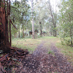
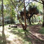
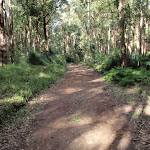
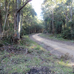
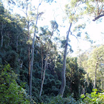
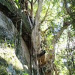
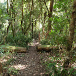
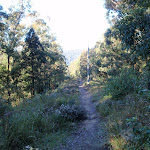
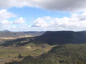
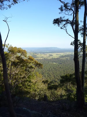
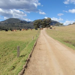
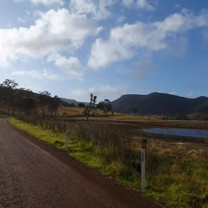
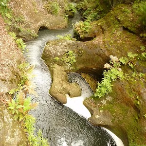
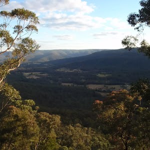
Gallery images
There are other downloads I am still working on.
You will probably need to login to access these — still all free.
* KML (google earth file)
* GPX (GPS file)
Special Maps/ brochures
* A3 topo maps
* PDF with Lands Topo map base
* PDF with arial image (and map overlay)
I wanted to get the main site live first, this extra stuff will come in time.
Happy walking
Matt 🙂
Comments