Boarding House Dam Circuit


30 mins

36 m
Moderate track

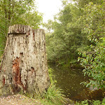

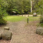


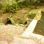


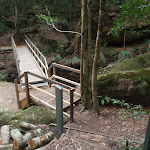


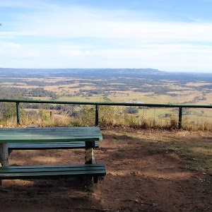
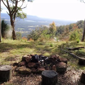
Boarding House Dam Picnic Area
(0km) Boarding House Dam Picnic Area → Int of Boarding House Dam loop

100 m
2 mins
3m
-4m
Easy track
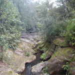
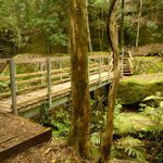
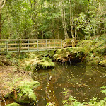
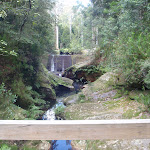
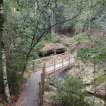
(0.1km) Int of Boarding House Dam loop → Moss Wall Bridge
360 m
9 mins
25m
-22m
Moderate track
(0.46km) Moss wall Bridge → Boarding House Dam Picnic Area
260 m
6 mins
8m
-14m
Moderate track
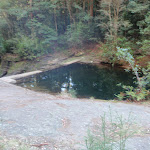
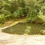
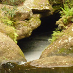
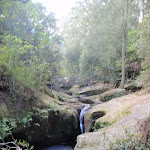
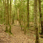
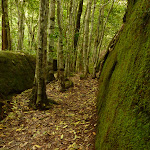
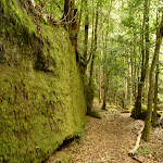
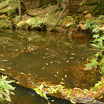
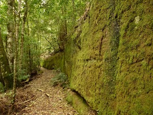
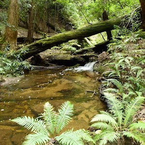
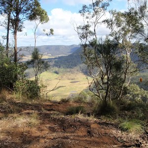
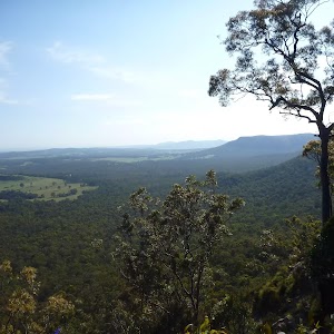
Continue straight: From the intersection[24], this walk follows the track gently up timber steps[25], with the creek and dam on your left. This walk follows the track (up timber steps[26] at one stage) for about 30m, to find a high point and views into the dam. This walk continues gently downhill[27] (with occasional timber steps) for about 45m, until coming to the boarding house dam picnic area[28] and car park.
Maps for the Boarding House Dam Circuit walk
You can download the PDF for this walk to print a map.These maps below cover the walk and the wider area around the walk, they are worth carrying for safety reasons.
| Quorrobolong | 1:25 000 Map Series | 91322S QUORROBOLONG | NSW-91322S |
| Morisset | 1:25 000 Map Series | 91311N MORISSET | NSW-91311N |
| Cessnock | 1:50 000 Map Series | 91322 CESSNOCK | CW-91322 |
| Cessnock | 1:100 000 Map Series | 9132 CESSNOCK | 9132 |
| Gosford | 1:100 000 Map Series | 9131 GOSFORD | 9131 |
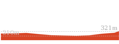
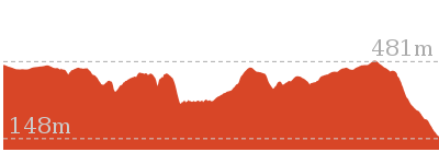
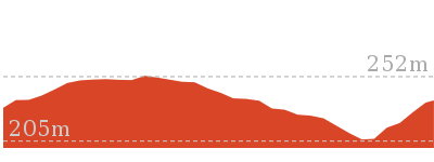
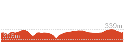
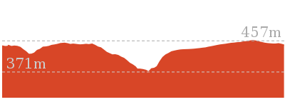
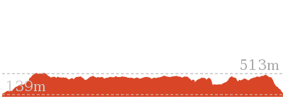
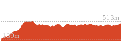
Cross sectional view of the Boarding House Dam Circuit bushwalking track
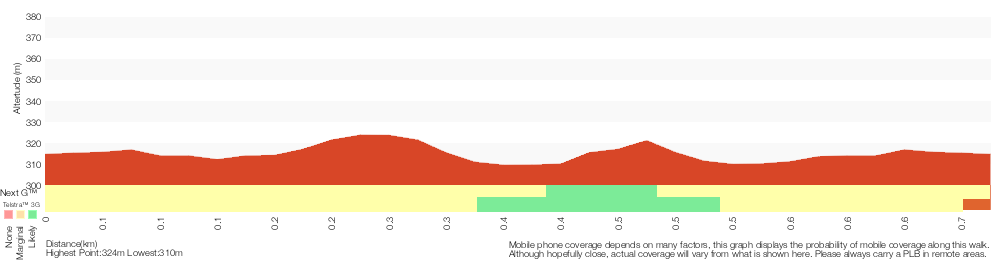
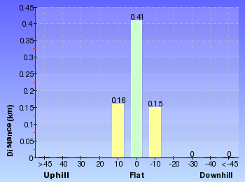
Analysis and summary of the altitude variation on the Boarding House Dam Circuit
Overview of this walks grade – based on the AS 2156.1 – 2001
Under this standard, a walk is graded based on the most difficult section of the walk.
| Length | 718 m | ||
| Time | 30 mins | ||
| . | |||
| Grade 3/6 Moderate track |
AS 2156.1 | Gradient | Gentle hills with occasional steps (2/6) |
| Quality of track | Formed track, with some branches and other obstacles (3/6) | ||
| Signs | Directional signs along the way (3/6) | ||
| Experience Required | Some bushwalking experience recommended (3/6) | ||
| Weather | Weather generally has little impact on safety (1/6) | ||
| Infrastructure | Limited facilities, not all cliffs are fenced (3/6) |
Some more details of this walks Grading
Here is a bit more details explaining grading looking at sections of the walk
Gradient
This whole walk, 720m has gentle hills with occasional steps.
Quality of track
Around 520m of this walk follows a formed track, with some branches and other obstacles, whilst the remaining 200m follows a clear and well formed track or trail.
Signs
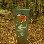
Around 560m of this walk is clearly signposted, whilst the remaining 160m has directional signs at most intersection.
Experience Required
Around 560m of this walk requires no previous bushwalking experience, whilst the remaining 160m requires some bushwalking experience.
weather
This whole walk, 720m is not usually affected by severe weather events (that would unexpectedly impact safety and navigation).
Infrastructure
Around 360m of this walk has limited facilities (such as not all cliffs fenced), whilst the remaining 360m is close to useful facilities (such as fenced cliffs and seats).
Similar walks

516 m Return
15 mins
Moderate track
Other Nearby walks
12.5 km One way
6 hrs
Hard track
8.1 km One way
4 hrs
Hard track

1.5 km Return
1 Hr
Moderate track
1.7 km Return
1 Hr
Hard track

406 m Return
30 mins
Hard track
1.3 km Circuit
45 mins
Moderate track

4.3 km One way
2 hrs
Hard track
5.6 km Circuit
2 hrs 30 mins
Hard track
2.5 km Circuit
1 Hr
Hard track
4.4 km Return
3 hrs 30 mins
Moderate track
29.7 km One way
2 Days
Hard track
17.2 km One way
7 hrs
Hard track
Plan your trip to and from the walk here
The Boarding House Dam Circuit walk starts and ends at the Boarding House Dam Picnic Area (gps: -32.9985, 151.40554)Your main transport option to Boarding House Dam Picnic Area is by;
(get details)


Short URL = http://wild.tl/bhdl
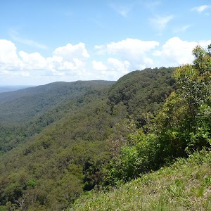
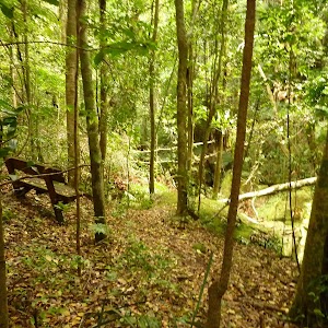
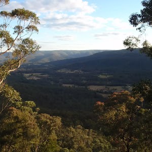
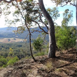
Gallery images
There are other downloads I am still working on.
You will probably need to login to access these — still all free.
* KML (google earth file)
* GPX (GPS file)
Special Maps/ brochures
* A3 topo maps
* PDF with Lands Topo map base
* PDF with arial image (and map overlay)
I wanted to get the main site live first, this extra stuff will come in time.
Happy walking
Matt 🙂
Comments