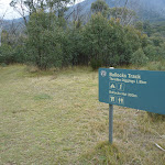
Bullock’s track – via Bullock’s Hut


2 hrs

110 m
Moderate track


Covered in snow part of the year

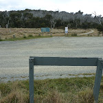
Thredbo Diggings Camping area
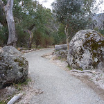
(0km) Thredbo Diggings Bullocks trackhead → Int of Bullocks Walking and car park tracks

2 km
34 mins
31m
-30m
Moderate track
(1.97km) Int of Bullocks Walking and car park tracks → Bullocks Loop bridge intersection
340 m
6 mins
0m
-15m
Moderate track
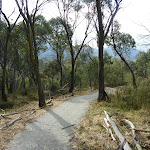
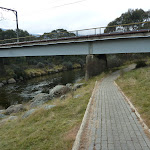
(2.31km) Bullocks Loop bridge intersection → SE corner of Skitube bridge
220 m
4 mins
1m
-5m
Moderate track
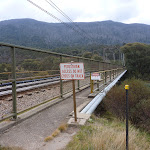
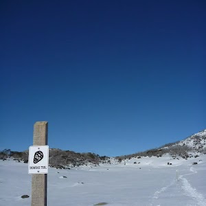
Skitube – Alpine Railway
(2.53km) SE corner of Skitube bridge → Steam Engine
310 m
6 mins
7m
-3m
Moderate track
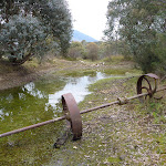
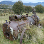
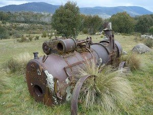
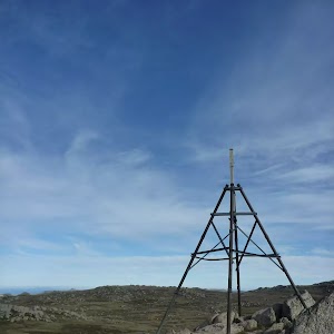
Steam Engine
(2.53km) SE corner of Skitube bridge → Bullocks Hut
100 m
1 mins
0m
0m
Moderate track
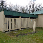
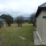
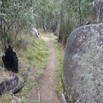
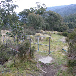
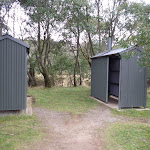
Veer right: From the intersection, this walk heads directly away from the river, through the gap in the fence[45] to the large grassy clearing. The walk heads left through the clearing (passing the toilet, on your right) to come to a series of buildings[46], the last of which is Bullocks Hut[47].
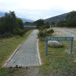
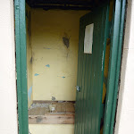
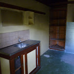
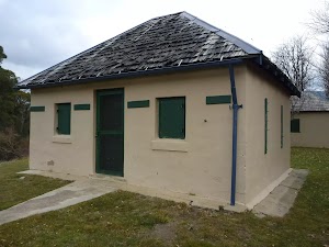
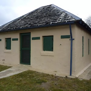
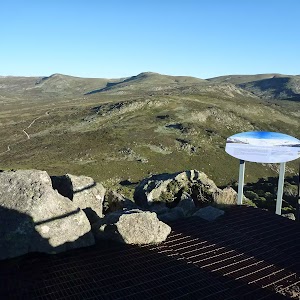
Bullocks Hut
(2.63km) Bullocks Hut → Bullocks Loop bridge intersection
410 m
7 mins
6m
-1m
Moderate track
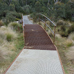
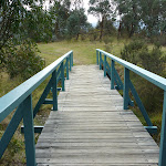
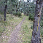
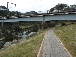
Continue straight: From the intersection, this walk follows the ‘Skitube’ sign[60] along the track, keeping the river to your right. The track leads over a metal grate[61] and almost immediately comes to a signposted three-way intersection, just before the bridge[62].
Continue straight: From the intersection, this walk follows the ‘Skitube Carpark’ sign under the bridge[63], whilst keeping the river to your right. The walk follows the paved footpath uphill[64], passing a ‘Bullocks Hut’ sign[65] (facing the other way) and continuing straight along the wide gravel path[66]. This path soon narrows and bends left (at the water monitoring station[67]) and leads over the grass and across a timber bridge[68]. On the other side of the bridge, this walk comes to a three-way intersection[69] where there is a ‘Bullocks Hut 300m’ sign pointing back over the bridge[70].
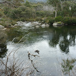
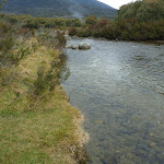
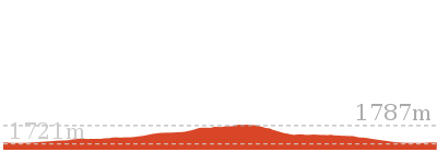
(3.04km) Bullocks Loop bridge intersection → Thredbo River rocks
1.4 km
28 mins
53m
-50m
Moderate track
(4.4km) Thredbo River rocks → Bull Creek bridge
480 m
9 mins
9m
-7m
Moderate track
(4.88km) Bull Creek bridge → Lower Thredbo Diggings
160 m
3 mins
2m
0m
Moderate track
(5.04km) Lower Thredbo Diggings → Thredbo Diggings Bullocks trackhead
190 m
4 mins
8m
0m
Moderate track
Maps for the Bullock’s track – via Bullock’s Hut walk
You can download the PDF for this walk to print a map.These maps below cover the walk and the wider area around the walk, they are worth carrying for safety reasons.
| Perisher Valley | 1:25 000 Map Series | 85252S PERISHER VALLEY | NSW-85252S |
| Chimneys Ridge | 1:25 000 Map Series | 85241N CHIMNEYS RIDGE | NSW-85241N |
| Kosciuszko | 1:100 000 Map Series | 8525 KOSCIUSZKO | 8525 |
| Jacobs River | 1:100 000 Map Series | 8524 JACOBS RIVER | 8524 |
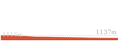
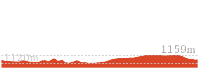
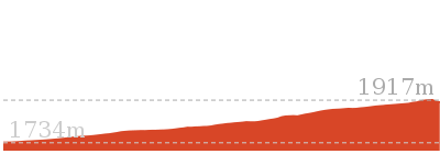
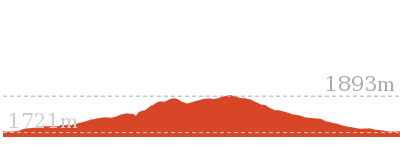
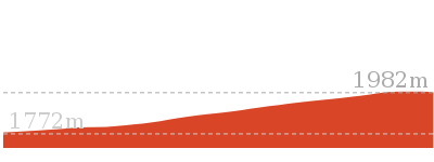
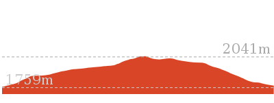
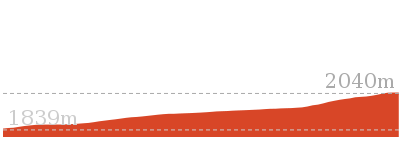
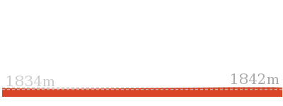
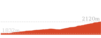
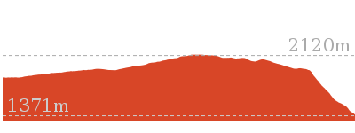
Cross sectional view of the Bullock’s track – via Bullock’s Hut bushwalking track
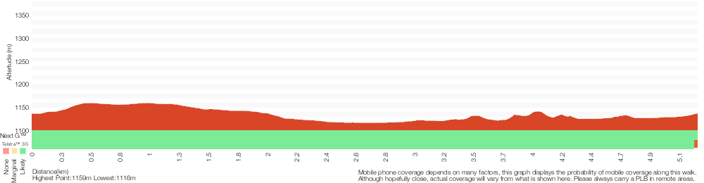
Analysis and summary of the altitude variation on the Bullock’s track – via Bullock’s Hut
Overview of this walks grade – based on the AS 2156.1 – 2001
Under this standard, a walk is graded based on the most difficult section of the walk.
| Length | 5.2 km | ||
| Time | 2 hrs | ||
| . | |||
| Grade 3/6 Moderate track |
AS 2156.1 | Gradient | Short steep hills (3/6) |
| Quality of track | Formed track, with some branches and other obstacles (3/6) | ||
| Signs | Clearly signposted (1/6) | ||
| Experience Required | No experience required (1/6) | ||
| Weather | Storms may impact on navigation and safety (3/6) | ||
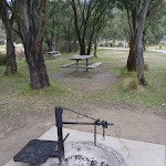
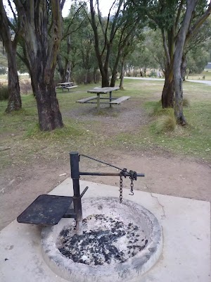
| Infrastructure | Generally useful facilities (such as fenced cliffs and seats) (1/6) |
Some more details of this walks Grading
Here is a bit more details explaining grading looking at sections of the walk
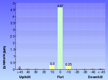
Gradient
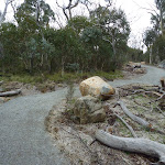
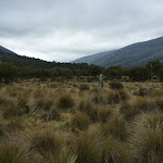
3.2km of this walk has gentle hills with occasional steps and another 1.4km has short steep hills. The remaining (690m) is flat with no steps.
Quality of track
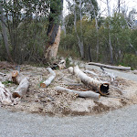
3.7km of this walk follows a clear and well formed track or trail and another 1.4km follows a formed track, with some branches and other obstacles. The remaining (190m) follows a smooth and hardened path.
Signs
This whole walk, 5km is clearly signposted.
Experience Required
This whole walk, 5km requires no previous bushwalking experience.
weather
This whole walk, 5km is affected by storms that may impact your navigation and safety.
Infrastructure
This whole walk, 5km is close to useful facilities (such as fenced cliffs and seats).
Similar walks
1.5 km Return
30 mins
Moderate track
4.5 km Circuit
1 hr 30 mins
Moderate track
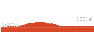
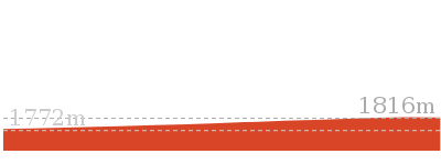
Other Nearby walks

5.6 km Return
2 hrs 30 mins
Hard track
3 km Circuit
1 hr 30 mins
Moderate track
7.3 km Circuit
3 hrs
Hard track
5.2 km One way
2 hrs 45 mins
Hard track

778 m Return
30 mins
Moderate track
2.4 km Return
1 hr 30 mins
Hard track
4.2 km Circuit
2 hrs 15 mins
Hard track
3.8 km Return
1 hr 45 mins
Hard track
374 m Return
15 mins
Moderate track
15.2 km Return
5 hrs 30 mins
Hard track
12 km Return
4 hrs 30 mins
Hard track
12.2 km One way
5 hrs
Hard track
Plan your trip to and from the walk here
The Bullock’s track – via Bullock’s Hut walk starts and ends at the Thredbo Diggings Bullocks trackhead (gps: -36.447772, 148.42542)Your main transport option to Thredbo Diggings Bullocks trackhead is by;
(get details)


Short URL = http://wild.tl/bc
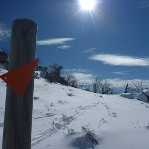
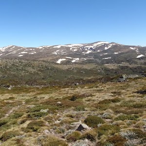
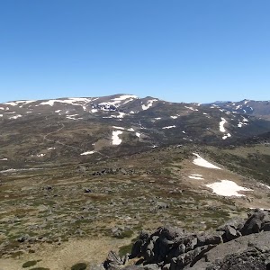
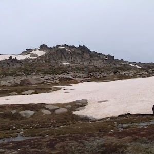
Gallery images
There are other downloads I am still working on.
You will probably need to login to access these — still all free.
* KML (google earth file)
* GPX (GPS file)
Special Maps/ brochures
* A3 topo maps
* PDF with Lands Topo map base
* PDF with arial image (and map overlay)
I wanted to get the main site live first, this extra stuff will come in time.
Happy walking
Matt 🙂
Comments