Chatswood Station to Mowbray Park


2 hrs

137 m
Hard track


(0km) Chatswood Station → Int. Edgar St and Edgar St Reserve Trk

620 m
13 mins
9m
-37m
Moderate track
Turn right: From the intersection, this walk heads north up the Pacific Highway, to turn left onto Western Way. The walk continues down Western Way through a dogleg, turning right onto Jenkins Rd then quickly left back onto Western Way. The walk heads down Western Way to turn right onto Edgar St and to the Edgar Reserve Park with green gate.
(0.62km) Int. Edgar St and Edgar St Reserve Trk → Int. Park Ave and Edgar St Reserve Trk
340 m
6 mins
1m
-12m
Moderate track
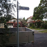
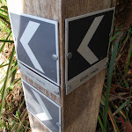
Continue straight: From the intersection, the walk heads between the tennis court fence on your right and the houses on your left for approximately 150m. The track then comes to an intersection with Park Ave, and a ‘Rail to River Walk’ sign[1].
(0.96km) Int. Park Ave and Edgar St Reserve Trk → Int. Park Ave and Rail to River Trk
30 m
1 mins
0m
-1m
Easy track
(0.99km) Int. Park Ave and Rail to River Trk → Harnett Pl sign post
500 m
13 mins
22m
-30m
Moderate track
Continue straight: From the intersection, the walk follows the creek (which remains on your left) down the gully for approximately 100m to the signposted intersection.
Veer right: From the intersection, the walk heads along the creek (which remains on the left) for approximately 60m to turn up the steps to a signposted intersection.
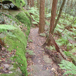
Turn right: From the intersection, this walk follows the ‘Rail to River Walk’ sign up the hill. The track zigzags up through mossy rock outcrops to a house on the left. This walk continues up the stairs to the intersection with the road.
(1.49km) Harnett Pl sign post → Int. Hawthorne Ave and Bellevue Ave
1 km
20 mins
22m
-35m
Easy track
Turn left: From the gate on Greville St, this walk passes through the park diagonally, past the play equipment and BBQs, to the gate on the Fullers Rd side of Lowanna Park.
Turn left: From Lowanna Park, this walk heads along Fullers Rd towards the mechanics, initially keeping the park on the left. The walk continues along Fullers Rd, as Millwood Ave breaks off to the right. The first left is the signposted intersection with Bellevue Ave.
Turn left: From the intersection, this walk follows the ‘Rail to River Walk’ signs down Bellevue Ave for approximately 500m, tending right to the signposted intersection.
(2.51km) Int. Hawthorne Ave and Bellevue Ave → Int. Rail to River Trk and Hawthorne Ave
50 m
1 mins
0m
-5m
Easy track
(2.56km) Int. Rail to River Trk and Hawthorne Ave → O.H. Reid Memorial Oval car park
210 m
4 mins
0m
-17m
Moderate track
Continue straight: From the intersection, the walk heads across the oval to the car park to the left of the toilet block.
(2.77km) O.H. Reid Memorial Oval car park → Int. Rail to River Trk and Reid Drive
380 m
7 mins
6m
-9m
Easy track
(3.15km) Int. Rail to River Trk and Reid Drive → Int. River Trk and Avian Cr Trk
1.4 km
27 mins
35m
-37m
Hard track
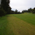
Turn left : From the intersection, this walk follows the track past the metal fence and along the right-hand side of the 8th fairway of Chatswood Golf Course, keeping the river on the right of the track. The walk continues up the fairway and over a bridge, passing two sand bunkers on the left. Approximately 20m after the second bunker, the walk comes to an intersection with a management trail, on the right.
Continue straight: From the intersection, this walk leaves the golf course and heads along the mangroves and waterline, to the right of the track. The walk follows the mangroves for a short time to the signposted intersection.
Veer right: From the intersection, this walk follows the arrow for the ‘River Walk’, keeping the Lane Cove River on the right. The track continues along some boardwalk sections which are raised above the mangroves in places. The track continues to a signposted intersection.
(4.51km) Int. River Trk and Avian Cr Trk → Mowbray Park
540 m
10 mins
9m
-15m
Moderate track
Continue straight: From the intersection, this walk heads west along the Lane Cove River bank, with the water to the right of the track. The track quickly opens out onto a clearing next to the river bank. The walk continues over two sections of boardwalked track, leading to a signposted intersection.
Turn right: From the signposted intersection, this walk heads towards the large rock next to the water (below on the right). The walk uses pins bolted into the rock as handholds, and climbs to the other side of the river bank. The track then continues along the gap between the mangroves and a rocky outcrop, to come to the Mowbray Park athletics field.
(5.05km) Mowbray Park → Int. River Trk and Bus Stop Trk
270 m
6 mins
21m
-11m
Moderate track
Turn right: From the intersection, this walk heads along the hillside towards the oval (below on the right). The track winds through the bush for approximately 60m to pass over a bridge and a ‘Mowbray Park’ sign in a grassed area. The walk crosses this grass area to come to the intersection with the footpath.
(5.31km) Int. River Trk and Bus Stop Trk → Mowbray car park (near oval)
120 m
2 mins
0m
-7m
Moderate track
(5.31km) Int. River Trk and Bus Stop Trk → Mowbray Park bus stop
40 m
2 mins
12m
0m
Moderate track
Maps for the Chatswood Station to Mowbray Park walk
You can download the PDF for this walk to print a map.These maps below cover the walk and the wider area around the walk, they are worth carrying for safety reasons.
| Parramatta River | 1:25 000 Map Series | 91303N PARRAMATTA RIVER | NSW-91303N |
| Sydney | 1:100 000 Map Series | 9130 SYDNEY | 9130 |
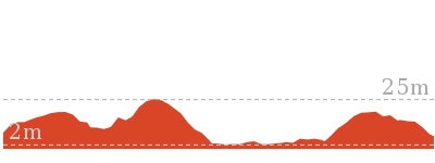
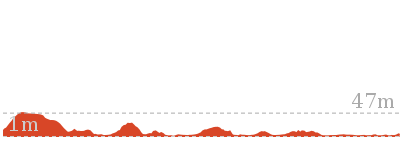
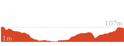
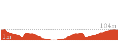
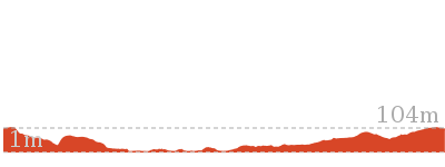
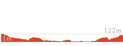
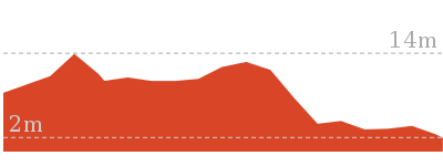
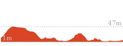
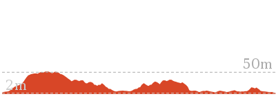
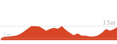
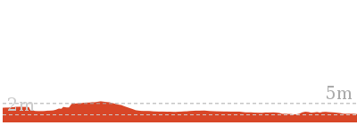
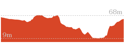
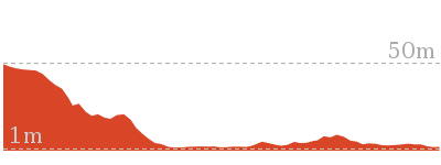
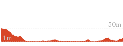
Cross sectional view of the Chatswood Station to Mowbray Park bushwalking track

Analysis and summary of the altitude variation on the Chatswood Station to Mowbray Park

Overview of this walks grade – based on the AS 2156.1 – 2001
Under this standard, a walk is graded based on the most difficult section of the walk.
| Length | 5.4 km | ||
| Time | 2 hrs | ||
| . | |||
| Grade 4/6 Hard track |
AS 2156.1 | Gradient | Very steep (4/6) |
| Quality of track | Formed track, with some branches and other obstacles (3/6) | ||
| Signs | Directional signs along the way (3/6) | ||
| Experience Required | Some bushwalking experience recommended (3/6) | ||
| Weather | Storms may impact on navigation and safety (3/6) | ||
| Infrastructure | Limited facilities, not all cliffs are fenced (3/6) |
Some more details of this walks Grading
Here is a bit more details explaining grading looking at sections of the walk
Gradient
2.5km of this walk is flat with no steps and another 2.2km has gentle hills with occasional steps. Whilst another 540m has short steep hills and the remaining 55m is very steep.
Quality of track
Around 2.9km of this walk follows a smooth and hardened path, whilst the remaining 2.4km follows a formed track, with some branches and other obstacles.
Signs
Around 3km of this walk has directional signs at most intersection, whilst the remaining 2.4km is clearly signposted.
Experience Required
Around 5km of this walk requires no previous bushwalking experience, whilst the remaining 140m requires some bushwalking experience.
weather
Around 5km of this walk is not usually affected by severe weather events (that would unexpectedly impact safety and navigation), whilst the remaining 140m is affected by storms that may impact your navigation and safety.
Infrastructure
Around 3.6km of this walk is close to useful facilities (such as fenced cliffs and seats), whilst the remaining 1.7km has limited facilities (such as not all cliffs fenced).
Similar walks
1.5 km Circuit
1 Hr
Moderate track
3.3 km Circuit
1 hr 30 mins
Moderate track

5.3 km Circuit
2 hrs 30 mins
Hard track
6 km One way
2 hrs 30 mins
Hard track
7.5 km Circuit
3 hrs
Hard track
11.2 km Circuit
4 hrs
Hard track

12.2 km One way
4 hrs 30 mins
Hard track

16.3 km One way
6 hrs
Hard track

18.1 km One way
6 hrs 45 mins
Hard track
Other Nearby walks

8.9 km One way
3 hrs 30 mins
Hard track
978 m Return
30 mins
Easy track
2.6 km One way
1 Hr
Hard track
4.3 km Circuit
1 hr 27 mins
Moderate track
1.5 km Return
45 mins
Moderate track
1.3 km Return
1 Hr
Moderate track

5.3 km One way
2 hrs
Hard track
2.2 km One way
1 Hr
Moderate track
6.9 km Circuit
2 hrs 30 mins
Hard track


11.9 km Circuit
5 hrs
Hard track
3.4 km Return
1 hr 30 mins
Moderate track
5.9 km Return
2 hrs 30 mins
Moderate track
Plan your trip to and from the walk here
The Chatswood Station to Mowbray Park walk starts at the Chatswood Station (gps: -33.797073, 151.18037)Your transport options to Chatswood Station are by;
(get details)
The Chatswood Station to Mowbray Park ends at the Mowbray Park bus stop (gps: -33.801252, 151.14757)
Your transport options to Mowbray Park bus stop are by;
(get details)


Short URL = http://wild.tl/cstmp
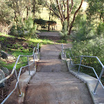
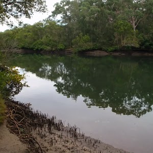
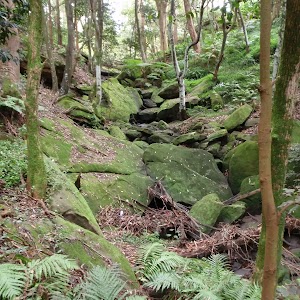
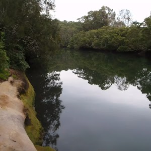
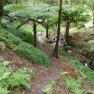
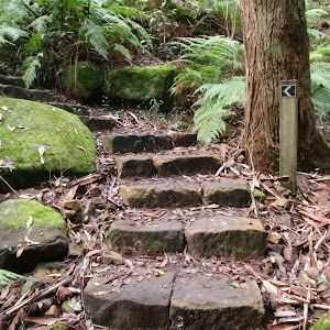
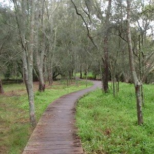
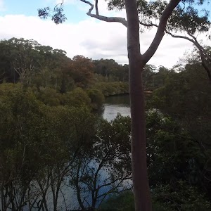
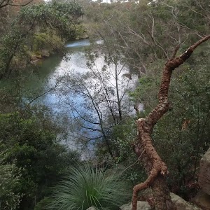
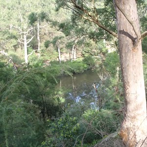
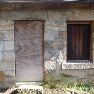
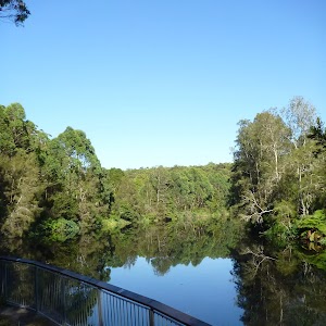
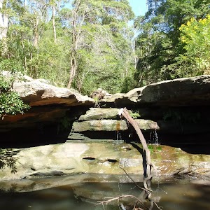
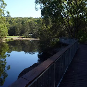
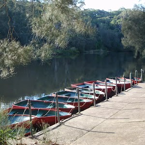
Gallery images
There are other downloads I am still working on.
You will probably need to login to access these — still all free.
* KML (google earth file)
* GPX (GPS file)
Special Maps/ brochures
* A3 topo maps
* PDF with Lands Topo map base
* PDF with arial image (and map overlay)
I wanted to get the main site live first, this extra stuff will come in time.
Happy walking
Matt 🙂
Comments