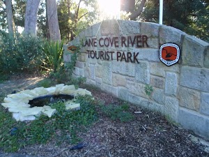
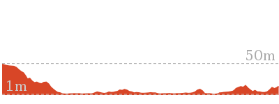
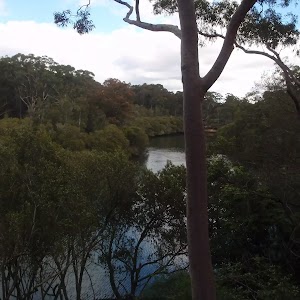
Lane Cove Tourist Park River Circuit


5 hrs

381 m
Hard track


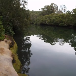
Lane Cove River tourist park
(0km) Lane Cove Tourist Park → Riverside Dr

540 m
11 mins
6m
-43m
Moderate track
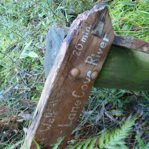
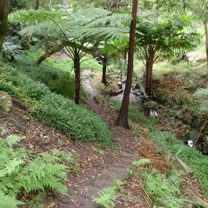
Turn right: From the intersection, the walk follows ‘Lane Cove River Weir’ sign[9] south down the hill. The track leads gently down the side of the hill for about 80m to pass a ‘Native Flora’ information sign[10][11], then about 90m later passes a ‘Bush Regeneration’ information sign[12] among the ferns. Just 30m past this sign, the track leads over a small metal bridge[13] beside the tall fern trees[14] and ‘Native Fauna’ information sign[15]. Here the track continues for a short distance to come to an intersection with Riverside Drive, where a ‘Tourist Park’ sign[16] points back up the hill.
(0.54km) Riverside Dr → 13 Cottonwood Glen
130 m
3 mins
0m
-11m
Easy track
(0.67km) 13 Cottonwood Glen → Porters Creek bridge East
2.1 km
35 mins
34m
-26m
Moderate track
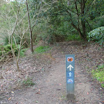
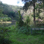
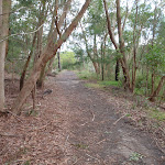
Continue straight: From ’18 Korong’ picnic area, this walk heads across the clearing and up the road to the sign marked ’19 Halfway Point’. The walk passes this sign and the gate next to it, heading to the bottom of the grass clearing. The track then turns left and follows the Lane Cove River for approximately 1km, passing through some small clearings. The track then rounds to the left over a rocky section, then passes a creek fed by a drain high on the left. The track winds right, into the picnic area ’20 Fern Valley’ where there are picnic tables.
Continue straight: From Fern Valley, this walk heads north along the river. The track winds and undulates for approximately 1km, following the Lane Cove River. The track then turns left to head up Porters Creek for approximately 100m, then heads up some stairs to Porters Creek bridge, on Riverside Drive.
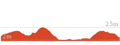
(2.73km) Porters Creek bridge East → Porters Creek bridge West
30 m
1 mins
0m
-1m
Very easy
(2.76km) Porters Creek bridge West → Int. Riverside Trk and Riverside Dr at park entrance
1.5 km
28 mins
53m
-23m
Hard track
(4.28km) Int. Riverside Trk and Riverside Dr at park entrance → Int. Riverside Trk and Ryde Rd Access Trk SE
280 m
6 mins
8m
-12m
Very easy
(4.55km) Int. Riverside Trk and Ryde Rd Access Trk SE → DeBurghs Bridge South
30 m
1 mins
6m
0m
Moderate track
(4.58km) DeBurghs Bridge South → DeBurghs Bridge North
270 m
8 mins
23m
-29m
Very easy
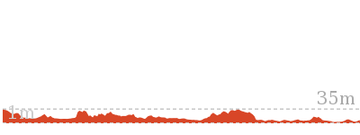
(4.85km) DeBurghs Bridge North → Sandstone caves
940 m
23 mins
44m
-59m
Hard track
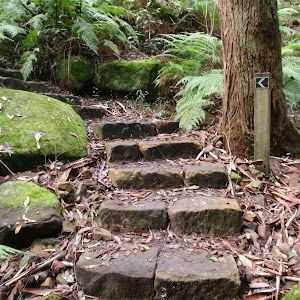
Veer left: From the intersection, the walk follows the sign to ‘Lane Cove River Weir via Great North Walk’[30] down the hill and steps, keeping the valley to your right. The track soon leads down some stone steps[31], then a little further along, partway down some timber steps, this walk comes to a three-way intersection[32], marked with a GNW arrow post.
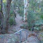
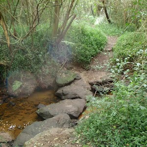
Turn left: From the intersection, this walk follows the GNW arrow post along the flat track[33], keeping the valley to your right. The track soon bends left then follows a GNW arrow post down off a rock platform[34] to cross the rocky Blackbutt Creek[35][36]. Here, the walk heads up a series of timber steps[37], then the track flattens out and turns right at another GNW arrow post[38]. Here the track widens into a trail and leads up over a partially buried, green metal pipeline[39] (sometimes hissing[40]) then follows the power lines[41] for about 50m before turning left and coming to a signposted intersection partway up the hill[42]. There is a ‘Great North Walk – Deburghs Bridge’ sign pointing back downhill[43].
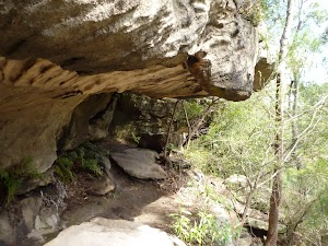
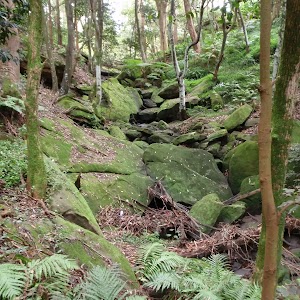
Veer right: From the intersection, this walk follows the GNW arrow post down the steps and along the narrower track[44], directly away from the face of the ‘Great North Walk’ sign. This track soon passes under some power lines[45] then continues through the open forest[46] for about 50m to head down some rocky steps[47]. From here, the walk follows the base of the rock wall[48] to head through a long tunnel-like sandstone overhang[49][50]. Here the track leads down to cross a mossy and rocky gully[51], then heads up around the left side of a large cube boulder[52] (know as ‘The Block’). The walk then follows along the base of long sandstone wall[54] (on your left) for about 130m and then enters a sandstone overhang[55].
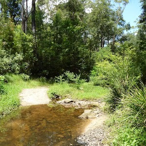
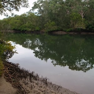
Sandstone caves
(5.79km) Sandstone caves → Fiddens Wharf Oval Trk
1.6 km
32 mins
49m
-62m
Moderate track
(7.35km) Bottom of Fiddens Wharf Oval Trk → Int. Great North Walk and Thistlethwaytes Picnic Area Trk
800 m
16 mins
44m
-23m
Moderate track
(8.14km) Int. Great North Walk and Thistlethwaytes Picnic Area Trk → Int. Max Allen Dr and Jenkins Hill Trk
970 m
21 mins
31m
-50m
Moderate track
Turn left: From the intersection, this walk follows the NPWS arrow up along the road[97] for a short distance and comes to another signposted intersection with another track[98] (on your right), a short distance before the locked gate.
Veer right: From the intersection, this walk follows the GNW arrow posts[99] down a couple of timber steps then along the narrow track. The track gently meanders through the open forest[100] for a short time until heading up some timber steps and coming to a T-intersection with a wide management trail.
Veer right: From the intersection, this walk follows the GNW arrow post[101] downhill along the wide management trail (keeping the house up to your left). The trail soon follows the power line[102] down to an intersection where a ‘Blue Hole – Fiddens Wharf’ sign[103] points back up the hill.
Turn right: From the intersection, this walk follows the ‘Park Visitors Centre’ sign[104] downhill, away from the houses. Just over 100m later, the wide trail bends left[105] and follows a cliff line to an intersection with a narrower track[106] (marked with a GNW arrow post) about 10m before a locked gate.
Veer right: From the intersection, this walk follows the GNW arrow post[107] downhill along the narrow track and soon comes to an intersection with Max Allen Dr[108], beside a large ‘Great North Walk’ sign[109].
Turn right: From the intersection, the walk follows the road up the hill. The road passes over the hill, to an intersection with a track on the left, marked by wooden posts. Now Turn left to rejoin the main walk .
(8.14km) Int. Great North Walk and Thistlethwaytes Picnic Area Trk → Thistlethwaytes Picnic Area
350 m
7 mins
5m
-28m
Moderate track
(8.49km) Thistlethwaytes Picnic Area → Int. Opposite Bakers Flat
620 m
12 mins
13m
-13m
Very easy
Continue straight: From the intersection, this walk heads along the road, with the water on the right. The walk tends left, continuing up the road to pass a brick building on the right, before coming to the signposted intersection, opposite Baker’s Flat.
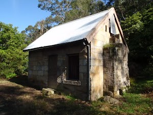
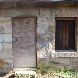
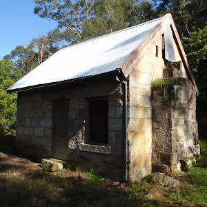
(9.12km) Int. Opposite Bakers Flat → Baker’s Cottage
120 m
3 mins
10m
-1m
Moderate track
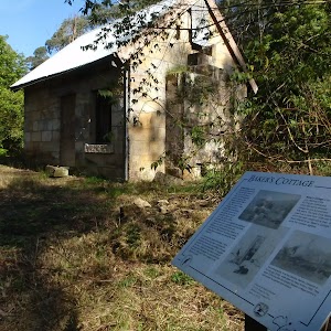
Baker’s Cottage
(9.12km) Int. Opposite Bakers Flat → Lane Cove Weir South
590 m
13 mins
15m
-19m
Moderate track
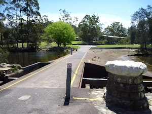
Turn right: From the intersection, this walk heads down the path for approximately 50m to pass a toilet block on the left of the track. The track continues to an intersection with a railed footpath.
Veer right: From the intersection, this walk heads down the slight gradient, away from the toilet block to the large concreted area above the weir.
Turn right: From the intersection, this walk heads directly down the hill to the weir at the water.
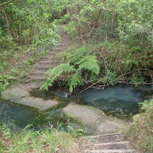
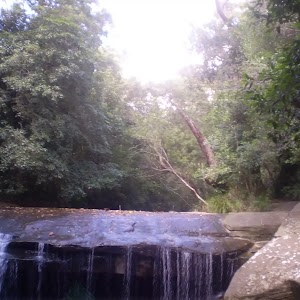
Continue straight: From the intersection, this walk follows the GNW arrow post[110] (past a seat on the right) to cross over the concrete ford (top of the weir wall[111]) to the other side of Lane Cove River to find an intersection marked with another GNW arrow post[112]. After heavy or prolonged rain, this crossing may be closed. It is unsafe to cross if water is flowing over the top.


Lane Cove Weir
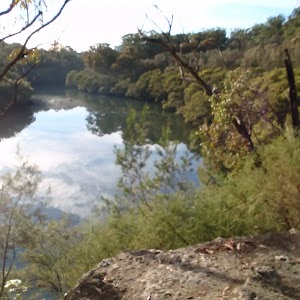
(9.71km) Lane Cove Weir South → Lane Cove River Lookout
50 m
1 mins
0m
0m
Very easy

(9.76km) Lane Cove River Lookout → Illoura Picnic Area
310 m
6 mins
7m
-7m
Easy track


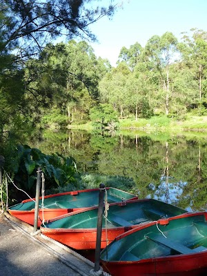
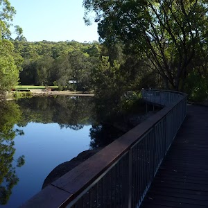
(10.07km) Illoura Picnic Area → Boat Shed
160 m
3 mins
1m
-1m
Moderate track


Lane Cove Boatshed
(10.22km) Boat Shed → 9 Carters Creek
690 m
13 mins
17m
-14m
Moderate track
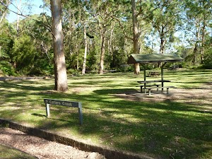
Continue straight: From the intersection, this walk follows the NPWS arrow post[143] along the narrow management trail, keeping the river to your right. After about 60m, this walk heads around a locked gate[144], then heads up over the grass to find a picnic area[145]. Here the walk heads over the timber bridge[146], past the ‘9 Carters Creek’ sign[147] and into the picnic area. The walk veers left across the picnic area[148] to come back to the car park, just below the toilet block[149] on the far side of the picnic area.
9 Carters Creek
(10.91km) 9 Carters Creek → 13 Cottonwood Glen
360 m
6 mins
2m
-5m
Moderate track
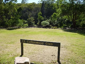
13 Cottonwood Glen
(11.28km) 13 Cottonwood Glen → Riverside Dr
130 m
3 mins
11m
0m
Easy track
(11.41km) Riverside Dr → Lane Cove Tourist Park
540 m
11 mins
43m
-6m
Moderate track
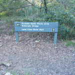
Turn left: From the intersection, the walk heads uphill directly away from the face of the ‘Scribbly Gums picnic area’ sign[176] and past the large scribbly gum[177]. The track leads under a banksia tree[178] and after about 40m starts to climb a series of stone steps[179]. After climbing these steps for about 60m, this walk heads through a gap in a fence[180] to come to the edge of the Lane Cove Tourist Park[181]. From here, this walk head directly away from the face of the ‘Lane Cove National Park’ sign[182] and straight up the internal road[183]. This road soon bends left then leads though the campsite for about 100m before bending right just past the laundry[184]. Here the walk heads up this road for about 50m, past the boom gates[185], to come to the front of the the ‘Lane Cove Tourist Park’ office[186].
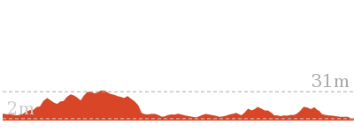
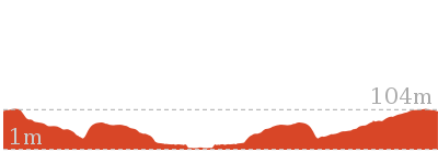
Maps for the Lane Cove Tourist Park River Circuit walk
You can download the PDF for this walk to print a map.These maps below cover the walk and the wider area around the walk, they are worth carrying for safety reasons.
| Parramatta River | 1:25 000 Map Series | 91303N PARRAMATTA RIVER | NSW-91303N |
| Sydney | 1:100 000 Map Series | 9130 SYDNEY | 9130 |
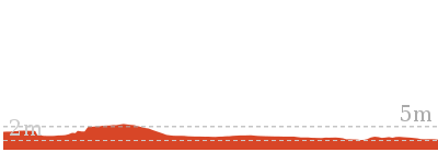
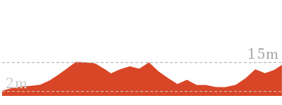
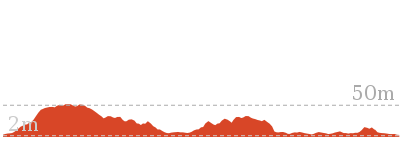
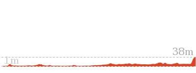
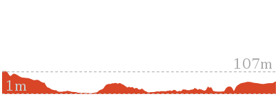
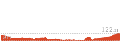
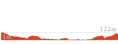
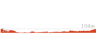
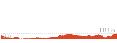
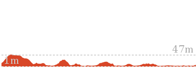
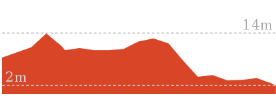
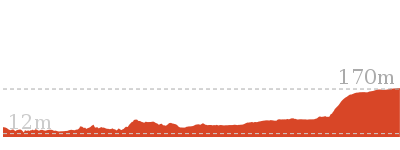
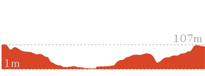
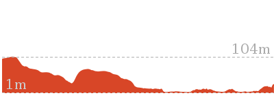
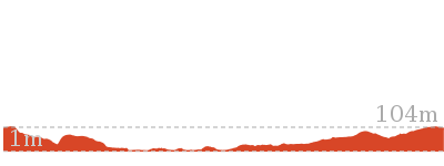
Cross sectional view of the Lane Cove Tourist Park River Circuit bushwalking track
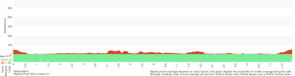
Analysis and summary of the altitude variation on the Lane Cove Tourist Park River Circuit
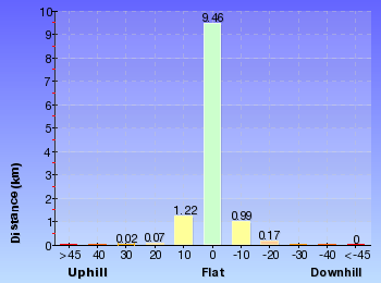
Overview of this walks grade – based on the AS 2156.1 – 2001
Under this standard, a walk is graded based on the most difficult section of the walk.
| Length | 11.9 km | ||
| Time | 5 hrs | ||
| . | |||
| Grade 4/6 Hard track |
AS 2156.1 | Gradient | Very steep (4/6) |
| Quality of track | Rough track, where fallen trees and other obstacles are likely (4/6) | ||
| Signs | Minimal directional signs (4/6) | ||
| Experience Required | Some bushwalking experience recommended (3/6) | ||
| Weather | Storms may impact on navigation and safety (3/6) | ||
| Infrastructure | Limited facilities (such as cliffs not fenced, significant creeks not bridged) (4/6) |
Some more details of this walks Grading
Here is a bit more details explaining grading looking at sections of the walk
Gradient
5km of this walk has short steep hills and another 2.8km is flat with no steps. Whilst another 2.5km has gentle hills with occasional steps and the remaining 1.5km is very steep.
Quality of track
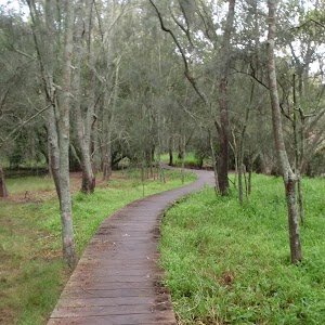
7km of this walk follows a formed track, with some branches and other obstacles and another 2.1km follows a smooth and hardened path. Whilst another 1.9km follows a rough track, where fallen trees and other obstacles are likely and the remaining 800m follows a clear and well formed track or trail.
Signs
5km of this walk is clearly signposted and another 5km has directional signs at most intersection. The remaining (1.5km) has minimal directional signs.
Experience Required
Around 10km of this walk requires no previous bushwalking experience, whilst the remaining 1.9km requires some bushwalking experience.
weather
Around 12km of this walk is not usually affected by severe weather events (that would unexpectedly impact safety and navigation), whilst the remaining 55m is affected by storms that may impact your navigation and safety.
Infrastructure
6km of this walk is close to useful facilities (such as fenced cliffs and seats) and another 4.5km has limited facilities (such as not all cliffs fenced). The remaining (1.5km) has limited facilities (such as cliffs not fenced, significant creeks not bridged).
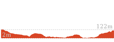
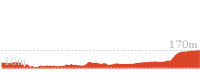
Similar walks
1.3 km Return
1 Hr
Moderate track
1.5 km Return
45 mins
Moderate track
2.6 km One way
1 Hr
Moderate track
3.4 km Return
1 hr 30 mins
Moderate track
4.3 km Circuit
1 hr 27 mins
Moderate track

5.3 km One way
2 hrs
Hard track
5.5 km One way
2 hrs
Hard track
5.9 km Return
2 hrs 30 mins
Moderate track
6 km One way
2 hrs 30 mins
Hard track
6.9 km Circuit
2 hrs 30 mins
Hard track


8.9 km One way
3 hrs 30 mins
Hard track

10.7 km One way
4 hrs 30 mins
Hard track
11.6 km One way
4 hrs 30 mins
Hard track

11.7 km One way
4 hrs 15 mins
Hard track

12.2 km One way
4 hrs 30 mins
Hard track
13.3 km One way
4 hrs 30 mins
Hard track


16.3 km One way
6 hrs
Hard track

18.1 km One way
6 hrs 45 mins
Hard track

25.8 km One way
2 Days
Hard track

33 km One way
2 Days
Hard track


44.4 km One way
3 Days
Hard track

Other Nearby walks
2.6 km One way
1 Hr
Hard track
5.3 km Circuit
2 hrs 30 mins
Hard track
1.5 km Circuit
1 Hr
Moderate track
978 m Return
30 mins
Easy track
9.7 km One way
3 hrs 45 mins
Hard track
6 km One way
2 hrs 30 mins
Hard track
5.4 km One way
2 hrs
Hard track
3.3 km Circuit
1 hr 30 mins
Moderate track

11.2 km Circuit
4 hrs
Hard track
7.5 km Circuit
3 hrs
Hard track
10.3 km One way
3 hrs 45 mins
Hard track

20.6 km One way
8 hrs
Hard track
Plan your trip to and from the walk here
The Lane Cove Tourist Park River Circuit walk starts and ends at the Lane Cove Tourist Park (gps: -33.789442, 151.14332)Your transport options to Lane Cove Tourist Park are by;
(get details)


Short URL = http://wild.tl/lctprc
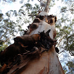
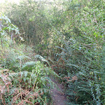
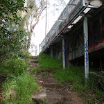
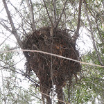
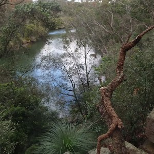
Gallery images
There are other downloads I am still working on.
You will probably need to login to access these — still all free.
* KML (google earth file)
* GPX (GPS file)
Special Maps/ brochures
* A3 topo maps
* PDF with Lands Topo map base
* PDF with arial image (and map overlay)
I wanted to get the main site live first, this extra stuff will come in time.
Happy walking
Matt 🙂
Comments