Norah Head Nature Trail


1 Hr

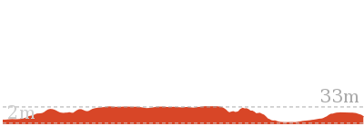
65 m
Moderate track


(0km) Bush St Reserve car park → Headland Nature Trail trackhead

90 m
2 mins
2m
-1m
Easy track
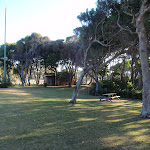
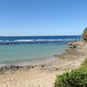
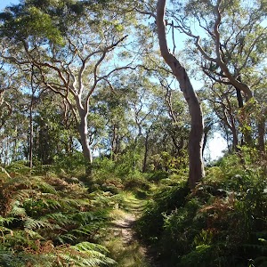
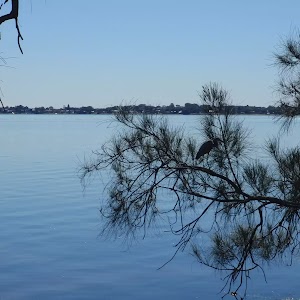
Bush St reserve
(0.09km) Headland Nature Trail trackhead → Int near headland lookout
160 m
3 mins
1m
-5m
Moderate track
(0.25km) Int near headland lookout → Headland lookout
20 m
0m
-1m
Moderate track
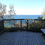
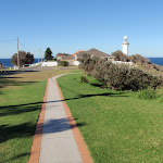
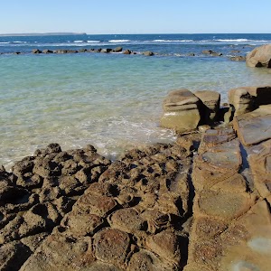
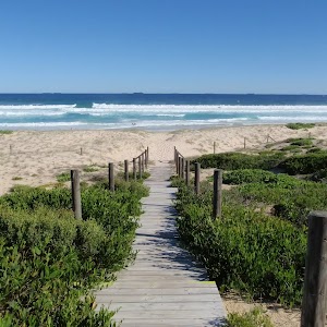
Headland lookout

(0.27km) Headland lookout → Lighthouse car park
380 m
7 mins
12m
-2m
Moderate track
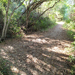
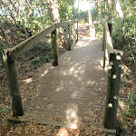
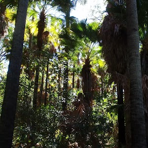
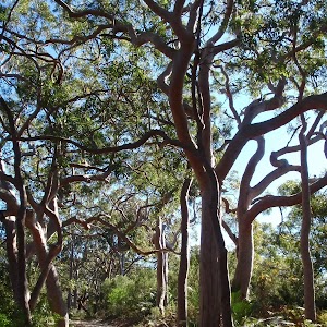
Veer left: From the intersection, this walk follows the bush track, taking the left fork, directly away from the nearby lookout platform. After a short distance, the track follows a ‘Nature Trail’ arrow to the left, ignoring a track to the right, and continues meandering through the bush. The track passes over a small timber bridge and bends to the right, continuing through the bush for some time and arriving at the end of the lighthouse car park.
(0.65km) Lighthouse car park → Merchant Mariners memorial lookout
90 m
2 mins
0m
-7m
Very easy
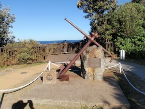
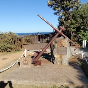
Merchant Mariners memorial and lookout
(0.74km) Merchant Mariners memorial lookout → Cottage car park
120 m
3 mins
4m
-11m
Very easy
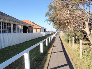
Lighthouse cottages and weddings
(0.85km) Cottage car park → Lighthouse
100 m
2 mins
6m
-5m
Very easy
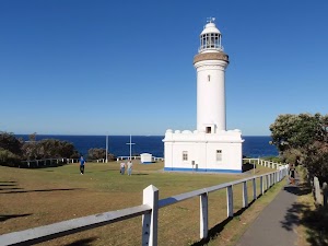
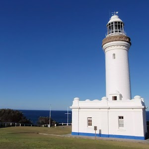
Norah Head Lighthouse
(0.95km) Lighthouse → Lighthouse Point lookout
80 m
1 mins
1m
-4m
Very easy
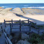
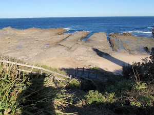
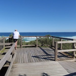
Norah Head Lighthouse Point lookout
(1.03km) Lighthouse Point lookout → Bottom of Norah Head steps
40 m
1 mins
1m
-2m
Moderate track
Maps for the Norah Head Nature Trail walk
You can download the PDF for this walk to print a map.These maps below cover the walk and the wider area around the walk, they are worth carrying for safety reasons.
| Toukley | 1:25 000 Map Series | 92313N TOUKLEY | NSW-92313N |
| Lake Macquarie | 1:100 000 Map Series | 9231 LAKE MACQUARIE | 9231 |
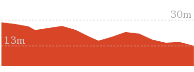
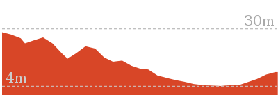
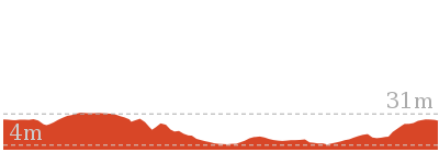
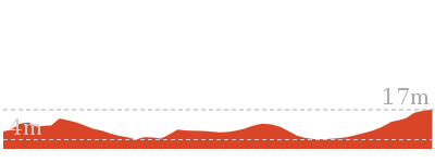
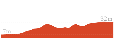
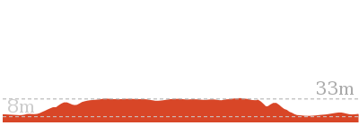
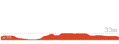
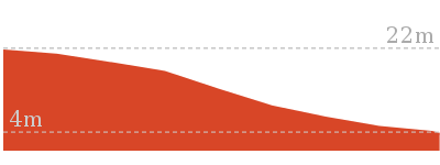
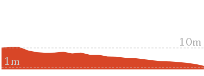
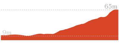
Cross sectional view of the Norah Head Nature Trail bushwalking track
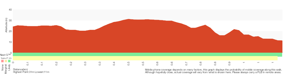
Analysis and summary of the altitude variation on the Norah Head Nature Trail
Overview of this walks grade – based on the AS 2156.1 – 2001
Under this standard, a walk is graded based on the most difficult section of the walk.
| Length | 2.2 km | ||
| Time | 1 Hr | ||
| . | |||
| Grade 3/6 Moderate track |
AS 2156.1 | Gradient | Short steep hills (3/6) |
| Quality of track | Formed track, with some branches and other obstacles (3/6) | ||
| Signs | Directional signs along the way (3/6) | ||
| Experience Required | Some bushwalking experience recommended (3/6) | ||
| Weather | Weather generally has little impact on safety (1/6) | ||
| Infrastructure | Generally useful facilities (such as fenced cliffs and seats) (1/6) |
Some more details of this walks Grading
Here is a bit more details explaining grading looking at sections of the walk
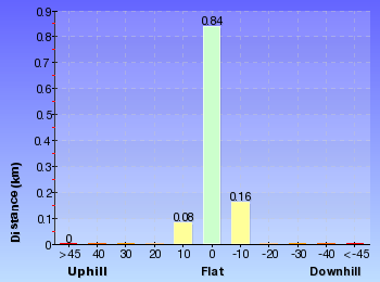
Gradient
490m of this walk has gentle hills with occasional steps and another 380m is flat with no steps. The remaining (200m) has short steep hills.
Quality of track
600m of this walk follows a formed track, with some branches and other obstacles and another 380m follows a smooth and hardened path. The remaining (95m) follows a clear and well formed track or trail.
Signs
Around 630m of this walk is clearly signposted, whilst the remaining 450m has directional signs at most intersection.
Experience Required
Around 1km of this walk requires no previous bushwalking experience, whilst the remaining 45m requires some bushwalking experience.
weather
This whole walk, 1.1km is not usually affected by severe weather events (that would unexpectedly impact safety and navigation).
Infrastructure
This whole walk, 1.1km is close to useful facilities (such as fenced cliffs and seats).
Similar walks
762 m Return
30 mins
Very easy
1.6 km Return
45 mins
Hard track
2.5 km Circuit
1 Hr
Hard track
2.6 km Return
1 Hr
Hard track
Other Nearby walks
150 m Return
15 mins
Easy track

4.8 km One way
1 hr 45 mins
Moderate track
3.1 km Return
1 hr 15 mins
Moderate track
3.4 km Circuit
1 hr 15 mins
Moderate track
6.9 km Circuit
2 hrs 15 mins
Moderate track

3.6 km Circuit
1 hr 15 mins
Moderate track
1.8 km Return
45 mins
Moderate track

444 m Return
10 mins
Easy track
136 m Return
3 mins
Very easy
1.2 km Return
25 mins
Easy track
3.3 km Return
1 hr 15 mins
Moderate track

4.2 km One way
1 hr 45 mins
Experienced only
Plan your trip to and from the walk here
The Norah Head Nature Trail walk starts and ends at the Bush St Reserve car park (gps: -33.28044, 151.56945)Your transport options to Bush St Reserve car park are by;
(get details)


Short URL = http://wild.tl/nhnt
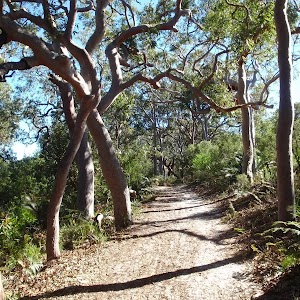
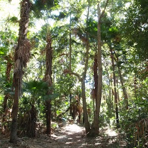
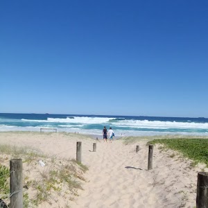
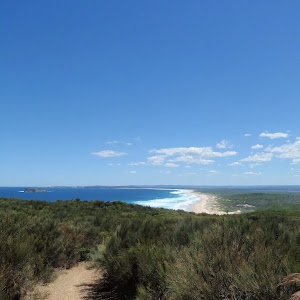
Gallery images
There are other downloads I am still working on.
You will probably need to login to access these — still all free.
* KML (google earth file)
* GPX (GPS file)
Special Maps/ brochures
* A3 topo maps
* PDF with Lands Topo map base
* PDF with arial image (and map overlay)
I wanted to get the main site live first, this extra stuff will come in time.
Happy walking
Matt 🙂
Comments