Lillypilly Loop Trail


1 hr 15 mins

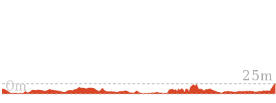
62 m
Moderate track


(0km) South car park → Int of Lilly Pilly loop and Sth Lilly Pilly access trail

80 m
2 mins
6m
0m
Moderate track
(0.08km) Int of Lilly Pilly loop and Sth Lilly Pilly access trail → Tuggerah lake vista
820 m
14 mins
3m
-19m
Moderate track
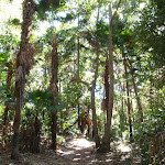
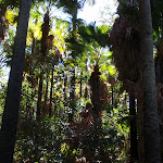
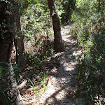
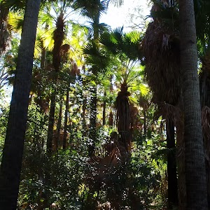
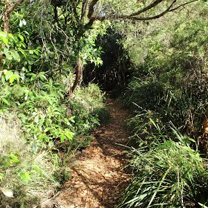
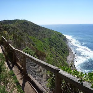
Lilly Pilly loop rainforest

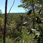
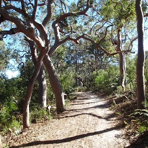
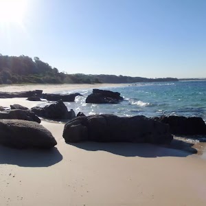
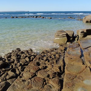
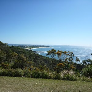
Tuggerah Lake vista

(0.9km) Tuggerah lake vista → Int of Lilly Pilly loop and Redgum track
1.2 km
21 mins
43m
-13m
Moderate track
(2.09km) Int of Lilly Pilly loop and Redgum track → Int of Lilly Pilly loop and Nth Lilly Pilly access trail
650 m
12 mins
3m
-14m
Moderate track
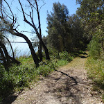
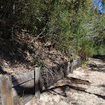
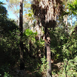
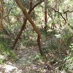
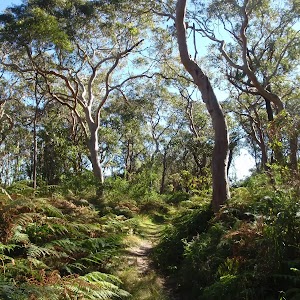
Veer right: From the intersection, the walk follows the sandy bush track up the hill, leaving the ‘Lilly Pilly Loop Trail’ sign on the right. After a while the track descends, with sections of erosion control board walkway, through nice forest, before reaching the intersection signposted with ‘Lilly Pilly Loop Link Trail’.
(2.74km) Int of Lilly Pilly loop and Nth Lilly Pilly access trail → South car park
860 m
15 mins
7m
-15m
Moderate track
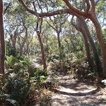
Turn left: From the intersection, the walk follows the level, sandy management trail towards the nearby road (opposite direction to the signpost arrow). After a short distance, the trail bends to the right and goes down hill a little. The walk passes an information board and ‘Lilly Pilly Loop Trail’ sign before going around a gate and arriving at the car park on the Central Coast Hwy, aka Wilfred Barret Dr (about 5.5 km north of The Entrance bridge, and about 4.6km south of the intersection with Main Rd, Noraville. Signposted ‘Wyrrabalong National Park’).
Maps for the Lillypilly Loop Trail walk
You can download the PDF for this walk to print a map.These maps below cover the walk and the wider area around the walk, they are worth carrying for safety reasons.
| Toukley | 1:25 000 Map Series | 92313N TOUKLEY | NSW-92313N |
| Lake Macquarie | 1:100 000 Map Series | 9231 LAKE MACQUARIE | 9231 |
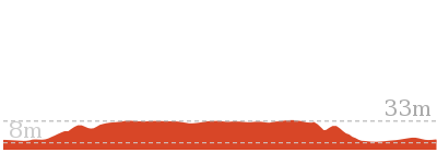
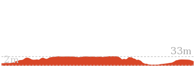
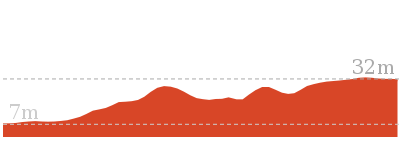
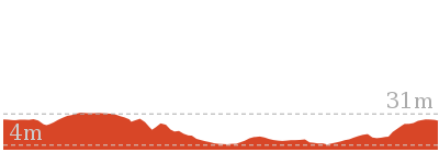
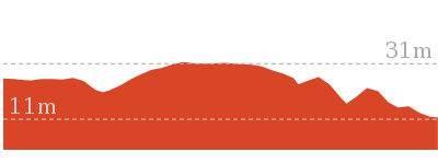
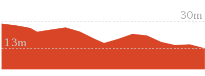
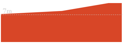
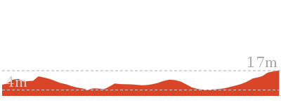
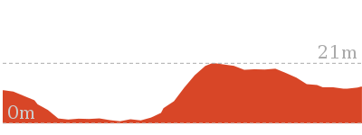
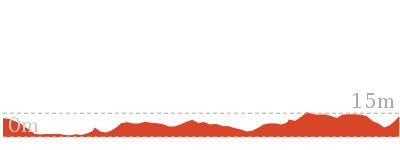
Cross sectional view of the Lillypilly Loop Trail bushwalking track
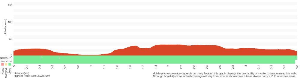
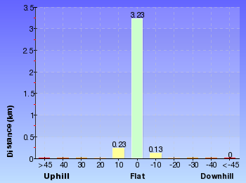
Analysis and summary of the altitude variation on the Lillypilly Loop Trail
Overview of this walks grade – based on the AS 2156.1 – 2001
Under this standard, a walk is graded based on the most difficult section of the walk.
| Length | 3.6 km | ||
| Time | 1 hr 15 mins | ||
| . | |||
| Grade 3/6 Moderate track |
AS 2156.1 | Gradient | Short steep hills (3/6) |
| Quality of track | Formed track, with some branches and other obstacles (3/6) | ||
| Signs | Directional signs along the way (3/6) | ||
| Experience Required | Some bushwalking experience recommended (3/6) | ||
| Weather | Weather generally has little impact on safety (1/6) | ||
| Infrastructure | Limited facilities, not all cliffs are fenced (3/6) |
Some more details of this walks Grading
Here is a bit more details explaining grading looking at sections of the walk
Gradient
Around 2.6km of this walk has short steep hills, whilst the remaining 990m has gentle hills with occasional steps.
Quality of track
Around 2.4km of this walk follows a clear and well formed track or trail, whilst the remaining 1.2km follows a formed track, with some branches and other obstacles.
Signs
Around 3.4km of this walk has directional signs at most intersection, whilst the remaining 160m is clearly signposted.
Experience Required
Around 2.4km of this walk requires some bushwalking experience, whilst the remaining 1.2km requires no previous bushwalking experience.
weather
This whole walk, 3.6km is not usually affected by severe weather events (that would unexpectedly impact safety and navigation).
Infrastructure
This whole walk, 3.6km has limited facilities (such as not all cliffs fenced).
Similar walks
1.8 km Return
45 mins
Moderate track

3.4 km Circuit
1 hr 15 mins
Moderate track
4.8 km One way
1 hr 45 mins
Moderate track
6.9 km Circuit
2 hrs 15 mins
Moderate track

Other Nearby walks
3.1 km Return
1 hr 15 mins
Moderate track
2.5 km Circuit
1 Hr
Hard track
2.2 km Return
1 Hr
Moderate track
1.6 km Return
45 mins
Hard track
762 m Return
30 mins
Very easy
150 m Return
15 mins
Easy track
2.6 km Return
1 Hr
Hard track
3.8 km One way
1 hr 30 mins
Moderate track
892 m Circuit
30 mins
Hard track
3.4 km Return
1 hr 15 mins
Experienced only
4.6 km One way
2 hrs
Experienced only
1.7 km One way
1 hr 30 mins
Moderate track
Plan your trip to and from the walk here
The Lillypilly Loop Trail walk starts and ends at the South car park (gps: -33.300644, 151.53294)Your main transport option to South car park is by;
(get details)


Short URL = http://wild.tl/25
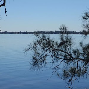
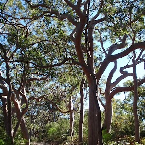
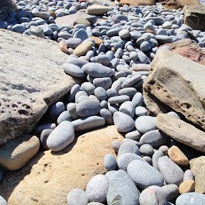
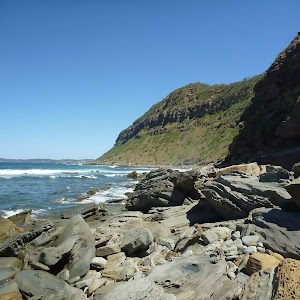
Gallery images
There are other downloads I am still working on.
You will probably need to login to access these — still all free.
* KML (google earth file)
* GPX (GPS file)
Special Maps/ brochures
* A3 topo maps
* PDF with Lands Topo map base
* PDF with arial image (and map overlay)
I wanted to get the main site live first, this extra stuff will come in time.
Happy walking
Matt 🙂
Comments