Balmoral to Middle Head Forts


2 hrs

187 m
Hard track


(0km) Balmoral Park car park → Int. Middle Head Rd and Chowder Bay Trk

570 m
15 mins
67m
-4m
Hard track
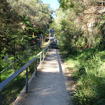
Turn left: From the intersection, this walk heads away from the oval, across a bridge. The walk then climbs a few flights of stairs to enter a fenced area with many signs. This walk continues for some time up stairs to turn right, through the fence and continues up stairs to the intersection with Middle Head Rd.
(0.57km) Int. Middle Head Rd and Chowder Bay Trk → Int. Middle Head Rd and Chowder Bay Rd
540 m
10 mins
3m
-30m
Moderate track
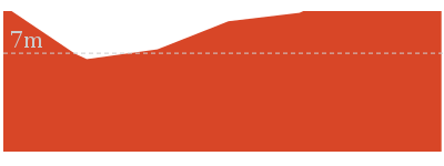
(1.1km) Int. Middle Head Rd and Chowder Bay Rd → Int. Old Fort and Govenors Rds
500 m
10 mins
21m
-14m
Moderate track
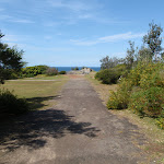
Veer left: From the intersection, this walk heads through the gate, keeping the view of the water to the right of the track. Note that if the gate is closed, visitors can walk around the right-hand side of the fence. The walk then follows the fenceline, (on the left of the track), to then continue up a small hill along the fenceline and to a short stone wall. The walk continues over the stone wall to the fork in the road.
(1.6km) Int. Old Fort and Govenors Rds → Old Fort Road gun brackets
220 m
4 mins
2m
-4m
Easy track

(1.82km) Old Fort Road gun brackets → Middle Head Fort
50 m
1 mins
1m
0m
Easy track
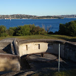
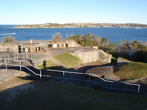
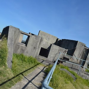
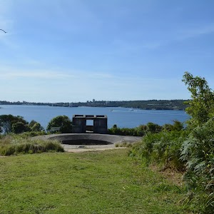
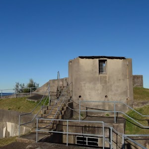
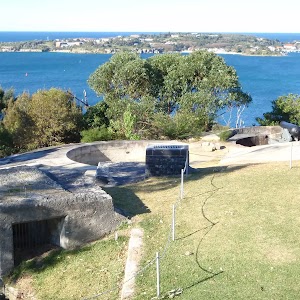
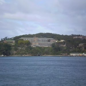
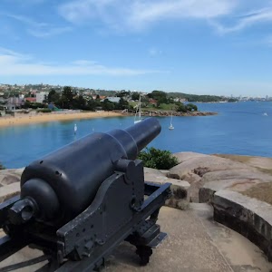
Outer Middle Head Battery
(1.87km) Middle Head Fort → Old Fort Road gun brackets
50 m
1 mins
0m
-1m
Easy track
(1.92km) Int. Lower Barracks Trk and Old Fort Rd → Int. Inner Forts and Lower Barracks Trks
250 m
4 mins
4m
-6m
Moderate track
Turn left: From the southern fort (surrounded by bush), this walk winds right, away from the fort keeping the sea on the right of the track. The track quickly leads to an intersection near the fort at the sea cliff.
(2.16km) Inner Forts intersection → Disappearing Gun Pit North
70 m
2 mins
0m
-18m
Moderate track

(2.16km) Inner Forts intersection → Behind Officers Quarters
210 m
4 mins
1m
-11m
Moderate track
Turn sharp right: From the intersection, this walk heads down the grass hill beside the old house, keeping the house on the left. The track then turns left and down the hill with the fence, to continue along the fenceline. Near the end of the fence, the track turns right, down the hill and comes to a management trail.
(2.37km) Cobblers and Officers Quarters int. → Middle Head Oval NE Gate
440 m
10 mins
30m
-31m
Hard track


Turn around: From the middle of Cobblers Beach, the walk follows the track up the hill, with the beach on the right of the track. The track steeply climbs up the hill to the white picket fence of Middle Head Oval. The track turns left, following the fence to the gate and ‘Middle Head’ sign. Now Veer right to rejoin the main walk .
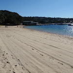
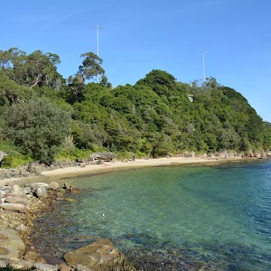
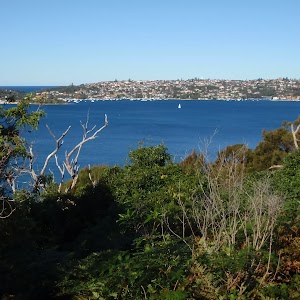
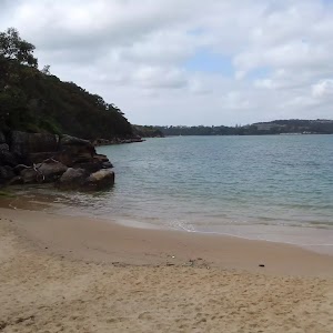
Cobblers Beach

(2.37km) Cobblers and Officers Quarters int. → Cobblers Beach Trail sign
130 m
4 mins
18m
-5m
Moderate track
(2.5km) Cobblers Beach Trail Top → Middle Head Oval NE Gate
160 m
6 mins
11m
-26m
Moderate track
(2.66km) Middle Head Oval NE Gate → Middle Head Oval SW Gate
140 m
4 mins
25m
-6m
Easy track
(2.8km) Middle Head Oval SW Gate → Int. Middle Head Rd and Chowder Bay Rd
30 m
1 mins
0m
-6m
Easy track
(2.84km) Int. Middle Head Rd and Chowder Bay Rd → Int. Middle Head Rd and Chowder Bay Trk
540 m
10 mins
30m
-3m
Moderate track
(3.37km) Int. Middle Head Rd and Chowder Bay Trk → Balmoral Park car park
570 m
15 mins
4m
-67m
Hard track
Turn right: From the intersection, this walk heads toward the sea, keeping the oval to your left. The walk passes ‘1st Balmoral Sea Scouts’ on the right before coming to the car park.
Maps for the Balmoral to Middle Head Forts walk
You can download the PDF for this walk to print a map.These maps below cover the walk and the wider area around the walk, they are worth carrying for safety reasons.
| Sydney Heads | 1:25 000 Map Series | 91302N SYDNEY HEADS | NSW-91302N |
| Sydney | 1:100 000 Map Series | 9130 SYDNEY | 9130 |
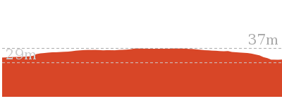
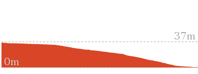
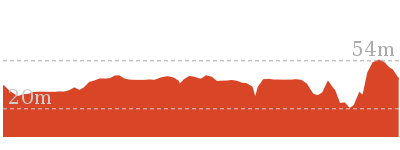
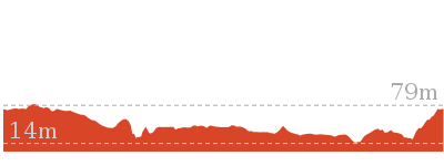
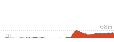
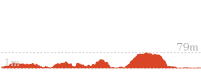
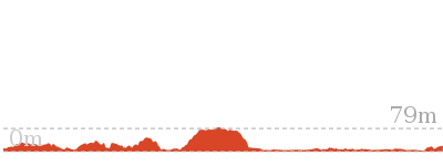
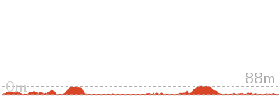
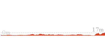
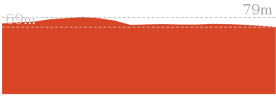
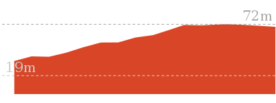
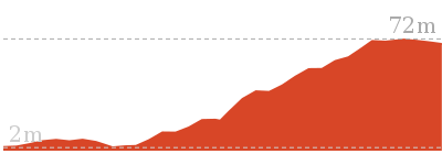
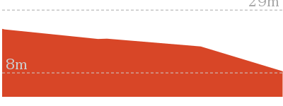
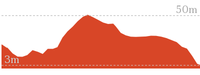
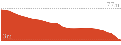
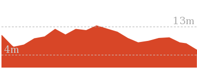
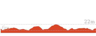
Cross sectional view of the Balmoral to Middle Head Forts bushwalking track
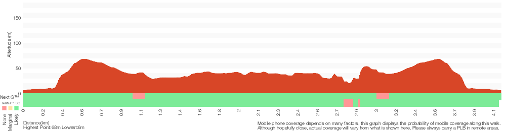
Analysis and summary of the altitude variation on the Balmoral to Middle Head Forts
Overview of this walks grade – based on the AS 2156.1 – 2001
Under this standard, a walk is graded based on the most difficult section of the walk.
| Length | 3.9 km | ||
| Time | 2 hrs | ||
| . | |||
| Grade 4/6 Hard track |
AS 2156.1 | Gradient | Very steep (4/6) |
| Quality of track | Formed track, with some branches and other obstacles (3/6) | ||
| Signs | Directional signs along the way (3/6) | ||
| Experience Required | No experience required (1/6) | ||
| Weather | Weather generally has little impact on safety (1/6) | ||
| Infrastructure | Limited facilities, not all cliffs are fenced (3/6) |
Some more details of this walks Grading
Here is a bit more details explaining grading looking at sections of the walk
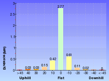
Gradient
2.5km of this walk has gentle hills with occasional steps and another 750m is very steep. Whilst another 550m is flat with no steps and the remaining 100m has short steep hills.
Quality of track
2.2km of this walk follows a smooth and hardened path and another 1.2km follows a formed track, with some branches and other obstacles. The remaining (490m) follows a clear and well formed track or trail.
Signs
Around 2.3km of this walk has directional signs at most intersection, whilst the remaining 1.6km is clearly signposted.
Experience Required
This whole walk, 3.9km requires no previous bushwalking experience.
weather
This whole walk, 3.9km is not usually affected by severe weather events (that would unexpectedly impact safety and navigation).
Infrastructure
Around 3.4km of this walk is close to useful facilities (such as fenced cliffs and seats), whilst the remaining 520m has limited facilities (such as not all cliffs fenced).
Similar walks
664 m Return
30 mins
Easy track
762 m Return
30 mins
Moderate track
930 m Return
30 mins
Hard track
1.9 km Circuit
1 Hr
Moderate track
4.9 km Circuit
2 hrs 30 mins
Moderate track
6.1 km One way
2 hrs 30 mins
Hard track
6.8 km One way
3 hrs
Hard track
10.4 km One way
5 hrs
Hard track
18.9 km One way
8 hrs
Hard track
Other Nearby walks
4.3 km One way
2 hrs 30 mins
Hard track
904 m Return
30 mins
Easy track
144 m Return
7 mins
Very easy
842 m Return
30 mins
Moderate track
1.7 km Return
1 Hr
Moderate track
548 m Circuit
20 mins
Moderate track
200 m Return
30 mins
Moderate track
2 km Return
1 Hr
Moderate track
1.7 km Return
1 Hr
Moderate track
358 m Return
15 mins
Easy track
992 m Return
30 mins
Moderate track
1.7 km Circuit
45 mins
Easy track
Plan your trip to and from the walk here
The Balmoral to Middle Head Forts walk starts and ends at the Balmoral Park car park (gps: -33.829055, 151.25568)Your transport options to Balmoral Park car park are by;
(get details)


Short URL = http://wild.tl/btmhf
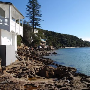
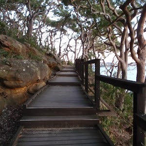
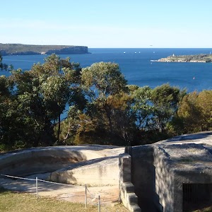
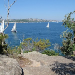
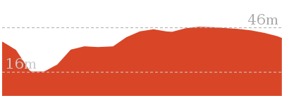
Gallery images
There are other downloads I am still working on.
You will probably need to login to access these — still all free.
* KML (google earth file)
* GPX (GPS file)
Special Maps/ brochures
* A3 topo maps
* PDF with Lands Topo map base
* PDF with arial image (and map overlay)
I wanted to get the main site live first, this extra stuff will come in time.
Happy walking
Matt 🙂
Comments