Spit Bridge to Middle Head Forts


2 hrs 30 mins

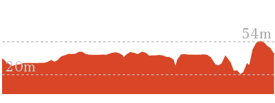
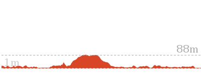
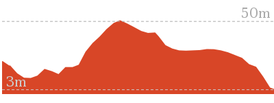
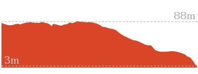
172 m
Hard track
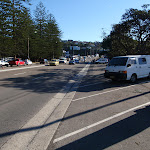


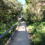


Spit Bridge
(0km) Spit Bridge South → Int. Middle Harbour Yacht Club car park and Spit Rd

280 m
5 mins
4m
-1m
Easy track
(0.28km) Int. Middle Harbour Yacht Club car park and Spit Rd → Int. Grecia Lane Trk and Chinamans Beach Reserve North
1.1 km
25 mins
56m
-55m
Moderate track
(0.28km) Int. Middle Harbour Yacht Club car park and Spit Rd → Int. Grecia Lane Trk and Chinamans Beach Reserve North
930 m
17 mins
20m
-19m
Hard track
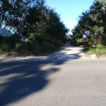
Veer right: From the Middle Harbour Yacht Club entrance, this walk heads along the road which goes behind the club building. The walk passes a boat ramp on the left and ‘The Shores’ restaurant before turning right, around the front of the Sydney Water ‘Spit Syphon’ building platform. From the platform, the walk drops down onto the rocky shore and continues to wind around and through the rocks for some time. As the walk meanders along the rocky shore, it passes over some sandy sections to then come out onto Chinamans Beach Reserve, heading to the bottom of the stairs (to the right).
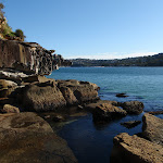
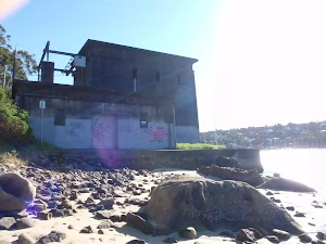
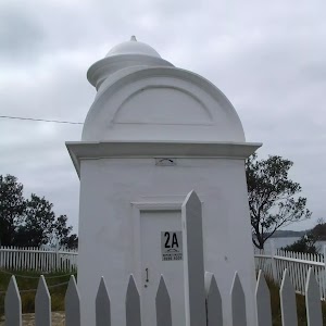
Spit Syphon
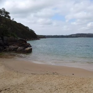
(1.22km) Int. Grecia Lane Trk and Chinamans Beach Reserve North → Middle of Chinamans Beach
70 m
1 mins
0m
-3m
Moderate track
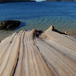
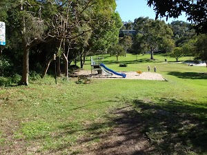
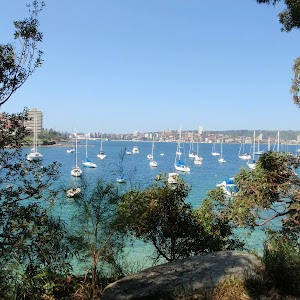
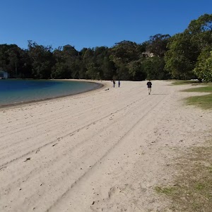
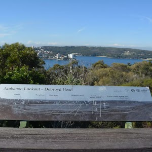
Chinamans Beach and Reserve
(1.28km) Middle of Chinamans Beach → Chinamans Beach Reserve South
160 m
3 mins
5m
-1m
Moderate track
(1.44km) Chinamans Beach Reserve South → Int. Wyargine Reserve Trk and Balmoral Beach
850 m
18 mins
43m
-42m
Moderate track
Turn left : From the intersection, this walk heads up Hopetoun Ave, away from the split levels in the road. The walk passes Kirk Oswald Ave (off to the right) and then veers right, where the road changes its name to Burran Ave, and soon splits into two levels again. As the road bends right again, this walk instead continues straight ahead into Stanton Rd. The track heads to the signposted intersection at the end of the road.
Continue straight: From the intersection, this walk heads down the steps towards the beach and through a rocky outcrop. The track turns left, winding to the intersection just behind the beach. Now Veer right to rejoin the main walk .
(1.44km) Chinamans Beach Reserve South → Rocky Point Bridge
1.3 km
24 mins
28m
-32m
Hard track
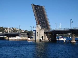
Turn left: From the intersection, this walk heads down the beach keeping the water to the left. The walk continues for approximately 200m to the bridge that connects the promenade footpath to the rocky island. The walk climbs the stairs onto the bridge.
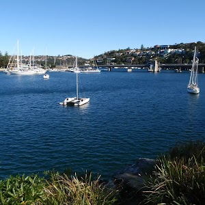
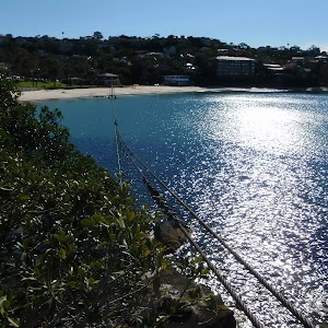
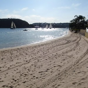
Balmoral Beach

(2.76km) Rocky Point Bridge → Balmoral Park car park
860 m
14 mins
9m
-5m
Easy track
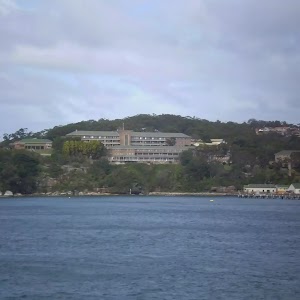
(3.62km) Balmoral Park car park → Int. Middle Head Rd and Chowder Bay Trk
570 m
15 mins
67m
-4m
Hard track
Turn left: From the intersection, this walk heads away from the oval, across a bridge. The walk then climbs a few flights of stairs to enter a fenced area with many signs. This walk continues for some time up stairs to turn right, through the fence and continues up stairs to the intersection with Middle Head Rd.
(4.18km) Int. Middle Head Rd and Chowder Bay Trk → Int. Middle Head Rd and Chowder Bay Rd
540 m
10 mins
3m
-30m
Moderate track
(4.72km) Int. Middle Head Rd and Chowder Bay Rd → Int. Old Fort and Govenors Rds
500 m
10 mins
21m
-14m
Moderate track
Veer left: From the intersection, this walk heads through the gate, keeping the view of the water to the right of the track. Note that if the gate is closed, visitors can walk around the right-hand side of the fence. The walk then follows the fenceline, (on the left of the track), to then continue up a small hill along the fenceline and to a short stone wall. The walk continues over the stone wall to the fork in the road.
(5.22km) Int. Old Fort and Govenors Rds → Old Fort Road gun brackets
220 m
4 mins
2m
-4m
Easy track

(5.44km) Int. Lower Barracks Trk and Old Fort Rd → Disappearing Gun Pit North
320 m
6 mins
4m
-24m
Moderate track
Turn left: From the southern fort (surrounded by bush), this walk winds right, away from the fort keeping the sea on the right of the track. The track quickly leads to an intersection near the fort at the sea cliff.
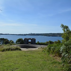
Turn right: From the intersection, this walk heads along the clear dirt track[6] towards the distant water view between two long sandstone trenches[7]. After 60m this walk heads across the grassy section[8] to come to the top edge of the northern Disappearing Gun Pit[9][10] beside the ocean cliffs[11]. Take extra care as the ground slopes towards the gun pit and cliff edges – stay 2 body lengths back from any significant drop. At the end of this side trip, retrace your steps back to the main walk then Veer left.

(5.44km) Old Fort Road gun brackets → Middle Head Fort
50 m
1 mins
1m
0m
Easy track
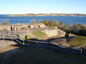
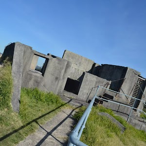
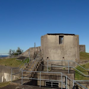
Outer Middle Head Battery
(5.48km) Middle Head Fort → Int. Middle Head Rd and Chowder Bay Rd
610 m
11 mins
12m
-14m
Easy track
Continue straight: From the beside row large gun timber brackets (bases)[24], this walk follows the old ashpalt road uphill away from the water. After about 50m the walk leads between the metal bollards[25] then 30m later heads over a rise then leads downhill for 130m to come to the intersection with ‘Govenors Rd’[26] with the toilet (to the left) and ‘Barracks No.1’[27] (to the right).
Continue straight: From the intersection, this walk heads gently downhill along the road and around the boom gate. The walk leads over the bridged ‘Middle Head Moat’[28][29], then along Middle Head Rd for about 50m to pass a car parking area (on the left) and come to the Cobblers Beach Trail track head (with a locked gate on the left).
Continue straight: From the intersection, the walk heads down Middle Head Road, away from the old cottage-style houses and fork in the road. The walk continues past houses, left and right, and then an oval on the right, after which it comes to an intersection in the roads.
Maps for the Spit Bridge to Middle Head Forts walk
You can download the PDF for this walk to print a map.These maps below cover the walk and the wider area around the walk, they are worth carrying for safety reasons.
| Parramatta River | 1:25 000 Map Series | 91303N PARRAMATTA RIVER | NSW-91303N |
| Sydney Heads | 1:25 000 Map Series | 91302N SYDNEY HEADS | NSW-91302N |
| Sydney | 1:100 000 Map Series | 9130 SYDNEY | 9130 |
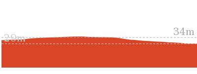
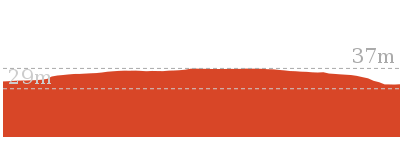
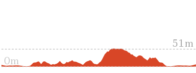
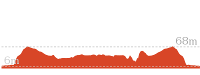
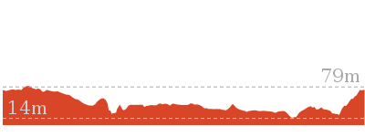
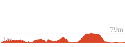
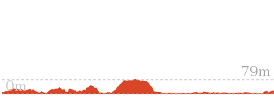
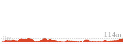
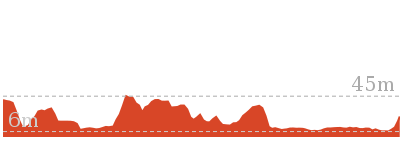
Cross sectional view of the Spit Bridge to Middle Head Forts bushwalking track
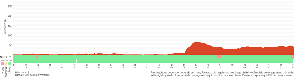
Analysis and summary of the altitude variation on the Spit Bridge to Middle Head Forts
Overview of this walks grade – based on the AS 2156.1 – 2001
Under this standard, a walk is graded based on the most difficult section of the walk.
| Length | 6.1 km | ||
| Time | 2 hrs 30 mins | ||
| . | |||
| Grade 4/6 Hard track |
AS 2156.1 | Gradient | Very steep (4/6) |
| Quality of track | Rough track, where fallen trees and other obstacles are likely (4/6) | ||
| Signs | Minimal directional signs (4/6) | ||
| Experience Required | Moderate level of bushwalking experience recommended (4/6) | ||
| Weather | Storms may impact on navigation and safety (3/6) | ||
| Infrastructure | Limited facilities, not all cliffs are fenced (3/6) |
Some more details of this walks Grading
Here is a bit more details explaining grading looking at sections of the walk
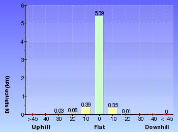
Gradient
2.1km of this walk is very steep and another 2km has gentle hills with occasional steps. The remaining (2km) is flat with no steps.
Quality of track
1.8km of this walk follows a smooth and hardened path and another 1.7km follows a rough track, where fallen trees and other obstacles are likely. Whilst another 1.4km follows a clear and well formed track or trail and the remaining 1.2km follows a formed track, with some branches and other obstacles.
Signs
2.7km of this walk is clearly signposted and another 1.7km has directional signs at most intersection. The remaining (1.7km) has minimal directional signs.
Experience Required
Around 4.4km of this walk requires no previous bushwalking experience, whilst the remaining 1.7km requires a leader a with moderate level of bushwalking experience.
weather
Around 4.4km of this walk is not usually affected by severe weather events (that would unexpectedly impact safety and navigation), whilst the remaining 1.7km is affected by storms that may impact your navigation and safety.
Infrastructure
Around 4.4km of this walk is close to useful facilities (such as fenced cliffs and seats), whilst the remaining 1.7km has limited facilities (such as not all cliffs fenced).
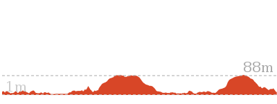
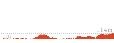
Similar walks
664 m Return
30 mins
Easy track
762 m Return
30 mins
Moderate track
1.9 km Circuit
1 Hr
Moderate track
3.6 km Circuit
1 hr 30 mins
Hard track
3.9 km Circuit
2 hrs
Hard track
4.3 km One way
2 hrs 30 mins
Hard track
4.9 km Circuit
2 hrs 30 mins
Moderate track
6.8 km One way
3 hrs
Hard track
10.4 km One way
5 hrs
Hard track
18.9 km One way
8 hrs
Hard track
Other Nearby walks
22.6 km One way
9 hrs 45 mins
Hard track
8.7 km Circuit
4 hrs
Moderate track
9.1 km One way
3 hrs 45 mins
Moderate track
200 m Return
30 mins
Moderate track
2 km Return
1 Hr
Moderate track
2.5 km Circuit
1 Hr
Hard track
3.6 km Return
2 hrs
Moderate track
142 m Return
15 mins
Very easy

60 m Return
3 mins
Moderate track

1.7 km Return
1 Hr
Moderate track
3.1 km One way
2 hrs
Moderate track
13.7 km One way
5 hrs 45 mins
Moderate track
Plan your trip to and from the walk here
The Spit Bridge to Middle Head Forts walk starts at the Spit Bridge South (gps: -33.804351, 151.24615)Your transport options to Spit Bridge South are by;
(get details)
The Spit Bridge to Middle Head Forts ends at the Int. Middle Head Rd and Chowder Bay Rd (gps: -33.827783, 151.26147)
Your transport options to Int. Middle Head Rd and Chowder Bay Rd are by;
(get details)


Short URL = http://wild.tl/sbtmhf
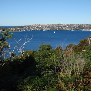
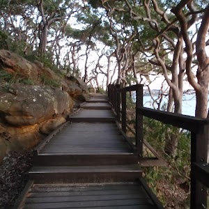
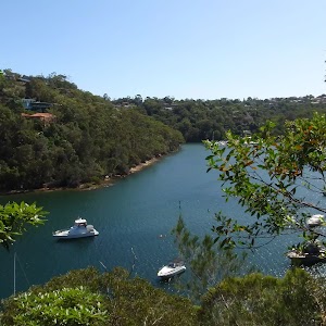
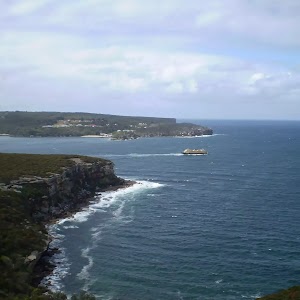
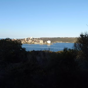
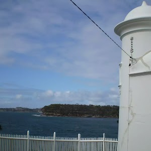
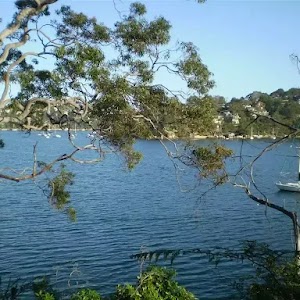
Gallery images
There are other downloads I am still working on.
You will probably need to login to access these — still all free.
* KML (google earth file)
* GPX (GPS file)
Special Maps/ brochures
* A3 topo maps
* PDF with Lands Topo map base
* PDF with arial image (and map overlay)
I wanted to get the main site live first, this extra stuff will come in time.
Happy walking
Matt 🙂
Comments