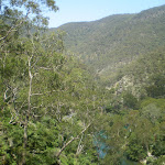
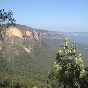
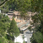
From Caves House, this short but relatively steep trail goes up to Carlotta’s Arch, enjoying fantastic views out over Blue Lake, the Jenolan Valley and River. Back at Caves House, you can enjoy a cup of coffee or a milkshake in the bistro. For those in Jenolan primarily do a caves tour, this is a great walk to add a little bit of variety to your day.
Carlotta’s Arch Track
And Walk
Carlotta’s Arch Track


30 mins
828 m Return

95 m
Moderate track
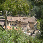


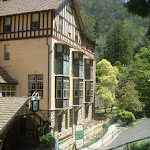
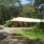
Jenolan Caves House
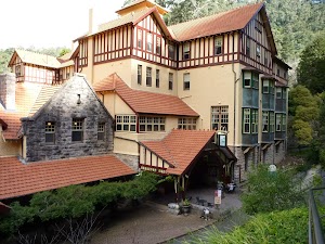
Jenolan Caves House, built in 1898, is a heritage-listed building which houses dining, a variety of accommodation options, and other services for visitors to the caves. Jenolan has two licensed restaurants: Trails Bistro is open from breakfast onwards and closes early evening. Trails serves a range of light meals including sandwiches, salads and hot food. Chisholm’s Restaurant is open each morning for breakfast and each evening for dinner from 6.00pm. Essential items and beautiful souvenirs may be purchased from Things Jenolan, located on the ground floor of Caves House. Don’t forget to explore one of the many caves to explore in the area. For more information, call Jenolan Caves on 1300 76 33 11.
(0km) Caves House → Carlotta Arch Lookout

410 m
12 mins
74m
-21m
Moderate track
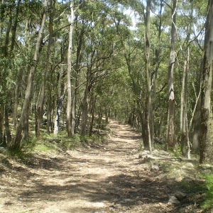
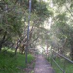
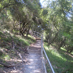
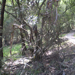
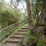
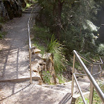
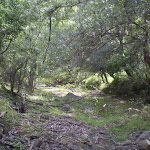
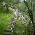
From the opposite side of the Jenolan Caves Road from Caves House[2], this walk follows the ‘Six Foot Track’ sign up the concrete steps[3]. The walk then follows the stone footpath up the side of the valley for about 80m to pass the ‘Southside Show Caves’ information sign[4] then just over 30m later to the ‘Grand Arch’ information sign (and view of the Arch)[5]. The walk continues fairly gently up the path for 100m (as it bends right) to find ‘Caves House’ information sign[6]. The path soon starts leading much more steeply up as it begins to Zig Zag up past a seat[7] and more views down to caves house[8] for 150m beside the limestone cliffs[9]. At the top of this climb the path leads over a small small rise then gently down to a fenced lookout beside ‘Carlotta Arch’[10][11].
(0.41km) Top of Carlotta Arch Steps → Bottom of Carlotta Arch Steps
30 m
1 mins
1m
0m
Moderate track
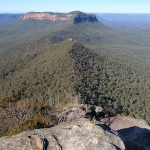
Turn right: From the intersection, this walk goes down the stairs until coming to the entrance of the cave. On the way, this walk goes under the towering Carlotta’s Arch. The lookout has great views of the valley and Blue Lake. At the end of this side trip, retrace your steps back to the main walk then Turn right.
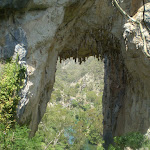
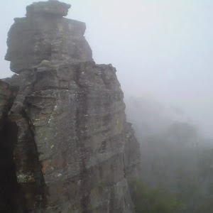
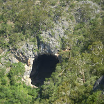
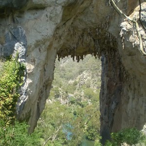
Carlotta Arch
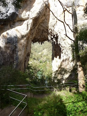
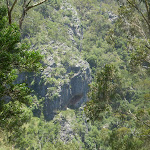
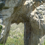
Carlotta Arch is a large and spectacular cave remnant overlooking Blue Lake. It is believed that the arch was named in honour of a daughter of a surveyor – General P.F. Adams. Adams is credited with having taken some of the earliest photos at Jenolan.
Maps for the Carlotta’s Arch Track walk
You can download the PDF for this walk to print a map.
These maps below cover the walk and the wider area around the walk, they are worth carrying for safety reasons.
| Six Foot Track | 1:50 000 Map Series | Six Foot Track | NSW-six-foot-track |
| Jenolan | 1:25 000 Map Series | 89303N JENOLAN | NSW-89303N |
| Katoomba | 1:100 000 Map Series | 8930 KATOOMBA | 8930 |
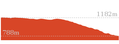
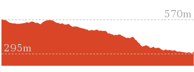
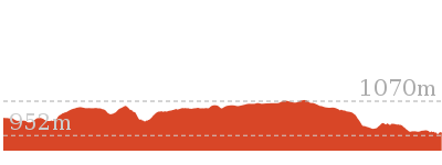
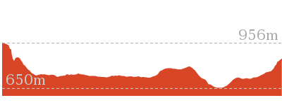
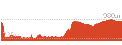
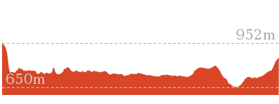
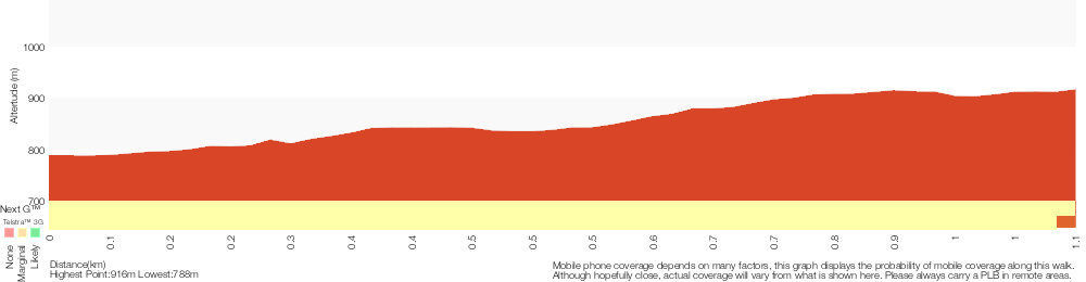
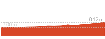
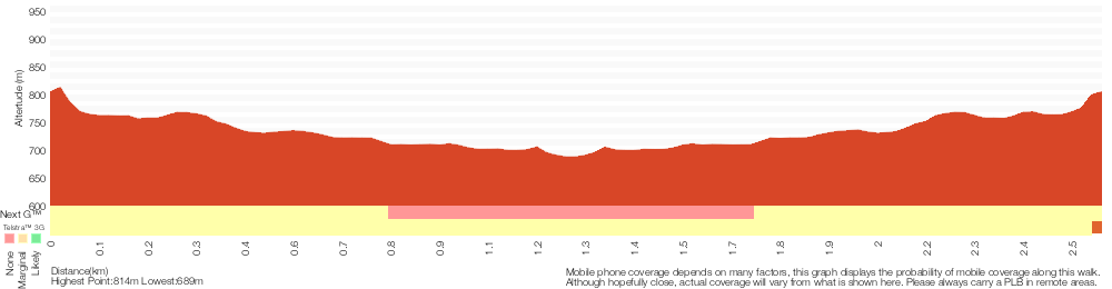
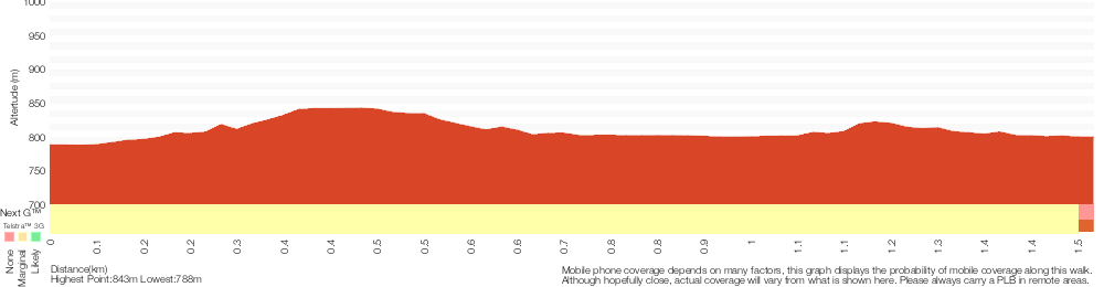
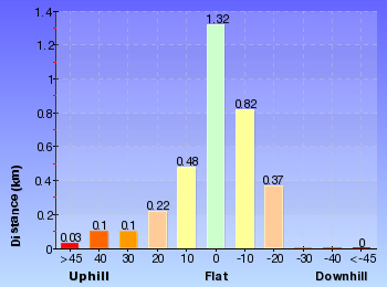
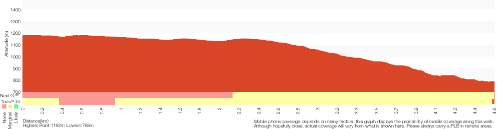
Cross sectional view of the Carlotta’s Arch Track bushwalking track
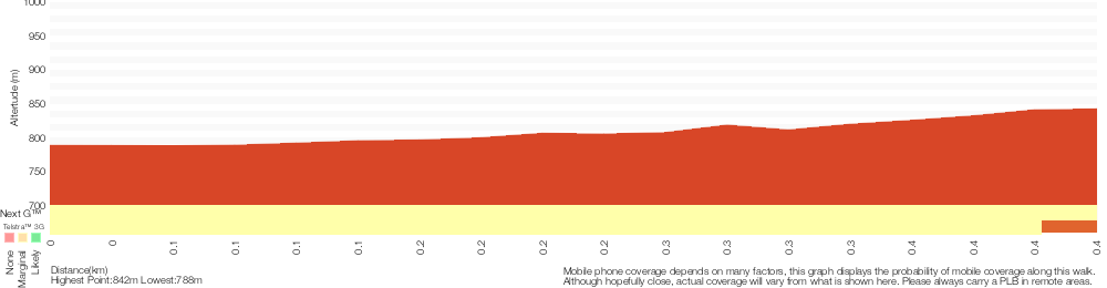
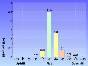
Analysis and summary of the altitude variation on the Carlotta’s Arch Track

Overview of this walks grade – based on the AS 2156.1 – 2001
Under this standard, a walk is graded based on the most difficult section of the walk.
| Length | 828 m | ||
| Time | 30 mins | ||
| . | |||
| Grade 3/6 Moderate track |
AS 2156.1 | Gradient | Short steep hills (3/6) |
| Quality of track | Smooth and hardened path (1/6) | ||
| Signs | Clearly signposted (1/6) | ||
| Experience Required | No experience required (1/6) | ||
| Weather | Weather generally has little impact on safety (1/6) | ||
| Infrastructure | Generally useful facilities (such as fenced cliffs and seats) (1/6) |
Some more details of this walks Grading
Here is a bit more details explaining grading looking at sections of the walk
Gradient
This whole walk, 410m has short steep hills.
Quality of track
This whole walk, 410m follows a smooth and hardened path.
Signs
This whole walk, 410m is clearly signposted.
Experience Required
This whole walk, 410m requires no previous bushwalking experience.
weather
This whole walk, 410m is not usually affected by severe weather events (that would unexpectedly impact safety and navigation).
Infrastructure
This whole walk, 410m is close to useful facilities (such as fenced cliffs and seats).
Similar walks
A list of walks that share part of the track with the Carlotta’s Arch Track walk.

2.2 km Return
1 hr 9 mins
Moderate track

3.1 km Return
1 hr 30 mins
Hard track
3.5 km Circuit
2 hrs
Hard track
4.6 km One way
2 hrs
Hard track
44.8 km One way
3 Days
Hard track
44.8 km One way
2 Days
Hard track

Other Nearby walks
A list of walks that start near the Carlotta’s Arch Track walk.
2.6 km Circuit
1 hr 30 mins
Moderate track


12.6 km Return
5 hrs 30 mins
Hard track
20 km Return
7 hrs
Moderate track
4.2 km Return
1 hr 45 mins
Hard track
11.7 km Return
8 hrs 45 mins
Experienced only
7.9 km Return
5 hrs
Hard track

29.2 km One way
2 Days
Experienced only

29.3 km One way
3 Days
Experienced only

5.9 km Circuit
3 hrs 30 mins
Hard track

6.7 km Return
4 hrs 30 mins
Moderate track
16.2 km Return
11 hrs
Experienced only
12.4 km Return
7 hrs 30 mins
Hard track
Plan your trip to and from the walk here
The Carlotta’s Arch Track walk starts and ends at the Caves House (gps: -33.820325, 150.02117)
Your main transport option to Caves House is by;
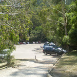
![]() Car. There is free parking available.
Car. There is free parking available.
(get details)


Short URL = http://wild.tl/cat
Gallery images
There are other downloads I am still working on.
You will probably need to login to access these — still all free.
* KML (google earth file)
* GPX (GPS file)
Special Maps/ brochures
* A3 topo maps
* PDF with Lands Topo map base
* PDF with arial image (and map overlay)
I wanted to get the main site live first, this extra stuff will come in time.
Happy walking
Matt 🙂
McKeowns Valley Lookdown Walk
And Walk
McKeowns Valley Lookdown Walk

1 hr 9 mins
2.2 km Return
220 m
Moderate track

Jenolan Caves House
Jenolan Caves House, built in 1898, is a heritage-listed building which houses dining, a variety of accommodation options, and other services for visitors to the caves. Jenolan has two licensed restaurants: Trails Bistro is open from breakfast onwards and closes early evening. Trails serves a range of light meals including sandwiches, salads and hot food. Chisholm’s Restaurant is open each morning for breakfast and each evening for dinner from 6.00pm. Essential items and beautiful souvenirs may be purchased from Things Jenolan, located on the ground floor of Caves House. Don’t forget to explore one of the many caves to explore in the area. For more information, call Jenolan Caves on 1300 76 33 11.
(0km) Caves House → Carlotta Arch Lookout
410 m
12 mins
74m
-21m
Moderate track
From the opposite side of the Jenolan Caves Road from Caves House[2], this walk follows the ‘Six Foot Track’ sign up the concrete steps[3]. The walk then follows the stone footpath up the side of the valley for about 80m to pass the ‘Southside Show Caves’ information sign[4] then just over 30m later to the ‘Grand Arch’ information sign (and view of the Arch)[5]. The walk continues fairly gently up the path for 100m (as it bends right) to find ‘Caves House’ information sign[6]. The path soon starts leading much more steeply up as it begins to Zig Zag up past a seat[7] and more views down to caves house[8] for 150m beside the limestone cliffs[9]. At the top of this climb the path leads over a small small rise then gently down to a fenced lookout beside ‘Carlotta Arch’[10][11].
Carlotta Arch
Carlotta Arch is a large and spectacular cave remnant overlooking Blue Lake. It is believed that the arch was named in honour of a daughter of a surveyor – General P.F. Adams. Adams is credited with having taken some of the earliest photos at Jenolan.
(0.41km) Top of Carlotta Arch Steps → Bottom of Carlotta Arch Steps
30 m
1 mins
1m
0m
Moderate track
Turn right: From the intersection, this walk goes down the stairs until coming to the entrance of the cave. On the way, this walk goes under the towering Carlotta’s Arch. The lookout has great views of the valley and Blue Lake. At the end of this side trip, retrace your steps back to the main walk then Turn right.
(0.41km) Carlotta Arch Lookout → Int of 6FT and Carlotta Arch Track
10 m
0m
0m
Very easy
Continue straight: From the ‘Carlotta Arch’[12][13] lookout, this walk follows the gravel path[14] (past the top of the steps) gently uphill (initially keeping the arch to your right) a short distance to an intersection with the sign posted ‘Six Foot Track’ (on your right), where another sign points back to ‘Caves House’[15].
(0.43km) Int of 6 ft track and Carlotta Arch Track → Carlotta Carpark Intersection
100 m
2 mins
7m
-8m
Easy track
Continue straight: From the intersection, this walk heads along the gravel footpath until coming to an intersection with a track signposted as the way to the ‘Devil’s Coachhouse’.
Veer left: From the intersection, this walk heads along the gravel footpath, following the ‘carpark no 2’ sign. The walk soon passes by the entrance to a cave, before going slightly uphill to an intersection. (There is a large car park to the left).
Veer left: From the intersection, this walk heads along the gravel footpath, following the ‘carpark no 2’ sign. The walk soon passes by the entrance to a cave, before going slightly uphill to an intersection. (There is a large car park to the left).
(0.53km) Carlotta Carpark Intersection → McKeowns Valley Lookdown
600 m
19 mins
92m
-18m
Moderate track
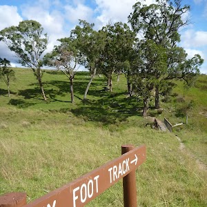
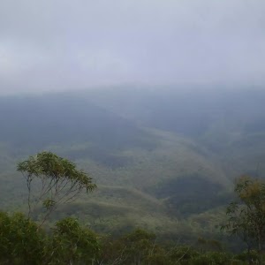
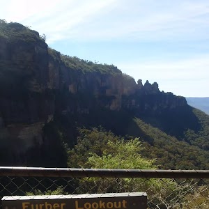
Continue straight: From the intersection, this walk heads up the footpath, zigzagging its way up the hill and, at one point, passing by Jenolan Caves Rd. Continuing up the hill, the walk soon comes to a great unofficial lookout over the valley and the Six Foot Track. The trail continues up the hill for about 20m before meeting up with Burma Rd, where there are several private dwellings. The track follows the ‘McKeown’s Valley’ sign, heading to the right and winding around the hill, before zigzagging up the hill again and passing a sign pointing back towards ‘Caves House’. At the top of the hill, the walk comes to an intersection with a dirt road, marked by another ‘Caves House’ sign.
Maps for the McKeowns Valley Lookdown Walk walk
You can download the PDF for this walk to print a map.
These maps below cover the walk and the wider area around the walk, they are worth carrying for safety reasons.
| Six Foot Track | 1:50 000 Map Series | Six Foot Track | NSW-six-foot-track |
| Jenolan | 1:25 000 Map Series | 89303N JENOLAN | NSW-89303N |
| Katoomba | 1:100 000 Map Series | 8930 KATOOMBA | 8930 |
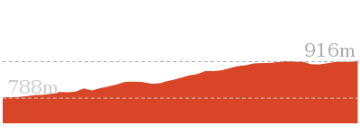
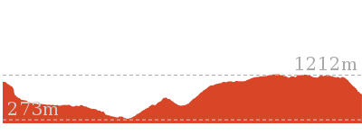
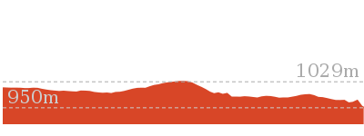
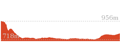
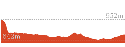
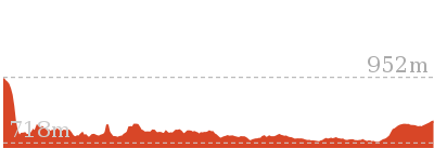
Cross sectional view of the McKeowns Valley Lookdown Walk bushwalking track
Analysis and summary of the altitude variation on the McKeowns Valley Lookdown Walk

Overview of this walks grade – based on the AS 2156.1 – 2001
Under this standard, a walk is graded based on the most difficult section of the walk.
| Length | 2.2 km | ||
| Time | 1 hr 9 mins | ||
| . | |||
| Grade 3/6 Moderate track |
AS 2156.1 | Gradient | Short steep hills (3/6) |
| Quality of track | Smooth and hardened path (1/6) | ||
| Signs | Clearly signposted (1/6) | ||
| Experience Required | No experience required (1/6) | ||
| Weather | Weather generally has little impact on safety (1/6) | ||
| Infrastructure | Generally useful facilities (such as fenced cliffs and seats) (1/6) |
Some more details of this walks Grading
Here is a bit more details explaining grading looking at sections of the walk
Gradient
1km of this walk has short steep hills and another 75m is flat with no steps. The remaining (35m) has gentle hills with occasional steps.
Quality of track
This whole walk, 1.1km follows a smooth and hardened path.
Signs
This whole walk, 1.1km is clearly signposted.
Experience Required
This whole walk, 1.1km requires no previous bushwalking experience.
weather
This whole walk, 1.1km is not usually affected by severe weather events (that would unexpectedly impact safety and navigation).
Infrastructure
This whole walk, 1.1km is close to useful facilities (such as fenced cliffs and seats).
Similar walks
A list of walks that share part of the track with the McKeowns Valley Lookdown Walk walk.
828 m Return
30 mins
Moderate track
3.1 km Return
1 hr 30 mins
Hard track
3.5 km Circuit
2 hrs
Hard track
4.6 km One way
2 hrs
Hard track
44.8 km One way
3 Days
Hard track
44.8 km One way
2 Days
Hard track
Other Nearby walks
A list of walks that start near the McKeowns Valley Lookdown Walk walk.
2.6 km Circuit
1 hr 30 mins
Moderate track
12.6 km Return
5 hrs 30 mins
Hard track
20 km Return
7 hrs
Moderate track
4.2 km Return
1 hr 45 mins
Hard track
11.7 km Return
8 hrs 45 mins
Experienced only
7.9 km Return
5 hrs
Hard track
29.2 km One way
2 Days
Experienced only
29.3 km One way
3 Days
Experienced only
5.9 km Circuit
3 hrs 30 mins
Hard track
6.7 km Return
4 hrs 30 mins
Moderate track
16.2 km Return
11 hrs
Experienced only
12.4 km Return
7 hrs 30 mins
Hard track
Plan your trip to and from the walk here
The McKeowns Valley Lookdown Walk walk starts and ends at the Caves House (gps: -33.820325, 150.02117)
Your main transport option to Caves House is by;
![]() Car. There is free parking available.
Car. There is free parking available.
(get details)
Short URL = http://wild.tl/mvlw
Gallery images
There are other downloads I am still working on.
You will probably need to login to access these — still all free.
* KML (google earth file)
* GPX (GPS file)
Special Maps/ brochures
* A3 topo maps
* PDF with Lands Topo map base
* PDF with arial image (and map overlay)
I wanted to get the main site live first, this extra stuff will come in time.
Happy walking
Matt 🙂
River Walk (Blue Lake)
And Walk
River Walk (Blue Lake)

1 hr 30 mins
2.6 km Circuit
216 m
Moderate track
This walk takes you from the Grand Arch along the surreal Blue Lake, following the hillside downstream to the old Jenolan Caves Hydroelectric Station. The track is dotted with magnificent views of Carlotta’s Arch and the top of the Grand Arch. The circuit-style walk brings you underneath the bridge and back to the amazing Grand Arch.


(0km) Grand Arch East → Blue Lake Access
110 m
5 mins
10m
-52m
Easy track
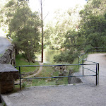
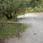
From the eastern side of the Grand Arch, the walk heads over the road to the right of the bridge and the lake behind. The walk then tends left around the lake for approximately 40m to an intersection marked by a ‘No swimming fishing or throwing stones’ sign.
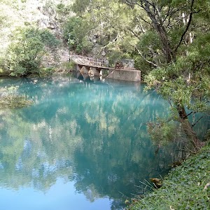
Blue Lake
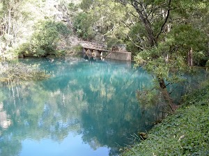
Blue Lake, or Lake Jenolan, is a small lake on the eastern side of the Grand Arch. The lake is fed by the River Styx and the Jenolan River. Blue Lake’s intense colour comes from the refraction of light through limestone sediments.
(0.11km) Blue Lake Access → Jenolan Hydroelectric Station
1.1 km
27 mins
40m
-114m
Moderate track
Continue straight: From the intersection, the walk follows the railing around the hillside, with the water to the left. The path passes a large weir on the left and continues past some old piping (which is sign marked). The track continues around the hill for approximately 50m to the unsignposted intersection.
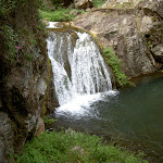
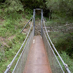
Continue straight: From the intersection, this walk rounds the hillside and down a suspended bridge. The walk winds to the bottom of a waterfall and continues above the creek (on the left) for a short time. The track then turns right, following the hillside around to comes to a bridge. The walk passes over the bridge then winds further around the hillside and banks of the creek to the old Jenolan Hydroelectric Power Station and picnic area.
Continue straight: From the intersection, this walk rounds the hillside and down a suspended bridge. The walk winds to the bottom of a waterfall and continues above the creek (on the left) for a short time. The track then turns right, following the hillside around to comes to a bridge. The walk passes over the bridge then winds further around the hillside and banks of the creek to the old Jenolan Hydroelectric Power Station and picnic area.
Jenolan Caves Hydroelectric Power Station
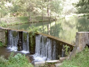
Jenolan Cave Hydroelectric Power Station was originally a Leffel Wheel, built in 1889 on the Jenolan River. The building has a glass front with a light switch to show the large machinery which was once used to power Jenolan. Near the hydroelectric building, there is a nice picnic area by the weir.
(1.26km) Jenolan Hydroelectric Station → Int. above bridge
1 km
25 mins
106m
-37m
Moderate track
Turn around: From Jenolan Caves Hydroelectric Power Station, this walk heads through the picnic area, with the creek below on the left. The track winds around the hillside and banks of the creek, then passes over a bridge. The track winds along the creek a little more before turning left around the hillside, following the left bank of the creek for approximately 300m to the bottom of a waterfall. The track then zigzags up the suspended bridge to round the hillside to an intersection above a bridge.
(2.31km) Int. above bridge → Grand Arch East
260 m
11 mins
60m
-13m
Moderate track
Turn right: From the intersection, this walk heads down to the creek bed and over the bridge to the other side of the creek. The walk then heads around and up the hillside for a little while, passing old pipes, the weir and some seats on the left. The track leads to the right, under a bridge, and heads up some stairs, then follows the railed track to the road before the Grand Arch.
De Burghs Bridge

The bridge spanning out from the Grand Arch was designed by Mr Ernest M. De Burgh, and built by the Public Works Department in 1896. The bridge allowed greater access to the caves and was built from locally cut limestone.
Maps for the River Walk (Blue Lake) walk
You can download the PDF for this walk to print a map.
These maps below cover the walk and the wider area around the walk, they are worth carrying for safety reasons.
| Six Foot Track | 1:50 000 Map Series | Six Foot Track | NSW-six-foot-track |
| Jenolan | 1:25 000 Map Series | 89303N JENOLAN | NSW-89303N |
| Katoomba | 1:100 000 Map Series | 8930 KATOOMBA | 8930 |
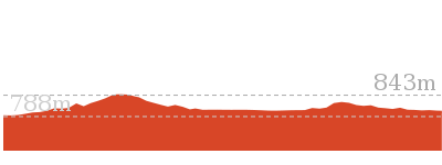
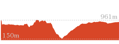
Cross sectional view of the River Walk (Blue Lake) bushwalking track
Analysis and summary of the altitude variation on the River Walk (Blue Lake)

Overview of this walks grade – based on the AS 2156.1 – 2001
Under this standard, a walk is graded based on the most difficult section of the walk.
| Length | 2.6 km | ||
| Time | 1 hr 30 mins | ||
| . | |||
| Grade 3/6 Moderate track |
AS 2156.1 | Gradient | Short steep hills (3/6) |
| Quality of track | Clear and well formed track or trail (2/6) | ||
| Signs | Clearly signposted (1/6) | ||
| Experience Required | No experience required (1/6) | ||
| Weather | Weather generally has little impact on safety (1/6) | ||
| Infrastructure | Limited facilities, not all cliffs are fenced (3/6) |
Some more details of this walks Grading
Here is a bit more details explaining grading looking at sections of the walk
Gradient
Around 2.5km of this walk has short steep hills, whilst the remaining 110m has gentle hills with occasional steps.
Quality of track
This whole walk, 2.6km follows a clear and well formed track or trail.
Signs
This whole walk, 2.6km is clearly signposted.
Experience Required
This whole walk, 2.6km requires no previous bushwalking experience.
weather
This whole walk, 2.6km is not usually affected by severe weather events (that would unexpectedly impact safety and navigation).
Infrastructure
Around 2.3km of this walk is close to useful facilities (such as fenced cliffs and seats), whilst the remaining 260m has limited facilities (such as not all cliffs fenced).
Similar walks
A list of walks that share part of the track with the River Walk (Blue Lake) walk.
Other Nearby walks
A list of walks that start near the River Walk (Blue Lake) walk.
828 m Return
30 mins
Moderate track
3.5 km Circuit
2 hrs
Hard track
2.2 km Return
1 hr 9 mins
Moderate track
3.1 km Return
1 hr 30 mins
Hard track
4.6 km One way
2 hrs
Hard track
12.6 km Return
5 hrs 30 mins
Hard track
20 km Return
7 hrs
Moderate track
4.2 km Return
1 hr 45 mins
Hard track
11.7 km Return
8 hrs 45 mins
Experienced only
7.9 km Return
5 hrs
Hard track
29.2 km One way
2 Days
Experienced only
29.3 km One way
3 Days
Experienced only
Plan your trip to and from the walk here
The River Walk (Blue Lake) walk starts and ends at the Grand Arch East (gps: -33.819113, 150.02388)
Your main transport option to Grand Arch East is by;
![]() Car. There is free parking available.
Car. There is free parking available.
(get details)
Short URL = http://wild.tl/rwl
Gallery images
There are other downloads I am still working on.
You will probably need to login to access these — still all free.
* KML (google earth file)
* GPX (GPS file)
Special Maps/ brochures
* A3 topo maps
* PDF with Lands Topo map base
* PDF with arial image (and map overlay)
I wanted to get the main site live first, this extra stuff will come in time.
Happy walking
Matt 🙂
McKeowns Valley Walk
And Walk
McKeowns Valley Walk

1 hr 30 mins
3.1 km Return
224 m
Hard track


Jenolan Caves House
Jenolan Caves House, built in 1898, is a heritage-listed building which houses dining, a variety of accommodation options, and other services for visitors to the caves. Jenolan has two licensed restaurants: Trails Bistro is open from breakfast onwards and closes early evening. Trails serves a range of light meals including sandwiches, salads and hot food. Chisholm’s Restaurant is open each morning for breakfast and each evening for dinner from 6.00pm. Essential items and beautiful souvenirs may be purchased from Things Jenolan, located on the ground floor of Caves House. Don’t forget to explore one of the many caves to explore in the area. For more information, call Jenolan Caves on 1300 76 33 11.
(0km) Caves House → Carlotta Arch Lookout
410 m
12 mins
74m
-21m
Moderate track
From the opposite side of the Jenolan Caves Road from Caves House[2], this walk follows the ‘Six Foot Track’ sign up the concrete steps[3]. The walk then follows the stone footpath up the side of the valley for about 80m to pass the ‘Southside Show Caves’ information sign[4] then just over 30m later to the ‘Grand Arch’ information sign (and view of the Arch)[5]. The walk continues fairly gently up the path for 100m (as it bends right) to find ‘Caves House’ information sign[6]. The path soon starts leading much more steeply up as it begins to Zig Zag up past a seat[7] and more views down to caves house[8] for 150m beside the limestone cliffs[9]. At the top of this climb the path leads over a small small rise then gently down to a fenced lookout beside ‘Carlotta Arch’[10][11].
(0.41km) Top of Carlotta Arch Steps → Bottom of Carlotta Arch Steps
30 m
1 mins
1m
0m
Moderate track
Turn right: From the intersection, this walk goes down the stairs until coming to the entrance of the cave. On the way, this walk goes under the towering Carlotta’s Arch. The lookout has great views of the valley and Blue Lake. At the end of this side trip, retrace your steps back to the main walk then Turn right.
Carlotta Arch
Carlotta Arch is a large and spectacular cave remnant overlooking Blue Lake. It is believed that the arch was named in honour of a daughter of a surveyor – General P.F. Adams. Adams is credited with having taken some of the earliest photos at Jenolan.
(0.41km) Carlotta Arch Lookout → Int of Carlotta and Mckeown’s Valley Tracks
80 m
1 mins
0m
-8m
Very easy
Continue straight: From the ‘Carlotta Arch’[12][13] lookout, this walk follows the gravel path[14] (past the top of the steps) gently uphill (initially keeping the arch to your right) a short distance to an intersection with the sign posted ‘Six Foot Track’ (on your right), where another sign points back to ‘Caves House’[15].
Continue straight: From the intersection, this walk heads along the gravel footpath until coming to an intersection with a track signposted as the way to the ‘Devil’s Coachhouse’.
Continue straight: From the intersection, this walk heads along the gravel footpath until coming to an intersection with a track signposted as the way to the ‘Devil’s Coachhouse’.
(0.49km) Int of Carlotta and Mckeowns Valley Tracks → Int of Mckeowns Valley Bushtrack and Devils Coachhouse Trail
190 m
7 mins
8m
-37m
Hard track
Turn right: From the intersection, this walk heads off the gravel footpath and goes down the stairs, zigzagging down the hill. The walk then crosses a bridge over the Jenolan River and comes to intersection with a bush track, marked by a ‘Devil’s Coachhouse’ sign.
(0.68km) Int of Mckeowns Valley Bushtrack and Devils Coachhouse Trail → McKeowns Valley Campsite
840 m
19 mins
35m
-41m
Easy track
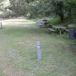
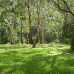
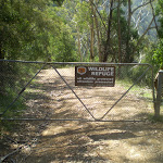
Turn left : From the intersection, this walk heads alongside the Jenolan River (left of the track). The track crosses the river at several points using metal bridges. (Watch out for stinging nettles along this part of the track.) Continuing north along the gravel footpath, the walk slowly winds to reach an electric fence, then heads through the grass clearings signposted as the ‘Old Playing Field’. The walk comes to a group of buildings and an intersection with a management trail (which crosses the Jenolan River).
Maps for the McKeowns Valley Walk walk
You can download the PDF for this walk to print a map.
These maps below cover the walk and the wider area around the walk, they are worth carrying for safety reasons.
| Six Foot Track | 1:50 000 Map Series | Six Foot Track | NSW-six-foot-track |
| Jenolan | 1:25 000 Map Series | 89303N JENOLAN | NSW-89303N |
| Katoomba | 1:100 000 Map Series | 8930 KATOOMBA | 8930 |
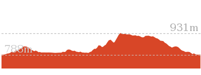
Cross sectional view of the McKeowns Valley Walk bushwalking track
Analysis and summary of the altitude variation on the McKeowns Valley Walk

Overview of this walks grade – based on the AS 2156.1 – 2001
Under this standard, a walk is graded based on the most difficult section of the walk.
| Length | 3.1 km | ||
| Time | 1 hr 30 mins | ||
| . | |||
| Grade 4/6 Hard track |
AS 2156.1 | Gradient | Very steep (4/6) |
| Quality of track | Clear and well formed track or trail (2/6) | ||
| Signs | Clearly signposted (1/6) | ||
| Experience Required | Some bushwalking experience recommended (3/6) | ||
| Weather | Weather generally has little impact on safety (1/6) | ||
| Infrastructure | Generally useful facilities (such as fenced cliffs and seats) (1/6) |
Some more details of this walks Grading
Here is a bit more details explaining grading looking at sections of the walk
Gradient
920m of this walk is flat with no steps and another 410m has short steep hills. The remaining (190m) is very steep.
Quality of track
Around 840m of this walk follows a clear and well formed track or trail, whilst the remaining 680m follows a smooth and hardened path.
Signs
This whole walk, 1.5km is clearly signposted.
Experience Required
Around 1.3km of this walk requires no previous bushwalking experience, whilst the remaining 190m requires some bushwalking experience.
weather
This whole walk, 1.5km is not usually affected by severe weather events (that would unexpectedly impact safety and navigation).
Infrastructure
This whole walk, 1.5km is close to useful facilities (such as fenced cliffs and seats).
Similar walks
A list of walks that share part of the track with the McKeowns Valley Walk walk.
828 m Return
30 mins
Moderate track
2.2 km Return
1 hr 9 mins
Moderate track
3.5 km Circuit
2 hrs
Hard track
4.6 km One way
2 hrs
Hard track
44.8 km One way
3 Days
Hard track
44.8 km One way
2 Days
Hard track
Other Nearby walks
A list of walks that start near the McKeowns Valley Walk walk.
2.6 km Circuit
1 hr 30 mins
Moderate track
12.6 km Return
5 hrs 30 mins
Hard track
20 km Return
7 hrs
Moderate track
4.2 km Return
1 hr 45 mins
Hard track
11.7 km Return
8 hrs 45 mins
Experienced only
7.9 km Return
5 hrs
Hard track
29.2 km One way
2 Days
Experienced only
29.3 km One way
3 Days
Experienced only
5.9 km Circuit
3 hrs 30 mins
Hard track
6.7 km Return
4 hrs 30 mins
Moderate track
16.2 km Return
11 hrs
Experienced only
12.4 km Return
7 hrs 30 mins
Hard track
Plan your trip to and from the walk here
The McKeowns Valley Walk walk starts and ends at the Caves House (gps: -33.820325, 150.02117)
Your main transport option to Caves House is by;
![]() Car. There is free parking available.
Car. There is free parking available.
(get details)
Short URL = http://wild.tl/mvw
Gallery images
There are other downloads I am still working on.
You will probably need to login to access these — still all free.
* KML (google earth file)
* GPX (GPS file)
Special Maps/ brochures
* A3 topo maps
* PDF with Lands Topo map base
* PDF with arial image (and map overlay)
I wanted to get the main site live first, this extra stuff will come in time.
Happy walking
Matt 🙂
McKeowns Valley Circuit
And Walk
McKeowns Valley Circuit
2 hrs
3.5 km Circuit
347 m
Hard track
Looping around the northern bush tracks surrounding Jenolan Caves, this walk explores a variety of different environments, up on the ridges and down along the river. The campsite is a great spot to break and enjoy the quiet, at one of the less-frequented areas of the park. Be sure to allow time to enjoy the views from up on the ridge and especially of Carlotta’s Arch. Watch out for stinging nettles down on the river.


(0km) Caves House → Carlotta Arch Lookout
410 m
12 mins
74m
-21m
Moderate track
From the opposite side of the Jenolan Caves Road from Caves House[1], this walk follows the ‘Six Foot Track’ sign up the concrete steps[2]. The walk then follows the stone footpath up the side of the valley for about 80m to pass the ‘Southside Show Caves’ information sign[3] then just over 30m later to the ‘Grand Arch’ information sign (and view of the Arch)[4]. The walk continues fairly gently up the path for 100m (as it bends right) to find ‘Caves House’ information sign[5]. The path soon starts leading much more steeply up as it begins to Zig Zag up past a seat[6] and more views down to caves house[7] for 150m beside the limestone cliffs[8]. At the top of this climb the path leads over a small small rise then gently down to a fenced lookout beside ‘Carlotta Arch’[9][10].
(0.41km) Top of Carlotta Arch Steps → Bottom of Carlotta Arch Steps
30 m
1 mins
1m
0m
Moderate track
Turn right: From the intersection, this walk goes down the stairs until coming to the entrance of the cave. On the way, this walk goes under the towering Carlotta’s Arch. The lookout has great views of the valley and Blue Lake. At the end of this side trip, retrace your steps back to the main walk then Turn right.
(0.41km) Carlotta Arch Lookout → Int of Mckeowns Valley Bushtrack and Devils Coachhouse Trail
270 m
8 mins
8m
-45m
Hard track
Continue straight: From the ‘Carlotta Arch’[11][12] lookout, this walk follows the gravel path[13] (past the top of the steps) gently uphill (initially keeping the arch to your right) a short distance to an intersection with the sign posted ‘Six Foot Track’ (on your right), where another sign points back to ‘Caves House’[14].
Continue straight: From the intersection, this walk heads along the gravel footpath until coming to an intersection with a track signposted as the way to the ‘Devil’s Coachhouse’.
Turn right: From the intersection, this walk heads off the gravel footpath and goes down the stairs, zigzagging down the hill. The walk then crosses a bridge over the Jenolan River and comes to intersection with a bush track, marked by a ‘Devil’s Coachhouse’ sign.
(0.68km) Int of Mckeowns Valley Bushtrack and Devils Coachhouse Trail → McKeowns Valley Campsite
840 m
19 mins
35m
-41m
Easy track
Turn left : From the intersection, this walk heads alongside the Jenolan River (left of the track). The track crosses the river at several points using metal bridges. (Watch out for stinging nettles along this part of the track.) Continuing north along the gravel footpath, the walk slowly winds to reach an electric fence, then heads through the grass clearings signposted as the ‘Old Playing Field’. The walk comes to a group of buildings and an intersection with a management trail (which crosses the Jenolan River).
(1.53km) McKeown’s Valley Campsite → McKeown’s Valley Lookdown
810 m
28 mins
183m
-67m
Moderate track
Turn left: From the campground, this walk crosses the Jenolan River and begins to zigzag up the hill to the south-west. This continues to the top of the hill, where the trail passes a large gate[15] and comes out next to a dirt road and several green buildings. At this point, the track heads south along the dirt road for about 20m, before coming to an intersection with a management trail, where there is a sign pointing towards ‘Caves House’[16].
(2.33km) McKeowns Valley Lookdown → Carlotta Carpark Intersection
600 m
19 mins
18m
-92m
Moderate track
Continue straight: From the intersection, this walk heads down the hill, following the ‘Caves House’ sign. The track winds past several private residences and soon heads uphill, coming near a dirt road (Burma Rd). The track turns left and begins to to go down the hill, soon coming to a great informal viewing point which looks over the valley and the Six Foot Track. At this point, the track begins to zigzag down the hill and, at several points, goes past Jenolan Caves Rd. In time, the track comes to a small picnic area and intersection, with a large car park off to the right.
(2.93km) Carlotta Carpark Intersection → Int of Carlotta and Mckeowns Valley Tracks
40 m
1 mins
0m
-7m
Easy track
Continue straight: From the intersection, this walk heads downhill along the gravel footpath. Shortly after passing the entrance to a cave (on the right), the track comes to an intersection with a set of stairs.
(2.96km) Int of Carlotta and Mckeown’s Valley Tracks → Caves House
490 m
13 mins
29m
-74m
Moderate track
Veer right: From the intersection, this walk heads along the gravel footpath until coming to an intersection with a track signposted as the ‘Six Foot Track’.
Continue straight: From the intersection, this walk follows the ‘Caves House’ sign[17] gently downhill along the gravel path a short distance to an intersection and fenced lookout near ‘Carlotta Arch’[18][19] (on your left).
Continue straight: From the fenced lookout near ‘Carlotta Arch’[20][21], this walk follows the ‘Caves House’ sign gently uphill along the stone path[22] with handrail. The path leads over a small rise to a view into another valley. Here the path begins to zig zag fairly steeply downhill for 150m beside the limestone cliffs[23] passing views down to Caves House[24], past a bench seat[25] to a ‘Caves House’ information sign[26]. The path continues more gently downhill for another 100m past the ‘Grand Arch’ information sign (and view of the Arch)[27] then just over 30m later to the ‘Southside Show Caves’ information sign[28]. The path continues down the side of the valley for another 80m to head down some concrete steps to the side of Jenolan Caves Road[29], opposite Caves House[30], where a ‘Six Foot Track’ sign points up the steps[31]. The official end of the Six Foot Track.
Maps for the McKeowns Valley Circuit walk
You can download the PDF for this walk to print a map.
These maps below cover the walk and the wider area around the walk, they are worth carrying for safety reasons.
| Six Foot Track | 1:50 000 Map Series | Six Foot Track | NSW-six-foot-track |
| Jenolan | 1:25 000 Map Series | 89303N JENOLAN | NSW-89303N |
| Katoomba | 1:100 000 Map Series | 8930 KATOOMBA | 8930 |
Cross sectional view of the McKeowns Valley Circuit bushwalking track

Analysis and summary of the altitude variation on the McKeowns Valley Circuit
Overview of this walks grade – based on the AS 2156.1 – 2001
Under this standard, a walk is graded based on the most difficult section of the walk.
| Length | 3.5 km | ||
| Time | 2 hrs | ||
| . | |||
| Grade 4/6 Hard track |
AS 2156.1 | Gradient | Very steep (4/6) |
| Quality of track | Clear and well formed track or trail (2/6) | ||
| Signs | Clearly signposted (1/6) | ||
| Experience Required | Some bushwalking experience recommended (3/6) | ||
| Weather | Weather generally has little impact on safety (1/6) | ||
| Infrastructure | Generally useful facilities (such as fenced cliffs and seats) (1/6) |
Some more details of this walks Grading
Here is a bit more details explaining grading looking at sections of the walk
Gradient
2.2km of this walk has short steep hills and another 990m is flat with no steps. Whilst another 190m is very steep and the remaining 35m has gentle hills with occasional steps.
Quality of track
Around 2.6km of this walk follows a smooth and hardened path, whilst the remaining 840m follows a clear and well formed track or trail.
Signs
This whole walk, 3.5km is clearly signposted.
Experience Required
Around 3.3km of this walk requires no previous bushwalking experience, whilst the remaining 190m requires some bushwalking experience.
weather
This whole walk, 3.5km is not usually affected by severe weather events (that would unexpectedly impact safety and navigation).
Infrastructure
This whole walk, 3.5km is close to useful facilities (such as fenced cliffs and seats).
Similar walks
A list of walks that share part of the track with the McKeowns Valley Circuit walk.
828 m Return
30 mins
Moderate track
2.2 km Return
1 hr 9 mins
Moderate track
3.1 km Return
1 hr 30 mins
Hard track
4.6 km One way
2 hrs
Hard track
44.8 km One way
3 Days
Hard track
44.8 km One way
2 Days
Hard track
Other Nearby walks
A list of walks that start near the McKeowns Valley Circuit walk.
2.6 km Circuit
1 hr 30 mins
Moderate track
12.6 km Return
5 hrs 30 mins
Hard track
20 km Return
7 hrs
Moderate track
4.2 km Return
1 hr 45 mins
Hard track
11.7 km Return
8 hrs 45 mins
Experienced only
7.9 km Return
5 hrs
Hard track
29.2 km One way
2 Days
Experienced only
29.3 km One way
3 Days
Experienced only
5.9 km Circuit
3 hrs 30 mins
Hard track
6.7 km Return
4 hrs 30 mins
Moderate track
16.2 km Return
11 hrs
Experienced only
12.4 km Return
7 hrs 30 mins
Hard track
Plan your trip to and from the walk here
The McKeowns Valley Circuit walk starts and ends at the Caves House (gps: -33.820325, 150.02117)
Your main transport option to Caves House is by;
![]() Car. There is free parking available.
Car. There is free parking available.
(get details)
Short URL = http://wild.tl/mvc
Gallery images
There are other downloads I am still working on.
You will probably need to login to access these — still all free.
* KML (google earth file)
* GPX (GPS file)
Special Maps/ brochures
* A3 topo maps
* PDF with Lands Topo map base
* PDF with arial image (and map overlay)
I wanted to get the main site live first, this extra stuff will come in time.
Happy walking
Matt 🙂
Jenolan Cottages to Caves
And Walk
Jenolan Cottages to Caves

2 hrs
4.6 km One way
103 m
Hard track
This is a great walk for those staying at Jenolan Cottages and wanting to walk to the Caves. Following the well-maintained and signposted Six Foot Track, there are great views and a variety of environments to enjoy. Be sure to notice the buildings surrounding Caves House as you come into the Jenolan Area. To finish the walk, Caves House is a great spot to sit and have a cup of coffee before exploring the caves or heading back to the cottages.
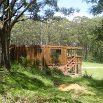


Jenolan Caves Cottages
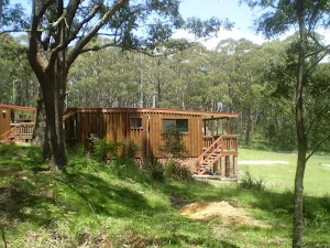
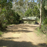
Located 9km from Jenolan Caves by road, Jenolan Caves Cottages offers eight well presented self contained timber cottages for guests to stay in. Each is fully insulated and furnished, with lounge, kitchen, two bedrooms and linen. The is a large flat grassy area in front with often with kangaroos grazing and with a children’s playground. For more information call the Jenolan Caves on 1300 763 311. The cottages have a two night minimum stay and prices are from around $130 per night per cabin.
(0km) Jenolan Caves Cottages Administration → Jenolan Caves Cottages
540 m
11 mins
17m
-18m
Easy track
From the intersection, this walk follows the ‘Cottages’ sign[3] along the driveway past the ’20’ km/h speed limit sign, initially keeping the office/house to your left[4]. The driveway leads over a small rise then heads downhill for about 300m to pass a toilet block[5]. Here the walk stays on the driveway as it bends left[6] and continues beside the clearing[7] to come beside the cottages[8].
(0.54km) Jenolan Caves Cottages → Int of 6 ft track and Mt George Firetrail
2.8 km
58 mins
42m
-232m
Hard track
Continue straight: From beside Jenolan Caves Cottages[9], this walk heads gently uphill along driveway[10] (initially keeping the cottages to your right) for about 60m to walk around the metal gate beside ‘Six Foot Track’ sign[11]. This walk continues along this mostly flat trail for 350m through tall wooded forest to a T-intersection marked with a ‘Kia-ora Hill Fire Trail’ sign[12]. This walk turns right and follows ‘Six Foot Track’ sign[13] gently down along the trail for about 300m to find a fairly large flat clearing[14]. The walk continues along the trail which generally leads downhill along the ridge line for 1.5km to where the trail moves to the side of the steep valley (on your right)[15]. The trail begins to become steeper then after 400m the trail leads particularly steeply down along the rocky trail[16] for about 600m. Here the trial flattens out on a saddle with a Y-intersection marked with a ‘Six Foot Track’ sign (pointing right) and a ‘Mt George’ sign (pointing ahead)[17].
(3.34km) Int of 6FT and Mt George trail → Int of 6FT and Carlotta Arch Track
870 m
24 mins
23m
-170m
Hard track
Veer right: From the intersection, this walk follows the ‘Six Foot Track’ sign[18] downhill along the narrowing track, keeping the steep wide valley to your right. After about 25m the track leads between two timber posts[19] and continues fairly steeply down the side of the valley with glimpses to the cave buildings for 500m where the track flattens out a bit and heads under a solid gum tree leaning over the track[20]. The track continues leading downhill for another 300m to cross a narrow saddle and along a very narrow ridge[21] where there are good views down to Blue Lake[22] (on your left). The track now leads down some timber steps for about 50m to a T-intersection[23] with a gravel path where a ‘Six Foot Track’ sign points back uphill.
(4.22km) Int of 6FT and Carlotta Arch Track → Carlotta Arch Lookout
10 m
0m
0m
Very easy
(4.23km) Top of Carlotta Arch Steps → Bottom of Carlotta Arch Steps
30 m
1 mins
1m
0m
Moderate track
Turn left: From the intersection, this walk goes down the stairs until coming to the entrance of the cave. On the way, this walk goes under the towering Carlotta’s Arch. The lookout has great views of the valley and Blue Lake. At the end of this side trip, retrace your steps back to the main walk then Turn left.
Carlotta Arch
Carlotta Arch is a large and spectacular cave remnant overlooking Blue Lake. It is believed that the arch was named in honour of a daughter of a surveyor – General P.F. Adams. Adams is credited with having taken some of the earliest photos at Jenolan.
(4.23km) Carlotta Arch Lookout → Caves House
410 m
12 mins
21m
-74m
Moderate track
Continue straight: From the fenced lookout near ‘Carlotta Arch’[27][28], this walk follows the ‘Caves House’ sign gently uphill along the stone path[29] with handrail. The path leads over a small rise to a view into another valley. Here the path begins to zig zag fairly steeply downhill for 150m beside the limestone cliffs[30] passing views down to Caves House[31], past a bench seat[32] to a ‘Caves House’ information sign[33]. The path continues more gently downhill for another 100m past the ‘Grand Arch’ information sign (and view of the Arch)[34] then just over 30m later to the ‘Southside Show Caves’ information sign[35]. The path continues down the side of the valley for another 80m to head down some concrete steps to the side of Jenolan Caves Road[36], opposite Caves House[37], where a ‘Six Foot Track’ sign points up the steps[38]. The official end of the Six Foot Track.
Jenolan Caves House
Jenolan Caves House, built in 1898, is a heritage-listed building which houses dining, a variety of accommodation options, and other services for visitors to the caves. Jenolan has two licensed restaurants: Trails Bistro is open from breakfast onwards and closes early evening. Trails serves a range of light meals including sandwiches, salads and hot food. Chisholm’s Restaurant is open each morning for breakfast and each evening for dinner from 6.00pm. Essential items and beautiful souvenirs may be purchased from Things Jenolan, located on the ground floor of Caves House. Don’t forget to explore one of the many caves to explore in the area. For more information, call Jenolan Caves on 1300 76 33 11.
Maps for the Jenolan Cottages to Caves walk
You can download the PDF for this walk to print a map.
These maps below cover the walk and the wider area around the walk, they are worth carrying for safety reasons.
| Six Foot Track | 1:50 000 Map Series | Six Foot Track | NSW-six-foot-track |
| Jenolan | 1:25 000 Map Series | 89303N JENOLAN | NSW-89303N |
| Katoomba | 1:100 000 Map Series | 8930 KATOOMBA | 8930 |
Cross sectional view of the Jenolan Cottages to Caves bushwalking track
Analysis and summary of the altitude variation on the Jenolan Cottages to Caves
Overview of this walks grade – based on the AS 2156.1 – 2001
Under this standard, a walk is graded based on the most difficult section of the walk.
| Length | 4.6 km | ||
| Time | 2 hrs | ||
| . | |||
| Grade 4/6 Hard track |
AS 2156.1 | Gradient | Very steep (4/6) |
| Quality of track | Formed track, with some branches and other obstacles (3/6) | ||
| Signs | Directional signs along the way (3/6) | ||
| Experience Required | Some bushwalking experience recommended (3/6) | ||
| Weather | Weather generally has little impact on safety (1/6) | ||
| Infrastructure | Limited facilities, not all cliffs are fenced (3/6) |
Some more details of this walks Grading
Here is a bit more details explaining grading looking at sections of the walk
Gradient
3.7km of this walk is very steep and another 540m has gentle hills with occasional steps. Whilst another 410m has short steep hills and the remaining 15m is flat with no steps.
Quality of track
3.3km of this walk follows a clear and well formed track or trail and another 870m follows a formed track, with some branches and other obstacles. The remaining (430m) follows a smooth and hardened path.
Signs
Around 3.7km of this walk has directional signs at most intersection, whilst the remaining 970m is clearly signposted.
Experience Required
Around 3.8km of this walk requires no previous bushwalking experience, whilst the remaining 870m requires some bushwalking experience.
weather
This whole walk, 4.6km is not usually affected by severe weather events (that would unexpectedly impact safety and navigation).
Infrastructure
Around 3.8km of this walk is close to useful facilities (such as fenced cliffs and seats), whilst the remaining 870m has limited facilities (such as not all cliffs fenced).
Similar walks
A list of walks that share part of the track with the Jenolan Cottages to Caves walk.
828 m Return
30 mins
Moderate track
2.2 km Return
1 hr 9 mins
Moderate track
3.1 km Return
1 hr 30 mins
Hard track
3.5 km Circuit
2 hrs
Hard track
44.8 km One way
3 Days
Hard track
44.8 km One way
2 Days
Hard track
Other Nearby walks
A list of walks that start near the Jenolan Cottages to Caves walk.
2.6 km Circuit
1 hr 30 mins
Moderate track
12.6 km Return
5 hrs 30 mins
Hard track
20 km Return
7 hrs
Moderate track
4.2 km Return
1 hr 45 mins
Hard track
11.7 km Return
8 hrs 45 mins
Experienced only
7.9 km Return
5 hrs
Hard track
29.2 km One way
2 Days
Experienced only
29.3 km One way
3 Days
Experienced only
5.9 km Circuit
3 hrs 30 mins
Hard track
6.7 km Return
4 hrs 30 mins
Moderate track
16.2 km Return
11 hrs
Experienced only
12.4 km Return
7 hrs 30 mins
Hard track
Plan your trip to and from the walk here
The Jenolan Cottages to Caves walk starts at the Jenolan Caves Cottages Administration (gps: -33.785898, 150.02527)
Your main transport option to Jenolan Caves Cottages Administration is by;
![]() Car. There is free parking available.
Car. There is free parking available.
(get details)
The Jenolan Cottages to Caves ends at the Caves House (gps: -33.820325, 150.02117)
Your main transport option to Caves House is by;
![]() Car. There is free parking available.
Car. There is free parking available.
(get details)
Short URL = http://wild.tl/jctc
Gallery images
There are other downloads I am still working on.
You will probably need to login to access these — still all free.
* KML (google earth file)
* GPX (GPS file)
Special Maps/ brochures
* A3 topo maps
* PDF with Lands Topo map base
* PDF with arial image (and map overlay)
I wanted to get the main site live first, this extra stuff will come in time.
Happy walking
Matt 🙂
Comments