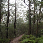
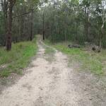
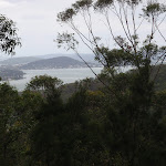
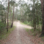
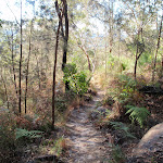
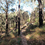
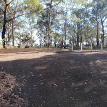
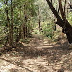
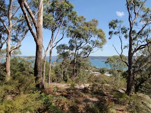
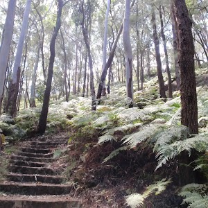
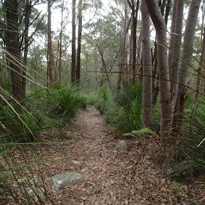
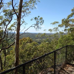
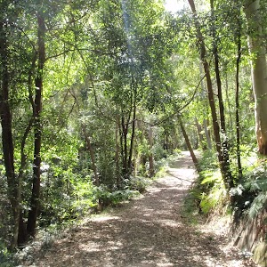
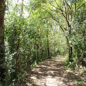
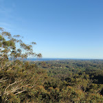
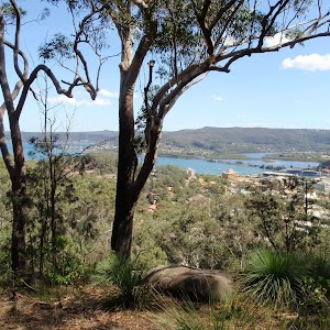
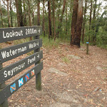
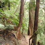
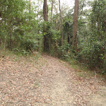
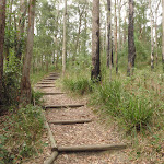
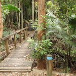
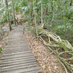
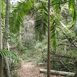
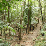
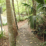
This walk starts at the bottom of Katandra Reserve and heads up the hill, exploring the ridge on the way to Gosford Station. You will visit a wide variety of plant communities and some lovely vistas over the surrounding towns and water. Along some of the secluded sections, you may forget that you are so close to houses. You will also find a few picnic areas and lookouts along the way, providing great places to rest.
Matcham to Gosford
And Walk
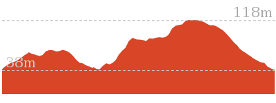
Matcham to Gosford


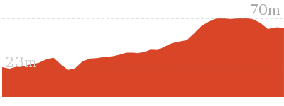
3 hrs 45 mins
8.5 km One way

381 m
Hard track


(0km) Katandra Rd Gate → Katandra Rd picnic area

70 m
2 mins
5m
0m
Easy track
From the gate (at the junction of Katandra Rd and Croton Ave), this walk follows the sealed driveway up the hill, soon coming to the car park and information board.
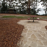
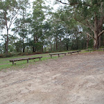
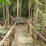
Katandra Rd Picnic Area
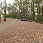
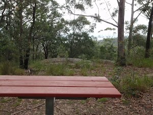
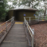
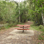
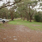
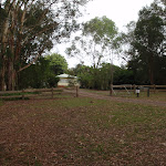
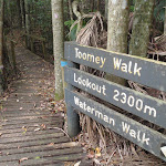
The Katandra Road Picnic Area is found at the end of a short driveway (signposted at the intersection of Katandra Rd and Croton Ave, Holgate). The picnic area is in front of the ranger’s residence and is open from 7am to 6pm daily. The picnic area provides some toilets, garbage bins, two picnic tables, parking and an information sign.
(0.07km) Katandra Rd picnic area → Behind the Rangers Residence
450 m
13 mins
54m
-8m
Moderate track
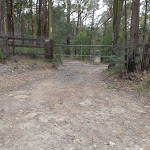
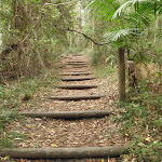
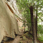
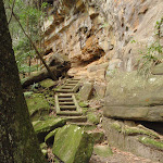
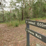
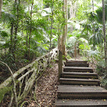
Turn left: From the picnic area, this walk follows the ‘Graves Walk’ and ‘Lookout 1500m’ signs gently downhill, initially keeping the ranger’s cottage to the right. The track then heads up a long series of steps, passing a steep trail on the left (that leads to Murina Close). The walk continues up the steps to a large five-way intersection above a ‘No Entry Rangers Residence’ sign[1] and locked gate.
(0.52km) Behind the Rangers Residence → Int of Graves and Mouat Walks
790 m
22 mins
93m
-3m
Moderate track
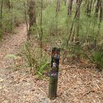
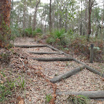
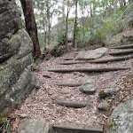
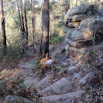
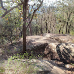
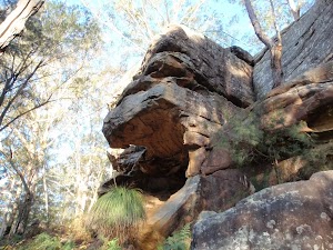
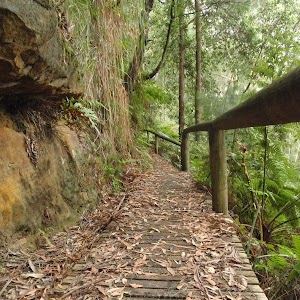
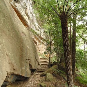
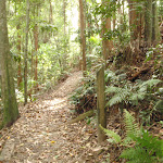
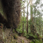
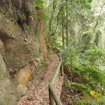
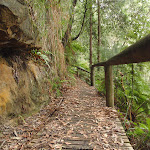
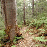
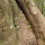
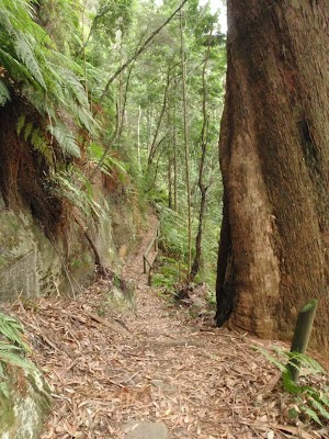
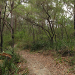
Continue straight: From the intersection, this walk follows the stairs up the hill to the rocky outcrop, heading directly away from the locked gate. The track heads through the rocks then along the top of the ridge, passing the number ‘6’ post (Aboriginal markings in the stone). The track continues gently uphill until coming to an intersection with a short link track (leading to the parallel horse track).
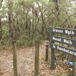
Continue straight: From the intersection, this walk follows the walking track gently uphill, keeping the horse track on the left. The track soon bends right and heads between the timber posts, then zigzags up the hill. The track passes between more posts to a signposted intersection with the ‘Mouat Walk’ and a sign pointing back along ‘Graves Walk’.
Continue straight: From the intersection, this walk follows the walking track gently uphill, keeping the horse track on the left. The track soon bends right and heads between the timber posts, then zigzags up the hill. The track passes between more posts to a signposted intersection with the ‘Mouat Walk’ and a sign pointing back along ‘Graves Walk’.
(1.31km) Int of Graves and Mouat Walks → St Johns Lookout
320 m
6 mins
9m
-17m
Easy track
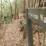
Veer right: From the intersection, this walk follows none of the arrows but heads away from the face of the sign gently uphill, keeping the valley to the right. The track soon opens up into a large clearing, passing the ‘Mount Mouat walk’ and ‘Graves Walk’ signs[2] and continuing for about 20m to an intersection with the signposted ‘Guringai walk’[3].
Continue straight: From the intersection, this walk heads through the clearing towards the picnic area, soon coming to the car park and information sign.
Continue straight: From the car park (signposted as ‘Katandra’ on Toomeys Rd), this walk heads across the picnic area and past the BBQ shelters, keeping the road up the hill to the left. Soon the walk comes to a sandstone footpath in front of the toilet block.
Turn right: From the toilet block, this walk follows the footpath past the information sign to the fenced and signposted ‘St Johns Lookout’ At the end of this side trip, retrace your steps back to the main walk then Continue straight.
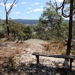
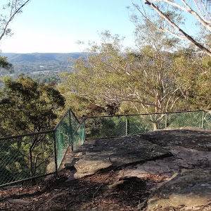
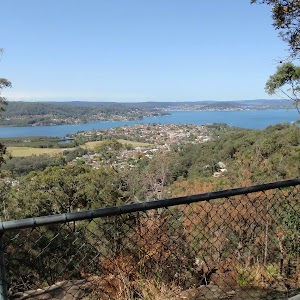
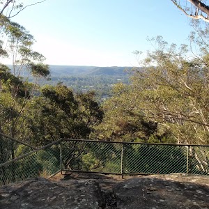
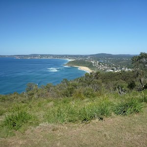
St Johns Lookout

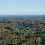
This fenced lookout is found at the top of Katandra Reserve, near the toilets. The lookout was upgraded by Gosford Council in September 2009 and now provides a safer platform and easier access. From the lookout, there are extensive views south-east over Matcham, Erina Heights and Terrigal, out to the ocean. The Guringai Walk passes below the lookout – please take extra care to not drop anything from the platform.
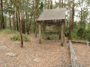
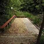
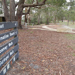
St Johns Lookout picnic area
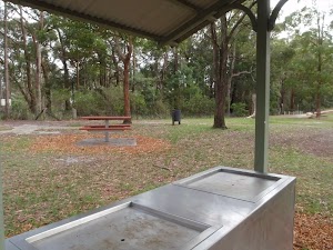
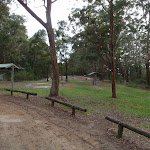
St Johns Lookout picnic area is a large open area found at the top of Katandra Reserve on Toomeys Rd. The picnic area provides wheelchair accessible toilets[6], picnic tables[7], free electric BBQ’s[8], parking areas[9] [10] and information boards[11]. There is plenty of open space with some natural shade provided by the surrounding trees. There are garbage bins provided[12] but no drinking water[13].
(1.31km) Int of Graves and Mouat Walks → Int of Mouat and Toomeys Rd Trails
1.1 km
23 mins
36m
-75m
Moderate track
Turn left : From the intersection, this walk follows the ‘Mouat Walk’ and ‘To Rumbalara Reserve’ signs along the track, keeping the valley to the left. The track soon comes to a four-way intersection, with a ‘Graves Track’ sign and a gate visible (up the hill to the right).
Continue straight: From the intersection, this walk follows the track from behind the ‘Graves Walk’ sign, initially keeping the gate up the hill to the right. The track winds through the bush, crossing a small rock platform (and ignoring the side tracks), then heads down a series of timber steps. The trail winds past a few large rocks then winds up the hill to come into view of (and run parallel to) the Toomeys management trail. The track then passes over another rocky outcrop (beware of the cliff drop on the left), then down some steps to come to the wide Toomeys Management trail and an arrow pointing back up the steps.
Continue straight: From the intersection, this walk follows the track from behind the ‘Graves Walk’ sign, initially keeping the gate up the hill to the right. The track winds through the bush, crossing a small rock platform (and ignoring the side tracks), then heads down a series of timber steps. The trail winds past a few large rocks then winds up the hill to come into view of (and run parallel to) the Toomeys management trail. The track then passes over another rocky outcrop (beware of the cliff drop on the left), then down some steps to come to the wide Toomeys Management trail and an arrow pointing back up the steps.
(2.36km) Int of Mouat and Toomeys Rd Trails → Top of Clyde Rd trail
570 m
11 mins
16m
-12m
Moderate track
Turn left: From the intersection, this walk follows the wide management trail, keeping the valley down on the right. The trail soon bends left then, approximately 200m later, passes a stockpile of dirt and rocks (on the right). About 250m later, the trail passes a locked gate of a private residence and, just after the gate, comes to an intersection at the top of the Clyde Rd Trail.
(2.93km) Top of Clyde Rd trail → Erina Trig
160 m
3 mins
8m
0m
Moderate track
Continue straight: From the intersection, this walk follows the upper trail south, keeping next to the fence on the right. The trail soon bends right, leaving the power lines and coming to an intersection with a track (on the left), near the corner of the fence and above a small pond (on the right).
Turn left: From the intersection, this walk follows the arrow up the steps away from the fence. The track gently winds up the hill to the Erina Trig station, surround by trees.
Turn left: From the intersection, this walk follows the arrow up the steps away from the fence. The track gently winds up the hill to the Erina Trig station, surround by trees.
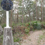
Erina Trig
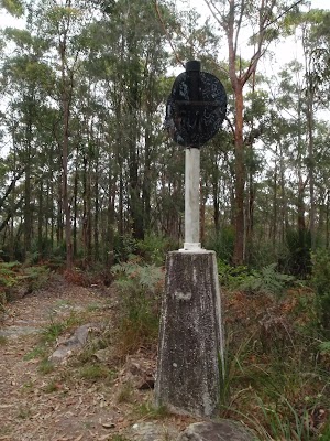
Erina Trig station is part of a national geodetic survey established during the 1970’s. The ‘Triangulation station’ (aka trigonometrical or trig station) is a distinct marker which was once clear of trees and would have been visible for many kilometers in the area. There are many such trig stations around Australia, used to help in surveying. Each station has a know position and altitude which allows surveyors to use triangulation to determine another point’s location. With advances in technology, these trig stations have been superseded and abandoned. More info.
(3.09km) Erina Trig → Int of trig track and Toomeys Rd trail
120 m
2 mins
0m
-11m
Moderate track
Continue straight: From the trig point, this walk follows the track south-west down the hill, soon coming to an intersection with Toomeys Rd management trail.
(3.21km) Int of trig track and Toomeys Rd trail → Mouat trail picnic table
480 m
10 mins
6m
-41m
Moderate track
Veer left: From the intersection, this walk heads south-west, down along the management trail, and soon follows a fence, on the right. The trail winds down the hill (steeply in one spot), generally next to the fence, until coming to a locked gate (on the right).
Continue straight: From the gate, this walk follows the narrower track, keeping the fence to the right. The track soon turns right (at the corner fencepost) and continues alongside the fence, passing a bench seat and unfenced view on the left. The track continues to follow the fence and soon passes another locked gate (and passes close to the management trail). Following the fence, the track soon comes to a picnic table and an unfenced view across the valley.
Continue straight: From the gate, this walk follows the narrower track, keeping the fence to the right. The track soon turns right (at the corner fencepost) and continues alongside the fence, passing a bench seat and unfenced view on the left. The track continues to follow the fence and soon passes another locked gate (and passes close to the management trail). Following the fence, the track soon comes to a picnic table and an unfenced view across the valley.
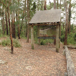
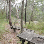
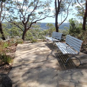
Mouat trail picnic table
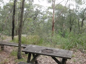
Mouat trail picnic table is found about halfway along the Mouat trail. There is an old picnic table and bench seat at the top of an unfenced cliff with filtered views over Springfield East Gosford and the Brisbane Water. A nice spot for a snack and rest.
(3.69km) Mouat trail picnic table → Locked gate
90 m
2 mins
0m
-7m
Moderate track
Continue straight: From the picnic table, this walk follows the track, keeping the fence to the right. The track keeps next to the fence until bending left around a rocky outcrop then down some stairs, coming to a management trail just below a locked gate.
(3.77km) Locked gate → Saddle intersection
180 m
3 mins
3m
-8m
Moderate track
Veer left: From the intersection, this walk follows the wide management trail downhill, away from the gate. The trail soon flattens out and crosses a long saddle, coming to a ‘Y’ intersection with a walking track (on the left), marked with a timber post.
(3.96km) Saddle intersection → 130 Picnic table
130 m
4 mins
15m
-1m
Moderate track
Veer left: From the intersection, this walk follows the walking track west up the hill, keeping the wider trail below to the right. The track winds up the hill through a rock outcrop to find a picnic table next to an unfenced view across East Gosford.
130 Picnic table
The 130 Picnic table (informally named based on the height of the hill) provides a spot to stop and rest. There are views from the top of this unfenced cliff across Brisbane Water and East Gosford. The single table has some limited natural shade from the surrounding trees.
(4.09km) 130 Picnic table → Int west of 130
200 m
4 mins
0m
-21m
Hard track
Continue straight: From the picnic table, this walk heads west, initially keeping the view to the left. The track heads along the top of the hill and turns left, following the arrow on the post down the hill and stairs through the cleft in the rock. The track continues down the hill, ignoring side tracks (on the right) to come to an intersection with a management trail in a fairly large clearing.
(4.29km) Int west of 130 → Powerline intersection
360 m
8 mins
12m
-22m
Moderate track
Veer left: From the intersection, this walk follows the management trail west, gently downhill, away from the rocky outcrop. The trail leads across a saddle and soon comes to an unsignposted ‘Y’ intersection with Bradys Gully trail (heading downhill on the right).
Continue straight: From the intersection, this walk follows the management trail south-west up the hill, initially keeping Bradys Gully trail below to the right. The walk soon takes the left fork (ignoring another trail on the right) to another saddle, with power lines running through the middle.
Continue straight: From the intersection, this walk follows the management trail south-west up the hill, initially keeping Bradys Gully trail below to the right. The walk soon takes the left fork (ignoring another trail on the right) to another saddle, with power lines running through the middle.
(4.64km) Powerline intersection → Sculpture of Edward John Eyre
440 m
10 mins
38m
-1m
Moderate track
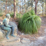
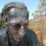
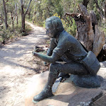
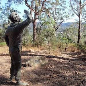
Continue straight: From the intersection, this walk follows the upper arrow on the post, away from the power line, heading uphill to the south. The walk soon veers left (ignoring the wider trail on the right) and winds up the timber steps, through the rocky outcrop and follows a wire fence for a short time. The track follows the top of the ridge (with some filtered district views) until coming to a bronze sculpture of Edward John Eyre.
Edward John Eyre
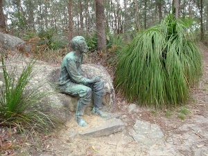
The Sculpture of Edward John Eyre is found near the southern end of the Mouat Trail in Rumbalara Reserve. Commissioned by Sara Lee Kitchens and the State Bicentennial Commission, this 1.25 scale figurative work was sculptured by Carl Merten[15]. A circular inscription at the base declares this to be ‘Edward John Eyre 1815-1901’[16]. Eyre is one of Australia’s more famous explorers. A father of 5, he was awarded the founder’s gold medal from the Royal Geographical Society in 1847. In 1841, Eyre was appointed as resident magistrate and protector of Aborigines. He summed up his work like this –
“Moorundie was a District densely populated by Natives and in which prior to 1841 no settler had ventured to locate, and where (before I was stationed there) frightful scenes of bloodshed, rapine and hostility between the Natives and Parties coming overland with Stock had been of very frequent occurrence, but where, from the time of my arrival, and up to the date of my leaving not a single case of serious injury or aggression ever took place on the part of the Natives against the Europeans, whilst the district became rapidly and extensively occupied by Settlers and by Stock“.
Eyre also served as lieutenant-governor for New Zealand, lieutenant-governor for St Vincent (West Indies), governor for Leeward Islands, governor for Antigua and governor-in-chief for Jamaica. More info.
(5.08km) Sculpture of Edward John Eyre → Int of Red Gum walk and Mouat Walk
150 m
2 mins
2m
-1m
Hard track
Continue straight: From the sculpture, this walk follows the management trail, leaving the sculpture behind on the left. The trail meanders for a short distance to an intersection with a bush track, on the right (with a gate visible straight ahead).
(5.22km) Int of Red Gum walk and Mouat Walk → Wannagan Lookout
290 m
6 mins
10m
-7m
Hard track
Veer right: From the intersection, this walk follows the track down the hill, leaving the nearby gate (beside the road) to the left. The walk meanders along the side of the hill for some distance, keeping the valley to the right, going up and down occasional steps before reaching the fenced Wannagan Lookout[19], with great views to the north.
Wannagan Lookout
The fenced Wannagan Lookout[20], on the Red Gum Walk, has great views over North Gosford. The fenced lookout sits at the top of a small cliff. Out of sight, beneath the lookout, is some great cliff and overhang scenery.
(5.51km) Wannagan Lookout → Int of Flannel Flower walk and Red Gum walk
420 m
12 mins
51m
-35m
Hard track
Turn left : From the lookout, this walk follows the track along the side of the hill, leaving the lookout behind to the right. The walk meanders through some good scenery for a short distance before reaching an intersection with a faint track, going down the hill to the right.
Veer left: From the intersection, this walk follows the level track, keeping the valley to the right. The track immediately passes a grasstree, to the right, and bends to the left. The track meanders for a while, with occasional steps, before winding steeply up the hill using numerous timber and stone steps. The track bends to the right at the top of a rock outcrop and continues a short distance to an intersection with a management trail.
Veer left: From the intersection, this walk follows the level track, keeping the valley to the right. The track immediately passes a grasstree, to the right, and bends to the left. The track meanders for a while, with occasional steps, before winding steeply up the hill using numerous timber and stone steps. The track bends to the right at the top of a rock outcrop and continues a short distance to an intersection with a management trail.
(5.92km) Int of Flannel Flower walk and Red Gum walk → Junction of Ironbark, Casuarina and Flannel flower walks
560 m
12 mins
21m
-29m
Moderate track
Turn right: From the intersection, this walk follows the management trail gently down the hill, away from the nearby reservoir tank. After a short distance, the walk passes another management trail (to the left) and continues further, to an intersection with a track on the left (just before the management trail bends a little to the right and goes very steeply down the hill).
Veer left: From the intersection, this walk follows the track, leaving the steep downhill section of the management trail to the right. The track follows under or near some power lines for a short distance, then climbs gently around the side of the hill for a while to an intersection with the road, with a ‘Flannel Flower Track’ signpost pointing back to ‘Loop to Yaruga Picnic Area’.
Continue straight: From the intersection, this walk follows the ‘Yaruga Picnic Area’ arrow across the road. The walk crosses the small car park, passing between some metal posts to a track junction with signposts for the ‘Ironbark Loop’, the ‘Casuarina Track’ and the ‘Flannel Flower Track’.
Rumbalara Reserve
Rumbalara Reserve lies just to the east of the Gosford CBD and is part of Gosford’s Coastal Open Space System (COSS). There is an extensive set of well marked walking tracks within the reserve. Yaruga Picnic Area has free electric BBQs while both Yaruga and Nurrunga picnic areas have toilets, picnic tables, nearby lookouts and proximity to walking tracks. The picnic areas are accessed via Dolly Ave, Springfield, with the gate being locked at 8pm each evening[21]. The Rumbalara Environmental Education Centre, at the end of Donnison St, Gosford, is one of several good access points to the walking tracks in the lower section of the reserve. More info.
(6.49km) Junction of Ironbark, Casuarina and Flannel flower walks → Sculpture of Charles Sturt
320 m
7 mins
3m
-24m
Moderate track
Turn left: From the junction, this walk follows the ‘Ouraka Point’ arrow (Casuarina Track), along the bush track, going gently down the hill. The track descends gently for a while, taking the right branch at a fork and going down the paved steps to an intersection with a management trail, with a ‘Casuarina Track’ signpost pointing back to the ‘Nurrunga Picnic Area’.
Veer right: From the intersection, this walk follows the management trail gently down the hill, keeping the views of Gosford to the right. After a while, the walk reaches a sculpture of Charles Sturt, to the left.
Veer right: From the intersection, this walk follows the management trail gently down the hill, keeping the views of Gosford to the right. After a while, the walk reaches a sculpture of Charles Sturt, to the left.
(6.81km) Sculpture of Charles Sturt → Int of Rainforest walk and Casuarina walk
30 m
1 mins
0m
-2m
Moderate track
Continue straight: From the sculpture, this walk follows the management trail, keeping the views of Gosford to the right and leaving Charles Sturt behind on the left. After a short distance, the walk reaches an intersection, with a ‘Casuarina Track’ signpost pointing back to the ‘Picnic Areas’.
Casuarina
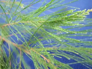
Commonly known as the she-oak, sheoak, ironwood, or beefwood, casuarinas have ‘delicate, slender ultimate branches and leaves that are no more than scales, making the tree look more like a wispy conifer’. There are 17 species of Casuarina ‘native to Australasia, southeastern Asia, and islands of the western Pacific Ocean’. More info.
(6.84km) Int of Rainforest walk and Casuarina walk → Ouraka Point
220 m
4 mins
1m
-13m
Moderate track
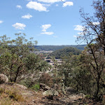
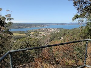
Continue straight: From the intersection, this walk follows the ‘Ouraka Point’ arrow along the management trail, going gently up the hill. After a short distance, the walk passes an informal, unfenced lookout area with obscured but nice views over Gosford, to the right. The walk continues a little further, passing a boulder in the middle of the trail, and arriving at the signposted ‘Ouraka Point’, with beautiful views over Gosford and the surrounding areas and waterways.
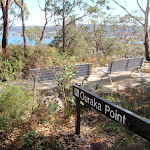
Ouraka Point
This picturesque spot with fantastic views over Gosford and the surrounding areas, including Brisbane Waters, is located within the Rumbalara Reserve, along the Casuarina Walk. It is a beautiful spot to sit and enjoy the views for a while during a walk in the reserve.
(7.06km) Ouraka Point → Int of Casuarina track and Casuarina link trail
200 m
5 mins
0m
-39m
Moderate track
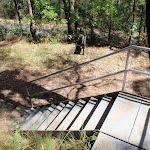
Continue straight: From Ouraka Point, this walk goes down the paved steps, keeping the views over Gosford to the right. The walk passes some large boulders (to the right) and continues down the steps before crossing over the end of a management trail and going down a metal staircase, then some sandstone steps, to an intersection with a management trail.
Continue straight: From the intersection, this walk follows the management trail gently down the hill, leaving the steps behind on the right. After a short distance, the walk arrives at an intersection marked by an information board, and a ‘Casuarina Track’ signpost pointing back to the ‘Picnic Areas’.
Continue straight: From the intersection, this walk follows the management trail gently down the hill, leaving the steps behind on the right. After a short distance, the walk arrives at an intersection marked by an information board, and a ‘Casuarina Track’ signpost pointing back to the ‘Picnic Areas’.
(7.25km) Int of Casuarina track and Casuarina link trail → Int of Casuarina track and JWD link trail
60 m
2 mins
0m
-8m
Moderate track
Turn right: From the intersection, the walk follows the ‘Field Studies Centre’ arrow down the steps. After a short distance, the walk goes down a metal staircase, arriving at an intersection with a management trail, and a ‘Casuarina Track’ signpost pointing back to the ‘Picnic Areas’.
(7.31km) Int of Casuarina track and JWD link trail → Rumbalara Environmental Education Centre trackhead
140 m
4 mins
1m
-18m
Moderate track
Turn right: From the intersection, this walk follows the management trail gently down the hill, leaving the metal staircase behind on the right. The trail goes gently down the hill for a short distance to an unmarked intersection with a bush track (going down some wooden steps to the left).
Turn left: From the intersection, this walk follows the track down the steps and immediately bends to the right. After descending a little, the track bends to the left and crosses a small bridge, then goes down some more steps to the trackhead at the back of the Rumbalara EEC buildings, with a ‘Walking Trail’ arrow pointing back the way you came.
Turn left: From the intersection, this walk follows the track down the steps and immediately bends to the right. After descending a little, the track bends to the left and crosses a small bridge, then goes down some more steps to the trackhead at the back of the Rumbalara EEC buildings, with a ‘Walking Trail’ arrow pointing back the way you came.
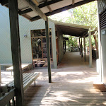
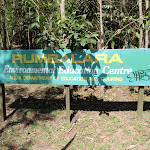
Rumbalara Environmental Education Centre
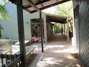
This centre is ‘a New South Wales Department of Education and Training facility that provides environmental education and field work opportunities to students, teachers and the community of the Central Coast’ . The centre is at the end of Donnison St, Gosford and is a good access point to some of the walking tracks in the adjoining Rumbalara Reserve. More info.
(7.44km) Rumbalara Environmental Education Centre trackhead → Gosford Station
1 km
19 mins
6m
-38m
Easy track
Turn right: From the trackhead, this walk goes across the timber deck and down the paved footpath to the nearby car park.
Turn left: From the car park, this walk heads downhill along the driveway and along Donnison St footpath (keeping the road on the left). The walk crosses Albany St, then Henry Parry Dr, then heads diagonally through Kibble Park. On the other side of Kibble Park, the walk heads through William St Mall, then turns right to follow the footpath along the Pacific Hwy. Soon after crossing Erina St, this walk heads up the stairs under the glass-covered footbridge, then crosses the bridge and road to Gosford Train Station.
Turn left: From the car park, this walk heads downhill along the driveway and along Donnison St footpath (keeping the road on the left). The walk crosses Albany St, then Henry Parry Dr, then heads diagonally through Kibble Park. On the other side of Kibble Park, the walk heads through William St Mall, then turns right to follow the footpath along the Pacific Hwy. Soon after crossing Erina St, this walk heads up the stairs under the glass-covered footbridge, then crosses the bridge and road to Gosford Train Station.
Maps for the Matcham to Gosford walk
You can download the PDF for this walk to print a map.
These maps below cover the walk and the wider area around the walk, they are worth carrying for safety reasons.
| Gosford | 1:25 000 Map Series | 91312S GOSFORD | NSW-91312S |
| Gosford | 1:100 000 Map Series | 9131 GOSFORD | 9131 |
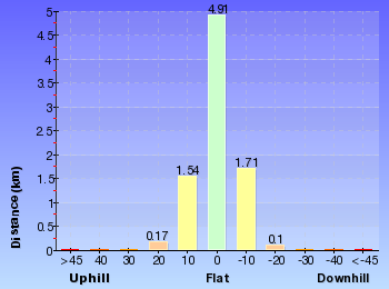
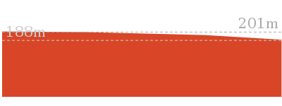
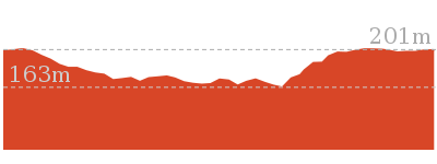
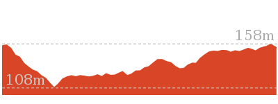
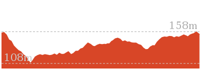
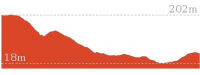
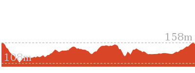
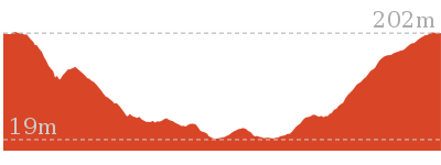
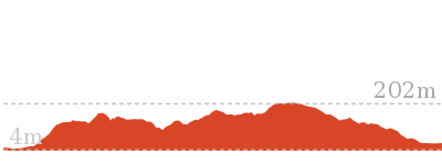
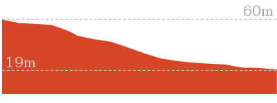
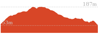
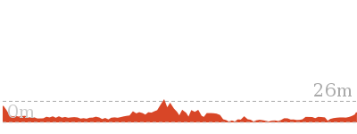
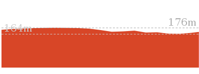
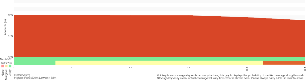
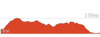
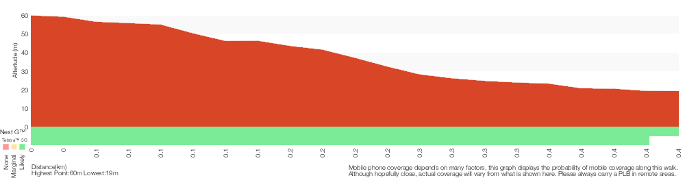
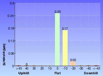
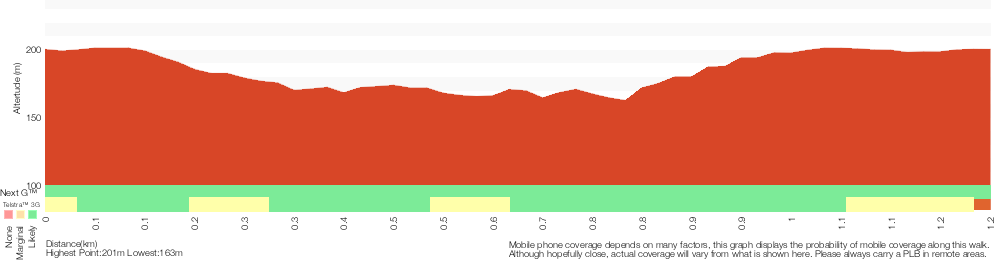
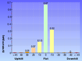
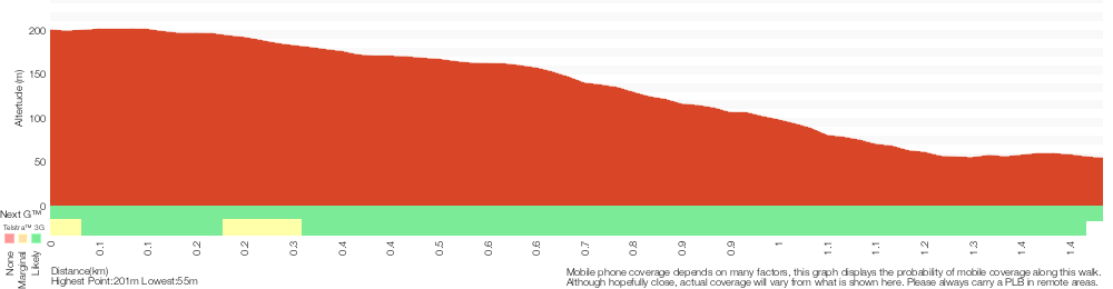
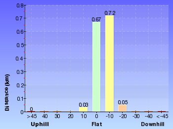
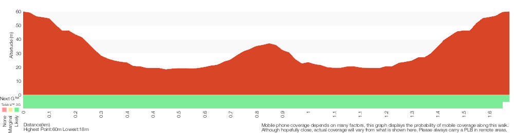
Cross sectional view of the Matcham to Gosford bushwalking track
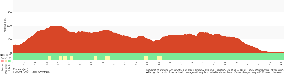
Analysis and summary of the altitude variation on the Matcham to Gosford
Overview of this walks grade – based on the AS 2156.1 – 2001
Under this standard, a walk is graded based on the most difficult section of the walk.
| Length | 8.5 km | ||
| Time | 3 hrs 45 mins | ||
| . | |||
| Grade 4/6 Hard track |
AS 2156.1 | Gradient | Short steep hills (3/6) |
| Quality of track | Formed track, with some branches and other obstacles (3/6) | ||
| Signs | Minimal directional signs (4/6) | ||
| Experience Required | Some bushwalking experience recommended (3/6) | ||
| Weather | Weather generally has little impact on safety (1/6) | ||
| Infrastructure | Limited facilities, not all cliffs are fenced (3/6) |
Some more details of this walks Grading
Here is a bit more details explaining grading looking at sections of the walk
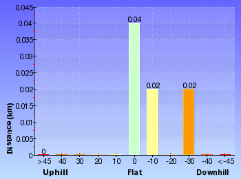
Gradient
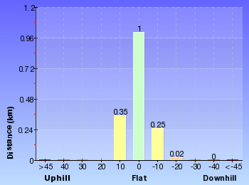
Around 5km of this walk has gentle hills with occasional steps, whilst the remaining 3.3km has short steep hills.
Quality of track
4.3km of this walk follows a clear and well formed track or trail and another 4km follows a formed track, with some branches and other obstacles. The remaining (110m) follows a smooth and hardened path.
Signs
4.7km of this walk has directional signs at most intersection and another 2.7km is clearly signposted. The remaining (1km) has minimal directional signs.
Experience Required
Around 5km of this walk requires no previous bushwalking experience, whilst the remaining 3.3km requires some bushwalking experience.
weather
This whole walk, 8km is not usually affected by severe weather events (that would unexpectedly impact safety and navigation).
Infrastructure
Around 6km of this walk is close to useful facilities (such as fenced cliffs and seats), whilst the remaining 2.5km has limited facilities (such as not all cliffs fenced).
Similar walks
A list of walks that share part of the track with the Matcham to Gosford walk.

166 m Return
10 mins
Very easy
900 m Return
30 mins
Hard track

1.2 km Circuit
45 mins
Moderate track
1.4 km Circuit
45 mins
Hard track
1.5 km One way
45 mins
Moderate track

1.6 km Circuit
45 mins
Moderate track

2.1 km Circuit
1 Hr
Moderate track
2.1 km Circuit
1 hr 15 mins
Hard track
2.2 km One way
1 Hr
Hard track
2.9 km One way
1 hr 30 mins
Moderate track
3 km One way
1 hr 30 mins
Hard track

3 km Return
1 hr 30 mins
Hard track
3.3 km Circuit
1 hr 30 mins
Hard track
4.1 km One way
2 hrs
Hard track
4.8 km Circuit
2 hrs 15 mins
Moderate track
5.3 km Circuit
2 hrs 45 mins
Moderate track

6.1 km Circuit
2 hrs 45 mins
Hard track
11.3 km One way
4 hrs 30 mins
Hard track
Other Nearby walks
A list of walks that start near the Matcham to Gosford walk.

2 km Return
1 Hr
Moderate track
890 m Return
30 mins
Easy track
1.6 km Circuit
45 mins
Easy track
643 m Circuit
30 mins
Moderate track
2.9 km Circuit
1 hr 30 mins
Hard track

2.2 km Return
1 hr 15 mins
Hard track
5.8 km Return
2 hrs 30 mins
Experienced only
1.5 km One way
45 mins
Hard track
991 m One way
30 mins
Moderate track
1.7 km Circuit
45 mins
Moderate track
922 m Return
20 mins
Easy track
1.3 km Circuit
30 mins
Easy track
Plan your trip to and from the walk here
The Matcham to Gosford walk starts at the Katandra Rd Gate (gps: -33.415032, 151.3965)
Your transport options to Katandra Rd Gate are by;
![]() Bus. (get details)
Bus. (get details)
![]() Car. There is free parking available.
Car. There is free parking available.
(get details)
![]() Train. (get details)
Train. (get details)
The Matcham to Gosford ends at the Gosford Station (gps: -33.42348, 151.34176)
Your transport options to Gosford Station are by;
![]() Bus. (get details)
Bus. (get details)
![]() Car. There is free parking available.
Car. There is free parking available.
(get details)


Short URL = http://wild.tl/mtg
Gallery images
There are other downloads I am still working on.
You will probably need to login to access these — still all free.
* KML (google earth file)
* GPX (GPS file)
Special Maps/ brochures
* A3 topo maps
* PDF with Lands Topo map base
* PDF with arial image (and map overlay)
I wanted to get the main site live first, this extra stuff will come in time.
Happy walking
Matt 🙂
St Johns Lookout
And Walk
St Johns Lookout

10 mins
166 m Return
13 m
Very easy
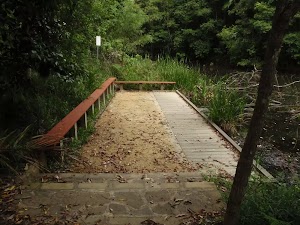
This is a very short walk across the picnic area to the lookout – you can see the end of the walk from the start. The council has installed a sandstone footpath that arcs around the picnic area and leads to St Johns Lookout. The path also leads to picnic tables and accessible toilets. You will also find electric BBQs, just off from the path. A great spot with some shade, the view from the lookout is great on a sunny day.


(0km) Katandra’s Mobility Parking → Toilet block
40 m
1 mins
0m
-1m
Very easy
From the mobility parking spots (marked with blue wheelchair symbol, on Toomey Rd), this walk follows the sandstone footpath past the picnic table to come to the front of the toilet block.
St Johns Lookout picnic area
St Johns Lookout picnic area is a large open area found at the top of Katandra Reserve on Toomeys Rd. The picnic area provides wheelchair accessible toilets[2], picnic tables[3], free electric BBQ’s[4], parking areas[5] [6] and information boards[7]. There is plenty of open space with some natural shade provided by the surrounding trees. There are garbage bins provided[8] but no drinking water[9].
(0.04km) Toilet block → St Johns Lookout
40 m
1 mins
0m
-12m
Very easy
Veer right: From the toilet block, this walk follows the footpath past the information sign to the fenced and signposted ‘St Johns Lookout’
St Johns Lookout
This fenced lookout is found at the top of Katandra Reserve, near the toilets. The lookout was upgraded by Gosford Council in September 2009 and now provides a safer platform and easier access. From the lookout, there are extensive views south-east over Matcham, Erina Heights and Terrigal, out to the ocean. The Guringai Walk passes below the lookout – please take extra care to not drop anything from the platform.
Maps for the St Johns Lookout walk
You can download the PDF for this walk to print a map.
These maps below cover the walk and the wider area around the walk, they are worth carrying for safety reasons.
| Gosford | 1:25 000 Map Series | 91312S GOSFORD | NSW-91312S |
| Gosford | 1:100 000 Map Series | 9131 GOSFORD | 9131 |
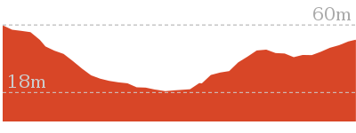
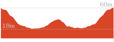
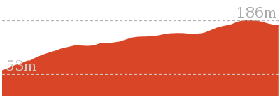
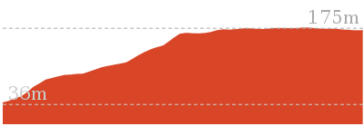
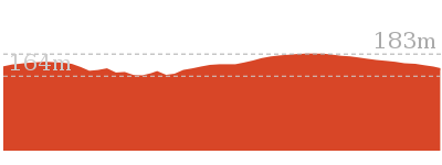
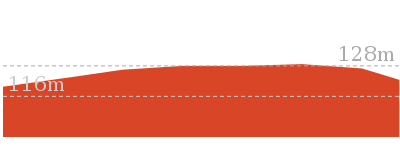
Cross sectional view of the St Johns Lookout bushwalking track
Analysis and summary of the altitude variation on the St Johns Lookout
Overview of this walks grade – based on the AS 2156.1 – 2001
Under this standard, a walk is graded based on the most difficult section of the walk.
| Length | 166 m | ||
| Time | 10 mins | ||
| . | |||
| Grade 1/6 Very easy |
AS 2156.1 | Gradient | Flat, no steps (1/6) |
| Quality of track | Smooth and hardened path (1/6) | ||
| Signs | Clearly signposted (1/6) | ||
| Experience Required | No experience required (1/6) | ||
| Weather | Weather generally has little impact on safety (1/6) | ||
| Infrastructure | Generally useful facilities (such as fenced cliffs and seats) (1/6) |
Some more details of this walks Grading
Here is a bit more details explaining grading looking at sections of the walk
Gradient
This whole walk, 85m is flat with no steps.
Quality of track
This whole walk, 85m follows a smooth and hardened path.
Signs
This whole walk, 85m is clearly signposted.
Experience Required
This whole walk, 85m requires no previous bushwalking experience.
weather
This whole walk, 85m is not usually affected by severe weather events (that would unexpectedly impact safety and navigation).
Infrastructure
This whole walk, 85m is close to useful facilities (such as fenced cliffs and seats).
Similar walks
A list of walks that share part of the track with the St Johns Lookout walk.
1.2 km Circuit
45 mins
Moderate track
2.9 km One way
1 hr 30 mins
Moderate track
4.8 km Circuit
2 hrs 15 mins
Moderate track
5.3 km Circuit
2 hrs 45 mins
Moderate track
8.5 km One way
3 hrs 45 mins
Hard track
11.3 km One way
4 hrs 30 mins
Hard track
Other Nearby walks
A list of walks that start near the St Johns Lookout walk.
1.5 km One way
45 mins
Moderate track
4.1 km One way
2 hrs
Hard track
2 km Return
1 Hr
Moderate track
890 m Return
30 mins
Easy track
1.6 km Circuit
45 mins
Easy track
900 m Return
30 mins
Hard track
1.6 km Circuit
45 mins
Moderate track
2.1 km Circuit
1 Hr
Moderate track
3.3 km Circuit
1 hr 30 mins
Hard track
1.4 km Circuit
45 mins
Hard track
643 m Circuit
30 mins
Moderate track
382 m Return
15 mins
Moderate track
Plan your trip to and from the walk here
The St Johns Lookout walk starts and ends at the Katandra’s Mobility Parking (gps: -33.405741, 151.39085)
Your main transport option to Katandra’s Mobility Parking is by;
![]() Car. There is free parking available.
Car. There is free parking available.
(get details)
Short URL = http://wild.tl/sjl
Gallery images
There are other downloads I am still working on.
You will probably need to login to access these — still all free.
* KML (google earth file)
* GPX (GPS file)
Special Maps/ brochures
* A3 topo maps
* PDF with Lands Topo map base
* PDF with arial image (and map overlay)
I wanted to get the main site live first, this extra stuff will come in time.
Happy walking
Matt 🙂
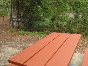
Seymour Pond
And Walk
Seymour Pond

30 mins
890 m Return
45 m
Easy track
This short walk takes you from the Katandra Rd Picnic Area to Seymour Pond. The pond was made to support a farm that was once in the area, and now the pond support many water birds. There is a simple picnic area and plenty of shady spots at the pond, making a nice place to sit and enjoy the birds. These notes also describe two side trips to some other interesting spots near the pond.


Katandra Rd Picnic Area
The Katandra Road Picnic Area is found at the end of a short driveway (signposted at the intersection of Katandra Rd and Croton Ave, Holgate). The picnic area is in front of the ranger’s residence and is open from 7am to 6pm daily. The picnic area provides some toilets, garbage bins, two picnic tables, parking and an information sign.
(0km) Katandra Rd picnic area → Int of Waterman walk and Katandra Rd track
140 m
3 mins
0m
-14m
Easy track
From the picnic area, this walk follows the ‘Seymour Pond’ and ‘Waterman Walk’ signs north-east along the clear track. The track soon heads down a series of steps and, shortly after turning right (at a locked gate), this walk comes to a three-way intersection marked with two blue/white arrows on a post.
(0.14km) Int of Waterman walk and Katandra Rd track → Seymour Pond Picnic area
300 m
8 mins
2m
-29m
Easy track
Turn left: From the intersection, this walk follows the upper arrow down the hill, keeping the fence and house to the right. The track heads down the hill then steps down into a palm-filled valley. Here, the walk climbs some steps and passes the ‘Commemorating 10 years of bushcaring in Katandra Reserve’ plaque[1], then bends right and around a sharp left-hand bend and past the number ‘5’ post (and old Wombat Hole). The track continues around the gully to cross a few small bridges and come to a picnic area and a ‘Seymour Pond’ sign.
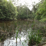
Seymour Pond

Seymour Pond is medium-sized water body in Katandra Reserve. The pond is fed by a spring coming from the cliffs at the top of the reserve. The small creek was dammed in the early 1900’s to provide water for a farm on the south side (growing vegetables). The pond is home to water birds, large lizards and other wildlife. The council does not allow swimming in the pond[4], helping to maintain the ecosystem that now relies on this pond. There are a few spots beside the pond where you can enjoy the cool climate and the visiting birds.
Seymour Pond Picnic Area
The Seymour Pond Picnic Area is found on the dam wall at the eastern end of Seymour Pond in Katandra Reserve. The picnic area provides a couple of picnic tables and a garbage bin. The picnic area is set in a lovely naturally shaded area in view of the Seymour Pond and beside Watermans and Toomeys walks.
(0.45km) Seymour Pond Picnic area → Strangler Fig Tube
130 m
2 mins
6m
-2m
Easy track
Veer right: From the picnic area, this walk heads across the dam wall, keeping the water on the left while passing the two picnic tables. The walk then crosses a timber bridge and comes to a signposted three-way intersection with ‘Toomey’ and ‘Waterman’ walks.
Continue straight: From the intersection, this walk follows the ‘Toomey Walk’ sign along the boardwalk, away from the pond. Soon the walk follows the track along the gully then follows the timber steps as they bend right and head up to the number ‘4’ post, next to the Strangler Fig tube. At the end of this side trip, retrace your steps back to the main walk then Turn around.
Continue straight: From the intersection, this walk follows the ‘Toomey Walk’ sign along the boardwalk, away from the pond. Soon the walk follows the track along the gully then follows the timber steps as they bend right and head up to the number ‘4’ post, next to the Strangler Fig tube. At the end of this side trip, retrace your steps back to the main walk then Turn around.
Strangler Fig Tube
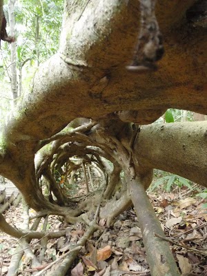
This Strangler Fig Tube is found beside Toomey Walk, just north of Seymour Pond. The scientific name of the tree is Ficus obliqua and it is listed on the Significant Tree Register. This Small-leaved Fig has grown around a large fallen log. The log has long-since rotted away, leaving a knotted tubular structure. Strangler Figs often grow from seeds dropped by birds. The seeds may fall on logs or rocks and the roots will make their way to the ground (to provided water, nutrients and a firm anchor), whilst the rest of the tree grows upwards for light. More info.
(0.45km) Seymour Pond Picnic area → Waterman View
110 m
2 mins
1m
-1m
Easy track
Turn sharp left: From the picnic tables, this walk heads past the ‘Seymour Pond’ sign (following the right-hand ‘Waterman walk’ arrow) and follows the track, keeping the pond close by on the right. The track soon leads to a viewing platform with long bench seats – Waterman view. At the end of this side trip, retrace your steps back to the main walk then Turn left.
Waterman View
Waterman view (informally named) is a viewing point at the western end of Seymour Pond. The platform has a couple of long bench seats. A timber platform on the water’s edge means that visitors can get right up near the water. Signs here remind visitors that swimming is not allowed. This is a great spot to enjoy the birds and other life around the pond.
Maps for the Seymour Pond walk
You can download the PDF for this walk to print a map.
These maps below cover the walk and the wider area around the walk, they are worth carrying for safety reasons.
| Gosford | 1:25 000 Map Series | 91312S GOSFORD | NSW-91312S |
| Gosford | 1:100 000 Map Series | 9131 GOSFORD | 9131 |
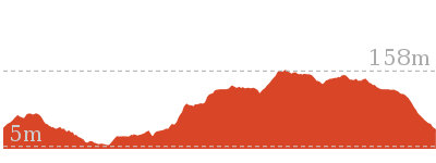
Cross sectional view of the Seymour Pond bushwalking track
Analysis and summary of the altitude variation on the Seymour Pond
Overview of this walks grade – based on the AS 2156.1 – 2001
Under this standard, a walk is graded based on the most difficult section of the walk.
| Length | 890 m | ||
| Time | 30 mins | ||
| . | |||
| Grade 2/6 Easy track |
AS 2156.1 | Gradient | Gentle hills with occasional steps (2/6) |
| Quality of track | Clear and well formed track or trail (2/6) | ||
| Signs | Clearly signposted (1/6) | ||
| Experience Required | No experience required (1/6) | ||
| Weather | Weather generally has little impact on safety (1/6) | ||
| Infrastructure | Generally useful facilities (such as fenced cliffs and seats) (1/6) |
Some more details of this walks Grading
Here is a bit more details explaining grading looking at sections of the walk
Gradient
This whole walk, 450m has gentle hills with occasional steps.
Quality of track
This whole walk, 450m follows a clear and well formed track or trail.
Signs
This whole walk, 450m is clearly signposted.
Experience Required
This whole walk, 450m requires no previous bushwalking experience.
weather
This whole walk, 450m is not usually affected by severe weather events (that would unexpectedly impact safety and navigation).
Infrastructure
This whole walk, 450m is close to useful facilities (such as fenced cliffs and seats).
Similar walks
A list of walks that share part of the track with the Seymour Pond walk.
1.6 km Circuit
45 mins
Easy track
2 km Return
1 Hr
Moderate track
2.9 km One way
1 hr 30 mins
Moderate track
4.8 km Circuit
2 hrs 15 mins
Moderate track
5.3 km Circuit
2 hrs 45 mins
Moderate track
Other Nearby walks
A list of walks that start near the Seymour Pond walk.
8.5 km One way
3 hrs 45 mins
Hard track
1.2 km Circuit
45 mins
Moderate track
1.5 km One way
45 mins
Moderate track
4.1 km One way
2 hrs
Hard track
166 m Return
10 mins
Very easy
900 m Return
30 mins
Hard track
1.6 km Circuit
45 mins
Moderate track
2.1 km Circuit
1 Hr
Moderate track
3.3 km Circuit
1 hr 30 mins
Hard track
1.4 km Circuit
45 mins
Hard track
643 m Circuit
30 mins
Moderate track
2.9 km Circuit
1 hr 30 mins
Hard track
Plan your trip to and from the walk here
The Seymour Pond walk starts and ends at the Katandra Rd picnic area (gps: -33.414582, 151.39599)
Your transport options to Katandra Rd picnic area are by;
![]() Bus. (get details)
Bus. (get details)
![]() Car. There is free parking available.
Car. There is free parking available.
(get details)
Short URL = http://wild.tl/sp
Gallery images
There are other downloads I am still working on.
You will probably need to login to access these — still all free.
* KML (google earth file)
* GPX (GPS file)
Special Maps/ brochures
* A3 topo maps
* PDF with Lands Topo map base
* PDF with arial image (and map overlay)
I wanted to get the main site live first, this extra stuff will come in time.
Happy walking
Matt 🙂
Guringai Walk
And Walk
Guringai Walk

45 mins
1.2 km Circuit
80 m
Moderate track
This is a surprisingly spectacular walk, following the base of the cliff below St Johns Lookout. From the car park, you will follow a gentle track through the bush before heading down some stairs to the cliff face. Handrails and timber walkways have been installed to make this walk more accessible. You will pass some large Angophora, Blackbutts and plenty of fern trees. A highlight of the walk comes when you follow the ledge next right next to the cliff.


(0km) St Johns Lookout car park → Southern end of Guringai walk
80 m
1 mins
2m
-1m
Easy track
From the car park, this walk heads across the clearing away from the main picnic area (keeping the road up the hill to the right). The walk soon comes to an intersection and a ‘Guringai walk’ sign.
(0.08km) Southern end of Guringai walk → Post 8
420 m
10 mins
18m
-47m
Moderate track
Veer left: From the intersection, this walk follows the ‘Guringai Walk’ sign down the gentle hill. The walk passes some grass trees and angophoras as is zigzags down the hill. Soon after the track crosses a small timber bridge, the walk follows the base of the cliff until coming to the number ‘8’ post marking a large Blackbutt tree.
Blackbutt
This Blackbutt tree is found at the base of the cliff next to post 8 on Guringai walk. The Eucalyptus pilularis is the scientific name for this tree that can grow as high as 70m. The tree has a brown fibrous bark on the lower half then a smooth grey bark at the top. The trees name ‘pilularis’ is Latin for small pill, referring to the tree’s fruit
(0.51km) Post 8 → Int of Toomey and Guringai Walks
360 m
10 mins
30m
-22m
Moderate track
Continue straight: From post ‘8’, this walk heads down along the track, keeping the valley to the right. The track follows the base of the cliff and, soon after climbing over a rise and coming very close to the cliff, the walk passes a section with broken glass (this is directly below St Johns Lookout). The walk continues along the base of the cliff then up a series of stairs. Just after flattening out, the track comes to a signposted intersection, with a sign pointing back along ‘Guringai Walk’.
(0.87km) Int of Toomey and Guringai Walks → Upper Int of Toomey walk and Katandra Horse track
70 m
2 mins
18m
-4m
Easy track
Turn left: From the intersection, this walk follows the ‘Lookout’ sign up the stairs and turns left. The track soon bends sharply right and then leads past some timber posts, coming to an intersection with the Katandra Horse track.
(0.94km) Upper Int of Toomey walk and Katandra Horse track → Toilet block
170 m
3 mins
9m
-3m
Easy track
Turn left: From the intersection, this walk heads up the hill and through the gap in the fence to a ‘Toomey walk’ sign, pointing back down the hill. At this sign, the walk turns left and heads through the picnic area, passed another sign (again pointing back to ‘Toomey walk’) and comes to a footpath in front of a toilet block.
(1.1km) Toilet block → St Johns Lookout
40 m
1 mins
0m
-12m
Very easy
Veer left: From the toilet block, this walk follows the footpath past the information sign to the fenced and signposted ‘St Johns Lookout’ At the end of this side trip, retrace your steps back to the main walk then Turn left .
St Johns Lookout
This fenced lookout is found at the top of Katandra Reserve, near the toilets. The lookout was upgraded by Gosford Council in September 2009 and now provides a safer platform and easier access. From the lookout, there are extensive views south-east over Matcham, Erina Heights and Terrigal, out to the ocean. The Guringai Walk passes below the lookout – please take extra care to not drop anything from the platform.
(1.1km) Toilet block → St Johns Lookout car park
130 m
2 mins
3m
-3m
Easy track
Continue straight: From the toilet block, this walk heads across the picnic area, passing the BBQ and keeping the lookout to the left. The walk soon comes to a information sign and car park (signposted as Katandra on Toomeys Rd).
Maps for the Guringai Walk walk
You can download the PDF for this walk to print a map.
These maps below cover the walk and the wider area around the walk, they are worth carrying for safety reasons.
| Gosford | 1:25 000 Map Series | 91312S GOSFORD | NSW-91312S |
| Gosford | 1:100 000 Map Series | 9131 GOSFORD | 9131 |
Cross sectional view of the Guringai Walk bushwalking track
Analysis and summary of the altitude variation on the Guringai Walk
Overview of this walks grade – based on the AS 2156.1 – 2001
Under this standard, a walk is graded based on the most difficult section of the walk.
| Length | 1.2 km | ||
| Time | 45 mins | ||
| . | |||
| Grade 3/6 Moderate track |
AS 2156.1 | Gradient | Short steep hills (3/6) |
| Quality of track | Clear and well formed track or trail (2/6) | ||
| Signs | Clearly signposted (1/6) | ||
| Experience Required | No experience required (1/6) | ||
| Weather | Weather generally has little impact on safety (1/6) | ||
| Infrastructure | Generally useful facilities (such as fenced cliffs and seats) (1/6) |
Some more details of this walks Grading
Here is a bit more details explaining grading looking at sections of the walk
Gradient
790m of this walk has short steep hills and another 240m has gentle hills with occasional steps. The remaining (210m) is flat with no steps.
Quality of track
This whole walk, 1.2km follows a clear and well formed track or trail.
Signs
This whole walk, 1.2km is clearly signposted.
Experience Required
This whole walk, 1.2km requires no previous bushwalking experience.
weather
This whole walk, 1.2km is not usually affected by severe weather events (that would unexpectedly impact safety and navigation).
Infrastructure
This whole walk, 1.2km is close to useful facilities (such as fenced cliffs and seats).
Similar walks
A list of walks that share part of the track with the Guringai Walk walk.
166 m Return
10 mins
Very easy
1.5 km One way
45 mins
Moderate track
2.9 km One way
1 hr 30 mins
Moderate track
4.1 km One way
2 hrs
Hard track
4.8 km Circuit
2 hrs 15 mins
Moderate track
5.3 km Circuit
2 hrs 45 mins
Moderate track
8.5 km One way
3 hrs 45 mins
Hard track
11.3 km One way
4 hrs 30 mins
Hard track
Other Nearby walks
A list of walks that start near the Guringai Walk walk.
2 km Return
1 Hr
Moderate track
890 m Return
30 mins
Easy track
1.6 km Circuit
45 mins
Easy track
900 m Return
30 mins
Hard track
1.6 km Circuit
45 mins
Moderate track
2.1 km Circuit
1 Hr
Moderate track
3.3 km Circuit
1 hr 30 mins
Hard track
1.4 km Circuit
45 mins
Hard track
643 m Circuit
30 mins
Moderate track
5.8 km Return
2 hrs 30 mins
Experienced only
3 km One way
1 hr 30 mins
Hard track
2.1 km Circuit
1 hr 15 mins
Hard track
Plan your trip to and from the walk here
The Guringai Walk walk starts and ends at the St Johns Lookout car park (gps: -33.406508, 151.39009)
Your main transport option to St Johns Lookout car park is by;
![]() Car. There is free parking available.
Car. There is free parking available.
(get details)
Short URL = http://wild.tl/gw
Gallery images
There are other downloads I am still working on.
You will probably need to login to access these — still all free.
* KML (google earth file)
* GPX (GPS file)
Special Maps/ brochures
* A3 topo maps
* PDF with Lands Topo map base
* PDF with arial image (and map overlay)
I wanted to get the main site live first, this extra stuff will come in time.
Happy walking
Matt 🙂
Graves Walk
And Walk
Graves Walk

45 mins
1.5 km One way
13 m
Moderate track
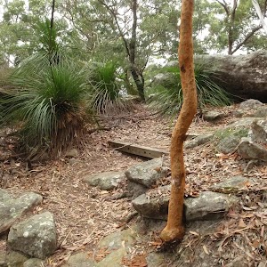
On this walk, you follow the signposted Graves Walk between the two main picnic area in Katandra Reserve. Starting near St Johns Lookout, this walk follows Graves Walking track down the ridge. You will see some valley views, open drier forest, some faint Aboriginal markings and plenty of interesting rock formations. This is the most direct walking route between the two picnic areas.


St Johns Lookout picnic area
St Johns Lookout picnic area is a large open area found at the top of Katandra Reserve on Toomeys Rd. The picnic area provides wheelchair accessible toilets[2], picnic tables[3], free electric BBQ’s[4], parking areas[5] [6] and information boards[7]. There is plenty of open space with some natural shade provided by the surrounding trees. There are garbage bins provided[8] but no drinking water[9].
(0km) St Johns Lookout car park → Int of Graves and Mouat Walks
150 m
3 mins
2m
-6m
Easy track
From the car park, this walk heads across the clearing away from the main picnic area (keeping the road up the hill to the right). The walk soon comes to an intersection and a ‘Guringai walk’ sign.
Continue straight: From the intersection, this walk heads through the clearing towards the ‘Mount Mouat Walk’ and ‘Graves Walk’ signs[10]. At these signs, the walk heads left, out of the clearing and down the track for a short distance to the signposted intersection with ‘Graves Walk’ and ‘Mouat Walk’[11].
Continue straight: From the intersection, this walk heads through the clearing towards the ‘Mount Mouat Walk’ and ‘Graves Walk’ signs[10]. At these signs, the walk heads left, out of the clearing and down the track for a short distance to the signposted intersection with ‘Graves Walk’ and ‘Mouat Walk’[11].
(0.15km) Int of Graves and Mouat Walks → Mid junction of Graves walk and Katandra Horse Trail
270 m
7 mins
0m
-26m
Moderate track
Veer left: From the intersection, this walk follows the ‘Graves Walk’ sign between the timbers posts and down along the track. The track winds down the hill then passes between a few more timber posts, past an arrow marker and a few more meters to another arrow marker and intersection with a short link track (to the horse trail).
(0.42km) Mid junction of Graves walk and Katandra Horse Trail → Behind the Rangers Residence
520 m
15 mins
3m
-67m
Moderate track
Continue straight: From the intersection, this walk follows the walking track and arrow gently downhill, keeping the horse track through the bush to the right. The track head down along the ridge and passes the number ‘6’ post (Aboriginal markings in the stone). Soon the ridge narrows to a rocky outcrop, where the track heads down the stairs to a large five-way intersection and a locked gate, behind the ranger’s residence.
(0.94km) Behind the Rangers Residence → Katandra Rd picnic area
450 m
13 mins
8m
-54m
Moderate track
Continue straight: From the intersection, this walk follows an arrow past the post with the purple strip down a few steps, initially keeping the locked gate to the left. After heading down more steps, the track passes a steep trail on the right (that leads to Murina Close). This walk continues gently down the hill, then down a series of steps, then the track starts to flatten out again and round a gully. The track then leads to a picnic area and car park in front of the ranger’s house.
Katandra Rd Picnic Area
The Katandra Road Picnic Area is found at the end of a short driveway (signposted at the intersection of Katandra Rd and Croton Ave, Holgate). The picnic area is in front of the ranger’s residence and is open from 7am to 6pm daily. The picnic area provides some toilets, garbage bins, two picnic tables, parking and an information sign.
(1.39km) Katandra Rd picnic area → Katandra Rd Gate
70 m
2 mins
0m
-5m
Easy track
Turn right: From the picnic area, this walk heads through the car park and follows the driveway down the hill, soon coming to a gate just above the junction of Katandra Rd and Croton Ave.
Maps for the Graves Walk walk
You can download the PDF for this walk to print a map.
These maps below cover the walk and the wider area around the walk, they are worth carrying for safety reasons.
| Gosford | 1:25 000 Map Series | 91312S GOSFORD | NSW-91312S |
| Gosford | 1:100 000 Map Series | 9131 GOSFORD | 9131 |
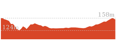
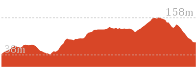
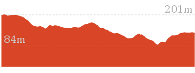
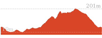
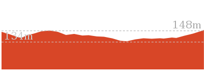
Cross sectional view of the Graves Walk bushwalking track
Analysis and summary of the altitude variation on the Graves Walk
Overview of this walks grade – based on the AS 2156.1 – 2001
Under this standard, a walk is graded based on the most difficult section of the walk.
| Length | 1.5 km | ||
| Time | 45 mins | ||
| . | |||
| Grade 3/6 Moderate track |
AS 2156.1 | Gradient | Short steep hills (3/6) |
| Quality of track | Formed track, with some branches and other obstacles (3/6) | ||
| Signs | Clearly signposted (1/6) | ||
| Experience Required | Some bushwalking experience recommended (3/6) | ||
| Weather | Weather generally has little impact on safety (1/6) | ||
| Infrastructure | Generally useful facilities (such as fenced cliffs and seats) (1/6) |
Some more details of this walks Grading
Here is a bit more details explaining grading looking at sections of the walk
Gradient
1.2km of this walk has short steep hills and another 140m has gentle hills with occasional steps. The remaining (80m) is flat with no steps.
Quality of track
1.2km of this walk follows a formed track, with some branches and other obstacles and another 150m follows a clear and well formed track or trail. The remaining (70m) follows a smooth and hardened path.
Signs
This whole walk, 1.5km is clearly signposted.
Experience Required
Around 940m of this walk requires no previous bushwalking experience, whilst the remaining 520m requires some bushwalking experience.
weather
This whole walk, 1.5km is not usually affected by severe weather events (that would unexpectedly impact safety and navigation).
Infrastructure
This whole walk, 1.5km is close to useful facilities (such as fenced cliffs and seats).
Similar walks
A list of walks that share part of the track with the Graves Walk walk.
1.2 km Circuit
45 mins
Moderate track
2.9 km One way
1 hr 30 mins
Moderate track
4.1 km One way
2 hrs
Hard track
4.8 km Circuit
2 hrs 15 mins
Moderate track
5.3 km Circuit
2 hrs 45 mins
Moderate track
8.5 km One way
3 hrs 45 mins
Hard track
11.3 km One way
4 hrs 30 mins
Hard track
Other Nearby walks
A list of walks that start near the Graves Walk walk.
166 m Return
10 mins
Very easy
2 km Return
1 Hr
Moderate track
890 m Return
30 mins
Easy track
1.6 km Circuit
45 mins
Easy track
900 m Return
30 mins
Hard track
1.6 km Circuit
45 mins
Moderate track
2.1 km Circuit
1 Hr
Moderate track
3.3 km Circuit
1 hr 30 mins
Hard track
1.4 km Circuit
45 mins
Hard track
643 m Circuit
30 mins
Moderate track
5.8 km Return
2 hrs 30 mins
Experienced only
3 km One way
1 hr 30 mins
Hard track
Plan your trip to and from the walk here
The Graves Walk walk starts at the St Johns Lookout car park (gps: -33.406508, 151.39009)
Your main transport option to St Johns Lookout car park is by;
![]() Car. There is free parking available.
Car. There is free parking available.
(get details)
The Graves Walk ends at the Katandra Rd Gate (gps: -33.415032, 151.3965)
Your transport options to Katandra Rd Gate are by;
![]() Bus. (get details)
Bus. (get details)
![]() Car. There is free parking available.
Car. There is free parking available.
(get details)
Short URL = http://wild.tl/gwt
Gallery images
There are other downloads I am still working on.
You will probably need to login to access these — still all free.
* KML (google earth file)
* GPX (GPS file)
Special Maps/ brochures
* A3 topo maps
* PDF with Lands Topo map base
* PDF with arial image (and map overlay)
I wanted to get the main site live first, this extra stuff will come in time.
Happy walking
Matt 🙂
Watermans Walk
And Walk
Watermans Walk
45 mins
1.6 km Circuit
67 m
Easy track
This lovely walk start from the Katandra Rd Picnic Area and circumnavigates Seymour Pond. On this walk, you will head through a few palm-filled valleys, discover a Strangler Fig Tube (on a side trip) and are likely to see a few water birds. Take some snacks and enjoy one of the resting areas – sit quietly and you might spot a water lizard or Lyrebird. This walk is well-signposted and follows a clear track.


Katandra Rd Picnic Area
The Katandra Road Picnic Area is found at the end of a short driveway (signposted at the intersection of Katandra Rd and Croton Ave, Holgate). The picnic area is in front of the ranger’s residence and is open from 7am to 6pm daily. The picnic area provides some toilets, garbage bins, two picnic tables, parking and an information sign.
(0km) Katandra Rd picnic area → Int of Waterman walk and Katandra Rd track
140 m
3 mins
0m
-14m
Easy track
From the picnic area, this walk follows the ‘Seymour Pond’ and ‘Waterman Walk’ signs north-east along the clear track. The track soon heads down a series of steps and, shortly after turning right (at a locked gate), this walk comes to a three-way intersection marked with two blue/white arrows on a post.
(0.14km) Int of Waterman walk and Katandra Rd track → Seymour Pond Picnic area
300 m
8 mins
2m
-29m
Easy track
Turn left: From the intersection, this walk follows the upper arrow down the hill, keeping the fence and house to the right. The track heads down the hill then steps down into a palm-filled valley. Here, the walk climbs some steps and passes the ‘Commemorating 10 years of bushcaring in Katandra Reserve’ plaque[1], then bends right and around a sharp left-hand bend and past the number ‘5’ post (and old Wombat Hole). The track continues around the gully to cross a few small bridges and come to a picnic area and a ‘Seymour Pond’ sign.
Seymour Pond
Seymour Pond is medium-sized water body in Katandra Reserve. The pond is fed by a spring coming from the cliffs at the top of the reserve. The small creek was dammed in the early 1900’s to provide water for a farm on the south side (growing vegetables). The pond is home to water birds, large lizards and other wildlife. The council does not allow swimming in the pond[4], helping to maintain the ecosystem that now relies on this pond. There are a few spots beside the pond where you can enjoy the cool climate and the visiting birds.
Seymour Pond Picnic Area
The Seymour Pond Picnic Area is found on the dam wall at the eastern end of Seymour Pond in Katandra Reserve. The picnic area provides a couple of picnic tables and a garbage bin. The picnic area is set in a lovely naturally shaded area in view of the Seymour Pond and beside Watermans and Toomeys walks.
(0.45km) Seymour Pond Picnic area → Int of Waterman and Toomey walks
70 m
1 mins
1m
-1m
Easy track
Veer right: From the picnic area, this walk heads across the dam wall, keeping the water on the left while passing the two picnic tables. The walk then crosses a timber bridge and comes to a signposted three-way intersection with ‘Toomey’ and ‘Waterman’ walks.
(0.51km) Int of Waterman and Toomey walks → Strangler Fig Tube
60 m
1 mins
5m
-1m
Easy track
Continue straight: From the intersection, this walk follows the ‘Toomey Walk’ sign along the boardwalk, away from the pond. Soon the walk follows the track along the gully then follows the timber steps as they bend right and head up to the number ‘4’ post, next to the Strangler Fig tube. At the end of this side trip, retrace your steps back to the main walk then Turn right.
Strangler Fig Tube
This Strangler Fig Tube is found beside Toomey Walk, just north of Seymour Pond. The scientific name of the tree is Ficus obliqua and it is listed on the Significant Tree Register. This Small-leaved Fig has grown around a large fallen log. The log has long-since rotted away, leaving a knotted tubular structure. Strangler Figs often grow from seeds dropped by birds. The seeds may fall on logs or rocks and the roots will make their way to the ground (to provided water, nutrients and a firm anchor), whilst the rest of the tree grows upwards for light. More info.
(0.51km) Int of Waterman and Toomey walks → Waterman View
550 m
11 mins
20m
-20m
Easy track
Veer left: From the intersection, this walk follows the ‘Waterman Walk’ sign past the blue striped post and across the bridge, keeping the pond to the left. The track winds through the bush, crossing a few smaller bridges with glimpse to the pond. After crossing a bigger bridge and gully, the track comes to a bench seat. Here, the track turns left and heads along the side of the gully, crossing a few more small bridges and then heading up some stairs. Soon, the track comes to a viewing platform (on the left) with some long bench seats and a good view across Seymour Pond.
Waterman View
Waterman view (informally named) is a viewing point at the western end of Seymour Pond. The platform has a couple of long bench seats. A timber platform on the water’s edge means that visitors can get right up near the water. Signs here remind visitors that swimming is not allowed. This is a great spot to enjoy the birds and other life around the pond.
(1.07km) Waterman View → Katandra Rd picnic area
550 m
13 mins
44m
-3m
Easy track
Turn right: From the pond viewing point, this walk follows the dirt track, keeping the pond on the left. The track skirts around the pond and soon comes to a ‘Seymour Pond’ sign and a couple of picnic tables.
Veer right: From the picnic area, this walk heads away from the pond, following the left-hand ‘Waterman walk’ arrow (next to the locked gate) into the bush and across a couple of small bridges. The track passes post ‘5’ (an old wombat hole) then sharply bends right, soon passing the ‘Commemorating 10 years of bushcaring in Katandra Reserve’ plaque[7], where this walk then heads down some stairs. After walking through the palm filled valley for a short distance, the walk heads up the steps and, soon after passing the house and fence (on the left), comes to a three-way intersection marked with a post (with blue and white arrows).
Turn right: From the intersection, this walk follows the lower arrow up the steps and turns left in front of the locked gate. The walk follows these steps up the hill, then soon flattens out as the track comes to a picnic area and car park.
Maps for the Watermans Walk walk
You can download the PDF for this walk to print a map.
These maps below cover the walk and the wider area around the walk, they are worth carrying for safety reasons.
| Gosford | 1:25 000 Map Series | 91312S GOSFORD | NSW-91312S |
| Gosford | 1:100 000 Map Series | 9131 GOSFORD | 9131 |
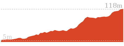
Cross sectional view of the Watermans Walk bushwalking track
Analysis and summary of the altitude variation on the Watermans Walk
Overview of this walks grade – based on the AS 2156.1 – 2001
Under this standard, a walk is graded based on the most difficult section of the walk.
| Length | 1.6 km | ||
| Time | 45 mins | ||
| . | |||
| Grade 2/6 Easy track |
AS 2156.1 | Gradient | Gentle hills with occasional steps (2/6) |
| Quality of track | Clear and well formed track or trail (2/6) | ||
| Signs | Clearly signposted (1/6) | ||
| Experience Required | No experience required (1/6) | ||
| Weather | Weather generally has little impact on safety (1/6) | ||
| Infrastructure | Generally useful facilities (such as fenced cliffs and seats) (1/6) |
Some more details of this walks Grading
Here is a bit more details explaining grading looking at sections of the walk
Gradient
Around 1.4km of this walk has gentle hills with occasional steps, whilst the remaining 180m is flat with no steps.
Quality of track
This whole walk, 1.6km follows a clear and well formed track or trail.
Signs
This whole walk, 1.6km is clearly signposted.
Experience Required
This whole walk, 1.6km requires no previous bushwalking experience.
weather
This whole walk, 1.6km is not usually affected by severe weather events (that would unexpectedly impact safety and navigation).
Infrastructure
This whole walk, 1.6km is close to useful facilities (such as fenced cliffs and seats).
Similar walks
A list of walks that share part of the track with the Watermans Walk walk.
890 m Return
30 mins
Easy track
2 km Return
1 Hr
Moderate track
2.9 km One way
1 hr 30 mins
Moderate track
4.8 km Circuit
2 hrs 15 mins
Moderate track
5.3 km Circuit
2 hrs 45 mins
Moderate track
Other Nearby walks
A list of walks that start near the Watermans Walk walk.
8.5 km One way
3 hrs 45 mins
Hard track
1.2 km Circuit
45 mins
Moderate track
1.5 km One way
45 mins
Moderate track
4.1 km One way
2 hrs
Hard track
166 m Return
10 mins
Very easy
900 m Return
30 mins
Hard track
1.6 km Circuit
45 mins
Moderate track
2.1 km Circuit
1 Hr
Moderate track
3.3 km Circuit
1 hr 30 mins
Hard track
1.4 km Circuit
45 mins
Hard track
643 m Circuit
30 mins
Moderate track
2.9 km Circuit
1 hr 30 mins
Hard track
Plan your trip to and from the walk here
The Watermans Walk walk starts and ends at the Katandra Rd picnic area (gps: -33.414582, 151.39599)
Your transport options to Katandra Rd picnic area are by;
![]() Bus. (get details)
Bus. (get details)
![]() Car. There is free parking available.
Car. There is free parking available.
(get details)
Short URL = http://wild.tl/2b
Gallery images
There are other downloads I am still working on.
You will probably need to login to access these — still all free.
* KML (google earth file)
* GPX (GPS file)
Special Maps/ brochures
* A3 topo maps
* PDF with Lands Topo map base
* PDF with arial image (and map overlay)
I wanted to get the main site live first, this extra stuff will come in time.
Happy walking
Matt 🙂
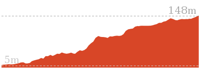
Strangler Fig Walk
And Walk
Strangler Fig Walk

1 Hr
2 km Return
96 m
Moderate track
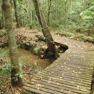
Starting from the Katandra Rd Picnic Area, you will head past Seymour Pond and along Toomey Walk to the Strangler Fig platform. You will see two magnificent examples of Strangler Fig trees – one growing on a large rock and the other forming a knotted tubular structure. A lovely walk through the dense forest, along a well-formed track. If you have a little extra time, the Watermans walk is a great addition to your visit to the valley.


Katandra Rd Picnic Area
The Katandra Road Picnic Area is found at the end of a short driveway (signposted at the intersection of Katandra Rd and Croton Ave, Holgate). The picnic area is in front of the ranger’s residence and is open from 7am to 6pm daily. The picnic area provides some toilets, garbage bins, two picnic tables, parking and an information sign.
(0km) Katandra Rd picnic area → Int of Waterman walk and Katandra Rd track
140 m
3 mins
0m
-14m
Easy track
From the picnic area, this walk follows the ‘Seymour Pond’ and ‘Waterman Walk’ signs north-east along the clear track. The track soon heads down a series of steps and, shortly after turning right (at a locked gate), this walk comes to a three-way intersection marked with two blue/white arrows on a post.
(0.14km) Int of Waterman walk and Katandra Rd track → Seymour Pond Picnic area
300 m
8 mins
2m
-29m
Easy track
Turn left: From the intersection, this walk follows the upper arrow down the hill, keeping the fence and house to the right. The track heads down the hill then steps down into a palm-filled valley. Here, the walk climbs some steps and passes the ‘Commemorating 10 years of bushcaring in Katandra Reserve’ plaque[1], then bends right and around a sharp left-hand bend and past the number ‘5’ post (and old Wombat Hole). The track continues around the gully to cross a few small bridges and come to a picnic area and a ‘Seymour Pond’ sign.
Seymour Pond
Seymour Pond is medium-sized water body in Katandra Reserve. The pond is fed by a spring coming from the cliffs at the top of the reserve. The small creek was dammed in the early 1900’s to provide water for a farm on the south side (growing vegetables). The pond is home to water birds, large lizards and other wildlife. The council does not allow swimming in the pond[4], helping to maintain the ecosystem that now relies on this pond. There are a few spots beside the pond where you can enjoy the cool climate and the visiting birds.
Seymour Pond Picnic Area
The Seymour Pond Picnic Area is found on the dam wall at the eastern end of Seymour Pond in Katandra Reserve. The picnic area provides a couple of picnic tables and a garbage bin. The picnic area is set in a lovely naturally shaded area in view of the Seymour Pond and beside Watermans and Toomeys walks.
(0.45km) Seymour Pond Picnic area → Int of Waterman and Toomey walks
660 m
13 mins
21m
-21m
Easy track
Veer left: From the picnic tables, this walk heads past the ‘Seymour Pond’ sign (following the right-hand ‘Waterman walk’ arrow) and follows the track, keeping the pond close by on the right. The track soon leads to a viewing platform with long bench seats – Waterman view.
Turn left: From the pond viewing point, this walk follows the timber track, keeping filtered views of the water to the right. The timber soon stops and the dirt track continues down some stairs, over a few small bridges, and soon crosses a bigger bridge just after a bench seat. From here, the track turns right, down the other side of the gully, where it crosses a few more small bridges before coming to a three-way intersection. The intersection is on timber boardwalk, just after a bridge where a sign points back along ‘Waterman Walk’. Now Turn left to rejoin the main walk .
Turn left: From the pond viewing point, this walk follows the timber track, keeping filtered views of the water to the right. The timber soon stops and the dirt track continues down some stairs, over a few small bridges, and soon crosses a bigger bridge just after a bench seat. From here, the track turns right, down the other side of the gully, where it crosses a few more small bridges before coming to a three-way intersection. The intersection is on timber boardwalk, just after a bridge where a sign points back along ‘Waterman Walk’. Now Turn left to rejoin the main walk .
(0.45km) Seymour Pond Picnic area → Int of Waterman and Toomey walks
70 m
1 mins
1m
-1m
Easy track
Veer right: From the picnic area, this walk heads across the dam wall, keeping the water on the left while passing the two picnic tables. The walk then crosses a timber bridge and comes to a signposted three-way intersection with ‘Toomey’ and ‘Waterman’ walks.
(0.51km) Int of Waterman and Toomey walks → Strangler Fig Tube
60 m
1 mins
5m
-1m
Easy track
Continue straight: From the intersection, this walk follows the ‘Toomey Walk’ sign along the boardwalk, away from the pond. Soon the walk follows the track along the gully then follows the timber steps as they bend right and head up to the number ‘4’ post, next to the Strangler Fig tube.
Strangler Fig Tube
This Strangler Fig Tube is found beside Toomey Walk, just north of Seymour Pond. The scientific name of the tree is Ficus obliqua and it is listed on the Significant Tree Register. This Small-leaved Fig has grown around a large fallen log. The log has long-since rotted away, leaving a knotted tubular structure. Strangler Figs often grow from seeds dropped by birds. The seeds may fall on logs or rocks and the roots will make their way to the ground (to provided water, nutrients and a firm anchor), whilst the rest of the tree grows upwards for light. More info.
(0.57km) Strangler Fig Tube → Strangler Fig platform
420 m
9 mins
35m
-8m
Moderate track
Continue straight: From the Number ‘4’ post, this walk heads to the top of the stairs and turns left around the Strangler Fig. The track soon crosses a small creek on a bridge then heads up a long flight of timber stairs. After gently winding through the forest, the track comes to post ‘3’ (a large Turpentine Tree). The track then continues, crossing a few more creeks on small timber bridges and heading along the valley floor to a large timber platform and an even larger Strangler Fig tree.
Strangler Fig platform
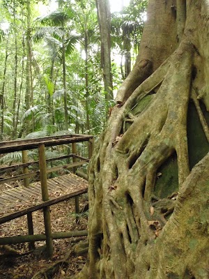
The Strangler Fig platform on Toomey Walk has been built to help walkers better appreciate this amazing feat of survival. The tree is formally know as Ficus obliqua and is listed on the Significant tree Register. More commonly know as a ‘Small-leaved Fig’ , this tree has an amazing root structure that grasps onto a large mossy boulder before heading underground. The platform is in a lovely shaded spot on the valley floor and the bench seat makes an inviting offer to sit whilst you soak up the surroundings. More info.
Maps for the Strangler Fig Walk walk
You can download the PDF for this walk to print a map.
These maps below cover the walk and the wider area around the walk, they are worth carrying for safety reasons.
| Gosford | 1:25 000 Map Series | 91312S GOSFORD | NSW-91312S |
| Gosford | 1:100 000 Map Series | 9131 GOSFORD | 9131 |
Cross sectional view of the Strangler Fig Walk bushwalking track
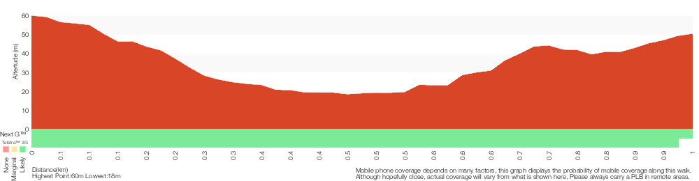
Analysis and summary of the altitude variation on the Strangler Fig Walk
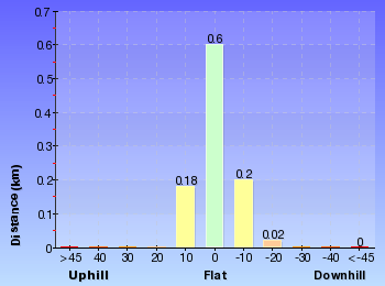
Overview of this walks grade – based on the AS 2156.1 – 2001
Under this standard, a walk is graded based on the most difficult section of the walk.
| Length | 2 km | ||
| Time | 1 Hr | ||
| . | |||
| Grade 3/6 Moderate track |
AS 2156.1 | Gradient | Short steep hills (3/6) |
| Quality of track | Clear and well formed track or trail (2/6) | ||
| Signs | Clearly signposted (1/6) | ||
| Experience Required | No experience required (1/6) | ||
| Weather | Weather generally has little impact on safety (1/6) | ||
| Infrastructure | Generally useful facilities (such as fenced cliffs and seats) (1/6) |
Some more details of this walks Grading
Here is a bit more details explaining grading looking at sections of the walk
Gradient
500m of this walk has gentle hills with occasional steps and another 420m has short steep hills. The remaining (70m) is flat with no steps.
Quality of track
This whole walk, 990m follows a clear and well formed track or trail.
Signs
This whole walk, 990m is clearly signposted.
Experience Required
This whole walk, 990m requires no previous bushwalking experience.
weather
This whole walk, 990m is not usually affected by severe weather events (that would unexpectedly impact safety and navigation).
Infrastructure
This whole walk, 990m is close to useful facilities (such as fenced cliffs and seats).
Similar walks
A list of walks that share part of the track with the Strangler Fig Walk walk.
890 m Return
30 mins
Easy track
1.6 km Circuit
45 mins
Easy track
2.9 km One way
1 hr 30 mins
Moderate track
4.8 km Circuit
2 hrs 15 mins
Moderate track
5.3 km Circuit
2 hrs 45 mins
Moderate track
Other Nearby walks
A list of walks that start near the Strangler Fig Walk walk.
8.5 km One way
3 hrs 45 mins
Hard track
1.2 km Circuit
45 mins
Moderate track
1.5 km One way
45 mins
Moderate track
4.1 km One way
2 hrs
Hard track
166 m Return
10 mins
Very easy
900 m Return
30 mins
Hard track
1.6 km Circuit
45 mins
Moderate track
2.1 km Circuit
1 Hr
Moderate track
3.3 km Circuit
1 hr 30 mins
Hard track
1.4 km Circuit
45 mins
Hard track
643 m Circuit
30 mins
Moderate track
2.9 km Circuit
1 hr 30 mins
Hard track
Plan your trip to and from the walk here
The Strangler Fig Walk walk starts and ends at the Katandra Rd picnic area (gps: -33.414582, 151.39599)
Your transport options to Katandra Rd picnic area are by;
![]() Bus. (get details)
Bus. (get details)
![]() Car. There is free parking available.
Car. There is free parking available.
(get details)
Short URL = http://wild.tl/2c
Gallery images
There are other downloads I am still working on.
You will probably need to login to access these — still all free.
* KML (google earth file)
* GPX (GPS file)
Special Maps/ brochures
* A3 topo maps
* PDF with Lands Topo map base
* PDF with arial image (and map overlay)
I wanted to get the main site live first, this extra stuff will come in time.
Happy walking
Matt 🙂
Toomeys Walk
And Walk
Toomeys Walk

1 hr 30 mins
2.9 km One way
135 m
Moderate track
This walk is a great way to explore the diverse forests of Katandra Reserve. Starting with the views from St Johns Lookout, this walk heads through the open forest, past many mossy rocks, then heads into the valley and rainforest. On the valley floor, the walk gently meanders past some great examples of Strangler Figs on the way to Seymour Pond. From the pond, you walk through another palm-filled valley and then open forest, before arriving at the Katandra Rd Picnic Area.
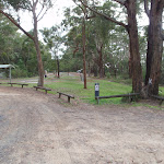
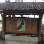

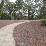

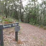
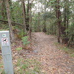

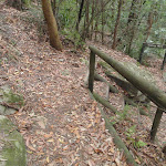
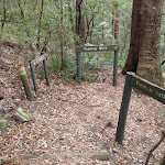
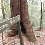
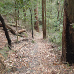


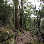

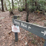

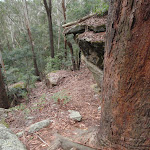


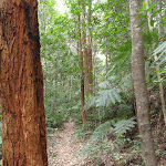
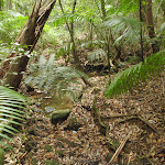
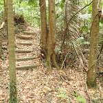
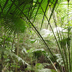
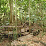

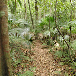

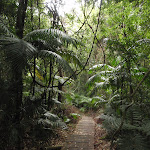
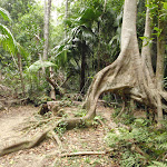
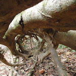
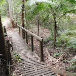
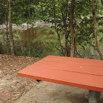
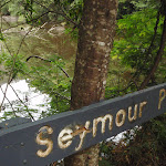
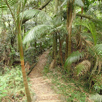
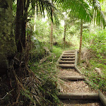


(0km) St Johns Lookout car park → Toilet block
130 m
2 mins
3m
-3m
Easy track
From the car park (signposted as ‘Katandra’ on Toomeys Rd), this walk heads across the picnic area and past the BBQ shelters, keeping the road up the hill to the left. Soon the walk comes to a sandstone footpath in front of the toilet block.
St Johns Lookout picnic area
St Johns Lookout picnic area is a large open area found at the top of Katandra Reserve on Toomeys Rd. The picnic area provides wheelchair accessible toilets[2], picnic tables[3], free electric BBQ’s[4], parking areas[5] [6] and information boards[7]. There is plenty of open space with some natural shade provided by the surrounding trees. There are garbage bins provided[8] but no drinking water[9].
(0.13km) Toilet block → St Johns Lookout
40 m
1 mins
0m
-12m
Very easy
Turn right: From the toilet block, this walk follows the footpath past the information sign to the fenced and signposted ‘St Johns Lookout’ At the end of this side trip, retrace your steps back to the main walk then Veer right.
St Johns Lookout
This fenced lookout is found at the top of Katandra Reserve, near the toilets. The lookout was upgraded by Gosford Council in September 2009 and now provides a safer platform and easier access. From the lookout, there are extensive views south-east over Matcham, Erina Heights and Terrigal, out to the ocean. The Guringai Walk passes below the lookout – please take extra care to not drop anything from the platform.
(0.13km) Toilet block → Upper Int of Toomey walk and Katandra Horse track
170 m
3 mins
3m
-9m
Easy track
Continue straight: From the toilet block, this walk heads through the clearing away from the lookout and BBQs. The walk follows the ‘Toomey Walk’ sign past a couple of picnic tables then turns right at the next ‘Toomey Walk’ sign. Just after passing through the gap in the fence, the walk comes to an intersection with a number of timber posts (on the right).
(0.3km) Upper Int of Toomey walk and Katandra Horse track → Int of Toomey and Guringai Walks
70 m
2 mins
4m
-18m
Easy track
Turn right: From the intersection, this walk follows the upper orange arrow past the timber posts and along the track. The track soon bends sharply left, heading down some stairs and coming to a three-way intersection, and a ‘Lookout’ sign pointing back up.
(0.36km) Int of Toomey and Guringai Walks → Lower Int of Toomey walk and Katandra Horse track
330 m
11 mins
27m
-78m
Moderate track
Continue straight: From the intersection, this walk follows the ‘Toomey Walk’ sign down the steps and left around the tree and through a cleft in the rock. The track zigzags down the hill and, about 100m past a rock platform with views, the track leads through some timber posts to come to a ‘T’ intersection with the Katandra Horse Track.
(0.69km) Lower Int of Toomey walk and Katandra Horse track → End of Ridgeway Rd trail
130 m
4 mins
16m
-3m
Moderate track
Veer right: From the intersection, this walk follows neither arrow but heads gently downhill along the wide horse trail, passing the post with the peach-coloured strip. The trail winds through the bush for a short time before coming to a clearing and signposted intersection with the ‘Ridgeway Road’ trail.
(0.82km) End of Ridgeway Rd trail → Strangler Fig platform
1 km
25 mins
29m
-121m
Moderate track
Veer right: From the intersection, this walk follows the left-hand arrow on the ‘Toomey Walk’ sign, over a small rise and along a narrow track. The track then heads down a short set of stairs and past a large rock. After a switchback, the track heads down another set of stairs then continues more gently down the hill. After a few more zigzags, the bush becomes more dense and thick vines become prevalent. Once on the valley floor, the walk crosses a couple of small creeks on small timber bridges and soon heads down some stairs, coming to the timber platform and a large Strangler Fig tree.
Strangler Fig platform
The Strangler Fig platform on Toomey Walk has been built to help walkers better appreciate this amazing feat of survival. The tree is formally know as Ficus obliqua and is listed on the Significant tree Register. More commonly know as a ‘Small-leaved Fig’ , this tree has an amazing root structure that grasps onto a large mossy boulder before heading underground. The platform is in a lovely shaded spot on the valley floor and the bench seat makes an inviting offer to sit whilst you soak up the surroundings. More info.
(1.86km) Strangler Fig platform → Strangler Fig Tube
420 m
9 mins
8m
-35m
Moderate track
Turn left: From the Strangler Fig Tree platform, this walk heads down a step and follows the flat track through the palm-filled valley. The track cross a few small creeks on small timber bridges to come to post ‘3’ (a large Turpentine Tree). From there, the track continues gently downhill. Soon after heading down a long set of timber stairs, the track crosses a small bridge then turns right, coming to the top of more stairs and a number ‘4’ post (a Strangler Fig tube).
Strangler Fig Tube
This Strangler Fig Tube is found beside Toomey Walk, just north of Seymour Pond. The scientific name of the tree is Ficus obliqua and it is listed on the Significant Tree Register. This Small-leaved Fig has grown around a large fallen log. The log has long-since rotted away, leaving a knotted tubular structure. Strangler Figs often grow from seeds dropped by birds. The seeds may fall on logs or rocks and the roots will make their way to the ground (to provided water, nutrients and a firm anchor), whilst the rest of the tree grows upwards for light. More info.
(2.28km) Strangler Fig Tube → Int of Waterman and Toomey walks
60 m
1 mins
1m
-5m
Easy track
Continue straight: From post ‘3’, this walk heads down the timber stairs and turns left. The walk follows the track and soon moves back onto a boardwalk, coming to a three-way intersection beside a large pond, with a sign pointing back along ‘Toomey Walk’.
(2.34km) Int of Waterman and Toomey walks → Seymour Pond Picnic area
70 m
1 mins
1m
-1m
Easy track
Continue straight: From the intersection, this walk follows none of the arrows and heads away from the face of the signs, across the bridge, keeping the pond on the right. The track then heads past the picnic tables and comes to an intersection and ‘Seymour Pond’ sign.
Seymour Pond
Seymour Pond is medium-sized water body in Katandra Reserve. The pond is fed by a spring coming from the cliffs at the top of the reserve. The small creek was dammed in the early 1900’s to provide water for a farm on the south side (growing vegetables). The pond is home to water birds, large lizards and other wildlife. The council does not allow swimming in the pond[18], helping to maintain the ecosystem that now relies on this pond. There are a few spots beside the pond where you can enjoy the cool climate and the visiting birds.
Seymour Pond Picnic Area
The Seymour Pond Picnic Area is found on the dam wall at the eastern end of Seymour Pond in Katandra Reserve. The picnic area provides a couple of picnic tables and a garbage bin. The picnic area is set in a lovely naturally shaded area in view of the Seymour Pond and beside Watermans and Toomeys walks.
(2.4km) Seymour Pond Picnic area → Int of Waterman walk and Katandra Rd track
300 m
8 mins
29m
-2m
Easy track
Veer left: From the picnic area, this walk heads away from the pond, following the left-hand ‘Waterman walk’ arrow (next to the locked gate) into the bush and across a couple of small bridges. The track passes post ‘5’ (an old wombat hole) then sharply bends right, soon passing the ‘Commemorating 10 years of bushcaring in Katandra Reserve’ plaque[19], where this walk then heads down some stairs. After walking through the palm filled valley for a short distance, the walk heads up the steps and, soon after passing the house and fence (on the left), comes to a three-way intersection marked with a post (with blue and white arrows).
(2.71km) Int of Waterman walk and Katandra Rd track → Katandra Rd picnic area
140 m
3 mins
14m
0m
Easy track
Turn right: From the intersection, this walk follows the lower arrow up the steps and turns left in front of the locked gate. The walk follows these steps up the hill, then soon flattens out as the track comes to a picnic area and car park.
Katandra Rd Picnic Area
The Katandra Road Picnic Area is found at the end of a short driveway (signposted at the intersection of Katandra Rd and Croton Ave, Holgate). The picnic area is in front of the ranger’s residence and is open from 7am to 6pm daily. The picnic area provides some toilets, garbage bins, two picnic tables, parking and an information sign.
(2.85km) Katandra Rd picnic area → Katandra Rd Gate
70 m
2 mins
0m
-5m
Easy track
Turn left: From the picnic area, this walk heads through the car park and follows the driveway down the hill, soon coming to a gate just above the junction of Katandra Rd and Croton Ave.
Maps for the Toomeys Walk walk
You can download the PDF for this walk to print a map.
These maps below cover the walk and the wider area around the walk, they are worth carrying for safety reasons.
| Gosford | 1:25 000 Map Series | 91312S GOSFORD | NSW-91312S |
| Gosford | 1:100 000 Map Series | 9131 GOSFORD | 9131 |
Cross sectional view of the Toomeys Walk bushwalking track
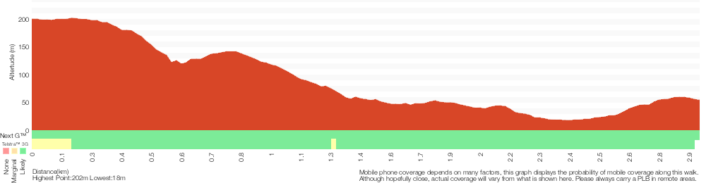
Analysis and summary of the altitude variation on the Toomeys Walk
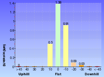
Overview of this walks grade – based on the AS 2156.1 – 2001
Under this standard, a walk is graded based on the most difficult section of the walk.
| Length | 2.9 km | ||
| Time | 1 hr 30 mins | ||
| . | |||
| Grade 3/6 Moderate track |
AS 2156.1 | Gradient | Short steep hills (3/6) |
| Quality of track | Clear and well formed track or trail (2/6) | ||
| Signs | Clearly signposted (1/6) | ||
| Experience Required | Some bushwalking experience recommended (3/6) | ||
| Weather | Weather generally has little impact on safety (1/6) | ||
| Infrastructure | Limited facilities, not all cliffs are fenced (3/6) |
Some more details of this walks Grading
Here is a bit more details explaining grading looking at sections of the walk
Gradient
1.5km of this walk has short steep hills and another 1.3km has gentle hills with occasional steps. The remaining (200m) is flat with no steps.
Quality of track
Around 2.8km of this walk follows a clear and well formed track or trail, whilst the remaining 70m follows a smooth and hardened path.
Signs
This whole walk, 2.9km is clearly signposted.
Experience Required
Around 1.5km of this walk requires some bushwalking experience, whilst the remaining 1.4km requires no previous bushwalking experience.
weather
This whole walk, 2.9km is not usually affected by severe weather events (that would unexpectedly impact safety and navigation).
Infrastructure
Around 1.5km of this walk has limited facilities (such as not all cliffs fenced), whilst the remaining 1.4km is close to useful facilities (such as fenced cliffs and seats).
Similar walks
A list of walks that share part of the track with the Toomeys Walk walk.
166 m Return
10 mins
Very easy
890 m Return
30 mins
Easy track
1.2 km Circuit
45 mins
Moderate track
1.5 km One way
45 mins
Moderate track
1.6 km Circuit
45 mins
Easy track
2 km Return
1 Hr
Moderate track
4.8 km Circuit
2 hrs 15 mins
Moderate track
5.3 km Circuit
2 hrs 45 mins
Moderate track
8.5 km One way
3 hrs 45 mins
Hard track
11.3 km One way
4 hrs 30 mins
Hard track
Other Nearby walks
A list of walks that start near the Toomeys Walk walk.
4.1 km One way
2 hrs
Hard track
900 m Return
30 mins
Hard track
1.6 km Circuit
45 mins
Moderate track
2.1 km Circuit
1 Hr
Moderate track
3.3 km Circuit
1 hr 30 mins
Hard track
1.4 km Circuit
45 mins
Hard track
643 m Circuit
30 mins
Moderate track
5.8 km Return
2 hrs 30 mins
Experienced only
3 km One way
1 hr 30 mins
Hard track
2.1 km Circuit
1 hr 15 mins
Hard track
6.1 km Circuit
2 hrs 45 mins
Hard track
382 m Return
15 mins
Moderate track
Plan your trip to and from the walk here
The Toomeys Walk walk starts at the St Johns Lookout car park (gps: -33.406505, 151.39009)
Your main transport option to St Johns Lookout car park is by;
![]() Car. There is free parking available.
Car. There is free parking available.
(get details)
The Toomeys Walk ends at the Katandra Rd Gate (gps: -33.415032, 151.3965)
Your transport options to Katandra Rd Gate are by;
![]() Bus. (get details)
Bus. (get details)
![]() Car. There is free parking available.
Car. There is free parking available.
(get details)
Short URL = http://wild.tl/tw
Gallery images
There are other downloads I am still working on.
You will probably need to login to access these — still all free.
* KML (google earth file)
* GPX (GPS file)
Special Maps/ brochures
* A3 topo maps
* PDF with Lands Topo map base
* PDF with arial image (and map overlay)
I wanted to get the main site live first, this extra stuff will come in time.
Happy walking
Matt 🙂
Mouat Trail (Katandra to Rumbalara)
And Walk
Mouat Trail (Katandra to Rumbalara)

2 hrs
4.1 km One way
139 m
Hard track
This walk follows a series of tracks and management trails along the top of the ridge between Katandra and Rumbalara Reserves. You will at times think you are a million miles from anywhere and other times enjoy views across the suburbs of the Central Coast and out to sea. In spring and early summer, you will discover many wildflowers. There are a few picnic tables with views, great spots for a snack and a rest on your walk.


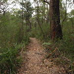
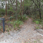
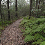
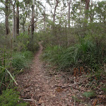

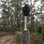
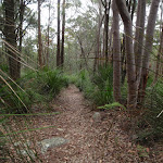
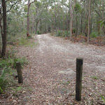


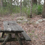
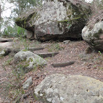


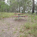

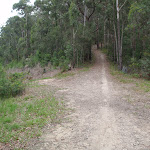


St Johns Lookout picnic area
St Johns Lookout picnic area is a large open area found at the top of Katandra Reserve on Toomeys Rd. The picnic area provides wheelchair accessible toilets[2], picnic tables[3], free electric BBQ’s[4], parking areas[5] [6] and information boards[7]. There is plenty of open space with some natural shade provided by the surrounding trees. There are garbage bins provided[8] but no drinking water[9].
St Johns Lookout
This fenced lookout is found at the top of Katandra Reserve, near the toilets. The lookout was upgraded by Gosford Council in September 2009 and now provides a safer platform and easier access. From the lookout, there are extensive views south-east over Matcham, Erina Heights and Terrigal, out to the ocean. The Guringai Walk passes below the lookout – please take extra care to not drop anything from the platform.
(0km) St Johns Lookout car park → Int of Graves and Mouat Walks
150 m
3 mins
2m
-6m
Easy track
From the car park, this walk heads across the clearing away from the main picnic area (keeping the road up the hill to the right). The walk soon comes to an intersection and a ‘Guringai walk’ sign.
Continue straight: From the intersection, this walk heads through the clearing towards the ‘Mount Mouat Walk’ and ‘Graves Walk’ signs[11]. At these signs, the walk heads left, out of the clearing and down the track for a short distance to the signposted intersection with ‘Graves Walk’ and ‘Mouat Walk’[12].
Continue straight: From the intersection, this walk heads through the clearing towards the ‘Mount Mouat Walk’ and ‘Graves Walk’ signs[11]. At these signs, the walk heads left, out of the clearing and down the track for a short distance to the signposted intersection with ‘Graves Walk’ and ‘Mouat Walk’[12].
(0.15km) Int of Graves and Mouat Walks → Int of Graves Walk and Maidens Brush management trail
240 m
5 mins
7m
-7m
Easy track
Continue straight: From the intersection, this walk follows the ‘Mouat Walk’ and ‘To Rumbalara Reserve’ signs along the track, keeping the valley to the left. The track soon comes to a four-way intersection, with a ‘Graves Track’ sign and a gate visible (up the hill to the right).
(0.39km) Int of Graves Walk and Maidens Brush management trail → Int of Mouat and Toomeys Rd Trails
810 m
18 mins
29m
-68m
Moderate track
Continue straight: From the intersection, this walk follows the track from behind the ‘Graves Walk’ sign, initially keeping the gate up the hill to the right. The track winds through the bush, crossing a small rock platform (and ignoring the side tracks), then heads down a series of timber steps. The trail winds past a few large rocks then winds up the hill to come into view of (and run parallel to) the Toomeys management trail. The track then passes over another rocky outcrop (beware of the cliff drop on the left), then down some steps to come to the wide Toomeys Management trail and an arrow pointing back up the steps.
(1.2km) Int of Mouat and Toomeys Rd Trails → Top of Clyde Rd trail
570 m
11 mins
16m
-12m
Moderate track
Turn left: From the intersection, this walk follows the wide management trail, keeping the valley down on the right. The trail soon bends left then, approximately 200m later, passes a stockpile of dirt and rocks (on the right). About 250m later, the trail passes a locked gate of a private residence and, just after the gate, comes to an intersection at the top of the Clyde Rd Trail.
(1.77km) Top of Clyde Rd trail → Pond intersection
80 m
1 mins
3m
0m
Moderate track
Continue straight: From the intersection, this walk follows the upper trail south, keeping next to the fence on the right. The trail soon bends right, leaving the power lines and coming to an intersection with a track (on the left), near the corner of the fence and above a small pond (on the right).
(1.84km) Pond intersection → Erina Trig
90 m
2 mins
5m
0m
Moderate track
Turn left: From the intersection, this walk follows the arrow up the steps away from the fence. The track gently winds up the hill to the Erina Trig station, surround by trees.
Erina Trig
Erina Trig station is part of a national geodetic survey established during the 1970’s. The ‘Triangulation station’ (aka trigonometrical or trig station) is a distinct marker which was once clear of trees and would have been visible for many kilometers in the area. There are many such trig stations around Australia, used to help in surveying. Each station has a know position and altitude which allows surveyors to use triangulation to determine another point’s location. With advances in technology, these trig stations have been superseded and abandoned. More info.
(1.93km) Erina Trig → Int of trig track and Toomeys Rd trail
120 m
2 mins
0m
-11m
Moderate track
Continue straight: From the trig point, this walk follows the track south-west down the hill, soon coming to an intersection with Toomeys Rd management trail.
(2.05km) Int of trig track and Toomeys Rd trail → Mouat trail picnic table
480 m
10 mins
6m
-41m
Moderate track
Veer left: From the intersection, this walk heads south-west, down along the management trail, and soon follows a fence, on the right. The trail winds down the hill (steeply in one spot), generally next to the fence, until coming to a locked gate (on the right).
Continue straight: From the gate, this walk follows the narrower track, keeping the fence to the right. The track soon turns right (at the corner fencepost) and continues alongside the fence, passing a bench seat and unfenced view on the left. The track continues to follow the fence and soon passes another locked gate (and passes close to the management trail). Following the fence, the track soon comes to a picnic table and an unfenced view across the valley.
Continue straight: From the gate, this walk follows the narrower track, keeping the fence to the right. The track soon turns right (at the corner fencepost) and continues alongside the fence, passing a bench seat and unfenced view on the left. The track continues to follow the fence and soon passes another locked gate (and passes close to the management trail). Following the fence, the track soon comes to a picnic table and an unfenced view across the valley.
Mouat trail picnic table
Mouat trail picnic table is found about halfway along the Mouat trail. There is an old picnic table and bench seat at the top of an unfenced cliff with filtered views over Springfield East Gosford and the Brisbane Water. A nice spot for a snack and rest.
(2.53km) Mouat trail picnic table → Locked gate
90 m
2 mins
0m
-7m
Moderate track
Continue straight: From the picnic table, this walk follows the track, keeping the fence to the right. The track keeps next to the fence until bending left around a rocky outcrop then down some stairs, coming to a management trail just below a locked gate.
(2.61km) Locked gate → Saddle intersection
180 m
3 mins
3m
-8m
Moderate track
Veer left: From the intersection, this walk follows the wide management trail downhill, away from the gate. The trail soon flattens out and crosses a long saddle, coming to a ‘Y’ intersection with a walking track (on the left), marked with a timber post.
(2.8km) Saddle intersection → 130 Picnic table
130 m
4 mins
15m
-1m
Moderate track
Veer left: From the intersection, this walk follows the walking track west up the hill, keeping the wider trail below to the right. The track winds up the hill through a rock outcrop to find a picnic table next to an unfenced view across East Gosford.
130 Picnic table
The 130 Picnic table (informally named based on the height of the hill) provides a spot to stop and rest. There are views from the top of this unfenced cliff across Brisbane Water and East Gosford. The single table has some limited natural shade from the surrounding trees.
(2.93km) 130 Picnic table → Int west of 130
200 m
4 mins
0m
-21m
Hard track
Continue straight: From the picnic table, this walk heads west, initially keeping the view to the left. The track heads along the top of the hill and turns left, following the arrow on the post down the hill and stairs through the cleft in the rock. The track continues down the hill, ignoring side tracks (on the right) to come to an intersection with a management trail in a fairly large clearing.
(3.13km) Int west of 130 → Top of Bradys Gully Trail
170 m
4 mins
0m
-20m
Moderate track
Veer left: From the intersection, this walk follows the management trail west, gently downhill, away from the rocky outcrop. The trail leads across a saddle and soon comes to an unsignposted ‘Y’ intersection with Bradys Gully trail (heading downhill on the right).
(3.29km) Top of Bradys Gully Trail → Powerline intersection
190 m
4 mins
12m
-2m
Moderate track
Continue straight: From the intersection, this walk follows the management trail south-west up the hill, initially keeping Bradys Gully trail below to the right. The walk soon takes the left fork (ignoring another trail on the right) to another saddle, with power lines running through the middle.
(3.48km) Powerline intersection → Sculpture of Edward John Eyre
440 m
10 mins
38m
-1m
Moderate track
Continue straight: From the intersection, this walk follows the upper arrow on the post, away from the power line, heading uphill to the south. The walk soon veers left (ignoring the wider trail on the right) and winds up the timber steps, through the rocky outcrop and follows a wire fence for a short time. The track follows the top of the ridge (with some filtered district views) until coming to a bronze sculpture of Edward John Eyre.
Edward John Eyre
The Sculpture of Edward John Eyre is found near the southern end of the Mouat Trail in Rumbalara Reserve. Commissioned by Sara Lee Kitchens and the State Bicentennial Commission, this 1.25 scale figurative work was sculptured by Carl Merten[14]. A circular inscription at the base declares this to be ‘Edward John Eyre 1815-1901’[15]. Eyre is one of Australia’s more famous explorers. A father of 5, he was awarded the founder’s gold medal from the Royal Geographical Society in 1847. In 1841, Eyre was appointed as resident magistrate and protector of Aborigines. He summed up his work like this –
“Moorundie was a District densely populated by Natives and in which prior to 1841 no settler had ventured to locate, and where (before I was stationed there) frightful scenes of bloodshed, rapine and hostility between the Natives and Parties coming overland with Stock had been of very frequent occurrence, but where, from the time of my arrival, and up to the date of my leaving not a single case of serious injury or aggression ever took place on the part of the Natives against the Europeans, whilst the district became rapidly and extensively occupied by Settlers and by Stock“.
Eyre also served as lieutenant-governor for New Zealand, lieutenant-governor for St Vincent (West Indies), governor for Leeward Islands, governor for Antigua and governor-in-chief for Jamaica. More info.
(3.92km) Sculpture of Edward John Eyre → Int of Mouat Walk and Dolly Ave
180 m
3 mins
3m
-2m
Hard track
Continue straight: From the sculpture, this walk follows the management trail, leaving the sculpture behind on the left. The trail meanders for a short distance to an intersection with a bush track, on the right (with a gate visible straight ahead).
Continue straight: From the intersection, this walk follows the management trail gently up the hill towards the gate. The walk passes around the gate to the intersection with Dolly Ave, with a ‘Mouat Walk’ signpost pointing back to the ‘Statue of Edward John Eyre 50 metres’.
Continue straight: From the intersection, this walk follows the management trail gently up the hill towards the gate. The walk passes around the gate to the intersection with Dolly Ave, with a ‘Mouat Walk’ signpost pointing back to the ‘Statue of Edward John Eyre 50 metres’.
Rumbalara Reserve Flora and Fauna
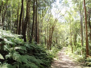
The reserve is home to a wide range of flora and fauna. The vegetation types range from the relatively dry ‘Coastal Narrabeen Ironbark Forest’ to pockets of ‘Coastal Warm Temperate Rainforest’. Commonly seen birds include Kookaburras, Eastern Rosellas and Magpies. Rarer birds such as the Glossy Black Cockatoo and Swift Parrot are sometimes sighted here as well. Sugar Gliders, Brush-tailed possums, Blue-tounged lizards and Tree snakes can be seen in the reserve if you are patient and lucky enough.
Maps for the Mouat Trail (Katandra to Rumbalara) walk
You can download the PDF for this walk to print a map.
These maps below cover the walk and the wider area around the walk, they are worth carrying for safety reasons.
| Gosford | 1:25 000 Map Series | 91312S GOSFORD | NSW-91312S |
| Gosford | 1:100 000 Map Series | 9131 GOSFORD | 9131 |
Cross sectional view of the Mouat Trail (Katandra to Rumbalara) bushwalking track
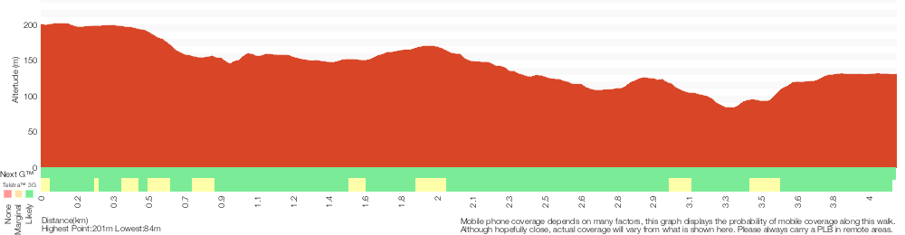
Analysis and summary of the altitude variation on the Mouat Trail (Katandra to Rumbalara)
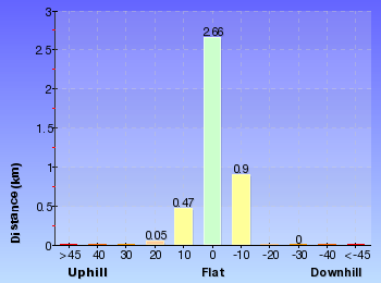
Overview of this walks grade – based on the AS 2156.1 – 2001
Under this standard, a walk is graded based on the most difficult section of the walk.
| Length | 4.1 km | ||
| Time | 2 hrs | ||
| . | |||
| Grade 4/6 Hard track |
AS 2156.1 | Gradient | Short steep hills (3/6) |
| Quality of track | Formed track, with some branches and other obstacles (3/6) | ||
| Signs | Minimal directional signs (4/6) | ||
| Experience Required | Some bushwalking experience recommended (3/6) | ||
| Weather | Weather generally has little impact on safety (1/6) | ||
| Infrastructure | Limited facilities, not all cliffs are fenced (3/6) |
Some more details of this walks Grading
Here is a bit more details explaining grading looking at sections of the walk
Gradient
3km of this walk has gentle hills with occasional steps and another 1km has short steep hills. The remaining (80m) is flat with no steps.
Quality of track
Around 2.4km of this walk follows a clear and well formed track or trail, whilst the remaining 1.7km follows a formed track, with some branches and other obstacles.
Signs
3.4km of this walk has directional signs at most intersection and another 390m is clearly signposted. The remaining (340m) has minimal directional signs.
Experience Required
Around 2.6km of this walk requires no previous bushwalking experience, whilst the remaining 1.5km requires some bushwalking experience.
weather
This whole walk, 4.1km is not usually affected by severe weather events (that would unexpectedly impact safety and navigation).
Infrastructure
Around 3.5km of this walk is close to useful facilities (such as fenced cliffs and seats), whilst the remaining 610m has limited facilities (such as not all cliffs fenced).
Similar walks
A list of walks that share part of the track with the Mouat Trail (Katandra to Rumbalara) walk.
900 m Return
30 mins
Hard track
1.2 km Circuit
45 mins
Moderate track
1.4 km Circuit
45 mins
Hard track
1.5 km One way
45 mins
Moderate track
3.3 km Circuit
1 hr 30 mins
Hard track
4.8 km Circuit
2 hrs 15 mins
Moderate track
5.3 km Circuit
2 hrs 45 mins
Moderate track
8.5 km One way
3 hrs 45 mins
Hard track
11.3 km One way
4 hrs 30 mins
Hard track
Other Nearby walks
A list of walks that start near the Mouat Trail (Katandra to Rumbalara) walk.
2.9 km One way
1 hr 30 mins
Moderate track
166 m Return
10 mins
Very easy
2 km Return
1 Hr
Moderate track
890 m Return
30 mins
Easy track
1.6 km Circuit
45 mins
Easy track
1.6 km Circuit
45 mins
Moderate track
2.1 km Circuit
1 Hr
Moderate track
643 m Circuit
30 mins
Moderate track
5.8 km Return
2 hrs 30 mins
Experienced only
3 km One way
1 hr 30 mins
Hard track
2.1 km Circuit
1 hr 15 mins
Hard track
6.1 km Circuit
2 hrs 45 mins
Hard track
Plan your trip to and from the walk here
The Mouat Trail (Katandra to Rumbalara) walk starts at the St Johns Lookout car park (gps: -33.406508, 151.39009)
Your main transport option to St Johns Lookout car park is by;
![]() Car. There is free parking available.
Car. There is free parking available.
(get details)
The Mouat Trail (Katandra to Rumbalara) ends at the Int of Mouat Walk and Dolly Ave (gps: -33.423723, 151.36051)
Your main transport option to Int of Mouat Walk and Dolly Ave is by;
![]() Car. There is free parking available.
Car. There is free parking available.
(get details)
Short URL = http://wild.tl/mttr
Gallery images
There are other downloads I am still working on.
You will probably need to login to access these — still all free.
* KML (google earth file)
* GPX (GPS file)
Special Maps/ brochures
* A3 topo maps
* PDF with Lands Topo map base
* PDF with arial image (and map overlay)
I wanted to get the main site live first, this extra stuff will come in time.
Happy walking
Matt 🙂
Katandra Circuit
And Walk
Katandra Circuit

2 hrs 15 mins
4.8 km Circuit
308 m
Moderate track
This walk explores many highlights in Katandra Reserve. Starting from St Johns Lookout, this walk winds down the hill into the much denser forest of the valley, enjoy many interesting rock formations on the way. Once in the valley, you walk past some fantastic examples of strangler figs before heading around Seymour Pond, enjoying the water birds. After resting at one of the picnic areas, you follow Graves Walk up the ridge, enjoying the open and dryer forest before returning to the car park.


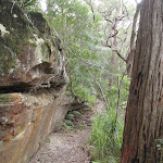
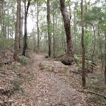
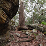

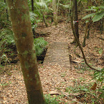


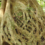
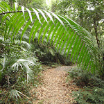

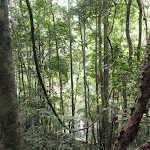

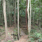
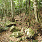

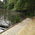
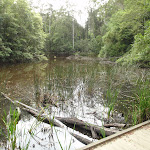
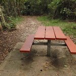
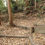
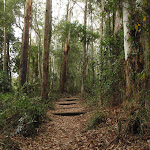
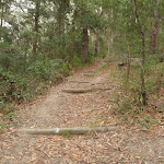
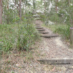


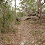
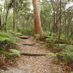

(0km) St Johns Lookout car park → Toilet block
130 m
2 mins
3m
-3m
Easy track
From the car park (signposted as ‘Katandra’ on Toomeys Rd), this walk heads across the picnic area and past the BBQ shelters, keeping the road up the hill to the left. Soon the walk comes to a sandstone footpath in front of the toilet block.
St Johns Lookout picnic area
St Johns Lookout picnic area is a large open area found at the top of Katandra Reserve on Toomeys Rd. The picnic area provides wheelchair accessible toilets[2], picnic tables[3], free electric BBQ’s[4], parking areas[5] [6] and information boards[7]. There is plenty of open space with some natural shade provided by the surrounding trees. There are garbage bins provided[8] but no drinking water[9].
(0.13km) Toilet block → St Johns Lookout
40 m
1 mins
0m
-12m
Very easy
Turn right: From the toilet block, this walk follows the footpath past the information sign to the fenced and signposted ‘St Johns Lookout’ At the end of this side trip, retrace your steps back to the main walk then Veer right.
St Johns Lookout
This fenced lookout is found at the top of Katandra Reserve, near the toilets. The lookout was upgraded by Gosford Council in September 2009 and now provides a safer platform and easier access. From the lookout, there are extensive views south-east over Matcham, Erina Heights and Terrigal, out to the ocean. The Guringai Walk passes below the lookout – please take extra care to not drop anything from the platform.
(0.13km) Toilet block → Upper Int of Toomey walk and Katandra Horse track
170 m
3 mins
3m
-9m
Easy track
Continue straight: From the toilet block, this walk heads through the clearing away from the lookout and BBQs. The walk follows the ‘Toomey Walk’ sign past a couple of picnic tables then turns right at the next ‘Toomey Walk’ sign. Just after passing through the gap in the fence, the walk comes to an intersection with a number of timber posts (on the right).
(0.3km) Upper Int of Toomey walk and Katandra Horse track → Lower Int of Toomey walk and Katandra Horse track
400 m
13 mins
31m
-96m
Moderate track
Turn right: From the intersection, this walk follows the upper orange arrow past the timber posts and along the track. The track soon bends sharply left, heading down some stairs and coming to a three-way intersection, and a ‘Lookout’ sign pointing back up.
Continue straight: From the intersection, this walk follows the ‘Toomey Walk’ sign down the steps and left around the tree and through a cleft in the rock. The track zigzags down the hill and, about 100m past a rock platform with views, the track leads through some timber posts to come to a ‘T’ intersection with the Katandra Horse Track.
Continue straight: From the intersection, this walk follows the ‘Toomey Walk’ sign down the steps and left around the tree and through a cleft in the rock. The track zigzags down the hill and, about 100m past a rock platform with views, the track leads through some timber posts to come to a ‘T’ intersection with the Katandra Horse Track.
(0.69km) Lower Int of Toomey walk and Katandra Horse track → Strangler Fig platform
1.2 km
29 mins
45m
-124m
Moderate track
Veer right: From the intersection, this walk follows neither arrow but heads gently downhill along the wide horse trail, passing the post with the peach-coloured strip. The trail winds through the bush for a short time before coming to a clearing and signposted intersection with the ‘Ridgeway Road’ trail.
Veer right: From the intersection, this walk follows the left-hand arrow on the ‘Toomey Walk’ sign, over a small rise and along a narrow track. The track then heads down a short set of stairs and past a large rock. After a switchback, the track heads down another set of stairs then continues more gently down the hill. After a few more zigzags, the bush becomes more dense and thick vines become prevalent. Once on the valley floor, the walk crosses a couple of small creeks on small timber bridges and soon heads down some stairs, coming to the timber platform and a large Strangler Fig tree.
Veer right: From the intersection, this walk follows the left-hand arrow on the ‘Toomey Walk’ sign, over a small rise and along a narrow track. The track then heads down a short set of stairs and past a large rock. After a switchback, the track heads down another set of stairs then continues more gently down the hill. After a few more zigzags, the bush becomes more dense and thick vines become prevalent. Once on the valley floor, the walk crosses a couple of small creeks on small timber bridges and soon heads down some stairs, coming to the timber platform and a large Strangler Fig tree.
Strangler Fig platform
The Strangler Fig platform on Toomey Walk has been built to help walkers better appreciate this amazing feat of survival. The tree is formally know as Ficus obliqua and is listed on the Significant tree Register. More commonly know as a ‘Small-leaved Fig’ , this tree has an amazing root structure that grasps onto a large mossy boulder before heading underground. The platform is in a lovely shaded spot on the valley floor and the bench seat makes an inviting offer to sit whilst you soak up the surroundings. More info.
(1.86km) Strangler Fig platform → Strangler Fig Tube
420 m
9 mins
8m
-35m
Moderate track
Turn left: From the Strangler Fig Tree platform, this walk heads down a step and follows the flat track through the palm-filled valley. The track cross a few small creeks on small timber bridges to come to post ‘3’ (a large Turpentine Tree). From there, the track continues gently downhill. Soon after heading down a long set of timber stairs, the track crosses a small bridge then turns right, coming to the top of more stairs and a number ‘4’ post (a Strangler Fig tube).
Strangler Fig Tube
This Strangler Fig Tube is found beside Toomey Walk, just north of Seymour Pond. The scientific name of the tree is Ficus obliqua and it is listed on the Significant Tree Register. This Small-leaved Fig has grown around a large fallen log. The log has long-since rotted away, leaving a knotted tubular structure. Strangler Figs often grow from seeds dropped by birds. The seeds may fall on logs or rocks and the roots will make their way to the ground (to provided water, nutrients and a firm anchor), whilst the rest of the tree grows upwards for light. More info.
(2.28km) Strangler Fig Tube → Int of Waterman and Toomey walks
60 m
1 mins
1m
-5m
Easy track
Continue straight: From post ‘3’, this walk heads down the timber stairs and turns left. The walk follows the track and soon moves back onto a boardwalk, coming to a three-way intersection beside a large pond, with a sign pointing back along ‘Toomey Walk’.
(2.34km) Int of Waterman and Toomey walks → Seymour Pond Picnic area
70 m
1 mins
1m
-1m
Easy track
Continue straight: From the intersection, this walk follows none of the arrows and heads away from the face of the signs, across the bridge, keeping the pond on the right. The track then heads past the picnic tables and comes to an intersection and ‘Seymour Pond’ sign. Now Veer left to rejoin the main walk .
(2.34km) Int of Waterman and Toomey walks → Waterman View
550 m
11 mins
20m
-20m
Easy track
Turn right: From the intersection, this walk follows the ‘Waterman Walk’ sign past the blue striped post and across the bridge, keeping the pond to the left. The track winds through the bush, crossing a few smaller bridges with glimpse to the pond. After crossing a bigger bridge and gully, the track comes to a bench seat. Here, the track turns left and heads along the side of the gully, crossing a few more small bridges and then heading up some stairs. Soon, the track comes to a viewing platform (on the left) with some long bench seats and a good view across Seymour Pond.
Waterman View
Waterman view (informally named) is a viewing point at the western end of Seymour Pond. The platform has a couple of long bench seats. A timber platform on the water’s edge means that visitors can get right up near the water. Signs here remind visitors that swimming is not allowed. This is a great spot to enjoy the birds and other life around the pond.
(2.89km) Waterman View → Seymour Pond Picnic area
110 m
2 mins
1m
-1m
Easy track
Turn right: From the pond viewing point, this walk follows the dirt track, keeping the pond on the left. The track skirts around the pond and soon comes to a ‘Seymour Pond’ sign and a couple of picnic tables.
Seymour Pond
Seymour Pond is medium-sized water body in Katandra Reserve. The pond is fed by a spring coming from the cliffs at the top of the reserve. The small creek was dammed in the early 1900’s to provide water for a farm on the south side (growing vegetables). The pond is home to water birds, large lizards and other wildlife. The council does not allow swimming in the pond[18], helping to maintain the ecosystem that now relies on this pond. There are a few spots beside the pond where you can enjoy the cool climate and the visiting birds.
Seymour Pond Picnic Area
The Seymour Pond Picnic Area is found on the dam wall at the eastern end of Seymour Pond in Katandra Reserve. The picnic area provides a couple of picnic tables and a garbage bin. The picnic area is set in a lovely naturally shaded area in view of the Seymour Pond and beside Watermans and Toomeys walks.
(3km) Seymour Pond Picnic area → Katandra Rd picnic area
450 m
11 mins
43m
-2m
Easy track
Veer right: From the picnic area, this walk heads away from the pond, following the left-hand ‘Waterman walk’ arrow (next to the locked gate) into the bush and across a couple of small bridges. The track passes post ‘5’ (an old wombat hole) then sharply bends right, soon passing the ‘Commemorating 10 years of bushcaring in Katandra Reserve’ plaque[19], where this walk then heads down some stairs. After walking through the palm filled valley for a short distance, the walk heads up the steps and, soon after passing the house and fence (on the left), comes to a three-way intersection marked with a post (with blue and white arrows).
Turn right: From the intersection, this walk follows the lower arrow up the steps and turns left in front of the locked gate. The walk follows these steps up the hill, then soon flattens out as the track comes to a picnic area and car park.
Turn right: From the intersection, this walk follows the lower arrow up the steps and turns left in front of the locked gate. The walk follows these steps up the hill, then soon flattens out as the track comes to a picnic area and car park.
Katandra Rd Picnic Area
The Katandra Road Picnic Area is found at the end of a short driveway (signposted at the intersection of Katandra Rd and Croton Ave, Holgate). The picnic area is in front of the ranger’s residence and is open from 7am to 6pm daily. The picnic area provides some toilets, garbage bins, two picnic tables, parking and an information sign.
(3.44km) Katandra Rd picnic area → Behind the Rangers Residence
450 m
13 mins
54m
-8m
Moderate track
Continue straight: From the picnic area, this walk follows the ‘Graves Walk’ and ‘Lookout 1500m’ signs gently downhill, initially keeping the ranger’s cottage to the right. The track then heads up a long series of steps, passing a steep trail on the left (that leads to Murina Close). The walk continues up the steps to a large five-way intersection above a ‘No Entry Rangers Residence’ sign[20] and locked gate.
(3.89km) Behind the Rangers Residence → Int of Graves and Mouat Walks
790 m
22 mins
93m
-3m
Moderate track
Continue straight: From the intersection, this walk follows the stairs up the hill to the rocky outcrop, heading directly away from the locked gate. The track heads through the rocks then along the top of the ridge, passing the number ‘6’ post (Aboriginal markings in the stone). The track continues gently uphill until coming to an intersection with a short link track (leading to the parallel horse track).
Continue straight: From the intersection, this walk follows the walking track gently uphill, keeping the horse track on the left. The track soon bends right and heads between the timber posts, then zigzags up the hill. The track passes between more posts to a signposted intersection with the ‘Mouat Walk’ and a sign pointing back along ‘Graves Walk’.
Continue straight: From the intersection, this walk follows the walking track gently uphill, keeping the horse track on the left. The track soon bends right and heads between the timber posts, then zigzags up the hill. The track passes between more posts to a signposted intersection with the ‘Mouat Walk’ and a sign pointing back along ‘Graves Walk’.
(4.68km) Int of Graves and Mouat Walks → St Johns Lookout car park
150 m
3 mins
6m
-2m
Easy track
Veer right: From the intersection, this walk follows none of the arrows but heads away from the face of the sign gently uphill, keeping the valley to the right. The track soon opens up into a large clearing, passing the ‘Mount Mouat walk’ and ‘Graves Walk’ signs[21] and continuing for about 20m to an intersection with the signposted ‘Guringai walk’[22].
Continue straight: From the intersection, this walk heads through the clearing towards the picnic area, soon coming to the car park and information sign.
Continue straight: From the intersection, this walk heads through the clearing towards the picnic area, soon coming to the car park and information sign.
Maps for the Katandra Circuit walk
You can download the PDF for this walk to print a map.
These maps below cover the walk and the wider area around the walk, they are worth carrying for safety reasons.
| Gosford | 1:25 000 Map Series | 91312S GOSFORD | NSW-91312S |
| Gosford | 1:100 000 Map Series | 9131 GOSFORD | 9131 |
Cross sectional view of the Katandra Circuit bushwalking track
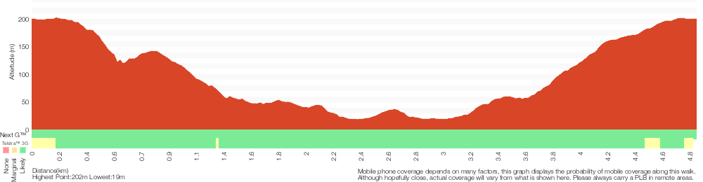
Analysis and summary of the altitude variation on the Katandra Circuit
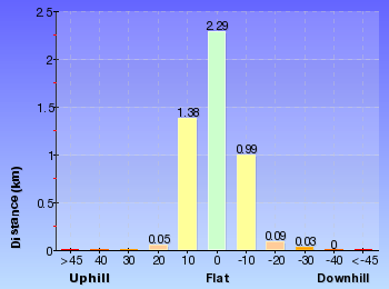
Overview of this walks grade – based on the AS 2156.1 – 2001
Under this standard, a walk is graded based on the most difficult section of the walk.
| Length | 4.8 km | ||
| Time | 2 hrs 15 mins | ||
| . | |||
| Grade 3/6 Moderate track |
AS 2156.1 | Gradient | Short steep hills (3/6) |
| Quality of track | Formed track, with some branches and other obstacles (3/6) | ||
| Signs | Clearly signposted (1/6) | ||
| Experience Required | Some bushwalking experience recommended (3/6) | ||
| Weather | Weather generally has little impact on safety (1/6) | ||
| Infrastructure | Limited facilities, not all cliffs are fenced (3/6) |
Some more details of this walks Grading
Here is a bit more details explaining grading looking at sections of the walk
Gradient
2.7km of this walk has short steep hills and another 1.8km has gentle hills with occasional steps. The remaining (320m) is flat with no steps.
Quality of track
Around 3.6km of this walk follows a clear and well formed track or trail, whilst the remaining 1.2km follows a formed track, with some branches and other obstacles.
Signs
This whole walk, 4.8km is clearly signposted.
Experience Required
Around 2.8km of this walk requires no previous bushwalking experience, whilst the remaining 2km requires some bushwalking experience.
weather
This whole walk, 4.8km is not usually affected by severe weather events (that would unexpectedly impact safety and navigation).
Infrastructure
Around 3.3km of this walk is close to useful facilities (such as fenced cliffs and seats), whilst the remaining 1.5km has limited facilities (such as not all cliffs fenced).
Similar walks
A list of walks that share part of the track with the Katandra Circuit walk.
166 m Return
10 mins
Very easy
890 m Return
30 mins
Easy track
1.2 km Circuit
45 mins
Moderate track
1.5 km One way
45 mins
Moderate track
1.6 km Circuit
45 mins
Easy track
2 km Return
1 Hr
Moderate track
2.9 km One way
1 hr 30 mins
Moderate track
4.1 km One way
2 hrs
Hard track
5.3 km Circuit
2 hrs 45 mins
Moderate track
8.5 km One way
3 hrs 45 mins
Hard track
11.3 km One way
4 hrs 30 mins
Hard track
Other Nearby walks
A list of walks that start near the Katandra Circuit walk.
900 m Return
30 mins
Hard track
1.6 km Circuit
45 mins
Moderate track
2.1 km Circuit
1 Hr
Moderate track
3.3 km Circuit
1 hr 30 mins
Hard track
1.4 km Circuit
45 mins
Hard track
643 m Circuit
30 mins
Moderate track
5.8 km Return
2 hrs 30 mins
Experienced only
3 km One way
1 hr 30 mins
Hard track
2.1 km Circuit
1 hr 15 mins
Hard track
6.1 km Circuit
2 hrs 45 mins
Hard track
382 m Return
15 mins
Moderate track
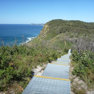
1.6 km One way
45 mins
Moderate track
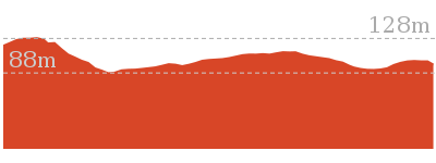
Plan your trip to and from the walk here
The Katandra Circuit walk starts and ends at the St Johns Lookout car park (gps: -33.406505, 151.39009)
Your main transport option to St Johns Lookout car park is by;
![]() Car. There is free parking available.
Car. There is free parking available.
(get details)
Short URL = http://wild.tl/2d
Gallery images
There are other downloads I am still working on.
You will probably need to login to access these — still all free.
* KML (google earth file)
* GPX (GPS file)
Special Maps/ brochures
* A3 topo maps
* PDF with Lands Topo map base
* PDF with arial image (and map overlay)
I wanted to get the main site live first, this extra stuff will come in time.
Happy walking
Matt 🙂
Comments