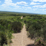
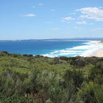
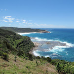
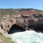
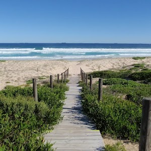
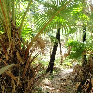
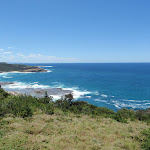
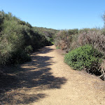
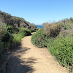
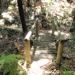
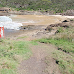
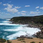
This walk follows the Coast Track to Frazer Beach, along the Geebung and (overgrown) Grass Tree Tracks. From the northern end of Frazer Beach, the walk heads across the exposed rockshelf to Snapper Point Beach, then on to Snapper Point (consider tide and sea conditions before setting out). From Snapper Point, there are more great ocean views and a lookout which views a large sea cave. If you have extra time, the side trip to Wybung Head is worth the effort. A very diverse walk exploring many of the highlights in the park.* This walk passes through very remote areas and sections have no visible track. At least one person in your group should have training and experience in off track walking and navigation. Even with these notes and a GPS these extra skills and equipment are required.
Campbell Drive to Snapper Point
And Walk
Campbell Drive to Snapper Point


1 hr 45 mins

135 m
Experienced only


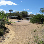


(0km) Int of Geebung Track and Campbell Dr → Birdie Beach View

1.7 km
29 mins
60m
-5m
Moderate track
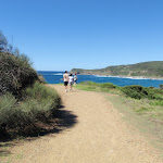
Birdie Beach View

(1.67km) Birdie Beach View → Int of Geebung Track and Wybung Head Rd
690 m
12 mins
32m
-5m
Moderate track
(2.35km) Int of Geebung Track and Wybung Head Rd → Upper end of Grass Tree Track
50 m
1 mins
0m
0m
Very easy
(2.41km) Upper end of Grass Tree Track → Tip of Wybung Head
790 m
15 mins
1m
-74m
Moderate track
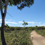
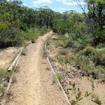
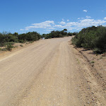
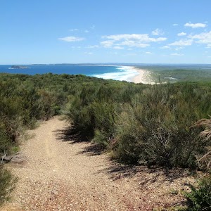
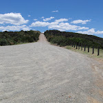
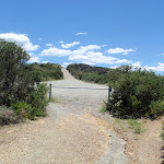
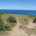
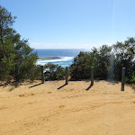
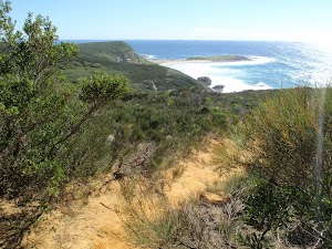
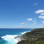
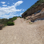
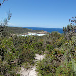
Continue straight: From the locked gate at the car park[22] (at the end of Wybung Head Rd), this walk heads downhill along the management trail. The trail soon passes a track (on the left, that leads to the whale watching area), and continues downhill along the wide trail to find the grand ocean views[23]. The trail then bends left and passes along the top of an unfenced cliff[24]. As the trail flattens out, it passes a grassy clearing and ends on the narrow saddle[25], with views up and down the coast.
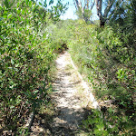
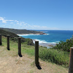
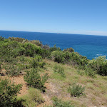
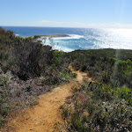
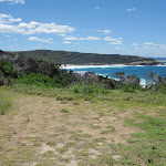
Continue straight: From the narrow saddle, this walk follows the narrower track towards the ocean along middle of the headland[26]. The track leads up a small rise and through some heath, to then suddenly open up at the top of an unfenced cliff and view across the ocean[27]. At the end of this side trip, retrace your steps back to the main walk then Turn right.
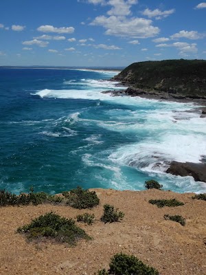
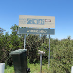
Wybung Head
(2.41km) Upper end of Grass Tree Track → Bongon Lagoon
740 m
16 mins
1m
-89m
Experienced only
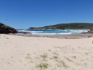
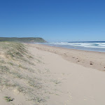
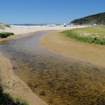
Frazer Beach
(3.15km) Bongon Lagoon → Frazer Beach Picnic Area
130 m
2 mins
3m
0m
Unknow grade
(3.27km) Frazer Beach Picnic Area → Frazer Beach Camping Ground
180 m
4 mins
8m
-1m
Unknow grade
Frazer camping ground

(3.45km) Frazer Beach Camping Ground → Northern end of Frazer Beach
70 m
2 mins
0m
-9m
Moderate track
(3.52km) Northern end of Frazer Beach → Snapper Point Beach
370 m
7 mins
13m
-9m
Experienced only
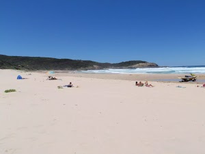
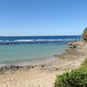
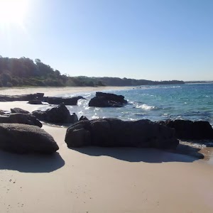
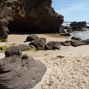
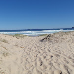
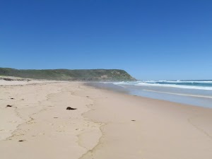
Snapper Point Beach
(3.9km) Snapper Point Beach → Snapper Point Beach Buoy
110 m
2 mins
2m
-4m
Experienced only
(4km) Snapper Point Beach Buoy → Life Buoy Sign
100 m
2 mins
13m
-1m
Moderate track
(4.11km) Life Buoy Sign → Snapper Point Memorial
30 m
1 mins
0m
-1m
Moderate track
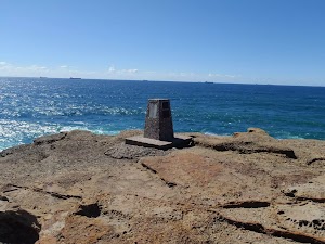
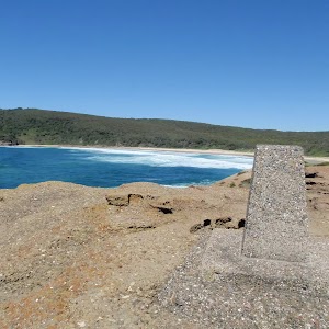
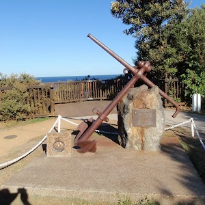
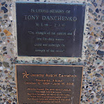
Snapper Point Memorial
(4.11km) Life Buoy Sign → Snapper Point car park
110 m
2 mins
3m
-1m
Easy track
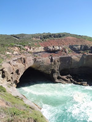
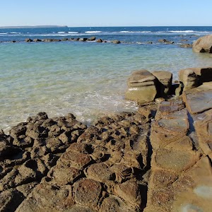
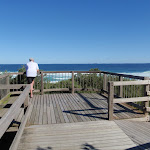
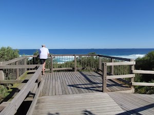
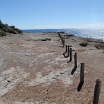
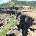
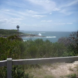
Snapper Point Cave Lookout
Maps for the Campbell Drive to Snapper Point walk
You can download the PDF for this walk to print a map.
These maps below cover the walk and the wider area around the walk, they are worth carrying for safety reasons.
| Catherine Hill Bay | 1:25 000 Map Series | 92314S CATHERINE HILL BAY | NSW-92314S |
| Lake Macquarie | 1:100 000 Map Series | 9231 LAKE MACQUARIE | 9231 |
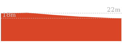
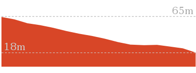
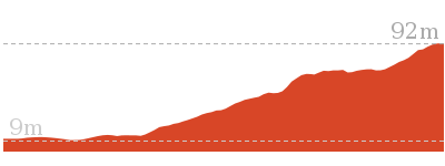
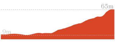
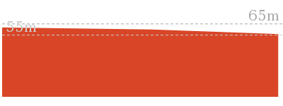
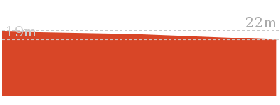
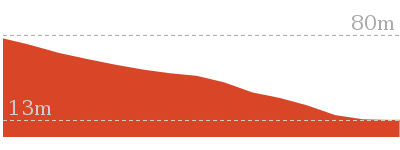
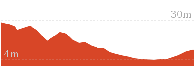
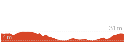
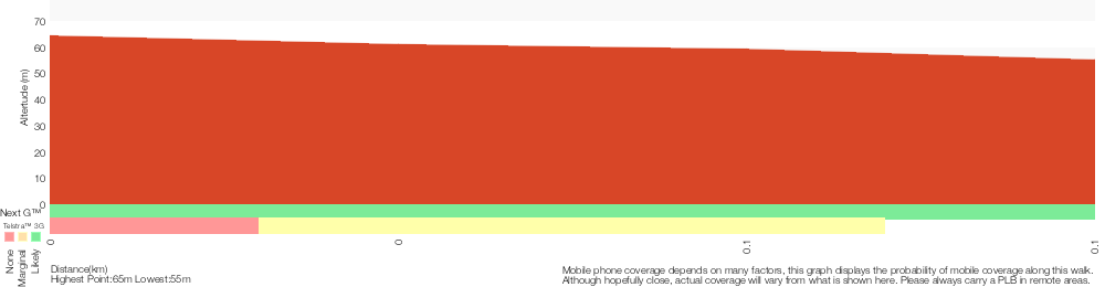
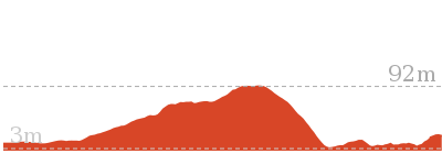
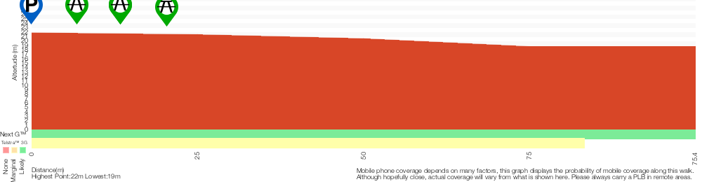
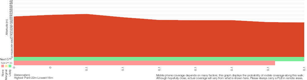
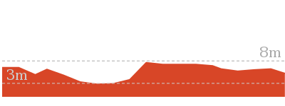
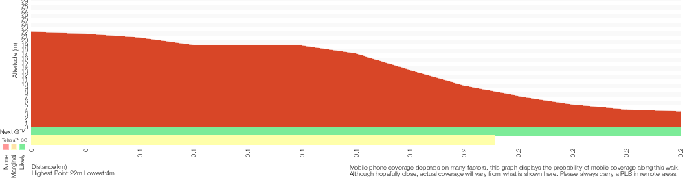
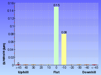
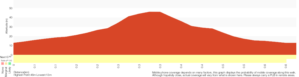
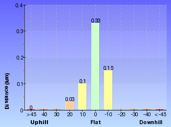
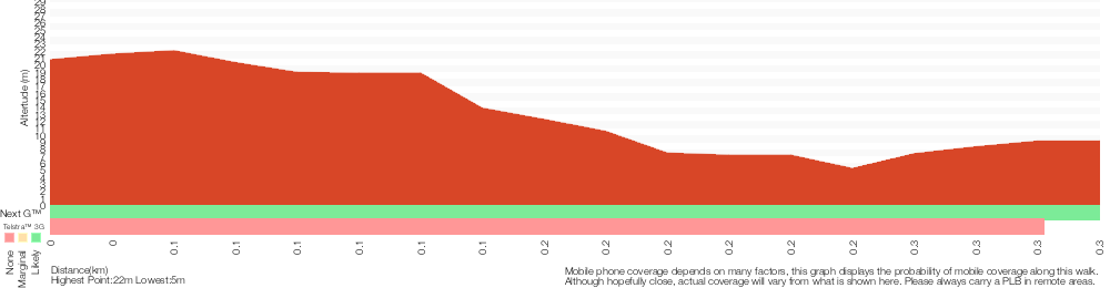
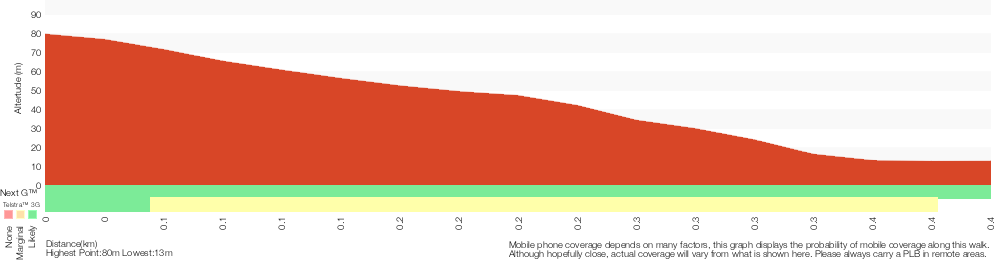
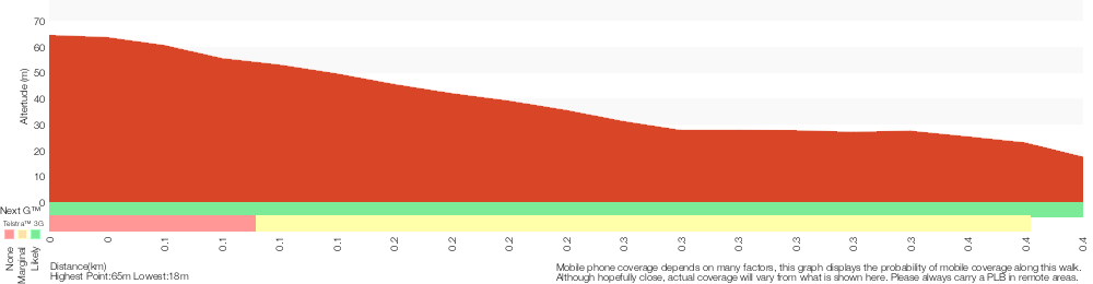
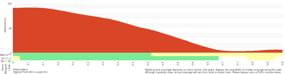
Cross sectional view of the Campbell Drive to Snapper Point bushwalking track
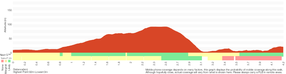
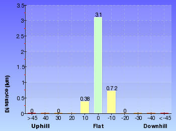
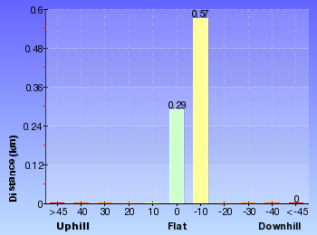
Analysis and summary of the altitude variation on the Campbell Drive to Snapper Point
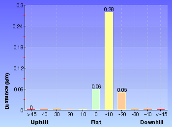
Overview of this walks grade – based on the AS 2156.1 – 2001
Under this standard, a walk is graded based on the most difficult section of the walk.
| Length | 4.2 km | ||
| Time | 1 hr 45 mins | ||
| . | |||
| Grade 5/6 Experienced only |
AS 2156.1 | Gradient | Short steep hills (3/6) |
| Quality of track | Rough unclear track (5/6) | ||
| Signs | No directional signs (5/6) | ||
| Experience Required | High level of bushwalking experience recommended (5/6) | ||
| Weather | Forecast, unforecast storms and severe weather likely to have an impact on your navigation and safety (5/6) | ||
| Infrastructure | Limited facilities, not all cliffs are fenced (3/6) |
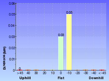
Some more details of this walks Grading
Here is a bit more details explaining grading looking at sections of the walk
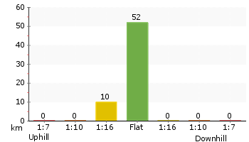
Gradient
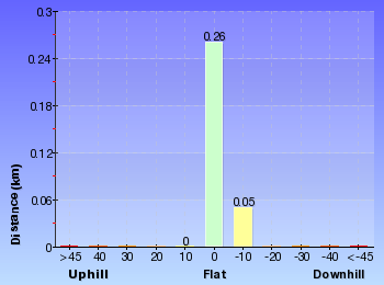
2.6km of this walk has gentle hills with occasional steps and another 1.3km has short steep hills. The remaining (340m) is flat with no steps.
Quality of track
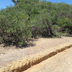
2.8km of this walk follows a clear and well formed track or trail and another 1.2km follows a rough unclear track. Whilst another 100m follows a formed track, with some branches and other obstacles and the remaining 55m follows a smooth and hardened path.
Signs
2.5km of this walk has directional signs at most intersection and another 1.2km Has no directional signs. The remaining (540m) is clearly signposted.
Experience Required
2.5km of this walk requires some bushwalking experience and another 740m requires a leader a with moderate level of bushwalking experience. Whilst another 540m requires no previous bushwalking experience and the remaining 480m requires a leader with a high level of bushwalking experience.
weather
2.6km of this walk is not usually affected by severe weather events (that would unexpectedly impact safety and navigation) and another 840m is affected by storms that may impact your navigation and safety. The remaining (480m) forecast, unforecast storms and severe weather likely to have an impact on your navigation and safety.
Infrastructure
Around 3.6km of this walk has limited facilities (such as not all cliffs fenced), whilst the remaining 640m is close to useful facilities (such as fenced cliffs and seats).
Similar walks
A list of walks that share part of the track with the Campbell Drive to Snapper Point walk.
280 m Return
10 mins
Moderate track
630 m Return
15 mins
Experienced only
804 m Return
20 mins
Moderate track
862 m One way
30 mins
Experienced only
2.4 km One way
1 Hr
Moderate track
3.3 km One way
1 hr 30 mins
Experienced only
3.3 km Return
1 hr 15 mins
Moderate track
Other Nearby walks
A list of walks that start near the Campbell Drive to Snapper Point walk.
1.2 km Return
25 mins
Easy track
142 m Return
5 mins
Easy track
444 m Return
10 mins
Easy track
136 m Return
3 mins
Very easy
609 m Circuit
20 mins
Moderate track
768 m Return
20 mins
Hard track
150 m Return
15 mins
Easy track

2.6 km Return
1 Hr
Hard track
1.6 km Return
45 mins
Hard track
762 m Return
30 mins
Very easy
2.5 km Circuit
1 Hr
Hard track
2.2 km Return
1 Hr
Moderate track
Plan your trip to and from the walk here
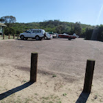
The Campbell Drive to Snapper Point walk starts at the Int of Geebung Track and Campbell Dr (gps: -33.195424, 151.60157)
Your main transport option to Int of Geebung Track and Campbell Dr is by;
![]() Car. A park entry fee is required for driving into the park.
Car. A park entry fee is required for driving into the park.
(get details)
The Campbell Drive to Snapper Point ends at the Snapper Point car park (gps: -33.18624, 151.62793)
Your main transport option to Snapper Point car park is by;
![]() Car. A park entry fee is required for driving into the park.
Car. A park entry fee is required for driving into the park.
(get details)


Short URL = http://wild.tl/cdtsp
Gallery images
There are other downloads I am still working on.
You will probably need to login to access these — still all free.
* KML (google earth file)
* GPX (GPS file)
Special Maps/ brochures
* A3 topo maps
* PDF with Lands Topo map base
* PDF with arial image (and map overlay)
I wanted to get the main site live first, this extra stuff will come in time.
Happy walking
Matt 🙂
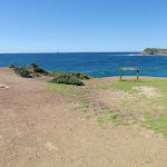
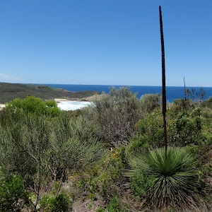
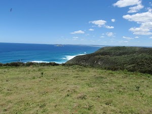
Wybung Head whale viewing area
And Walk
Wybung Head whale viewing area

5 mins
9 m
Easy track
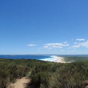
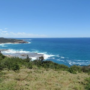
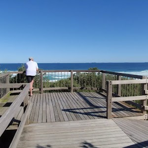
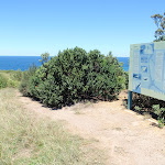
This short walk starts at the end of Wybung Head Rd, leading along the top of the ridge to a fairly large clearing with sweeping ocean views. A large sign provides some information on Marine Mammals. This is a good spot to watch migrations – northern migration from June to July and southern migration from Sept to Oct. There is no shade, wind protection or any other facilities, so come well prepared if planning to sit and watch for a while.
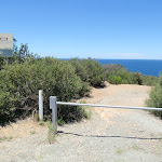


(0km) Wybung Head car park → Whale watching area
70 m
2 mins
0m
-9m
Easy track
Wybung Whale Watching Area
Maps for the Wybung Head whale viewing area walk
You can download the PDF for this walk to print a map.
These maps below cover the walk and the wider area around the walk, they are worth carrying for safety reasons.
| Catherine Hill Bay | 1:25 000 Map Series | 92314S CATHERINE HILL BAY | NSW-92314S |
| Lake Macquarie | 1:100 000 Map Series | 9231 LAKE MACQUARIE | 9231 |
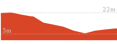
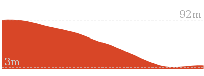
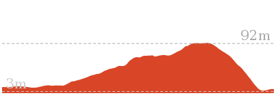
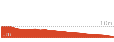
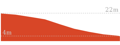
Cross sectional view of the Wybung Head whale viewing area bushwalking track
Analysis and summary of the altitude variation on the Wybung Head whale viewing area
Overview of this walks grade – based on the AS 2156.1 – 2001
Under this standard, a walk is graded based on the most difficult section of the walk.
| Length | 142 m | ||
| Time | 5 mins | ||
| . | |||
| Grade 2/6 Easy track |
AS 2156.1 | Gradient | Gentle hills with occasional steps (2/6) |
| Quality of track | Clear and well formed track or trail (2/6) | ||
| Signs | Clearly signposted (1/6) | ||
| Experience Required | No experience required (1/6) | ||
| Weather | Weather generally has little impact on safety (1/6) | ||
| Infrastructure | Generally useful facilities (such as fenced cliffs and seats) (1/6) |
Some more details of this walks Grading
Here is a bit more details explaining grading looking at sections of the walk
Gradient
This whole walk, 70m has gentle hills with occasional steps.
Quality of track
This whole walk, 70m follows a clear and well formed track or trail.
Signs
This whole walk, 70m is clearly signposted.
Experience Required
This whole walk, 70m requires no previous bushwalking experience.
weather
This whole walk, 70m is not usually affected by severe weather events (that would unexpectedly impact safety and navigation).
Infrastructure
This whole walk, 70m is close to useful facilities (such as fenced cliffs and seats).
Similar walks
A list of walks that share part of the track with the Wybung Head whale viewing area walk.
804 m Return
20 mins
Moderate track
Other Nearby walks
A list of walks that start near the Wybung Head whale viewing area walk.
862 m One way
30 mins
Experienced only
3.3 km Return
1 hr 15 mins
Moderate track

4.2 km One way
1 hr 45 mins
Experienced only
2.4 km One way
1 Hr
Moderate track
3.3 km One way
1 hr 30 mins
Experienced only
280 m Return
10 mins
Moderate track
630 m Return
15 mins
Experienced only
609 m Circuit
20 mins
Moderate track
1.2 km Return
25 mins
Easy track
768 m Return
20 mins
Hard track
444 m Return
10 mins
Easy track
136 m Return
3 mins
Very easy
Plan your trip to and from the walk here
The Wybung Head whale viewing area walk starts and ends at the Wybung Head car park (gps: -33.196221, 151.62127)
Your main transport option to Wybung Head car park is by;
![]() Car. A park entry fee is required for driving into the park.
Car. A park entry fee is required for driving into the park.
(get details)
Short URL = http://wild.tl/whwva
Gallery images
There are other downloads I am still working on.
You will probably need to login to access these — still all free.
* KML (google earth file)
* GPX (GPS file)
Special Maps/ brochures
* A3 topo maps
* PDF with Lands Topo map base
* PDF with arial image (and map overlay)
I wanted to get the main site live first, this extra stuff will come in time.
Happy walking
Matt 🙂
Tea Tree Picnic Area to Bird Island Lookout

3 mins
3 m
Very easy
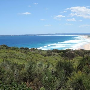
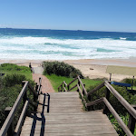
This short walk leads from the Tea Tree car park and Picnic Area to the Bird Island Lookout. The view from the fenced platform looks up and down Birdie Beach, and out to sea to Bird Island. The walk starts from the car park and heads across the compacted dirt and gravel track, before leading up a timber ramp to the actual lookout. A short walk to a grand view.


(0km) Tea Tree car park → Tea Tree car park information sign
10 m
0m
0m
Very easy


(0.01km) Tea Tree car park information sign → Tea Tree Picnic area
30 m
0m
0m
Easy track
Tea Tree Picnic area

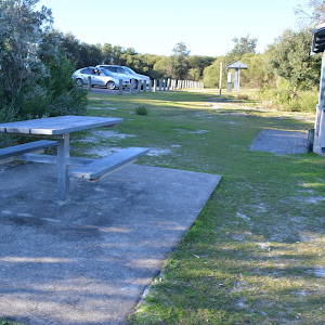
in a shelter[7] and a 4 picnic tables


, and tap water

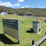
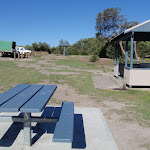
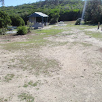
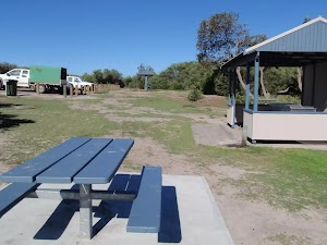
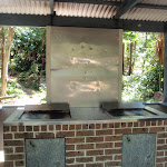
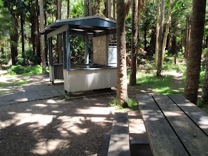
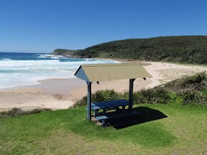
. An information sign[8] markes the start of a track, leading to a lookout and to Birdie Beach. The grass is usually short and the ground well packed, although gently sloping and uneven in places. There is limited shade, but the heath provides fair protection from the afternoon sea breeze. A quiet picnic area, great if visiting the beach. (There is a toilet a short drive away at the main Birdie Beach car park).
(0.01km) Tea Tree car park information sign → Bird Island Lookout
60 m
1 mins
0m
-3m
Very easy
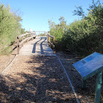
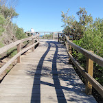
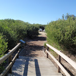
, this walk follows the firm gravel track directly away from the car park[10] (towards the ocean) for about 50m to pass the ‘Seabird Survival’ information sign[11] and find the start of the boardwalk. The walk continues along the timber boardwalk for just shy of 15m to find an intersection (with a boardwalk on the right) and the fenced, un-signposted lookout[12].
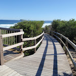
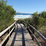
Bird Island Lookout
Maps for the Tea Tree Picnic Area to Bird Island Lookout walk
You can download the PDF for this walk to print a map.
These maps below cover the walk and the wider area around the walk, they are worth carrying for safety reasons.
| Catherine Hill Bay | 1:25 000 Map Series | 92314S CATHERINE HILL BAY | NSW-92314S |
| Lake Macquarie | 1:100 000 Map Series | 9231 LAKE MACQUARIE | 9231 |
Cross sectional view of the Tea Tree Picnic Area to Bird Island Lookout bushwalking track
Analysis and summary of the altitude variation on the Tea Tree Picnic Area to Bird Island Lookout
Accessibility summary information for the Tea Tree Picnic Area to Bird Island Lookout
Toilets: There are 0 designated accessible toilets on this walk.
Seats: There are 1 places to sit on this walk.
Hazards: There are 0 specific noteable accessability related hazards on this walk.
Accessibility Details


Overview of this walks grade – based on the AS 2156.1 – 2001
Under this standard, a walk is graded based on the most difficult section of the walk.
| Length | 136 m | ||
| Time | 3 mins | ||
| . | |||
| Grade 1/6 Very easy |
AS 2156.1 | Gradient | Flat, no steps (1/6) |
| Quality of track | Smooth and hardened path (1/6) | ||
| Signs | Clearly signposted (1/6) | ||
| Experience Required | No experience required (1/6) | ||
| Weather | Weather generally has little impact on safety (1/6) | ||
| Infrastructure | Generally useful facilities (such as fenced cliffs and seats) (1/6) |
Some more details of this walks Grading
Here is a bit more details explaining grading looking at sections of the walk
Gradient
This whole walk, 70m is flat with no steps.
Quality of track
This whole walk, 70m follows a smooth and hardened path.
Signs
This whole walk, 70m is clearly signposted.
Experience Required
This whole walk, 70m requires no previous bushwalking experience.
weather
This whole walk, 70m is not usually affected by severe weather events (that would unexpectedly impact safety and navigation).
Infrastructure
This whole walk, 70m is close to useful facilities (such as fenced cliffs and seats).
Similar walks
A list of walks that share part of the track with the Tea Tree Picnic Area to Bird Island Lookout walk.
444 m Return
10 mins
Easy track
Other Nearby walks
A list of walks that start near the Tea Tree Picnic Area to Bird Island Lookout walk.
1.2 km Return
25 mins
Easy track
3.3 km Return
1 hr 15 mins
Moderate track
4.2 km One way
1 hr 45 mins
Experienced only
2.4 km One way
1 Hr
Moderate track
3.3 km One way
1 hr 30 mins
Experienced only
804 m Return
20 mins
Moderate track
142 m Return
5 mins
Easy track
862 m One way
30 mins
Experienced only
609 m Circuit
20 mins
Moderate track
280 m Return
10 mins
Moderate track
630 m Return
15 mins
Experienced only
768 m Return
20 mins
Hard track
Plan your trip to and from the walk here
The Tea Tree Picnic Area to Bird Island Lookout walk starts and ends at the Tea Tree car park (gps: -33.20585, 151.60275)
Your main transport option to Tea Tree car park is by;
![]() Car. A park entry fee is required for driving into the park.
Car. A park entry fee is required for driving into the park.
(get details)
Short URL = http://wild.tl/ttpatbil
Gallery images
There are other downloads I am still working on.
You will probably need to login to access these — still all free.
* KML (google earth file)
* GPX (GPS file)
Special Maps/ brochures
* A3 topo maps
* PDF with Lands Topo map base
* PDF with arial image (and map overlay)
I wanted to get the main site live first, this extra stuff will come in time.
Happy walking
Matt 🙂
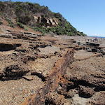
Snapper Point
And Walk
Snapper Point

10 mins
5 m
Moderate track
This short walk takes you from the great view of Snapper Point Sea Cave (at the end of Snapper Point Rd) along a management trail to Snapper Point. The area is very rocky and provides grand ocean views. The memorial on Snapper Point gives a good reminder to take care. There are views out over the ocean, and also south to Frazer Beach and north up the coast. An enjoyable short walk with great views, especially on sunny days.


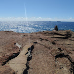


Snapper Point Cave Lookout
(0km) Snapper Point car park → Life Buoy Sign
110 m
2 mins
1m
-3m
Easy track
(0.11km) Life Buoy Sign → Snapper Point Memorial
30 m
1 mins
0m
-1m
Moderate track
Snapper Point Memorial
Maps for the Snapper Point walk
You can download the PDF for this walk to print a map.
These maps below cover the walk and the wider area around the walk, they are worth carrying for safety reasons.
| Catherine Hill Bay | 1:25 000 Map Series | 92314S CATHERINE HILL BAY | NSW-92314S |
| Lake Macquarie | 1:100 000 Map Series | 9231 LAKE MACQUARIE | 9231 |
Cross sectional view of the Snapper Point bushwalking track
Analysis and summary of the altitude variation on the Snapper Point
Overview of this walks grade – based on the AS 2156.1 – 2001
Under this standard, a walk is graded based on the most difficult section of the walk.
| Length | 280 m | ||
| Time | 10 mins | ||
| . | |||
| Grade 3/6 Moderate track |
AS 2156.1 | Gradient | Gentle hills with occasional steps (2/6) |
| Quality of track | Formed track, with some branches and other obstacles (3/6) | ||
| Signs | Directional signs along the way (3/6) | ||
| Experience Required | Some bushwalking experience recommended (3/6) | ||
| Weather | Storms may impact on navigation and safety (3/6) | ||
| Infrastructure | Generally useful facilities (such as fenced cliffs and seats) (1/6) |
Some more details of this walks Grading
Here is a bit more details explaining grading looking at sections of the walk
Gradient
Around 110m of this walk is flat with no steps, whilst the remaining 35m has gentle hills with occasional steps.
Quality of track
Around 110m of this walk follows a clear and well formed track or trail, whilst the remaining 35m follows a formed track, with some branches and other obstacles.
Signs
Around 110m of this walk is clearly signposted, whilst the remaining 35m has directional signs at most intersection.
Experience Required
Around 110m of this walk requires no previous bushwalking experience, whilst the remaining 35m requires some bushwalking experience.
weather
Around 110m of this walk is not usually affected by severe weather events (that would unexpectedly impact safety and navigation), whilst the remaining 35m is affected by storms that may impact your navigation and safety.
Infrastructure
This whole walk, 140m is close to useful facilities (such as fenced cliffs and seats).
Similar walks
A list of walks that share part of the track with the Snapper Point walk.
630 m Return
15 mins
Experienced only
4.2 km One way
1 hr 45 mins
Experienced only
Other Nearby walks
A list of walks that start near the Snapper Point walk.
609 m Circuit
20 mins
Moderate track
768 m Return
20 mins
Hard track
862 m One way
30 mins
Experienced only
142 m Return
5 mins
Easy track
804 m Return
20 mins
Moderate track
3.3 km Return
1 hr 15 mins
Moderate track
2.4 km One way
1 Hr
Moderate track
3.3 km One way
1 hr 30 mins
Experienced only
1.2 km Return
25 mins
Easy track
444 m Return
10 mins
Easy track
136 m Return
3 mins
Very easy
904 m Return
30 mins
Hard track
Plan your trip to and from the walk here
The Snapper Point walk starts and ends at the Snapper Point car park (gps: -33.18624, 151.62793)
Your main transport option to Snapper Point car park is by;
![]() Car. A park entry fee is required for driving into the park.
Car. A park entry fee is required for driving into the park.
(get details)
Short URL = http://wild.tl/2h
Gallery images
There are other downloads I am still working on.
You will probably need to login to access these — still all free.
* KML (google earth file)
* GPX (GPS file)
Special Maps/ brochures
* A3 topo maps
* PDF with Lands Topo map base
* PDF with arial image (and map overlay)
I wanted to get the main site live first, this extra stuff will come in time.
Happy walking
Matt 🙂
Tea Tree Picnic Area to Birdie Beach
And Walk
Tea Tree Picnic Area to Birdie Beach

10 mins
18 m
Easy track
Starting at Tea Tree Picnic Area, this short walk follows a beach access track to Birdie Beach. Along the way, the walk visits Bird Island Lookout, providing a great view of Bird Island, and up and down Birdie Beach. The walk continues down the timber path and steps, across the sand to the edge of the ocean. The beach is not patrolled, so swimming is not recommend, but it is a good place for fishing or enjoying a stroll along the sand.


(0km) Tea Tree car park → Tea Tree car park information sign
10 m
0m
0m
Very easy
(0.01km) Tea Tree car park information sign → Tea Tree Picnic area
30 m
0m
0m
Easy track
Tea Tree Picnic area
in a shelter[7] and a 4 picnic tables
, and tap water
. An information sign[8] markes the start of a track, leading to a lookout and to Birdie Beach. The grass is usually short and the ground well packed, although gently sloping and uneven in places. There is limited shade, but the heath provides fair protection from the afternoon sea breeze. A quiet picnic area, great if visiting the beach. (There is a toilet a short drive away at the main Birdie Beach car park).
(0.01km) Tea Tree car park information sign → Bird Island Lookout
60 m
1 mins
0m
-3m
Very easy
, this walk follows the firm gravel track directly away from the car park[10] (towards the ocean) for about 50m to pass the ‘Seabird Survival’ information sign[11] and find the start of the boardwalk. The walk continues along the timber boardwalk for just shy of 15m to find an intersection (with a boardwalk on the right) and the fenced, un-signposted lookout[12].
Bird Island Lookout
(0.07km) Bird Island Lookout → Birdie Beach (Tea Tree picnic area track)
150 m
3 mins
0m
-15m
Easy track
Birdie Beach
Maps for the Tea Tree Picnic Area to Birdie Beach walk
You can download the PDF for this walk to print a map.
These maps below cover the walk and the wider area around the walk, they are worth carrying for safety reasons.
| Catherine Hill Bay | 1:25 000 Map Series | 92314S CATHERINE HILL BAY | NSW-92314S |
| Lake Macquarie | 1:100 000 Map Series | 9231 LAKE MACQUARIE | 9231 |
Cross sectional view of the Tea Tree Picnic Area to Birdie Beach bushwalking track
Analysis and summary of the altitude variation on the Tea Tree Picnic Area to Birdie Beach
Overview of this walks grade – based on the AS 2156.1 – 2001
Under this standard, a walk is graded based on the most difficult section of the walk.
| Length | 444 m | ||
| Time | 10 mins | ||
| . | |||
| Grade 2/6 Easy track |
AS 2156.1 | Gradient | Gentle hills with occasional steps (2/6) |
| Quality of track | Clear and well formed track or trail (2/6) | ||
| Signs | Clearly signposted (1/6) | ||
| Experience Required | No experience required (1/6) | ||
| Weather | Weather generally has little impact on safety (1/6) | ||
| Infrastructure | Generally useful facilities (such as fenced cliffs and seats) (1/6) |
Some more details of this walks Grading
Here is a bit more details explaining grading looking at sections of the walk
Gradient
Around 150m of this walk has gentle hills with occasional steps, whilst the remaining 70m is flat with no steps.
Quality of track
Around 150m of this walk follows a clear and well formed track or trail, whilst the remaining 70m follows a smooth and hardened path.
Signs
This whole walk, 220m is clearly signposted.
Experience Required
This whole walk, 220m requires no previous bushwalking experience.
weather
This whole walk, 220m is not usually affected by severe weather events (that would unexpectedly impact safety and navigation).
Infrastructure
This whole walk, 220m is close to useful facilities (such as fenced cliffs and seats).
Similar walks
A list of walks that share part of the track with the Tea Tree Picnic Area to Birdie Beach walk.
136 m Return
3 mins
Very easy
Other Nearby walks
A list of walks that start near the Tea Tree Picnic Area to Birdie Beach walk.
1.2 km Return
25 mins
Easy track
3.3 km Return
1 hr 15 mins
Moderate track
4.2 km One way
1 hr 45 mins
Experienced only
2.4 km One way
1 Hr
Moderate track
3.3 km One way
1 hr 30 mins
Experienced only
804 m Return
20 mins
Moderate track
142 m Return
5 mins
Easy track
862 m One way
30 mins
Experienced only
609 m Circuit
20 mins
Moderate track
280 m Return
10 mins
Moderate track
630 m Return
15 mins
Experienced only
768 m Return
20 mins
Hard track
Plan your trip to and from the walk here
The Tea Tree Picnic Area to Birdie Beach walk starts and ends at the Tea Tree car park (gps: -33.20585, 151.60275)
Your main transport option to Tea Tree car park is by;
![]() Car. A park entry fee is required for driving into the park.
Car. A park entry fee is required for driving into the park.
(get details)
Short URL = http://wild.tl/ttpatbb
Gallery images
There are other downloads I am still working on.
You will probably need to login to access these — still all free.
* KML (google earth file)
* GPX (GPS file)
Special Maps/ brochures
* A3 topo maps
* PDF with Lands Topo map base
* PDF with arial image (and map overlay)
I wanted to get the main site live first, this extra stuff will come in time.
Happy walking
Matt 🙂
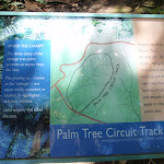
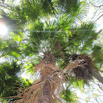
Palm Tree Circuit Track
And Walk
Palm Tree Circuit Track

20 mins
37 m
Moderate track
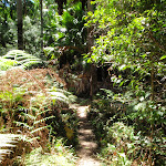
This circuit walk explores the valley of palm trees and the dry woodland on the ridge. Starting from the back of the Palms Picnic Area, this walk follows an arrow through a palm forest then across a small creek and up a hill. At the top of the hill is an information sign, where the walk turns left and heads down the ridge, passing more palms before heading back to the picnic area. A great walk before lunch at the picnic area.


The Palms Picnic Area
(0km) The Palms Picnic Area → Opening Up intersection
310 m
8 mins
33m
0m
Moderate track
(0.31km) Opening Up intersection → The Palms Picnic Area
300 m
7 mins
4m
-38m
Moderate track
Maps for the Palm Tree Circuit Track walk
You can download the PDF for this walk to print a map.
These maps below cover the walk and the wider area around the walk, they are worth carrying for safety reasons.
| Catherine Hill Bay | 1:25 000 Map Series | 92314S CATHERINE HILL BAY | NSW-92314S |
| Lake Macquarie | 1:100 000 Map Series | 9231 LAKE MACQUARIE | 9231 |
Cross sectional view of the Palm Tree Circuit Track bushwalking track
Analysis and summary of the altitude variation on the Palm Tree Circuit Track
Overview of this walks grade – based on the AS 2156.1 – 2001
Under this standard, a walk is graded based on the most difficult section of the walk.
| Length | 609 m | ||
| Time | 20 mins | ||
| . | |||
| Grade 3/6 Moderate track |
AS 2156.1 | Gradient | Short steep hills (3/6) |
| Quality of track | Formed track, with some branches and other obstacles (3/6) | ||
| Signs | Clearly signposted (1/6) | ||
| Experience Required | No experience required (1/6) | ||
| Weather | Weather generally has little impact on safety (1/6) | ||
| Infrastructure | Generally useful facilities (such as fenced cliffs and seats) (1/6) |
Some more details of this walks Grading
Here is a bit more details explaining grading looking at sections of the walk
Gradient
This whole walk, 610m has short steep hills.
Quality of track
This whole walk, 610m follows a formed track, with some branches and other obstacles.
Signs
This whole walk, 610m is clearly signposted.
Experience Required
This whole walk, 610m requires no previous bushwalking experience.
weather
This whole walk, 610m is not usually affected by severe weather events (that would unexpectedly impact safety and navigation).
Infrastructure
This whole walk, 610m is close to useful facilities (such as fenced cliffs and seats).
Similar walks
A list of walks that share part of the track with the Palm Tree Circuit Track walk.
Other Nearby walks
A list of walks that start near the Palm Tree Circuit Track walk.
280 m Return
10 mins
Moderate track
630 m Return
15 mins
Experienced only
768 m Return
20 mins
Hard track
862 m One way
30 mins
Experienced only
142 m Return
5 mins
Easy track
804 m Return
20 mins
Moderate track
3.3 km Return
1 hr 15 mins
Moderate track
4.2 km One way
1 hr 45 mins
Experienced only
2.4 km One way
1 Hr
Moderate track
3.3 km One way
1 hr 30 mins
Experienced only
1.2 km Return
25 mins
Easy track
444 m Return
10 mins
Easy track
Plan your trip to and from the walk here
The Palm Tree Circuit Track walk starts and ends at the The Palms Picnic Area (gps: -33.184725, 151.61718)
Your main transport option to The Palms Picnic Area is by;
![]() Car. A park entry fee is required for driving into the park.
Car. A park entry fee is required for driving into the park.
(get details)
Short URL = http://wild.tl/ptct
Gallery images
There are other downloads I am still working on.
You will probably need to login to access these — still all free.
* KML (google earth file)
* GPX (GPS file)
Special Maps/ brochures
* A3 topo maps
* PDF with Lands Topo map base
* PDF with arial image (and map overlay)
I wanted to get the main site live first, this extra stuff will come in time.
Happy walking
Matt 🙂
Snapper Point Beach
And Walk
Snapper Point Beach

15 mins
24 m
Experienced only
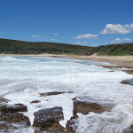
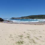
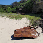
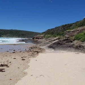
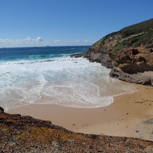
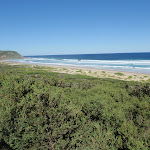
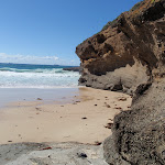
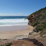
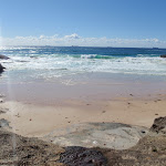
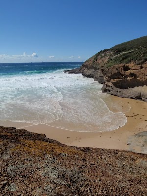
Snapper Point Beach is an informal name for the small beach between Frazer Beach and Snapper Point. This walk starts from the great views of the sea cave and leads out to Snapper Point. Here, the walk turns right and follows the shore to the lifebuoy, then across the rocks to the secluded beach. The high grade on this walk is due to the risk associated with walking on the rock ledge, please take care. The notes mention an alternate route that can be used as a shortcut back to the car park.* This walk passes through very remote areas and sections have no visible track. At least one person in your group should have training and experience in off track walking and navigation. Even with these notes and a GPS these extra skills and equipment are required.


Snapper Point Cave Lookout
(0km) Snapper Point car park → Life Buoy Sign
110 m
2 mins
1m
-3m
Easy track
(0.11km) Life Buoy Sign → Snapper Point Memorial
30 m
1 mins
0m
-1m
Moderate track
Snapper Point Memorial
(0.11km) Life Buoy Sign → Snapper Point Beach Buoy
100 m
2 mins
1m
-13m
Moderate track
(0.21km) Snapper Point Beach Buoy → Snapper Point car park
120 m
3 mins
14m
0m
Moderate track
(0.21km) Snapper Point Beach Buoy → Snapper Point Beach
110 m
2 mins
4m
-2m
Experienced only
Snapper Point Beach
Maps for the Snapper Point Beach walk
You can download the PDF for this walk to print a map.
These maps below cover the walk and the wider area around the walk, they are worth carrying for safety reasons.
| Catherine Hill Bay | 1:25 000 Map Series | 92314S CATHERINE HILL BAY | NSW-92314S |
| Lake Macquarie | 1:100 000 Map Series | 9231 LAKE MACQUARIE | 9231 |
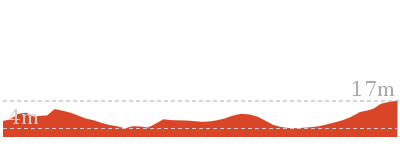
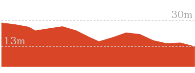
Cross sectional view of the Snapper Point Beach bushwalking track
Analysis and summary of the altitude variation on the Snapper Point Beach
Overview of this walks grade – based on the AS 2156.1 – 2001
Under this standard, a walk is graded based on the most difficult section of the walk.
| Length | 630 m | ||
| Time | 15 mins | ||
| . | |||
| Grade 5/6 Experienced only |
AS 2156.1 | Gradient | Short steep hills (3/6) |
| Quality of track | Rough unclear track (5/6) | ||
| Signs | No directional signs (5/6) | ||
| Experience Required | High level of bushwalking experience recommended (5/6) | ||
| Weather | Forecast, unforecast storms and severe weather likely to have an impact on your navigation and safety (5/6) | ||
| Infrastructure | Limited facilities, not all cliffs are fenced (3/6) |
Some more details of this walks Grading
Here is a bit more details explaining grading looking at sections of the walk
Gradient
110m of this walk is flat with no steps and another 110m has short steep hills. The remaining (100m) has gentle hills with occasional steps.
Quality of track
110m of this walk follows a clear and well formed track or trail and another 110m follows a rough unclear track. The remaining (100m) follows a formed track, with some branches and other obstacles.
Signs
110m of this walk is clearly signposted and another 110m Has no directional signs. The remaining (100m) has directional signs at most intersection.
Experience Required
110m of this walk requires no previous bushwalking experience and another 110m requires a leader with a high level of bushwalking experience. The remaining (100m) requires some bushwalking experience.
weather
110m of this walk is not usually affected by severe weather events (that would unexpectedly impact safety and navigation) and another 110m forecast, unforecast storms and severe weather likely to have an impact on your navigation and safety. The remaining (100m) is affected by storms that may impact your navigation and safety.
Infrastructure
Around 210m of this walk is close to useful facilities (such as fenced cliffs and seats), whilst the remaining 110m has limited facilities (such as not all cliffs fenced).
Similar walks
A list of walks that share part of the track with the Snapper Point Beach walk.
280 m Return
10 mins
Moderate track
4.2 km One way
1 hr 45 mins
Experienced only
Other Nearby walks
A list of walks that start near the Snapper Point Beach walk.
609 m Circuit
20 mins
Moderate track
768 m Return
20 mins
Hard track
862 m One way
30 mins
Experienced only
142 m Return
5 mins
Easy track
804 m Return
20 mins
Moderate track
3.3 km Return
1 hr 15 mins
Moderate track
2.4 km One way
1 Hr
Moderate track
3.3 km One way
1 hr 30 mins
Experienced only
1.2 km Return
25 mins
Easy track
444 m Return
10 mins
Easy track
136 m Return
3 mins
Very easy
904 m Return
30 mins
Hard track
Plan your trip to and from the walk here
The Snapper Point Beach walk starts and ends at the Snapper Point car park (gps: -33.18624, 151.62793)
Your main transport option to Snapper Point car park is by;
![]() Car. A park entry fee is required for driving into the park.
Car. A park entry fee is required for driving into the park.
(get details)
Short URL = http://wild.tl/spb
Gallery images
There are other downloads I am still working on.
You will probably need to login to access these — still all free.
* KML (google earth file)
* GPX (GPS file)
Special Maps/ brochures
* A3 topo maps
* PDF with Lands Topo map base
* PDF with arial image (and map overlay)
I wanted to get the main site live first, this extra stuff will come in time.
Happy walking
Matt 🙂
Timber Beach
And Walk
Timber Beach

20 mins
67 m
Hard track
Timber Beach is a secluded beach in Munmorah State Conservation Area. The walk starts from a short side road off Snapper Point Rd, at Timber Beach Lookout. From here, the walk follows an eroded track down the ridge, then bends left to cross a clearing and come to the back of Timber Beach. The beach is surrounded by rock walls and is quite small, especially at high tide. A lovely quiet spot to visit.


Timber Beach Lookout
(0km) Timber Beach Lookout → Timber Beach
380 m
9 mins
0m
-67m
Hard track
Timber Beach
Maps for the Timber Beach walk
You can download the PDF for this walk to print a map.
These maps below cover the walk and the wider area around the walk, they are worth carrying for safety reasons.
| Catherine Hill Bay | 1:25 000 Map Series | 92314S CATHERINE HILL BAY | NSW-92314S |
| Lake Macquarie | 1:100 000 Map Series | 9231 LAKE MACQUARIE | 9231 |
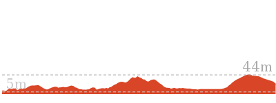
Cross sectional view of the Timber Beach bushwalking track
Analysis and summary of the altitude variation on the Timber Beach
Overview of this walks grade – based on the AS 2156.1 – 2001
Under this standard, a walk is graded based on the most difficult section of the walk.
| Length | 768 m | ||
| Time | 20 mins | ||
| . | |||
| Grade 4/6 Hard track |
AS 2156.1 | Gradient | Very steep (4/6) |
| Quality of track | Rough track, where fallen trees and other obstacles are likely (4/6) | ||
| Signs | Minimal directional signs (4/6) | ||
| Experience Required | Moderate level of bushwalking experience recommended (4/6) | ||
| Weather | Storms may impact on navigation and safety (3/6) | ||
| Infrastructure | Limited facilities, not all cliffs are fenced (3/6) |
Some more details of this walks Grading
Here is a bit more details explaining grading looking at sections of the walk
Gradient
This whole walk, 380m is very steep.
Quality of track
This whole walk, 380m follows a rough track, where fallen trees and other obstacles are likely.
Signs
This whole walk, 380m has minimal directional signs.
Experience Required
This whole walk, 380m requires a leader a with moderate level of bushwalking experience.
weather
This whole walk, 380m is affected by storms that may impact your navigation and safety.
Infrastructure
This whole walk, 380m has limited facilities (such as not all cliffs fenced).
Similar walks
A list of walks that share part of the track with the Timber Beach walk.
Other Nearby walks
A list of walks that start near the Timber Beach walk.
280 m Return
10 mins
Moderate track
630 m Return
15 mins
Experienced only
609 m Circuit
20 mins
Moderate track
862 m One way
30 mins
Experienced only
142 m Return
5 mins
Easy track
804 m Return
20 mins
Moderate track
3.3 km Return
1 hr 15 mins
Moderate track
4.2 km One way
1 hr 45 mins
Experienced only
2.4 km One way
1 Hr
Moderate track
3.3 km One way
1 hr 30 mins
Experienced only
1.2 km Return
25 mins
Easy track
444 m Return
10 mins
Easy track
Plan your trip to and from the walk here
The Timber Beach walk starts and ends at the Timber Beach Lookout (gps: -33.180641, 151.62515)
Your main transport option to Timber Beach Lookout is by;
![]() Car. A park entry fee is required for driving into the park.
Car. A park entry fee is required for driving into the park.
(get details)
Short URL = http://wild.tl/tb
Gallery images
There are other downloads I am still working on.
You will probably need to login to access these — still all free.
* KML (google earth file)
* GPX (GPS file)
Special Maps/ brochures
* A3 topo maps
* PDF with Lands Topo map base
* PDF with arial image (and map overlay)
I wanted to get the main site live first, this extra stuff will come in time.
Happy walking
Matt 🙂
Wybung Head
And Walk
Wybung Head

20 mins
49 m
Moderate track
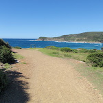
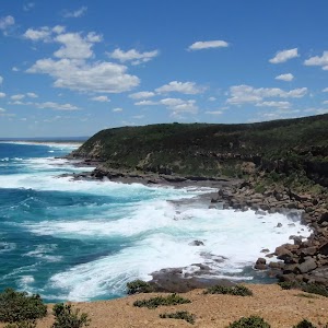
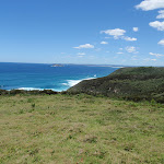
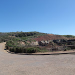
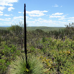
Wybung Head is found at the end of Wybung Head Rd. This walk leads from the car park along a wide trail to the grand views up and down the coast from the end of the headland. A narrow track finishes the walk to the tip of Wybung Head, where there are 270-degree views of the ocean, up and down the coast. There are many large and crumbly cliffs here, please take care. A great spot for whale watching or just enjoying the turbulent ocean views.


(0km) Wybung Head car park → Whale watching area
70 m
2 mins
0m
-9m
Easy track
Wybung Whale Watching Area
(0km) Wybung Head car park → Wybung Head clearing
280 m
6 mins
0m
-37m
Moderate track
(0.28km) Wybung Head clearing → Tip of Wybung Head
130 m
2 mins
1m
-11m
Moderate track
Wybung Head
Maps for the Wybung Head walk
You can download the PDF for this walk to print a map.
These maps below cover the walk and the wider area around the walk, they are worth carrying for safety reasons.
| Catherine Hill Bay | 1:25 000 Map Series | 92314S CATHERINE HILL BAY | NSW-92314S |
| Lake Macquarie | 1:100 000 Map Series | 9231 LAKE MACQUARIE | 9231 |
Cross sectional view of the Wybung Head bushwalking track
Analysis and summary of the altitude variation on the Wybung Head

Overview of this walks grade – based on the AS 2156.1 – 2001
Under this standard, a walk is graded based on the most difficult section of the walk.
| Length | 804 m | ||
| Time | 20 mins | ||
| . | |||
| Grade 3/6 Moderate track |
AS 2156.1 | Gradient | Gentle hills with occasional steps (2/6) |
| Quality of track | Formed track, with some branches and other obstacles (3/6) | ||
| Signs | Directional signs along the way (3/6) | ||
| Experience Required | Some bushwalking experience recommended (3/6) | ||
| Weather | Storms may impact on navigation and safety (3/6) | ||
| Infrastructure | Limited facilities, not all cliffs are fenced (3/6) |
Some more details of this walks Grading
Here is a bit more details explaining grading looking at sections of the walk
Gradient
This whole walk, 400m has gentle hills with occasional steps.
Quality of track
Around 280m of this walk follows a clear and well formed track or trail, whilst the remaining 130m follows a formed track, with some branches and other obstacles.
Signs
Around 280m of this walk is clearly signposted, whilst the remaining 130m has directional signs at most intersection.
Experience Required
This whole walk, 400m requires some bushwalking experience.
weather
Around 280m of this walk is not usually affected by severe weather events (that would unexpectedly impact safety and navigation), whilst the remaining 130m is affected by storms that may impact your navigation and safety.
Infrastructure
Around 280m of this walk is close to useful facilities (such as fenced cliffs and seats), whilst the remaining 130m has limited facilities (such as not all cliffs fenced).
Similar walks
A list of walks that share part of the track with the Wybung Head walk.
142 m Return
5 mins
Easy track
3.3 km One way
1 hr 30 mins
Experienced only
4.2 km One way
1 hr 45 mins
Experienced only
Other Nearby walks
A list of walks that start near the Wybung Head walk.
862 m One way
30 mins
Experienced only
3.3 km Return
1 hr 15 mins
Moderate track
2.4 km One way
1 Hr
Moderate track
280 m Return
10 mins
Moderate track
630 m Return
15 mins
Experienced only
609 m Circuit
20 mins
Moderate track
1.2 km Return
25 mins
Easy track
768 m Return
20 mins
Hard track
444 m Return
10 mins
Easy track
136 m Return
3 mins
Very easy
904 m Return
30 mins
Hard track
8.3 km Return
3 hrs
Hard track
Plan your trip to and from the walk here
The Wybung Head walk starts and ends at the Wybung Head car park (gps: -33.196223, 151.62127)
Your main transport option to Wybung Head car park is by;
![]() Car. A park entry fee is required for driving into the park.
Car. A park entry fee is required for driving into the park.
(get details)
Short URL = http://wild.tl/wh
Gallery images
There are other downloads I am still working on.
You will probably need to login to access these — still all free.
* KML (google earth file)
* GPX (GPS file)
Special Maps/ brochures
* A3 topo maps
* PDF with Lands Topo map base
* PDF with arial image (and map overlay)
I wanted to get the main site live first, this extra stuff will come in time.
Happy walking
Matt 🙂
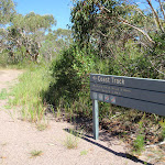
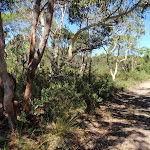
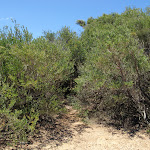
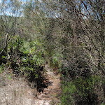
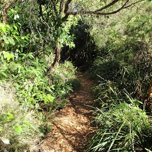
Grass Tree Track
And Walk
Grass Tree Track

30 mins
4 m
Experienced only
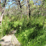
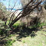
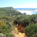
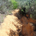
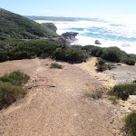
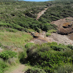
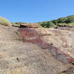
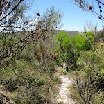
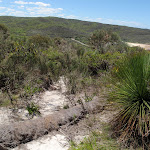
The Grass Tree Track links Wybung Head Rd with Frazer Beach via a ridge-top track. At the time of writing, this track was very overgrown (hence the high grade) and the trackhead difficult to find. Once on course, much of the track is clearer and quiet eroded in places. It is an interesting walk to see some diverse vegetation,noticing how it changes with altitude. At the bottom of the hill, the track emerges onto Frazer Beach before heading to the picnic area at the end of Frazer Rd.* This walk passes through very remote areas and sections have no visible track. At least one person in your group should have training and experience in off track walking and navigation. Even with these notes and a GPS these extra skills and equipment are required.

(0km) Upper end of Grass Tree Track → Bongon Lagoon
740 m
16 mins
1m
-89m
Experienced only
Frazer Beach
(0.74km) Bongon Lagoon → Frazer Beach Picnic Area
130 m
2 mins
3m
0m
Unknow grade
Frazer Beach Picnic Area
Maps for the Grass Tree Track walk
You can download the PDF for this walk to print a map.
These maps below cover the walk and the wider area around the walk, they are worth carrying for safety reasons.
| Catherine Hill Bay | 1:25 000 Map Series | 92314S CATHERINE HILL BAY | NSW-92314S |
| Lake Macquarie | 1:100 000 Map Series | 9231 LAKE MACQUARIE | 9231 |
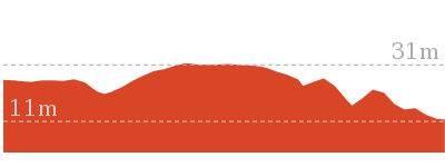
Cross sectional view of the Grass Tree Track bushwalking track
Analysis and summary of the altitude variation on the Grass Tree Track
Overview of this walks grade – based on the AS 2156.1 – 2001
Under this standard, a walk is graded based on the most difficult section of the walk.
| Length | 862 m | ||
| Time | 30 mins | ||
| . | |||
| Grade 5/6 Experienced only |
AS 2156.1 | Gradient | Short steep hills (3/6) |
| Quality of track | Rough unclear track (5/6) | ||
| Signs | No directional signs (5/6) | ||
| Experience Required | Moderate level of bushwalking experience recommended (4/6) | ||
| Weather | Storms may impact on navigation and safety (3/6) | ||
| Infrastructure | Limited facilities, not all cliffs are fenced (3/6) |
Some more details of this walks Grading
Here is a bit more details explaining grading looking at sections of the walk
Gradient
Around 740m of this walk has short steep hills, whilst the remaining 130m has gentle hills with occasional steps.
Quality of track
Around 740m of this walk follows a rough unclear track, whilst the remaining 130m follows a clear and well formed track or trail.
Signs
Around 740m of this walk Has no directional signs, whilst the remaining 130m is clearly signposted.
Experience Required
Around 740m of this walk requires a leader a with moderate level of bushwalking experience, whilst the remaining 130m requires no previous bushwalking experience.
weather
This whole walk, 740m is affected by storms that may impact your navigation and safety.
Infrastructure
Around 740m of this walk has limited facilities (such as not all cliffs fenced), whilst the remaining 130m is close to useful facilities (such as fenced cliffs and seats).
Similar walks
A list of walks that share part of the track with the Grass Tree Track walk.
3.3 km One way
1 hr 30 mins
Experienced only
4.2 km One way
1 hr 45 mins
Experienced only
Other Nearby walks
A list of walks that start near the Grass Tree Track walk.
142 m Return
5 mins
Easy track
804 m Return
20 mins
Moderate track
609 m Circuit
20 mins
Moderate track
3.3 km Return
1 hr 15 mins
Moderate track
2.4 km One way
1 Hr
Moderate track
280 m Return
10 mins
Moderate track
630 m Return
15 mins
Experienced only
1.2 km Return
25 mins
Easy track
768 m Return
20 mins
Hard track
444 m Return
10 mins
Easy track
136 m Return
3 mins
Very easy
904 m Return
30 mins
Hard track
Plan your trip to and from the walk here
The Grass Tree Track walk starts at the Upper end of Grass Tree Track (gps: -33.193935, 151.61836)
Your main transport option to Upper end of Grass Tree Track is by;
![]() Car. A park entry fee is required for driving into the park.
Car. A park entry fee is required for driving into the park.
(get details)
The Grass Tree Track ends at the Frazer Beach Picnic Area (gps: -33.187821, 151.62196)
Your main transport option to Frazer Beach Picnic Area is by;
![]() Car. A park entry fee is required for driving into the park.
Car. A park entry fee is required for driving into the park.
(get details)
Short URL = http://wild.tl/gtt
Gallery images
There are other downloads I am still working on.
You will probably need to login to access these — still all free.
* KML (google earth file)
* GPX (GPS file)
Special Maps/ brochures
* A3 topo maps
* PDF with Lands Topo map base
* PDF with arial image (and map overlay)
I wanted to get the main site live first, this extra stuff will come in time.
Happy walking
Matt 🙂
Comments