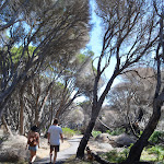
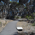
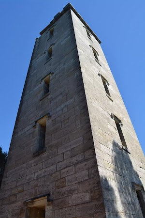
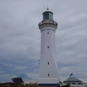
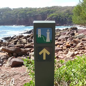
Boyd Tower


15 mins

15 m
Very easy


(0km) Ben Boyd car park → Boyd Tower Intersection

280 m
5 mins
0m
-15m
Very easy


(0.28km) Int. Boyds Tower and Lookout Trks → Red Point Lookout
40 m
1 mins
1m
-5m
Moderate track
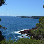
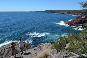
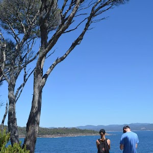
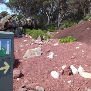
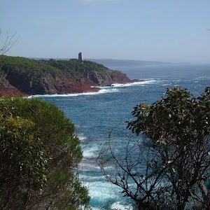
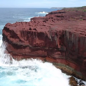
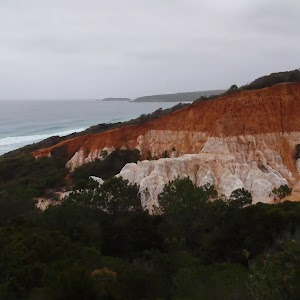
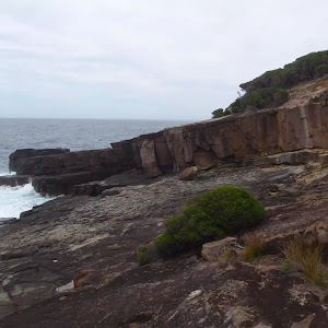
Red Point Lookout
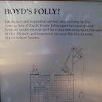
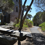
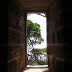
Boyds Tower
(0.29km) Boyds Tower → Twofold Bay lookout
90 m
2 mins
0m
-10m
Very easy

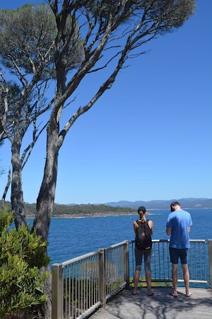
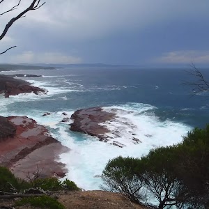
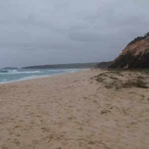
Twofold Bay Lookout
Maps for the Boyd Tower walk
You can download the PDF for this walk to print a map.These maps below cover the walk and the wider area around the walk, they are worth carrying for safety reasons.
| Eden | 1:25 000 Map Series | 88231N EDEN | NSW-88231N |
| Eden | 1:100 000 Map Series | 8823 EDEN | 8823 |
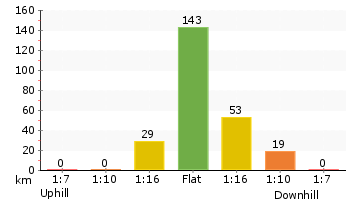
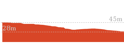
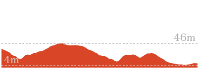
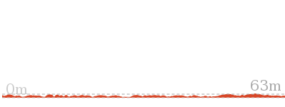
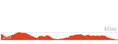
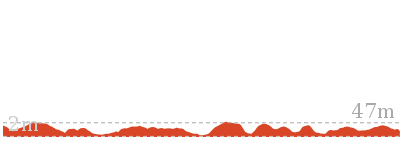
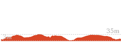
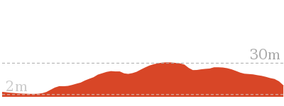
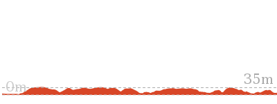
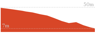
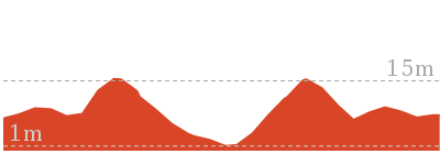
Cross sectional view of the Boyd Tower bushwalking track

Analysis and summary of the altitude variation on the Boyd Tower
Accessibility summary information for the Boyd Tower
Toilets: There are 0 designated accessible toilets on this walk.
Seats: There are 2 places to sit on this walk. They are 230m apart.
Hazards: There are 1 specific noteable accessability related hazards on this walk.
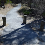
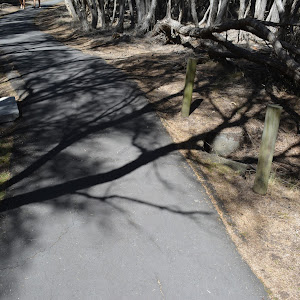
Trip Hazard Culvert under path with exposed drainage ditch on the very edge of path. A drop of about 25cm. Marked with timber bollards, there are a series of 4 more similar drainage ditches about every 40m. Found about 90m into the walk.
Accessibility Details


Overview of this walks grade – based on the AS 2156.1 – 2001
Under this standard, a walk is graded based on the most difficult section of the walk.
| Length | 582 m | ||
| Time | 15 mins | ||
| . | |||
| Grade 1/6 Very easy |
AS 2156.1 | Gradient | Flat, no steps (1/6) |
| Quality of track | Smooth and hardened path (1/6) | ||
| Signs | Clearly signposted (1/6) | ||
| Experience Required | No experience required (1/6) | ||
| Weather | Weather generally has little impact on safety (1/6) | ||
| Infrastructure | Generally useful facilities (such as fenced cliffs and seats) (1/6) |
Some more details of this walks Grading
Here is a bit more details explaining grading looking at sections of the walk
Gradient
This whole walk, 290m is flat with no steps.
Quality of track
This whole walk, 290m follows a smooth and hardened path.
Signs
This whole walk, 290m is clearly signposted.
Experience Required
This whole walk, 290m requires no previous bushwalking experience.
weather
This whole walk, 290m is not usually affected by severe weather events (that would unexpectedly impact safety and navigation).
Infrastructure
This whole walk, 290m is close to useful facilities (such as fenced cliffs and seats).
Similar walks
764 m Return
20 mins
Very easy
4.9 km Return
2 hrs
Hard track
13.4 km One way
5 hrs
Hard track
30.9 km One way
2 Days
Hard track
30.9 km One way
3 Days
Hard track

Other Nearby walks
9.3 km Return
3 hrs 30 mins
Hard track
18.3 km Return
7 hrs
Hard track
8.8 km Return
3 hrs 30 mins
Hard track
3.3 km Return
1 hr 30 mins
Moderate track
8.5 km Return
3 hrs
Hard track

9.1 km One way
3 hrs 30 mins
Hard track

9.8 km Return
3 hrs 30 mins
Hard track
8.5 km Return
3 hrs
Hard track
702 m Return
20 mins
Hard track
1.1 km Circuit
30 mins
Moderate track

715 m Circuit
20 mins
Hard track
5.3 km One way
2 hrs
Hard track
Plan your trip to and from the walk here
The Boyd Tower walk starts and ends at the Ben Boyd car park (gps: -37.104516, 149.95119)Your main transport option to Ben Boyd car park is by;
(get details)


Short URL = http://wild.tl/1v
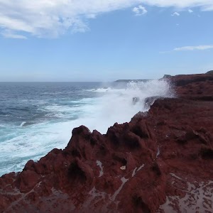
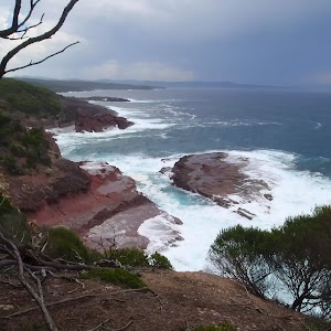
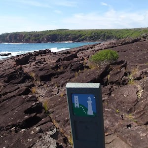
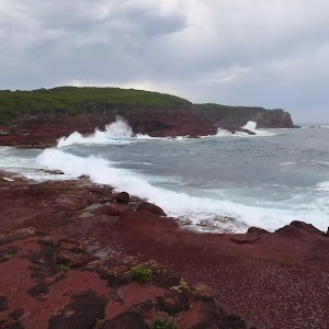
Gallery images
There are other downloads I am still working on.
You will probably need to login to access these — still all free.
* KML (google earth file)
* GPX (GPS file)
Special Maps/ brochures
* A3 topo maps
* PDF with Lands Topo map base
* PDF with arial image (and map overlay)
I wanted to get the main site live first, this extra stuff will come in time.
Happy walking
Matt 🙂
Comments