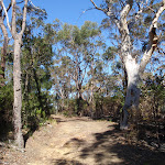
Cherrybrook to Refuge Rock


1 hr 45 mins

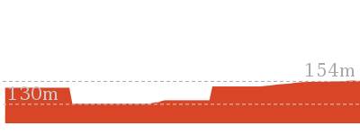
147 m
Moderate track


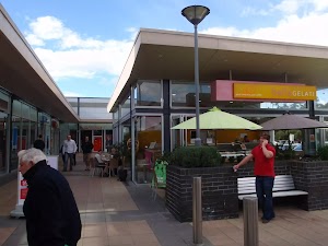
Cherrybrook Village shopping centre
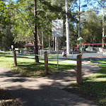
(0km) Top of The Lakes Of Cherrybrook park → Lakes trackhead

50 m
1 mins
0m
-4m
Very easy
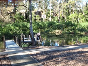
The Lakes Of Cherrybrook
(0.05km) Lakes trackhead → Int at stone wall
120 m
2 mins
1m
-4m
Very easy
(0.17km) Int at stone wall → Int. of Blackwattle Trail and Callicoma Walk
180 m
3 mins
4m
-7m
Moderate track
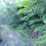
Veer right: From the clearing, the walk follows the bush track, initially keeping the Girl Guides hall on the left. The track passes a shortcut track on the right before coming to a ‘T’ intersection with a management trail marked with track arrows.
(0.35km) Int. of Blackwattle Trail and Callicoma Walk → Opposite 21 Daphne Place
1.5 km
31 mins
58m
-46m
Moderate track
Continue straight: From the intersection at the top of the steps, the walk follows the management trail, keeping the houses to the left, and soon comes to the intersection just before the gate at the end of Blackwattle Place.
Continue straight: From the intersection behind the gate at the end of Blackwattle Place, the walk follows the management trail steeply downhill to cross the concrete causeway. The track then meanders along before coming to the intersection with another management trail (which goes steeply down the hill on the right).
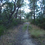
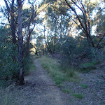
Continue straight: From the intersection, the walk follows the management trail, keeping the creek on the right, and soon bends to the right. The walk gently meanders along the management trail above the forested creek on the right, with only occasional glimpses of the houses up to the left. On a curve to the left, the walk comes to an intersection with another management trail (initially overgrown) going up the hill on the left, and a faint bush track going gently down the hill to the right.
Continue straight: From the intersection, the walk follows the management trail along the flat section, initially keeping the steep uphill management trail to the left, and soon crosses a concrete causeway. The walk meanders for a while before passing a gate and coming out opposite 21 Daphne Place.
(1.89km) Opposite 21 Daphne Place → End of Daphne Place
70 m
2 mins
5m
0m
Very easy
(1.97km) End of Daphne Place → Opposite 5 Patricia Place
520 m
12 mins
35m
-15m
Moderate track
(2.48km) Opposite 5 Patricia Place → Beside 6 Patricia Pl
110 m
2 mins
4m
-2m
Moderate track
(2.59km) Beside 6 Patricia Pl → Refuge Rock
810 m
16 mins
16m
-27m
Moderate track
Turn right: From the intersection, the walk follows the management trail, directly away from the houses. After a short distance, the trail reaches an intersection with another management trail, signposted ’92A/92B …’.
Veer left: From the intersection, the walk follows the ‘ST22/23’ arrow, going gently up the hill, along the management trail. After a very short distance, the trail passes under some high voltage powerlines and immediately reaches an intersection with a bush track, to the right, and management trail, to the left.
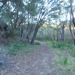
Continue straight: From the intersection, the walk follows the management trail away from the high voltage powerlines, leaving the visible tower to the left. The trail descends gently, through pleasant forest (ignoring an unmarked bush track to the right) and reaches an intersection with another management trail, signposted ’92A 92B/16′.
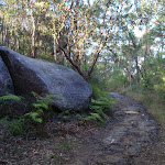
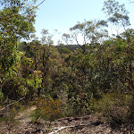
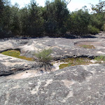
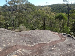
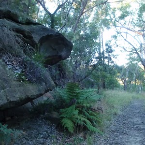
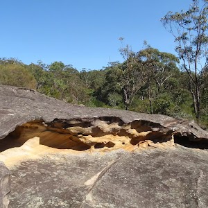
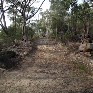
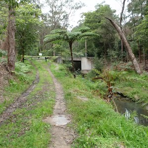
Veer right: From the intersection, the walk follows the level management trail, leaving the ’92A 92B/16′ signpost behind on the left. After a short distance, the trail passes a clearing, to the left, and descends for a while before arriving at a large, flat rock outcrop, the western edge of ‘Refuge Rock’.
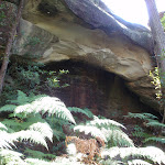
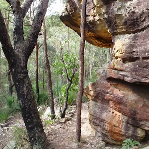
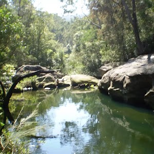
Refuge Rock
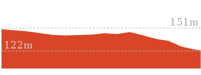
(3.4km) Refuge Rock → Natural Arch
300 m
6 mins
4m
-21m
Hard track
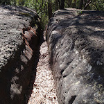
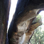
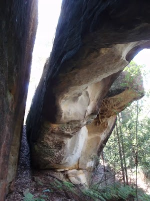
Veer left: From the intersection, the walk drops into the first of two very prominent slots in the rock platform to the north-east (beside a banksia tree). The walk follows this slot to the edge of the rock platform then bends around to the right to enter the next slot (closer to the cliff line). The walk drops through this very narrow slot to emerge at the base of the very cool natural arch. At the end of this side trip, retrace your steps back to the main walk then Turn left.
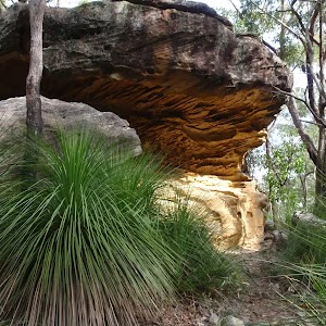
Natural Arch
(3.4km) Refuge Rock → End of Trevors Ln
690 m
13 mins
24m
-14m
Moderate track
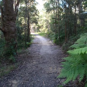
Veer left: From the intersection, the walk follows the management trail up the hill and immediately bends to the right. The trail climbs gently for a while (ignore the bush track to the left), through pleasant forest, and flattens out before reaching an intersection with a bush track, to the left, and management trail, to the right, immediately before the high voltage powerlines.
Continue straight: From the intersection, the walk follows the management trail, immediately passing under the high voltage powerlines, leaving the visible tower to the right. After a short distance, the trail reaches an intersection with another management trail, signposted ’92A/92B …’.
Veer right: From the intersection, the walk follows the (unsignposted) management trail down the hill and immediately bends to the left. After a short distance, the trail arrives at an intersection with another management trail, at the back of a row of houses.
Turn right: From the intersection, the walk follows the management trail, keeping the houses to the left. The walk almost immediately, passes around a gate and then arrives at the end of Trevors Ln, Cherrybrook.
Maps for the Cherrybrook to Refuge Rock walk
You can download the PDF for this walk to print a map.These maps below cover the walk and the wider area around the walk, they are worth carrying for safety reasons.
| Hornsby | 1:25 000 Map Series | 91304S HORNSBY | NSW-91304S |
| Sydney | 1:100 000 Map Series | 9130 SYDNEY | 9130 |
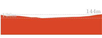
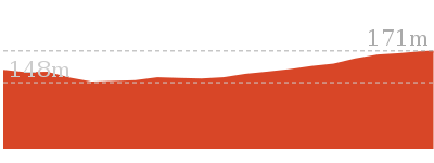
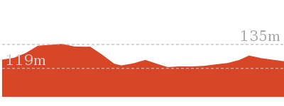
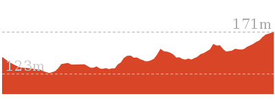
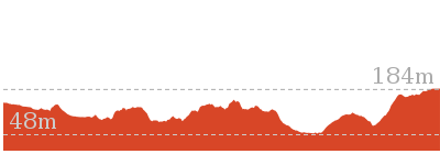
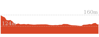
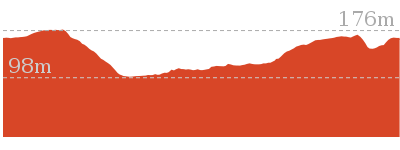
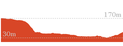
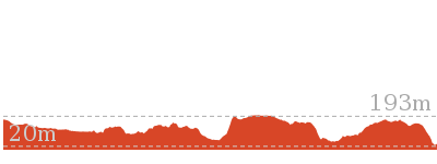
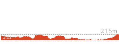
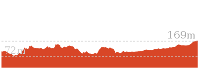
Cross sectional view of the Cherrybrook to Refuge Rock bushwalking track
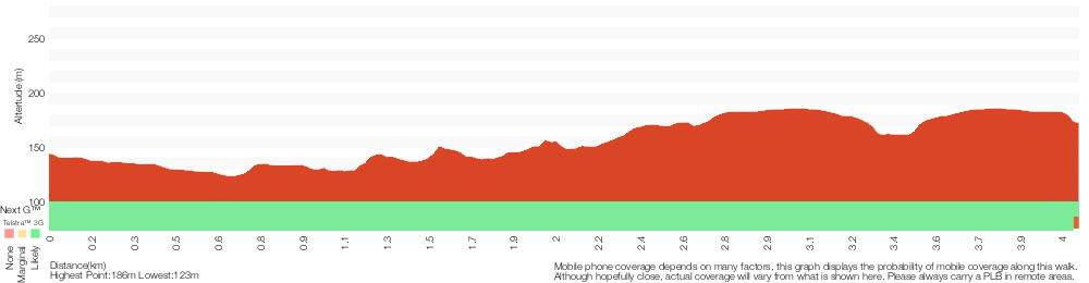
Analysis and summary of the altitude variation on the Cherrybrook to Refuge Rock
Overview of this walks grade – based on the AS 2156.1 – 2001
Under this standard, a walk is graded based on the most difficult section of the walk.
| Length | 4.1 km | ||
| Time | 1 hr 45 mins | ||
| . | |||
| Grade 3/6 Moderate track |
AS 2156.1 | Gradient | Short steep hills (3/6) |
| Quality of track | Clear and well formed track or trail (2/6) | ||
| Signs | Directional signs along the way (3/6) | ||
| Experience Required | Some bushwalking experience recommended (3/6) | ||
| Weather | Storms may impact on navigation and safety (3/6) | ||
| Infrastructure | Limited facilities, not all cliffs are fenced (3/6) |
Some more details of this walks Grading
Here is a bit more details explaining grading looking at sections of the walk
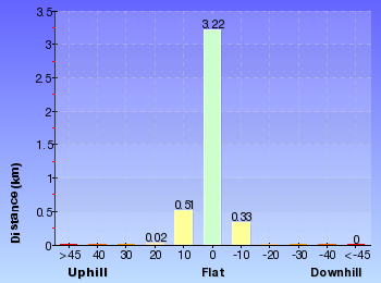
Gradient
3.2km of this walk has gentle hills with occasional steps and another 630m has short steep hills. The remaining (240m) is flat with no steps.
Quality of track
Around 3.7km of this walk follows a clear and well formed track or trail, whilst the remaining 350m follows a smooth and hardened path.
Signs
Around 3.9km of this walk has directional signs at most intersection, whilst the remaining 240m is clearly signposted.
Experience Required
Around 2.3km of this walk requires no previous bushwalking experience, whilst the remaining 1.8km requires some bushwalking experience.
weather
Around 3.4km of this walk is not usually affected by severe weather events (that would unexpectedly impact safety and navigation), whilst the remaining 670m is affected by storms that may impact your navigation and safety.
Infrastructure
Around 3.8km of this walk has limited facilities (such as not all cliffs fenced), whilst the remaining 310m is close to useful facilities (such as fenced cliffs and seats).
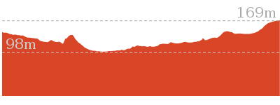
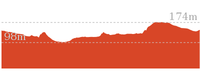
Similar walks
439 m Circuit
15 mins
Moderate track
515 m One way
15 mins
Moderate track
1.4 km Return
30 mins
Moderate track
2.2 km One way
1 Hr
Moderate track

4.4 km One way
1 hr 45 mins
Moderate track
5.1 km Circuit
2 hrs
Hard track
9 km One way
3 hrs 45 mins
Hard track
Other Nearby walks
2.5 km Return
1 hr 30 mins
Hard track
4.2 km Circuit
1 hr 45 mins
Hard track
828 m Return
30 mins
Moderate track
619 m One way
30 mins
Moderate track
529 m One way
15 mins
Moderate track

6.1 km One way
2 hrs 30 mins
Hard track
6.6 km Circuit
2 hrs 30 mins
Hard track

35.9 km One way
2 Days
Hard track
15.5 km One way
6 hrs
Hard track
10.2 km One way
4 hrs
Hard track

28.1 km One way
2 Days
Hard track
8.6 km One way
3 hrs 45 mins
Hard track
Plan your trip to and from the walk here
The Cherrybrook to Refuge Rock walk starts at the Top of The Lakes Of Cherrybrook park (gps: -33.721735, 151.04418)Your transport options to Top of The Lakes Of Cherrybrook park are by;
(get details)
The Cherrybrook to Refuge Rock ends at the End of Trevors Ln (gps: -33.708264, 151.05772)
Your transport options to End of Trevors Ln are by;
(get details)


Short URL = http://wild.tl/ctrrttl
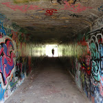
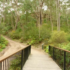
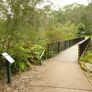
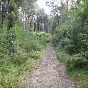
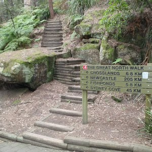
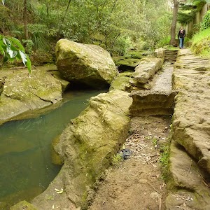
Gallery images
There are other downloads I am still working on.
You will probably need to login to access these — still all free.
* KML (google earth file)
* GPX (GPS file)
Special Maps/ brochures
* A3 topo maps
* PDF with Lands Topo map base
* PDF with arial image (and map overlay)
I wanted to get the main site live first, this extra stuff will come in time.
Happy walking
Matt 🙂
Comments