Thornleigh to Galston Gorge


6 hrs

768 m
Hard track


(0km) Thornleigh Train Station → Morgan Rd

990 m
18 mins
7m
-47m
Easy track
(0.99km) Morgan Rd → Int of Bike Trail and Morgan Rd tracks
230 m
4 mins
3m
-7m
Moderate track
(1.22km) Int of Bellamy trail and Morgan Rd tracks → Zig Zag Creek Bridge int.
130 m
2 mins
0m
-6m
Easy track

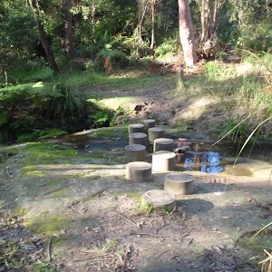
Thornleigh zigzag railway
(1.34km) Zig Zag Creek Bridge intersection → The Jungo
1.4 km
25 mins
16m
-37m
Moderate track
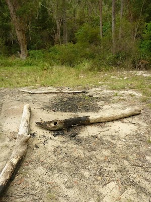
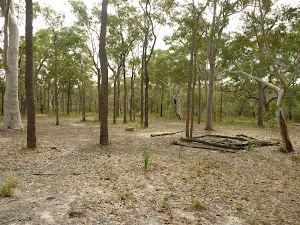
The Jungo
(2.78km) Jungo campsite → Int of GNW and Stringybark Ridge trail
100 m
2 mins
1m
0m
Moderate track
(2.88km) Int of GNW and Stringybark Ridge trail → Elouera Lookout
1 km
27 mins
81m
-58m
Moderate track
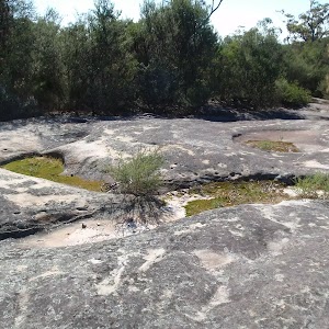
Elouera Lookout
(3.93km) Elouera Lookout → Int of the Great North Walk and the Quarter Sessions Road track
2.2 km
54 mins
152m
-130m
Moderate track
(6.08km) Int of the Great North Walk and the Quarter Sessions Road track → Int of the Great North Walk and the Blackfellows Head lookout track
620 m
16 mins
36m
-64m
Moderate track
(6.7km) Int of the Great North Walk and the Blackfellows Head lookout track → Int of the Great North Walk and the Blue Gum Walk (SW)
80 m
2 mins
7m
-9m
Moderate track
(6.77km) Int of the Great North Walk and the Blue Gum Walk (SW) → Fishponds Lookout
990 m
21 mins
21m
-87m
Hard track
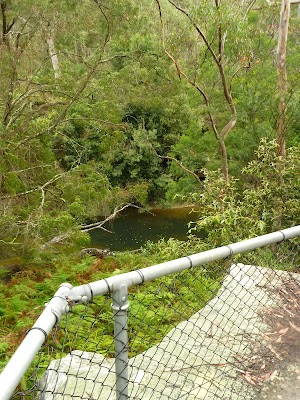
Fishponds Lookout
(7.76km) Fishponds Lookout → Fishponds crossing
70 m
2 mins
3m
-4m
Moderate track
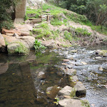
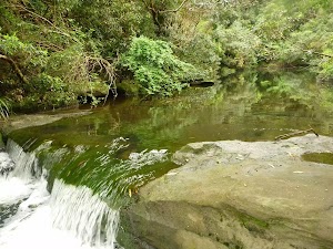
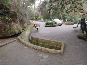
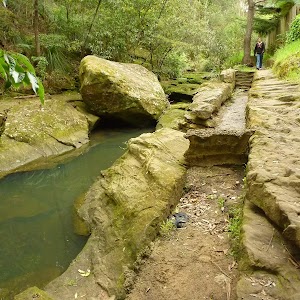
Fishponds
(7.76km) Fishponds Lookout → Corner of Dilkera and Manor Rd
500 m
19 mins
131m
0m
Moderate track
Veer left: From the intersection, this walk follows the ‘Alternative Route’ arrow on the GNW sign[112]. The track dips before heading steeply uphill, zigzagging in several sections. The walk leads you up a large metal staircase to the top of the cliffs, coming to the intersection of Manor Rd and Dilkera Cl.
(8.26km) Corner of Dilkera and Manor Rd → End of Clarinda St
1.7 km
31 mins
36m
-49m
Easy track
Continue straight: From the intersection, this walk heads north along Rosamond St following the Great North Walk arrow. The walk then turns left into Clarinda St and follows it to the end of the road, to find the ‘Clarinda Wetlands’ sign.
(9.91km) End of Clarinda St → Int of Clarinda St trail and waterfall track
1.1 km
24 mins
51m
-66m
Easy track
Continue straight: From the intersection, this walk follows the flat management trail, heading away from Simon Place past the ‘Berowra Valley Regional Park’, ‘Dogs Prohibited’ sign[113]. The walk gently meanders along the trail, enjoying the ferns and sandstone rocks for a while until coming to a ‘Great North Walk’ sign[114] highlighting the intersection with small track on the left.
(10.99km) Int of Clarinda St and waterfall track → Int of Stewart Ave service trail and waterfall track
470 m
13 mins
9m
-98m
Moderate track
Veer right: From the waterfall, this walk climbs the stone stairs (keeping the waterfall initially on the left) and then turns right, heading up out of the gully. Once at the top of the stairs, the walk heads through the bush until soon coming to a ‘T’ intersection with the Stewart St management trail, signposted with a large ‘Great North Walk’ sign[116].
(11.46km) Int of Stewart Ave service trail and waterfall track → Steele Bridge
400 m
8 mins
5m
-29m
Easy track
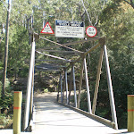
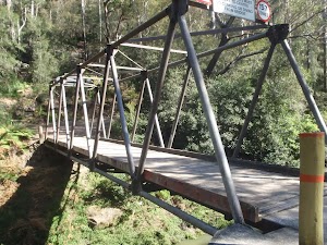
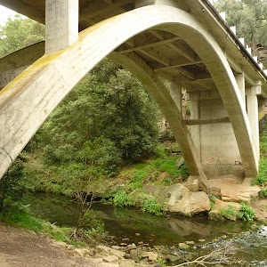
Historic Military ‘Steele’ Bridge
(11.86km) Steele Bridge → Tunks Ridge Rest Area
1.8 km
44 mins
160m
-33m
Hard track
Tunks Ridge Rest Area
(13.63km) Tunks Ridge Rest Area → Int of Great North Walk and Galston Gorge track
1.4 km
28 mins
38m
-68m
Moderate track
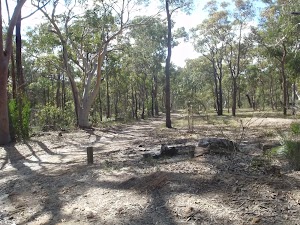
Top of Galston Gorge Campsite
(14.99km) Int of Great North Walk and Galston Gorge track → Galston Gorge track head
550 m
16 mins
14m
-119m
Hard track
Galston Gorge track head
Maps for the Thornleigh to Galston Gorge walk
You can download the PDF for this walk to print a map.These maps below cover the walk and the wider area around the walk, they are worth carrying for safety reasons.
| Hornsby | 1:25 000 Map Series | 91304S HORNSBY | NSW-91304S |
| Sydney | 1:100 000 Map Series | 9130 SYDNEY | 9130 |
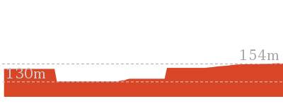
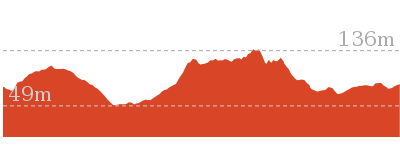
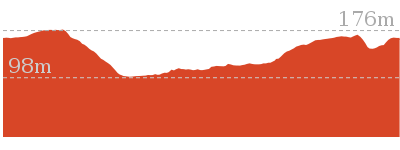
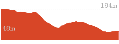
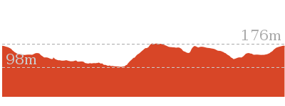
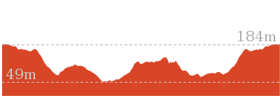
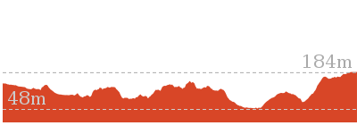
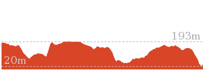
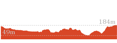
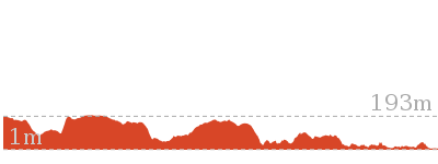
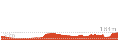
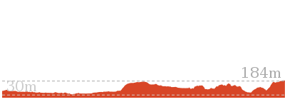
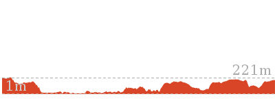
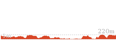
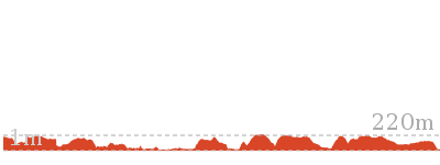
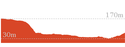
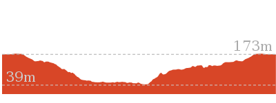
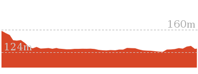
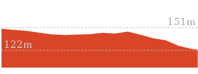
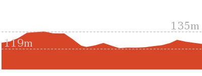
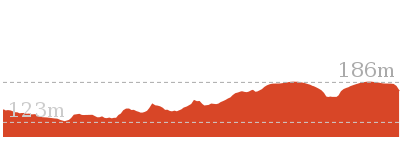
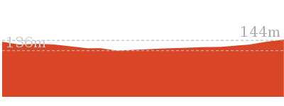
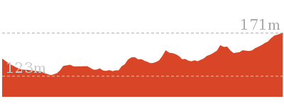
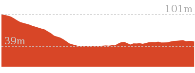
Cross sectional view of the Thornleigh to Galston Gorge bushwalking track
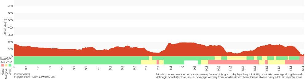
Analysis and summary of the altitude variation on the Thornleigh to Galston Gorge
Overview of this walks grade – based on the AS 2156.1 – 2001
Under this standard, a walk is graded based on the most difficult section of the walk.
| Length | 15.5 km | ||
| Time | 6 hrs | ||
| . | |||
| Grade 4/6 Hard track |
AS 2156.1 | Gradient | Very steep (4/6) |
| Quality of track | Formed track, with some branches and other obstacles (3/6) | ||
| Signs | Directional signs along the way (3/6) | ||
| Experience Required | Moderate level of bushwalking experience recommended (4/6) | ||
| Weather | Storms may impact on navigation and safety (3/6) | ||
| Infrastructure | Limited facilities, not all cliffs are fenced (3/6) |
Some more details of this walks Grading
Here is a bit more details explaining grading looking at sections of the walk
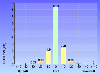
Gradient
6km of this walk has short steep hills and another 3.8km has gentle hills with occasional steps. Whilst another 3.3km is very steep and the remaining 2.2km is flat with no steps.
Quality of track
7km of this walk follows a clear and well formed track or trail and another 6km follows a formed track, with some branches and other obstacles. The remaining (1.9km) follows a smooth and hardened path.
Signs
Around 8km of this walk has directional signs at most intersection, whilst the remaining 7km is clearly signposted.
Experience Required
9km of this walk requires no previous bushwalking experience and another 5km requires some bushwalking experience. The remaining (990m) requires a leader a with moderate level of bushwalking experience.
weather
Around 15km of this walk is not usually affected by severe weather events (that would unexpectedly impact safety and navigation), whilst the remaining 990m is affected by storms that may impact your navigation and safety.
Infrastructure
Around 8km of this walk has limited facilities (such as not all cliffs fenced), whilst the remaining 7km is close to useful facilities (such as fenced cliffs and seats).
Similar walks

499 m One way
15 mins
Easy track

529 m One way
15 mins
Moderate track

619 m One way
30 mins
Moderate track
4.2 km Circuit
2 hrs
Hard track
4.2 km Circuit
1 hr 45 mins
Hard track

4.4 km One way
1 hr 45 mins
Moderate track
5.1 km Circuit
2 hrs
Hard track
5.6 km Return
2 hrs 30 mins
Hard track
6.6 km Circuit
2 hrs 30 mins
Hard track

6.7 km Circuit
3 hrs
Hard track
8.6 km One way
3 hrs 45 mins
Hard track
9 km One way
3 hrs 45 mins
Hard track
9.7 km One way
4 hrs
Hard track
10.2 km One way
4 hrs
Hard track
16.1 km One way
6 hrs 45 mins
Hard track
17.5 km One way
6 hrs 45 mins
Hard track

20.6 km One way
8 hrs
Hard track
22.3 km One way
9 hrs
Hard track
22.6 km One way
9 hrs 18 mins
Hard track

25.8 km One way
2 Days
Hard track

28.1 km One way
2 Days
Hard track

35.9 km One way
2 Days
Hard track
43.1 km One way
3 Days
Hard track

44.4 km One way
3 Days
Hard track

Other Nearby walks
6.1 km One way
2 hrs 30 mins
Hard track
8.2 km Circuit
3 hrs
Hard track
717 m Circuit
20 mins
Very easy

2.5 km Return
1 hr 30 mins
Hard track
828 m Return
30 mins
Moderate track
4.1 km One way
1 hr 45 mins
Moderate track
439 m Circuit
15 mins
Moderate track
2.2 km One way
1 Hr
Moderate track

516 m Return
15 mins
Moderate track
2.8 km Return
1 Hr
Moderate track
3.2 km Return
1 hr 30 mins
Moderate track
Plan your trip to and from the walk here
The Thornleigh to Galston Gorge walk starts at the Thornleigh Train Station (gps: -33.731949, 151.07815)Your transport options to Thornleigh Train Station are by;
(get details)
The Thornleigh to Galston Gorge ends at the Galston Gorge track head (gps: -33.66458, 151.08031)
Your main transport option to Galston Gorge track head is by;
(get details)


Short URL = http://wild.tl/ttgg
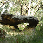
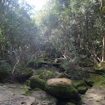
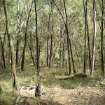
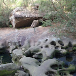
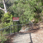
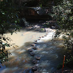
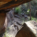
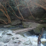
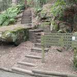
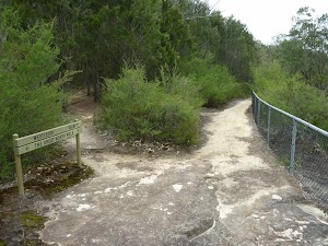
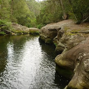
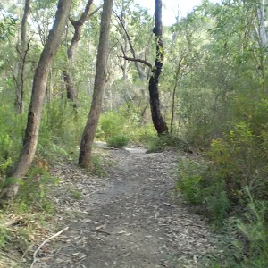
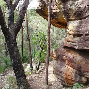
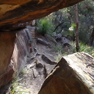
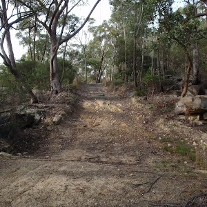
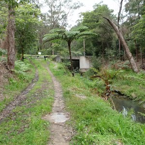
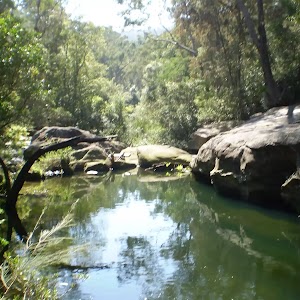
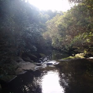
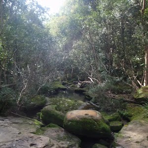
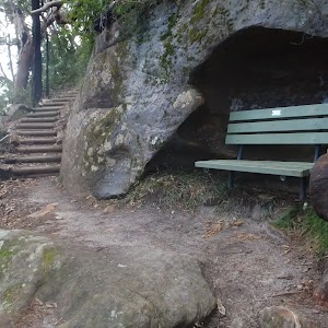
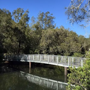
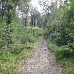
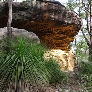
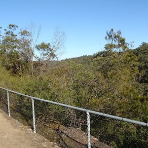
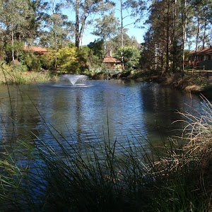
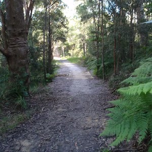
Gallery images
There are other downloads I am still working on.
You will probably need to login to access these — still all free.
* KML (google earth file)
* GPX (GPS file)
Special Maps/ brochures
* A3 topo maps
* PDF with Lands Topo map base
* PDF with arial image (and map overlay)
I wanted to get the main site live first, this extra stuff will come in time.
Happy walking
Matt 🙂
Comments