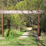
The Charles Darwin Walk


2 hrs

189 m
Moderate track


(0km) Wentworth Falls Railway Station → Wilson Park

490 m
9 mins
13m
-15m
Very easy
(0.49km) Wilson Park → Int of Charles Darwin Track and Wentworth Falls Fire Station Trail
220 m
4 mins
4m
-9m
Easy track
Continue straight: From the intersection, this walk passes the blue sign (on the right) and turns right down the steps to immediately come to an intersection just before the bridge (and a ‘Charles Darwin Walk’ sign).
(0.7km) Int of Charles Darwin Track and Wentworth Falls Fire Station Trail → Int of Charles Darwin and Fletcher St Tracks
1.2 km
25 mins
38m
-68m
Easy track
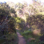
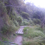
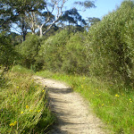
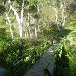
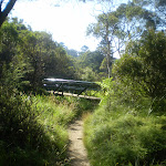
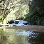
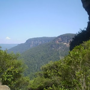
Continue straight: From the intersection near the pipe bridge, this walk follow the ‘Wentworth Falls Waterfall’ sign downstream (keeping the creek on the right). The walk soon passes another track (that crosses the creek using a small bridge on the right) and then passes a bush regeneration sign to leave the clearing. The track meanders alongside the creek for a while before heading down some stairs and crossing the creek on a bridge. On the other side the walk passes a bench seat and then comes to an intersection with the signposted ‘Parkes Street’ track (on the right). From this intersection, this walk heads downstream (keeping the creek to the left). The walk crosses the creek on a foot bridge and follows the creek closely soon passing a beautiful set of cascades. After cascades, the walk goes down a steep section of stairs and once again crosses the creek. The track continues along a section of boardwalk before joining up with a track that continues beside the creek. This goes along a mixture of boardwalk and bush track until coming to an intersection with a track, with ‘Fletcher St’ and ‘Falls’ signs.
(1.87km) Int of Charles Darwin and Fletcher St Tracks → Int of Charles Darwin and Weeping Rock Tracks
780 m
13 mins
3m
-24m
Moderate track
(2.65km) Int of Charles Darwin and Weeping Rock Tracks → Weeping Rock waterfall
40 m
1 mins
0m
-2m
Moderate track
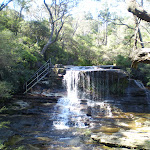
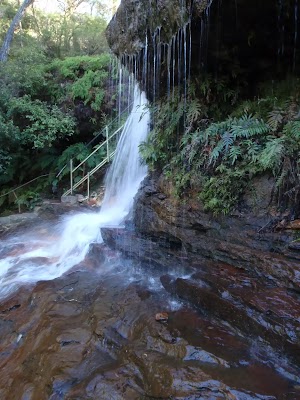
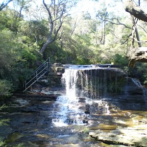
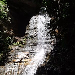
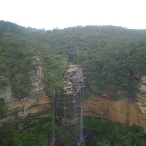
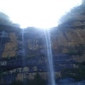
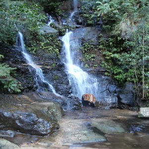
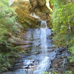
Weeping Rock
(2.69km) Weeping Rock waterfall → Int of Weeping Rock and Wentworth Falls Tracks
40 m
1 mins
0m
-8m
Moderate track
(2.73km) Int of Weeping Rock and Wentworth Falls Tracks → Top of Wentworth Falls
60 m
1 mins
3m
-2m
Moderate track
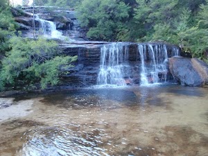
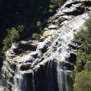
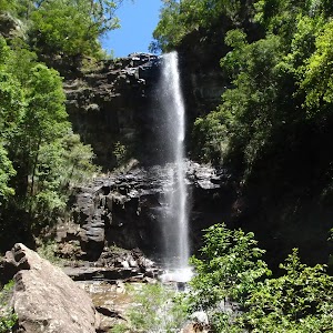
Queen’s Cascades
Maps for the The Charles Darwin Walk walk
You can download the PDF for this walk to print a map.These maps below cover the walk and the wider area around the walk, they are worth carrying for safety reasons.
| Katoomba | 1:25 000 Map Series | 89301S KATOOMBA | NSW-89301S |
| Katoomba | 1:100 000 Map Series | 8930 KATOOMBA | 8930 |
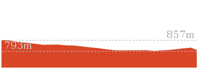
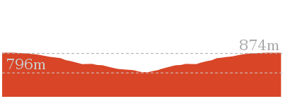
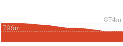
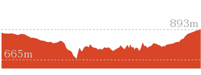
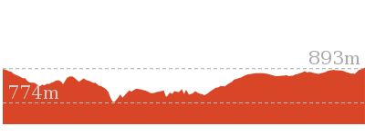
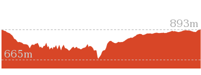
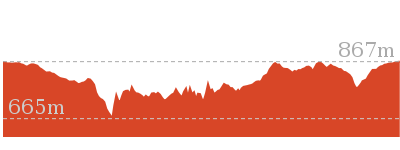
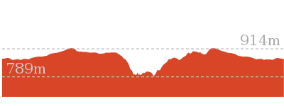
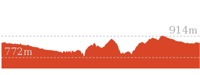
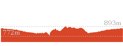
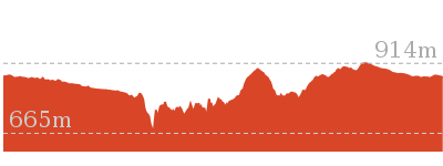
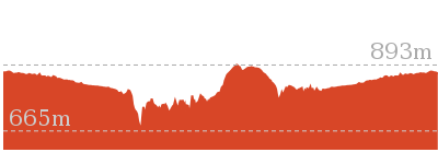
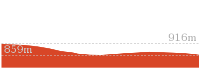
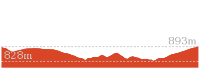
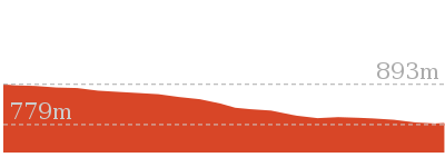
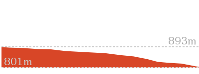
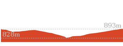
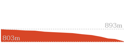
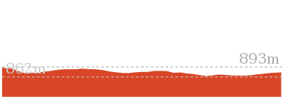
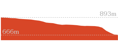
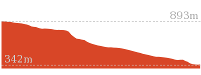
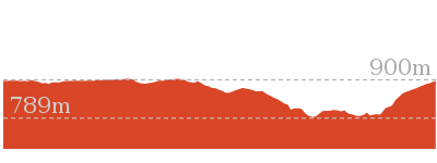
Cross sectional view of the The Charles Darwin Walk bushwalking track
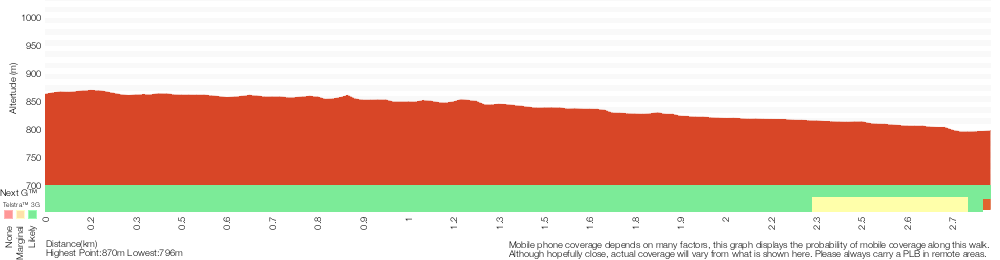
Analysis and summary of the altitude variation on the The Charles Darwin Walk
Overview of this walks grade – based on the AS 2156.1 – 2001
Under this standard, a walk is graded based on the most difficult section of the walk.
| Length | 5.6 km | ||
| Time | 2 hrs | ||
| . | |||
| Grade 3/6 Moderate track |
AS 2156.1 | Gradient | Gentle hills with occasional steps (2/6) |
| Quality of track | Formed track, with some branches and other obstacles (3/6) | ||
| Signs | Directional signs along the way (3/6) | ||
| Experience Required | Some bushwalking experience recommended (3/6) | ||
| Weather | Storms may impact on navigation and safety (3/6) | ||
| Infrastructure | Generally useful facilities (such as fenced cliffs and seats) (1/6) |
Some more details of this walks Grading
Here is a bit more details explaining grading looking at sections of the walk
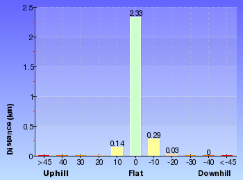
Gradient
Around 2.3km of this walk has gentle hills with occasional steps, whilst the remaining 490m is flat with no steps.
Quality of track
1.9km of this walk follows a smooth and hardened path and another 840m follows a clear and well formed track or trail. The remaining (75m) follows a formed track, with some branches and other obstacles.
Signs
Around 2km of this walk is clearly signposted, whilst the remaining 780m has directional signs at most intersection.
Experience Required
Around 2.7km of this walk requires no previous bushwalking experience, whilst the remaining 140m requires some bushwalking experience.
weather
Around 2.7km of this walk is not usually affected by severe weather events (that would unexpectedly impact safety and navigation), whilst the remaining 140m is affected by storms that may impact your navigation and safety.
Infrastructure
This whole walk, 2.8km is close to useful facilities (such as fenced cliffs and seats).
Similar walks
1.3 km Return
1 Hr
Moderate track
1.4 km Circuit
45 mins
Moderate track
1.5 km Return
45 mins
Moderate track
3.6 km One way
3 hrs
Hard track

4 km Circuit
2 hrs
Moderate track
4.6 km Circuit
3 hrs 30 mins
Hard track
5 km Circuit
4 hrs
Hard track
5.1 km Circuit
4 hrs
Hard track
6.7 km Circuit
3 hrs
Hard track
8.6 km Circuit
5 hrs
Hard track

8.9 km Circuit
4 hrs 30 mins
Hard track
9.4 km Circuit
4 hrs
Moderate track
9.5 km Circuit
5 hrs 30 mins
Hard track
10.2 km Circuit
6 hrs
Hard track

29.2 km One way
2 Days
Experienced only

29.3 km One way
3 Days
Experienced only

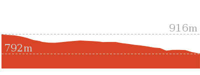
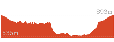
Other Nearby walks
880 m Return
30 mins
Moderate track

1.6 km Return
1 Hr
Moderate track
4.8 km Circuit
4 hrs
Hard track
1.9 km Circuit
1 Hr
Moderate track
1.1 km Return
1 Hr
Hard track
762 m Return
30 mins
Moderate track
950 m Circuit
30 mins
Moderate track
696 m Return
30 mins
Moderate track
1.1 km One way
30 mins
Moderate track
1.5 km Return
1 hr 30 mins
Hard track
3.8 km Return
4 hrs
Experienced only
3.1 km Circuit
2 hrs
Hard track
Plan your trip to and from the walk here
The The Charles Darwin Walk walk starts and ends at the Wentworth Falls Railway Station (gps: -33.709737, 150.37644)Your transport options to Wentworth Falls Railway Station are by;
(get details)


Short URL = http://wild.tl/tcdw
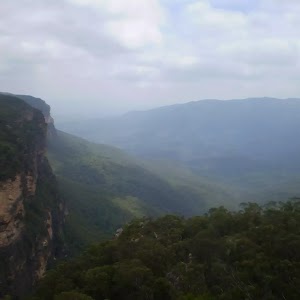
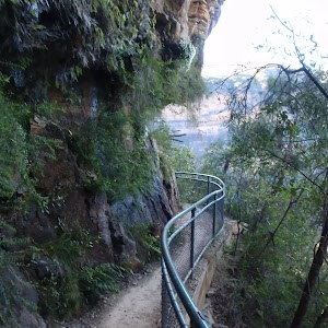
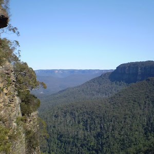
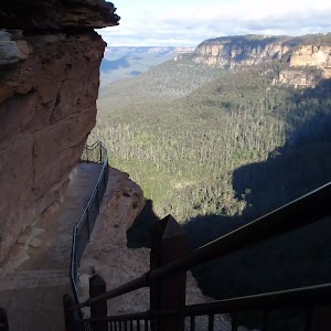
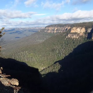
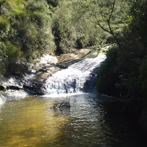
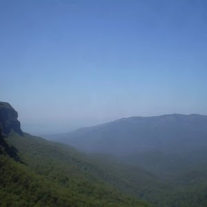
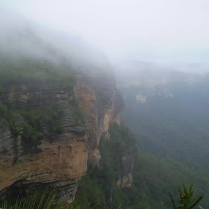
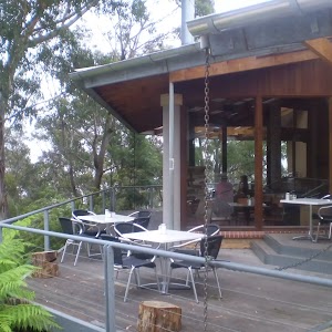
Gallery images
There are other downloads I am still working on.
You will probably need to login to access these — still all free.
* KML (google earth file)
* GPX (GPS file)
Special Maps/ brochures
* A3 topo maps
* PDF with Lands Topo map base
* PDF with arial image (and map overlay)
I wanted to get the main site live first, this extra stuff will come in time.
Happy walking
Matt 🙂
Comments