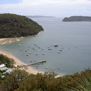
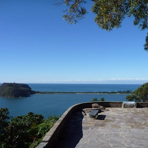
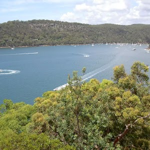
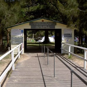
Flint and Steel Beach and bay loop


1 hr 30 mins

227 m
Very experienced only


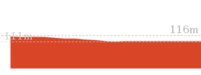
(0km) Flint and Steel carpark → Signpost at saddle

330 m
8 mins
1m
-57m
Moderate track
(0.33km) Signpost at Saddle → Flint and Steel beach
740 m
21 mins
35m
-116m
Moderate track
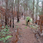
Continue straight: From the intersection, this walk follows the track heading straight down the hill towards the beach, splitting for a about 10m before coming to a rock shelf above the waterline. From here, the track turns right and follows this rock shelf for about 20m, onto Flint and Steel Beach.
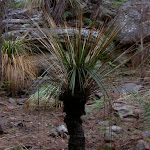
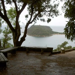
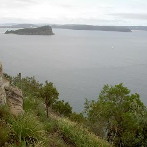
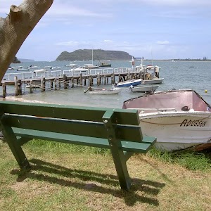
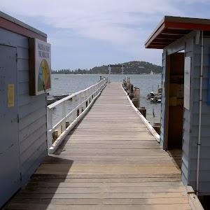
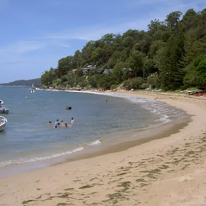
Flint and Steel Beach

(1.07km) Flint and Steel beach → Spur above Flint and Steel Beach
160 m
4 mins
24m
-3m
Moderate track
(1.23km) Spur above Flint and Steel Beach → McGaw Ruins
820 m
18 mins
30m
-45m
Very experienced only
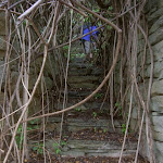
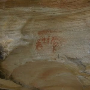
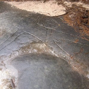
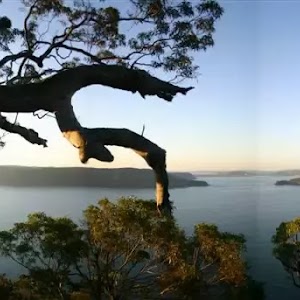
McGaw Ruins

(2.05km) McGaw Ruins → White Horse Beach
220 m
5 mins
6m
-10m
Hard track
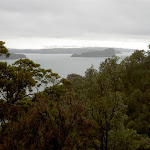
White Horse Beach

(2.05km) McGaw Ruins → Signpost at Saddle
370 m
14 mins
80m
-5m
Hard track
(2.42km) Signpost at saddle → Flint and Steel carpark
330 m
8 mins
57m
-1m
Moderate track
Maps for the Flint and Steel Beach and bay loop walk
You can download the PDF for this walk to print a map.These maps below cover the walk and the wider area around the walk, they are worth carrying for safety reasons.
| Broken Bay | 1:25 000 Map Series | 91301N BROKEN BAY | NSW-91301N |
| Ku-ring-gai Chase National Park Tourist Map | 1:40 000 Map Series | CMA Ku-ring-gai Chase National Park Tourist Map | CMA Ku-ring-gai Chase National Park Tourist Map |
| Sydney | 1:100 000 Map Series | 9130 SYDNEY | 9130 |
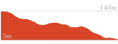
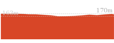
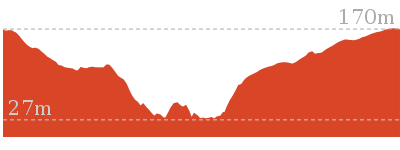
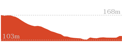
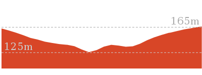
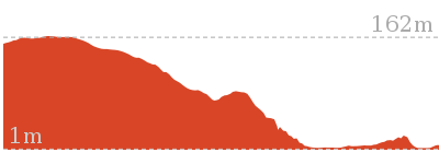
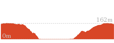
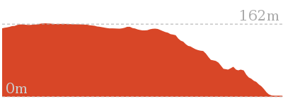
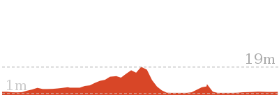
Cross sectional view of the Flint and Steel Beach and bay loop bushwalking track
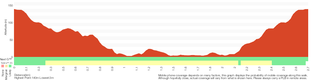
Analysis and summary of the altitude variation on the Flint and Steel Beach and bay loop
Overview of this walks grade – based on the AS 2156.1 – 2001
Under this standard, a walk is graded based on the most difficult section of the walk.
| Length | 2.8 km | ||
| Time | 1 hr 30 mins | ||
| . | |||
| Grade 6/6 Very experienced only |
AS 2156.1 | Gradient | Very steep (4/6) |
| Quality of track | Rough unclear track (5/6) | ||
| Signs | No directional signs (5/6) | ||
| Experience Required | Some bushwalking experience recommended (3/6) | ||
| Weather | Storms may impact on navigation and safety (3/6) | ||
| Infrastructure | No facilities provided (5/6) |
Some more details of this walks Grading
Here is a bit more details explaining grading looking at sections of the walk
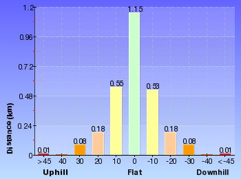
Gradient
Around 1.6km of this walk has short steep hills, whilst the remaining 1.2km is very steep.
Quality of track
1.6km of this walk follows a formed track, with some branches and other obstacles and another 820m follows a rough unclear track. The remaining (370m) follows a rough track, where fallen trees and other obstacles are likely.
Signs
900m of this walk has directional signs at most intersection and another 820m Has no directional signs. Whilst another 660m is clearly signposted and the remaining 370m has minimal directional signs.
Experience Required
Around 1.8km of this walk requires some bushwalking experience, whilst the remaining 980m requires no previous bushwalking experience.
weather
Around 1.4km of this walk is affected by storms that may impact your navigation and safety, whilst the remaining 1.4km is not usually affected by severe weather events (that would unexpectedly impact safety and navigation).
Infrastructure
Around 1.9km of this walk has limited facilities (such as not all cliffs fenced), whilst the remaining 820m has no facilities provided.
Similar walks

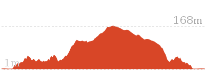
1.9 km Return
1 Hr
Hard track

2.1 km Return
1 Hr
Moderate track
8.6 km Circuit
5 hrs
Hard track

Other Nearby walks
403 m Circuit
30 mins
Moderate track
1.1 km Circuit
45 mins
Moderate track
3.7 km Return
1 hr 30 mins
Hard track
3.5 km Circuit
1 hr 45 mins
Hard track
1.9 km Return
1 Hr
Moderate track
810 m Circuit
30 mins
Moderate track
238 m Return
10 mins
Easy track
8.2 km Return
3 hrs
Hard track
5.9 km Circuit
3 hrs
Hard track
5.6 km Return
2 hrs 30 mins
Moderate track
1.4 km Circuit
45 mins
Moderate track
5.4 km Circuit
3 hrs
Hard track
Plan your trip to and from the walk here
The Flint and Steel Beach and bay loop walk starts and ends at the Flint and Steel carpark (gps: -33.578863, 151.28879)Your main transport option to Flint and Steel carpark is by;
(get details)


Short URL = http://wild.tl/fasbabl
Gallery images
There are other downloads I am still working on.
You will probably need to login to access these — still all free.
* KML (google earth file)
* GPX (GPS file)
Special Maps/ brochures
* A3 topo maps
* PDF with Lands Topo map base
* PDF with arial image (and map overlay)
I wanted to get the main site live first, this extra stuff will come in time.
Happy walking
Matt 🙂
Comments