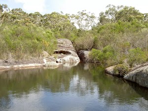
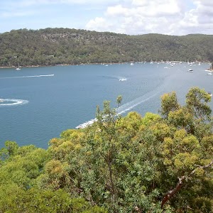
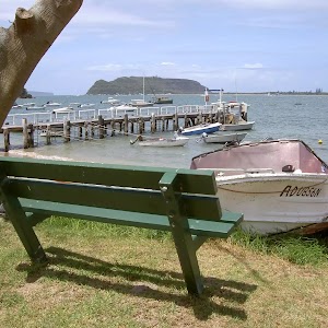
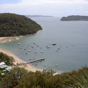
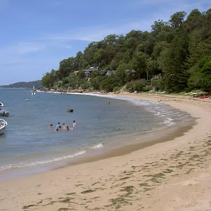
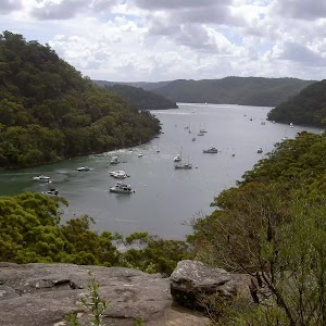
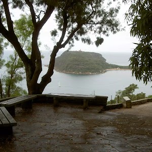
The Basin


2 hrs 30 mins

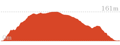
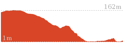
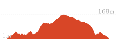
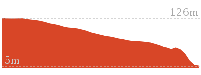
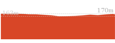
218 m
Moderate track


(0km) Int. Basin Trk and West Head Rd → Int. Basin Trk and Aboriginal Engraving Trk Entry

360 m
7 mins
13m
-3m
Moderate track
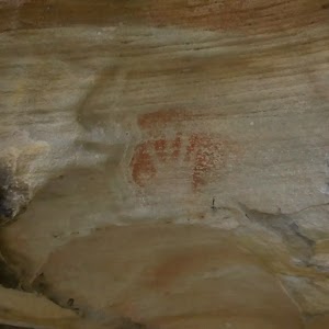
(0.36km) Int. Basin Trk and Aboriginal Engraving Trk Entry → Int. Basin Trk and Aboriginal Engraving Trk Exit
110 m
2 mins
3m
-1m
Easy track
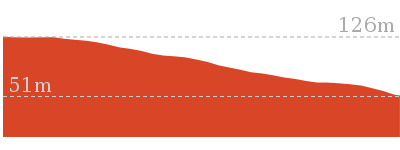
(0.36km) Int. Basin Trk and Aboriginal Engraving Trk Entry → Int. Basin Trk and Euro Trk
1.5 km
27 mins
14m
-62m
Moderate track
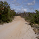
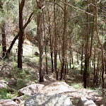
Continue straight: From the intersection, the walk winds gently uphill along the management trail, keeping the engravings track initially on the right. The management trail then comes to the intersection with the signposted ‘Mackerel service trail’[1] on the left.
Continue straight: From the intersection, the walk follows the wide management trail up the hill, not following the ‘Mackarel Service Trail’ signs arrow. The track winds left up the hill and leads up to a high point on a hill with views of the sea. The track then undulates across a saddle and up another hill. The track then leads down the hill for a little while to the sign marked intersection on the right.
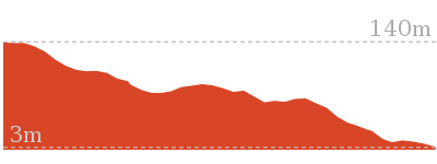
(1.89km) Int. Basin Trk and Euro Trk → Dam
870 m
18 mins
25m
-42m
Moderate track
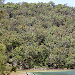
The Basin Dam
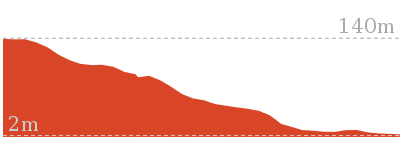
(1.89km) Int. Basin Trk and Euro Trk → The Basin Campsite
780 m
18 mins
8m
-115m
Moderate track
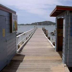
(2.67km) The Basin Campsite → The Basin Wharf
130 m
2 mins
0m
-3m
Moderate track
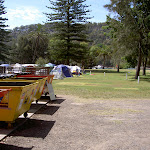
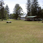
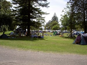
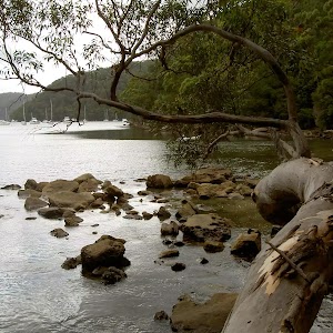
The Basin Campsite
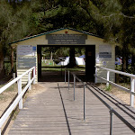
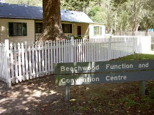
Beechwood Function and Convention Centre
Maps for the The Basin walk
You can download the PDF for this walk to print a map.These maps below cover the walk and the wider area around the walk, they are worth carrying for safety reasons.
| Broken Bay | 1:25 000 Map Series | 91301N BROKEN BAY | NSW-91301N |
| Ku-ring-gai Chase National Park Tourist Map | 1:40 000 Map Series | CMA Ku-ring-gai Chase National Park Tourist Map | CMA Ku-ring-gai Chase National Park Tourist Map |
| Sydney | 1:100 000 Map Series | 9130 SYDNEY | 9130 |
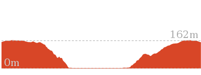
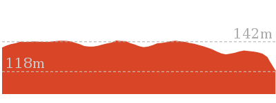
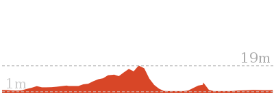
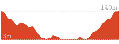
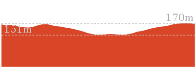
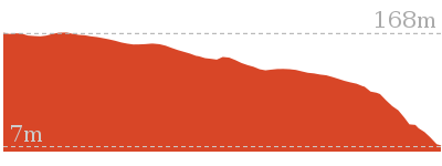
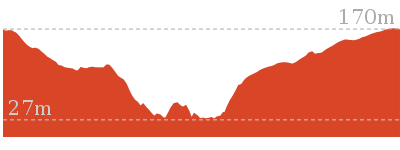
Cross sectional view of the The Basin bushwalking track
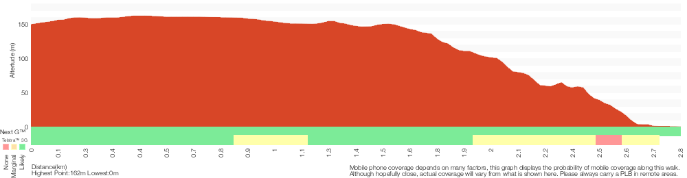
Analysis and summary of the altitude variation on the The Basin
Overview of this walks grade – based on the AS 2156.1 – 2001
Under this standard, a walk is graded based on the most difficult section of the walk.
| Length | 5.6 km | ||
| Time | 2 hrs 30 mins | ||
| . | |||
| Grade 3/6 Moderate track |
AS 2156.1 | Gradient | Short steep hills (3/6) |
| Quality of track | Clear and well formed track or trail (2/6) | ||
| Signs | Directional signs along the way (3/6) | ||
| Experience Required | No experience required (1/6) | ||
| Weather | Weather generally has little impact on safety (1/6) | ||
| Infrastructure | Limited facilities, not all cliffs are fenced (3/6) |
Some more details of this walks Grading
Here is a bit more details explaining grading looking at sections of the walk
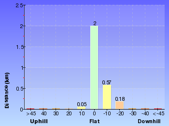
Gradient
2km of this walk has short steep hills and another 430m is flat with no steps. The remaining (360m) has gentle hills with occasional steps.
Quality of track
Around 2.7km of this walk follows a clear and well formed track or trail, whilst the remaining 130m follows a smooth and hardened path.
Signs
Around 2.1km of this walk has directional signs at most intersection, whilst the remaining 670m is clearly signposted.
Experience Required
This whole walk, 2.8km requires no previous bushwalking experience.
weather
This whole walk, 2.8km is not usually affected by severe weather events (that would unexpectedly impact safety and navigation).
Infrastructure
Around 1.9km of this walk has limited facilities (such as not all cliffs fenced), whilst the remaining 910m is close to useful facilities (such as fenced cliffs and seats).
Similar walks
4.5 km One way
1 hr 45 mins
Hard track
5.9 km Circuit
3 hrs
Hard track
8.2 km Return
3 hrs
Hard track
8.6 km Circuit
5 hrs
Hard track

Other Nearby walks
3 km Return
1 hr 15 mins
Moderate track
1.4 km Circuit
45 mins
Moderate track
5.4 km Circuit
3 hrs
Hard track

2.8 km Circuit
1 hr 30 mins
Very experienced only

2.1 km Return
1 Hr
Moderate track

1.9 km Return
1 Hr
Hard track
2.2 km Return
1 hr 15 mins
Hard track
1.9 km Return
45 mins
Moderate track
403 m Circuit
30 mins
Moderate track
1.1 km Circuit
45 mins
Moderate track
3.7 km Return
1 hr 30 mins
Hard track
3.5 km Circuit
1 hr 45 mins
Hard track
Plan your trip to and from the walk here
The The Basin walk starts and ends at the Int. Basin Trk and West Head Rd (gps: -33.590099, 151.28222)Your main transport option to Int. Basin Trk and West Head Rd is by;
(get details)


Short URL = http://wild.tl/tbtxx
Gallery images
There are other downloads I am still working on.
You will probably need to login to access these — still all free.
* KML (google earth file)
* GPX (GPS file)
Special Maps/ brochures
* A3 topo maps
* PDF with Lands Topo map base
* PDF with arial image (and map overlay)
I wanted to get the main site live first, this extra stuff will come in time.
Happy walking
Matt 🙂
Comments