Boronia Park to North Ryde


2 hrs 45 mins

231 m
Moderate track


Boronia Park

(0km) Boronia Park → Princes St trackhead

550 m
11 mins
6m
-40m
Moderate track
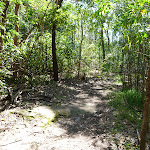
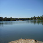
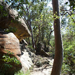
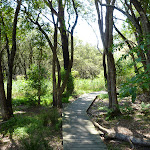
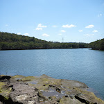
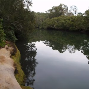
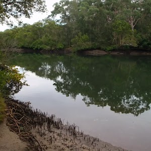
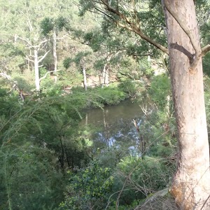
Continue straight: From the end of Boronia Avenue[9], this walk follows the GNW arrow post[10] up along the rocky track. The track leads over a small rise then bends right (ignoring the track to your left), to head down a few stone steps[11], then a series of timber steps[12]. The track then continues along the bank of the Lane Cove River[13][14] (to your right) for about 100m to come to a T-intersection with Princes St[15]. Here the walk turns left and heads up the road[16] (away from the water view[17]) for about 50m, coming to an intersection with another track and a large green ‘The Great North Walk’ signpost[18] (on your right).
(0.55km) Princes St trackhead → Int of Great North Walk and Meyers Avenue track
560 m
11 mins
19m
-21m
Moderate track
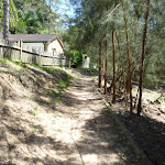
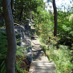
Turn right: From the picnic area, this walk follows the GNW arrow post across the rocky Brickmakers Creek[22] and up the steps[23]. The walk continues along the short timber boardwalk[24], then leads up the timber steps[25] for about 100m where the track flattens out, veering right at another GNW arrow post[26]. Here the track leads down between the rocks[27], with a filtered view to the water, and a short distance later, the track veers right again at another GNW arrow post[28], heading gently down between some more rocks. For another 150m , the mostly flat track leads over some rock platforms[29][30] then along a short section of timber boarding[31] to come to a three-way intersection marked with a GNW arrow, and a larger unfenced rock platform[32] (to the right).
(1.11km) Int of Great North Walk and Meyers Avenue track → Int of Great North Walk and the Lane Cove River track
530 m
10 mins
15m
-12m
Moderate track
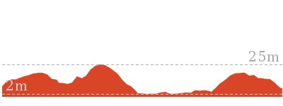
(1.64km) Int of Great North Walk and the Lane Cove River track → End of Lane Cove River track
90 m
2 mins
0m
-6m
Moderate track
(1.64km) Int of Great North Walk and the Lane Cove River track → Mangrove viewing platform
510 m
10 mins
14m
-18m
Moderate track
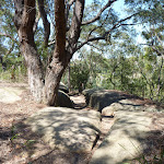
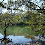
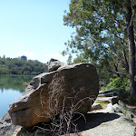
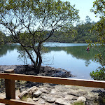
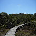
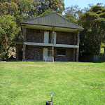
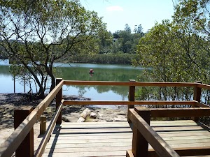
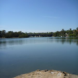
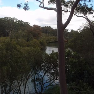
Continue straight: From the intersection, this walk follows the GNW arrow post[50] along the clear track, leading gently uphill (initially keeping the concrete building and Barton Cres track on your left[51]). The fairly flat, rocky track leads through the forest, keeping the Lane Cove River[52] not far to your right. After about 300m, the track leads up some steps[53] to a boulder outcrop[54] with good views over the river. The track continues for another 100m to a small clearing and a timber viewing platform[55] (on your right).
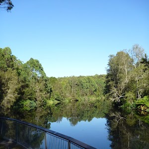
Mangrove viewing platform
(2.15km) Mangrove viewing platform → Buffalo Creek track head
780 m
13 mins
17m
-16m
Easy track
Turn right: From the intersection[74], this walk follows GNW arrow up along Pains Rd[75] for about 20m to the intersection with a wide track, marked with another GNW arrow post[76], just where the road bends left[77].
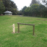
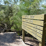
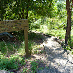
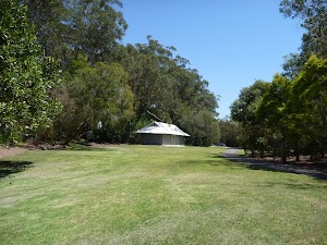
Continue straight: From the bend in Pains Rd (near house number 4), this walk follows GNW arrow[78] along the wide track, whilst keeping a few houses up to your left[79]. After about 120m, the track leads up a grassy hill[80] to find a large open parkland, Buffalo Creek Reserve[81][82]. Here, the walk turns right and follows the ‘Great North Walk’ sign[83] across the grass, passing a picnic table[84] and fireplace[85], and coming to the large ‘Buffalo Creek Track Head’ signpost[86][87] (on your right).
Buffalo Creek Reserve
(2.93km) Buffalo creek track head → Int of Great North Walk and Pittwater Road carpark path
740 m
17 mins
42m
-32m
Moderate track
Turn right: From the intersection, this walk follows the ‘Sugarloaf Point’ sign[104] along the flat rocky and sandy track, keeping the valley to your right. The track generally bends left around the side of the hill, passing a few interesting rock platforms[105] along the way. Soon after heading down some stone steps[106], this track comes to a signposted T-intersection with a wide sandy trail[107]. There is a ‘Buffalo Ck Reserve’ sign[108] pointing back up the steps.
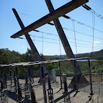
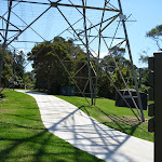
Turn left: From the intersection, this walk follows the ‘Pittwater Road 0.25km’ sign[109] up along the wide management trail, which soon becomes sealed[110]. The trail winds up beside a large, fenced, high-tension power line concrete tower[111][112]. The trail soon leads around a locked gate[113] and comes to an intersection[114] just before Pittwater Rd, with a ‘Great North Walk’ track sign[115] (on the right).
(3.67km) Int of Great North Walk and Pittwater Road carpark path → Magdala Park carpark
1.3 km
24 mins
25m
-29m
Moderate track
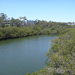
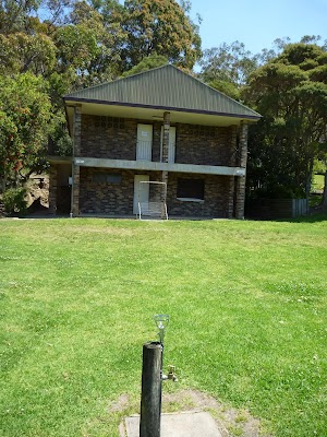
Turn right: From the intersection, this walk follows the GNW arrow[126] along the wide track, initially keeping Kittys Creek to your right. The track almost immediately bends left (ignoring the side track on the left[127]) and follows the bank of the Lane Cove River[128] (on your right) through the casuarina forest[129] for just shy of 200m. Here, the track starts edging away from the river and enters more dense vegetation[130] for just over 200m, before the track opens up and comes to a ‘Lane Cove National Park – Sugarloaf Point’ sign[131]. From the sign, the walk leads up along the grass[132], keeping the playing fields[133] to your right and coming to a GNW arrow post[134] in front of the toilet block[135] beside Magdala Park car park[136].
Magdala Park
(4.97km) Magdala Park carpark → Int. opposite end of Mowbray Rd
420 m
8 mins
13m
-11m
Easy track
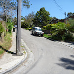
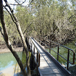
Turn right: From the transmissions tower[148], this walk follows the ‘Newcastle’ sign[149] downhill along the concrete footpath away from Magdala Park. The path soon turns right[150] and leads over the ‘Clifford Love’ footbridge[152]. The 150m-long bridge leads over Lane Cove River[153][154] and then over the ‘National Starch’ factory[155], to find a footpath on the other side. The footpath leads around the edge of the fenced car park[156] and comes to the footpath beside Epping Rd, just beside the traffic lights[157] at Mowbray Rd.
(5.39km) Int. opposite end of Mowbray Rd → Int. Corporate Park Scenic Trail and Great North Walk
720 m
15 mins
32m
-21m
Moderate track
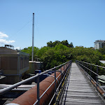
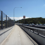
Continue straight: From the intersection[161], this walk follows the GNW arrow post down across the main bridge span, keeping the traffic to your right. After almost 100m, this walk comes to the other side of the bridge, where there is an intersection with another set of stairs[162] (on your left) and another GNW arrow[163].
Turn left: From the intersection[164], this walk follows the GNW arrow post down the stairs[165][166] and towards the water. At the bottom of the stairs, the walk turns left and follows the footpath under the bridge[167][168] then up a few steps to a signposted intersection[169], just on the other side of the bridge.
Veer right: From the intersection, this walk follows the ‘Lane Cove National Park – Fairyland Track’ sign[170] down along the dirt track, keeping the filtered view of Lane Cove River to your right[171]. The track soon leads down some timber steps[172], past a short rock wall[173] and across two short flat timber bridges[174][175]. The walk continues up some steps and across a timber bridge with a hand rail[176]. The rocky track then leads downhill[177] for about 100m before going gently uphill past the high tension transmission tower[178], to then come to a signposted intersection[179], just after passing under the power lines.
(6.11km) Int. Scenic Trail and Great North Walk → Intersection behind Honeywell
220 m
5 mins
12m
-7m
Moderate track
Veer right: From the intersection, this walk heads up the timber staircase[185] to then follow the ‘0.8km scenic trail’ arrow post[186] gently uphill. From this sign, the track leads up over a series of rocks[187] and up a few rock steps[188] (ignoring a track on your right) for about 40m to pass an ‘Aboriginal uses for plants’ information sign[189]. Here the walk continues up the stone steps to then follow alongside a wire fence[190] for just shy of 100m (behind the ‘Honeywell’ building[191]). The walk then follows one of a few tracks that continues straight to come to a T-intersection with a sealed road[192], just at the far corner of the ‘Honeywell’ building.
(6.32km) Intersection behind Honeywell → North Ryde Train Station
890 m
16 mins
36m
-1m
Easy track
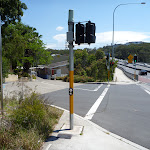
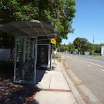
Turn right: From the intersection, this walk heads north following the footpath beside Julius Ave gently uphill[197]. After just shy of 100m, this walk leaves the ‘Riverside Corporate Park east Entrance’[198] and turns left at Delhi Rd. The walk now follows the footpath[199] (past a bus stop[200] and post box[201]) for 270m to come to the traffic lights[202] at the intersection of Delhi Rd & (the other end of) Julius Ave at the ‘Riverside Corporate Park West Entrance’[203].
Continue straight: From the intersection, this walk crosses Julius Ave[204] and follows the footpath alongside Delhi Rd (on the other side of the road from Macquarie Park Cemetery). After about 60m, this footpath leads past ‘Delhi Convenience Store’[205] (open 7am-7pm M-F & 10am-4pm weekends Ph: 02 9889 8822) and continues (crossing a driveway with traffic lights[206]) for about 200m to come to the entrance of ‘North Ryde’ train station[207].
Maps for the Boronia Park to North Ryde walk
You can download the PDF for this walk to print a map.These maps below cover the walk and the wider area around the walk, they are worth carrying for safety reasons.
| Parramatta River | 1:25 000 Map Series | 91303N PARRAMATTA RIVER | NSW-91303N |
| Sydney | 1:100 000 Map Series | 9130 SYDNEY | 9130 |
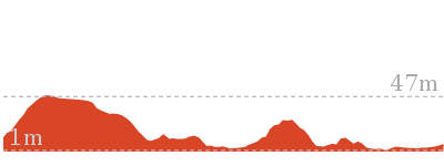
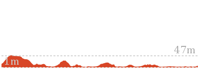
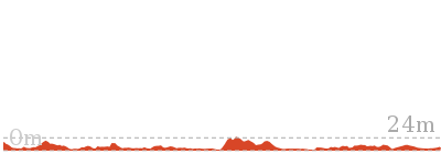
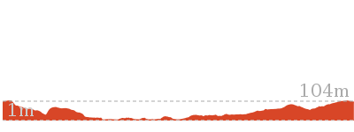
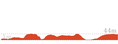
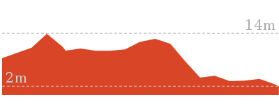
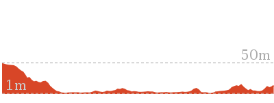
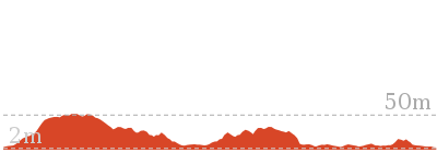
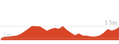
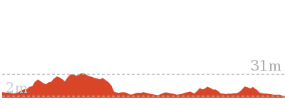
Cross sectional view of the Boronia Park to North Ryde bushwalking track
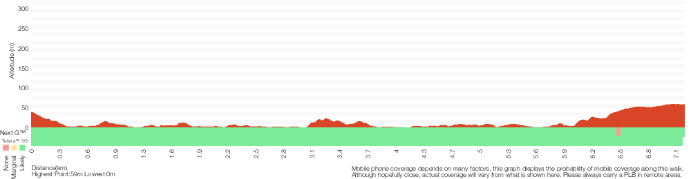
Analysis and summary of the altitude variation on the Boronia Park to North Ryde
Overview of this walks grade – based on the AS 2156.1 – 2001
Under this standard, a walk is graded based on the most difficult section of the walk.
| Length | 7.2 km | ||
| Time | 2 hrs 45 mins | ||
| . | |||
| Grade 3/6 Moderate track |
AS 2156.1 | Gradient | Short steep hills (3/6) |
| Quality of track | Formed track, with some branches and other obstacles (3/6) | ||
| Signs | Directional signs along the way (3/6) | ||
| Experience Required | Some bushwalking experience recommended (3/6) | ||
| Weather | Weather generally has little impact on safety (1/6) | ||
| Infrastructure | Limited facilities, not all cliffs are fenced (3/6) |
Some more details of this walks Grading
Here is a bit more details explaining grading looking at sections of the walk
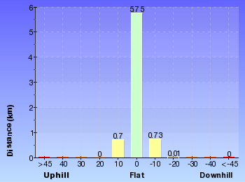
Gradient
4.5km of this walk has gentle hills with occasional steps and another 1.4km is flat with no steps. The remaining (1.3km) has short steep hills.
Quality of track
3.2km of this walk follows a clear and well formed track or trail and another 2.6km follows a formed track, with some branches and other obstacles. The remaining (1.5km) follows a smooth and hardened path.
Signs
Around 4.6km of this walk is clearly signposted, whilst the remaining 2.6km has directional signs at most intersection.
Experience Required
Around 7km of this walk requires no previous bushwalking experience, whilst the remaining 480m requires some bushwalking experience.
weather
This whole walk, 7km is not usually affected by severe weather events (that would unexpectedly impact safety and navigation).
Infrastructure
Around 6km of this walk is close to useful facilities (such as fenced cliffs and seats), whilst the remaining 1.4km has limited facilities (such as not all cliffs fenced).
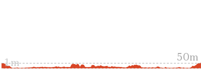
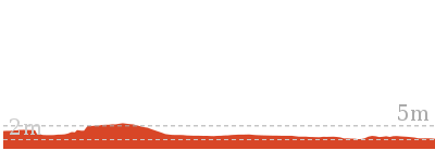
Similar walks
2.6 km One way
1 Hr
Hard track
5.3 km Circuit
2 hrs 30 mins
Hard track
5.5 km One way
2 hrs 30 mins
Moderate track
6.9 km Circuit
2 hrs 30 mins
Hard track

11.2 km Circuit
4 hrs
Hard track

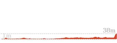
33 km One way
2 Days
Hard track


44.4 km One way
3 Days
Hard track

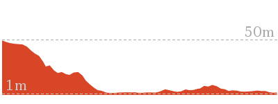
Other Nearby walks
5.8 km One way
2 hrs
Moderate track
1.5 km Circuit
1 Hr
Moderate track
978 m Return
30 mins
Easy track

11.9 km Circuit
5 hrs
Hard track
3.4 km Return
1 hr 30 mins
Moderate track

5.9 km Return
2 hrs 30 mins
Moderate track
4.3 km Circuit
1 hr 27 mins
Moderate track
1.5 km Return
45 mins
Moderate track
1.3 km Return
1 Hr
Moderate track
5.3 km One way
2 hrs
Hard track
2.6 km One way
1 Hr
Moderate track
11.6 km One way
4 hrs 30 mins
Hard track
Plan your trip to and from the walk here
The Boronia Park to North Ryde walk starts at the Boronia Park (gps: -33.827161, 151.13814)Your transport options to Boronia Park are by;
(get details)
The Boronia Park to North Ryde ends at the North Ryde Train Station (gps: -33.794427, 151.13796)
Your transport options to North Ryde Train Station are by;
(get details)


Short URL = http://wild.tl/bptnr
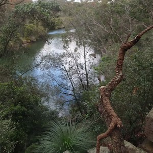
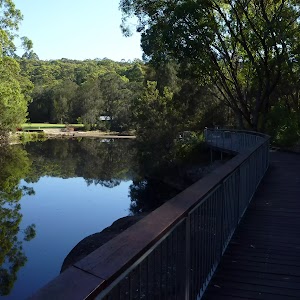
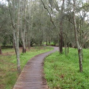
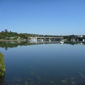
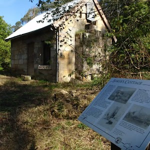
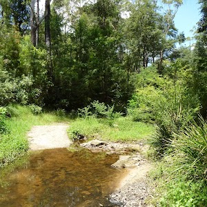
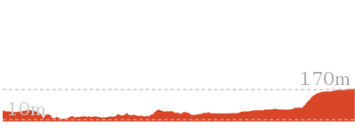
Gallery images
There are other downloads I am still working on.
You will probably need to login to access these — still all free.
* KML (google earth file)
* GPX (GPS file)
Special Maps/ brochures
* A3 topo maps
* PDF with Lands Topo map base
* PDF with arial image (and map overlay)
I wanted to get the main site live first, this extra stuff will come in time.
Happy walking
Matt 🙂
Comments